Sunday, May 17, 2015

Driving Through the Most Dangerous Plate Boundary in the World: Exploring the Oceanic Crust Without Unobtainium

One of the movies I most love to hate is "The Core". There are plenty of ridiculous parts, there are several earnest geologist characters, there are the many gory deaths while the heroes save planet Earth from being severely microwaved or something like that, and there is of course unobtainium, the magical element that makes everything else possible, including "Avatar". But mostly I scream at the end when the heroes make it though the oceanic crust at the "plate boundary" near Hawaii. Just like physicists yelling "you can't hear explosions in space", I yell "there's no plate boundary at Hawaii". But there is oceanic crust, and it is very hard to explore. In fact most oceanic crust is pretty much inaccessible except by the use of expensive drilling rigs at sea, and they haven't penetrated the deepest parts of the crust yet. Oh, and unobtainium doesn't really exist...
But many flowers do exist in Del Puerto, at the right time of year.
The thing is, we can explore the oceanic crust, and for us in Central California, it involves simply driving up Del Puerto Canyon in the portion of the Coast Ranges called the Diablo Range. We began our exploration in the last post of our series about driving through the most dangerous plate boundary in the world. We were journeying through the depths of hell as represented by the peridotite and serpentine of the Earth's mantle. That portion is in the uppermost parts of the canyon. As we descend towards the Great Valley, we make our way through a section of oceanic crust called the Coast Range Ophiolite.
We saw some elements of an ophiolite sequence while we explored the Marin Headlands in this post a few weeks ago. The big difference is that the rocks of the Marin formed a few thousand miles from the California coast as much as 200 million years ago. The Coast Range Ophiolite is thought to have originated much closer to the margin of the continent around 140 million years ago.
The upper canyon has some nice exposures of highly contorted deep-sea chert similar to those of the Marin Headlands (above), but pillow basalts are a bit harder to find in Del Puerto Canyon. Other parts of the oceanic crust are well-represented however. Pillow basalts form during eruptions onto the sea floor. The rocks of Del Puerto formed much deeper in the crust. The eruptions of basalt on the sea floor were fed by numerous sheet dikes in the mid-levels of the crust, which were in turn supplied by plutons of basaltic magma that later cooled slowly to form gabbro plutons. Gabbro looks like no other rock in the coast ranges (below).
The blocky exposures reveal a rock full of mafic (dark iron-rich) minerals. The "black granite" of many stone countertops is not granite at all, but gabbro. The gabbro of Del Puerto is somewhat finer grained than most rock used in countertops, but under a microscope it is very pretty. It often contains small crystals of green olivine (the gemstone peridot).

The gabbro exposed in the middle part of Del Puerto has been split by a quartz-rich dike that captures the attention of most canyon travelers. It is probably related to hydrothermal fluids (hot water solutions) developed during faulting and uplift of the range.
The quartz vein is very resistant to erosion and forms a wall of rock running up the cliff. It has caught the attention of gold seekers, although I am unaware of any economical ores in the region. This hasn't stopped the speculators. The vein was recently staked for mining, even though no one has found anything there in 90 years of easy access to the outcrop.
This stretch of the canyon gets a fair amount of precipitation and reasonably good soils develop on the slopes. Some water is usually present on the valley floor all year. The vegetation is some of the most diverse to be found anywhere in Coast Ranges, and several hundred bird species have been sighted in the canyon at one time or another.
The sediments of the Great Valley Group were deposited on the Coast Range Ophiolite. The boundary between the ophiolite and sedimentary rocks along Del Puerto Canyon road is a fault, the Tesla-Ortigalita. It's a little hard to see in the photo below, but note the color change in the rocks from lower right to upper left. Some years ago, about 1996, I stood here with Al Bennison, who as a child discovered the first dinosaur ever found in California. He went on to a career in paleontology, and mapped much of the region. He mentioned that the shale on the right side of the fault sometimes yielded up ammonite fossils. He walked over, looked at the rock a moment, then pulled out an ammonite specimen. I have gone back to that exposure a dozen times or more, staring for hours at the rocks, hammering away, and I have never found one.
A final note about exploring Del Puerto Canyon. It is a marvelous habitat for many wonderful creatures, but there are some that one may enjoy better from a distance. In 2008 we saw this rattlesnake.
And in 2012 a flipped rock revealed this small arachnid. Explore carefully!
This post is part of a continuing series about the ancient subduction zone complex exposed in Central California. It is no longer active as such, but once was a zone of earthquakes, tsunamis, volcanoes and many dinosaurs must have perished when it was active in Mesozoic time. For a preview of the series, check out this original post for the series.

Friday, May 15, 2015

Tis-sa-ack (Half Dome) From Some Different Angles

Tis-sa-ack (Half Dome) from Glacier Point. For the origin of the name Tis-sa-ack, check my post at http://geotripper.blogspot.com/2014/11/if-these-cliffs-could-talk-tis-sa-ack.html
Tis-sa-ack is, along with Yosemite Falls and El Capitan, Yosemite Valley. The iconic rock stands high above the east end of the valley, rising to 8,839 feet (2,694 meters), just short of a vertical mile above the valley floor. It is perhaps the most instantly recognizable feature of the park. And one of the less understood features as well. Glaciation is often invoked as the origin of the unique shape of Half Dome, but glaciers only had a marginal role, as they never overtopped the dome. They only reached the base.
A view from Washburn Point, a bit more to the south than Glacier Point. Both views are looking roughly east.
Half Dome is composed of a granitic rock called  the Half Dome Granodiorite. The distinction of granite and granodiorite may be lost on some people, but here it is: both rocks contain the mineral quartz, but granodiorite has a somewhat higher proportion of plagioclase feldspar than it has of potassium feldspar. It will have a slightly higher proportion of mafic (dark) minerals like hornblende or biotite mica. But really, "granite" will suffice.

Many of the granitic rocks of Yosemite Valley are highly jointed, meaning that the rocks fractured as they were exposed at the surface by erosion. Jointing is also influenced by regional stresses, such as nearby fault zones. Jointed rocks are easily quarried by glacial action, and in Yosemite Valley, such rocks form the recessed parts of the canyon walls. Rocks like El Capitan and Half Dome have very few joints, and thus stand out as a monolithic cliffs and peaks.

The rounded shape of the dome is the result of exfoliation jointing. Exfoliation is the tendency to form slabs of rock parallel to the surface of the rock. Corners and edges are preferentially broken off, leading to the dome shape. The cause of exfoliation is still being researched, with a traditional explanation of pressure relief as the rock is exposed by erosion. More nuanced causes are related to thermal stresses and compressional forces within the rock. A rather stunning example of exfoliation in action was caught on film last year. Check out my post on the subject here: http://geotripper.blogspot.com/2014/09/ongoing-exfoliation-event-at-twain.html.

Whatever the cause of the exfoliation and doming, glaciers did play a role in the unusual shape of Half Dome. A planar joint forms the face of Half Dome, and it was glaciers in the valley below that quarried away the rocks on the other side of the joint. Boulders and blocks of Half Dome Granodiorite can be found miles downstream in Yosemite Valley.
Most visitors to Yosemite see the dome from the west, down in Yosemite Valley. Many visitors make the journey to Glacier Point or Washburn Point to gain a perspective from across the great chasm of the Merced River, and from an only slightly lower elevation. 

It takes just a bit of walking to Mirror Lake and the valley above to see Half Dome from the base. Somehow the dome looks huge from below.
Such vertical cliffs are not immune from gravity, no matter how strong the rock. As noted in the last post, a huge rockfall came off the rock on the flank of Half Dome in March of 2009. The Ahwiyah Point rock fall forever changed the appearance of Tis-sa-ack. But that's the nature of geology. Nothing on Earth remains the same, and some of those changes happen in a human time frame. Just ask the people of New Hampshire about their state emblem (story here). 
It isn't overly difficult to see Half Dome from the north. One needs merely to drive towards Tuolumne Meadows and stop at Olmsted Point. All of the other pictures in this post came from my trip last weekend, but the picture below came from one of the strangest journeys I ever had in Yosemite National Park. At the beginning of the current drought in 2011, practically no snow fell in November and December, so Tioga Pass was still open after New Year's Day in 2012. We went over the pass on January 5, and caught the sunset on the face of Half Dome. Catch some other pictures of that strange journey here and here.
That leaves, for me anyway, a couple of bucket list items: to see Half Dome from the south, from the east, and from under my feet! Here's hoping...

Thursday, May 14, 2015

Is This the Best View from a Tunnel Anywhere? And Other Slightly Unfamiliar Views of Yosemite (and Gratuitous Bear Cub)

I did something a little different this last weekend for Mother's Day. I found there was a single campsite available in Yosemite Valley on Sunday night, so we headed there for a little explore. I also did something just a little bit different at Tunnel View, and walked a bit into the tunnel to get the iconic view of Yosemite Valley framed by the arching granite of the tunnel entrance. Is there a tunnel exit anywhere in the world with a more incredible sight at the end? I'd love to hear any ideas.

I found out something about sound in tunnels. A car or truck can be a quarter mile away in the tunnel, but the sound of the engine is funneled and reflected to the point that it sounds like a jet plane right behind you. It was mildly terrifying.
In any case, we concentrated on visiting some of the spots I don't get to see when I take students there on a field excursion. Those spots include the Mariposa Grove of Sequoia Trees from the last post, Glacier Point, Washburn Point, and Mirror Lake. The picture above is the view of Yosemite Valley from the slopes of Turtleback Dome just west of the tunnel. I don't enter the valley from that direction as often, so the iconic rocks like Half Dome and El Capitan seem just a tad less familiar, and thus all the more spectacular.
Mirror Lake is a deep bend in Tenaya Creek that backs up during the spring runoff to flood the adjacent meadow and form a wonderful reflecting pond. The pond formed because of a huge prehistoric rockfall that blocked much of the canyon floor. It is probably the largest slide documented in Yosemite Valley. A number of rockfalls have occurred in historic time as well. In March 2009, the Ahwiyah Point rock fall left the white scars on the cliff in the picture above on the right. It involved 46,700 cubic meters of granitic rock. Fortunately the slide occurred early in the morning and no one was injured.
Cathedral Rocks are very famous and familiar from the west side where Bridalveil Falls spill over the cliffs. From the east, they are sometimes overlooked as the cliffs across the valley from El Capitan. In any other setting in the world, these rocks would be as iconic as El Capitan or Half Dome.
People who are on short trips miss out when they only visit the valley floor. An excursion to Glacier Point offers one of the greatest panoramas in the world, seeing the entire extent of Yosemite Valley from 3,000 feet above. The video below shows part of the sweeping view. But if you make the time to see Glacier Point, don't miss Washburn Point. It gives an entirely different perspective of "Half Dome". What works better? Four-fifths Dome? Three-quarters Dome?


As promised, here is the gratuitous bear cub. The bears are emerging from hibernation, and we saw a mother Black Bear and her cub above the highway near Chinquapin (the turnoff to Glacier Point). They were being good and doing bear things in the forest instead of breaking into cars in a campground. It's taken a few years, but most of the tourists have finally been trained to stop luring bears into the campgrounds, and the crafty old campground bears have died off or retired, and there aren't new mama bears teaching their cubs how to break in. In the late 1990s nearly a million dollars of damage was done by the bears, but in the most recent year the damage was only about $5,000. For the record, although the bears are incredibly strong and heavily armed (clawed), they have been very patient with humans. There has not been a single fatality in the Sierra Nevada that can be attributed to a Black Bear. We have unfortunately killed lots of them, mostly with traffic collisions. The extinct California Grizzly Bears were a different story.
Only a fraction of the Black Bears in Yosemite are actually black. They range from black to brown to blonde. If the cub above is looking a bit bedraggled, it is losing its winter coat. I may seem close from this view, but I was a good 200 feet away and across the road. A zoom lens is a wonderful thing in wildlife photography!

Monday, May 11, 2015

An Invasion of Ents? No, Just the Biggest Living Things on the Planet

Giant Ent toes. Or Imperial Walkers. Run for your lives!
There are things in Yosemite National Park other than Yosemite Valley. One of the gems (out of a great many) is the Mariposa Grove, a forest of about 500 gigantic Sequoia Trees near the south entrance of the park. A visit to the grove is a delight, as I found out yesterday. I've been there a few times, but on this occasion we spent several hours wandering through the trees, having sworn ourselves to a leisurely pace, a bizarre concept with which I am unfamiliar. It turns out this will be our last visit (and everyone else) to the grove for at least two years. They are shutting it down so they can do right by the wonderful trees.
Until last year, there was a tram that offered tours of the grove (for a price, of course), so a paved road wound through the forest. There is a large parking lot within the forest, a small store (now permanently closed), and that staple of parks and monuments: pit toilets. The problem is that the trees have shallow root systems that are generally less than six feet deep, but which spread widely about the tree. The constant pressure of vehicles and feet damages the root systems. We have been slowly loving the trees to death.

When finished, the grove will be a different place. Parking will be moved to the edge of the grove, and trams will provide free access from an even larger parking lot two miles away. The grove will be traversed by footpaths only, including an ADA access trail to the largest tree in the grove, the Grizzly Giant. There will be flush toilets at the parking area. If these changes work like similar actions that have been taken in other national parks, visitors will have a much different experience, including better chances to observe wildlife in the groves.
The cars are tree-killers
There is a bit of confusion about the Giant Sequoias (Sequoiadendron gigantea), because California has two gigantic tree species. The other tree is the Coast Redwood (Sequoia sempervirens), which grows in a narrow coastal corridor between Big Sur and the Oregon state line. The Coast Redwood grows to immense heights (nearly 400 feet), but is usually slimmer. The tallest Sequoia trees usually don't exceed 300 feet (the tallest is 311 feet), but the trunk is more robust to a high level, so the shorter trees have the greater bulk, making them the largest living thing on the planet. The state legislature didn't know the difference (a big red tree is a tree, right?), so they made the "native redwood" into the official state tree without defining which of the trees they meant. The attorney general of the state eventually got involved, making a final ruling declaring both species to be the state tree. Both tree species live for thousands of years, but neither is the oldest living thing in existence. That honor goes to the Bristlecone Pine which is found in several western states. The oldest, a recently discovered 5,000 year old survivor, is also a California resident.
The trees have a geological story. They once thrived across the northern hemisphere, and in North America fossils of the trees are preserved in Yellowstone and Petrified Forest National Parks (the direct ancestors are preserved in Nevada). The petrified trees in Yellowstone are several tens of millions of years old, but the trees in Petrified Forest are several hundred million years old! Ancestors to the Sequoia date at least to the Jurassic Period, so the trees were witness to the evolution of the dinosaurs and their extinction. Climate change seems to have been the tree's nemesis, and the Pleistocene ice ages probably eliminated them from most of their former range. The trees were able to survive in the Sierra Nevada in part because they could propagate downslope and upslope in response to the advancing and receding glaciers (see this National Park Service article for the details on the origin and distribution of the Sequoia trees).
Not much can kill the trees, as they are resistant to fires, insects, and disease. Their main enemies are humans, gravity, and geology. Humans cut them down of course, for a while, but their wood is useless for most purposes. They made pencils and grape stakes out of them. The logging was put to an end, but in protecting the groves wildfires were suppressed, allowing big Sugar Pines to grow among the Sequoias. Fires can't burn through the bark of the Sequoia trees very well, but the Sugar Pines go up in flames easily, allowing the fires to "crown", burning away the foliage of the Sequoias and killing them. Fires have always been part of the ecology of the trees, as the small ground fires burned away invasive saplings of other trees, and cleared the duff from the forest floor, allowing the Sequoia seeds to germinate properly.

Most trees die by toppling over, in the occasional violent windstorm, or because erosion has undercut part of their root system. The fallen trees take centuries to decay away, as the Fallen Giant in the picture above illustrates. It fell long before the grove was discovered by European settlers.
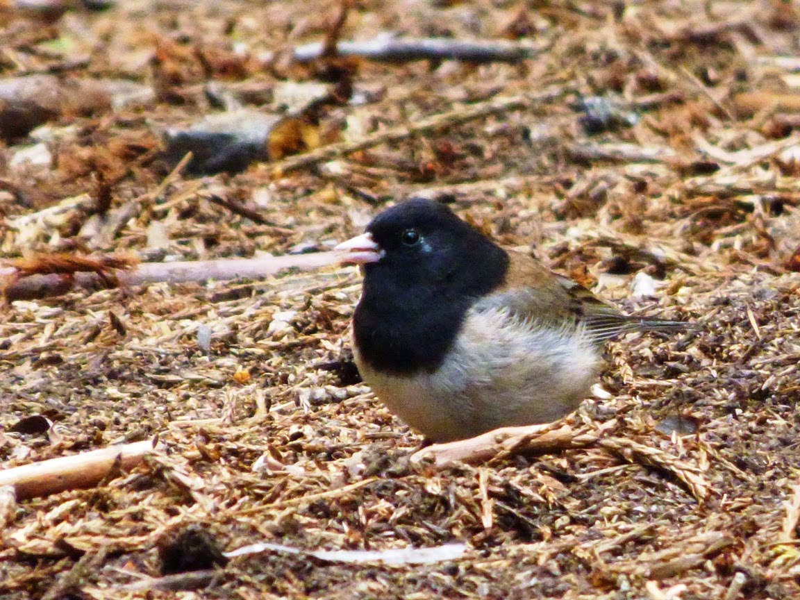
We saw several forest species on our stroll through the Sequoia grove, including Juncos (above), and the White-headed Woodpecker, a purely western species. It's found only in California, Nevada, and the Pacific Northwest. There were the requisite rodents, the squirrels and chipmunks, and the ever present deer. The deer are dangerous; they've killed more people in Yosemite National Park than the Black Bears (bears: 0 / deer 1).
There was also some kind of creature at the base of the big tree in the picture below...
Walking through a Sequoia grove is like walking back in time. One can imagine Velociraptors hunting prey in the shadows of these forests. Or, if you will, Imperial Storm Troopers looking for Luke Skywalker ("A long time ago in a galaxy far away").
Perhaps the most eloquent reminder of the antiquity of these incredible trees was a discovery made by my colleague at Modesto Junior College. During the Jurassic period, there was an ancestral Sierra Nevada, a mountain range that would have resembled today's Andes in South America, with high mountain ridges and active volcanoes. Rivers flowed through the mountains and onto the coastal plains, and dinosaurs wandered through forests of Sequoia-related species of trees. Some trees would occasionally fall into the rivers, and woody debris would be carried into the adjacent sea. Some of the needles and stems would be preserved as fossils that would later be uplifted and exposed by erosion in the foothills of the modern Sierra Nevada. And a twig of Sequoia needles is what my colleague Noah found in 2013 as we searched for fossils in the Foothills Terrane of the Sierra Nevada Mother Lode. A tree that was once widespread across the northern hemisphere now exists only along the California Coast, and in a few dozen scattered groves in the Sierra Nevada.
You can read the whole story of our little fossil adventure here: http://geotripper.blogspot.com/2013/02/hunting-for-fossils-in-sierra.html.

And if your plans this summer include Yosemite, try and visit the Mariposa grove before they shut it down. If you are too late, you can still hike to the smaller Tuolumne and Merced groves in the western part of Yosemite, or you can visit spectacular groves in Sequoia and Kings Canyon National Parks to the south, or Calaveras Big Tree State Park on Highway 4 to the north. There are a few other groves tucked away in the national forests that lie between the other parks.

Friday, May 8, 2015

Driving Through the Most Dangerous Plate Boundary in the World: At the Portal of Hell in the Diablo Range

At the portal of hell? For the miners who once worked these tunnels, it was...


I miss the tabloids sometimes. Sure, there's the Onion, which gets mistaken for real news sometimes. But there was nothing like standing in the grocery store lines perusing headline after headline of "real" news, like Elvis sightings, UFO reports, and "Loch Ness Monster Meets Yeti" stories. On extended field trips when group morale was slipping a bit, I could pick up a copy of one of those tabloids and read stories around the campfire, and it worked like magic to bring a group out of the doldrums.


Source: http://www.snopes.com/religion/wellhell.asp
One story has stuck in my mind over the years, the one about the Russians (or Alaskans, or Norwegians) who were digging the world's deepest well on the Kola Peninsula in Russia (or on the North Slope, or in Scandinavia) and when they reached a depth of 7 miles (or 9 or 12), the drill started spinning wildly, and they measured temperatures of 2,000 degrees, but scariest of all, they lowered a microphone (into the 2,000 degrees...) and heard the unmistakeable sounds of screaming souls in Hell. In some versions, gases rose and took the form of the devil, and...well, you get the general picture. As can be seen from the link at the start of the paragraph, the story spread so widely that it merited a Snopes article. What does it tell you that some people (including one or two of my students) took this seriously?

In any case, we are back on our journey through the most dangerous plate boundary in the world, and when we finished our last episode we had passed through the Franciscan Complex, the rock unit that formed in the accretionary wedge of California's Mesozoic subduction zone. We are now making our way down the eastern margin of the Diablo Range through the gorge of Del Puerto Canyon. The association of "Diablo", and "Puerto" ("Devil" and "Portal") is what brought to mind the "screams of the damned" in the old tabloids.

The geologists were trying to dig a hole into the deep crust. They wanted perhaps to break through the continental crust and into the underlying mantle, a layer of peridotite and other ultramafic rocks that make up about 80% or so of the Earth's volume. They failed, but what an effort they made! The thing is, if one really wants to reach the mantle, there is an easier way: find the places where the mantle has risen to the Earth's surface. And that's what happened in Del Puerto Canyon.
Peridotite is composed largely of the mineral olivine (the gemstone peridot). The Earth's mantle is made of gemstones!

As we travel down this canyon we are going to do the literal equivalent of traveling from the Earth's mantle upwards through four or five miles of the oceanic crust, and then "climb" through 25,000 feet of oceanic sediments. All while coasting down a pleasant country avenue in one of the most scenic of the Coast Range's canyons. Along this journey we will also finally leave behind the accretionary wedge of the Franciscan subduction zone, and enter into the intriging forearc basin.

The ultramafic rocks of the upper canyon host a number of unusual minerals and ores. Among them are mercury and chromite. The mercury mined here was used in the process of separating gold from the tailings in the Mother Lode on the other side of the Great Valley. As I understand it, one could make very good wages mining the mercury, but you didn't last long at the job. The mines literally killed the miners. For them, the tunnels really were the portals of Hell. The mercury vapor in the air got into their nervous system, first destroying their minds, and then their bodies.
Chromite from upper Del Puerto Canyon

The chromite that was mined in the upper canyon was not nearly so dangerous. Chromite is of course the source of chrome, which most people associate with shiny car accessories. The most important use of the metal is much more pervasive: it is a major component of stainless steel. The United States usually imports cheap ores from overseas, but during periods of war domestic sources were exploited, and that's what happened in the upper part of Del Puerto Canyon. The road we are traveling was once a railway that serviced the mines.
The orange streaks in the ultramafic rocks of Del Puerto Canyon are slickensides, scratch marks left by faulting

There is a large quarry face in the upper canyon where the rocks can be readily observed. The unweathered rock is dark in color, but weathers readily into an iron oxide rich patina. The region came to be known as the Red Mountain Mining District. The ultramafic rocks are very poor in important in plant macronutrients, and also contain some toxic elements as well. The vegetation on the slopes reflects the difficulty of surviving in this poisonous chemical environment. A number of the species found here are endemic to California and the Coast Ranges. And few invasive species ever gain a roothold on these slopes.

Next, we'll see if we can find the oceanic crust, the rock sequence known as the Coast Range Ophiolite. Stay tuned...

Tuesday, May 5, 2015

Sharing Science in the Local Community: What Ideas Do You Have?

How often do you wish you had a blank slate? The term can have many meanings and contexts, but most often it means the chance to start over, or to start a project free of restrictions. That in essence is what you see in the pictures in this post. After 10 years of uncertainty and doubt, we have received the green light to begin planning and designing the last component of our Science Community Center at Modesto Junior College.. What you see in the pictures above and below are views of what is almost literally a blank slate. It's made of clay (and silt), the same material that slate starts with, but it hasn't been compressed yet. It the footprint of  the future Outdoor Education Laboratory.
This last piece of the puzzle is part of a science education complex that includes teaching laboratories for biology, astronomy, chemistry, physics and geology, a planetarium, an observatory, and a wonderful new museum based on the natural history of the Great Valley in California. The building on the left in the picture above is a new museum storage structure, and the buildings in the background are condemned and will be removed, probably to become an eventual parking lot. We were worried for some time that the parking lot was going to be put on the site of the outdoor lab.
I hate committee meetings. A lot. I find that many of them don't accomplish much. But today's meeting was fun. It was a gathering of professors and museum staff to decide the shape and nature of the Outdoor Education area. We had a lot of discussion about how it would be laid out and what it would include. It is meant to be an area that will be utilized by students for research, and by the school children of our region to learn about the biology and geology of our region. Our only restriction is that because of the horrific drought, we can't include new water features.

The water restriction was a sour note (even though it was understandable), but it turns out that a pond is already in place, and it's not really using up any water. It's actually capturing used water. If you've followed my blog for any period of time, or if you follow my birding adventures over at Geotripper's California Birds, you would know that an old drainage pond exists just a few hundred feet away from the future outdoor lab, and that it is shaded by mature oak and cottonwood trees. We will probably adapt it for use as an education feature.
So my question to you is this: What would you do with a barren stretch of ground, an adequate (but not infinite) budget, and a commission to enhance the natural science education of our students (both young and "mature")? What would you include in the plans? We had some long discussions today, but I'm wondering what we might have missed. What would you do?

By the way, if we seem somehow privileged to be doing this, it might help to know that all of these wonderful improvements to our campus are not funded by the state or the federal government. They were paid for by the voters and taxpayers in our own economically distressed community. We have one of the highest unemployment rates and the highest poverty rates in the entire country, but our citizens saw their way to support the future of our children by producing some of the finest teaching facilities possible, not just in the sciences, but across the entire college. I'm really proud of my community these days.

Monday, May 4, 2015

What Lies Beneath Yellowstone? Yosemite, of course!

Upper Yosemite Falls, 1,250 feet high. Taken together the three components of Yosemite Falls amount to the fifth or seventh highest waterfall on the planet, at 1,425 feet (depending on who is measuring).
Okay, it's more fair to ask "what lies beneath Mt. Rainier or Crater Lake?". Yellowstone National Park sits atop a continental hot spot, and the plume of hot material will either explode out in a violent rhyolite tuff eruption, or cool deep underground into a granitic pluton. And Yosemite National Park exposes a great deal of granitic rock. But the origin of the granite at Yosemite is more related to arc magmatism, the formation of volcanic and plutonic rock as a plate of oceanic lithosphere sinks into the mantle beneath the edge of a continent. That's what is happening today in the Cascades, and it's what formed the famous volcanoes of that range: Rainier, Hood, St. Helens, Crater Lake, and more than a dozen others.
Lower Yosemite Falls, 320 feet high. Note the people for scale.
In a way, today's post is a sneak preview of the ending portion of my certain blog series on "Driving Through the Most Dangerous Plate Boundary in the World". The Franciscan subduction zone that was active during the Mesozoic Era was responsible for forming the Sierra Nevada batholith (batholith is a term for large bodies of magma, or a combination of numerous plutons in a region). The neat thing one can consider when visiting a Sierra Nevada park like Yosemite is that not only are you standing on the underside of former volcanoes and calderas, but you can also imagine the dinosaurs that once tromped around on the slopes of said volcanoes (we have even found fossils of a few of them, down in the sediments of the Great Valley)!
The Cathedral Rocks. Bridalveil Falls lie hidden on the other side.
I was in the valley again on Saturday, working through the onerous chore of dragging students around on a geology field trip. Somebody has to do it, after all. Buses can only stop in a couple of places around the valley floor, so we got off the bus and used the valley tram system to make a series of appointments at several spots in the valley to discuss the very cool geology.
The Middle Brother slide, from 1987. It is the largest slide in Yosemite's recorded history
Given a choice, I usually fore-go the tram in favor of walking to the appointment spots. It's not that I don't like the trams; they make a big difference in traffic congestion on the valley floor (you think it's crowded today? Imagine all the people on the trams in individual vehicles...). But because the trams make around thirty stops while traveling the loop of 8 or 9 miles, I can progress as fast or faster on foot. So I hoofed it from Yosemite Lodge to Happy Isles, a distance of about four miles. I had an hour and twenty minutes to get there, and I arrived with not a second to spare. But I saw marvelous sights along the way!

Yosemite Falls was at what may be the best flow it will have all year (top two photos). The drought left the park with 5% of its normal snowpack, and much or most of the ice is already flowing down the creeks and rivers. The falls will be dry in early summer.

I walked south from Yosemite Lodge where I had some very nice views of the Cathedral Rocks and the Middle Brothers Slide. The slide took place in 1987, and was the largest slope failure in Yosemite's recorded history, with over a million tons of rock.
Washington Column, the Royal Arches, and Clouds Rest
Washington Column, the Royal Arches, and Clouds Rest make for an awesomely steep gorge from the perspective of Swinging Bridge. The Bridge doesn't swing anymore, darn it! But it makes a nice platform for viewing Yosemite Falls and Yosemite Point from some distance away. The Merced River should be a bit more riotous at this time of year.
Yosemite Falls and the Merced River from Swinging Bridge
I added one small new section of trail to my experience this day. The Yosemite Loop trail travels the length of the valley on both sides, and I have walked most of it, but the section from the chapel to the LeConte Memorial Building was new to me. Despite the dry conditions, the forest floor was green and bursting with small white flowers.
From the south side of the valley, Washington Column stands as a bold cliff like the prow of a mighty battleship. It is shaped by joint fissures, large vertical cracks formed when the rock was exposed by erosion and expanded. North Dome, high above the Column, was formed by a similar process called exfoliation, where the rock expanded outwards, breaking off slabs that are parallel to the surface of the rock. The process tends to form domes all across the Sierra without the action of glacial erosion. The slabs formed by exfoliation can be dangerous to humans. In 1996, a slab the size of a football field came off the valley rim near Glacier Point, and collapsed on the valley floor near Happy Isles. The rocks killed one person and severely injured another. I was racing to the appointment at Happy Isles to show the students the site.
It was a beautiful day on the valley floor, and it was the first time some of my students had ever visited the park. That is one of the great privileges I have as a teacher of geology, introducing them to such a wonderful place, and providing an in-depth story explaining how the place came to exist. And dinosaurs!