Thursday, November 18, 2021

Sure It's Safe...Until It Isn't. Don't be a Scour Critical Bridge


Source: https://hickmanbridge.com/#

It's a bridge. Just like tens of thousands of other bridges across the country. It was pretty modern when I moved to my little town in the Great Valley of California. It crosses the Tuolumne River about 12 miles upstream of Modesto, and it's a fairly important transportation corridor that carries a lot of traffic including heavily loaded gravel trucks from the quarries upstream. And it's home to dozens of White-throated Swifts, European Starlings, and apparently 6,000 bats!

But I've been here for 30 years, which means the bridge is more than half a century old, and...it has a problem. A serious problem, a major vulnerability. In fairness in case you are worried, there's no disaster coming later in the post. The bridge didn't collapse or anything. But time (and a couple of major floods) had revealed an important structural deficiency. It is a "scour critical" bridge. You really don't want a bridge that is scour critical. It is the underlying cause in more than half the bridge failures in the United States.

The picture above was apparently taken in 2017 when the river last flooded (I kind of miss the days of too much water compared to what we have now). Notice how the columns are all under water. There are some pretty powerful currents coursing around the bridge supports.


Now, take a look at the bridge in low-water conditions (above and below). The columns supporting the bridge are connected to concrete pads. The foundation extends 16 feet into the ground, which consists mainly of loose river sediment (although there may be some fairly solid sandstone too, but I don't have access to the geological reports from the engineers for this project).

Major floods in 1997 and in 2017 apparently scoured out much of the sediment surrounding the columns, and threatened to destabilize the entire bridge (I recall the bridge being closed for many days during both floods).


The problem became pronounced enough that an attempt was made to reinforce the foundation with concrete Tetris blocks (below). 

As I became aware of the problem, the old bridge began to look more and more delicate and fragile. I had been driving over the bridge for three decades without giving a second thought to the safety of the span, and did not learn the details of the threat until signs suddenly appeared on the river trail announcing the closure of a section of the trail for the next three years (in 2019), and a bunch of beautiful old oak trees were unceremoniously chopped down. They were beginning construction of a new bridge.

The construction crews quickly built a temporary trestle just above river level (betting against another 100-year flood during the construction period). It was strong enough to hold up to three gigantic cranes at once. The new bridge is going to be wider with bike lanes and a pedestrian walkway (the old bridge was rather terrifying to walk or bike across). But most important, the bridge will be supported by pairs of columns that will extend more than 100 feet into the riverbed and into the bedrock below. Scour will no longer be a serious threat.


The new bridge was constructed rather quickly all things considered, and is opening for business just three days from now. The old bridge was shut down permanently about 10 days ago. The photo below is a webcam image from November 17.

Source: https://app.oxblue.com/open/stancounty/hickmanbridge

The bridge is going to always have an odd alignment, as it would have been economically disruptive to remove the old bridge first and then build the new one over a three year period. I am now extremely curious how they will proceed with the demolition of the old bridge. There is nothing in the promotional materials that indicates how they will do it. It seems unlikely that they'll blow it up, considering the proximity of the new bridge to the old one. Their timeline suggests six months or so to accomplish the task. Geotripper will be there to report if anything interesting goes on!


When I photographed the bridges side by side the other day, I was struck by the degree to which the old bridge sags. I had never really thought about it before, wondering if that was originally part of the plan, or did it 'sink' a bit over the years. It bothers me a little not knowing the answer!

There was a huge political scuffle over the infrastructure bill that was recently passed into law over the objections of one major political party (they even want to punish the 13 members of their party who voted for it),. There are tens of thousands of structurally deficient bridges all across our nation that are 'safe until they aren't safe'. This particular bridge didn't collapse as it could have, but there are many, many others that are more dangerous than we collectively think. We drive over them every day, never knowing about the cracks in the concrete, and the rusting superstructure that holds the bridges together. This new investment in our country's infrastructure should have been implemented years ago, but I'm glad we got it through when we did. We deserve better from those who would 'serve' over us.


Monday, November 8, 2021

"What We Find Belongs to the Public Domain of Science": The Boy Paleontologists and the Irvingtonian Land Mammal Stage


Mission Peak from the Sabercat Trail in Fremont, California

I can just hear the script writers arguing about one of the scenes in an Indiana Jones movie...

George Lucas says "How about 'What we find belongs to the public domain of science'?"

Someone, presumably Harrison Ford in disguise says "George, you can type this s**t, but you sure can’t say it.

Someone else pipes up and says "Shorten it to 'That belongs in a museum'" and history was made.

I'm sure it never happened that way, but "What We Find Belongs to the Public Domain of Science" was in fact the motto of the Boy Paleontologists, who prior to last weekend I had never heard of. As adventurers, they were far more real than Indiana Jones, and ended up contributing far more to science than a glorified tomb raider. And to my surprise, I learned a lot more in an unexpected moment of serendipity.

Interpretive sign on the trail describing the paleontology efforts at Sabercat Trail

To begin with, Irvington simply is not a city that I've ever heard of in California. There's Irving, Texas, and Irvine, California, but no Irvington. But there is a part of the geological time scale called the Irvingtonian North America Land Mammal Stage. And that means there's an Irvington somewhere in North America, but a moment of research reveals that there are hundreds of fossil sites of Irvingtonian age scattered across the continent (and in fact the world). I never really thought to look up the actual location (and yes I see that Irvington, NJ is a place). 

The Irvingtonian North American Land Mammal Age (NALMA) on the geologic timescale spans from 1.9 million to 250,000 years ago. The Irvingtonian is usually considered to overlap the Lower Pleistocene and Middle Pleistocene epochs (basically the middle of the ice ages). The Irvingtonian is preceded by the Blancan and followed by the Rancholabrean NALMA  (which I absolutely knew about; I wrote about it tangentially just months ago).

The beginning of the Irvingtonian is defined by the first appearance of Mammuthus south of 55° N in North America, and the beginning of the succeeding Rancholabrean is defined by the first appearance of Bison.

Source: Barnosky et al., Prelude to the Anthropocene: Two new North American Land Mammal Ages (NALMAs). The Anthropocene Review. 1. 1-18. 10.1177/2053019614547433.

So how do these land mammal stages happen? Basically someone finds a huge number of fossils in a particular locality, and the assemblage turns out to be correlated to lots of other fossil sites across the continent to the extent that any fossil site with the same assemblage can be confidently dated. 

My son has been encouraging me for months to come and visit and walk the path in a Fremont park called the Sabercat Trail. He said they dug up a bunch of fossils there and it was preserved as a historical park now. I was intrigued, but COVID cut down on the opportunities to visit so it didn't happen until last weekend.


We got there and I was confused. I was in Fremont, but I was in Irvington. It turns out that Irvington once did exist as a village, but it was incorporated into the larger city of Fremont, but retains its character as the Irvington Neighborhood. And suddenly I realized this Sabercat Historical Park was a lot more important than I took it for. It wasn't just a fossil dig, it was THE Irvingtonian fossil dig. And what a story it had!

The fossils were first reported in 1867 when a local dentist named Lorenzo Gordin Yates found bones on Mission Creek (Sabercat Historical Park is just a few blocks from Mission San Jose). He sent them to Yale University because there was no one yet on the west coast who could identify them. His samples apparently included horses, camels and mammoth bone fragments.

Decades passed, and despite being just a few miles north, paleontologists from U.C. Berkeley didn't visit the site until the 1930s. The head of the Paleontology department at Berkeley, Ruben Stirton collected an assemblage of fossils and published a report in 1939 that first referred to the Irvingtonian fauna. It was defined as a land-mammal age as a result of Don Savage's studies in 1951.

A very large mammoth tusk at the Bell Quarry. Source: Pleistocene Ecosystem (msnucleus.org) by Wesley Gordon

The Boy Paleontologists entered the scene in middle 1940s when Wesley Gordon brought his sons and several of their friends on a fossil-collecting trip to the site. By now the locality was an active gravel quarry (the mind reels at the number of specimens that must have been destroyed over the years). A weekend hobby turned into a major excavation using young volunteers from the local community. The digs continued for around 15 years, and were even the subject of a Life Magazine article. They ultimately recovered 150,000 specimens of 58 species. 

The site unfortunately lay in the path of "progress", or more specifically the 680 freeway. Most of the quarry is covered by pavement now, although the account mentions that Wes Gordon convinced CalTrans to slightly divert the route to preserve a Short-faced Bear locality. My son mentions that the Ohlone people fought a 20-year legal battle to preserve an ancient burial site from the same freeway.

What exactly did they find? Who was living in the San Francisco Bay region between 1.9 million to 250,000 years ago? The trail provides some very nice interpretations of the ecosystem that existed at the time.


The cast of creatures ranges from mammoths larger than today's elephants to frogs and toads. During the ice ages, San Francisco Bay didn't exist as such because sea level was hundreds of feet lower than today. The area was broadly similar to what it would be today, if not cooler and slightly wetter. The grazing animals were dominated by camels, horses, deer, mammoths, mastodons, peccaries, and a unique species of four-horned antelope first discovered at Irvington. There were also gigantic ground sloths many times the size of their cousins today in Brazil. Rodents and rabbits would have been as common as today, and their remains are part of the assemblage that was discovered. Because of the delicate nature of their bones, only a few birds, a Canada Goose and Mallard duck, have been found as fossils. There were undoubtedly hundreds of species as there are today.

The carnivores were diverse and imposing. Sabertooth cats have been found (hence the name of the park), as well as scimitar cats, dire wolves, coyotes, foxes, badgers, and raccoons. The most terrifying must have been the short-faced bear, which makes grizzlies look small. It is considered the largest terrestrial mammal carnivore known. 


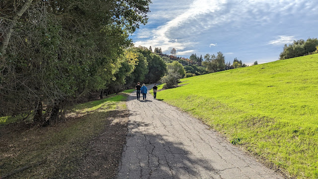
The park is a different place today. Bobcats and coyotes have replaced the bears, wolves, and sabertooth cats. It offers a network of trails that wind in and out of Sabercat Creek, and there is a smaller wilderness area in adjacent Mammoth Creek. Most all the trails are paved and accessible except for the actual remains of the quarry overlooking the freeway. Most of the fossiliferous layers were eliminated by the construction of the freeway, but the view from that end of the park is far-ranging (below).


I have a feeling that the park is an underutilized birding site. 84 species have been reported so far, but that is probably far fewer than what is actually there, given the excellent riparian habitat. We saw 18 species during our short visit including a very accommodating Western Bluebird.


I'm glad my son dragged us out to the Sabercat Trail. It was quite a revelation and answered some questions I've always wondered about!


Tuesday, November 2, 2021

Fall in California: On the Way to Yosemite Valley

Have you ever felt a sense of joy that could hardly be contained? It doesn't happen much in life, and when it does, don't you wish you could hang onto as long as possible? That's about all I can say after our brief sojourn in one of our most precious national parks these last two days.

Pretty much on a whim Mrs. Geotripper and I decided to take a time out from work and spend a few days out of the Central Valley up in the Sierra Nevada. I hadn't paid too much attention to reports from Yosemite Valley, but I figured being early November that most of the fall colors would have been past their prime, but we figured that one can never really have a bad time in the mountains, no matter the time of year. We headed up Highway 120 towards the Big Oak Flat entrance to Yosemite National Park. The sun put on quite a light show as we passed through the prairies beyond Knights Ferry.

I pretty much forget every year that fall colors are not so much a singular event as much a process that unfolds over many weeks. The Aspens in the high country may have burst into bright gold and shed their leaves, but in the middle-altitude forests the Dogwoods and Black Oaks were just coming into their most colorful time. We were mesmerized and stopped at practically every pullout to stare at the kaleidoscope of colors. 
And as tragic as the California wildfires have been, I learned of at least one benefit that becomes apparent at this time of year. Several stretches of Big Oak Flat Road burned in recent years, removing the thick forest cover of conifers. They've been pretty slow about coming back, but the oaks sprouted from the roots and covered the hillsides with shrubby young trees that had turned bright orange as you can see in the picture below.
A close look at some of the leaves reveals that insects have been busy building fat stores for the coming winter.
We entered the park and continued to stop at every bright display of color. Half the day had passed, and we still hadn't reached Yosemite Valley. We were just SO distracted! I almost missed the first look at the valley because not a single car was parked there. We took a moment to view Half Dome and El Capitan and then continued down the highway into the Merced River canyon.

We continued to be distracted by the colorful displays along the road, but we finally reached the valley floor.
I rarely stop at Fern Spring at the west end of the valley because there's not a whole lot to see because of the thick forest, but the forest turned out to be the attraction this time. I jumped down the slope to the Merced River and something was very different, something that I had never really seen before: the river was flowing! In these dry years by late October the Merced River is flowing at a mere dozen cubic feet per second or so. But not today; the river was splashing along as if it were early spring rather than the end of the most deadly drought year in history. The record-breaking storm of the previous week was still draining out of the high country where two or three feet of snow had fallen. It was an astounding sight, and I realized that our time in valley might be something special.

So we moved on up the road into the valley itself, but that is a story for the next post!