Showing posts with label Leaning Tower. Show all posts

Thursday, April 12, 2018

After the Deluge: Yosemite Valley a Day Later (and a sight I've never seen in more than 100 visits)

Yosemite National Park is a treasure. And the gem of the park is Yosemite Valley. There are spectacular spots to visit throughout the park and region, but ultimately, the sheer granite walls and booming waterfalls are the heart of this part of the Sierra Nevada. Most people know this of course, and the valley struggles with the desires of millions of people who wish to see the park for themselves. There are horror stories of absolute gridlock throughout the valley, with upset families who wait for hours just to get into the park, and then never find a place to park and get to know it better. I can barely imagine the frustration of devoting a hard-earned vacation to see the place and then have it spoiled by the chaos of too many people.
Bridalveil Fall (620 feet) and the Leaning Tower at the west end of the valley
I've been privileged to live relatively close to the park, and in 30 years, I've been there over a hundred times. I've quite literally never had a bad time, but part of the reason is that I've been able to pick and choose the times I visited. It turns out that the time most people set aside for vacation, in July or August, is possibly the least interesting time to do so. It's still spectacular, but the crowds are the worst, the waterfalls mostly dry, and it's hot. In fall, the valley is quieter, and the oaks and dogwoods add a splash of color. Winter brings snow and silence. Spring is noisy because of the waterfalls booming from the canyon rim. If your schedule allows, go there in the off season!
Ribbon Falls only flows in the spring; it's the highest free-falling waterfall in the park at 1,612 feet.
Of course, if you come at another time of year, you would be taking a chance with the weather. That's what happened to me last week. I was scheduled to take my students there on Saturday, but fate intervened with an epic warm tropical storm that dumped inches of rain on the snowpack. The Merced River swelled to nearly 14 feet (10 is official flood level) and major roads in the valley were under a few feet of water. For one of very few times in its history, the park was closed as a precaution and people were evacuated. I was luckily able to reschedule for Sunday, because the sun came up in a cloudless sky and the difference between the two days was astounding.
Upper Yosemite Falls, 1,430 feet high, the second highest in the park after Ribbon Falls (above).
I included some direct comparisons between Saturday and Sunday in my previous post (with thanks to the Park Service for posting pictures of the storm). Today I am offering views of some of the classic views in the park, revealing the vast amounts of water still flowing into and through the valley. The Merced River had subsided somewhat but was still flowing at flood level, but only barely. The main effect was the low-lying valley meadows that were still underwater (the next two pictures).
A flooded Cook's Meadow forms the foreground for Upper Yosemite Falls.
The occasional flooding of the meadows is part of what maintains the meadows as open areas. Tree saplings are smothered underwater, and only grasses and sedges that can survive the high water table. Not all of the meadows have survived however. Since the park was established, some of the original meadows have progressed into thick forest...there are only about 65 acres of meadows left out of the original 745 acres that existed at the time of European discovery. The growth of the forest is largely the result of fire suppression. The park service will occasional burn some of the meadow margins on purpose to help maintain the integrity of the open spaces.
No visit to Yosemite Valley would seem complete without a view of Half Dome, but I have been there a fair number of times when my students never had a chance to see it. When rain is falling, it can be completely hidden in the clouds. But on Sunday it was there in all its glory. The unique shape is due to a combination of exfoliation (the fracturing of rocks parallel to the surface, and jointing, which is the result of expansion as the rock is exposed at the surface. Exfoliation, which tends to remove corners and edges, leads to the rounding of the rock into the dome shape. But a prominent joint crossed the dome, and glacial quarrying at the base caused the rock on one side of the joint to be eroded away, forming the prominent cliff, or face, of Half Dome. When seen from other angles, it is clear that Half Dome should have been called Four-fifths Dome...
Directly across from Half Dome are North Dome and the Washington Column (below). The Royal Arches, in the center-left of the picture, are the result of a sort of reverse exfoliation, where the rock snapped out and fell from the middle of the arch, instead of the overlying cliff.
At the end of our day, we made a final stop at Valley View, one of the unheralded pullouts (only eight parking spaces) with one of the finest views to be had in all the valley (which is maybe why they call it "Valley View"). El Capitan, the sheer 3,000 feet cliff, looms on the left, while the Cathedral Rocks and Bridalveil Falls dominate the right side of the valley. A swollen flooded Merced River fills the foreground, with Bridalveil Meadow just across the raging waters. Only one of the ice age glaciers made it past this point, the so-called Pre-Tahoe (or Sherwin) Glaciation that took place around 800,000 years ago. The subsequent Tahoe and Tioga glaciers only reached the base of El Capitan and Cathedral Rocks. The Pre-Tahoe Glaciation probably did the most work in shaping the valley we see today.
I promised in the title of the post that we would include a sight I have never seen in more than 100 visits to the valley. We arrived that day when the gates to the valley reopened, at noon. A great many other people arrived at the same time, and for the first two hours the valley felt crowded. But by 4 PM, most of the visitors were already on their way back home, and the parking lots were practically empty. That is a sight in itself. But it was the drive out that astounded me.  Every time I visit the valley, Northside Drive from Curry Village to the Visitor Center area is always full of cars. Always.
But these two pictures show the astounding sight...not a single car ahead of us or behind us. For a few precious moments, we had the valley to ourselves. It's something I've never seen before, ever.

There's a secret though...even on the most crowded days in Yosemite Valley, you can find peace, serenity, and quiet. It requires that you park the car and get out. Not every trail is crowded, and in some places you can make your own path through the forest. The number of fellow hikers decreases exponentially with the distance from any paved road. If you are ever given a precious few moments in this grandest of valleys, give it a try. You won't regret it.
And that's the way it was, after the deluge...

Wednesday, April 15, 2015

A Fleeting Spring in a Horrible Drought: A Day in Yosemite Valley

There are so many moments when I want to deny the reality of the California drought. It has been relentless, the winter air warm and dry, the soil crunching under my feet at a time when it should be muddy and covered with vegetation. Even though my backyard rain gauge says we've had a normal year for precipitation, the reality is that it almost all fell in December, and almost none fell as snow in the Sierra Nevada. The snowpack is 5% of normal. Five percent! It's still April, and the main pulse of snowmelt in the mountains has already taken place when it should be happening in May and June. The spring season is fleeting this year, and that's the background to my trip to Yosemite Valley last weekend.
It was incredibly beautiful up there as it always is, but there were signs of a stressed environment. The forest is showing large patches of dead and dying trees. Dry spring conditions mean the trees have less sap to fight off pine-borer beetles which are then able to kill the trees. The valley does in fact have too many trees, but I'd rather not see them die off this way.
Bridalveil Fall and the Leaning Tower
There is still water in the waterfalls, but of course they should be booming and flooding, not merely falling. Visitors in the height of summer this year need to scale back some of their expectations. Yosemite without waterfalls is still an incredible place, but they shouldn't be dry by May. 
I was able to get a unique view of the Cathedral Rocks from the middle of the Merced River. At this time of year I should have been drowning in the flood, not standing on a rock. 
A very pretty sight for this time of year is the blooming of the Dogwood trees in the valley. The white "petals" aren't actually flowers, they are modified leaves. The actual flowers are at the center. I have to admit it's been awhile since I've seen such a colorful explosion of the flowers.
The Redbuds were mostly past their main blooming period, but there were still a few of them around.
The rocks are more or less eternal, though, at least from human standards. They could care less whether there is a drought or not. Some rocks will come tumbling down here and there, but in a thousand years, the valley walls will look pretty much the same. Below is North Dome from Curry Village.
The meadows are green, but are already showing a bit of brown in places. It's really been dry. Below is Stoneman Meadow, with Royal Arches, North Dome, and Washington Column behind.
The bridges of Yosemite Valley are beautiful human works of art. The placid Merced River flows under Stoneman Bridge with the bright green of newly awakened Cottonwood trees in the background. As pretty as it is, the river should be surging and flooding right now, not flowing gently. 
And that's why I want to deny the reality of the horrific drought. I don't want the summer to come, I don't want the rivers to be dry, I don't want the forests dying from beetle kills or from apocalyptic wildfires. Changes are coming to this beautiful valley that I don't really want to contemplate. I want it to thrive. But we'll see. The walls of rock will always be there no matter what happens, standing like sentries over the plants, trees, and animals on the valley floor below. Including the only slightly furry ape-like creatures running around in bermuda shorts with cameras in hand.

Wednesday, November 5, 2014

If These Cliffs Could Talk: Leaning Tower and Bridalveil Fall in Yosemite

Bridalveil Fall and Leaning Tower on Sunday afternoon
Nature abhors cliffs as a general rule. Gravity dictates that cliffs will be a rarity in most parts of the world, because most rocks are simply not capable of resisting the intense stresses the cliffs cause. The cliffs of Yosemite are thus extraordinary, because they are among the highest in the world. The reason, of course, is because they are composed of extraordinary rock.

The subterranean world beneath an active volcano is a place from which the imagery of hell has been drawn. Seething hot magma pulses upwards through the crust, invading every crack and fissure, wedging rocks apart, and occasionally breaking through and producing catastrophic volcanic eruptions. But eventually the volcanic system becomes inactive, and the magma chambers eventually, and slowly, cool down. The silicate-based chemical stew starts to crystallize, and the interlocking crystals produce extremely strong rocks with names like granite, diorite, tonalite, and granodiorite. The rocks vary by (and are defined by) the percentages of quartz, plagioclase feldspar and orthoclase feldspar. Other accessory minerals, the dark ones like hornblende or biotite mica, give the resulting rock the characteristic speckled appearance. In a general way, the granite is lighter in overall appearance while the others are somewhat darker. These are the kinds of rocks that can stand in high vertical cliffs.

But other things have to happen to make cliffs. Normal river erosion tends to produce slopes, not sheer cliffs. Yosemite Valley was once a deep river-cut canyon, but the slopes would have been unremarkable, steeply sloping, but probably covered with talus (rocky debris) and vegetation. The lower Merced River canyon (below) provides a hint of how it might have looked: deep and rugged, but not the sheer cliffs of Yosemite. One of the factors is ice.

Conditions in the Sierra Nevada changed starting about two million years ago. The climate worldwide went through a series of cooling periods, and ice sheets covered much of North America and Europe. The climate would warm up again, the ice would recede, and then cooling would return. Perhaps a dozen ice ages took place, the most recent ending only around 12,000 years ago.

The ice did not cover the entire Sierra Nevada, nor did it cover the tops of the high peaks along the crest. The glaciers were confined for the most part to the valley floors, where the ice plucked boulders and abraded surfaces, eventually producing U-shaped valleys. There is direct evidence of at least three glacial episodes that scoured Yosemite Valley, the Pre-Tahoe (somewhere around 800,000 to 1 million years ago), the Tahoe (several pulses between about 160,000-65,000 years ago), and the Tioga (about 13,000-20,000 years ago).

And yet ice needs some help when attacking such hard rock. There have to be fractures and fissures for the ice to exploit before serious quarrying can take place. And that is where jointing and exfoliation come into the picture.
Intersecting joint sets in Tokopah Valley, Sequoia National Park
Granitic rocks cool at depths of several miles within the crust. Pressure is high at such depths, and so as the rocks are lifted towards the surface and exposed by erosion, they expand and fracture. Fractures that occur parallel to the surface are called exfoliation sheets. More or less vertical fractures, which may form from subtle extensional or compressional forces, are called joints. Joint sets can form in several directions as seen in the images above and below.
Intersecting joint sets in Joshua Tree National Park, southern California
Closely jointed rocks are readily excavated by glaciers, while more widely jointed rocks are not. Yosemite Valley, with ten different intrusions of granitic rock, exhibits wide variation in susceptibility to erosion, so that some units tend to form recessed slopes (i.e. the Diorite of the Rockslides), while other rocks tend to form bold cliffs such as El Capitan (the El Capitan granite).

I'm back from my first Yosemite trips in a number of  months, so I would like to share a couple of cliffs with you in the next couple of posts! I was going to call this mini-series "If These Walls Could Talk", but a short search revealed that naturalists at Yosemite are already using that title! So, I've modified it just a bit.
The cliff of the day is the one that extends from Bridalveil Fall to the Leaning Tower. Bridalveil Fall is a classic example of a glacial hanging valley that formed when the main Merced glacier cut a deeper valley than the smaller tributary glacier in Bridalveil Creek. The waterfall drops 620 feet, and runs pretty much all year, though in the autumn it is often just a trickle, as can be seen in the top photo of this post. 
In the spring runoff, the fall is spectacular. A couple of years back, in the blissful pre-drought days, I caught a rainbow in the spray coming of the base of the fall.
The Leaning Tower is composed of several kinds of rock, including the El Capitan granite and the Leaning Tower granodiorite. The granite is about 103 million years old, and the granodiorite somewhat younger, although a precise age hasn't been determined that I can find. The most remarkable feature of the Leaning Tower is...it leans! The cliff prominently hangs out over the valley below. El Capitan does this as well, but it isn't so easily seen. The cliff is one of the more popular climbs in the valley.

Next post: what's on the other side of Bridalveil Falls?

Sunday, April 14, 2013

A Day for Dam Big Rocks

Some of my students have a penchant for misusing a certain expletive when they want to describe something related to reservoirs. I occasionally take advantage of oral presentations by referring to "dam engineers" in reference to some of the big mistakes made in reservoir engineering (i.e. Vaiont Reservoir in Italy and St. Francis Dam in Southern California). So I can't resist a bit more today.

I was out in the field again today, taking my students to Yosemite National Park, looking at some dam big rocks (DBRs). The first two DBRs were in the Merced River gorge near Elephant Rock. They are but two pieces of a very large rock fall that took place in 1982. The material in the slide mass (termed the Cookie Slide) totaled around 100,000 cubic meters. The slide closed highway 140 for months, and permanently closed the old Coulterville Road that once existed on the upper slope. I guess I could call these DBRs because if the rock mass had been any larger, it would have dammed the Merced River.
Just the same, I found myself wondering how such giant boulders could have survived the fall down the steep slope without breaking into small pieces.

Speaking of DBRs not breaking up, take a look at Leaning Tower near Bridalveil Fall in the picture below. The rock actually leans more than 200 feet over the valley floor. What the heck is holding up that dam rock?
And finally there is the biggest dam rock of all, El Capitan. That's a heck of a big blank wall of granite, nearly 3,000 feet of sheer rock. Can I make a case that these are DBRs too? Sure: when glaciers were scouring out Yosemite Valley, primarily during the Pre-Tahoe (Sherwin glaciation) about 800,000-1,000,000 years ago, the ice couldn't make much headway downward through hard ridge of granite on the valley floor between El Capitan and the Cathedral Rocks. This ridge, only about 300 feet beneath the valley floor, prevented the glaciers from cutting the valley any deeper, and thus served as a sort of dam.
Oh, but it was a pretty day for learning some geology in one of the most beautiful places on the planet. More later...

Sunday, April 10, 2011

A Day at Yosemite in the "Spring": The Iconic Rocks

As I pointed out in yesterday's post, living near a spectacular, photogenic place like Yosemite means that putting a digital camera in hands like mine is dangerous, at least to hard drive memory storage. No matter how many times I stand at a place like Tunnel View (above), I take the same pictures from the same spot.

I might make the argument that every moment at these places is different, and that would be true; the presence or absence of clouds, the season, the time of day, these are all factors in the interest of a picture. So it is, that for the 38th time, I took digital shots of the iconic rocks of Yosemite Valley. Enjoy!

The most famous view of Yosemite Valley quite probably is that from Tunnel View, where Highway 41 emerges from the darkness to reveal a sweeping panorama of El Capitan, Half Dome, the Cathedral Rocks, and Bridalveil Fall. I liked the view on Saturday because Half Dome was obscured by clouds. It's not that I don't like Half Dome; it's just that when expected parts of the scene are missing, the emphasis of the photo changes.


Half Dome spent the whole day Saturday peeking from behind clouds. I like it that way; drifting clouds provide a sense of the immensity of the dome. It rises more than 4,000 feet above the valley floor. Half Dome is the product of the release of pressure as the rocks were exposed by erosion. The rock expanded and fractured parallel to the surface, a process called exfoliation. Edges and corners break away over time, leading to the dome-like shape. The steep cliff formed along a vertical fracture called a joint. For the record, when viewed from other angles, it becomes clear that the dome is somewhat misnamed. If anything, it should be called Four-fifths Dome.
Sentinel Dome is the result of vertical jointing. I liked the way the snow flurries were whirling about the cliff faces, giving the cliff a more mysterious aura.
Storm clouds covered the eastern end of Yosemite Valley, but the sun was occasionally breaking through at the western end. In the picture above, we have Bridalveil Fall and the Leaning Tower. The source of its name should be obvious.

We are three weeks into spring, but it is obvious that winter still governs the landscape. There had been several inches of snow the previous night, and our van was constantly clobbered by clots of snow falling off the trees.
El Capitan is a three thousand foot high cliff of relatively unjointed granite. El Capitan granite is composed of quartz, potassium feldspar, and biotite mica. A slide a few years back dropped some chunks of the granite onto Highway 140, allowing us to see what the rock looks like up close. The casual visitor almost never sees such clean fresh surface because it turns out that there is an entire other world within a world in Yosemite, as well as almost everywhere else. That will be the subject of another post.

Sunday, November 7, 2010

What a Difference a Week Makes: Fall Report from the Yosemite Valley

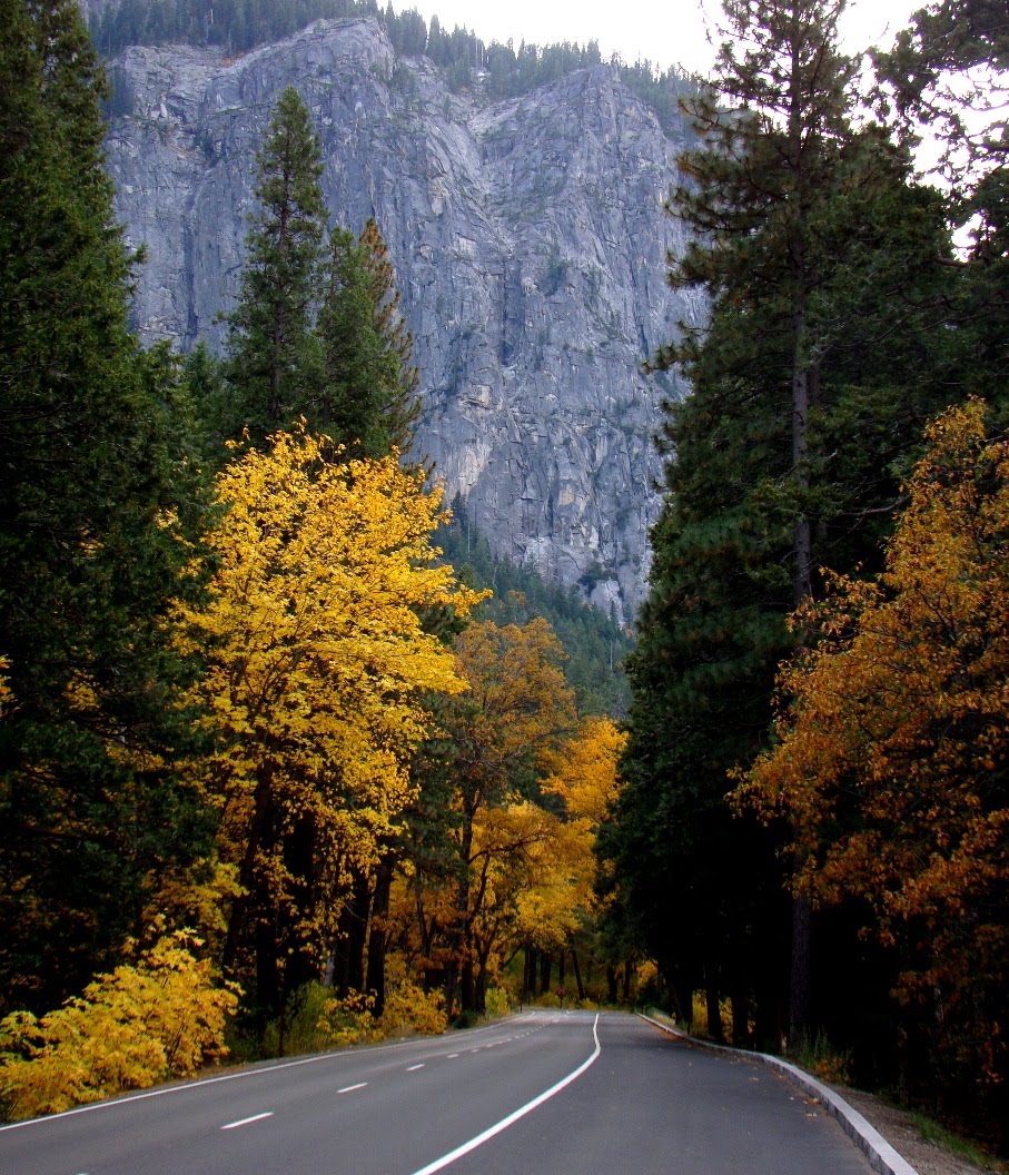
On a whim, we headed up to Yosemite Valley last Friday, searching for some fall color after a visit the previous weekend showed little evidence of the arrival of the autumn. The journey through the foothills gave us oak and alders turning, and the Big Oak Flat-Crane Flat road brought out the flaming red dogwoods. These beautiful turns in the road became just the opening acts as we found an overwhelmingly beautiful scene when we reached the valley floor. Water was still flowing in Yosemite Falls (above) after the rains of the previous week, providing a nice contrast with the alders in the meadow below.The road wound through an avenue of yellow trees, and in the breaks of the forest canopy we could see the Leaning Tower (below)....

And 620 foot Bridalveil Fall (below)...
Knowing that the rivers were flowing again from the recent storms, we headed towards Mirror Lake at the upper end of valley. Mirror Lake kind of begs the definition of a "lake". If formed as a result a massive rockfall off the north cliff near Washington Column. A much larger lake persisted for centuries, but it slowly filled in with sand and gravel over the years. During spring runoff, Tenaya Creek ponds up, providing a reflective surface very popular with photographers.

Half Dome looms high above Mirror Lake, so high that it is difficult to get the cliff and the reflection in a single picture. There was enough water in the creek Friday to catch reflections of the trees and Mt. Watkins, although the water was several feet below the level we've seen in springtime.
It was a beautiful place to watch the last rays of the sun...
The previous week I saw a bear and a coyote, but not a single deer. This week there were plenty of deer, including one or two that wanted to introduce themselves to my bumper. Others were just doing deer things in the meadows, and I got one to pose for me...

Then, it was time for dinner at the Mountain Room, and a stop to watch the stars at Gateway View, and a two hour drive home and back to the reality of grading. It was a wonderful day.

Saturday, June 12, 2010

A Few Snapshots for a Saturday: High Water in Yosemite

I've been to Yosemite Valley many, many times, so when I visit these days, I resolve to seek out the more unfamiliar corners and sort of skip past the things I've photographed a few hundred times. So it was with the iconic Tunnel View that everyone stops at. I was driving past it on the way to Glacier Point, but something caught my eye, something I had not ever seen before. Orange and yellow water flying out the base of Bridalveil Fall!

It was a rainbow, of course, as we drove by at just the perfect moment in the afternoon. It was a fascinating sight.

Bridalveil Fall is a classic example of a glacial hanging valley. The main glacier in Yosemite Valley was able to carve deeper than the tributary glacier in Bridalveil Creek, so the bottom of Bridalveil Creek stands more than 600 feet higher than the floor of Yosemite Valley.

The water was flowing at a seasonal high, and Bridalveil runoff was not sticking to the usual channels; it was flowing over the trail and through the parking lot, and the creek in the picture below was only one of three overflowing distributaries coming off the base of the fall. "Rain" was falling everywhere around the fall, and everyone hiking to the viewpoint came back soaked.
We came by in the twilight and had the falls more or less to ourselves. Bridalveil Fall and the adjacent Leaning Tower are two of the spots that make Yosemite a special place!