Showing posts with label Royal Arches. Show all posts

Thursday, April 12, 2018

After the Deluge: Yosemite Valley a Day Later (and a sight I've never seen in more than 100 visits)

Yosemite National Park is a treasure. And the gem of the park is Yosemite Valley. There are spectacular spots to visit throughout the park and region, but ultimately, the sheer granite walls and booming waterfalls are the heart of this part of the Sierra Nevada. Most people know this of course, and the valley struggles with the desires of millions of people who wish to see the park for themselves. There are horror stories of absolute gridlock throughout the valley, with upset families who wait for hours just to get into the park, and then never find a place to park and get to know it better. I can barely imagine the frustration of devoting a hard-earned vacation to see the place and then have it spoiled by the chaos of too many people.
Bridalveil Fall (620 feet) and the Leaning Tower at the west end of the valley
I've been privileged to live relatively close to the park, and in 30 years, I've been there over a hundred times. I've quite literally never had a bad time, but part of the reason is that I've been able to pick and choose the times I visited. It turns out that the time most people set aside for vacation, in July or August, is possibly the least interesting time to do so. It's still spectacular, but the crowds are the worst, the waterfalls mostly dry, and it's hot. In fall, the valley is quieter, and the oaks and dogwoods add a splash of color. Winter brings snow and silence. Spring is noisy because of the waterfalls booming from the canyon rim. If your schedule allows, go there in the off season!
Ribbon Falls only flows in the spring; it's the highest free-falling waterfall in the park at 1,612 feet.
Of course, if you come at another time of year, you would be taking a chance with the weather. That's what happened to me last week. I was scheduled to take my students there on Saturday, but fate intervened with an epic warm tropical storm that dumped inches of rain on the snowpack. The Merced River swelled to nearly 14 feet (10 is official flood level) and major roads in the valley were under a few feet of water. For one of very few times in its history, the park was closed as a precaution and people were evacuated. I was luckily able to reschedule for Sunday, because the sun came up in a cloudless sky and the difference between the two days was astounding.
Upper Yosemite Falls, 1,430 feet high, the second highest in the park after Ribbon Falls (above).
I included some direct comparisons between Saturday and Sunday in my previous post (with thanks to the Park Service for posting pictures of the storm). Today I am offering views of some of the classic views in the park, revealing the vast amounts of water still flowing into and through the valley. The Merced River had subsided somewhat but was still flowing at flood level, but only barely. The main effect was the low-lying valley meadows that were still underwater (the next two pictures).
A flooded Cook's Meadow forms the foreground for Upper Yosemite Falls.
The occasional flooding of the meadows is part of what maintains the meadows as open areas. Tree saplings are smothered underwater, and only grasses and sedges that can survive the high water table. Not all of the meadows have survived however. Since the park was established, some of the original meadows have progressed into thick forest...there are only about 65 acres of meadows left out of the original 745 acres that existed at the time of European discovery. The growth of the forest is largely the result of fire suppression. The park service will occasional burn some of the meadow margins on purpose to help maintain the integrity of the open spaces.
No visit to Yosemite Valley would seem complete without a view of Half Dome, but I have been there a fair number of times when my students never had a chance to see it. When rain is falling, it can be completely hidden in the clouds. But on Sunday it was there in all its glory. The unique shape is due to a combination of exfoliation (the fracturing of rocks parallel to the surface, and jointing, which is the result of expansion as the rock is exposed at the surface. Exfoliation, which tends to remove corners and edges, leads to the rounding of the rock into the dome shape. But a prominent joint crossed the dome, and glacial quarrying at the base caused the rock on one side of the joint to be eroded away, forming the prominent cliff, or face, of Half Dome. When seen from other angles, it is clear that Half Dome should have been called Four-fifths Dome...
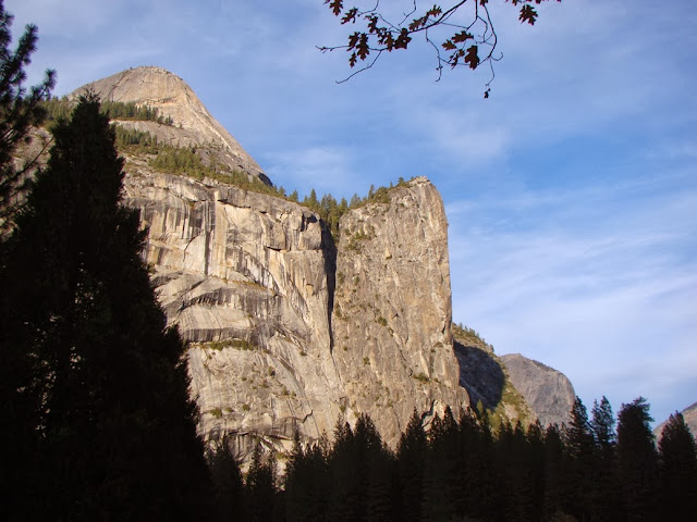
Directly across from Half Dome are North Dome and the Washington Column (below). The Royal Arches, in the center-left of the picture, are the result of a sort of reverse exfoliation, where the rock snapped out and fell from the middle of the arch, instead of the overlying cliff.
At the end of our day, we made a final stop at Valley View, one of the unheralded pullouts (only eight parking spaces) with one of the finest views to be had in all the valley (which is maybe why they call it "Valley View"). El Capitan, the sheer 3,000 feet cliff, looms on the left, while the Cathedral Rocks and Bridalveil Falls dominate the right side of the valley. A swollen flooded Merced River fills the foreground, with Bridalveil Meadow just across the raging waters. Only one of the ice age glaciers made it past this point, the so-called Pre-Tahoe (or Sherwin) Glaciation that took place around 800,000 years ago. The subsequent Tahoe and Tioga glaciers only reached the base of El Capitan and Cathedral Rocks. The Pre-Tahoe Glaciation probably did the most work in shaping the valley we see today.
I promised in the title of the post that we would include a sight I have never seen in more than 100 visits to the valley. We arrived that day when the gates to the valley reopened, at noon. A great many other people arrived at the same time, and for the first two hours the valley felt crowded. But by 4 PM, most of the visitors were already on their way back home, and the parking lots were practically empty. That is a sight in itself. But it was the drive out that astounded me.  Every time I visit the valley, Northside Drive from Curry Village to the Visitor Center area is always full of cars. Always.
But these two pictures show the astounding sight...not a single car ahead of us or behind us. For a few precious moments, we had the valley to ourselves. It's something I've never seen before, ever.

There's a secret though...even on the most crowded days in Yosemite Valley, you can find peace, serenity, and quiet. It requires that you park the car and get out. Not every trail is crowded, and in some places you can make your own path through the forest. The number of fellow hikers decreases exponentially with the distance from any paved road. If you are ever given a precious few moments in this grandest of valleys, give it a try. You won't regret it.
And that's the way it was, after the deluge...

Saturday, November 2, 2013

The Way it Was Today: Yosemite Valley in November

What a wonderful week! I had the privilege of visiting the most beautiful place in the world twice in the space of a few days. It's true I was taking a bunch of students with me, but we were learning geology in one of the most spectacular settings possible and it was a fine and enthusiastic group. For some it was their first visit to the valley. For others it was the first time seeing the place in a geological sense.
It was an eventful week as well. A storm blew through, leaving a few inches of snow in the valley, but it was all but gone by the time we arrived this morning. Last week there were lots of leaves on the trees in full glory of color, but things were dusty. Today the ground and air were moist, the forest smelled sweet, but there were fewer leaves on the trees.

Our first stop was to visit the Tunnel View, a spot just a few hundred feet below where the valley was first discovered by Europeans in 1851. There was trouble between American settlers and the local Native Americans, so a militia had been raised to search them out. Their medical officer Lafayette Bunnell was entranced with the valley and wrote a glowing account of its beauty.

I seemed to be concentrating on Half Dome a lot today. We had arrived in a large bus, and buses aren't allowed to park in many parts of the valley, so we toured on the free trams with appointments to meet at several locations. I elected to walk between points, and had a few new angles with which to view the iconic chunk of granitic rock (granodiorite, to be specific).

Despite the appearance, the dome is not really in half. It might be more properly called Three-Quarter Dome, although I prefer the Native American name of Tis-sa-ack. The south east flank is a classic exfoliation dome, shaped by the slabbing off of the corners and edges in response to the release of pressure as the rock was exposed by erosion. The steep northwest face is a joint surface that was exploited by glaciers that flowed beneath the face of the dome.
There are other lesser known domes, such as North Dome, seen below. It is the rounded edge of a long ridge of granitic rock. Like Half Dome, it was formed by exfoliation. Glacial ice never covered it. North Dome lies above Tenaya Creek, across from the face of Half Dome.
I was walking from Yosemite Lodge to Happy Isles. I started by wandering through the forest in an unfamiliar direction and almost immediately discovered the central receiving facility for all the raw sewage in the valley (I don't know this for sure, as the building was locked and unlabeled, but the stench was convincing). I reconsidered my route and headed out to the meadow near Sentinel Bridge. I was rewarded with a beautiful panorama of the Cathedral Rocks and the Three Brothers (below).
I said there were fewer leaves, but they certainly weren't gone by any means. Fewer leaves means that the remaining ones stood out in bolder relief.
The Merced River continues its late season serenity. Low flows provide marvelous reflective properties. The picture below is from a stretch of the river just downstream of the tent cabins at Curry Village.
The ravens were out in force. I stopped for a snack and they were flanking me. When I got up to discard my trash, they were thinking about seeing what was left in my pack. I found myself imagining that they will be the next truly intelligent being to evolve after we humans are gone. Like us, they seem capable of surviving practically anywhere (the deserts of Death Valley to the high peaks of the Sierra Nevada and across the desert southwest), and they are probably already smarter than the average touron in Yosemite (it's how they stay fed).
After meeting with the students at Happy Isles, we started back across the valley to Yosemite Lodge. I decided to walk and see if I could beat the tram. I did, by about 10 seconds (Unlike the tram, I didn't have to stop, and I could take the shortest route along roads and trails). I snapped a few shots while rushing along the road. Below is another view of North Dome, and a side of the Royal Arches, a form of exfoliation in reverse.
Washington Column is a steep cliff that overlooks the Mirror Lake area. The largest slide known from Yosemite Valley occurred here a few thousand years ago, forming the lake (that is a lake only seasonally). It may have been about twenty times larger than the biggest historical mass wasting event, the Middle Brother slide of 1987, which involved 600,000 cubic yards of granitic rock.
As I got closer to our final stop, I had one more wonderful view of Half Dome. The late afternoon sun was casting dappled shadows across the meadow. It was another beautiful day in a wonderful place. In a few more short weeks it will be winter!

Saturday, August 24, 2013

Into the Great Unknown: Looking for the Rivers Within the Rivers of Marble Canyon

The Grand Canyon has many moods. So many of my pictures show a canyon bathed in bright sunlight and vivid colors, but twilight often revealed softer tones. The picture above is the view from my campsite at Buck Farm Creek at dusk on the third night of the trip.

We continued our journey into the Great Unknown of the Colorado River. On day four we were expecting to make for Nankoweap Creek about 11 miles downstream. For me it was the chance to find the "river" within the river. That's not some kind of philosophical quest. It was a geological thing, to be explained shortly. But before that, we did some exploring with the extra time afforded by a short distance on the river.

As we often did, we explored the area around our camp while taking advantage of the shade. We headed up Buck Farm Canyon just to see what could be seen. There were a lot of large fallen boulders of Redwall Limestone littering the lower slopes.
Buck Farm quickly narrowed as we climbed up the canyon. We had reached deeper into the crust and were now walking on ledges of Muav Limestone, which in most places underlies the Redwall Limestone. It seems simple to say that one layer sits on top of another, but there is just a bit of time difference between the two layers: the Muav dates from the late Cambrian Period, while the Redwall is Mississippian in age. More than 150 million years elapsed between the deposition of the two layers. That's the same time period that separates the Jurassic (and her many dinosaurs) and our own current era. What happened here?
We climbed over the dry talus slopes and eventually discovered a verdant canyon and even a small clear trickling stream. It was a nice little explore, but now the sun was shining down on us, furiously hot. We headed back to the river.
It was another day remarkably free of large rapids, with only President Harding Rapid (4) standing in our way. As we drifted down the river, more gigantic caverns could be seen in the Redwall cliffs. I think the alcove below is called the Royal Arches.
We also continued to see evidence of recent mass wasting activity along the river. The rockfall seen in the picture below shows a truer color of the Redwall Limestone. It's gray on fresh surfaces, but is often stained by iron oxides leaching out of the overlying Supai Group.
Mile 43 revealed an odd sight. A thousand years ago, the Ancestral Puebloans constructed a foot bridge across ledges of Muav Limestone. From river level we could see no sign of a trail or possible route on either side of the bridge, but there it was. We joked that it was a ruse designed to catch their enemies. They would climb up there to see where it went, where they could be picked off at random.
Some of the Cambrian layers in the Grand Canyon are greenish in color, especially the Bright Angel Shale. The color comes from a mineral called glauconite. The Bright Angel is composed of what used to be ocean-floor muds, and generally forms slopes. Where freshly carved by the river, it formed the ledges seen below.
At Mile 47, we reached Saddle Canyon. I kind of awoke from my entrancement and prepared to stroll up the gentle tributary valley. I asked about the cut in talus slopes to the left of the canyon. "Oh, that's the trail" they said, "the canyon itself is far too steep to go climbing in". Oh geesh, this wasn't going to be at all that easy! We started climbing the incredibly steep talus slope, up through several hundred feet of Bright Angel and Muav layers. It...was...hot.
 As always, though, the view of the river was wonderful.
 The "trail" leveled briefly. It was wonderful not stepping up and over the large boulders.
The stream valley rose to meet the trail, and suddenly we were in a merry little paradise. It's amazing what a little bit of water in the desert can do. Life was everywhere.
We reached the small waterfall and the lusciously cool pool at the base. My picture doesn't have people in it, but I can assure you that every one of us submerged ourselves under the water.
At this time of year I didn't expect to find many flowers, but in the cool moist micro-climate of Saddle Canyon there were some beautiful columbines, one of my favorite flowers.
 I spoke of a river within a river in the title. I was looking for something I had never seen before: the Temple Butte Formation. The Temple Butte is Devonian in age, around 400 million years, which puts the formation between the overlying Redwall and the underlying Muav Limestone. But it isn't a continuous layer. The Muav Limestone was exposed to erosion and eventually developed a series of river channels that ultimately filled with limestone as sea level rose in Devonian time. In other areas, the limestone covered the whole landscape, but after its deposition, the Temple Butte in eastern Grand Canyon was eroded again, leaving only lenses of the formation in the 400 million year old river channels. There are ancient rivers in the depths of the modern river canyon.
Walking out of Saddle Canyon, I spied a really nice example of the purplish Temple Butte between the Redwall and the Muav. If you can't quite visualize what I've been describing, I annotated the picture below. I missed the formation on my previous trips in the canyon, but once I saw it and knew what I was seeing, I began seeing it everywhere!
We continued to float down the river for four miles to our camp at Little Nankoweap Creek. The canyon was beautiful beyond words. Pete let me row again, and I even traversed two gigantic rapids. Okay, they were riffles. Okay, they weren't even that...they were piffles. But I did manage to navigate the raft into camp!

Sunday, October 28, 2012

How it was: Today in Yosemite Valley

It was one of those treasured kind of days, the chance to explore Yosemite Valley. I was on the road with my students, and we got a great day of sun and fall colors (and quite a bit of geology, too). I lead with a picture of Half Dome along with one of the most beautiful trees in the world, an old elm in the meadow between the visitor center and Lower Yosemite Falls.
On a geology field trip, one does not just march into Yosemite (shades of Sean Bean and Mordor?). One has to be properly prepared. A trip from the Great Valley to Yosemite Valley involves passage through the Sierra Nevada Metamorphic Belt and a journey through time, back as far as the latest Proterozoic. We stopped along the Merced River several times, first to look at gold dredging tailings (and an osprey tending to a nest), and then to look at some incredibly contorted ocean-floor cherts of the Calaveras Complex. What a great mapping exercise for structural geology students! Of course, accessibility is a problem...these rocks are completely underwater for most of the year.
Then a stop at the famed Tunnel View, which is close to the spot where the first European-Americans discovered the valley in 1851. The local Miwok people discovered the valley thousands of years ago, of course, but that somehow seems to escape the attention of the historians (and really, why do we still celebrate Columbus Day?).
 Fall is just getting going in Yosemite Valley. We had a rainstorm last week, so the air was clean and crisp. I often think that fall is my favorite time of year in Yosemite, with the vivid colors and sparse crowds (but then I visit in spring...or winter...or summer, and change my mind).
I gave the students a bit of free time with an appointment to meet at the upper end of the valley in a couple of hours. I set off across the meadows and over to the Merced River to have a look...
The Royal Arches and North Dome seemed little changed. This is not so true of Half Dome since the Ahwiyah Rock Fall in 2009 permanently changed the appearance of the iconic rock.
 The deer were out in force, distracting my students, and me too...
I walked across Sentinel Bridge to take in a view of Half Dome from a perspective that no one in the world has ever thought to photograph (ok, ok, everyone who visits Yosemite Valley takes this picture; but really, who can resist?). But it did give me an idea, after a moment's reflection. I set off towards Happy Isles along a new route...more on that next time.
It was a beautiful day.

Wednesday, May 7, 2008

Staring into the Abyss #4 - Yosemite as you (maybe) have never seen it (and my 100th Post!)

Today is the four-month anniversary and the 100th post on Geotripper! I wasn't really sure what it was going to be like, and whether I would be able to keep the site active with all of the other stuff going on in my life as a college teacher, but I have made it work by allowing myself a blog entry as a reward for finishing a pile of grading. And there are always piles of grading! But I have enjoyed sharing my photographs and opinions, and I have especially appreciated the positive feedback that I have received from the geoblogosphere. I enjoy being a part this interesting group of earth scientists, and I hope to see more of the students and teachers out there getting involved! It was far easier to start a blog than I thought it would be and it has been rewarding. Now I will have to see if I can make it all the way through a year!

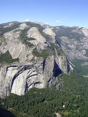
Today's view of the abyss comes from a familiar tourist stop: Glacier Point. It is accessible by paved road and trail, and is visited by hundreds of thousands of people every year. It is easily one of the greatest scenic vistas on the planet. The view is dominated by Half Dome and the Tenaya Canyon, as well as the cliffs around Yosemite Falls. Between the two is an interesting view of a pair of exfoliation domes called North Dome (left) and Basket Dome (right). From the valley floor they are barely visible above Royal Arches and Washington Column.

Exfoliation takes place when the weight is removed from homogeneous rock like granite, and the rock expands. It fractures parallel to the surface and this leads to a tendency to remove corners and edges of otherwise rectangular rocks. A great many domes grace the Sierra Nevada, and a vast number of them have never been touched by glaciers.

The mountain on the skyline is Mt. Hoffman, which is a high peak close to the geographic center of Yosemite National Park. N. King Huber used the view from the summit as the springboard to a discussion of the geology of the park in his excellent Geologic Story of Yosemite National Park. It is a great hike, and is likely to be the subject of future posts.