Showing posts with label California drought. Show all posts

Sunday, January 1, 2023

Dry Creek: Anatomy of a Flood (One of Many Across California Today)


After days of gloomy and wet weather, New Year's Day dawned bright and sunny, and we couldn't resist driving out into the California prairie to have a look at the beautiful landscape. The streams across the prairies east of Modesto were full and flowing in a way we haven't seen for a number of years. And that's the problem of course. 

This creek, normally dry, was just one of many dozens of tributaries to Dry Creek, which is itself an unregulated, undammed tributary to the Tuolumne River. This entire area received upwards of five inches of precipitation in the last day or two, and all the water had to go somewhere.

I included a picture of Dry Creek in my post yesterday, when it was flowing at about 600 cubic feet per second (cfs). I am including another picture below, taken at the same time, but from an angle that shows the pasture to the left. I knew that more water would be coming downstream, maybe as much as 1,500 cfs, an amount that would actually be more, by a wide margin, than the main drainage in the area, the Tuolumne River.

That's not quite what happened...

When we crossed the Dry Creek Bridge north of Waterford today, the creek was running at 6,000 cubic feet per second, more than ten times the flow of the previous day. Take a look below at what happened to the pasture (not to mention all the shrubs and brambles at the base of the oak trees).

By the time we arrived in the prairies in the afternoon today, most of the floodwaters had subsided in the upper watershed, but we could see evidence everywhere that a significant flood event had taken place. Rocks were strewn across the roadways, and every watercourse showed evidence of having been feet deeper the previous day. One bridge we crossed would have been four feet underwater during the height of the storm. 

The flood hydrograph below tells the story. The data is taken from a stream gage downstream in Modesto. The bar graph at the top shows the pattern of the rainfall in the storm up in the watershed, and the subsequent rise of Dry Creek. Notice how the rise of the creek lagged behind the precipitation. This so-called lagtime makes sense because it takes time for the water to gather into the tributaries and then to flow the twenty miles or so downstream. Lagtime represents the critical hours that residents downstream can prepare for the oncoming flood.

Wouldn't it be nice if there were a government entity that could monitor all rivers and all flood events so that when such events unfold, there could be timely warnings? Perhaps even keeping records of storms over the course of a century or more, so that specific warnings could be made about the timing and the expected intensity of the oncoming flood? Unlike earthquakes, floods can be predicted, and there are in fact government institutions that are tasked with this job, mainly the United States Geological Survey (across the entire US), and the Department of Water Resources specifically in California.


Which brings us to the handy-dandy bottom portion of the hydrograph. The blue line on the graph is what happened already. The pink line is the prediction. We have another intense storm coming on Wednesday, and after dropping to around 300 cfs, Dry Creek is going to rise again to at least 6,000 cfs and maybe more. Isn't it nice that we have several days warning? That's just one huge example of the value of science in our society.

Of course, no one is perfect, and all models and predictions can be affected by unknown and unexpected factors. The storm this week offers one tragic example. Although most streams and rivers behaved more or less as predicted, the Cosumnes River defied the predictions and produced record flooding, well beyond the predicted levels. 

What went wrong? Those who do science fully understand that errors happen, and it their goal is to understand the reason for such errors. The factors in the Cosumnes River flooding are being analyzed and may include an unexpected slowing of the storm front causing increased precipitation, two or three broken levees, and the Caldor Fire of 2021 that ravaged much of the watershed upstream. If you want to follow the analysis, check out the Weather West blog by Daniel Swain (@Weather_West on Twitter).

So, there is my science homily for the day. But we were out to explore some nature, and in any case, we need to appreciate the gifts we have been given. The day, a respite from a long series of expected storms, was beautiful. 


Mountain Bluebirds are not common on the valley floor, but we saw a small flock along the road.


An American Kestrel is a sharp-looking small member of the falcon family. This one remained perched near our car for a few moments.


Bald Eagles are not especially abundant in the region, but we found one. So had an 'unkindness' of Common Ravens, and they were making their displeasure known to the eagle.

And finally, an old horse seemed to appreciate the sunshine. The horses were brought to the continent by the Spaniards in the 1500s, but they actually have a long heritage here. They evolved in North America tens of millions of years ago! They migrated across the Bering Land Strait and spread throughout the world, but for some reason went extinct along with many other large mammal species in North America about 12,000 years ago.


Saturday, December 31, 2022

Year-end Look at the California Water Situation


It's the last day of 2022, and the third year of a stunning drought in California. It's been raining pretty much across the state during December, and there are hopes of alleviating the drought a bit. Let's hope so. The map above from the California Data Exchange Center gives a pretty clear idea of the situation. Reservoirs across the state are for the most part well below normal, and in the case of the biggest (Shasta, Oroville, etc.), still ominously low. I hope to revisit this diagram in a few weeks and see some changes, but we will see.

The long-term predictions earlier this year were for a continuation of dry conditions, so the current onslaught of atmospheric river storms is somewhat of a surprise, albeit a welcome one. But of course, one has to be wary of what one wishes for. There are flood watches up all around the state as one more storm will blow through to end the year.

There is also the cautionary tale of the previous rain year. We had some record storms in October and December last year, and things were looking great, but then January and February were about as dry as can be. I recorded a mere 0.08 inches in those two months.

Still, this year has some promise. From the weather station in the Geotripper backyard 13 miles east of Modesto, we've had 7.14 inches of precipitation in December, the highest total in the 32 years that I've been keeping statistics (I've recorded more than 5 inches in six different years, but never more than 6). Even with the earlier dry months, we should round out 2022 with about 8.6 inches as we move into the critical months of January and February when most of the precipitation should happen.

Despite the rain, I felt a need to check out our local barometer of runoff conditions. The Tuolumne River cannot serve in this capacity because of the numerous reservoirs upstream that very carefully control the daily flow levels. I checked instead at Dry Creek, of which there are many in California. This particular Dry Creek has its headwaters in the lower foothills of the Sierra Nevada Mother Lode, and flows for about 40 miles before joining the Tuolumne River in Modesto. Ironically, there is almost always some water in Dry Creek, obviously from rain runoff during the winter season, but also from irrigation overflow during the dry summer months. Without any substantial flood control structures, it is a good measure of runoff conditions during storms.


The creek was running about 600 cubic feet per second when I got this picture, which is about twice the current flow of the reservoir-controlled Tuolumne River. As can be seen from the discharge graph from the USGS Water Resources site, it has already been well over 1,500 cfs a couple of times in the last week. I haven't seen this much water in the creek in a couple of years.


Of course, the local picture is not the most important statistic. Everything in California's water infrastructure depends on the snow conditions, especially in the Sierra Nevada. Although these atmospheric river storms we are experiencing derive from tropical sources and are warmer than we might want, the current snow conditions are promising. Check out the report:

Let's hope this keeps up. A lot of forests, rivers, animals and people are depending on it.

What are conditions like in your region?


Tuesday, December 28, 2021

A History of the Drought in Three Pictures.


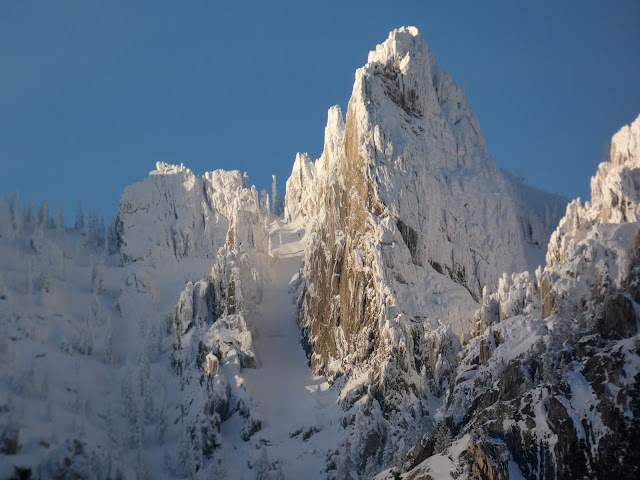
Castle Crags on December 27, 2021
It's nice to be able to report some good news once in a great while. Global warming models for California paint a truly depressing picture going forward of crippling droughts, failing snowpacks, and many tough choices to make regarding water use. We've been living those models for the past few decades with a five-year drought ending in 2017, and one of the worst drought years in history just last year. We are coming to depend more and more on the occasional intense atmospheric river events to fill reservoirs in preparation for the dry years. They've been in short supply in recent years.

My family-related travels have encapsulated the story of California's precarious water situation. The pandemic had prevented many forays north to Oregon and Washington, but we managed a trip last April, and we just completed a rather harrowing trip today. These trips were a lesson in contrasts.

We always try to take a break at Castle Crags State Park near Dunsmuir and Mt. Shasta. The granite peaks are geologically the equivalent of the Sierra Nevada, but geographically they are part of the Klamath Mountains (which were displaced west from the Sierra millions of years ago). The Crags are shorter than the adjacent Sierra Nevada, but the loftiest peaks reach 6,500 feet, which allowed for glacial erosion during the Pleistocene Ice Ages.

Castle Crags on December 18, 2021
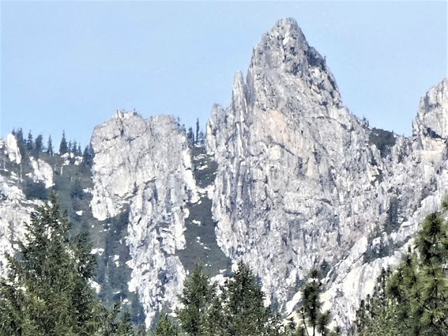
When we visited last April, the forest surrounding the crags was frighteningly dry (below). What should have been a damp forest floor with streams swollen by meltwater was like a tinder box waiting for the spark that would ignite an inferno. Like the rest of the mountains surrounding the Central Valley, the snowpack was gone, literally 5% of a normal year. 

When we left on our trip on December 18, things were looking up a little. There had been a surprising strong storm in late October that had dropped some snow on the mountains, but warmer weather had melted much of it. A dry November left the snowpack at 19% of normal.

Then a bunch of storms coincided with our trip plans. When we stopped in at Castle Crags on December 18th, there was a delightful cover of snow on the peaks (the picture above). It seemed a promising beginning of a decent snowpack.

We were in Seattle area at the beginning of one of the biggest snow events in the city's history. We left the city on freeways so covered in ice that the lane dividers couldn't be seen, and everyone guessed (only somewhat correctly) where those lanes were. Spinouts and accidents were everywhere, and it took us nearly four hours to go the first hundred miles towards the south. We eventually outran the storm but stopped for the night in Oregon were the storm caught back up to us. 

Our next day was 380 miles of icy anxiety, but luckily the roads were clear when we reached the top of the Siskiyou Mountains and Mt. Shasta. But what huge amount of snow had fallen! Looking at the top photo in the post, you can see the high peaks were literally coated in snow.

Castle Crags on April 23, 2021
In a more official vein, the Sierra Nevada had jumped from 19% to 159% of normal snowpack in the space of three weeks (below). We've received the 52% of the total amount of snow year, with three normally wet months to go. And at least two more storms are forecast in the next ten days. It's really good news, a possible respite from the long-term drought that has been gripping the region. But it's a real mess if you have to be traveling in it.

Source: Snow Pack Conditions - Snow Water Content Chart (ca.gov)
But the snowpack is not the whole story. Reservoirs across the state reached critically low levels in two years of drought (below), and it will take more than a couple of good storms to build them up again. A heavy snowpack is great, but warm periods can prematurely melt and evaporate the ice. I'm going to stay optimistic, but my mind is telling me that this is a respite, not a solution to our problems. If we get a good water year, we will still face imminent droughts and depleted groundwater reservoirs. We need to face the problems, and not put them off. 

Source: Interactive map of water levels for major reservoirs in California | American Geosciences Institute
But it sure was nice to see all that snow!


Monday, March 26, 2018

Liveblogging the Deluge: 2018 Short Version

High water on the Tuolumne River, February 2018, about 15,000 cubic feet per second.

Why "short"? What deluge? Hasn't this been another dry year?
Tuolumne River on January 19, 2018, flow at about 300 cubic feet per second.

If you've been reading over the last year, you would know that I started what I thought would be a short blog series (Liveblogging the Deluge) on what looked like (and almost was) a record-breaking atmospheric storm that hit California last January. The storm hit, and then there was another. And another. Prodigious amounts of snow and rain fell in central and northern California through the end of April, putting an end to California's historically bad five-year drought, and filling the state's dry reservoirs. So much snow accumulated in the drainage of the Tuolumne River that the main reservoir, Don Pedro, was constantly at the edge of overflowing, so the outflow was maintained at near flood-level (averaging 9,000 cubic feet per second, briefly to 15,000 cfs) through July. We really had no chance to see the changes on the floodplain until September.
Tuolumne River on March 25, 2018, flow at about 4,500 cubic feet per second

And then...when the "storm door" was supposed to open in November, barely anything happened. My backyard gauge told the story: October, 0.07", November 1.15", December 0.0". January finally brought an almost normal amount, 3.44", but the next month was one of the driest Februarys ever recorded, with my gauge recording a mere 0.37". Statewide, the snowpack was a mere 20-25% of normal. At Don Pedro Reservoir, there was a lot of water in storage, but realizing that there would be almost no snowmelt, the operators kept the outflow into the lower Tuolumne River at very low levels, about 300 cubic feet per second. They left a minimum of space for emergency flood control.
Tuolumne River, January 19, 2018, flow at 300 cubic feet per second.

And then March happened. The storm door opened in a big way, and three major storms blew through the state raising havoc with floods and mudflows in numerous localities, including some of the areas affected by the horrific fires of last summer (and December, unfortunately). Locally, we received 3.36", but my little town was one of the driest spots in the state. The snow in the Sierra Nevada was measured in feet, including 7-8 feet in a few places.
Tuolumne River on March 25, flow at 4,500 cubic feet per second.

It wasn't a drought ending month, but it took the snowpack from disastrous to merely disappointing. Current levels range from 44% to 66% of normal. And now the operators at Don Pedro Reservoir can expect some runoff amounts that will be semi-normal. That means they'll need a bit more reservoir space....

I noticed the first ramping up of river flows about a week ago, when the discharge was tripled to about 1,000 cubic feet per second. I could hear the river again (the velocity of the water at 300 cfs is very low). But then when I walked the river trail yesterday, the river was raging along at 4,500 cubic feet per second. Not a flood, but a higher level than at almost any point during the entire run of the 2012-2017 drought. The islands and gravel bars that were being used by fisher-people and picnickers were once again underwater. The slough at the west end of the Parkway Trail where I walk was once again flowing. This is good on a number of counts: salmon and other fish will have a better chance of survival and getting to the sea, and the invasive weed river hyacinth will probably not gain root in the upper areas of the river. The river weed choked the slough and parts of the river channel during the drought, smothering out other vegetation, and making life difficult for fish and aquatic wildlife.

Farther afield, the outlook is reasonably good. Most of California's reservoirs are at or well-above normal (flood-damaged Lake Oroville is an exception at 75% of normal). Don Pedro came up at least 8 feet during the storms in March.
While good for the snowpack and reservoirs, the storms did a lot of damage. Roads were washed out in numerous places in the foothills of the Sierra Nevada. We almost lost a smaller reservoir on Moccasin Creek. In the end, the "Deluge" was a lot shorter than the one we got last year, but in a year as dry as this, it was good to have a little extra water "in the bank". With the uncertainties related to global warming, and the expectation of future extended droughts, every drop counts.

Saturday, January 27, 2018

The Difference a Year Makes: Liveblogging the "Deluge" (Hint: There isn't one)


This post is both a look back at ten years of Geotripping, but is also an update on snow and precipitation conditions in California right now, and that picture is not pretty. My backyard rain gauge had amassed a mere 1.22" of rain by the beginning of January, and while January had higher than normal precipitation, I only show 4.66" for the rain year, just a bit over 50% of normal (I think we benefited from a few isolated downpours, as Modesto, just 13 miles away is at 3.09"). During the historic drought of 2011-16, three of the dry years were wetter than this.

I walked the Tuolumne River Parkway Trail today, and for the first time in weeks I could see the Sierra Nevada, the peaks that loom high above Yosemite Valley. The sun reflected off a snowpack that was far different than it was a year ago. The snowpack is only 30% of normal (see below). It's late January and there are a few ski resorts that haven't even opened yet (if they'll even open at all).

Source: http://cdec.water.ca.gov/snowapp/sweq.action
If there is any bright spot in this dismal year it is California's reservoirs. Because of the ample rain and snow last year, most of the reservoirs are at healthy levels, more than 100% of normal (see below). One prominent exception is Oroville Reservoir, which was lowered drastically to allow repairs to the spillways that failed during the height of the storms last year. There is at least some comfort to know that we have some resources to weather another drought, at least for a few years. I would have preferred a few wet years to help replenish our depleted groundwater reservoirs. That is a lasting effect of the drought that may not be fixed any time soon.
Source: http://cdec.water.ca.gov/cgi-progs/products/rescond.pdf
The Tuolumne River Parkway is a changed place. During the deluge last year, river flows were maintained at or near flood levels through July. Much of the river floodplain was underwater for months, and hundreds of trees and shrubs were uprooted and carried downstream, in places leaving behind huge masses of dead vegetation. Riverside vegetation really never had a chance to recover and regrow once the water subsided. The hated invasive weed River Hyacinth is gone, but so are many riparian shrubs. The six month flood was necessary to protect human developments on the river, but it didn't do the habitat much good. I'm hoping that the wholesale redistribution of river gravels will do the Salmon and other river organisms some good. I have run across signs of beaver, otter, raccoon, and foxes on the floodplain in recent days.

I've been going through the Geotripper archives to select some of my favorite blog posts of the last ten years. The first half of 2017 was dominated by my observations of the extraordinarily wet year and the flooding, which I called "Liveblogging the Deluge". I wrote dozens of posts all through the first half of the year, and it was hard to pick any particular ones to illustrate here, so I settled on the one I wrote exactly one year ago. It involved the post-mortem of the first of the major atmospheric river storms that battered the state. Many more were to come...

Thursday, January 26, 2017

Liveblogging the Deluge: The Post Mortem...Storms That Made a Difference

The atmospheric river storms of January have finally subsided, and we are looking at kind of a new landscape across California. We had a couple of sunny days, so we headed up the highway to have a look at Don Pedro Reservoir on the Tuolumne River coming out of Yosemite. When we visited on January 5, the lake stood at 786 feet, which translates to 76% of capacity. That was 114% of normal for this time of year, which was a relief after five years of intense drought.
Don Pedro Reservoir on January 26 after two atmospheric river storms, elevation 813 feet (90% of capacity).

When we arrived yesterday, the lake stood at 813 feet, or 90% of capacity, which is 133% of normal. It is only 17 feet below the level of the dam. It could have been higher, but the dam operators have been maintaining constant outflows in the range of 7,000-9,000 cubic feet per second, a level that is just short of flood stage. Had they not done this, the lake could have overflowed and flooded downstream urban areas as happened in 1997.
Source: http://cdec.water.ca.gov/cgi-progs/products/rescond.pdf
It is a similar picture at the major reservoirs all around California. The monster reservoirs, Shasta and Oroville, are at more than 120% of normal for this time of year. San Luis Reservoir, the critical link in the California Water Project, is 103% of normal, and may fill for the first time in five years. A few are still low, most notably New Melones (68% of normal), and Trinity (84% of normal), but they are way up from where they stood before the storm.
Source: http://cdec.water.ca.gov/cgi-progs/products/rescond.pdf
The picture in my corner of the woods is brighter too. The Tuolumne River is running fast and cold, and in many places it covers practically the entire floodplain, and has done so for several weeks now. I believe that most areas downstream are not affected by the high flows (there is a history after all of flooding, and outflow from Don Pedro is regulated so as to prevent it). Instead the river is flushing itself of invasive hyacinth, which has been threatening numerous creatures and plants. Gravel bars are shifting and accumulated silt is being removed, providing better nesting areas for salmon and other fish species. Silt is being redistributed across the floodplain, rejuvenating the soils of the riparian areas. Groundwater aquifers in the vicinity of the river are being recharged.
Tuolumne River in Waterford, about 8,000 cubic feet per second

My rain gauge has been active. My friends in more humid regions may snicker a bit when I talk of how we've had 7.38 inches of precipitation in January. That might not seem like all that much but in 25 years of recording rainfall in Waterford, only two had greater amounts, 7.58" in 1995, and 8.60" in 2011.  We've had a year where that was the total for the entire season (7.26" in 2014). We've already passed the total rainfall normally received in an average year (14.69" so far compared to 13.92" average for the last 25 years).

But the real story? The snowpack.

At the height of the drought, we had a snowpack that was 5% of normal. 5%! It was both unbelievable and appalling.
Source: http://www.sacbee.com/news/state/california/water-and-drought/article124305504.html
This year started out with some good healthy storms, but the January events threatened to undo the progress. On the first of January, the statewide average was 70% of normal, which was an improvement over the last five years.The atmospheric rivers began as warm tropical storms that threatened to melt what snow there was. At first they did, but colder arctic are started to move in and the snowpack began to build. After the first set of storms blew through, the statewide snowpack had improved to more than 100% of normal.

And the snow kept falling! The second atmospheric river storm system brought even more snow, and as of today, the snowpack is nearly 200% of normal. If the trend continues (there is NO guarantee of this), we could be on track for a record snowpack. I don't consider it likely, but it would be nice to start recharging the groundwater aquifers that have been severely depleted in recent years.
Source: http://cdec.water.ca.gov/cgi-progs/products/swccond.pdf


The record snowpack should not be seen as evidence that global warming isn't happening. Average temperatures are defiinitely up and have been for several decades. The thing is, snow is snow whether the temperature is 15 degrees or 30 degrees. A not-at-all unusual heat wave could undo the progress in the snow levels. The sky spigot could turn off. After the record flooding of 1997, February and March both provided less than a quarter inch of rain over the entire month. And the drought will never be truly over, as demand outstrips supply even in plentiful years. And little is being done to replenish declining groundwater aquifers.

All in all, though, I'm happier to have plentiful rain rather than crippling drought!

Wednesday, December 13, 2017

Fire in the Sky: The Perspective That Comes When Time is Running Out


It was nothing more than the evening commute to school to give a final examination in my Earth Science course. It was a bit after 4 PM and the sun was settling into the horizon, and the spectacle of it all caused me to pull to the side of the road. I have a habit of taking my camera with me everywhere, so I was able to snap a few pictures of the seemingly striped orb. It was also a moment of reflection.

It was a beautiful sight, but it was tinged with great sadness. The color is coming from the homes and dreams of a lot of people in Southern California who are battling a devastating wildfire that has consumed nearly 250,000 acres (that's nearly 400 square miles). At least 700 homes have been lost already. The flames, driven by a severe Santa Ana Wind event, produced volcano-like plumes of smoke and ash that flowed out to sea and then up the coast of Central and Northern California. There is a ridge of high pressure out there, parked over an exceedingly warm Pacific Ocean that is diverting the normal late fall and early winter rainstorms far to the north. There has been no precipitation in our area for weeks, and none in the long-range forecast. The fires in SoCal come on the heels of the even more devastating fires that swept through the wine country a few weeks back, destroying thousands of homes, and killing several dozen people. The drought and the attendant wildfire intensity is seemingly back after a brief one year respite.
Source: www.latimes.com/local/lanow/la-me-fire-ledeall-20171213-story.html

It's hard to convince skeptics of climate change if they are not living in the path of the worst effects. But the effects are extending to more and more people as the decades slip by. There were warnings of mega-droughts and longer fire seasons in the west and southwest years ago. There were predictions of hurricanes amped up by warmer ocean water. There were the obvious forecasts of sea-level rise that are now having a visible impact in coastal cities like Miami, Florida and Venice, Italy. And the glaciers and icecaps are continuing to melt away as they were decades ago, and at an accelerating pace. Unprecedented record-setting heatwaves are becoming distressingly commonplace. The evidence of global climate change is becoming ever more apparent to people around the world, and to their leaders as well, all of whom are signatories to the Paris Climate Accords. Every country, that is, except one. The United States of America.

Many people, probably most, don't consider science when they stand in the voting booth and make their choices. A distressing number of people end up never standing in the booth for one reason or another, but too often because of voter suppression activity. The rest are thinking about the "issues" like standing for national anthems (or kneeling), or building walls, or any one of dozens of temporary controversies (look up Willie Horton ads some day). Perhaps most think about misogyny, racism, taxes, or the economy. These things are important, of course, because these are issues of life, and quality of life. But few think about science, the environment, and the long term effects of what we are doing with the choices that we make. In the long run, these are some of the most important things that impact our lives. But our political representatives can only think in time frames of two, four, and six years, the length of their terms in office. We need to hold their feet to the fire (figuratively) to make choices that benefit us all long after their terms have ended.

Perhaps the most important game in town right now is education. It is only through education that people can make the right choices that will secure their future and the future of their children and their grandchildren. An educated populace is not going to be hoodwinked and cheated by charlatans and con-men running for public office. And education never stops in high school or college. It is a life-long skill, especially now when the entire breadth and depth of human knowledge can be accessed by the phone in your pocket. Take advantage of it.

The sun doesn't seem to move all that fast when it is high in the sky and hours are left in the day. But when the end of the day is near, and one has the perspective of the horizon, the darkness comes quickly. We are being given that "gift" (or warning, if you wish) of perspective concerning climate change. We've been given the predictions and projections from twenty and thirty years ago, with results that are sometimes off by a bit, but almost invariably worse than expected. I don't know when it is too late; it is different for different groups of people and different biomes and ecosystems. But we have been warned.

In any case, that's what I thought about while the sun sank below the horizon and the darkness set in.

Wednesday, November 29, 2017

Our Children Will Say "Why Didn't You Tell Us?", and We'll Say We Tried: The Government Isn't Just Denying Climate Change.

I'm reposting my blog from January 27 of this year. It is a story that needs to be told again. At the time I wrote it shortly after the inauguration, it could have been described as alarmist...that I wasn't giving the new president a chance. But the reality is that after 10 months, we are being endangered by the actions of this administration. Word comes today from National Public Radio that scientists applying for grants from the National Science Foundation are removing the words "global warming" or "climate change" from their proposals. They are censoring themselves. This is beyond concerning.

The budgets at NASA, NOAA, the National Weather Service, and the National Park Service have been deeply slashed to literally blind us to the effects of climate change. Those who work for these agencies doing climate change research have been marginalized if not outright fired. The appointees to the EPA, the Department of Energy and other agencies are climate change deniers. And yet the effects of climate change continued unabated during the past year. We have seen the amped up hurricanes that devastated Texas, Florida, and Puerto Rico. We saw the worst fires in California history destroy thousands of homes. We have sweltered through unprecedented heat waves.We see entire forests dying from the attacks of bugs that are normally killed in cold winter conditions. The Great Barrier Reef in Australia is dying in front of our eyes. The Arctic ice is at record low levels and declining. Sea level continues to rise. And we are in the process of withdrawing from the Paris Climate Accords, the only country in the world that is doing so.

I am not a major voice in the political debate. My blog reaches hundreds of people, although on a good day it will reach thousands. But we have to stand up to this denial, and I hope that those of you who have followed my blog over the years will make your voice heard. We still have tools, we can still protest, we can still contact those who "represent" us in Congress. In many cases, we still have the right to vote (although that right is seriously threatened as well).

Please read what follows to understand why we must stand up to this administration:

Is Trumpism/Pencism the New Lysenkoism? The Need to Defend Science From "Alternative Facts"
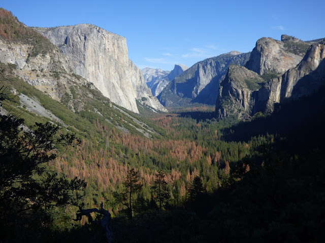
Drought-killed trees in Yosemite Valley, California

Imagine what it must have been like living under communist rule in the Soviet Union during Joseph Stalin's regime. I can't even begin to imagine the unspeakable horrors that led to the deaths of tens of millions of people for a variety of reasons, but events this week have brought to mind a particular episode that is unfamiliar to the public at large, but which had a profound effect on Soviet agriculture. It was no doubt among the reasons for the failure of the totalitarian rule over the Soviet Union. Why? Because they were never really able to feed their own people, especially wheat. The Soviets had plenty of arable land. Why did this happen? There were always profound inefficiencies in the Soviet economy, but the heart of the problem was a single man: Trofim Denisovich Lysenko.
Trofim Denisovich Lysenko, 1898-1976. Source: https://en.wikipedia.org/wiki/Trofim_Lysenko
How could one man do so much damage? It had to do with how science was done in the Soviet Union under communist rule. Scientific research, at least in agriculture, was done from the top down. The government decided what was true, and directed that research must confirm what the government knew was true. If that didn't happen, scientists and researchers faced arrest, re-education, and possible death. And in the Soviet Union, from the 1920s until 1965, Lysenko was in charge of agriculture.

Simply stated, Lysenko didn't accept the theory of evolution by natural selection. He denied Mendelian genetics or even the presence of genes in plants and animals. He instead believed an earlier hypothesis called Lamarkism as well as his own bizarre ideas about inheritance. In essence, he believed that organisms could pass down their experiences to their offspring. A simple model to illustrate this would be an experiment in which dogs had their tails surgically removed, generation after generation. After enough time had passed, puppies would start being born without tails. These were called acquired characteristics. In essence, he insisted that the best strains of cold-weather wheat could be achieved by repeatedly subjecting the seeds of warmer climate strains with cold temperatures. They would then acquire the ability to grow in colder climates.

And so, under his direction, farmers were ordered to grow inferior wheat strains for decades, and the results were no surprise. Production suffered, and over the years the Soviets had to import wheat from other countries, including the United States. The study of DNA, genetics, and natural selection continued unabated in other parts of the world, and agricultural yields ballooned as a result. Yet despite these failures, Lysenko continued as the Director of Genetics for the Academy of Sciences for decades. And he had true power. Under his reign, more than 3,000 geneticists who didn't toe the Lysenko line were arrested, and many of them were executed.
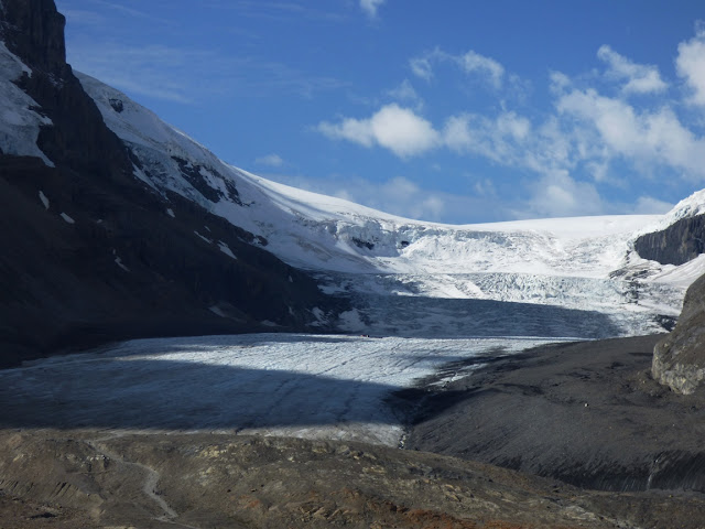
Athabasca Glacier in Jasper National Park in Alberta, Canada. The glacier has been receding for decades

So why are we talking about Lysenko tonight? I can barely keep up with the daily outrages of the new Trump/Pence administration, but one of the most chilling news stories during the transition period and inaugural week has been the attack on science and scientific research. Global warming and climate change have been declared to be false, and Trump officials have taken steps to end government research into this most pressing environmental issue. They have demanded the names of climate researchers at the Environmental Protection Agency, the National Park Service and other departments, suggesting a coming purge (update: this has happened). They announced a gag order on dissemination of the results of research by government experts, even outside of government channels. They have attempted to restrict information flow via the social media. There have been hints of draconian budget cuts in scientific research.
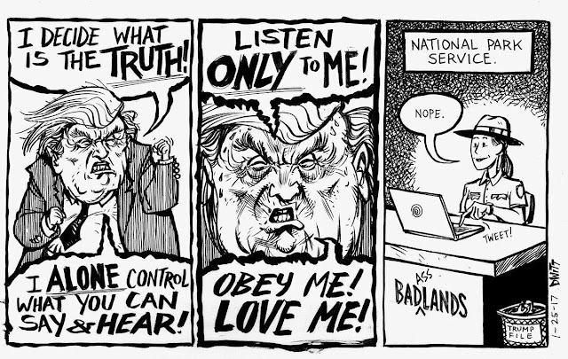
The cause, of course, is not a belief in some other cause of warming. Many of Trump's followers deny that warming is even happening. Because Trump, Pence, and the others in the administration do not believe in global warming, they have decided that it must not be investigated. They are trying to use their position of power to alter the direction of scientific research to conform to their own preconceived beliefs. That runs absolutely counter to the trajectory and goal of scientific exploration, and very much counter to the role of science in America throughout its history. Scientific research and discovery has been a driver that has allowed the American economy to thrive. For a country to promote scientific research that is directed from above towards categorically wrong conclusions is courting disaster, and the implications are worldwide in scope.

I am encouraged at the response of the scientific community. There has been a concerted effort to protect and preserve the research that has been conducted in the past, and researchers are beginning to realize that they will have to become politically active, despite a tendency to avoid it in the past. Resistance has been growing in the social media. To be clear, this is not a Democratic-Republican issue, or a liberal-conservative issue. It is a battle between factual truths and willful ignorance. It is also an economic issue, as the opposition is richly funded by corporations who stand to profit handsomely by denying the existence of global warming. Unfortunately, we will all lose in the end.

I've tended to avoid politics in this blog, but that has to change now. Until the Trump/Pence administration acknowledges the critical role of independent scientific research, they must be challenged at every turn. The stakes are simply too high for Americans and the rest of the world. It doesn't matter what Trump and Pence believe. They may believe warming hasn't happened, but sea level will continue to rise anyway. Coral reefs will continue to die off. Glaciers will continue to melt. Storms will become more intense, as will droughts. The world will get hotter, and each year will decrease our chances to deal effectively with the issue. For Pence and Trump to be willfully ignorant about science is appalling. To ignore the advice and counsel of experts in the many fields of science is absolute folly.
Source: https://www.earthmagazine.org/article/comment-crazy-times-arctic

I fear we have entered into a new age of Lysenkoism. Yes, that is a term. And it would be a tragedy.

Friday, October 20, 2017

Can't See the Forest for the Creek; Or is it the Other Way Around? California's Mega-droughts


The eastern Sierra Nevada is home to one of the strangest forests I know of. It's not the species of tree that is odd; they are mostly Ponderosa, a pretty but unremarkable tree which can also be found on the adjacent slopes. What's strange is that these trees are dead. Not the "recent forest fire" kind of dead. It's that they have been dead for the nearly a thousand years. Oh, and they are still standing, and are located in the middle of a good sized river.

The West Walker River drains a rather large region in the vicinity of Leavitt Meadows and Sonora Pass. Several forks come together near the junction of Highways 108 and 395, and the river plunges into a narrow gorge before spreading out into the Antelope Valley near Topaz Lake on the Nevada border. The trees, and there are several dozen, are found at the head of the gorge near the campground at Chris Flat. Studies have found that these trees sprouted, grew to maturity, and died within a relatively limited period of time between about 800 and 1350 C.E. (common era, equivalent to A.D.).

The weird part is that the trees pretty much filled the entire canyon bottom. They don't do well immersed in water, which seems to suggest that there was almost no room for a river channel when these trees were growing. This implies that the river was much smaller and therefore there were two crippling droughts that lasted on the order of 200 years  and 140 years respectively. Once the droughts ended, the river filled the channel with sediment again, perhaps supplemented by outwash gravels from the Matthes glaciation (the Little Ice Age).


These ghostly forests exist in other parts of the Sierra Nevada. Tenaya Lake, Lake Tahoe, and Fallen Leaf Lake all have submerged forests that grew to maturity during these periods when the lakes didn't have enough water to flow through their outlets. Oral histories of California's Native Americans also hint at terrible droughts.

In human time frames, droughts are a fact of life here in California. We had extended droughts from 1928-1934, 1960-61, 1976-77, 1988-92, and most notably, from 2011-2016.  Our population has grown so large that each drought becomes more problematic, and we muddle through on the strength of a few extraordinary precipitation years like 2017 that fill reservoirs for a time. What would we do if another century-long drought were to come? And what role will anthropogenic global warming play? I might not be here to find out, but my grandchildren might have a real struggle.