Thursday, June 12, 2014

It's Not What's There in Grand Canyon That's Incredible, It's What's Missing


Our trip last week started in Las Vegas, Nevada, where we paid a visit to an exposure of the "Great Unconformity" which is also seen in the bottom of the Grand Canyon. A participant noted that he had seen Copperfield make an elephant disappear once, but that this week he had seen a geologist make a billion years disappear. That's what is incredible about the Grand Canyon. There are lots of interesting rocks to see, but the story they tell is that a whole lot more rocks are missing. Many times more rocks that we can see.

No part of the crust holds a complete story of the Earth. There simply hasn't been a spot that has been stable enough through the billions of years of geologic time to continually collect sediments. Instead, the story of every place one can ever visit on Earth is that it has been uplifted, eroded, deformed, and subsided numerous times. The Grand Canyon has been unusually stable compared to most, but still there are huge gaps in the story. These gaps where erosion took place are called unconformities. There are at least fourteen of them exposed in the Grand Canyon.

The most obvious kind of unconformity is called an angular unconformity and the eastern part of the canyon exposes one of the most famous examples in the world. It separates the tilted rocks of the Grand Canyon Supergroup from the flat-lying Paleozoic sediments that make up the most visible part of the canyon walls. Sediments more than 12,000 feet thick once covered the region. They accumulated between 1.25 billion and 700 million years ago, but were eventually broken and tilted by faulting. Almost all the rocks were eroded away except for isolated blocks such as those seen in the picture above.
The second kind of unconformity divides older metamorphic and igneous rocks from younger flat-lying sediments. It is called a nonconformity. It is one of the most profound in the region, as the old metamorphic rocks represent the roots of a vast mountain range many thousands of feet high that was completely eroded away to a flat plain. The gap between the rocks extends from 1.7 billion years to just 500 million years ago.
If you ever have the opportunity to raft the Colorado River, be sure to stop in Blacktail Canyon and walk a short distance up. It's gorgeous in its own right, but is one of the best places in the entire canyon where one can lay a hand across a billion years.
Photo by Mrs. Geotripper
 The third type of unconformity is a disconformity, where there are horizontal sediments both above and below the surface of erosion. Most of the boundaries between the Paleozoic formations making up the bulk of the canyon walls are disconformities. The time gap between the Cambrian layers of the Tonto Group and the Mississippian Limestone is more than 100 million years (in the picture below). For perspective, consider that 100 million years ago, dinosaurs still dominated terrestrial habitats on Earth.
The black lines are disconformities, places where erosion has removed rocks.
Most written descriptions and interpretive signs emphasize the thickness and nature of the rocks exposed in the Grand Canyon. J. Michael Timmons and Karl E. Karlstrom, in their wonderful work Grand Canyon Geology: Two Billion Years of Earth's History, have taken a different tack in representing the rocks. Their stratigraphic column showing the formations in the canyon also shows the approximate time frame of the time periods that are missing (in white).
It's not an unconformity, but the other rocks that are missing from the Grand Canyon are the roughly two miles of sediments that once lay on top of the Kaibab Formation. We know they were there because they are found all around the Grand Canyon region, but they've been removed by the unrelenting forces of erosion. All told, there are about 4,000 feet of Paleozoic rocks making up the walls of the Grand Canyon. But there are in excess of 25,000 feet of sediments that have been removed, and a similar amount of metamorphic and igneous rocks as well.
The Grand Canyon is incredible, but the missing rocks of Grand Canyon are extraordinary!

Tuesday, June 10, 2014

Little Mysteries in Big Canyons: The Faulty View from Yavapai Point, Grand Canyon

The Grand Canyon certainly has its faults. Loads of them actually. For a place that is famous for having relatively unbroken strata for tens of miles, the number of fault lines is kind of staggering. A stop at Yavapai Point and the Geology Museum is a nice spot to gain an appreciation for the role of faulting in the shape of the canyon.

If you look just right of center in the photo above, you can see the canyon of Bright Angel Creek and the linear pattern that it follows. Erosion worked preferentially at removing the crushed and broken rocks along the fault line, giving the canyon its unusually straight appearance. The picture below provides a closer perspective.


Faulting has influenced the region numerous times in the history of the Kaibab Plateau, including episodes of faulting in Proterozoic time 1.7 billion years ago that were primarily compressional in nature. Later, another period of mainly extensional faulting took place around 600-800 million years ago as the ancient supercontinent of Rodinia was breaking up. As can be seen in the geologic map below of the Bright Angel Creek area, the ancient rocks are riddled with faults (the entire map of the eastern part of Grand Canyon National Park can be found at http://pubs.usgs.gov/imap/i-2688/i-2688.pdf).

Source: http://geomaps.wr.usgs.gov/fed_lands/task1.html

There's an interesting little "twist" just downstream of Bright Angel Creek in the canyon of the Colorado River. Can you see it? There's another fault exposed in the Proterozoic rocks of the Granite Gorge Metamorphic Suite and the Grand Canyon Supergroup. The fault is ancient, having not offset the overlying Paleozoic rocks. It may be a trick of perspective (and I'm open to correction), but I think I'm seeing a prominent drag fold where the layers have been twisted in the direction of the fault motion. If it is a drag fold, can you see the little mystery?
I've annotated the picture below to help define the fault relationships in the outcrop. So, what strange thing happened here? When a few of you have guessed, I'll tell you what I think in the comments section!

Monday, June 9, 2014

Is There Ever a Boring Sunset at Grand Canyon?

The Grand Canyon is the place. It is perhaps the most stunning exposure of raw geology in the world (although I know there will be some who have their own candidates in this matter). What sets the Grand Canyon apart from so many others is the sheer scale of the scenery; it is a place where any side canyon would be a national park of its own in any other setting. It is a spectacle, day or night, and those parts in between. Especially those parts in-between.
I've never lived at the Grand Canyon, but I have been there dozens of times, and I can't remember a boring sunset. The lengthening shadows add perspective and depth to an already amazing scene. On our recent visit, we headed out to Powell Point. Park interpretive materials suggest a number of places for excellent views, but none of them suggest Powell, which was fine with me. I was surprised by how few people joined us on the rim. Powell Point juts out into the canyon a short walk from Hopi, but on our particular night only a dozen or so people were present at the end of the trail.
It had been somewhat of an overcast day, and the sun was hidden behind a bank of clouds as it sank towards the horizon, so the colors were somewhat muted at first. But we could see a gap in the clouds near the horizon where the sun would have a brief moment of clarity before setting. The light burst through and the canyon lit up.
The Grand Canyon offers up such visual spectacle because of the variety of changing environments over the course of 300 million years in the Paleozoic Era. The iron-rich sediments of the Supai Group and Hermit Shale, laid down in the floodplains and deltas of the Ancestral Rocky Mountains provide the intense reds and browns in the middle canyon. The windblown sandstones of the Coconino and the limey sandstones and gypsum beds of the Kaibab shoreline provide yellows and whites near the canyon rim. The dark metamorphic rocks of the Proterozoic lie hidden in the depths of the inner gorge.
Any place in the world can put on a light show as the sun sinks beneath the horizon, but the Grand Canyon is nearly 8,000 feet above sea level with a long gentle slope to the west. The horizon is many miles distant, and clouds stay lit much longer than normal.
The sun finally faded, and we patiently awaited the tram that would bring us back to our abode for the night. I took a walk along the rim later that night just to hear the emptiness and silence. There simply is no place like the Grand Canyon.

Sunday, June 8, 2014

Exploring the Depths of the Grand Canyon...By Car?

The Grand Canyon is one of the great spectacles of the Earth. Millions of people every year stand on the edge of the abyss and peer in, taking in the vivid colors and hidden depths. Tens of thousands venture down some of the few trails that reach into the incredible gorge, and several thousand raft the river. But how many drive the canyon? Did you even know you could?
And no, I'm not talking about visiting the canyon "Thelma and Louise" style...

For more than two hundred river miles, no road crosses the Grand Canyon (plus another hundred miles to Lake Mead). Navajo Bridge near Lee's Ferry is at one end, and Pat Tilman Bridge near Lake Mead is at the other. In between in the depths of Grand Canyon there is a single road that reaches the river. It's called Diamond Creek Road, and it starts on Hualapai Nation lands at Peach Springs. It's a marvelous adventure.

Without even considering the philosophical objections to building roads through the wilderness world of the Grand Canyon (objections I completely agree with), there are staggering engineering barriers. There are a series of formations, including the Redwall Limestone and the Coconino Sandstone that form sheer cliffs. The locations of trails in the Grand Canyon are controlled almost entirely by the few locations where they can surmount the cliffs of these two layers.

At Diamond Creek, the Hurricane Fault has offset the formations in just such a way that the cliffs can be avoided entirely. For the entire twenty mile length of the road, there is nary a cliff to worry about, as the road follows the bottoms of desert arroyos and washes. The biggest worry is flash floods and mudflows, which can easily shut down the road in July and August during the monsoons (and badly inconvenience river rafters who plan to take out at Diamond Creek).
One can certainly discuss the idea that it's "cheating" to drive to the bottom of the canyon, and there is a certain validity that scenery that hasn't been "earned" by completing a stiff hike might end up being less appreciated. But many people can't handle the very strenuous hiking and many simply don't have the time. Driving down into the canyon is a unique opportunity to study the oldest rocks of the canyon, the ones that are the very hardest to access in any other situation.
Diamond Creek cuts through to the Granite Gorge Metamorphic Suite, which is the oldest group of rocks found in the American Southwest, dating to as early as 1.8 billion years ago. At roadside there are marvelous exposures of schist, gneiss, and pegmatite granite with bright shiny crystals of muscovite mica and quartz.
A bit farther up the canyon one can see the layers of the Tonto Group, a series of three formations called the Tapeats Sandstone, the Bright Angel Shale, and the Muav Limestone. The three layers formed as the Pacific Ocean transgressed and covered much of the western North American continent in Cambrian time, just over 500 million years ago. The Tapeats Sandstone sits atop the rocks of the Granite Gorge Metamorphic Suite.

That last sentence needs a bit more explanation. The boundary between the Tapeats and the Granite Gorge rocks is a profound unconformity representing a gap of more than a billion years. This unconformity is actually called the "Great Unconformity", and is an erosional surface that was witness to not one, but two major mountain-building events. The metamorphic rocks were once the core of a vast mountain range that formed 1.7 billion years ago when the North American continent collided with a set of two exotic terranes, the Yavapai block and the Mazatzal block. Imagine an island the size of California or New Zealand grinding into the edge of a continent along a subduction zone and you will get the picture. This massive mountain range eroded to a flat low-relief surface over the next few hundred million years.
Later on, about a billion years ago, the continent stretched and broke apart, forming a series of fault-block mountain ranges that reached heights similar to the mountains in and around Death Valley National Park today. The rocks of these mountains are exposed in the easternmost part of the Grand Canyon, but they too were eventually eroded down to a low-relief surface as well, although small  ridges a few hundred feet high persisted. Along the lower reaches of Diamond Creek Road, you can lay your hand on a boundary between two rock sequences with a gap of more than a billion years between them. The unconformity can be seen in the photo above where a conglomerate rests on contorted metamorphic rocks in the bit of shadowed ledge. The "Diamond" of Diamond Creek is the uniquely shaped peak on the left side of the photograph. It is actually a sliver of rock caught between two branches of the Hurricane fault system.
Another layer that is prominently exposed along Diamond Creek Road is Devonian-aged Temple Butte Limestone. Most park visitors never see it because in the eastern section of Grand Canyon National Park the Temple Butte is a discontinuous thin layer that is pretty well invisible from the rim. In western Grand Canyon it is more than 700 feet thick. It formed as a tidal estuary and tidal flats along the edge of the continent about 385 million years ago.
The most "mysterious" aspect of Diamond Creek and Peach Springs Canyon is that the tributary canyons to this creek are older than the Grand Canyon itself. It's an odd problem. Along the upper reaches of Peach Springs Canyon, there are a series of Paleocene to Miocene-aged rocks clinging to the canyon walls. They once filled the canyon, meaning the canyon was carved prior to sixty million years ago, and the rivers that carved it flowed northeast, opposite of the Colorado River today. Apparently the land subsided so that the canyons were filled with sediment, and then they were exhumed when the modern Grand Canyon was carved, most likely within the last four or five million years.
Photo by Mrs. Geotripper

Diamond Creek is a fascinating excursion. It is entirely on Hualapai lands, and they charge a fee of around $25 per person for permission to drive the road. I never mind paying the fee, because the tribe doesn't have many sources of income or all that many jobs on the reservation. The town of Peach Springs where the road starts has a very nice motel and restaurant (and not much else), and if you are a train lover, you'll be able to listen to them all night long. The rails are amongst the busiest you'll ever see.The town is on one of the last remaining stretches of the original Route 66.

Wednesday, June 4, 2014

It's a Dam Big Reservoir, But There Are Some Dam Scary Things About It.
First off, I am so sorry for the dam puns. I'm a geologist, and we geologists are just no dam good at resisting stupid puns. It's something you'll just have to take for granite.

In any case, this is a dam big reservoir. It's Hoover Dam, the first of the gigantic mega-dams constructed in the U.S. back in the 1930s during the height of the Great Depression. Thousands of hungry unemployed men came from all over the country to work in the construction, and in the dangerous conditions, more than one hundred of them died. It's 726 feet high, which at the time was the highest dam in the world (it's the 18th highest now). It holds back about 30 million acre-feet of Colorado River water, equivalent to more than two years of normal stream-flow. At least, what was normal thirty years ago.
It's an astonishing achievement even if I seem to belittle it with semi-sarcastic puns. Walking across the dam is an experience in perspective. It is really big. Ultimately, some thirty million people in three states and Mexico depend on the water that it stores.
Not that it's pretentious or anything, but there are trimmings that make me think of the old USSR. Gigantic statures of winged gods greet the visitor on the Nevada side of the dam, and a loudspeaker emits a constant stream of platitudes about the glory of the achievement of making a river slow down for an instant of geologic time.
Can you guess the purpose of this golden door? Is it the entrance to the Watermaster's Throne Room, the portal into the Cathedral of Power Generation? No, it's actually the door to the men's bathroom on the top of the dam. Unfortunately it is undergoing renovation, so I can't show you the pretentiousness that awaits within (plus, I would have been arrested as some sort of creepy person).

Still, there are some dam frightening things about visiting Lake Mead and Hoover Dam. First and foremost, the dam is missing something. Water. It's missing a lot of water. It's sitting at the lowest level ever seen since the dam's floodgates closed in the 1930s. It hasn't been full as far as I know since the flooding in 1983, and prospects are not good for changing this situation in the face of ongoing drought and climate change.
Then you see stuff. Walking down the stairway from the new parking structure, there are all these square pieces of metal stuck to the cliff. What the hell? Those are rock bolts, essentially long screws encased in concrete and bolted to the rock wall for the purpose of maintaining the rock wall as an actual wall, instead of a rock fall. If the dam is built in stable rock, what do they need rock bolts for?
Then you start to notice other things. In the roadcuts across the highway from the dam there are strange looking scratch marks on the rock surface. They're called slickensides, and they develop as one block of rock grinds against another. Along a fault. Yeah, those things that cause/result from earthquakes.

Before I started researching the field seminar that I'm currently conducting, I assumed that Hoover Dam was anchored in ancient stable metamorphic and plutonic rocks. That is the kind of rock that is exposed in Black Canyon downstream from the dam. A close look at the rocks reveals a different composition: they are rhyolitic volcanic rocks, and according to the guides and the maps, they are Neogene in age, from around maybe 15 million years ago.
The volcanic rocks erupted in a complicated geologic environment of extension and transcurrent faulting that opened up spaces between crustal blocks that allowed magma to rise to the surface. They have been complexly faulted, and it turns out that a walking tour of the dam site is a nice lesson in a comparison of normal and strike-slip faulting. The dam engineers and the dam architects back in the 1930s declared the dam abutments to be safe and stable, and who am I to argue with them? I am not a dam engineer or a dam architect. It doesn't look like any leaks are occurring in the canyon walls downstream, unlike a certain other dam reservoir that I was looking at today.
The other dam thing I saw today wasn't really scary, except in my imagination. You have to realize I was looking down 200 feet at this big fish, a carp or something. It may have been three or four feet long, and for a moment it looked a dam shark! Maybe that Sharknado thing really happened, and a few landed in Lake Mead...

The dam morning was almost over, so we hit the road. We were headed towards the Grand Canyon, a much better place to appreciate the Colorado River.

Monday, June 2, 2014

Revealing the Riddle of the Red Rocks

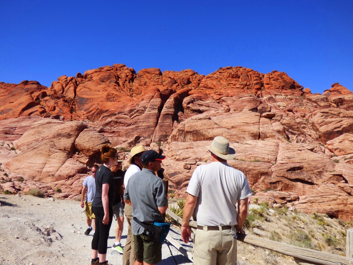
 It's pretty amazing the places that didn't get made into national parks. It's pretty amazing that tens of millions of people visit Las Vegas and never make it just a few miles west of the city limits to see an incredible place where the rocks are red, and the rocks are a bit of a riddle. The problem? The rocks on the top, the gray limestone seen on the distant ridges is 300 million years older than the red rocks underneath. They are out of proper order.
The red rocks are the Aztec Sandstone, a Jurassic aged sand dune deposit that is correlated with the Navajo Sandstone, found in national parks like Zion, Arches and Capitol Reef. They developed in an immense sand dune "sea" that once extended from Wyoming to Arizona to eastern California.
The red color comes from iron oxide (the mineral hematite, or natural rust) coating the sand grains. I haven't found a lot of agreement over whether the red staining is a secondary effect, or a primary feature of the sandstone.
In either case, the outcrops are colorful, in shades of white, pink, red and brown. The rock exposures also display beautiful crossbedding, the sloping layers representing the slip faces of the ancient dunes, frozen in time by calcite or other mineral cement. In many places the rocks are broken up as if they have been through a gigantic nutcracker.

Which, by the way, they have.
Faults run through the region, an earlier set representing intense compression related subduction off the western coast of North America, and a later set formed during the extension that led to the development of the Basin and Range Province. The compressional thrust faults had the effect of pushing the older limestone rocks up and over the younger Jurassic sandstone during the Sevier Orogeny towards the end of the Mesozoic Era (that's the one with the dinosaurs). There are several such faults in the area, but the best known is the Keystone Thrust.
The later normal faulting dropped the valley floors and lifted the mountains, exposing the older faults to view. Erosion has resulted in the spectacular outcrops that make up the conservation area we see today.

Red Rock Canyon National Conservation Area is a wonderful place to visit, whether you've blown all your money at the casinos and can't afford to do anything else (hold back $10 for park admission!), or if you came to Vegas for the expressed purpose of visiting this wonderland of rocks. It is a much better use of your time if you ask me!

Sunday, June 1, 2014

"Fly-over Country" Moniker Doesn't Do this Land Justice: Crossing the Basin and Range

The Basin and Range province is one of the largest geological provinces in North America, covering all of Nevada, parts of eastern California, half of Utah, and large parts of Arizona. It is also one of the least populated, at least outside of the urban centers of Las Vegas, Phoenix, Reno, and Salt Lake City. The region was stretched in late Cenozoic time (during the last 30 million years) so that the crust broke apart and gigantic blocks slipped against each other like shelves of books tipping over. Several hundred horsts (ranges) and grabens (fault valleys) are the defining features of the province.

We were on our way to an exploration of the Colorado Plateau, but needed to make our way to Las Vegas to meet our group. We could have taken the freeways through the Central Valley and Mojave Desert, but I've been down that road several hundred times over the last quarter century. We elected to cross the Sierra Nevada at Tioga Pass and cross the high ranges and deep basins of the region referred to by many as "fly-over" country. It's barren on some ways, but it is a treasure in so many others. How many places will you visit in your life where you have a decent chance of being the only human being on a particular mountain range? That can happen out here.
I could be accused of false advertising in showing these pictures of the alpine scenery of Yosemite National Park, but the presence of the Sierra Nevada is what forms the character of the Basin and Range. Many consider the Sierra to be the westernmost of the Basin and Range mountains, and the high 400 mile long mountain crest blocks the majority of precipitation from ever reaching the region. During the ice ages, the glaciers of the Sierra had a profound effect on the province, primarily in the formation of vast freshwater lakes in some of the driest places on the planet, Death Valley being an outstanding example. It once contained a lake 100-plus miles long and 600 feet deep.

A few of the lakes persist, barely. After we crossed Tioga Pass, we had an outstanding view of Mono Lake, which is huge, but it was once much larger and deeper. Evaporation (and water diversions by Los Angeles) have left behind saline water in which only small fairy shrimp and brine flies can survive. Not a complex ecosystem, but millions of birds depend on the rich protein.
Those birds include species like the gull below, which I suspect of supplementing its diet with scraps of sandwiches from the Whoa Nellie Deli!

The White Mountains, the next major range east of the Sierra Nevada, are spectacular, with a high point of 14,252 feet at White Mountain Peak, and several others exceeding 13,000 feet. The north end of the range extends into Nevada where Boundary Peak forms the highest point in the state of Nevada at 13,147 feet. We headed south along the east flank of the mountains in Fish Springs Valley.
The valley supports some ranching and alfalfa fields, but it's also very dry. We saw some immense dust devils that looked a bit like tornadoes.
We climbed to Lida Summit and looked back across one mountain range after another to the Palisades Crest in the Sierra Nevada.
A number of wildflowers were in evidence, including many Prickly Poppies and Globe Mallows. It's dry country, but lots of plants have adapted to the harsh conditions. The extreme range of elevations from 14,000 feet to below sea level have caused the province to have a stunning number of plant species.
We headed down from Lida Summit and started south towards Las Vegas on Highway 95.
As we rolled slowly (lots of speed traps) through the town of Beatty, Nevada, we encountered dozens of wild Burros. They are the descendants of animals abandoned by the early miners, and they have become a pest in many ways, contributing to overgrazing, trampling rare plants, and fouling springs, but darn it, they're also terribly cute. In hopes of controlling the populations of these creatures the Bureau of Land Management captures as many as they can and puts them up for adoption.

We made to Sin City, and today we met our fellow travelers for the coming week. We had a great day touring the geological environs of Las Vegas, and pictures will undoubtedly appear soon here on Geotripper!