Showing posts with label Syncline. Show all posts

Sunday, April 10, 2016

Flowers, Folds, and Floods on the Way to Yosemite

So this thing happened yesterday. California, despite near-normal amounts of precipitation this year, is still in the grip of a long-term drought. The first part of March was wet, but for the last three weeks the rain ceased entirely, like someone turned off the tap. Then a low pressure system parked itself  right on top of my town and the swirling air mass dropped around two inches of rain onto the region between Yosemite National Park and Modesto-Turlock. Our Great Valley towns had the unusual distinction of being pretty much the wettest places in the entire state.
That being the case, I had a field studies class scheduled yesterday to Yosemite Valley. The weather forecasts (which had not really predicted the prodigious amounts of rain) suggested that the storm was waning and that we might see some clearing in the afternoon when we arrived at the valley. We have schedules to keep, and timelines to follow, so the trip left as planned. It never stopped raining for a minute that entire trip from start to finish.

Despite the nonstop rain, we accomplished most of our goals, and saw most of the features of Yosemite and the Merced River Canyon (Half Dome was a no-show, though). We managed to thread our way through the day, catching some stops when the rain had declined to a drizzle, or having a sheltered place to discuss the geological features of particular stops.
One of our first stops was on Highway 140 to Mariposa, where we got to see an outcrop of the Mariposa Slate, a former mudstone from the deep ocean floor that had been compressed and baked into a hard sequence of slate and phyllite. The rocks have been uplifted and tilted, but as one can see in the picture above, folded into a series of very tight 'v's. The rocks have been on a long journey, forming on the floor of the Pacific Ocean, and being swept under the North American plate. We are looking at the part of the seafloor that was scraped off and added to the continental edge around 200 million years ago.
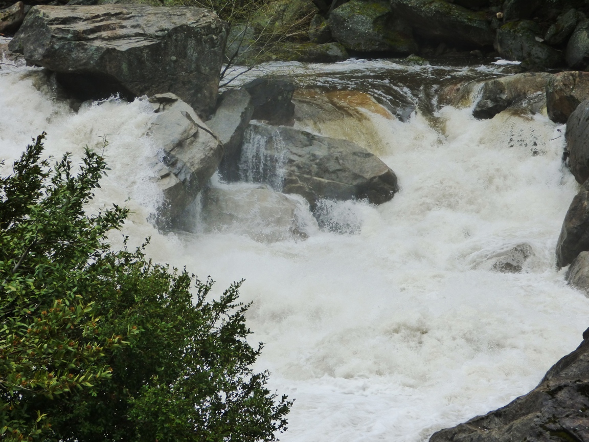
The Merced River was a raging fury. The very warm March and April dry periods were causing an early snowmelt so the river was running high, and the widespread rain added to the runoff. Average flow for early April is around 800 cubic feet per second. The flow of the river yesterday was at least three times average, around 2,800 cfs.

The flow yesterday may have been a record for the date (although I'm not quite clear how to interpret the graph on that count). The river was not actually officially flooding (it would have to reach 6,600 cfs), but flows yesterday were consistent with the peak runoffs that normally occur in late May and early June. The record low flow for the date was just set last year, at 244 cfs. The greatest recorded flood ever occurred during the El Nino year of 1997 when the river reached 24,600 cubic feet per second.
Whether assisted by yesterday's freak rainstorm or not, the high flows are a bit ominous. The future of the Merced River under the most generous of global warming scenarios includes the possibility of more precipitation, but far less snow. That means earlier runoff and less chance to store water in reservoirs because of the necessity to leave room for flooding events.

Wednesday, April 30, 2014

Adventures Along California's San Andreas Fault: The Devil's Punchbowl (but no earthquakes today)

The Devil gets blamed for a lot of stuff, and who am I to say he isn't responsible for bad things? But one can hardly blame us for blaming him for massive earthquakes when he goes around leaving things next to major fault systems, like punchbowls.

Southern California is a tortured landscape, and it isn't just the pop culture. The entire region has been twisted more than 90 degrees from its original orientation, forming one of the very few east-west trending mountains ranges in North America. The rotation is a consequence of the crust being caught between the Pacific and North American plates along the San Andreas and related fault systems. The end result of the rotation and stepwise motion of the fault is massive compressional forces that have lifted the San Gabriel and San Bernardino mountains to great heights in a very short period of geologic time, just a few million years.
The San Andreas fault shifts sideways with the consequence that long ridge lines called shutter ridges offset stream channels and block drainages. The two foreground ridges run parallel to the San Andreas along the north side of the San Gabriels.
Our journey home this last weekend followed the path of the San Andreas fault as it passed along the north side of the rugged San Gabriel Mountains. These mountains are statistically one of the steepest mountain ranges on the planet, and the huge number of ancient and modern landslides in and around the mountains attests to their instability. The deformation of the crust is most intense in the immediate vicinity of the fault zone, so we encountered a mess of rocks when we arrived at Devils Punchbowl County Park outside the town of Pearblossom.
Devils Punchbowl is administered by the county of Los Angeles, and has a nice little visitor center with a couple of interesting trails that wind among the steeply dipping rock layers. The rocks exposed in the park are called the Punchbowl formation, and they were deposited in alluvial fans in basins that formed about 13 million years ago in the vicinity of the fault. They have since been twisted into a series of upward (anticlines) and downward pointing folds (synclines).

The axis of the most obvious fold in the main part of the park, a syncline, plunges into the ground to the west directly towards the park headquarters.


If it is hard to pick out, take a look at the annotated picture below. In a syncline, the layers slope, or dip, towards the center (the axis) of the fold. The axis slopes towards the observer, i.e. water would tend to flow downwards along the axis of the fold.
A popular one-mile long loop trail winds through the center of the punchbowl, offering some nice views of the conglomerate and arkosic sandstones that make up the cliffs. I had a few moments to spare, so I walked quickly down the trail to have a look around (I moved considerably slower on the climb back up!).
If these rocks look a little like a place where Captain Kirk should be fighting Gorns, you aren't too far off, although it's a different formation, a different fault, and a different location. The Vasquez Rocks are along Highway 14 on the other side of the San Gabriel Mountains, but the rocks there also formed in alluvial fans, and were tilted by fault motions.
The trail started to climb steeply, and I realized that all my walking exercises over the last five months have done wonders for my leg muscles, but somewhat less for my aerobic capacity. I've got to spend more time on stairs! As an old favorite folk song says, I'd rather be huffing than not huff at all.
The Devils Punchbowl is a fascinating place to visit. You access the park from a turnoff at the east end of the village of Pearblossom on Highway 138 between Palmdale and Cajon Pass. There are picnic facilities, but no camping. The kids will love Squints the owl and the other animals in the visitor center.

Geologists sometimes seem to court disaster, in the sense that someone like me will stand on a major fault zone and think to himself that it would be cool to see the "Big One" happen just then.  Such an event is going to be a horrible tragedy, and I would never wish it on anyone, but we live here in California, and the quakes do happen. It's just that there is an intellectual curiosity about what it looks like when a fault ruptures and shifts 15 or 20 feet. It would indeed be a sight to see.
So we hung around near the fault trace just to see what would happen. Nothing did, of course, or everyone would have heard of it. The big earthquakes have a recurrence interval of around 100-150 years, and with the last major event in 1857, there is plenty of stress built up, but there was no compelling reason to think that it would happen while we were there. No, we just heard the light breezes, the buzz of busy insects, and watched the sun shining on myriads of wildflowers hiding among the shrubs.
We stooped down and started photographing flowers, including this one, a variant of the Mariposa Lily that I was not familiar with. It's stunningly beautiful, but if you are a small bug, it can be deadly as well, as you can see in the photo below...
There were just a few Beavertail Cacti blooming in the area.
There were lots of Coreopsis growing in isolated patches.
And there were lots of Desert Dandelions along the highways where they benefited from the little bit of extra runoff from the road surface.

All in all, a beautiful day, courtesy of the Devil leaving his punchbowl lying around a major plate boundary.

Monday, July 2, 2012

The Abandoned Lands...A Journey Through the Colorado Plateau: Beginnings

The soil. And water. It's everything.

No matter how many toys we invent, the cars, the computers, the planes, all the things we call the necessities of life, without soil we are done for. Without water, life withers away. We all depend on it, no matter how far removed from the land we have become.
Central Valley and Coast Ranges from near New Hogan Reservoir
The land that is my home, the Central Valley of California, is not likely to be abandoned any time soon. The soil may be buried under the thousands of suburban houses constructed in the last few decades, but it will reappear and eventually it will be tilled again. Global warming may alter the climate of my nearby Sierra Nevada, superfires may remove the forests, but the valley will always have some water, and some kind of growth will always be possible. This is not the kind of place that humans will ever totally abandon, short of some kind of nuclear holocaust.
Canyonlands National Park from Grandview Point
The Colorado Plateau and the desert lands that surround it are different. Life is always on the edge. There is soil here and there, and water exists in some places, but much of the plateau is barren rock. Life is subject to the vagaries of drought and heat and wind. Life is not easy...

I know I am being dramatic, but this was on my mind as we set out on our two-week journey across the plateau. We drove through 200 miles of the Great Valley, watching the land change from savannah to desert, where agriculture was only possible because of vast transfers of water from wetter climates to the north. We turned east at Bakersfield and crossed the Sierra Nevada at Tehachapi Pass into an even drier climate, the Mojave Desert. It was a hot day, hot as blazes. We were comfortable in our air-conditioned vans, and were making good progress. In my last post, I mentioned how cities were possible out here only because of the vast transfer of energy and supplies from other places. A bad accident and the subsequent back-up of traffic was a reminder of just how much material moves across these roads each day. It takes a lot to maintain our chosen standard of living. While we were stuck, the van's cooling systems were strained to the limit, and the thin boundary between us and the inferno outside narrowed.
It was inconvenient, the long wait, but for others it was tragic, a truly terrible accident. Having seen the cars involved, it was hard to believe that everyone survived, but there were serious injuries. The accident was a shock, but we needed to change gears and start the learning process. Because of the time delay, we found it necessary to change our itinerary, and instead of visiting Rainbow Basin, we pulled into the parking lot at Calico Ghost Town near Barstow. .

A parking lot? How much can be learned in a parking lot? Well, the parking lot at Calico is a place apart; check it out!
Calico was an important silver mining district in the 1880's and 1890's, and in the early 1900's it was a source of borate minerals. The minerals played out and the town was abandoned. Years later, Walter Knott took some of the buildings to Buena Park and rebuilt them into the core of Knott's Berry Farm. The remaining buildings were ultimately given to San Bernardino County for development as a park.
We weren't interested in the shops and boutiques up on the hill; we were drawn to the marvelous folds in the parking area. Textbook examples of anticlines and synclines were present in Miocene terrestrial sediments of the Barstow and Jackhammer formations. This was a place to learn the basics of geology: formations, sedimentary environments, structural geology, and sedimentary rock identification.
There are excellent examples of sedimentary structures like mudcracks and ripplemarks. They aren't common in the parking lot, but fossils elsewhere in the formation reveal an ancient savannah environment occupied by the early ancestors of camels, horses, antelope, elephants, sabertooth cats, dogs, and bears.
For our anthropology students, there was a nineteenth-century trash dump on the other side of the parking lot. We did a quick exercise in dating of cultural sites.
So, in a parking lot we laid the groundwork for understanding the basics of our respective sciences as we journeyed further into the desert's interior.The hour was late, and we had several hours of driving to get to our camp in the Mojave National Preserve. We packed into our vans and moved down the road.

Here is the explanation of my "abandonment" theme for this series: http://geotripper.blogspot.com/2012/06/abandoned-landsa-journey-through.html

Friday, April 2, 2010

A Friday Fun Foto, Part 2: Please Don't Try These Arguments

Folks caught on pretty quick to what I was showing in the previous post if the comments are any guide: this feature, seen anywhere in the world by any trained geologist, would be identified readily as a doubly plunging syncline, sedimentary layers twisted into an elongated bowl shaped form. But this particular fold in the rock carries a lot of emotional baggage, located as it is just a few miles from Mt. Ararat in Turkey. After a fuzzy picture of the feature appeared in LIFE magazine in 1960, a number of individuals quickly decided the feature had to be Noah's Ark, and a small cottage industry has grown around the selling of the idea.

As mentioned before, I have discussions with students about religion and science, and especially about the age of the Earth and evolutionary theory. They sometimes bring up items like this, in the full confidence that they have discovered for themselves the absolute proof of Noah, a worldwide flood, and a 6,000 year old earth. It's hard to be patient sometimes, to explain that a feature like this is easily explained by science, and that maybe, just maybe, the promoters of the "evidence" on the internet might not have the most honorable of motivations.

Here are some arguments about the age of the Earth and evolution you might not want to bring up:

1. Moon dust proves a young moon.

2. NASA computers, in calculating the positions of planets, found a missing day and 40 minutes, proving Joshua’s “long day” (Joshua 10) and Hezekiah’s sundial movement.

3. There are no beneficial mutations.

4. Darwin recanted on his deathbed.

5. Woolly mammoths were flash frozen during the Flood catastrophe (with buttercups in their mouths!).

6. No new species have been produced.

7. Ron Wyatt has found much archaeological proof of the Bible, including the Ark of the Covenant, and also the Ark of Noah, the subject of the picture above.

8. Evolution is just a theory (I've discussed the meaning of theory in the past).

9. Microevolution is true but not macroevolution.

10. The Paluxy tracks in Texas prove that humans and dinosaurs co-existed.

11. The Japanese trawler Zuiyo Maru caught a dead plesiosaur near New Zealand.

12. The speed of light has decreased over time.

13. Archaeopteryx is a fraud.

I'm not going to waste my time or yours explaining why these phenomena and assertions are unusable in an argument over the age of the Earth or evolution. I don't have to. I derived this list from a young-earth creationist organization website. It is they who say these shouldn't be used in an argument with scientists. Even they know these arguments are bogus (you are welcome to Topeka, er, uh, Google "creationists arguments that shouldn't be used" if you are interested).

There are plenty of other assertions made by young-earth creationists that can be used in a debate that are equally untrue, but at least the YEC folks believe them. To use "facts" like those on the list above reveals a distinct lack of basic internet research skills and a lack of critical thinking. When a person "wants to believe", they are easily duped...

Thursday, December 31, 2009

The Other California: Prairies Past and Some Nice Folding

Visitors at Calico Ghost Town in the Mojave Desert geomorphic province are treated to an authentic old mining town complete with bars, melodrama theatres, staged gunfights, and portraits in oldtime clothing. They may even learn a bit of genuine history of the old silver mining district from the occasional sign. Calico is California's Official Silver Rush Ghost Town (discussed in a previous post), and is definitely worth a stop, but not necessarily for the reason envisioned by those who run the park. The parking lot sits in the gulch below the town, and exposes some of the finest folds to be seen anywhere. They have appeared in many geology textbooks ("textbook examples" of anticlines, the upward pointing folds, and synclines, the downward pointing folds).
The origin of these folds has been the subject of much discussion, but their proximity to an active transverse fault (the Calico fault) suggests they developed as a result of transpressional stress. Place a sheet of paper flat on a table, and put your palms on each end. Moving one hand towards you and the other away from you will cause crumpling across the middle. Those crumples are transpressional folds.

A bit farther to the west, the Barstow Formation is exposed at Rainbow Basin Natural Area, administered by the Bureau of Land Management. An upside-down rainbow, the Barstow Syncline, is one of the most striking features. I talked about the area in a previous post.

In a marked contrast to the volcanic rocks that make up the core of the Calico Mountains, the Barstow layers are sedimentary rocks. Sedimentary structures such as mudcracks (below) and ripplemarks indicate that the sediments accumulated in a faulted basin in a moderately tropical and occasionally arid environment, essentially similar to the African Savannah of today's world. It was a world of grasslands and palm trees that existed between 13 and 19 million years ago, based on radiometric dates of volcanic ash layers that bracket the sedimentary strata.
An African savannah. Visions of elephants, giraffes, zebras, and rhinos. But not in America, right? Well, time for a new vision. The most stunning aspect of the Barstow Formation is the diversity of fossil species found in its layers. Numerous species of ancestral horses and camels, a rhino ancestor (Aphelops), and an early elephant called a gomphotherium (similar to those big elephants in the Lord of the Rings movie, only much smaller) are among the discoveries. Feeding on these planteaters were one of the earliest cats (Pseudaelurus), an ancestor to the coyotes (Tomarctus), and a probable forebear to the bears and dogs called an Amphicyon (pictured below).

Photograph by Ghedoghedo

The extreme diversity of the fossil assemblage, and the fact that the formation is well-dated led to the establishment of a portion of the geologic time scale called the Barstovian stage of the Miocene epoch, referring to the time period from 16.3 to 13.6 million years ago.

One further aspect of the fossil record in the Barstow Formation are calcareous nodules that contain nicely fossilized insects. Insects are rarely preserved as fossils, but the bugs in the lake sediments were replaced by silica and were supremely preserved, to the extent that even leg hairs are visible.


Learn more here:

A technical article from the GSA Bulletin on the Barstow Formation (abstract; full article requires fee or GSA membership)

A nice slideshow about the Barstow Formation and the fossils it contains, from the San Bernardino County Museum.

This has been an entry in the series on the Other California.