So this thing happened yesterday. California, despite near-normal amounts of precipitation this year, is still in the grip of a long-term drought. The first part of March was wet, but for the last three weeks the rain ceased entirely, like someone turned off the tap. Then a low pressure system parked itself right on top of my town and the swirling air mass dropped around two inches of rain onto the region between Yosemite National Park and Modesto-Turlock. Our Great Valley towns had the unusual distinction of being pretty much the wettest places in the entire state.
That being the case, I had a field studies class scheduled yesterday to Yosemite Valley. The weather forecasts (which had not really predicted the prodigious amounts of rain) suggested that the storm was waning and that we might see some clearing in the afternoon when we arrived at the valley. We have schedules to keep, and timelines to follow, so the trip left as planned. It never stopped raining for a minute that entire trip from start to finish.
Despite the nonstop rain, we accomplished most of our goals, and saw most of the features of Yosemite and the Merced River Canyon (Half Dome was a no-show, though). We managed to thread our way through the day, catching some stops when the rain had declined to a drizzle, or having a sheltered place to discuss the geological features of particular stops.
One of our first stops was on Highway 140 to Mariposa, where we got to see an outcrop of the Mariposa Slate, a former mudstone from the deep ocean floor that had been compressed and baked into a hard sequence of slate and phyllite. The rocks have been uplifted and tilted, but as one can see in the picture above, folded into a series of very tight 'v's. The rocks have been on a long journey, forming on the floor of the Pacific Ocean, and being swept under the North American plate. We are looking at the part of the seafloor that was scraped off and added to the continental edge around 200 million years ago.
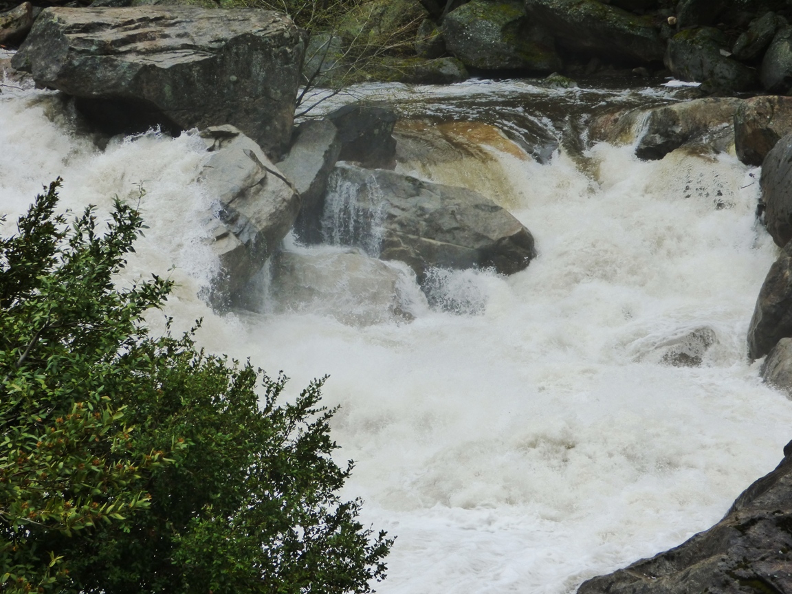
The Merced River was a raging fury. The very warm March and April dry periods were causing an early snowmelt so the river was running high, and the widespread rain added to the runoff. Average flow for early April is around 800 cubic feet per second. The flow of the river yesterday was at least three times average, around 2,800 cfs.
The flow yesterday may have been a record for the date (although I'm not quite clear
how to interpret the graph on that count). The river was not actually
officially flooding (it would have to reach 6,600 cfs), but
flows yesterday were consistent with the peak runoffs that normally
occur in late May and early June. The record low flow for the date was just set last year, at 244 cfs. The greatest recorded flood ever occurred
during the El Nino year of 1997 when the river reached 24,600 cubic feet
per second.
Whether assisted by yesterday's freak rainstorm or not, the high flows are a
bit ominous. The future of the Merced River under the most generous of
global warming scenarios includes the possibility of more precipitation,
but far less snow. That means earlier runoff and less chance to store
water in reservoirs because of the necessity to leave room for flooding
events.
Showing posts with label Mariposa Slate. Show all posts
Sunday, April 10, 2016
Thursday, October 15, 2015
A Series of Fortunate Events: Fall in Yosemite National Park
It was a privilege this last weekend to conduct a field studies
exploration of Yosemite National Park and the surrounding region. It was
a new class, but was similar to one we last taught back in 2008 when
the Great Recession put a serious crimp in the scheduling of our field
studies courses (we still did them, but there were fewer of them). Even
better, I have another day trip scheduled on Saturday for a different
course. Yosemite twice in a week!
I say it in a joking manner, telling students they have to "earn" the right to explore Yosemite. It's true though, in a way. There is a lot of geologic history in the rocks west of Yosemite National Park, and they help us to understand the origin of the rocks in the park. An example is the outcrop along Highway 140 between Merced and Mariposa. Just east of Dial's Rock Shop is an exposure of the Mariposa Slate.
The Mariposa Slate is a deposit that formed on the bottom of a deep sea off the coast of California in Jurassic time. The shoreline lay east of where it is today, and the Sierra Nevada was a different place: a series of active volcanoes led to a coastal forest. Dinosaurs, pterosaurs, and primitive mammals roamed the forests and floodplains. In the sea, large swimming reptiles including plesiosaurs and ichthyosaurs were found. The Mariposa is somewhat less altered than many other rocks of the metamorphic belt, and because of this, a few fossils have been found which enabled geologist to figure out the age of the rocks. This was an important step in unraveling the complex geologic history of the region.
The Mariposa is part of a large section of crust called the Foothills Terrane, a group of rocks that were added to the western part of North America during Triassic and Jurassic time along a subduction zone plate boundary. A great deal of compression caused the rocks to be tightly folded, as can be seen in the photo above (note a set of car keys just below the center of the shot). The slate has excellent rock cleavage (the tendency to split into very flat surfaces) so it finds use as chalkboards and billiard tables. There is a quarry on the top of the hill above the outcrop (you can just make out some heavy machinery in the second picture above, on the left side).
The Mesozoic subduction zone that placed the Mariposa Slate against the edge of the continent was also instrumental in the placement of the vast granitic plutons that are exposed today in Yosemite National Park. The slate provides some insight into what came before the intrusive igneous rocks.
Our path was not the straightest route. Instead of following Highway 140 directly into Yosemite, we turned south at Mariposa and followed Highway 49 to the town of Oakhurst. We were having a look at the largest living things in existence, as well one of the greatest mineral collections in the state. More next time!
I say it in a joking manner, telling students they have to "earn" the right to explore Yosemite. It's true though, in a way. There is a lot of geologic history in the rocks west of Yosemite National Park, and they help us to understand the origin of the rocks in the park. An example is the outcrop along Highway 140 between Merced and Mariposa. Just east of Dial's Rock Shop is an exposure of the Mariposa Slate.
The Mariposa Slate is a deposit that formed on the bottom of a deep sea off the coast of California in Jurassic time. The shoreline lay east of where it is today, and the Sierra Nevada was a different place: a series of active volcanoes led to a coastal forest. Dinosaurs, pterosaurs, and primitive mammals roamed the forests and floodplains. In the sea, large swimming reptiles including plesiosaurs and ichthyosaurs were found. The Mariposa is somewhat less altered than many other rocks of the metamorphic belt, and because of this, a few fossils have been found which enabled geologist to figure out the age of the rocks. This was an important step in unraveling the complex geologic history of the region.
The Mariposa is part of a large section of crust called the Foothills Terrane, a group of rocks that were added to the western part of North America during Triassic and Jurassic time along a subduction zone plate boundary. A great deal of compression caused the rocks to be tightly folded, as can be seen in the photo above (note a set of car keys just below the center of the shot). The slate has excellent rock cleavage (the tendency to split into very flat surfaces) so it finds use as chalkboards and billiard tables. There is a quarry on the top of the hill above the outcrop (you can just make out some heavy machinery in the second picture above, on the left side).
The Mesozoic subduction zone that placed the Mariposa Slate against the edge of the continent was also instrumental in the placement of the vast granitic plutons that are exposed today in Yosemite National Park. The slate provides some insight into what came before the intrusive igneous rocks.
Our path was not the straightest route. Instead of following Highway 140 directly into Yosemite, we turned south at Mariposa and followed Highway 49 to the town of Oakhurst. We were having a look at the largest living things in existence, as well one of the greatest mineral collections in the state. More next time!
Subscribe to:
Posts (Atom)