Friday, December 12, 2014

Halftime Report on Stormageddon: The View from the Great Valley (possibly a Great Lake now)

Source: Intellicast
The predicted atmospheric river storm has arrived in California. Not just northern or central California, but pretty much the entire state. These are the kind of storms that can start us on the road towards breaking the drought, but it will take a lot more like this before we can dig ourselves out of the worst drought in centuries here in the Golden State. The water deficit is truly that bad.

Atmospheric river storms carry as much water as more than dozen Mississippi Rivers, and when oriented right, they can drop prodigious amounts of water in short periods of time. Parts of the California coast have received more than 10 inches of rain in the past day or two, and more rain is falling. Cities in the Bay Area have more than 3 inches thus far, and the flooding has been intense, as the news reports are showing. It didn't help matters that the storm included gale-force winds that brought down trees and caused power outages. Ours was out for an hour this morning.
Source: NOAA
It took a lot longer for the slow-moving storm to reach us in the San Joaquin Valley, the southern part of the Great Valley. The winds were blowing all night, and the rain started a little after noon. In the last twelve hours my rain gauge recorded 2.10 inches (I'm just east of Modesto, which at midnight had recorded 2.06 inches). I checked my rain gauge records, which go back to 1990, and found but a single day that ever exceeded 2 inches, back in January of 2006 (that day was 2.32 inches). But here's the thing: I measure from midnight to midnight, and the storm is still going strong. By morning, I am pretty sure we will have a record rainfall for a single storm in my 24 year record of rainfall events.

Those numbers might seem paltry to my friends in rainy environments, but our local environment is a near desert that is surrounded by mountain ranges that exert a distinct rain-shadow effect. Our average yearly rainfall is only 12 inches. And our valley floor is flat. Really, really flat. We don't have effective storm drain systems to handle such storm events. In general, the storm drains don't have enough gradient to reach nearby rivers, so we have depended on dry wells to divert the storm runoff  into our groundwater supply. This works most of the time, but when the rain exceeds an inch or so, large lakes and ponds will develop that fill streets, lawns and parking lots. It may take days for the water to seep underground. Storms of today's magnitude can develop dangerous conditions for drivers.

My neighborhood is lucky. I live east of the flattest valley floor, at an elevation of 125 feet (Modesto is closer to 65 feet). I also live only a mile from the Tuolumne River. A decade ago the city completed a storm drain that connects directly with the river, so we don't get the horrible ponding that once took place.

The rain will be falling through the day on Friday, and we'll have a break until Monday when another storm will move in. We appreciate the moisture so much, but a bit of it at a time, please!

The birds in my neighborhood took things in stride. Here is an Anna's Hummingbird that sheltered in our backyard for awhile today.

Thursday, December 11, 2014

The Holidays Come Early at the Great Valley Museum: A Big Toothy Predator Arrives

So, I got a call the other day from Receiving..."You've got a giant crate that's been delivered. Where do you want it? And I think "Huh? I don't remember having anything on order". And then in the fog of my brain (it's finals week; I'm more addled than normal), a vague memory emerges: we ordered something a year ago! And it finally arrived!

The crate was indeed huge. We had to remove close to two dozen screws, and like the father in the movie "A Christmas Story" ("fra-gee-lay"), we found a great deal of stuffing. But slowly it emerged: Jaws. Very big jaws.
The children of the Great Valley are impoverished and are poorly served by a state that sometimes has other priorities than education (can you spell "prisons" or "tax breaks for the rich"?). Few of the students have spent much time beyond the boundaries of their own towns, and have little knowledge of the natural world that lies beyond the housing developments and farms. The Great Valley Museum at Modesto Junior College has labored for years to teach our children about the rich ecosystem that once existed here (and still exists in small pockets here and there), but the exhibits languished in a modified 80 year old converted house. At long last this is changing, and we are on the verge of opening up the new museum on the bottom floor of our Science Community Center in just a month or two.

The museum will be an essential destination for learning about the natural history of the Great Valley and surrounding regions. Now, I'm all for this kind of thing (just take a short look at my other blog, for instance), but the unfortunately sad other fact is that practically no one in our county is familiar with the incredible paleontology of our region. Mention "digging for fossils" and most people think dinosaurs, and invariably dinosaurs in some other place. But the history of our planet is much more than just dinosaurs, and our region is richly blessed with an incredible fossil record of strange and wonderful creatures that have lived here through the ages. I've discussed them in the past, and will do so again, but today's arrival was a special part of our fossil heritage.

In the waning part of the dinosaur era (the Mesozoic), a creature related to the Komodo Dragon adapted to living in a marine environment, becoming one of the top predators of their time. Upwards of 30-40 feet long, the Mosasaurs were terrifying, with massive teeth, huge jaws, and presumably a huge appetite for anything that swam the seas. They have been found worldwide, and several have been found in the sediments of the Great Valley Group. An excellent specimen of a creature called Plotosaurus bennisoni was discovered in our county by a young man from Gustine in the 1930s. They were here! Another specimen, called Prognathodon rapax was discovered in Fresno County to the south of us.
This Mosasaur is on display at the Royal Tyrrell Museum in Drumheller, Alberta
No one sells specimens or replicas of those exact species, so we purchased a related species that will get the point across. It's a skull of a Prognathodon stadtmani that was discovered in the Durango, Colorado region. It is a big skull! I can't imagine a child upon seeing this skull not wanting to get out and explore and maybe find one on their own. And knowing that it could actually happen because one like it was found in their own county. The dinosaurs were okay, they might think, but we had really interesting creatures that lived right here!
This is an exciting time for the children of our valley, even if they don't know it yet. They are about to discover a world, their world, that includes massive and sometimes ferocious creatures like the Mosasaurs, Ichthyosaurs, Plesiosaurs, Saber-tooth Cats, Short-faced Bears, Dire Wolves, American Lions, Megalodon sharks and many others.

Tuesday, December 9, 2014

If These Cliffs Could Talk: Wa-ha'-ka, the Three Brothers Who Are All Out of Joint

Actually the Three Brothers are just full of joints, and that's the problem.

If any legends exist concerning the rocks known as the Three Brothers in Yosemite Valley, they have not come to me via the anthropologists or the internet. The rocks seem have been called Wa-ha'-ka, Wawhawke, or Kom-po-pai-zes, with meanings that include leaping frogs, couples enjoying each other (to use a family-friendly description), or the one that makes the most sense to geologists, "falling rocks". Rocks fall in Yosemite on a constant basis, but the Three Brothers are prizewinners in that regard.
The rather boring English name came from a historical event when James Savage's militia (the Mariposa Battalion) caught up to three of Chief Tenaya's sons near the base of the rock in 1851. It's a pretty mundane name, and I would really love to see a campaign started to officially re-name all of Yosemite's most prominent rocks with their ancestral First Nation monikers.

In any case, Wa-ha'-ka is a unique cliff for the three striking peaks, Eagle (the highest), Middle Brother, and Lower Brother. The triangular shape is derived from the joint pattern that courses through the cliffs. As mentioned previously in this short blog miniseries on Yosemite, joints are the fractures that occur in granitic rocks as they reach the surface and come under lateral pressure from nearby fault zones or regional stresses. There are two intersecting joint systems that formed the Three Brothers, one descending about a 60 degree angle. It can be seen best from across the valley at Taft Point, and the related Taft Fissures. The joints run through El Capitan granite and Sentinel granodiorite.
The Three Brothers and Yosemite Falls from Taft Point

Notice in the photo below how the slope in the foreground near Taft Point is angled the same direction as the joints at Three Brothers across the valley. There are many good reasons to make the short hike out to Taft Point, and this is one of them.

There is a very good reason thinking that First Nation name of the rock means "falling rocks". Crossing joints provide the instability that leads to slope failure. The rocks here fall often, and indeed in 1987, the largest recorded rockfall in recorded history at Yosemite took place at the base of Middle Brother. Thankfully the park road had been closed as a precaution and no one was hurt.
The Middle Brother Slide
The park historian at the time, Jim Snyder, was standing in the meadow below and described what happened (from Wieczorek et al., 1992*):
At 2:47 p.m. PST on March 10, 1987, a large rock fall dropped 800 m from the face of Middle Brother and spread rapidly across a talus cone, covered Northside Drive, and sent boulders across the Merced River. Much smaller rock falls from Middle Brother had begun on March 8, and by about 2:20 p.m. on March 10, because of an increasing number of rock falls and audible rock popping noises from the face of Middle Brother, Northside Drive, the main exit road from the valley, had been closed and the portion of Leidig Meadow below Middle Brother had been cordoned off.
...Jim Snyder observed the rock fall initiate as an intact planar slab of rock that separated from the cliff face. As the slab fell it appeared to shorten in a folding-like manner similar to the steps of an escalator. The slab disaggregated into a rock avalanche upon hitting and sliding along a prominent ledge before falling onto the talus cone below.
Another large rock fall from the face of Middle Brother occurred later that day at 5:10 p.m. The volume of these rock falls totaled an estimated 600,000 cubic meters of material weighing about 1.3 million metric tons. Dozens of smaller rock falls continued during the next several days..."
*Wieczorek, G.F., Snyder, J.B., Alger, C.S., and Isaacson, K.A., 1992, Rock Falls in Yosemite Valley, California, U.S. Geological Survey Open File Report 92-387, 186 pages.

Saturday, December 6, 2014

If These Cliffs Could Talk: The Legend of Kos-su-kah, Tee-hee-nay, and Hum-mo in the Valley of the Ah-wah-nee


I've done a lot of traveling in the last month, from Arizona and back, to Pinnacles National Park, and then through Northern California to the Oregon Coast. In the blogging sense, I got distracted from a little mini-blog-series I was doing on Yosemite Valley, but today we're back among some of the most beautiful cliffs in the world.

There is a spire kind of hidden in plain view among the high precipices near Yosemite Falls, the Three Brothers and Yosemite Point. It's more prominent from some angles than others, but it helps if some clouds are pouring over the high cliffs, defining it. The spire is called the Lost Arrow. It formed in the El Capitan granite and Sentinel granodiorite where vertical joints have caused the rocks around the spire to fall away (joints are straight fractures in the rock caused by the release of pressure as the rocks are exposed by erosion).
This is what joints look like if there isn't an adjacent 3,000 foot cliff (Tokopah Valley in Sequoia National Park)
As with many of the distinctive rocks of the valley, there is a Miwok legend told of it, not so much as its origin, but of an event to which it is related. As I read this narrative, I was struck by the sensitivity and heart of the story. It has a bit less of the fantastical mythological aspects that often accompany such stories, and thus in a way seems grounded in possible real events. In a biblical setting, this would be like comparing the narratives of Genesis floods and Egyptian Plagues with their apocalyptic themes to the later stories of King David and his relationships with Jonathan or Bathsheba. Or maybe the narratives concerning Ruth and Boaz.

We pick up the story as it is related by Galen Clark in The Indians of the Yosemite Valley and Vicinity (1904):
Tee-hee'-nay was a beautiful Ah-wah-nee maiden, said to be the most beautiful of her tribe, and she was beloved by Kos-su'-kah, a strong and valiant young brave. Valuable presents had been made to the bride's parents, and they had given their consent to an early marriage, which was to be celebrated by a great feast.

To provide an abundance of venison and other meat for this banquet, Kos-su'-kah gathered together his young companions and went into the mountains in search of game. In order that Tee-hee'-nay might know of his welfare and the success of the hunt, it was agreed between the lovers that at sunset Kos-su'-kah should go to the high rock to the east of Cho'-lack (Yosemite Falls), and should shoot an arrow into the Valley, to which should be attached a number of grouse feathers corresponding to the number of deer that had fallen before the skill of the hunters.

At the time appointed Tee-hee'-nay went near the foot of the great cliff and waited, with her eyes raised to the towering rocks above, hoping with her keen sight to see the form of her lover outlined against the sky, but no form could she see, and no arrow fell into the Valley. As darkness gathered, gloomy forebodings took possession of her, and she climbed part way up the canyon called Le-ham'-i-tee because the arrow-wood grew there, and finally she stood at the very foot of the rocky wall which rose to dizzy heights above her, and there she waited through the long night.
The Miwoks and other First Nation people who utilized Yosemite Valley for thousands of years no doubt had a good understanding of the geologic hazards of the valley. In about eighty visits to Yosemite Valley, I've seen two rockfalls, and heard several others. They are common events in the glacially steepened valley. Joints and exfoliation fractures provide the loosened rock, while ice wedging or earthquakes provide the tipping point that sends the rocks plummeting to the valley floor.
With the first streak of dawn she bounded swiftly up the rough canyon, for she was fully convinced that some terrible fate had overtaken the brave Kos-su'-kah, and soon she -stood upon the lofty summit, where she found her lover's footsteps leading towards the edge of the precipice. Drawing nearer she was startled to find that a portion of the cliff had given way, and, upon peering over the brink, what was her horror to discover the blood-stained and lifeless body of Kos-su'-kah lying on a rocky ledge far beneath.
Summoning assistance by means of a signal fire, which was seen from the Valley below, a rope was made of sapling tamaracks lashed firmly together with thongs from one of the deer that was to have furnished the marriage feast, and Tee-hee'-nay herself insisted on being lowered over the precipice to recover the body of her lover. This was at last successfully accomplished, and when his ghastly form lay once more upon the rocky summit, she threw herself on his bosom and gave way to a passionate outburst of grief.
Finally she became quiet, but when they stooped to raise her they found that her spirit had fled to join the lost Kos-su'-kah, and that the lovers were re-united in death.

The fateful arrow that was the cause of so much sorrow could never be found, and the Indians believe that it was taken away by the spirits of Kos-su'-kah and Tee-hee'-nay. In memory of them, and of this tragedy, the slender spire of rock that rises heavenward near the top of the cliff at this point is known among the Indians as Hum-mo', or the Lost Arrow.
There are so many elements of humanity in this legend, even to the echoes of the ending of Romeo and Juliet (there is also a favorite folk song of the eastern Sierra Nevada with a similar tragic ending: Darcy Farrow). After all, what is the role of a myth but to teach us about life, both the happy parts and the tragic ones? This is one of my favorite Sierra legends.

I couldn't help but notice that in the legend it is a remarkable thing to have descended a vertical cliff, something that today is considered a form of recreation. One year I caught sight of someone tight-rope walking from the Lost Arrow back to the main cliff. Times are different...

A Scarred and Beaten Ecosystem Persists: The Native Species of the Great Valley


I live in an extraordinary place! In my last post on the Great Valley I was discussing our use and abuse of our most precious resource, one of the richest soils on the planet. Some 95% of the original ecosystem has been manipulated by humans to achieve the highest biomass production possible. Our burgeoning population has to eat after all, and the amount of arable lands is declining worldwide, not expanding. I also posted a number of photographs that intimated what the Great Valley might have looked like prior to 200 or so years ago when European colonists began twisting the landscape to their desires. The valley must have been a fascinating sight in all seasons!
Cedar Waxwing (Bombycilla cedrorum). For more pictures of these beautiful birds, check out my post at Geotripper's California Birds.

Since arriving home after nearly two weeks of extensive travels, I finally had a chance to get out and check my walking routes, around the pasture near my home, and out by the "mini-wilderness" on the west campus of Modesto Junior College. We also stole a moment from our errands today and watched the sun set at the Beckwith unit of the San Joaquin National Wildlife Refuge, which has a viewing platform just eight miles west of town. There had been a lot of changes in the two weeks as a number of migrant species had arrived, including especially the Cedar Waxwings (above).
Nuttall's Woodpecker (Picoides nuttallii), a California endemic species.

Walking through my normal haunts, I was struck once more with a realization about the scarred and embattled ecosystem I live in. There are survivors of the apocalypse still living among us. Like a war zone, there are vast areas of destruction, and little enclaves where the native species still hang on. Sometimes it is in stretches of woodland along rivers where the ground was too uneven to plow. In other instances, the alien invaders happened to plant ornamental trees that produce just enough berries or fruits that the natives can thrive. In a few precious localities, the alien invaders set aside larger environments from abandoned farmlands (partly so they could hunt the natives species, but that's the Faustian bargain that had to be made). In any case, the walks and observations this week for some reason included no Pigeons, Starlings, or House Sparrows, all of whom are opportunistic alien species. The birds I saw were the native species that had found a way to survive in this new alien world. There was a Nuttall's Woodpecker, a California endemic (when one includes a portion of Baja California, anyway). It was hunting for insects on fenceposts instead of trees.
Yellow-billed Magpie (Pica nuttalli):  More on this California endemic can be seen in this post.

There was a small flock of Yellow-billed Magpies in the pasture. These striking birds are a wholly Californian endemic species, found only in our Great Valley. They were almost wiped out by the West Nile virus, but they are slowly making a comeback.
Western Bluebird (Sialia mexicana)

I see the Western Bluebirds on occasion throughout the winter and spring. I think they migrate up into the Sierra Nevada during the summer. 
Western Scrub Jay (Aphelocoma californica)

The Western Scrub Jay is a perennial visitor to the feeders in my backyard. They've done well in relation to agricultural development, especially with nut trees, as can be seen above. They'll often make noise on our roof as they peck at pecans (and a number have taken root in our yard after pecans being left behind by the jays)
Oak Titmouse (Baeolophus inornatus) on a west campus oak tree.

Another more-or-less California endemic is the Oak Titmouse (Baeolophus inornatus). It ranges a little into Baja California and Oregon. The acre or so of oak trees in the "mini-wilderness" provides them a bit of valley habitat in our area.

Sooty Fox Sparrow (Passerella iliaca unalaschcensis)

Finally, there is a Sooty Fox Sparrow (Passerella iliaca unalaschcensis) that I discovered Tuesday on the west campus of my school. I'm new at this birding business and so was not used to searching the leaf litter for what I always thought were House Sparrows. The Sooty is one of four subspecies of Fox Sparrows. The number and variety of American sparrows is incredible, and is a startling picture of ongoing evolution in action.

It's inspiring to find that some hint or echo of the Great Valley's natural heritage still survives here and there, especially when it is a short walking distance from home or work. More than anywhere else, though, the glory of the ancient days still lives on in the federal bird refuges that line our valley like a string of pearls. Last night we saw a sky filled with migratory birds, thousands of them, who still have a winter home on part of the valley floor (see the video at the top of the post). These are places that should be protected and cherished, and not criticized because they take up some of the water in these hard drought years. Although I understand farmer resentment in such situations, the total water devoted to wildlife survival is no doubt a small percentage of the total utilized, and I'd rather see a healthy population of native birds over an additional field of cabbage or corn.

Wednesday, December 3, 2014

A Truly Great Valley: Ruminations on California's Most Valuable Resource

What is the most valuable mineral commodity in California, the so-called Golden State? Gold? Not hardly. We produced somewhere around 150 million ounces of the stuff over the last 160 years, netting riches for a few, and producing a sad heritage of scarred hillsides, fouled rivers and bays, and thousands of people (and their cultures) dead before their time.

So what is it? California has one of the largest ore bodies in the world of borate minerals, and we produce something like 50% of the world's supply of these important industrial chemicals. But their value pales in comparison to the most precious resource.

What about rare-earth elements?  For several decades California was the world's largest producer of these technologically important chemicals before being supplanted by China, which now produces around 95% of the world supply. Nope, it's not that one either.

There's oil, of course. We've been drilling it for more than a century, and currently produce around 200 million barrels a year. At current prices, maybe $15 billion a year. But that's not our most productive resource either.
No, our most valuable mineral resource is dirt. Or more specifically, soil. Our Great Valley is covered with it, and we produce incredible riches by converting the macronutrients stored on the surface of clay particles into carbohydrates, which are then consumed in large amounts by populations worldwide. In other words, we produce food. Lots and lots of food, more than 200 different kinds. For a variety of geological reasons, the soils in the Great Valley are among the richest, most productive on the planet. Our valley, comprising about 1% of the agricultural lands of the United States (about 15,000 sq. miles out of 1,500,000 sq. miles) produces about 25% of the country's table food.

I imagine that my description sounds a bit like a public relations campaign, but it's not. I was thinking about the valley, my home, as I traveled through the northern half of it on Thanksgiving weekend. For more than 200 miles, I passed one planted field after another pretty much without a break, other than a few widely spaced farm towns (Sacramento and Stockton being two huge urban exceptions). In that entire distance I could see but a view spots where the valley resembled anything like its natural condition, including the Sacramento National Wildlife Refuge near Willows, and a  handful of river crossings. We have, I realized, treated our most valuable mineral resource the same way we dealt with gold when it was discovered: get as much out of it as possible, and damn any repercussions. We've tried to squeeze every last bit of profit from the rich soil, through the addition of fertilizers, pesticides, herbicides and imported water until the natural ecosystem was in a shambles. Our valley is one of the most altered landscapes on the planet. The gold miners affected a few tens or hundreds of square miles with poisons and wastes. In the Great Valley we've affected around 15,000 square miles.

Of course, it couldn't be any other way. We have to eat, and the story of humans for the last 8,000 years or so is the development of agriculture leading to the development of cities and civilizations. We could not colonize a landscape like California without providing a source of food, shelter and water. The wistfulness in my thinking the other day is the fact that we did this thing with no planning, and no thought to sustainable development. The bounty of the valley was also sustaining millions of birds, grazing animals, amphibians, and fish, and we simply plowed over those habitats and many of the animals simply disappeared. It's only in the last few decades that we've started to recognize that we are truly part of a worldwide ecosystem, and that there is value in maintaining ecological diversity. We are finally setting aside some of the leftovers of our headlong development of the valley in an effort to provide for the millions of birds, fish and other animals that have depended on the valley for hundreds of thousands of years.
The Great Valley is a gigantic geological anomaly in the normally mountainous American west. It's incredibly flat, flatter maybe even than Florida or Louisiana. 400 miles long and around 30-40 miles wide, it is a vast trough that has been collecting sediments for around 140 million years, first as a seaway formed between a subduction zone and the coastline (a forearc basin), and later as a series of river floodplains and deltas. In places like Bakersfield, the thickness of the sediments approaches 10 miles. In my neck of the woods, they reach half that, a mere 25,000 feet or so (sort of an upside down Mt. Everest).

The "primeval" valley was mostly a dry savanna or short-grass prairie, more desert-like in the south, more oak woodland in the north. Dozens of rivers flowed out of the Sierra Nevada, providing hundreds of miles of riparian habitat. The rivers at the south end of the valley ended in huge ephemeral lakes, the now dry Buena Vista and Tulare lakes. Until 11,000 or 12,000 years ago, the valley teemed with horses, camels, antelope, bison, mammoths, mastodons, sloths, bears, sabertooth cats, lions, and dire wolves. After the great extinction at the end of the last ice age, the valley still had vast herds of pronghorn antelope, deer, and tule elk who were hunted by wolves, coyotes, grizzly bears, and mountain lions, and the new arrivals, the humans.

For birds, the valley was paradise. Sure, when the weather got hot billions of them migrated far to the Arctic north where they could consume the trillions of bugs and breed, but when the winter came, they migrated back to the snow-free Great Valley and fed on the marsh grasses, berries, fish, amphibians and bugs that lived along the rivers, marshes, lakes and other wetlands in the verdant valley.
So it was that I was visiting one of the few spots in the valley where one could imagine the way things once were before the agricultural revolution. The Sacramento National Wildlife Refuge is one of a series of reclaimed farmlands and marshes that serve as a winter home of hundreds of thousands of geese, ducks, cranes, and other migratory fowl, as well as the yearlong resident birds and other animals. It is, in fact, a highly regulated landscape, with square plots that are flooded some years, dry in others, managed in such a way as to provide as much forage for the birds as possible. But it recalls the primeval environment. Driving along the auto loop, we were quietly amazed at the sheer numbers of birds. There were thousands of Snow Geese, and at one point literally all of them took flight. The rush of thousands of flapping wings was like the sound of a jet plane.

A lot of us kind of take the Great Valley for granted. It's actually not the nicest place in the world to live, with foul air, dust and heat in the summer, cold tule fogs in the winter, high unemployment rates, and crushing poverty in many areas. But it is we who feed the rest of the state, and much of the rest of the country. We've made a kind of devil's bargain with the land, wresting as much nutrition as we can from the soil, and leaving a bit of the leftovers for the others who inhabit the planet with us. But if you can, give our valley a look, especially on a clear winter's day. I suggest a stop at a place like the Sacramento National Wildlife Refuge just off Interstate 5 near Willows, or the Merced National Wildlife Refuge near Merced and Los Banos. You will be truly astounded to realize that we have our own small version of the Serengeti right here in the middle of the tilled fields.

Monday, December 1, 2014

Lenticular Clouds on Cascades Volcanoes, Part II (still no alien landings noted)


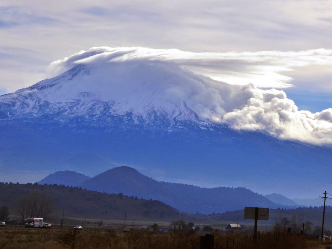
Volcanoes are endlessly fascinating for so many reasons, not the least of which is the way they make their own weather. Mt. Shasta, at the south end of the Cascades Range is no exception, as it rises around 10,000 feet above the surrounding valleys. The view of Shasta this morning was much different than it was on Thursday! It's really nice to see even more snow coming this week.
The clouds on the flank make me think of pyroclastic ash flows...
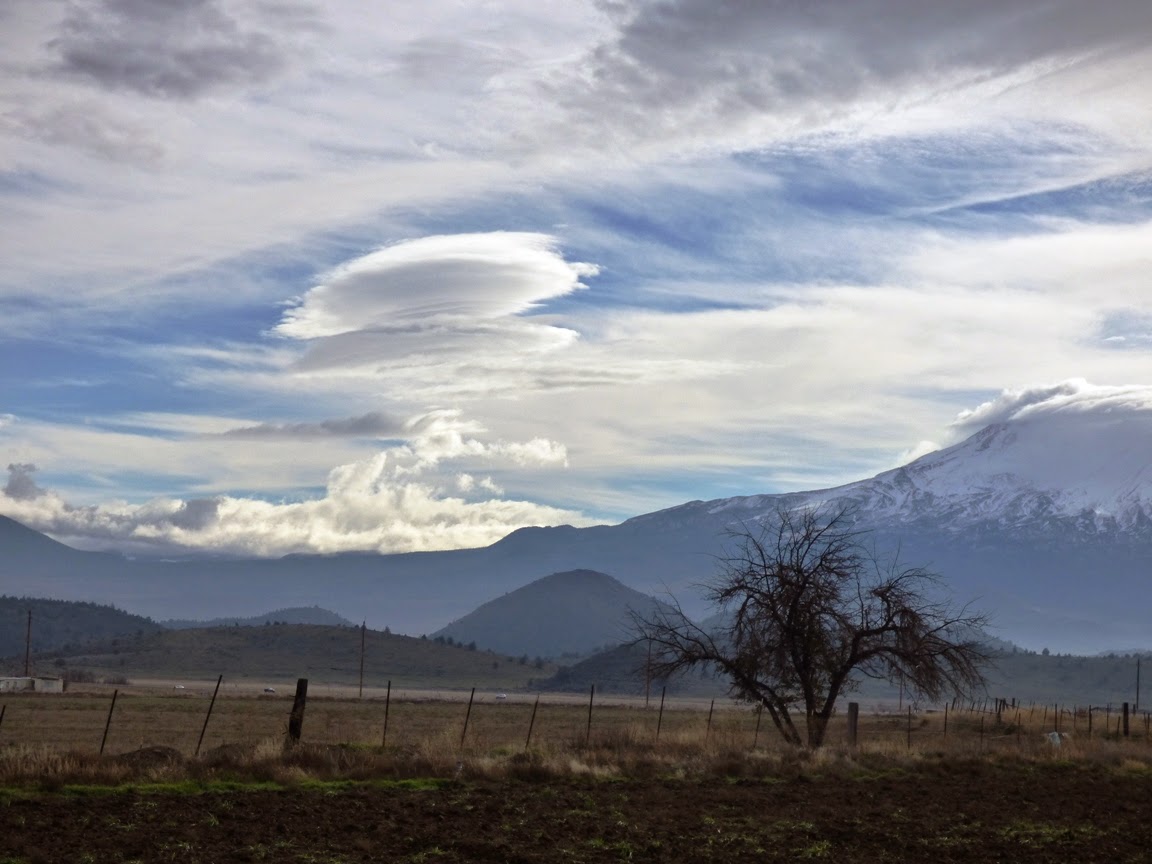
The strange lenticular clouds often seen around the mountain's summit have given rise to all kinds of speculation about UFOs and that kind of thing. The reason for the cloud phenomena, as mentioned yesterday, is the condensation that occurs as humid air is pushed over the summit by prevailing winds. As the air mass sinks on the leeward side it evaporates again. A storm system was moving through the area on the far side of the peak.
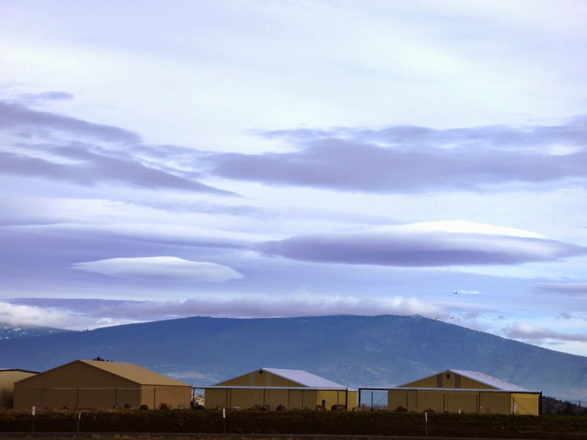
Some much more nicely developed lenticular clouds were visible just left of the peak (in the picture above), and over the one of the older shield volcanoes off to the east of the Shasta Valley. No wonder these things get mistaken for flying saucers (I've also heard it said that, yes of course those are lenticular clouds, not UFOs. They just give cover to the UFOs that are landing up there!)

Mt. Shasta never fails to be an interesting sight, no matter the season or hour. One of the most fascinating views I've ever had was one I couldn't catch on camera, but it stole my breath away. We drove up through Redding one night in a rainstorm that turned to snow as we approached the mountain. We were worried about reaching our destination at the late hour in the drifting snow. When we reached the far side of the mountain near Weed, the clouds parted and Shasta appeared, completely clear, and bathed in the light of a full moon. Unforgettable, and downright mystical.