Friday, December 20, 2013

CREC, the Basin and Range, and Sunsets: On the Lower Colorado River

Although there is some geological discussion going on here, this series of photos is really an excuse to share an extraordinary sunset that I enjoyed yesterday evening. Sometimes a sunset is spectacular in its own right, no matter where one might be (my home in the Great Valley being a rare example). Sometimes, though, the landscape and the geological forces that produced it become part of the sky show. That's how it felt yesterday.
It had actually been a gloomy overcast day as we traveled from the Phoenix area to Laughlin, Nevada, with only a bit of sunshine breaking through now and then. Laughlin is of course the small casino strip that provides an alternative to Las Vegas. As a casino town it has the bright lights and giant billboards, but lacks the level of crime and grunge. It has very cheap but reasonably nice rooms ($24 on a weeknight!), and it sits on the shore of the Colorado River. I'm not like a lot of people...I didn't lose any quarters to the one armed bandits because we were there for the room, being a nice overnight break from the long drive home.

We came up from Phoenix on Highway 93 through Wickenburg and Kingman. From Kingman we headed west across Highway 68 through Golden Valley, and over Union Pass in the Black Mountains. We were not far from the edge of the Colorado Plateau (the Grand Wash Cliffs are north of Kingman), and were headed into the interior of the Basin and Range geological province.
The Basin and Range is one of the larger geologic provinces of the United States, extending across all of Nevada, much of Arizona and Nevada, and the eastern part of California. It is a part of the Earth's crust that has been stretched quite literally to the breaking point. Hot upwelling mantle material had raised the landscape and stretched it not unlike the crust on a baking loaf of bread. The solid crust and upper mantle fractured and split, forming major systems of normal faults and near-horizontal detachment surfaces. The land broke into large mountain ranges (horsts) and deep fault valleys (grabens). Ancient river systems were broken up, and with the exception of the Colorado, no rivers flow out of the region to reach the sea. Most of the valleys are interior drainages, ending in playas (dry lakes).

The Colorado River is a strange one all on its own. The upper reaches of the river have been in place for tens of millions of years (dinosaurs may have roamed some of the most ancient canyon passages), but the gorge of the Grand Canyon has probably existed for no more than 6 million years (researchers are still arguing), and the passage to the sea in the Gulf of California for only 4 million years. There have been some wholesale changes in the pathway followed by the river, with the details a great mystery, although more is learned each year.

The valley of the Colorado River at Bullhead City and Laughlin is a heritage of the tectonics of the Basin and Range Province. The river did not carve the valley. It instead flows through a valley that developed from the extreme extensional faulting that formed this part of the province. The researchers in this region call it the Colorado River Extensional Corridor, or CREC.
The upper mantle is a region in the Earth's interior a hundred or so miles down where it is hot enough to melt rock, except for the extreme pressure the prevents the melting from taking place. One of the consequences of extreme extension is that pressure is released on the upper mantle, and some partial melting occurs, forming bodies (or plutons) of hot magma. Volcanism is thus a constant geological phenomenon in areas of crustal extension. We were crossing the Black Mountains, which are mostly composed of exposures of ancient schist, gneiss and granite. But at Union Pass, there are numerous exposures of light colored rhyolite.

Rhyolite can be a violently explosive material depending on the gas content of the magma. One of the eruptions in the immediate region produced the Peach Springs Tuff, an ash layer that coated the landscape from Barstow California to Peach Springs Arizona, with around 150 cubic miles being extruded in one eruptive sequence. Numerous other eruptions rocked the region from about 16 to 19 million years ago (a new geologic map of the area was published this year if you want to take a look).
So what does the landscape have to do with beautiful sunsets? Maybe not much, but here are some ideas: the Basin and Range is a hard place to live. Behind the rain shadow of the Sierra Nevada and Peninsular Ranges of California, the region is the nation's driest. Aside from the aberration of Las Vegas, there are few large towns and consequently few sources of air pollution. The air masses that move across the region are constantly encountering mountain ranges and thus rise and fall, leading to instability of the wind currents. It's rare, I imagine, to see stratus clouds blanketing the region as they might do in flatter places. And finally, the high mountains provide a vantage point from which to see horizons that might be more than a hundred miles away.
 So it was that we came over Union Pass in the Black Mountains at the end of a long day, expecting more of the gloomy overcast that we had seen all day. That's not what we got. As we started down the long grade to the Colorado River, a sliver of sunlight broke through the clouds on the western horizon, and the rhyolite cliffs seemed to catch fire from within.
I found a gravel road on the south side of the highway and we climbed to the top of the ridge to catch the light show. For a few brief moments a sun pillar lit the sky across the valley from us (below).
As the yellow and golden light faded, we got in the car and started down the highway, only to see the sky light up again in bright crimson and magenta. We stopped again in front of a new housing development on the highway.
The colors were stunning. Even the locals were impressed; our waitress at dinner saw some of these pictures on my laptop and commented how gloriously the evening had ended.
I used the zoom lens to concentrate on the most distant horizon, catching a sky that had seemingly caught fire. After a few moments the colors faded and we headed down the hill, back to habitations of humans.

Monday, December 16, 2013

The Sierra Nevada Underground: Natural Bridges of Gold Rush Country

In our last post we had a look at one of the showcase caves of the Sierra Nevada, Moaning Caverns. They are well-known, if for no reason other than the billboards along Highway 99, and the leaflets in restaurants all over the region. And the cave is spectacular. Far less known are some cavern features just a few miles away as the crow flies: Natural Bridges.

Most people hearing the name will think of Natural Bridges State Park on the beach in Santa Cruz. The caves we visited are a long distance from the coast. They are located on the upper reaches of Coyote Creek, a tributary of the Stanislaus River that drains into New Melones Reservoir near Columbia State Historical Park. It's in the middle of the Mother Lode Gold Rush country.
The bridges are at the end of a hike of about a mile on a good trail, although we were surprised by a bit of mud and snow on the trail last Saturday. It was slippery in a few spots, but we got down the hill okay.
There are two bridges that span Coyote Creek. I thought for a long time that the creek had breached a cavern below the river bed, and that erosion had carved the openings below the bridges. The facts are a bit more complicated. There was a canyon first (no caverns), and a set of springs that emerged from the sides of the canyon. The springs were full of dissolved calcium carbonate, and as the water evaporated, calcite deposits, called travertine, were left behind. They perhaps would have resembled Mammoth Hot Springs in Yellowstone National Park. The springs grew larger and larger, and eventually spanned the creek. Somewhere along the way, the water breached the base of the springs and flowed through, and even eroded into the underlying marble.
The creek usually has a modest flow, although I've read of flash floods that backed up and flowed over the top of the upper bridge. The water has pooled under the bridges, in some places 7-8 feet deep. In warmer weather, visitors will swim or float inner tubes through the caves. Last Saturday, we looked at the snow, and most of us chose to stay dry. It is possible though to explore several yards into the caves on dry rock.
The lower entrance to the main bridge/cave is wide with a large clear pool of water. In the afternoon, the sun reflects off the surface and shimmers on the roof of the cave.
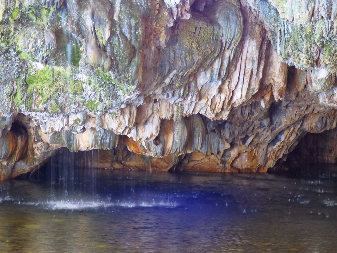
Some of the springs that formed the travertine are still active, and pour into the pool from the ceiling of the cave entrance. There is a constant chorus of dripping and pouring water.
After exploring the upper cave, we made the somewhat more complicated trip downstream to see the lower bridge. There is a trail, but it climbs the south slope in a few seemingly illogical spots (although trying to bushwhack through the "shortcut" soon convinced us otherwise).
Around a third of a mile downstream, the lower bridge comes into view. Like the upper bridge, the water has ponded inside, requiring a swim or float to get through. There are rock ledges that provide dry access for some distance into the upper entrance.
Both of the caves show the effects of decades of visitation and occasional examples of wanton vandalism, but plenty of features remain, especially those that are out of reach in the darkness above. Since the construction of New Melones Reservoir, the caves fall under the jurisdiction of the Bureau of Reclamation, so the caves have some degree of protection, and the area was free of trash and garbage when we visited.
Maps and description of the trail can be found at http://www.usbr.gov/mp/ccao/newmelones/planning_visit.html#hiking. Parking is provided along an older route of Parrots Ferry Road a few miles north of the Gold Rush town of Columbia. It can also be accessed from Vallecito on Highway 4. There is a vault toilet at the trailhead, but not along the creek. The trail is particularly beautiful in the spring when the wildflowers bloom.

Saturday, December 14, 2013

Inside the Biggest Cavern Opening in California: Moaning Caverns in the Sierra Nevada Foothills

Yes, I had another field trip today! It was less academic then some, as it was a Geology Club tour, but learning was part of the experience. We headed into the Sierra Nevada foothills to check out some karst topography, visiting Moaning Caverns, and exploring Natural Bridges at New Melones Reservoir. I'll cover the Natural Bridges in a separate post later on.

Moaning Caverns has one overwhelming distinction: it has the largest underground opening in California. The 180 foot tall main room could actually fit the Statue of Liberty (but good luck getting it through the narrow cave opening)! There are other interesting features, but size is everything here. I've been to Carlsbad Cavern, and it is in a class by itself, but I've also been in many caves in California, and none has a room to match this one.
I'm proud to say that one of our geology majors served as our guide at the cave tour today. She did herself proud. The tour starts around the historical cavern entrance, and it wasn't a historically great place to discover a cave: it has a vertical drop that with a few wall collisions totals around 170 feet (the guides call it the 7-second tour). Animals and humans have stumbled into the cave many times in the past, and many bones have been discovered in the bottom, including a human skull said to be 12,000 years old (I'll have to ask some anthropologists for a judgement on that one). Some of the bones are displayed in the glass cabinet in the picture above.
The cavern has been known for a century or more, and tours have been offered since the 1920s. The difficulty of the original entry has been circumvented by blasting a narrow passageway and the installation of stairs. Lots of stairs. I've been exercising a lot in recent weeks and yet my legs were rubbery by the time I got to the top!
The base of the stairwell is a platform that allows a view down into the main room. It's hard to get a true perspective of the size, and our guide pointed out that features we thought were a few tens of feet away were actually more than a hundred.
It's kind of fun to have our guide narrate the tour while dangling from a rope a hundred feet above the base of the main room. Serena displayed a flair for the dramatic! We tourists took the alternate route, a circular stairway 100 feet high that was welded from fragments of a World War I battleship in about 1922. What's more scary, a 165 foot rappel, or trusting a ninety year old iron stairwell that has been in a humid environment the whole time?
 It's a thrill ride either way!
 From the bottom of the stair, we could look up at some of the excellent speleothems (cave decorations). There was a twenty or thirty foot high stalagmite...
And an IMMENSE flowstone feature called the Chocolate Fall. I've never seen anything like quite like it anywhere else. It seemed to extend halfway up the wall of the main room.
It is very difficult to discern the scale of the room in a photograph. Below, you can see the stalagmite and Chocolate Fall in comparison to the circular stairwell. 
And here is a shot from near the top of the circular stairwell, looking straight down. Those little dots are some of my students still exploring the bottom of the cave.
Moaning Caverns offers a standard walking tour (what we did), and a more extended adventure tour that explores additional rooms below and around the main chamber. Some lower passages haven't been explored in years. The vertical nature of the cave means that carbon dioxide can accumulate to dangerous levels in the deepest portions.

One can also rappel. Um, no thanks, I'll take a rain check.

The owners of the caves are quite decent about providing discounts for student groups. They can be contacted at http://www.caverntours.com/MoCavRt.htm.
Next, an adventure in the Natural Bridges...

PS: "Moaning"? I didn't talk about the name, did I? They say today that it is from the particular way that dripping water echoes off some of the rocks, but I remember hearing (this isn't hearsay at all!) that the pressure differences caused a very strong airflow through the original entrance that would whistle and moan like a ghost. The development of the cave nearly a century ago destroyed the effect.

Thursday, December 12, 2013

Here's a Totally Unfamiliar Sight: Some Call it the Golden Gate

We are continuing our exploration of the most beautiful coastline in the world, the shoreline that runs from Big Sur to Bodega Bay. Today we'll have a look at one of the best-kept secrets of the entire state of California.

One of these times, you might find yourself in the city of San Francisco. It's a beautiful city built on a number of hills on the San Francisco Peninsula with a gorgeous stretch of beach, and a complex mix of rocks and sand dunes. If you do visit the city, try and take the time to seek out one of the unknown wonders of the city. As early as 1917, talk began of building a bridge across the opening of San Francisco Bay to the Marin Headlands. Much to the surprise of many visitors to the city, the bridge was actually built in 1937, providing a quick shortcut to the Sonoma/Napa Valley region, another part of California that no one has heard much about.
Locals call the span the Golden Gate Bridge. They try and keep it a secret from the tourists, fearing that it might get crowded and clogged by traffic. But if tourists are persistent, they can navigate their way through the back streets and find the bridge. Be aware that there will be people at one end collecting money from gullible drivers, insisting that they are simply charging a "toll" to use the bridge.
The bridge as seen from Fort Baker on the north side.
Oh, heck, I don't know how long I can drag this joke out. The bridge is only one of the most famous spans in the world and one of the most iconic symbols of California. Still it is a wonder to see, and I can't resist stopping whenever it comes into view. The setting is spectacular with steep coastal cliffs, the beautiful skyline of the City by the Bay, and the dark forests of the Presidio. When built, it had the longest span of any suspension bridge in the world at 4,200 feet, and is still the second longest in the United States. It rises nearly 250 feet above the waters of the Golden Gate. The two suspension towers are 746 feet high. A small army of thirty eight painters works continuously to protect corrosion-prone surfaces. And then there is the fascinating geology...
The bridge from the Marin Headlands.
San Francisco Bay is one of only two natural harbors along the California coast, and for two centuries has been a critical transportation and trade corridor for the state. Rivers that drain 40% of the state of California flow into the bay. It originated only 8,000 years ago as the last major ice age ended and sea level rose to flood the lower Sacramento River Valley (There were no doubt previous incarnations of the bay during earlier interglacial periods). During the ice advances sea level would drop three hundred feet or more, and the Sacramento River would flow to a delta near the Farallon Islands more than twenty miles offshore. Despite the urbanization, the bay is one of the most important estuary-wetland environments on the entire west coast of North America.
Several important fault systems cut across the Bay Area, including the well-known San Andreas, but also the less familiar Hayward, San Gregorio, Calaveras and many others. The proximity of these faults to the bridge is cause for some concern to the engineers who desire that the bridge would survive a major seismic event (retrofits have recently been completed). Part of the problem is the that the southern abutment is situated in serpentinite, a notoriously unstable rock (the cliff just visible on the right of the picture above is Baker Beach, which is made up of numerous landslide blocks).
The Golden Gate as viewed from the summit of Mt. Diablo in the east bay region.
The geology is incredibly complicated. The hills are composed of exotic terranes in the Franciscan Complex, bits and pieces of continental and oceanic crust that were carried hundreds or thousands of miles from their point of origin and accreted to the western edge of North America along a vast subduction zone. The subduction zone changed to a transform plate boundary (lateral movement along the San Andreas fault) only in the last few tens of millions of years.
Source: National Park Service

The rugged cliffs of the Marin Headlands (seen in the picture below from Fort Point) will be the subject of a follow-up post soon, but in short they are made of a complex mix of ocean floor basalt and reddish chert, a quartz-rich sedimentary rock that formed originally on the sea floor as diatomite. The diatomite was composed of trillions of microscope shells of one-celled creatures called (you guessed it) diatoms. The rock forms a solid foundation for the northern bridge abutment.
As mentioned already, the foundation of the southern abutment is in serpentinite, a far less stable rock (seen below from Baker Beach). You can see the landslides on the right side of the picture. I probably had a chance of being arrested the day I took the picture. It was September 15, 2001, just a few days after the tragedy of the Twin Towers and Flight 93. We were on a field trip with the National Association of Geoscience Teachers that had almost been cancelled. Airlines were not yet flying, and security around iconic symbols around the country was very tight. I imagine that if we had wandered closer to the base of the bridge there would have been trouble, or at least some very pointed questions from the California Highway Patrol.

Tuesday, December 10, 2013

Little Boxes on the Hillside, Little Boxes Made of Ticky-Tacky...The Mess at Mussel Rock and the San Andreas Fault

Little boxes on the hillside,
Little boxes made of ticky tacky
Little boxes on the hillside,
Little boxes all the same,
There's a pink one and a green one
And a blue one and a yellow one
And they're all made out of ticky tacky
And they all look just the same...

Malvina Reynolds (1962)
Photo by Mrs. Geotripper

The next beach on our journey along the most beautiful coastline in the world may not actually be the prettiest beach ever, but there is a lot going on here. Mussel Rock lies along the coast between Pacifica and Daly City, and a high cliff of really unstable looking rock slopes precipitously towards the waves. Some of the terraces in the photo above are the remains of an old alignment of Highway 1, and an earlier railroad track. Of course no one would ever be so foolish as to build houses in such a place? Oh, wait...
Photo by Mrs. Geotripper
There are little box-like houses up there! And some of them aren't up there anymore. A number have tumbled down the cliff face over the years. There is also a garbage dump that was active from 1957-1978 and is now threatening to slide into the ocean. Wave action keeps undercutting the slopes below the dump (I don't call it a sanitary waste disposal facility, because it isn't sanitary; it isn't lined, so all manner of pollutants can leak out too). All in all, it is a pretty good example of how many ways we can abuse a coastline. And yet it still has a certain beauty.
Daly City has never really figured out how to deal with the mess at Mussel Rock. They've finally decided to call it a park, but it has never been developed other than to have a small parking lot. It's kind of a sad missed opportunity because Mussel Rock has another incredible distinction. The San Andreas fault passes along the base of the cliff and heads out to sea at this locality. The epicenter of the 1906 San Francisco Earthquake was probably just offshore of the point. The actual Mussel Rock is composed of Franciscan Complex rocks, while the unstable cliffs are composed of the Merced Formation, a collection of sandstone and siltstone that was raised from the sea in geologically recent time. On the one hand, Daly City may not want the notoriety of being the origin of a quake that destroyed the City By the Bay, but it sure is a great opportunity to educate people about California's most prominent fault line. Shane Heiser has written an extensive history of the site that proposes developing the beach as an educational park and protected habitat for the rare San Francisco Garter Snake.


The actual fault trace is obscured by the landslides. In the picture at the top of the post, one can see the distant Point Reyes Peninsula on the horizon. The San Andreas comes on land again at the low pass on the left in the far distance.

The song "Little Boxes" was a folk anthem from the early 1960s written by Malvina Reynolds and also sung by Pete Seeger. It decried the rigid conformity of the day, and was inspired by the very homes you see on the cliffs above Mussel Rock. The houses do have a sort of cookie-cutter aspect.

Friday, December 6, 2013

You Mean That Aliens Didn't Do It? New Research on Mima Mounds in the American West

Mima mounds south of Seattle, Washington
What's life without a little mystery? For years, geologists and geomorphologists have been curious about a landscape that shows up on prairie lands around the American West. It's a regular pattern of low hillocks called mima mounds. The hills are a few feet high and a few dozen yards across. They generally occur where there is a clay substrate that sometimes causes pools to collect between the mounds. These are called vernal pools, and for the few months that they hold water, they support a large variety of unique plants and animal species.
Mounds in the Yokohl Valley region in the Sierra foothills near Sequoia National Park.
The mima mounds are a mystery because their origin is not exactly clear. Early settlers thought they were burial mounds for Native Americans, but that is not supported at all by archaeological research. Some have suggested that they result from disruption of the soil by earthquake waves. The mima mounds I photographed from above (first picture) were in Washington near the margins of the vast continental glaciers, and some have speculated that they formed as a result of meltwater flooding in some fashion. Other less scientifically oriented observers suggest that aliens from space have something to do with their formations (landing pads, maybe?).
Mima mounds near Willms Road in the Sierra Nevada foothills near Knights Ferry on the Stanislaus River.
Of course, some people suggested that the origin might be a bit simpler (remembering Occam's Razor: among competing hypotheses, the hypothesis with the fewest assumptions should be selected). They suggested generations and centuries of activity by ground squirrels or gophers resulted in the formation of the mounds. In the prairie environment, the mounds would give the rodents a better view of approaching predators, and their burrows would stay drier, being above the impermeable clays.

I was pleased to run across some current research on the origin of these enigmatic mounds by Manny Gabet at San Jose State University, and the verdict is...gophers. Generation after generation of gophers, building their mounds in the same place over time. Gabet doesn't insist that this is the absolute explanation for all mounds, but the computer modeling provides strong support for the idea. The mounds would develop after around 500-700 years.
Snow patches outline mima mounds at Tehachapi Pass in southern California (photo by Mrs. Geotripper).

Sorry, alien lovers...maybe Roswell has some new evidence.