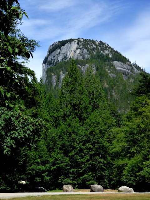
We were vagabonding our way through the landscapes of the Cascadia Subduction Zone between Northern California and the southern end of British Columbia. We were headed south towards home, but there were still some pretty intense sights ahead. As we drove down the Sea to Sky Highway back towards Vancouver, we had a chance to check out the awesome cliff of Siám' Smánit, Stawamus Chief at the head of Howe Sound. We got our first look of the immense cliff from several miles upstream at the Tantalus Overlook (below).
Stawamus Chief is a huge cliff and dome of granitic rock, specifically granodiorite (which chemically is a bit less rich in silica than actual granite). The chief has a height of 700 meters (2,297 feet), which is only a few hundred meters short of El Capitan in Yosemite National Park (900 meters, 3,000 feet). Interestingly, both names refer to "chiefs". The rock originated in magma chambers many kilometers below the surface of the Earth, underneath volcanoes that are presumed to have existed far above about 100 million years ago (the Cretaceous Period; dinosaurs would have wandered the slopes of these volcanoes). Tens of millions of years of erosion have removed the volcanoes and the many kilometers of intervening rock. We were quite literally standing within the internal plumbing of an ancient volcano!
One of the agents of erosion that has shaped Stawamus Chief was glaciation. We were at the head of Howe Sound, North America's southernmost glacial fjord, a spot where the ice stream was thousands of meters thick. The ice completely covered the "Chief" and eventually scoured and trimmed the edges of the huge rock.
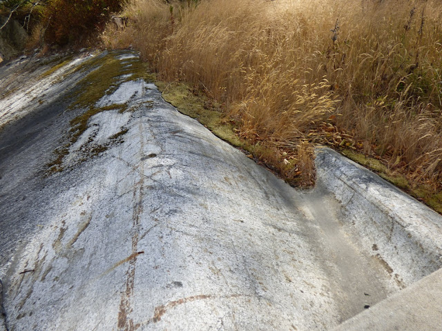
In the 12,000 years or so since the ice melted back, the scoured and polished surfaces of the rock were weathered away, or buried beneath rock debris. Fresh looking glacial surfaces can be hard to find at times, but the 2010 Winter Olympics provided some excellent exposures here at Stawamus. How? The organizers widened the highway, and constructed a pedestrian bridge that provided access to the provincial park for people parking to the north.
The slopes in the Stawamus area were covered with glacial till and outwash deposits that hid the scoured granite surfaces. Engineers cut a low pass through the till. but they realized that the loose debris would be a road hazard. They carted away the till, exposing the beautifully carved and polished surfaces underneath.
Some of the till was still visible on the south side of the highway (below).
From north of the bridge, even more of the immense cliff could be seen. The mountain attracts legions of rock climbers, and we could see several of them inching their way up the rock face.
It was getting late, and the vagabonders had made no plans for the night. We continued down the highway, eventually finding accommodations in North Vancouver. The next day we would be making the border crossing back into the United States, where new adventures awaited. More to come!


2 comments:
What causes some granite to exfoliate while others remain smooth since the glacial scouring occurred?
Granitic rock comes in several compositions, and some are more subject to exfoliation and jointing than others. If the rock is highly jointed (fractured), then exfoliation is less likely. Regional stresses play a part as well, especially compressive forces.
Post a Comment