Sunday, March 9, 2014

Viewing Half Dome from the Great Valley

Once or twice a year the air clears in the Great Valley. Our valley as great as it is, is a closed basin. The Sierra Nevada and Coast Ranges make it hard for air pollution and dust to move out of the region, and as such the cities of the San Joaquin Valley (south of Stocton) often appear on the top ten "most polluted air" lists. On those few clear days, my eyes drift east towards the Sierra Nevada, and if I am on the way to Turlock, I stop on Hickman Road just south of the Keyes Road intersection and see if Half Dome is visible. For the last two days, it's been visible.

It's not easy to see. Half Dome towers over Yosemite Valley by about 4,000 feet, but the orientation of Yosemite Valley and even the curvature of the Earth make it a challenge unless one knows exactly what to look for. The intervening foothills block the view from most directions. It is only a narrow part of the valley that is framed by the Merced River canyon allows the dome to be seen. In the establishment shot above, nothing is visible. One has to go to the zoom.
 In the picture above, Half Dome is visible, but is not well framed by the snow on the peaks behind. It's almost in the dead center of the picture above, but still hard to see.
 Zooming in a bit more, the outline of the dome with just a bit of snow on top becomes visible (just a bit right of center. If you haven't seen it yet, I drew in the outlines below.
It isn't the clearest of shots. I got a clearer shot a few years ago (look below). Even at that, the issue of visibility from the valley has been an occasional tempest in a teapot, with a few folks arguing that such a view was impossible, and that someone had been photoshopping. Great idea, but beyond my skills!

UPDATE (3/10):Went to Turlock today after a half inch of rain overnight. The pictures I took today show more convincing details, including the top of El Capitan. See below:


And here is the annotated version with the top of El Capitan added.


Thursday, March 6, 2014

The Harrowing Journey to the Valley of Death (21st Century Style)

When is the next bathroom? Will there be flush toilets at the campground? What about showers?

Geology field tripping in Death Valley National Park in the modern era is a far cry from the adventures of centuries past, specifically the 19th and 20th (the earth scientists living among the Native Americans in past centuries left no record, but they no doubt knew which rocks and minerals were valuable for tool making). In the 19th century the "earth scientists" were the few itinerant miners and prospectors looking for other kinds of valuable minerals, especially gold and silver (though the most valuable finds were probably the borates and talc). Just getting to the gigantic blank spot on the map was a challenge, and surviving in the harsh climate was a gamble.
At the beginning of the 20th century, access was improving, and rough dirt roads coursed up many of the valleys and crossed the less rugged passes of the mountain ranges. These roads were utilized by the first of the university-trained geologists who undertook the daunting task of mapping the Death Valley region. It wasn't that the rocks weren't exposed well. They offer some of the best exposures to be found anywhere. But the Basin and Range Province is so vast the few individuals who first worked in the region were limited simply by time and mortality. There was hardly enough time in one life to see it all!

By the 1930s, mining roads made for much better access, and the designation of Death Valley as a national monument by Herbert Hoover in 1933 led to increased tourist traffic. The mines began converting their hospitality facilities to tourist destinations, particularly at Furnace Creek. Paved highways allowed for quick trips out of Las Vegas or the Los Angeles region, and Death Valley began to feel just a little bit "urbanized". But not really. It can be easy to forget that this land is still the same harsh climate that it's been for the last few thousand years since the end of the ice ages. The heat and dryness can still lead to heat stroke and dehydration, and all it takes to bring one to the edge of mortality is a blown radiator hose or flat tire.

And so it was that we were making our way into the "Valley of Death" for our geology field studies class a couple of weeks ago. We had already searched for fossils at Sharktooth Hill, learned the basics of stratigraphy at Red Rock Canyon, and explored a dry ice age waterfall at Fossil Falls, but it was time to head east out of the Owens Valley and into one of the most isolated regions of the lower forty-eight states. We first crossed the relatively muted topography of the Darwin Plateau at the south end of the Inyo Range (top picture), and then took the Mr. Toad's Wild Ride down the steep highway to Panamint Springs and Panamint Valley. We made a short stop at the Father Crowley Vista Point (above). This site used to be a wide dirt lot on the side of the highway, but has been developed into a formal vista point with a simple toilet facility and protective fencing (gotta keep them tourists from falling over the cliffs...). The view is stupendous, with an excellent vista of the Panamint and Cottonwood Mountains across the way. There are complex relationships between the rocks of the Panamints, which are hinted at in the picture below, where dark flows of basaltic lava cover intensely folded Paleozoic carbonate rocks. The hill beyond exposes a granitic pluton.
The bottom of Panamint Valley holds more recent geologic phenomena, including the Panamint dune field and a fault scarp along the mountain base (the sunlit terrace)....
 ...and Panamint Dry Lake (below). Telescope Peak, the highest point in the park at 11,049 feet, is often graced by snow during the winter months. On the other side of the Panamint Range is Death Valley itself, which in large part lies at a depth of several hundred feet below sea level. Not many places around the world have such great relief.
From the Panamint Valley at about 1,000 feet we began climbing to cross the Panamint Mountains over Towne Pass at 4,956 feet, and in the setting sun we followed the long grade down the alluvial fan system to Stovepipe Wells at sea level. We pulled into the campground at dusk under a beautiful fiery sky.
 As the western sky faded, the light grew in the east as the full moon rose above the Funeral Range.

We had reached the Valley of Death, and it was a beautiful place. And there were flush toilets and showers!

Tuesday, March 4, 2014

The Water Pirates: A Can a Day is All We Ask (plus 107 million gallons)

New orchard on the California prairie
It's a sad and familiar story for California: there is a valuable resource in the ground, free for the taking. There are those who come to exploit the resource, tearing up the land and leaving behind a wake of destruction. There are no laws to control the behavior of the miners, except for a few arcane rules from a previous century. In the end the resource is gone, and so is the chance for any sustainable use of the land for future generations. In the end, it was all about money, which landed in the hands of a few powerful people. It certainly didn't benefit the ones who did all the physical work.

This could describe the effects of the California Gold Rush of the 1850s, but unfortunately it is not. It is a story that is happening right now in my neck of the woods (prairie?), and the worst of the destruction still lies ahead. And right now, there isn't a whole lot anyone can do to stop it. It's not gold, it's water. And despite the fact that gold is worth somewhere around $1,000 an ounce, the water is far more valuable.

Our local paper, the Modesto Bee, has been running a series of reports recently including this one by reporter J.N. Sbranti that should receive much wider exposure. Almonds have become a valuable and profitable commodity these days, and there is a wild rush on to plant as many acres of almonds as possible. In many cases farmers are simply switching from corn or other yearly crops and putting in orchards. The most destructive aspect, however is the planting of some 30,000 acres of almonds and other nut trees on the former prairie and grazing lands east of Modesto adjacent to the foothills of the Sierra Nevada.

The problem with the trees on the valley floor is that one can't let the fields lie fallow in the driest of years like the one we are now suffering through. The trees must be watered or they die, and they require 4 acre-feet of water per acre each year. If the water gets prohibitively expensive, so what? They'll have to pay the price.
California's version of "snow". The almonds are beautiful when they are blooming.

What's worse are those almond orchards in the foothills. They can't be irrigated by normal means, as there is no infrastructure to deliver water there from the local irrigation district. The only source of water is from the ground, and there are few if any rules regarding the use of the groundwater. The large agribusinesses simply buy up the cheap grazing lands, put in the trees, and start pumping vast amounts of groundwater to water them. According to the Sbranti report in the Bee, the 30,000 acres of new orchards are consuming 39 billion gallons of groundwater each year, which is more than is currently pumped for domestic use across the entire county. The groundwater resource is limited, and will likely be depleted in the service of these orchards. When the water runs out, the orchards will die, but the owners will have gotten their cash. All legally of course, and damn the consequences.

It's all well and good to complain about government regulations, but theoretically government exists to watch over the well-being of the citizens. When there is no governance, the pirates take over, and we all lose. There oughta be a law, but I don't hear about anyone working on it. Much too arcane a political issue. At least until the wells run dry...

Monday, March 3, 2014

The Other California: The Wetlands of the San Joaquin Valley, Actually Wet.


It's been a miserable year, one of the worst on record. For the last year much of California, including my home in the Great Valley, has received an amount of rain more appropriate to Death Valley than to one of the most fertile agricultural regions on the planet. It's been dry and dusty, and the farms in the valley have been surviving off of storage in the irrigation reservoirs, but after three dry years in a row, the reservoirs are on empty.
A Black-necked Stilt

In a valley where farming is king and 95% of the landscape is totally devoted to agricultural development, wildlife concerns take a back seat, especially when water runs short. The valley once hosted millions and millions of migratory birds, but during the development of the farmlands, lakes and marshes were drained and plowed, and what few birds persisted got themselves driven off or shot for consuming crops when natural forage was no longer available.
No, it's not drunk, and it's not falling over. A split second later it was airborne.

It would be nice to think that wildlife refuges were established to stabilize and preserve the original environment of the valley, but in some cases the motives were less noble: some, like the Merced National Wildlife Refuge where we visited yesterday, were designed to distract the birds from nearby farmlands where they were causing crop damage. And of course many refuges were designed to make it easier to "hunt" and shoot the birds. Whatever the original motive, their form and function has evolved. As we have come to understand the intricate nature of the migratory bird ecosystem, management of the refuges has begun to promote a stable winter home for numerous species. In some cases they have become spectacularly successful: the Merced Refuge protects 60,000 geese and 20,000 Sandhill Cranes. The refuges are managed as a complex ecosystem, with protection extended to the many other birds, mammals, reptiles, amphibians, fish and invertebrates.
A Black-necked Stilt and a Killdeer forage on the refuge road.

Our previous visits to the refuges (which we pretty much discovered only this year after living around here for a quarter of a century) have been dry times. Some of the fields were flooded but so little water was available. The drought has not broken, but we've finally received some rain, and on Sunday we paid a visit during a rainstorm. The birds seemed pleased, and the noise was almost deafening at times. It was delightful.

The Black-necked Stilts (Himantopus mexicanus) were especially common, and cooperated nicely with our efforts to get pictures, so they are the stars of today's post. "Stilt" is an appropriate enough name; their legs are ridiculously long, allowing them to wade in deeper water than some other birds.

There is only one Ibis in the American West, the White-faced Ibis (Plegadis chihi). We saw it for the first time on our last trip here, and were pleased to see it again. According to some of my guides, the bird is in decline California, primarily because of the need for large marsh areas for breeding. Those have been sorely lacking in these dry years.

They have one of the stranger looking beaks I've seen. They are obviously good for foraging deep in the mud.

Their feathers have a beautiful iridescence (that was not real obvious on this cloudy day).


The edge of the refuge include a few trees, still lacking their leaves. We were watching for raptors, but were thrilled to see a huge Great Horned Owl (Bubo virginianus) staring at us. Actually the stare was mildly disconcerting. The curve of their brows suggests malevolence, even though none presumably exists (I hope; given that birds are the only remaining dinosaurs in the world, I shiver to think of that stare coming from a creature fifteen feet tall).

I saw a fencepost off in the distance, but realized after a moment that it was actually a Great Blue Heron (Ardea herodias) standing very still. Another bird who cooperated nicely as we snapped a few pictures.

It is such an elegant looking bird!

We couldn't get very close to the vast flocks of Ross' Geese, Snow Geese and Sandhill Cranes, but we could see thousands of them off in the distance. The picture below is just part of the main grouping of Sandhill Cranes. The managers grow several hundred acres of corn on the refuge to feed the birds and give them full stomachs for the long flight north to their breeding grounds.

We stayed until the sun disappeared below the horizon in a beautiful sunset. This is the Great Valley at its best; I have been guilty of thinking of my home grounds as boring, bereft of geological interest and lacking much of anything resembling a natural environment that recalls the days following the last ice ages when wooly mammoths and dire wolves roamed the prairies, along with horses, camels, elk, bison, antelope, and saber-tooth cats. But here in the setting sun, with the cacophony of hundreds of thousands of birds, I felt a sense of how it once was before we "improved" the land.

The western sky was graced with a beautiful thin crescent moon.

The "Other California" is my long-neglected blog series on the places in my beautiful state that are often missed  by travelers from outside the region, especially those that tell a geological story. Toyota stole my idea, actually. I've never seen a tour bus full of foreign tourists stop at any of these refuges, but I imagine the sight of tens of thousands of geese soaring into the sky would be a sight that would impress any California visitor. And in the American West, the story of such a flat place, full of wetlands and marshes, is truly unusual, considering the geological violence that has occurred throughout the region, raising vast mountain ranges and high plateaus. The diversity of our landscapes, and the wide diversity of our native species is truly stunning.

Note: The San Joaquin Valley noted in the title is the name given the southern half of the Great Valley, from about Stockton to Bakersfield.

Saturday, March 1, 2014

Action on our Seismometer Today: Earthquake Swarm or Volcanic Harmonic Tremor? (hint: no...)

 Frankly, if we lived next to a major fault zone or an active volcano, the seismic record above on our department seismometer would be worrisome beyond measure. Earthquake after earthquake usually means very bad things, the harmonic tremor leading to a major volcanic eruption or the buildup to a huge earthquake. Fortunately, I live in the Great Valley of California and such outcomes are unlikely. No, this seismometer is recording something much more positive: Science!

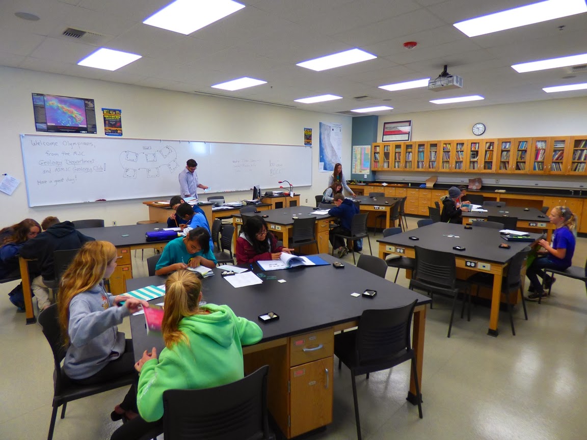
Or more to the point, it's the pounding footfalls of 500 or so enthusiastic future scientists running up and down the halls of our Science Community Center competing in the annual Regional Science Olympiad. The event brought teams from several dozen junior and senior schools to compete in 24 different events designed to test the creativity and rigor of the student's education in a variety of disciplines.
The competition is as intense as any football game, and the stakes are high. The winning schools will compete in the Northern California Science Olympiad, and the winners there will compete nationally. The enthusiasm of the students is palpable, even in the "secondary" events like Rocks and Minerals and Dynamic Planet that were conducted by the members of our campus geology club. I call them "secondary" because they don't always get the attention of glamour events like the bots, helicopters, and bottle rockets. What I and the coaches know, though, is that the competition is won and lost in these events, the trenches of scientific competition.
What that means is that unlike the football quarterbacks and receivers who get called heroes for bouncing an odd-shaped ball about, is that the geeks and nerds get the recognition and appreciation of their fellow students for bringing glory and victory to their schools. And since it takes a few dozen students to put a winning team together, they share richly in the accolades. That quiet kid in the back of the classroom who never says much but always has a few minerals in his or her backpack and a book on geology can be the winner of an event that puts their school over the top. He or she will never forget the moment.

And the best part? When they go on, they won't reach middle age with bad knees and constantly sore backs with faded memories of glory on the athletic fields. They will instead be the real heroes of society, being the doctors and scientists who bring about positive change in the world.
And that's not all. There are other heroes...there are the coaches and volunteers who put these teams together at the different schools and organize and train the students. There are the event judges, volunteers all, who design and conduct the various events. There are dozens and dozens of volunteers from the community who support the judges. Our county board of education has to be commended for their ongoing support of the program, which has now extended over decades without a break. All in all, there are hundreds of people coming together to support the concept of science education in our community.
There was one more star today as well. As my usual readers know, we only recently opened up our Science Community Center at Modesto Junior College for operations, a wonderful facility that has modern laboratories, a museum, an observatory, and one of the finest planetariums in the country. This incredible learning center happened because our community decided to support science education with the passage of a bond act that paid for it. This was no state program, or national initiative. It was the decision of the people in our community, one of the poorest in the nation, to make things better for their children.
So yes, there were earthquakes today. It was the pounding of hundreds of feet of students who may have a better future because their community insisted on it. Modesto and Stanislaus County can be proud of what they've accomplished.

Friday, February 28, 2014

Out of the Valley of Death: Dreams of the Water Times at Fossil Falls


The lands east of the Sierra Nevada are dry. The massive mountain wall of granitic rock captures the Pacific storms that reach California and wrings the moisture out, leaving barren deserts and culminating in the hottest spot in the world and the driest locality in North America: Death Valley. Rocks of course are superbly exposed in this landscape, but the overwhelming impression for most visitors is the dryness.

It wasn't always this way. Climate change happens on different scales. There is the very rapid climate change that we are enduring in the present day, where major changes are taking decades rather than centuries or millennia. And then there is the kind of change that happens on a time scale of tens of thousands of years. That has been happening in the eastern Sierra Nevada over the last two million years as the northern hemisphere alternated between cold wet periods and warmer stretches. These were the Pleistocene ice ages. Evidence for at least six glacial advances can be discerned in the rocks and sediments of the Sierra Nevada, but independent analysis of ocean core sediments suggests that at least a dozen glacial advances took place (larger events tended to erase the evidence of earlier but smaller events in land deposits).


And yet the rocks retain the memory of water. Or in non-anthropomorphic language, the rocks contain clear evidence of earlier periods of wetter climate. A popular stop for geology field trips in the eastern Sierra Nevada is Fossil Falls in the Coso volcanic field between Ridgecrest and Lone Pine. The attraction of the site isn't a fossil, but the evidence of a large flowing river in the desert.
The valleys east of the Sierra Nevada are there not there because of river erosion. They exist because the crust itself has been stretched to the breaking point, and faults have formed. Some blocks sank to form deep graben valleys, while other blocks remained elevated to form the high mountains (horsts). Previously existing river systems were disrupted and vast regions no longer drained to the sea. This area of interior drainage is called the Great Basin, and it extends from the Sierra Nevada to the Wasatch Front in the state of Utah.

During the wet and cold periods the glaciers didn't reach far down into the valleys east of the Sierra Crest. But they did melt, and the meltwaters collected in lakes in the bottom of the deep graben valleys. When the cold periods lasted long enough, the lakes would fill to overflowing and spill over into the next basin. Fossil Falls are situated between Owens Lake and China Lake, with the cinder cones, plug domes, and basaltic lava flows of the Coso volcanic field in between. Lava flows from cones like Red Hill (above) occasionally blocked the river that would sometimes flow between the two currently dry lakes (Owens Lake contained a thirty foot deep lake as recently as the 1920s, but water diversions to Los Angeles caused it to dry up; it would need to be several hundred feet deep before it could spill over again at Fossil Falls).

The strangely shaped rocks then originated as the Owens River flowed and spilled over the edge of the lava flow that stood in its path. The smallest irregularities in the basalt would cause swirls and eddies in the flow, and sand, gravel and pebbles would grind at the edges of the shallow basins, eroding and deepening them. Eventually they would become potholes, and some of the potholes at Fossil Falls are immense. At least one of them tunneled ten or twelve feet down and broke through the canyon wall (below), forming a climbing challenge for canyon explorers (I proved I could shimmy up the thing a decade or two ago, so I don't need to prove it anymore...).


There is life in the potholes. When rain fills some of them, eggs of fairy shrimp hatch and for a few short weeks the small arthropods live, grow, mate, and die, leaving their eggs to wait for the next wet year.

It is strange to stand at this ancient river bed and hear only the gusts of wind. One can travel in one's mind though, and start to hear the crashing waters, the verdant cottonwood trees rustling, and the sounds of animals coming to the river for a drink. There were mammoths at the time, and horses, and camels, along with the more familiar deer and pronghorn antelope. One might have spied a Sabertooth Cat, a Dire Wolf, or an American Lion lying in wait in the hope for a meal. In the latest times, humans hunted for game in this more equitable environment. Chips of obsidian and housing rings are still present.

2005 was an extraordinarily wet year, and storms were actively dumping water into the drainage upstream of Fossil Falls. That year was the one and only time I've ever seen water flow through the gorge. The little stream could never be mistaken for the torrent that once flowed through and carved the canyon, but it was beautiful to see an echo of the water times of the Owens River system.

Fossil Falls is on Bureau of Land Management lands, and has been "developed" as a recreation site, with a small parking lot, campsite, and restrooms. The trail to the fall is not long, about a quarter mile, but it has a few rough spots. Climbing around the potholes can be a little intimidating, but the views are great from the rim as well.

Thursday, February 27, 2014

Out of the Valley of Death: Explorations in Red Rock Canyon

The next stop on our way to Death Valley National Park was one of the most ideal locations for learning the basics of stratigraphy to be found anywhere: Red Rock Canyon State Park in the El Paso Mountains along the Garlock Fault. The park protects exposures of the Miocene deposits of the Dove Springs formation (formerly the Ricardo formation), aged at about 8-12 million years. The formation of conglomerate, sandstone and claystone was laid down in alluvial fans, floodplains, and lakes in a semi-arid savanna environment. The region was home to a vast array of grazing mammals and predators, including extinct elephants, rhinos, three-toed horses, giraffe-like camels, saber-toothed cats, and bone-crushing dogs as well as smaller animals like ancestral skunks, martens, alligator lizards, rodents, and shrews. (follow the links to descriptions of each type of animal on the Los Angeles Natural History Museum website).
The park has stunning exposures of the sedimentary and volcanic rocks that illustrate many of the basic principles of stratigraphy (superposition, original horizontality, lateral continuity, and cross-cutting relationships). I worked with the students to observe and identify the rocks, and to work out a sequence of events that led to the formation of the exposures. And then I turned them loose to produce a rudimentary map of the geology of the area around the beautiful red cliffs.
It was February, and the sun was blazing! The temperature topped out at about 90 degrees. In a sense it was quite pleasant, especially compared to the frigid conditions back in the eastern United States, but it was also a reminder that we never had winter this year. There has been so little rain that there are parts of the Central Valley that have received less precipitation than Death Valley. It was a bit disturbing to realize how dry conditions are across the state.
Red Rock Canyon State Park has been the setting for numerous movies over the years, including old-time westerns, but my favorite movie scene was the opening sequence of Jurassic Park, where the protagonists were excavating velociraptors from Snakewater Creek or some such place in Montana. I sometimes find myself thinking "your cute little velociraptors wouldn't stand a chance against our bone-crushing dogs and sabertooth cats!".