Showing posts with label Washburn Point. Show all posts

Friday, August 7, 2020

The Way it Was: Yosemite in the Times of a Pandemic

Tunnel View, close to the spot where the valley was first "discovered" by European colonizers

The pandemic rages on, and our lives have been upended in so many ways we could never have foreseen. My heart goes out to all of those whose lives have been devastated, whether by disease, unemployment, or fear. We've been fortunate so far, and we've been careful to stay out of harm's way, staying home for the most part, wearing masks in public, and always the social distancing. 

I walk along my river almost every day to maintain sanity and health, but except for a single short excursion up north for my grandmother's funeral, we've not been out of our county since March. But this week I went online and scored an E-ticket (you have to be an older person to understand that reference): a reservation for entry into Yosemite National Park.
The park has been trying to deal with two opposing directives: opening the park as much as possible, and maintaining some degree of safety in trying to prevent the spread of the coronavirus. They settled on limiting the number of visitors by instituting a reservation system (info at reservation.gov). The goal is to have the park at about 50% of usual visitation. 80% of the reservations are available a month in advance, while the other 20% come available two days before the visitor's arrival. That's the ticket I was able to get.
We headed up as early in the day as we could, intensely curious to see what things would be like. And out of the 100+ journeys we've made to the park in the last 30 years, it was unusual to say the least. There was a long wait at the entrance station like usual, but reason was different. There were fewer people, yes, but it took longer to confirm everyone's identity (the reservations aren't transferable). Once inside the park, the transformation was remarkable. There was very little traffic on the road, and there were spots available in every parking lot that we could see. The lot at Tunnel View (the top picture in this post) was only half full. And no buses were idling.
We headed up Glacier Point Road and had a long lunch at Summit Meadow, and we had it almost entirely to ourselves (admittedly not one of the 'destination spots' for visitors, but still...). We stopped at the nearly empty parking lot at Washburn Point, and then headed to Glacier Point, which was also only half full. It seemed a different world than from our 'normal' Yosemite experience. The picture below of Glacier Point was not cropped to remove people; that's how many were actually there.
After so many months of sheltering in place, it felt so good to get out of the valley and see the high country of the Sierra Nevada. We've missed it so much.
We drove back down to the floor of Yosemite Valley and found the valley to be equally devoid of crowds. There were a few gatherings near the taco trucks that are serving as food purveyors while parts of Curry Village are renovated. But again, most of the lots were uncrowded. The afternoon shadows were lengthening as we passed Sentinel Bridge and Lower Yosemite Falls (the merest trickle in this dry year), and we made our way down to Valley View.
When Yosemite Falls is dry, Yosemite Point takes on an entirely different perspective. It's the prominent cliff that is still lit by the sun on the right in the picture below. Yosemite National Park is like that...there are those most famous cliffs like El Capitan and Half Dome that dominate people's experiences, but there are dozens of lesser-known rock cliffs and spires that in any other place would be national parks and monuments in their own right.
The Cathedral Rocks are one of those cliffs. They are the incredible cliffs in the picture below. They are behind you when you stare up the vertical face of El Capitan. I don't recall ever seeing them on the t-shirts and coffee mugs in the curio shops (although I don't spend a lot of time in the shops when I'm in the valley).
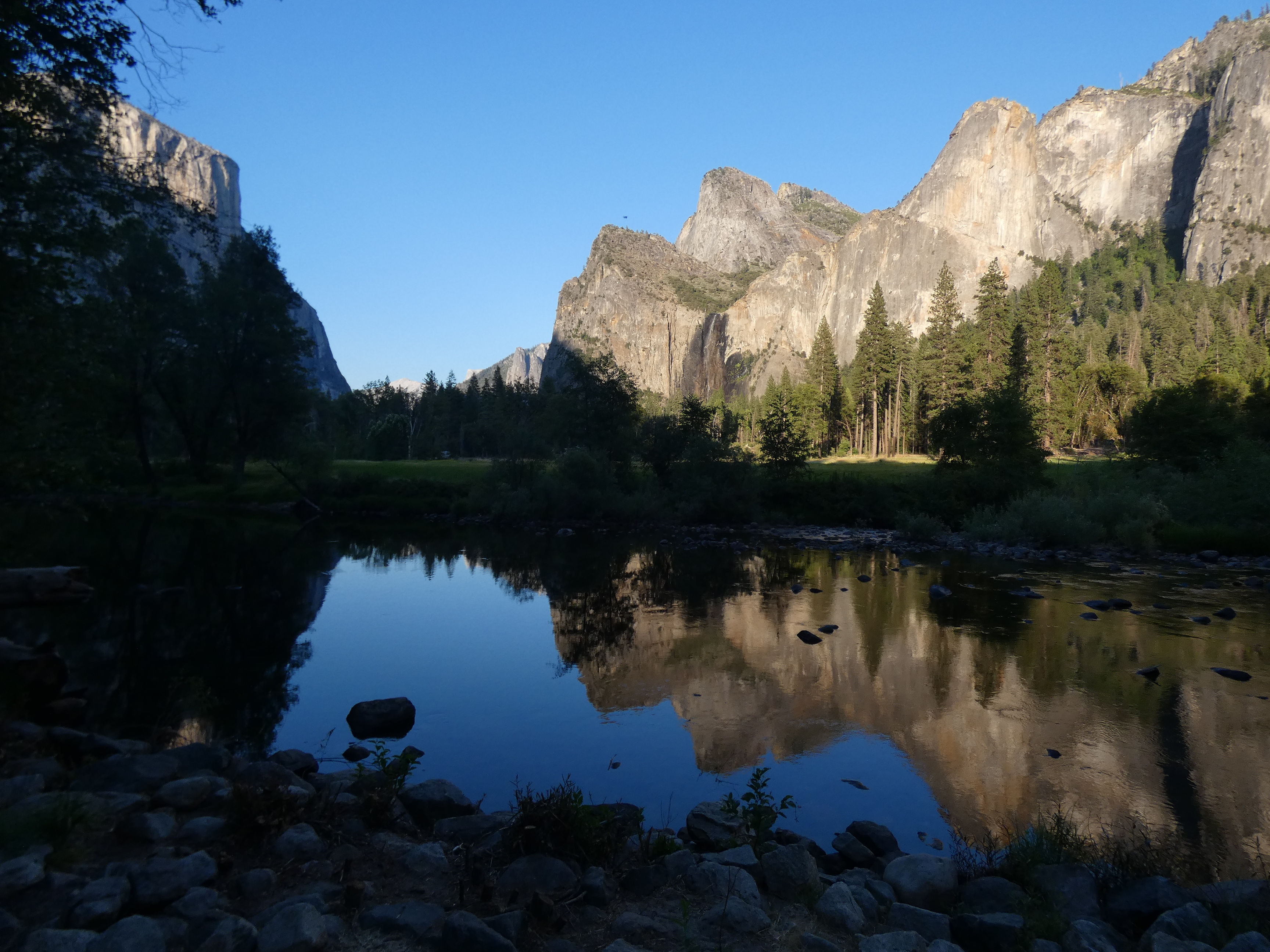
We made our last stop at Valley View where we could enjoy the evening light on El Capitan, Bridalveil Falls, and the other (better-known) side of the Cathedral Rocks. The Merced River was a beautiful reflective pool at this time of low water.
We noticed an American Dipper foraging in the water. It's one of the few songbirds that regularly swims. Also called the Water Ouzel, it was one of John Muir's favorite Sierra birds. I've only seen them a few times.
We saw a Black Bear at Crane Flats. There has been a lot written about the resurgence of wildlife in the absence of the usual crowds of humanity at Yosemite. It was simply napping away at the edge of the meadow and no one was bothering it. On the whole, Yosemite National Park was a delightful place to visit that day, a far cry from what we experienced during our Labor Day visit a year ago when we experienced bumper-to-bumper traffic jams, no parking, and no chance to see the sights. It wasn't fun for anyone that day.

We need to reconsider the role of our national parks in our national life. They are precious places, and we are loving them to death. Yosemite certainly isn't alone in this regard. Arches and Zion national parks in Utah in particular have become so crowded that few are able to experience and enjoy them in any meaningful way. I hate to say we need to keep a reservation system like this in place, but at the same time we also need to make more places available to our population. 

One of the most egregious acts by the present administration was the destruction of two of our most significant national monuments, Bear's Ears, and Grand Staircase-Escalante. These parks are within an easy day's drive from Zion, and offer equally spectacular natural experiences. But they were eviscerated by the administration, Grand Staircase by 50%, and Bear's Ears by 90%. We need these parks, and more. It's something to consider as we enter into a bitter election season. Which party is better equipped to safeguard our national treasures?

And that's the way it was in Yosemite. Words can barely describe the beauty and serenity of the day.

Friday, November 3, 2017

Perhaps a Last Look at Some Yosemite High Country (for the Winter, Anyway)

"Half" Dome from Washburn Point
I made the trek up the hill to see Yosemite last weekend, with a field trip on the valley floor on Saturday with my students, and a quieter tour in the high country with Mrs. Geotripper on Sunday. We headed up Glacier Point Road to gain a unique perspective on Yosemite Valley and the higher country above. With a fairly powerful storm arriving tonight, it is at least conceivable that the road could close for the winter due to snow. There was certainly a mood of closing down. The road was uncrowded, and so were the parking lots. The curio shop at Glacier Point was closed for the season.
Yosemite high country, with Mt. Broderick, Liberty Cap, and Nevada Fall in the foreground.
Many people who travel to Glacier Point tend to be single-minded in their quest, and often miss one of the truly spectacular viewpoints the road has to offer: Washburn Point. It is perched at the 7,400 foot level above the Merced River directly across from "Half" Dome. It is from this point that the misnomer is most obvious. If anything, Half Dome should have been named "Four-fifths Dome".
Nevada Fall on the upper Merced River
There is a stupendous view towards the high country of Little Yosemite Valley and the headwaters of the Merced River. The effect of glaciation is apparent everywhere. Glacial stairsteps, caused by pervasive vertical fractures in the granite ("joints"), were the origin of the two major waterfalls on the Merced River, Nevada Fall (594 feet, above), and Vernal Fall (317 feet, below). Along the skyline above, the glacially-carved horns, aretes, and cirques can be seen. It's wild and beautiful country.
Vernal Fall from Washburn Point
I imagine Washburn Point gets less traffic than Glacier Point because it doesn't look down on the main part of Yosemite Valley. That's okay with me. It's notable that not a single road is visible from Washburn. One is looking at wilderness, something that is sorely lacking in the more populated parts of Yosemite National Park.
North Dome and Basket Dome on the north side of Yosemite Valley. Mt. Hoffman rises in the distance.

Tuesday, October 20, 2015

A Series of Fortunate Events: Is it Time to Rename Half Dome?

We spent three days exploring the geology of the Yosemite region last week, and the first stop on Saturday was Washburn Point, an amazingly quiet viewpoint given its proximity to Glacier Point. It's a parking lot, sure, but no bathrooms, no curio or snack shops, few interpretive signs, and in my experience it is far less crowded. One can't see as much of Yosemite Valley from the point as one can from Glacier, but it provides an outstanding vista of the high peaks above the valley floor. And it provides an educational peek at Half Dome. And like no other point in the valley, it reveals the lie in the dome's name. It's not a "half". At best, one could call it Three-quarters Dome, or Four-fifths Dome, but not Half Dome.
We bloggers have our favorite posts, and one of mine is the one I wrote last year as part of my "If These Cliffs Could Talk" series: Tis-sa-ack and Tu-tok-a-nu-la (A Geologic Love Story). You can click on the title to read it if you missed it originally. In the story we find that the dome is named "Tis-sa'-ack" after a beautiful stranger who disappeared after spurning the love of a chief. The chief's actions led to disaster for his people, but eventually the gods relented and the people of the valley once again had plenty

I stuck the statement way at the end of that post, but I wondered at the time why we haven't renamed Half Dome? "Tis-sa'-ack" evokes great beauty and grandeur, and recalls the culture of the original inhabitants of the valley. What does "Half Dome" evoke?

What do you think? Our nation's highest mountain now carries the original name of Denali, instead of the name of an obscure American president who never even visited Alaska. Why can't we consider the same for one of the most famous icons of one of our most beautiful national parks?

Tuesday, June 22, 2010

A Last Look at High Water in Yosemite...

Well, I finished culling through the, er, um, 227 pictures I took while at Yosemite during the high point of the spring runoff (the earlier posts started here). The Merced River spent a day or two at a bit more than 7,000 cubic feet per second, about three times normal for the date, and just above flood stage, enough to cover many valley meadows in a few inches of water. The late afternoon had us at Washburn Point, the less-known and less crowded viewpoint perched on the valley rim near Glacier Point. The view is almost indescribable...

Here, we are looking towards the headwaters of the Merced River, and this shot shows the famous plunge of the river over Vernal Fall (317 feet) and Nevada Fall (594 feet), along with the dome of Liberty Cap (center), and Half Dome on the left. From this perspective, one can see that Half Dome would better be called Two-Thirds Dome (I prefer the Native American name of Tis-sa-ack).

During the height of the ice ages, ice covered almost all the scene before us, except for the topmost part of Half Dome and the higher peaks in the far distance. As the ice flowed, it dropped over jointed sections of bedrock, and plucked the rocks in such a way as to form a series of stairsteps. These steps became the setting for two of the most spectacular waterfalls in Yosemite National Park.

A zoom shot is necessary to convey the size of these waterfalls and the volume of water that was flowing over the brink. Nevada, above, is further upstream and a bit longer of a hike. Vernal Fall is a relatively short hike from Happy Isles and is one of the most busiest trails in the entire park. At this time of year you will end up soaked if you take the lower trail (I wonder why they call it the Mist Falls trail?). Scale? Click on the photo below and realize there is a crowd of people on the right side of the brink. There is a guardrail, but it is terrifying to see how many people will go outside of it. This is one of the most deadly spots in the park, both to the ones that fall in the water, and to those who bravely try to save them from going over the edge...

This is one of the most beautiful places on our planet....