Showing posts with label Ione formation. Show all posts

Saturday, November 14, 2015

2.0% of the Tuolumne River Story, Courtesy of the Tuolumne River Trust. And 8-foot-long Saber-toothed Salmon!

Standing on the Dana Fork, close to the headwaters of the Tuolumne River in January of 2012 (when no snow had yet fallen)
Rivers often get used as a metaphor for life. Writers might compare the exuberance of youth with the dancing streams and waterfalls at the headwaters of rivers, and the calm deep waters of the big rivers denote adulthood. And of course, there is the "Old Man River". In a way, geologists once did the same thing, designating different stages of river erosion as "youth", "maturity" and "old age". On a planet that is so active, rivers rarely follow the script of such simplicity. Rivers undergo constant change, and some parts of river systems can be older than other parts. The watersheds can be altered by mountain-building events, lava flows, landslides, and other dramatic changes in a landscape. The Tuolumne River certainly fits that bill.
The Tuolumne River flows through the flat valley of Tuolumne Meadows, the location of a 2,000 foot deep ice sheet during the ice ages. The longest glaciers of the Sierra Nevada, 40 miles long, originated here.
The river seems "normal" enough. It has headwaters high in the Sierra Nevada in Yosemite National Park, it has carved a deep canyon along the middle stretches, it flows onto the plains of the Great Valley of California, joins up with other rivers, most notably the San Joaquin (although the San Joaquin hasn't contributed significant water to the system in many decades), and finally ends in the delta complex at the head of San Francisco Bay.

But there are significant deviations. In the high country of the Sierra Nevada, the river flows across a mostly horizontal landscape for a number of miles. Tuolumne Meadows could almost be described as a swampy stretch of river, especially during the spring runoff in wet years. Then the river plunges headlong into a deep gorge, complete with waterfalls and cascades that would be more characteristic of the headwaters.
Into the river at LaGrange Bridge
Along the ridges and slopes high above the present day river, there are stretches of river gravels from a long-gone ancestral Tuolumne River, one that may have had its origin in central Nevada. Other ancestral Tuolumne Rivers lie within the sediments of the Mehrten Formation that form bluffs around the present-day river in the foothills. These mudflow deposits (and occasional lava flows) record a time when volcanoes erupted near the Sierra Nevada crest only 9-10 million years ago.
I had a marvelous opportunity to explore 2% of the river last week, courtesy of the Tuolumne River Trust. The trip was a three mile long canoeing expedition (the river is 149 miles long, thus 2% of the river), from the Old LaGrange Bridge to the Old Basso Bridge. It was a yearly event, the "Paddle with the Salmon" trip. This part of the river flows among the lowest foothills of the Sierra Nevada, just a few miles upstream from where the river emerges onto the floor of the Great Valley at Waterford.
2% of a river doesn't sound like all that much, but there is a lot of geological history wrapped up in those couple of miles of river. Old LaGrange Bridge was built in a spot where the granitic and metamorphic rocks of the river disappear beneath sedimentary layers. There are three named formations in this part of the Sierra Nevada foothills: the Ione, Valley Springs, and Mehrten formations. They encompass around 40 million years of geologic history.
Around fifty million years ago, the region was very different. The Sierra Nevada, which had been an Andean-sized mountain range throughout most of the Mesozoic Era (the age of the dinosaurs), had been deeply eroded to what amounted to low hills (in many interpretations anyway; the issue is "under discussion" in research circles). Large rivers with a source at least as far east as central Nevada flowed across what would later become the crest of the present-day Sierra Nevada. These rivers flowed into a tropical coastal complex that included swampy estuaries and extensive sandy beaches. The resulting Ione formation has been mined for low-grade coal called lignite, for clay (used in ceramics), and the beach sand has been mined for glass-making (you can tour one of the old mines at Black Diamond Mines Regional Preserve near Antioch). We drove past exposures of the Ione where we got onto the river.
The river sediments, called the Auriferous Gravels were also mined, much to the detriment of the riparian habitat of the Tuolumne River. "Auriferous" means gold-bearing (Au is the chemical symbol of gold). Miners turned the river upside down in their search for the elusive metal. They used pans and other placering methods at first, but by the early 1900s they were using large floating barges called dredges. The dredges would be floated in a newly dug pond (filled by seepage from the high water table), and giant shovels ate away at one edge of the pond. They processed the sediments for the gold on the barge itself, and then used a conveyor belt to dump the waste rock at the other end. In other words, the dredges were sailing across the landscape, carrying their ponds with them.
The biggest terrifying rapid of the day! When one of the canoes got hung up on a rock, the trip leader hopped out of her raft, walked over the canoe, and moved it along. Yeah, the river was kind of low...
The dredges remained active through the early 1970s. The dilapidated remains of an abandoned dredge can be seen just a couple of miles from our section of the river, off LaGrange Road. The remains of a dredge maintenance camp can be seen on a bluff above the river at Old Basso Bridge. One of the old dredge fields has been preserved as a county park called the Joe Domecq Wilderness.
Many of the efforts of the Tuolumne River Trust involve the rehabilitation of the riparian habitat along the river, to assist in the recovery of the population of Chinook Salmon and other native species. There is a lot of work to do. The dredges were terribly efficient, with the emphasis on "terribly". The heritage of the mining efforts are barren fields of boulders. The fertile soils are long gone.
Near the end of the rafting trip we passed buff-colored exposures of the Valley Springs formation. The layers contain volcanic ash and tuff from gigantic eruptions of rhyolite calderas (so-called "supervolcanoes"). Incredibly, the eruptions took place in central Nevada. These ash layers traveled hundreds of miles! There were Native American grinding stone holes in some of the exposures.
In the hills above us we could see ledges and cliffs of the Mehrten formation. From about 11 million to 7 million years ago, eruptions from andesite volcanoes near the crest of the present-day Sierra Nevada produced huge lahars, or volcanic mudflows that choked old channels of the ancestral Tuolumne River. The river would shift in response to the disruption and establish new channels. The rivers flowed across low plains populated by various species of camels, horses, antelope, and mastodons. There were also large Galapagos Tortoise-sized turtles, and strangest of all, 8 foot long salmon with large teeth variably described as tusks or saber-teeth. Despite the fearsome teeth, they probably fed on small prey. If you would like to learn more about the salmon and the turtles, check out the new exhibit at the Great Valley Museum at Modesto Junior College.
We only saw a few salmon during our float trip, but that was okay. We know they're out there. What we did see was 40 million years of Sierra Nevada history exposed along just 2% of the river's length. What a marvelous adventure in the past (and in the present day as well)! I deeply appreciate the kindness of the Tuolumne River Trust for allowing me to join in on their journey.

Saturday, June 6, 2015

Driving Through the Most Dangerous Plate Boundary in the World: A Gentle Landscape Belies a Fiery Past


As we leave the Great Valley behind on our journey through the most dangerous plate boundary in the world, we finally enter the world of the Sierra Nevada. Many may think of Yosemite Valley or Lake Tahoe when the Sierras are mentioned, but the mountains rise modestly from the west side. The transition from the flat Great Valley to the gentle rolling terrain of the Sierra Nevada is not always obvious. Because most of my Sierra journeys begin there, we'll start in the central part of the range, the drainages of the Tuolumne, Merced, and Stanislaus Rivers. The picture below is the new bridge over the Tuolumne River near Old Basso Bridge upstream of Turlock Lake State Recreational Area.
This quiet gentle landscape belies a violent past in several ways. The initial rock outcrops along the rivers look sedimentary, given that they are layered and are composed of gravel, sand and silt, but the origin of some of these rocks was in fire. They are volcanic. Secondly, the lowermost rock layer found here contained gold, and miners ripped into these rocks with a ferocity that would humble today's heavy equipment operators. Thirdly, the rocks underlying these sediments record the intense deformation related to terrane collisions in an earlier time, when the Ancestral Sierra Nevada was forming.

The Sierra Nevada begins as prairie, or near the rivers, forests of cottonwood, sycamore, oak and the occasional Gray Pine. It's dry country, a far cry from the cool pine forests and alpine peaks that people usually associate with the Sierra Nevada. One can choose to follow the high-speed roads like Highway 108 out of Oakdale, or Highway 140 out of Merced, but I suggest some of the quieter avenues, like Lake Road or Highway 132. There are ranch roads that provide an even more serene journey through the foothills. The picture below is from Warnerville and Willms Roads east of Oakdale.

The basal sedimentary rock is called the Ione formation. The gravels, sands and clays of the Ione were deposited in a distinctly different environment than we see today. The sand was deposited along a beach strand, the clays (and associated low-grade coal deposits) in coastal estuaries and swamps, while the gravels settled in large rivers flowing into the coastal delta complex. Fossils in the Ione indicate tropical conditions. The Sierra of 40-50 million years ago was a coastal jungle, not unlike the coast of the Yucatan Peninsula of Mexico today!

Things changed around 25 million years ago. The climate cooled, the sea retreated to the west, and intense rhyolite eruptions began from calderas off to the east, near the present-day Sierra Crest, and farther away in central Nevada. These eruptions produced not lava, but volcanic ash, the pulverized remains of rock that exploded rather than flowed. These eruptions are the most violent known, killing all life over hundreds or thousands of square miles. The Sierra Nevada, a mountain range that had been laid low by erosion, was stirring again. The mountains were about to rise again...
Next up: mud. Lots and lots of mud...

Wednesday, May 21, 2014

Through the Looking "Glass" and into the Rabbit Hole: A Tour of the Black Diamond Mine

Coal mining...

Barren open pits, overburden stripped away, ruined rivers, flattened mountain tops. It doesn't have a very good reputation and probably doesn't deserve it. Yet even today it provides a significant part of our energy mix, despite the destructive effects it has on our atmosphere, land, water, and the lives of the miners themselves. A hundred years ago it provided much more of our energy.

California doesn't have much of a reputation for coal mining. During the middle and late Paleozoic, when widespread parts of the eastern United States and parts of Europe were covered by forests, swampls and coastal estuaries, California was pretty much underwater, and no major coal seams ever formed.

The situation was a little different about 50 million years ago. The Ancestral Sierra Nevada, the mountains that formed while granite was cooling deep in the Earth, had been worn away, and the modern Sierra Nevada had not yet begun rising. Large meandering rivers coursed across the landscape, bringing sediments into the coastal complex from sources as distant as central Nevada and Idaho. A shallow sea filled the forearc basin that paralleled the Pacific coast, and along its margins there were beaches and barrier islands, along with coastal estuaries and jungles of tropical vegetation. The river and coastal complex formed a sedimentary layer called the Domengine Formation (in the Sierra Nevada foothills, it is known as the Ione Formation and the Auriferous Gravels). It was here that coal formed in California. It was a low-grade form of coal called lignite. It had none of the quality or energy content of  bituminous or anthracite coal, but it was close to San Francisco, and it was the only coal for hundreds, even thousands of miles. Coal mining began in the Coast Ranges above Antioch in the 1850s, eventually producing four million tons before shutting down around a half century later. Several thousand miners and their families lived in five villages in the immediate vicinity, and dug miles and miles of tunnels into the hills (I've heard of upwards of 200 miles of passageways).

The towns faded away and many of the underground workings collapsed. In the 1920s, a new resource was being mined here: sand. Sand? What in the world for? For glass-making. It turns out that the sandstone of the Domengine Formation is very pure, almost 100% quartz. If you've ever stood on a sandy beach in California, you would know that the sand in the state is usually gray or brown in color because of the many other minerals that are present. It's only sands that have been transported along lengthy rivers and deposited in coastal regions where they would be washed back and forth for millennia that they reach that level of purity. Those were the conditions present as the Domengine was being laid down 50 million years ago. Glass mining took place through the 30s and 40s, and ultimately 8 miles of huge tunnels were excavated. That's a lot of glass bottles...
California paleogeography from interpretive signs at Black Diamond Mines, mapping by Ron Blakey of Northern Arizona University

So it was that last Saturday, the Geology Club at my college finally conducted their semester field trip, two weeks after the semester was done. We headed out to the Black Diamond Mines Regional Preserve, a unit of the East Bay Regional Park District to have a tour. Not a tour of the former towns...we were going underground!
We gathered outside the portal of the Hazel Atlas mine where we met Pat, the mining technician and engineer for the park. He came to work here in 1998 to prepare for the reopening the mines for tours after safety concerns shut them down in 1989 after the Loma Prieta earthquake.
We donned our hardhats, grabbed flashlights, and headed into the main portal. One thinks of mines as dark dank places, and I'll bet they were to the original coal miners, but with lighting and white colored walls of sand, the tunnel was actually fairly bright, at first not really different than walking down a corridor in a factory.
The main adit intersected one of the thinner coal seams in the Domengine Formation. The miners in the 1800s generally followed the seams until they thinned out to a foot or so. The thickest of the coal seams, the Black Diamond vein, averaged 40 inches thick
One can see in the picture above that the layers in the mine slope about 30 degrees. The miners accessed the coal seams from the lower end and excavated their way upward, allowing gravity to do some of the work for them.

Diagram from interpretive signs in the visitor center
The walls of the mine reveal other signs of the depositional environment of the sandstone. In the picture below are some crossbeds, formed in coastal dune complexes.
Farther in, the sand layers broke away to reveal symmetrical ripplemarks, which indicate oscillating waves in shallow water. Although I didn't get good shots, there were trackways of worms in some sand layers, and burrows from crabs or shrimp. Such disturbances of sediment by biologic activity is called bioturbation.
By this point we had gone several hundred feet into the mountainside, and the tunnel turned 90 degrees to run parallel to the surface.
We had reached the main part of the mine, where excavation was done by the room and pillar method, where large chunks of sandstone were left in place to support the ceiling of the mine, in many places 6o feet above our heads. It's not often that I am in underground chambers this big. I almost expected a Balrog to come around a corner ("You shall not pass", he said, wielding his rock hammer like a wizard...)
There were dark unlit pits too. The dark squares on the left in the picture below are rock bolts, drilled into the rock to hold unstable jointed rock in place. Pat reported that chunks of rock do occasionally split off the walls and fall. One of his jobs is to locate such rocks along the main tour tunnel and either stabilize them or pull them down. That actually sounds like fun, even if a bit dangerous.
We had reached the end of the regularly scheduled tour, and found that there is an escape route out of the mines in the event of a collapse. We continued on, following the escapeway, because there was some good geology still to be seen!
We were now following a stope back towards the surface.
We intersected one of the coal seams, and could see why the coal mining was so dangerous. The rock was much softer and incompetent. They occasionally have problems with the coal because it generates noxious gases. When the sand mine intersected with one of the old coal mining passageways, there would occasionally be a spike in carbon dioxide or other gases, and the coal tunnel would have to be isolated to keep the air fresh.
I was surprised by how good the air was. The temperature was about 56 degrees and there was usually a current of air blowing through. It was not at all like some mining tunnels I've been in. I don't think there is any worse feeling than warm stagnant air in a dark tunnel.

Near the exit, we had a view down into the Eureka slope, one of the coal mines active in the 1860s. The picture below doesn't provide the downward perspective. It sloped about 30 degrees or more and disappeared in the darkness below. Visiting a coal mine? Fine. Working in one every day of one's working life? No, thank you. I like the job I have now.

We approached the surface after close to a half mile of walking underground. We had barely begun to explore the intricate boxwork of passageways in the mine. The visitor center occupies a particularly large tunnel at the other opening to the mine (the "emergency exit").
We emerged back into the world of sunlight and blue sky.

Although there are occasional tailings piles of coal here and there, the region has recovered nicely from the mining days, and is a nature preserve today with miles of trails and picnic areas. More information about the park can be found at http://www.ebparks.org/parks/black_diamond. It's well worth a visit!

Thursday, December 5, 2013

Where the Sierra Nevada Rises From the Sea: Half Moon Bay


There was a time when the seas lapped against the Sierra Nevada foothills. Around 50 million years ago, the Great Valley was a shallow sea trapped between the western edge of the North American continent and a huge subduction zone that was carrying ocean crust, seafloor sediment and assorted volcanoes back into the crust and down into the mantle. The Sierra Nevada Mountains as we know them today didn't exist. At most there were low hills and a long slope that led to highlands in central Nevada. Vast rivers carried sediment into deltas and swamplands along the coastal complex. The resulting layer in the Sierra foothills is called the Ione Formation. It is related to the Domengine Formation found in the Coast Ranges along the west side of the valley.

Half Moon Bay is a bit different than the other coastal regions we've visited in my little mini-series on the most beautiful coastline in the world, the stretch between Big Sur and Bodega Bay. The mountains above the coast at Half Moon Bay don't rise so abruptly as they do further to the south. I can look at the coastal terraces and low hills and imagine a scene that is reminiscent of the Sierra in the time of the Ione. Except for the jungles. There are no jungles here. The presence of coal seams and fossils of palm trees suggest that the Sierra Nevada looked more like the Yucatan Peninsula of Mexico than any place in California. Still, the hills above the coast have extensive exposures of Sierra granite that has been carried hundreds of miles northwest along the San Andreas fault over the last 20-30 million years.

The fairly muted terrain along this stretch of coast displays some really fine examples of geologic structures and coastal erosion features. In the cliff shown in the picture above at Miramontes Point, one can see the tan colored gravels and sandstones of the coastal terrace, but underneath are tilted layers of the Purisima Formation, a gray silt-rich deposit. The Purisima was deposited as horizontal layers, but subsequent faulting and tectonic activity caused the rocks to be pushed and eroded before being covered by the terrace sediment. This type of contact is called an angular unconformity.
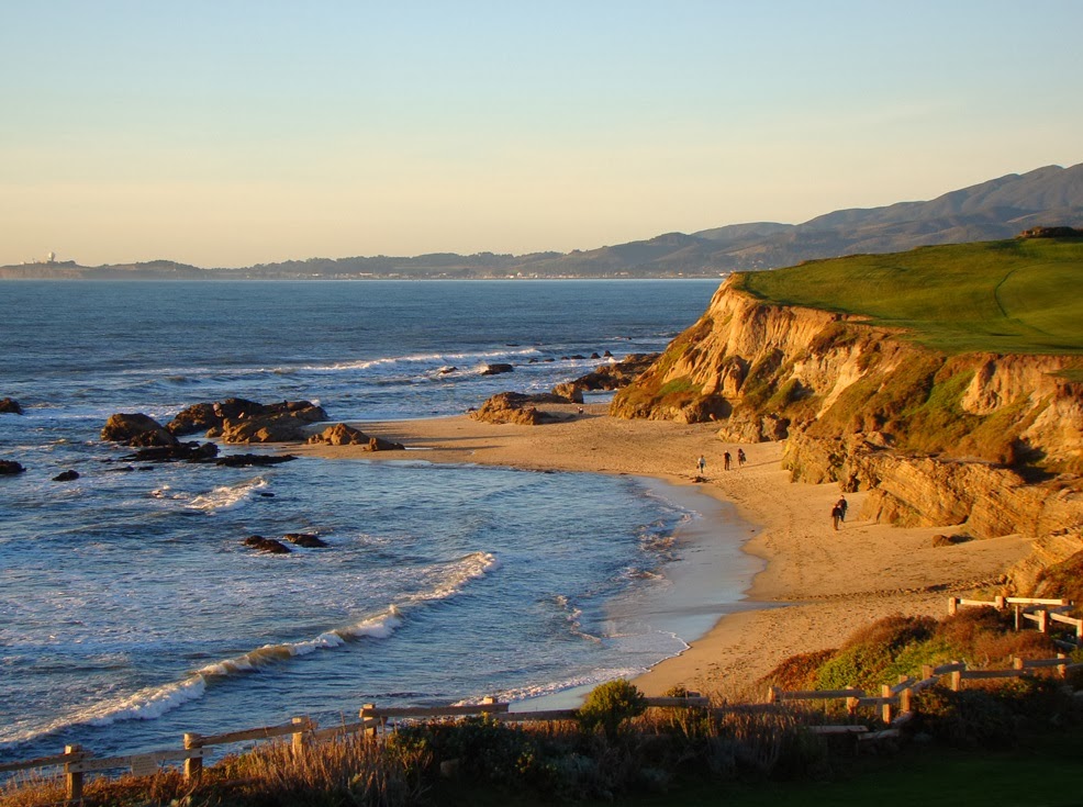
The most intense wave erosion in a beach environment is going to be directed at headlands, the rocky points that stick out into the sea. Conversely, the least wave action occurs within the protected coves. As a result, sandy beaches accumulate in the coves (as in the picture above, and sea stacks (small rocky islands) predominate just offshore of headlands (such as in the picture below at the Ritz-Carlton).

The Ritz-Carlton is a bit rich for my taste (~$500/night), but the beach is free by state law. It's a beautiful place to wander.

There are some nice tide pools in the bedrock exposures, and low tide brings many small discoveries. Snails, clams and octopi are related families within the phylum Mollusca. They are descended from a common ancestor that may have resembled the chiton, the creature with the segmented shell in the middle of the picture below. A chiton can be thought of as a snail with a flat segmented shell instead of a coiled shell. Or it could be thought of as a half clam, with just a top shell (and biologists everywhere want to yell at me now).
The terraces and sea cliffs of Half Moon Bay result from uplift along local faults that has raised former wave-cut benches out of the surf. In other words, waves once rolled across the flat areas at the top of the cliffs. Undercutting of the slopes by relentless wave action maintains the vertical cliffs and cliff retreat can measure in inches or feet per year (be careful how you site your beachcliff home!).

It isn't just the cliffs. The coastal lowlands just north of town have been suffering from wave erosion, and some shoreline roads have to be reinforced with riprap, large boulders used to absorb wave energy. We've watched severe storm waves splash on the front windows of one our favorite restaurants in the area.

There is one other thing I would love to see some day in the Half Moon Bay region. One certain days of the year when the offshore storms are just right, the configuration of the seafloor off of Pillar Point (below) causes the production of monumental waves that can exceed 50 feet in height. The so-called Mavericks are legendary, and when they are crashing, a major surfing competition is organized.


Sunday, October 9, 2011

Fall in the Sierra Foothills

It's California, so the season "fall" doesn't always have the same panache that it might in the northeastern states or northern Rocky Mountains. It also comes a lot later. Except for the (somewhat) unusual inch of rain we had last week, these days would be largely indistinguishable from summer. Dry, dusty, and only a little bit cooler (highs in the eighties are expected this week).

Still, it did rain last week, so the air was cooler today, and there was a freshness we haven't felt in months. We took a little picnic this afternoon up the Tuolumne River into the Sierra Nevada foothills. We stopped at Old Basso Bridge, a river crossing that was once the focus of some rather intense gold dredging. Numerous ponds from the mining days dot the landscape, filled with groundwater. Today they provide habitat for wildlife, and a nice recreational area for fishing and wildlife photography.
The old Basso Bridge was replaced with a sleek modern concrete edifice that dominates the view from the boat ramp, but a short walk provides a view downstream towards the old bridge (which is closed to autos, but available for pedestrian use).
The old dredge ponds provide a surprising sight for this time of year: lots of flowers. There were hundreds of what looked like Brown-Eyed Susans.

The other interesting sight at the park are the boulders they've used for rip rap to reinforce the base of the bridge. They are chunks of a deeply oxidized conglomerate that is found locally in a layer called the Ione formation. It formed in Paleogene time as rivers flowed over the not-quite risen Sierra Nevada. The rivers had their source in central Nevada or more distant regions, and flowed through a landscape much different than that of today.

The rivers ended in an estuary/delta complex along the Pacific Ocean (the Central Valley was a shallow sea at the time), and in a series of swamplands that later produced lignite coal that was utilized during the settlement of California after the Gold Rush. Fossils of palms and other warm weather vegetation indicate tropical conditions.
The conglomerates also contained significant amounts of gold (hence the local dredging activity). There were a couple of guys panning gold today, and they actually had come up with 20 or 30 pinhead-sized flakes.

Fall is just beginning. I'm looking forward to some color (of the leafy kind) in the next few weeks!