Showing posts with label Fault scarp. Show all posts

Monday, April 7, 2014

Out of the Valley of Death: Geology at Fifty-five


One of the first things I tell my students (and occasionally even with some success) is "don't sleep while traveling in the vans". Death Valley National Park is the largest national park in the lower 48 states, and no matter how much time one has, it's hard to take it all in. When you only have four days, it's pretty well impossible, but there is still much to see in transit between stops. On our third day out we were set to explore the northern end of Death Valley, which in a park that is mostly desert wilderness, feels even more isolated and lonely (despite the presence of Scotty's Castle up one of the side canyons).
The day started with a stunning sunrise as seen from one of the most isolated RV parks in the American west, Stovepipe Wells. The campground is literally a parking lot, but it's a parking lot with one of the most incredible views possible. The resort is situated on the distal end of the huge alluvial fan that emerges from Mosaic Canyon on Tucki Mountain, which we'll check out in a future post. The elevation is sea level, but it somehow feels higher, given the spectacular and far-ranging view.
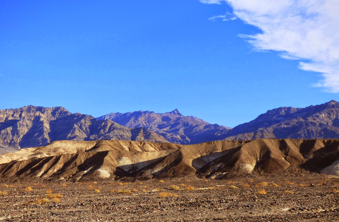
Two great desert mountain ranges form the boundaries of the northern reaches of Death Valley, the Cottonwoods on the left and the Grapevine Mountains on the right in the picture above. The mountains tower over the valley floor, reaching nearly 9,000 feet above a valley floor that is barely above sea level. The view extends thirty miles or more.
A drive north towards the end of the valley reveals a series of classic desert features, starting with the Mesquite Flat sand dunes, sometimes known as Death Valley dunes. Sand dunes are picturesque enough by themselves, but in Death Valley they have a dramatic backdrop of high barren mountains.
We raced by at 55 miles per hour ("Honest, officer!"), but cameras these days are versatile, capturing the image as if we were standing still. And this is the sort of incredible sight one could miss if one is snoring away.
The dunes have formed here because prevailing winds sweep down the northern reaches of Death Valley (and a number of destroyed tents over the years can attest to the power of these winds). The vast bulk of Tucki Mountain at the north end of the Panamint Mountains stands in the path of these winds, causing them to break up and form eddies. The sand accumulated in the region as the powerful winds lose energy and drop their load of sand and dust. They are sometimes referred to as star dunes, or modified sub-barchan dunes. Even if you've never been to Death Valley, you've probably seen these dunes anyway; they formed the backdrop for the droids lost on the planet Tatooine in the original Star Wars movie.

In the picture above, one can see the valley floor beyond the dunes is interrupted by a terrace of some sort. This is the scarp for the Furnace Creek fault zone which is one of the important structural features of the Death Valley graben.
A closer look provides a view of light-colored sedimentary rocks exposed in the face of the scarp. The fine-grained mud and silt layers are part of the Furnace Creek formation, which was deposited into a fault trough similar to present-day Death Valley, but oriented in a more northwest-southeast direction. Crustal stretching has effected the crust in the region more than once. The erosion of the Furnace Creek formation in this dry environment produces badlands topography, which we will explore in greater detail in another post.
The fault system interrupts the surface of the alluvial fan, shifting it in an right lateral direction (the rocks across the fault are displaced to the observer's right). These faults roughly parallel the San Andreas fault, which lies far to the west. The fault is presumably still active, but has not produced a major earthquake in modern times.
Another incredible sight visible from the road is the series of alluvial fans that extend from the edge of the mountains down to the valley floor. They build up as the rare but violent flash floods and mudflows carry boulders and debris across the valley floor. They have a somewhat convex slope, becoming steeper near mountain front. Death Valley is famous for the variety and number of fans it has.
The fans reveal variations in color. The darker surfaces on the fans result from desert varnish, a mixture of manganese oxides and clay that coat the exposed surfaces of the rock. It accumulates over time, and the origin is debated. Bacteria are likely involved in the process.

As we drove further north, the valley floor narrowed, and we soon reached an area where the alluvial fans from the two mountain ranges merged in the center of the valley. We were approaching the end of the Death Valley graben. In the distance we could see dark-colored rocks coating the surface of the alluvial fans. We had reached the volcanoes of Death Valley.

In the next post: the Ubehebes!
Saturday, May 8, 2010

A Smattering of Scarps for a Saturday


I was going over some of the contributed photos from our recent NAGT-NESTA field conference in Bishop, California, and I saw this wonderful shot of Slinkard Valley by Ryan Hollister. The valley is a half-graben, with the main fault on the right side, which formed as the Sierra Nevada block (mini-plate) pulled northwest from the Basin and Range Province. The extensional forces caused the crust to break up and form normal faults (the overhanging fault block, the headwall, slips down relative to the sloping fault block, the footwall - see the photo below). Such faults that slip along curved planes are known as listric faults. The exposed surface of the fault plane is called a scarp, and scarps are the features I want to highlight today.

Scarps are the faces of fault terraces, and can result from a single earthquake, or they can be an entire mountain range front, resulting from hundreds of large quakes over several million years, as in the shot below of the Sangre de Cristo Range in Colorado (below). The Sangre de Cristos form the eastern margin of the Rio Grande Rift that extends from Colorado down into Texas.

As the mountains rise and the valleys sink, erosion attacks the flanks of the new range. The rapid downcutting forms deep 'V'-shaped valleys, and the debris washed off the mountain accumulates in large alluvial fans. The erosion of adjacent valleys forms triangular spurs called triangular facets, which are nicely exposed in the picture above because the trees are missing (presumably a wildfire). The combination of a wide upper valley, a narrow valley opening, and an alluvial fan reminded geologists of a wine goblet, so these are called wineglass canyons (noted on the photo below). Some would argue that anything reminds geologists of wine or beer...

Extensional stresses don't always result in a single zone of faulting. If you enlarge the picture below, you will notice how the landscape drops from left to right in a series of stairsteps. Each 'step' is a normal fault. Tule Lake, on the far right, occupies the lowest downdropped block, a graben. This picture is from Lava Beds National Monument, at the boundary between the Cascades Province and the Basin and Range Province in northern California.

So, what about scarps caused by single earthquakes? Here's your first quiz: where is the scarp in the photo below? This alluvial fan (or cone) formed along the Sierra Nevada's Wheeler Crest at the north end of the Owens Valley near Bishop, California. The scarp resulted from an earthquake within the last 10,000 years or so (it crosses the 13,000 year old moraines of Pine Creek just a few miles away).


Another great place to see recent fault scarps is Death Valley National Park. The graben of Death Valley has dropped so much it now lies 282 feet below sea level (the picture was taken at Badwater, the lowest point reachable by car in the western hemisphere). The one or two earthquakes that caused these scarps happened several thousand years ago, but are almost untouched by erosion because of the exceedingly dry conditions here (current rainfall average is less than 2 inches a year).

Looking for something more recent? The scarp in the photo below is located at the town of Lone Pine in the Owens Valley east of the Sierra Nevada. It originated in the magnitude 7.8 magnitude Lone Pine earthquake of 1872. The quake killed 28 people (out of a local population of about 300), and formed scarps over a distance of around 100 miles. It remains one of the three largest earthquakes in California's recorded history.

Are you looking for something even more recent? How about the one below? It formed in the 1992 Landers Earthquake, magnitude 7.3, in the Mojave Desert of southern California. The scarp could be followed for a distance of more than 50 miles. It was in a remote area, but killed three people nonetheless. If such a quake hit a more populated part of California, the results would be unthinkable.

And not that anyone in southern California would forget, but the Easter Sunday El Mayor-Cucapah Earthquake this year (magnitude 7.2) formed scarps that could be followed for 50 miles from Baja California into Alta California near Calexico.


Photo of the Cucapah-El Mayor Earthquake from the Southern California Seismic Network

Have you got a favorite scarp posted somewhere? Send it and share it!

Update: Ah, Lockwood was a day ahead of me and wrote about the Lone Pine scarps yesterday!

Update #2: Forrest Hopson checks in with his favorite scarp, the Pinto Mountain fault in Twentynine Palms near Joshua Tree National Park. Water is forced to the surface along the fault zone, allowing the palms to thrive.

Sunday, April 25, 2010

Scarps to the Left of Me, Sag Ponds to the Right, Here I am, Stuck in the Middle with You!

The San Andreas fault is the best known (and most feared) fault line in California, and yet few people know where it actually is, and might not even know it if they were living on it (and far too many people in the state do live on the fault line, not only the San Andreas, but many others as well). The San Andreas is remarkably accessible, and there are only a few places where the fault lies more than a mile or so from a paved highway. One very accessible site to see the fault can be found at Tejon Pass on the main freeway connection between northern and southern California. Interstate 5 crosses the fault at Gorman, but a stop on the freeway would be very dangerous. If you exit at Gorman and follow the frontage road east (Gorman Post Road), you can see some wonderfully exposed fault features from a safe vantage point. Unless the BIG ONE hits. Then again, I'd rather be out in the open watching a scarp forming than being trapped in a building somewhere.

The most obvious fault feature is the linear valley. In the picture above, the fault follows the shallow valley in the foreground to the notches on the horizon to the left. I was standing atop a scarp (a fault-formed terrace) that resulted from large earthquakes every few centuries (the last major quake here occurred in 1857, with a magnitude of about 7.8). The juniper bush is growing on the slope of the scarp.
A little to the west of the first photo, the fault is marked by a linear pattern of springs and vegetation. The brush-covered hill just right of center is another fault scarp.

The motion of the San Andreas is right-lateral, meaning that objects on the side of the fault opposite the observer are shifted to the right. As mentioned in a recent post, the Neenach Volcanics which show up just east of here have been separated by 195 miles over the last 10 million years or so. The other half of the Neenach volcano is exposed at Pinnacles National Monument near Hollister in the Coast Ranges.

The lateral motion of the fault produces disruptions and offsets of streambeds, and lakes often result. The picture above is a sag pond on Gorman Post Road. If you think about it at all, natural lakes are a rarity in southern California. Many lakes result from Ice Age glacial scouring, which wasn't much of an issue this far south. Others, like Crystal Lake in the Angeles National Forest, result from landslides that block creeks. But a rather large number of lakes can be found along the trace of the San Andreas and other active faults, such as the one above. It's a great bird-watching spot too!

This is a serious geology blog, so you know that I wouldn't put together a geology blurb just so I could show pictures of the glorious wildflowers I saw last weekend...but I am in fact showing you some flower pictures. The slopes in the picture above were just west of the sag pond. They were gorgeous! Just the same, the Gorman stop is a great place to see some fault features at the cost of just a few minutes of your time while traveling on Interstate 5 any time of the year. And you know you needed a bathroom stop anyway....

Below is another gratuitous flower picture. The color explosion includes California Poppies, Lupine, and a blue flower I am not familiar with. An identification would be welcome!

Sunday, January 10, 2010

The Other California: Fleener Chimneys, Spatter Cones and Fault Scarps

This post continues our exploration of one of California's hidden corners, Lava Beds National Monument, on the flank of California's biggest volcano, the Medicine Lake Highland.

So what, pray tell, is the feature below? A Sarlaac from a Star Wars movie? A Doomsday Machine from Star Trek? Brendan Fraser's pathway to the center of the earth? No, it's one of the abandoned volcanic vents from Lava Beds, the Fleener Chimneys. There are three holes like this, around fifty feet deep, that were the conduits for the Devil's Homestead Lava Flow around 12,000 years ago.

The eruptions were mildly explosive and messy, at least in the final stages. The Fleener Chimneys (below) are spatter cones, formed as molten bits of basalt were flung from the vents. Lava emerged and almost immediately floweed into lava tube systems, the openings of which can be seen in the near vicinity. After traveling some distance, the lava flows cooled enough to start forming a'a flows that give the Devil's Homestead its characteristic appearance.

Another fine example of a spatter cone, much younger and fresher looking, can be seen at Black Crater, just a short distance away from the Fleener Chimneys turnoff on the main park road. It erupted only about 1,250 years ago, but might as well have been yesterday given its youthful appearance.

Why have these eruptions occurred on the lower flanks of the Medicine Lake Highland? A stereotypical volcano has a crater at the summit that produces the explosions, the ash, and the lava flows. As has been pointed out previously, the Highland is a unique exception to the "rules" of volcano types. Shaped like a massive shield, it has numerous small magma chambers with a variety of magma compositions. Fluid basalts follow weaknesses in the crust, and fault zones make a fine conduit to reach the surface.

Medicine Lake Highland sits at the boundary between the Cascades and the Modoc Plateau, and fault zones project into the volcanic edifice. Gillems Bluff, seen in the picture below, is a fault scarp, with the sunken graben of Tule Lake on the right side of the photo. It just happens that the fault that formed Gillems Bluff projects right through the Fleener Chimneys.

These features are easy to access during a visit to the park. If you are tempted to toss a rock into the Fleener Chimneys to see how deep they are, please resist the urge. A clean up crew recently removed 35 tons of rock from just one of the holes.