Saturday, February 11, 2017

Liveblogging the Deluge: Meanwhile, Back at the Local Dam...Don Pedro Reservoir Today

With all the attention being directed at Oroville Dam today with the broken spillway, it's a bit too easy to forget that similar conditions are being experienced all across Northern California. Several reservoirs are approaching full capacity, including Lake Shasta (96%), and Don Pedro Reservoir (97%). Since it is a few miles upstream of my village, Don Pedro has been the center of my attention since the present series of atmospheric river storms arrived in Northern California.
Source: http://cdec.water.ca.gov/cdecapp/resapp/getResGraphsMain.action
The capacity of Don Pedro is 2.03 million acre-feet (water elevation 830 feet), and the latest measurements I've seen show that the lake rose 6 feet in the last day to just over 825 feet. Inflow continues in the range of 30,000 cubic feet per second, while outflow continues at just below flood level, about 9,200 cubic feet per second. It may very will be that the inflow will decline (in the past day it dropped from 32,000 cfs to 28,000 cfs) just enough that the reservoir will stop rising, but it will be a close thing. I've heard no word about plans for opening the emergency floodgates, but if they do, it will be for only the second time ever. The last time was in 1997. That event carved a new channel through a pasture area that reached a depth of 40 feet. Since that channel is already present, I don't expect there will be too many problems associated with the overflow, but uncontrolled runoff could result in some minor flooding downstream in Modesto. I would appreciate hearing from anyone in the know who can shed light on the plans for the next few days.
In any case, the reservoir is higher than it has been in many years, and room must be made for the coming runoff from the near record snowpack. That means that the Tuolumne is going to be flowing at thousands of cubic feet per second for the next few months. That is an unprecedented situation that may very well change the configuration of the river in some areas.

It's a good thing that we now have a window of good weather, maybe five days before the next storm arrives. We need some time to make more space in the reservoirs.

POSTSCRIPT (2/12/17): As of this morning, the reservoir has risen to 827.27 feet, and is less than 3 feet from being full. The lake has 1,995,000 acre-feet out of a capacity of 2,030,000 acre-feet (98% of capacity). Source: https://waterdata.usgs.gov/nwis/uv?site_no=11287500

Friday, February 10, 2017

Liveblogging the Deluge: The Concerns (Panic?) at Oroville Dam, a Story We've Seen Before

The graphic above (from the Los Angeles Times, Google Earth, and the California Dept. of Water Resources) succinctly explains the serious problem unfolding right now at Oroville Dam on the Feather River. The lake is the second largest reservoir in California backed behind the highest dam in the United States. It is very close to capacity, but the main relief valve, the spillway, has been severely damaged and is essentially crippled. Without the spillway, the operators have only two choices to get rid of the rapidly rising floodwaters. They could let the floodwaters flow over the top of the dam itself, or they open a second emergency spillway.
California Dept. of Water Resources via The Landslide Blog
The first choice is unthinkable. The structure is an earthen-fill dam, made up of a core of impermeable clay covered by other sediments and rock material. If floodwaters top the dam, they would easily cut through the loose material, and the dam could fail. Such a failure would be a catastrophe without precedent. The instantaneous release of more than 3 million acre-feet into the Sacramento River system would be a flood of Biblical proportions. Sacramento and other towns would be inundated, threatening the lives of hundreds of thousands of people. The water delivery system for California would be crippled for years or decades. Postscript: Darn it, I wasn't thinking right. The emergency spillways are below the level of the dam by 20 feet, so this is unlikely to happen, at least due to flooding. It just made such vivid narrative.  Thanks jfmiller for the clarification (see comments below). So that is not going to happen.
Source: CA Dept. of Water Resources via The Landslide Blog
The second choice is magnitudes less catastrophic, but would still be a problem. The emergency spillway would flow across slopes and hillsides that have never been exposed to fast-moving floodwaters. Trees, rocks, and mud will pour into the river downstream, complicating efforts to prevent flooding and levee breaches downstream.

We'll see where this situation resolves over the next few days. But I couldn't help but be reminded of two historical events involving dams and reservoirs that put a spotlight on the choices we've made to build such titanic structures to serve the needs of our society: Don Pedro Reservoir in 1997, and Glen Canyon Dam in 1983.
Glen Canyon Dam in Arizona
We tend to think of these huge structures as monuments to our creativity, power, and control over nature (it's an entirely different issue that I almost wrote "man's control over mother nature", which sounds very patriarchal or chauvinistic). The fact remains though, that we sometimes have flaws in our thinking and planning. Let's take Glen Canyon as an epic example.

Glen Canyon Dam was built between 1957-1964. It is 710 feet high (216 m) and 1,560 feet (475 m) wide, with a volume of 5,370,000 cubic yards (4,110,000 cubic meters) of concrete. It is anchored in Navajo Sandstone. When full the lake is 186 miles (299 km) long, with 1,960 miles (3,150 km) of shoreline, and a total capacity of 26.2 million acre feet (equivalent of two years of the average flow of the Colorado River). The main thing to notice about the picture above is that the dam has no spillway. It...has...no...spillway. If water ever came over the top of the dam, the floodwaters could destroy the power generators below, possibly "pulling the bath plug" on the dam. The sandstone that anchors the dam is relatively easy to erode, so such an event could threaten the very stability of the dam itself.

That not to say the operators have no way to deal with floods. When they built the dam, the Colorado River was diverted through tunnels in the cliffs around the dam site. The tunnels were adapted into an underground spillway within the cliffs. When floodwaters threatened to fill the reservoir, they would simply open the spillways and millions of gallons of water would shoot out of the cliffs at the base of the dam.

Which brings us to the events of 1983.
Wait a second...why is there a dam made of plywood here?

After construction was completed in 1964, the lake slowly filled (since water use downstream did not cease, only surplus water was used to fill the lake) and did not reach capacity until 1980. In 1983, the dam came perilously close to failing due to a major flood and design errors. An unexpectedly warm and wet storm caused a tremendous flood upstream of the nearly full Lake Powell. To prepare for the huge influx of water, the dam engineers opened up the underground spillways for the first time. They proved woefully inadequate to the task as cavitation caused the walls of the diversion tunnels to rip out. In places the powerful flow of water cut 32 feet (10 meters) into the soft Navajo Sandstone and threatened the structural integrity of the dam itself. People working within the dam reported rumblings and vibrations that simply shouldn't have been happening.

The diversion tunnels had to be shut down, and the lake threatened to flow over the crest of the dam in an uncontrolled fashion. As noted above, this could have led to catastrophe, as such uncontrolled flow could have eroded and weakened the sandstone abutments of the dam. Failure of Glen Canyon dam would have led to the domino-like destruction of other large dams downstream, and the decimation of the water-supply infrastructure of some thirty million people. The disaster was averted by the construction of an 8 foot high dam of wood flashboards that held back the water long enough for the flood to subside (see the picture above). The structural integrity and survival of the dam came down to less than a foot...the distance between the water level and the top of the flashboard dam in 1983.
The damaged spillway at Glen Canyon Dam in 1983
That is what came to mind as I saw pictures of the Oroville spillway yesterday. The other echo of the past was the need to open up the spillway onto new ground. Something very similar happened at Don Pedro during the floods of 1997 (and if the narrative below seems familiar, yes, I used it a couple of weeks ago as an introduction to the coming atmospheric river storms. I'm revisiting the story because of the similarity of events at Oroville Dam).

Don Pedro Reservoir on the Tuolumne River stores water for the Modesto and Turlock Irrigation Districts, and also serves as storage for Hetch Hetchy Reservoir water bound for San Francisco. The earth-fill dam stands 580 feet high and inundates 26 miles of the Tuolumne River, which flows out of Yosemite National Park. It stores just over 2 million acre-feet of water. The dam was built for irrigation storage, hydroelectric power generation, and recreation. And flood control.

The water year of 1996-1997 was unusual, but unfortunately familiar given the events of the last month in California. A series of large storms in December had built up a record or near-record snowpack in the Yosemite high country. Then a New Years Day Pineapple Express storm took aim at central California. The warm, moist atmospheric river flowed over the Central Valley dropping only a few inches of rain, but when it hit the mountains, it poured as much as three feet of rain at elevations as high as 10,000 feet and onto the record snowpack.
Don Pedro Reservoir was at the proper level for normal flash flood conditions, with about 300,000 acre feet of storage available. But the water coming downstream was not normal. At the peak, the rivers flowed into the lake at an unbelievable rate of 130,000 cubic feet per second (the Feather River, by the way, reached about 170,000 cubic feet per second this week). To put this number into perspective, the Tuolumne River is considered to be at flood stage at 9,000 cubic feet per second. The dam operators had a big problem and they knew it. They had to purposely flood the cities downstream to prevent a total catastrophe. They ramped up the power generating turbines, and for the first time in the dam's history, they opened the floodgate.
The floodgate didn't open into the Tuolumne River. It faced a meadow that had never before had a river flowing through. As can be seen from the pictures here, the meadow was hit by a flood of gigantic proportions. Ripping away soil and solid rock, the river quarried a channel forty feet deep in the space of three days. And it barely worked. At the highest point, the reservoir was flowing uncontrolled over a concrete weir that was the never supposed to be topped. The water was only a foot deep, but spread out over several hundred feet, it ripped away soil, rock, and the highway that passed below the floodgates.
The city of Modesto and others downstream experienced the greatest flood in their history, with top flows of around 60.000-70,000 cubic feet per second. But if Don Pedro Dam had not been there, the towns would have been hit with a flood twice as big.

Only one flood in recorded history could possible compare with 1997. That was the flood of 1861-62, which was so large that parts of the Great Valley turned into a lake for weeks. Sacramento was abandoned as the state capitol for months while the waters subsided. No gauges were present on any of the rivers so we don't know how the numbers compare, but considering that 1997 was considered a 250 year flood (a 1/250 chance of occurring in any one year), it must have been truly extraordinary. And in the last month, only twenty years later, we seem to have reached a similar level of flooding on many of our rivers in California.

And that's the way it is with Oroville Dam today. With a dam and a river that is larger than the Tuolumne. I can't imagine the stress levels of those who are dealing with the situation as they try to navigate their way between undesirable choices.

Since we have chosen to live together as a society in numbers totaling millions of people, we have to make many choices about how much we alter and change the landscape that supports us. Our basic needs of water, food and shelter have to be provided on a massive scale, but the infrastructure at such kinds of scale also have the potential to fail at equally high magnitude. Politicians are fond of keeping taxes low and complain endlessly about "burdensome" regulations and guidelines. They cut the budgets of agencies who provide the expertise that can allow us to avoid catastrophes. When they do this, they are setting up conditions for failure on an astronomic scale. So who will we blame in the end?

I wish the operators of Oroville Dam all the best. I assume they are talented at what they do and that they will be making the best possible decisions in coming days. I also hope that those who represent us in the halls of government will gain some kind of insight about the best ways to care for and improve the infrastructure that supports and protects us all. I hope, but I'm not all that optimistic, seeing the disdain that those in power right now hold for science and knowledge.

POSTSCRIPT: The incoming flow has declined to 120,000 cfs, with 65,000 cfs outflow. If it continues to drop, the operators might not need to use the emergency spillway.

POSTSCRIPT (2/11/17 at 8 AM): According to this Mark Finan at KCRA, this is the emergency spillway this morning at 7 AM. About to go over the edge...

The incoming flow at 8 AM is 89,276 cubic feet per second, the outflow is 55,092 cfs. The lake is still rising, with less than 2 inches of clearance before water flows through the spillway.

POSTSCRIPT (2/12/17): The inflow to Oroville Reservoir is finally dropping below the outflow, so the lake level can start dropping (hopefully enough to deal with the next storm in five days).
POSTSCRIPT (2/12/17, 6:45 PM): Gee whiz, things were quiet, so I went birding for a few hours and all hell broke loose while I was gone. First, if you are in the Oroville area, take the official announcements seriously and follow evacuation orders without delay. It's got to be serious if they take a step like that. In any case, the auxiliary spillway is in imminent danger of failing. If it does so, lake water would be surging over bedrock in an uncontrolled manner. It depends what kind of bedrock there is (I'm working on that), since the rapid flows could erode the rock channel downward (as happened at Don Pedro in 1997) which could then lead to higher flows and flooding downstream. It sounds like the operators increased flow on the other damaged spillway, so that the flow over the auxiliary spillway is down to 2 inches, rather than the 1 1/2-2 feet. That takes a lot of pressure off the auxiliary spillway, and offers hopes for some kind of repairs before the next storm hits.

Wednesday, February 8, 2017

Half Dome Makes a Surprise Appearance on the Floor of the Great Valley Today

It doesn't happen for me all that often, maybe because of air pollution, or the fact that I characteristically drive past the spot only once a week, but I can occasionally spot Half Dome in Yosemite Valley from the floor of the Great Valley (some people call it the Central Valley, but we know better). There's a narrow line of sight that passes through Denair and Turlock where the iconic dome can sometimes be spotted. One has to know where to look, and binoculars or a strong zoom are very helpful, but I always see it first with the naked eye.

It was a surprise today because we are right in the middle of the third major atmospheric river storm in a month's time, and the sky was overcast and raining for most of the day. There was a short break in the storm during the late afternoon, so I caught a few pictures on my way to teach my night class in Turlock. I had to play with the contrast a lot to bring out the image.
It was easier to see today because clouds obscured the high peaks of the Sierra Nevada crest that rise behind the dome. In the picture below, one can compare the appearance of the dome on less cloudy days (this shot is from February of last year).

Tuesday, February 7, 2017

Pseudoscience, Scientific Illiteracy and the Greatest Human Journey. What to do?

How many people do you know? How many of them are scientists?

Wait a minute...how did THAT happen??
Many people do not know scientific researchers in their everyday lives, and that is a situation that seriously needs to change. There is a massive amount of misinformation floating about the Internet, and an unfortunate misunderstanding about the way that science works. People are just not being given the tools to critically distinguish between scientific facts and pseudo-scientific garbage. The actions of the new administration suggest that government-sponsored scientific data and research will be improperly manipulated or simply censored in support of political ideology (I salute those heroes of science who labor at places like the Environment Protection Agency, U.S. Geological Survey, NOAA, and other government science-based departments. They are not the ones who are misrepresenting science. One has to look higher in the bureaucracy for the miscreants).

So what can be done?

As always, education is the key. Callan Bentley at Mountain Beltway got me started on this entire reflection with a short blast I saw on his social media. In his words:
I want to serve society in combating science illiteracy, and I think one way I can do that is to solicit questions or topics from those who want to learn more, and use those as a springboard for discussion. It’s time for me to let my social media network including you, dear reader, drive the content of the blog. I’ve set up a simple Google Form to allow anyone to submit questions anonymously.
This is a GREAT idea, and I am shamelessly going to do somewhat the same thing. Although I've always answered questions through the blog comments, I am adding a sidebar to make queries an official thing (it's not so cool as Callan's Google form, but an email question will work). If there are geological things you've always wanted to know more about, this is one place to look.

What else can be done?

One can get to know the people who do scientific research. Check out #actuallivingscientist on Twitter. Many of the people posting there are offering to answer questions about their work. It's a great way to get some perspective on the richness of the human journey.

Because that is what science is: the greatest human adventure. Sports figures come and go. Actors and celebrities get married and do stupid things in public. Politicians collect their accolades and sometimes their bribes. But that all passes. What doesn't pass is our knowledge of the cosmos and our continuing adventure into realms of the unknown.
The cosmos as seen from Mauna Kea on the Big Island of Hawai'i

Monday, February 6, 2017

Lady Gaga, Woody Guthrie, and the Times We're Living In


Lady Gaga has never been mentioned in my blog before, but she earned my deepest respect yesterday when she included the Woody Guthrie song "This Land is Your Land" to open the Super Bowl half-time show. Because generations of children learned the song in primary school, it has become so familiar that it is easy to forget that the song is a populist protest anthem of the people. And it has become more than appropriate to remember the song as we face the political situation of the present day. We face huge threats, not from terrorists, not from foreign powers, but from those who now control the apparatus of our own government, and who want to twist the power of that government to profit a handful of oligarchs.

This land is your land This land is my land
From California to the New York island;
From the redwood forest to the Gulf Stream waters
This land was made for you and Me.

As I was walking that ribbon of highway,
I saw above me that endless skyway:
I saw below me that golden valley:
This land was made for you and me.

I read these lyrics and think proudly of the beautiful lands that we've set aside for the enjoyment of all our people, and those who visit from across the planet. Not just our national parks, but all of the national monuments, national wildlife refuges, and state parks across the country. And yet at this very moment, there is a movement in Congress to sell off some of our precious lands to private interests, to let the fossil fuel industry drill without regulation. One of the most beautiful landscapes in our country was set aside in the closing days of the Obama administration, and now there are those trying to remove protection from the Bear's Ears National Monument and others.


I've roamed and rambled and I followed my footsteps
To the sparkling sands of her diamond deserts;
And all around me a voice was sounding:
This land was made for you and me.

When the sun came shining, and I was strolling,
And the wheat fields waving and the dust clouds rolling,
As the fog was lifting a voice was chanting:
This land was made for you and me.

But the song is much more than a paean to the beauty of our land. Our people are precious too, all of them. The song was written in the depths of the Great Depression, when more than a quarter of the population was unemployed and hungry. The oligarchs didn't care then, and they don't care today. The people who came to California looking for a better life were mistreated then just as they are today, whether they came from Oklahoma and Texas in the 1930s, or from Mexico in the present day.

As I went walking I saw a sign there
And on the sign it said "No Trespassing."
But on the other side it didn't say nothing,
That side was made for you and me.

In the shadow of the steeple I saw my people,
By the relief office I seen my people;
As they stood there hungry, I stood there asking
Is this land made for you and me?

Others added to the protest. I'm not sure who wrote it, but this verse was taught to me 45 years ago:

This land is your land, but it once was my land,
Until we sold you Manhattan Island.
You pushed our Nations to the reservations;
This land was stole by you from me.

The last verse from Woody honors not the freedom to roam the highways, but anyone who fights to have the rights reserved for all Americans, and in case we've forgotten, the rights of all people worldwide to live free:

Nobody living can ever stop me,
As I go walking that freedom highway;
Nobody living can ever make me turn back
This land was made for you and me
.

If you ever want to understand true populism, the kind that isn't sold like snake oil by wanna-be dictators, then embrace all the meaning of this incredible song. In these times, this should be our national anthem. It celebrates the people and the land, not military victories. The real strength of our country comes not from military conquest, but the preservation and promotion of freedom for all.

Liveblogging the Deluge: What Changes are Coming to the Tuolumne River?

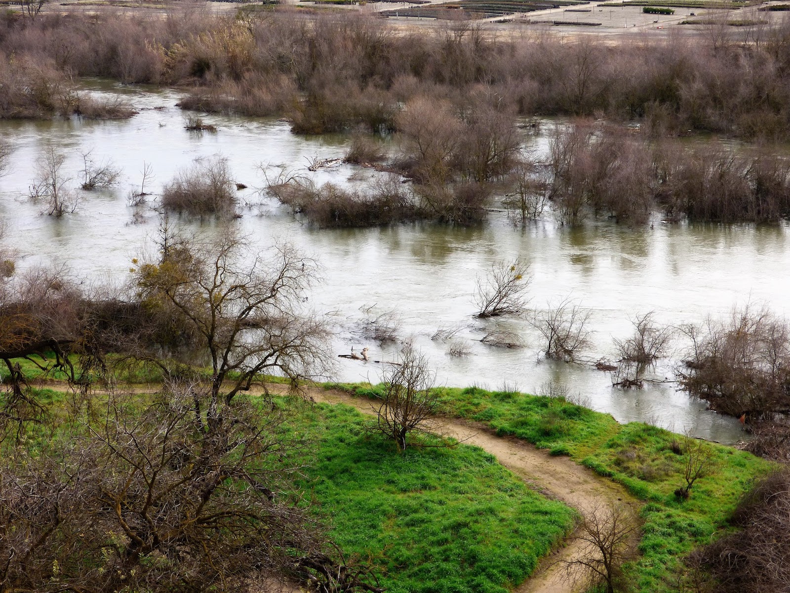
Knowing that another storm is headed in this week, I took advantage of the nice day and took a stroll along the swollen Tuolumne River. It was an amazing sight, and has been for a month now as the operators of Don Pedro Reservoir have been keeping flows at near flood level (today it the river was flowing at about 9,000 cubic feet per second). They are trying to build storage capacity in the face of continuing large storms.
The current Google image of the Tuolumne River where I walk
As I walked today, I considered how we've changed the Tuolumne River over the last 150 years, and also how the river will be changing as a result of a month of extremely high flows. There has not been a sustained flow like this in a decade or more. How will things look in a few weeks?

It's hard to say what the river looked like before the Gold Rush. Maps from that time aren't at all detailed. But we can say that the river of 1848 was certainly different than the one we see today. Most of the gravels along floodplain have been sifted and sluiced multiple times for the elusive yellow metal. In later years, from the early 1900s to as late as 1970, gold dredges processed the gravels yet again. The river gravels then were utilized as construction material, a use that continues today. However things were, the river today hardly resembles its former self.
This Google map image shows the slough that I reference below, between the S. Reinway Park and Trailhead and the pond at Frantz Wholesale Nursery. Compare to the satellite image above to see it filled with invasive River Hyacinth.

I doubt that this part of the river had the kinds of meanders found further downstream on the flatter parts of the floor of the Central Valley. It is more likely that it had somewhat of a braided pattern (multiple constantly changing channels), given the vast amount of sediment being carried from the higher parts of the Sierra Nevada. The sediment load today is diminished because of major reservoirs upstream. It would have been ideal habitat for spawning salmon.
Flows of the river are (usually) carefully controlled, not for the benefit of the stream environment, but for irrigation distribution and flood control. Intense flooding is not allowed except under the most dire of conditions such as those of 1997 when Don Pedro Dam filled unexpectedly. At that time, the peak runoff exceeded 60,000 cubic feet per second (compared to 9,000 cfs today). Had the dam not been in place, the peak runoff would have been as high as 130,000 cfs. The results of such floods in prehistoric times must have been dramatic.
The slough mentioned below is underwater on the left side of the photograph.
I imagine that change will be apparent when the present-day flood recedes in a few weeks. I'm curious as to the differences between a moderate flood that lasts for a month or more versus the floods of yesteryear when gigantic floods would occur, but last for only a few days. As I walked the banks of the river, I could see potential new channels where the river has been dry for years. I'll be revisiting the sites in these pictures to see what is new. In particular, there is a slough (an abandoned, but water-filled river channel) near the stairwell that has been stagnant for years, collecting invasive river hyacinth and garbage. A powerful current has been flushing it out, and it is possible the river may cut through and start flowing there again.
There will no doubt be other changes. Trees and shrubs have been uprooted and carried downstream, and willow thickets have been collecting debris. Gravel bars will be shifted and perhaps removed. All in all, the river may be taking the first steps towards a condition more like prehistoric times, and more conducive to the survival of salmon and other river life. We shall see.

Saturday, February 4, 2017

February Fights For Flooding Fame: New Atmospheric River Storm Approaching

From https://twitter.com/Weather_West/status/828096290097475584
I'm getting a funny sense of deja vu, like we've been here before. It's the fourth day of the month, and we are looking down the maw of a massive storm, a huge atmospheric river storm that threatens to cause flooding up and down the state of California. The difference is that it is the month of February, not January, and we've already had two sets of storms of historic proportions. And now another is coming. It feels like February is wanting to throw some weight around after the January show.
http://cdec.water.ca.gov/cdecapp/resapp/getResGraphsMain.action
I've been wrapped up with a variety of housing projects, and hadn't been down to the Tuolumne River of late, but I stopped by yesterday and saw that flows are still in the 9,000 cubic feet per second range (this level is just short of official flood stage). The operators of Don Pedro Reservoir upstream are clearly trying to build up some storage space for the coming round of storms. This appears to be the case at a number of reservoirs around the state, as most are way ahead of normal, and have kept flows high. Of the major reservoirs in northern California, only Folsom (81%), Trinity (85%), and New Melones (73%) are below average, although New Melones is up 5 percent.
http://cdec.water.ca.gov/cdecapp/snowapp/sweq.action

The snowpack is still very healthy, with a statewide average of 171% of normal for the date compared to 189% a week ago following a week of warmer conditions and little precipitation. The coming storm may once again be a warm one, raising concerns of some rapid snowmelt during the storm and possible flooding downstream.

Locally, the picture is also wet. My backyard rain gauge has gathered 15.16 inches so far, which is more than an inch higher than the average for the entire rain year since I've been measuring, starting in 1991 (my recorded average is 13.92" for 1991-2016). The official total for Modesto so far this year is 11.96", which is just short of the average rainfall for the entire year (12.16"). Modesto's records go back to 1888. The normal rainfall to date for Modesto is 6.98". It's been an interesting year, in that every single month since the start of the rainy season has been well above average. February may get to the average for the entire month by Wednesday. It's going to be an interesting week. Stay dry!