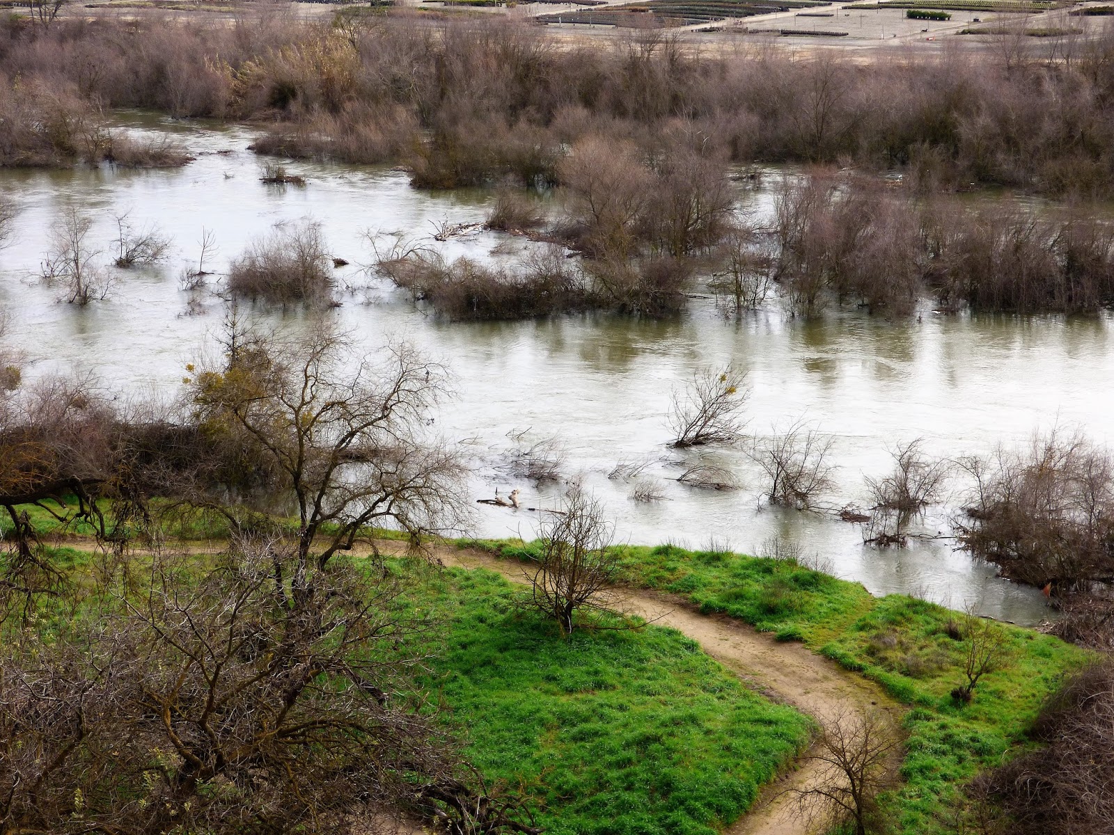
Knowing that another storm is headed in this week, I took advantage of the nice day and took a stroll along the swollen Tuolumne River. It was an amazing sight, and has been for a month now as the operators of Don Pedro Reservoir have been keeping flows at near flood level (today it the river was flowing at about 9,000 cubic feet per second). They are trying to build storage capacity in the face of continuing large storms.
 |
| The current Google image of the Tuolumne River where I walk |
As I walked today, I considered how we've changed the Tuolumne River over the last 150 years, and also how the river will be changing as a result of a month of extremely high flows. There has not been a sustained flow like this in a decade or more. How will things look in a few weeks?
It's hard to say what the river looked like before the Gold Rush. Maps from that time aren't at all detailed. But we can say that the river of 1848 was certainly different than the one we see today. Most of the gravels along floodplain have been sifted and sluiced multiple times for the elusive yellow metal. In later years, from the early 1900s to as late as 1970, gold dredges processed the gravels yet again. The river gravels then were utilized as construction material, a use that continues today. However things were, the river today hardly resembles its former self.
 |
| This Google map image shows the slough that I reference below, between the S. Reinway Park and Trailhead and the pond at Frantz Wholesale Nursery. Compare to the satellite image above to see it filled with invasive River Hyacinth. |
I doubt that this part of the river had the kinds of meanders found further downstream on the flatter parts of the floor of the Central Valley. It is more likely that it had somewhat of a braided pattern (multiple constantly changing channels), given the vast amount of sediment being carried from the higher parts of the Sierra Nevada. The sediment load today is diminished because of major reservoirs upstream. It would have been ideal habitat for spawning salmon.

Flows of the river are (usually) carefully controlled, not for the benefit of the stream environment, but for irrigation distribution and flood control. Intense flooding is not allowed except under the most dire of conditions such as those of 1997 when Don Pedro Dam filled unexpectedly. At that time, the peak runoff exceeded 60,000 cubic feet per second (compared to 9,000 cfs today). Had the dam not been in place, the peak runoff would have been as high as 130,000 cfs. The results of such floods in prehistoric times must have been dramatic.
 |
| The slough mentioned below is underwater on the left side of the photograph. |
I imagine that change will be apparent when the present-day flood recedes in a few weeks. I'm curious as to the differences between a moderate flood that lasts for a month or more versus the floods of yesteryear when gigantic floods would occur, but last for only a few days. As I walked the banks of the river, I could see potential new channels where the river has been dry for years. I'll be revisiting the sites in these pictures to see what is new. In particular, there is a slough (an abandoned, but water-filled river channel) near the stairwell that has been stagnant for years, collecting invasive river hyacinth and garbage. A powerful current has been flushing it out, and it is possible the river may cut through and start flowing there again.

There will no doubt be other changes. Trees and shrubs have been uprooted and carried downstream, and willow thickets have been collecting debris. Gravel bars will be shifted and perhaps removed. All in all, the river may be taking the first steps towards a condition more like prehistoric times, and more conducive to the survival of salmon and other river life. We shall see.


No comments:
Post a Comment