Saturday, December 25, 2010

The Last Christmas Gift: A Joshua Tree

A last Christmas scene...

Some of my family lives in the desert near Joshua Tree National Park. We hadn't been there in the past, and expected one of those California-style cookie cutter housing developments imposed on a desert landscape that doesn't really reflect the nature of the desert. Arriving late in the day, I was delighted to find that there was an unspoiled Joshua Tree forest adjacent to their lot. The sun was setting, so I took off across the desert to get a few pictures.

Joshua Trees are a species almost unique to California (I think a few spill over into Arizona and Nevada), and they are a semi-tropical holdover from a different climate and ecosystem. Their seeds do not have a readily available method of dispersal so the tree isn't invading new habitats as the climate grows warmer. It has been suggested that prior to 13,000 years before the present their seeds were spread by giant ground sloths, who were known to eat the fruits of the tree. No animal performs the task today.
The tree got its name from the early Mormon colonizers in the region, who likened the branches to the arms of Joshua of the Bible raised in prayer. They are a unique part of the flora that defines the Mojave Desert.

Have a good Christmas night!

Friday, December 24, 2010

The Christmas Gift: Storm Passes in Grand Canyon

Christmas gifts come in many different forms. The storm that engulfed the Grand Canyon the previous evening gave way to a new morning, and hints emerged that this day would be different. The rain and cold wind had stopped, and on the far rim there were signs that the clouds might be clearing a little.
We walked to the rim of the abyss and looked into what had been darkness, and saw instead that walls and ridges were emerging from the mist. And just like that, the veil was lifted and the canyon filled with light and color.

Christmas has many meanings to many people; it is the solstice, the cycling of the seasons, it is the birth of a saviour, it is a time of family, it is the high season of the economic cycle when profits are made. To me it is also a reminder that our existence is a gift to be cherished and that there is much that is beautiful in the world. The rocks exposed in the Grand Canyon tell a long and ancient story, a story in which humans are but the smallest blip, yet in 2 billion years of time, there is this short and unique moment when the entire story has been laid bare by erosion in the most spectacular fashion possible. But rock by falling rock, the canyon is being removed and in a few more million years, the story will be lost in the mists of time. We are here together to share this brief moment, and these moments of life are the most precious gift I can imagine.
Stay safe in your travels and have a most joyous Christmas and New Year!

Thursday, December 23, 2010

The Christmas Gift: A Storm in the Grand Canyon

We journeyed across three states for the opportunity to see the precious treasure that is the Grand Canyon. Our trip happened to coincide with the arrival of an intense series of storms that have wreaked havoc across California and the southwest, and we reached the rim just in time to see the storm reach the Grand Canyon area. It was cold and windy, and darkness was spreading across the North Rim, about 14 miles away as the raven flies, but ravens weren't out and about on a day like this one. We were, though.
In a matter of minutes, all that was beautiful about the canyon was obscured by the growing darkness. The colorful formations that record some 2 billion years of Earth history disappeared under the shadow of the present moment in time.
At numerous points, rain and clouds started pouring over the rim, and nothing could be seen through the impenetrable fog. The sign at the canyon overlook became an ironic commentary (which reminded me of another sign that I saw at the entrance station: "Bad weather predicted; visibility impaired; no refunds).
The rain came hard, cold and fast, and we had to retreat from the edge, seeking comfort in warmer and drier places. The storm was in control, and we had no way of knowing what was coming next. The future was obscured...
There are gifts of many kinds; even in the darkest moments, there is sometimes beauty and optimism. Next...the hope of morning.

Wednesday, December 22, 2010

The Other California: Hemming and Hawing on the Hogback

The nearly unprecedented deluge in California, Nevada, Arizona and Utah reminds me that I need to finish up some old business. Piling up a foot or more of rain on slopes that were burned in the last few years is a dangerous situation that can lead to mudflows and other slope failures problems on the steep slopes surrounding the L.A. Basin and California's Inland Empire. But such events have long been part of the history of the mountains, dating to long before humans entered the picture.

On Friday I posted a question about the Hogback in San Antonio Canyon in the Transverse Ranges of Southern California: what is it? It was an imposing barrier to my little VW Bug when I drove up the canyon decades ago, and it looks out of place, but it fits in very well with the dominant geological processes in the steepest of mountain ranges, the San Gabriel Mountains. That process is mass wasting, the failure of slopes and rock masses under the influence of gravity. Rock falls, debris avalanches, slumps, earthflows and soil creep are all common forms of mass wasting.
A view of the hogback from upstream (this shot is from Cow Canyon Saddle) gives a better view of what happened. A large mass of rock slid from the slope on the right, breaking up as it covered the canyon floor. It dammed San Antonio Creek, forming a temporary lake. Within a few centuries the lake filled with rock and debris, forming one of the few flat areas in the canyon, which much later allowed for a small village to be developed on the canyon floor. Ironically, many of the developments in the San Gabriels are built on mass wasting deposits (Wrightwood is built on mudflow debris and is sited atop the San Andreas fault for good measure, and Crystal Lake is an avalanche deposit as well).

The rock slide is nicely exposed along the old highway, with a clear delineation between the lighter colored slide breccia on the left and brownish river gravels on the right. In retrospect, placing a highway at the toe of a huge rock slide next to a volatile stream seemed a less than bright idea. As noted before, the current highway goes over the top of the slide.
San Antonio Creek was forced into the left wall of the canyon (from the upstream side), and it started to carve directly through the solid bedrock, forming a deep gorge with a 30 foot waterfall. The sheer cliffs below the waterfall are used as a practice wall by technical rock climbers.
Once you know what to look for, many instances of mass wasting become obvious throughout the canyon. The rock mass above lies near the entrance of Icehouse Canyon, and drivers must climb a series of steep switchbacks to reach Manker Flats and the ski area in the canyon above. Another rock mass, at Cow Canyon Saddle, tells a very interesting story about the formation of San Antonio Canyon (below).
The upper part of San Antonio Canyon abruptly changes direction near Baldy Village, and Cow Canyon Saddle is situated at the turn. To the west, Cow Canyon drains into the larger and deeper San Gabriel River system. Before the landslide took place, upper San Antonio Canyon probably drained to the west into the San Gabriel River. The slide at Cow Canyon Saddle blocked the ancestral canyon, and diverted the drainage into the lower San Antonio gorge (or headward erosion quickly captured the dammed up drainage).

It will be interesting to see if any major changes took place in the canyon after the events of this week...

Tuesday, December 21, 2010

2010, The Year of Traveling Dangerously (Storms in California)

Water in California is always a proposition of too much or too little, and sometimes those problems occur at the same time (the north-south dichotomy is striking sometimes). This week we are experiencing the biggest series of storms in five years, and some localities in the Los Angeles region have received 12 inches or more, and the storms are continuing this evening.

I had occasion to tour a large swath of California yesterday, through the southern San Joaquin Valley, over the southernmost Sierra Nevada at Tehachapi, and across the Mojave Desert to the Colorado River near Needles. On the 500 mile journey, the rain did not stop. I did not see the most intense problems (apparently the entire town of McFarland was evacuated, for instance), but I saw plenty of water where I've never seen water before. I have been over Tehachapi Pass perhaps 80 times in the last 20 years, and I have never seen water in the channel of Caliente Creek where it flows into the Central Valley near Bakersfield. That's it above...
Dry Creek near Modesto is actually rarely dry because of irrigation runoff, but it also rarely looks like a river. I've seen it worse, but then the Modesto area was one of the areas least affected by the current storms.

The desert was simply soaked. The western Mojave Desert has an internal drainage system (doesn't flow to the ocean) and is exceedingly flat. The ground was already saturated by the time we came through, and water was ponding everywhere, including our highway near Barstow. Greenery was already showing through, and the additional moisture means there is potential for a spectacular wildflower display in another month or two. I have my fingers crossed for our Death Valley trip in February!

Some pretty serious problems cropped up in western national parks. Road damage closed Sequoia National Park in California, and Zion National Park in Utah (Zion may not reopen until January). The normal flow of the Virgin River in Zion is 40-50 cubic feet per second; today it reached 5,000 cfs in the morning and was continuing to rise.

Thanks to Susan for the first and third pictures!

Monday, December 20, 2010

2010, The Year of Traveling Dangerously (The Postscript)

Lessee....after reading of the travel travails of my many geoblogging and tweeting geologists during the AGU meeting last week, after blogging repeatedly about the threats and hazards of living underneath very high and steep mountains in Southern California, and after making a modest attempt at humor about "traveling dangerously", guess who's leaving today on a journey through the Central Valley and Mojave Desert? They've had more than 7 inches of rain in a few places in SoCal in the biggest storm series to hit the state in at least 5 years (and possibly more than that). The conditions are reminiscent of some of our most famous flood years, like 1969 or 1938. I will keep my camera handy if anything interesting happens!

Sunday, December 19, 2010

2010, The Year of Traveling Dangerously (Geology Meme!)

OK, now Silver Fox at Looking For Detachment started it this year, and others are picking up the theme; the question is where you have traveled this year? It's always dangerous to ask a geologist about their travels. They do it a lot, whether for their jobs in industry, or as teachers leading field trips, or just for the fun of it. And they are always glad to expound on their experiences and show LOTS of pictures. And that, poor reader, is what is happening to you now. Some of our destinations will seem similar to those of last year, as I lead field trips to the same places, but a few new spots show up on the itinerary every year. I like seeing new places whenever I can, but I also like to return some haunts over and over, getting to know them intimately, and through their seasonal changes (note the Yosemite pictures that follow).

As usual, I did travel a lot, for a lot of reasons. Traveling dangerously? It felt that way a few times, but mostly it was just a lot of fun exploring.

Our holiday travels brought us to within a four-hour drive of the South Rim of Grand Canyon, so we headed to one of our favorite winter destinations...icy roads, shivering cold temperatures, and no crowds. And a beautiful covering of snow to offset the intense reds and yellows of the Permian formations (the Kaibab, Toroweap, and Hermit Formation and the Supai Group).

A few days later, we got caught in a scary dust storm outside of Tucson. Four or five people died in a massive chain reaction accident in the southbound lanes. Visibility was as bad as I have ever seen, worse even than our Tule Fogs in the Central Valley. Apparently the dust was caused by agricultural fields being plowed, but I have heard that dust storms in the Four Corners region have been getting worse lately with the intense drought (apparently the worst in 1,000 years according to Ken Salazar).

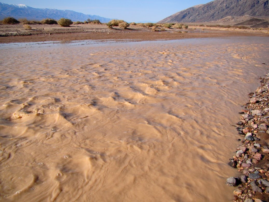
February brought the big field studies journey to Death Valley National Park. We saw water in the Amargosa River (if you aren't from around here, the word 'river' is tricky; most years, very little water flows, but this year the river was almost navigable in a canoe). There were a number of road closures that stymied our efforts to see some of the popular overlooks, but we did get to see something unique: The Devils Hole Pupfish in Ash Meadows. OK, we didn't see the actual fish; a fence protects the extremely endangered species in their cavern entrance home.
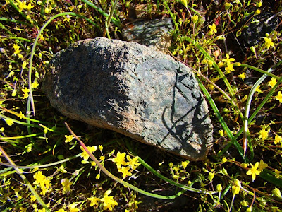
March was our day tour of the southern Mother Lode between Mariposa and Sonora. I snapped a shot of a chunk of ultramafic rock in the serpentine exposures in the Bagby Grade area. Serpentine...I had no idea what was about to happen with that rock this year!
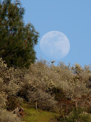
A week or two later, I was exploring the Red Rocks Area of Critical Environmental Concern, caught an interesting moonrise, and wrote about life on serpentine-based soils. Again, I didn't know what was about to happen with serpentine, our state rock.
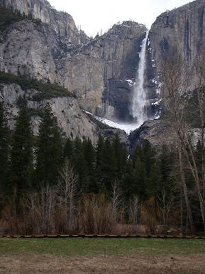
I made some April trips to Yosemite Valley and found the park still in the grip of winter. It was a cold spring this year, and the snow runoff was delayed by weeks. The valley floor was showing just a hint of greenery, and the waterfalls were modest.
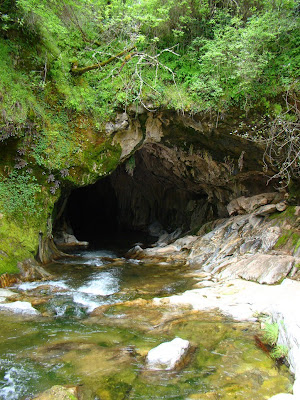
A few weeks later, the Geology Club at the school hiked down to a pair of natural bridges in the karst topography of the Mother Lode near Columbia in the Sierra Nevada foothills. They are imaginatively called "Natural Bridges", and are actually a pair of marble caverns that have been breached by Coyote Creek. They are a fascinating place to explore.
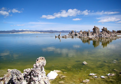
The National Association of Geoscience Teachers, Far Western Section had a conference at the beginning of May, and we explored the eastern Sierra Nevada and Owens Valley. We drove over Carson Pass which was still encased in snow, and had a wonderful time exploring Mono Lake and the Long Valley Caldera.
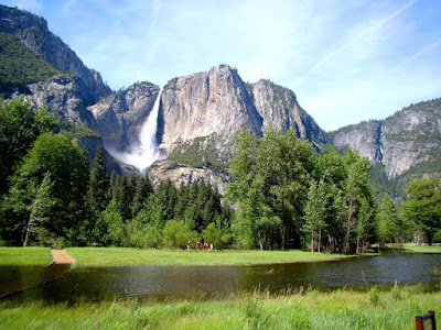
Later in May, we managed to pay a visit to Yosemite Valley on the peak day of runoff from the long delayed snowmelt. The river hit around 7,000 cubic feet per second, and there was some minor flooding of the meadows (yes, the wood pathway goes into the water in the picture below).
.
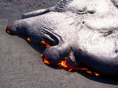
In August, we headed out to the Hawaiian Islands, for a bit of personal exploration instead of a class. The lava was starting to flow again in Kalapana, and I had a brief moment at the edge of the lava flow.
In June, July and August, California's state rock turned into a nationwide news story, and I had a brief career as a hand model on the cover of the San Francisco Chronicle. I was glad I had a store of pictures of the serpentine landscapes in our Coast Ranges and Sierra foothills so I could participate in the efforts to retain the rock as one of our state symbols.
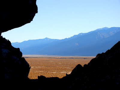
Fall arrived, and it was time for some more field trips with my students. We spent five days exploring the eastern Sierra, the Owens Valley, and the White Mountains. We were searching for amazonite and aquamarine when I snapped the shot above of the Owens Lake depression.
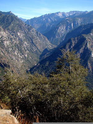
In October the NAGT--FWS had their fall conference, sponsored by CSU Fresno, with explorations of the Carrizo Plains, Yosemite, the Sierra foothills, and one of the deepest canyons on North America, Kings Canyon (above).
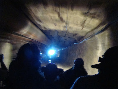
A week or two later, we took a day trip to the Mother Lode near Jackson and Angels Camp. Our journey included an underground tour of the Sutter Gold Mine (Sutter Creek), and Black Chasm Cavern outside the village of Volcano.

In November, we made one more trip into Yosemite Valley, and saw some glorious fall colors. There had been enough early rain to have a bit of water flowing over the falls. It was one of the most beautiful sights I've ever seen.
OK, wake up now, the slide show is done! Have some more eggnog!