Showing posts with label Hawai'i Volcanoes National Park. Show all posts

Saturday, June 15, 2024

Geotripper on How to Plan a Perfect Volcanic Eruption, Hawai'i Style!

So you want to demonstrate a volcanic eruption for your field geology course, and are unsure how to proceed? Let the crew (of one) here at Geotripper help you to plan out the very best eruption experience for your students! There are several important steps and considerations:

1) Pick a volcano

This is a pretty important first step. Some volcanoes can be very dangerous, and we at Geotripper feel that safety is a hugely important consideration. We have chosen the Big Island of Hawai'i for our demonstration, as eruptions there TEND to be on the quiet side, although there are important exceptions.

Kilauea Caldera and Kilauea Iki in the distance

2) Do a site evaluation

Take a hike out to the potential eruption site. This is kind of critical, because we want to choose a site that is isolated and away from buildings and populated areas. Yet we also want the site to be visible once the eruption begins, since this is the whole point of planning such things.

Hiking out to the Ka'u Desert ("Footprints Trail") on May 29, 2024

3) Consult with the local volcanic deities:


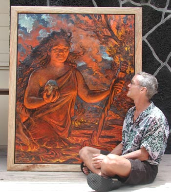
Painting of the Hawaiian goddess Pele at the Kilauea Visitor Center with the artist, Arthur Johnson (Source: NPS).

Once again a critical factor. One doesn't conduct eruptions without the permission and cooperation of the deities that inhabit the place. In our current example we are dealing with Pele, also known as Pele-honua-mea ("Pele of the sacred land") and Ka wahine ʻai honua ("The earth-eating woman"). 

A side note: the gist of this post is tongue-in-cheek, but I take Pele pretty seriously. Check out my interaction with a mysterious woman on the flanks of Kilauea a few years ago. Who was she??

4) Start the Field Trip

Taking twenty students to the Hawaiian Islands for two weeks is no small task, and we here at Geotripper strongly suggest planning the trip many months in advance of the eruption. Remember to consider such logistics as hotels, transportation, airline flights, food, and group interpersonal interactions.

5) Educate your students on the basics of volcanoes and vulcanism

There are many ways to do this. One of my favorites is to pay a visit to the 
Hawaiian Volcano Observatory (currently based in Hilo, Hawai'i after their original home on the brink of the Kilauea caldera was damaged by an eruption in 2018). Our expert host provided an excellent introduction to the methods and technology of volcano monitoring.

6) Subtly prepare the group for the experience of the eruption

This step requires some public relation skills. We don't want to have the experience spoiled by high expectations and the like. We want our group to be both surprised and prepared when the eruption happens. There are a number of ways to do do this. For instance, have them look at seismic records and see if they notice the uptick in earthquakes in recent days. Ask a Hawaii Volcanoes National Park ranger leading questions like "why did you close the Devastated Area Trail yesterday?" You can make jokes, like "Wouldn't it be interesting if an eruption were to happen while we are on the trip?". Don't overdo it, though.

7. Conduct the Eruption

In many ways this is the easiest step, since the Earth does all the work. If you arrange for the eruption overnight, you can plan on an early departure from the hotel to beat the tourists to all the best overlooks. If you have prepared in the way that we have put forth here, your students will be duly impressed even if they can't stick things into the lava flow or even see spewing lava. Seeing the ash and steam rising from the distant rift zone will be more than enough!

Oh, I see a hand in the back...what was your question? How do we actually cause the eruption to happen at the perfect time? Oh, it's kind of complicated. We don't really have time enough to explain...

8. Provide a cooling down period

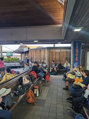
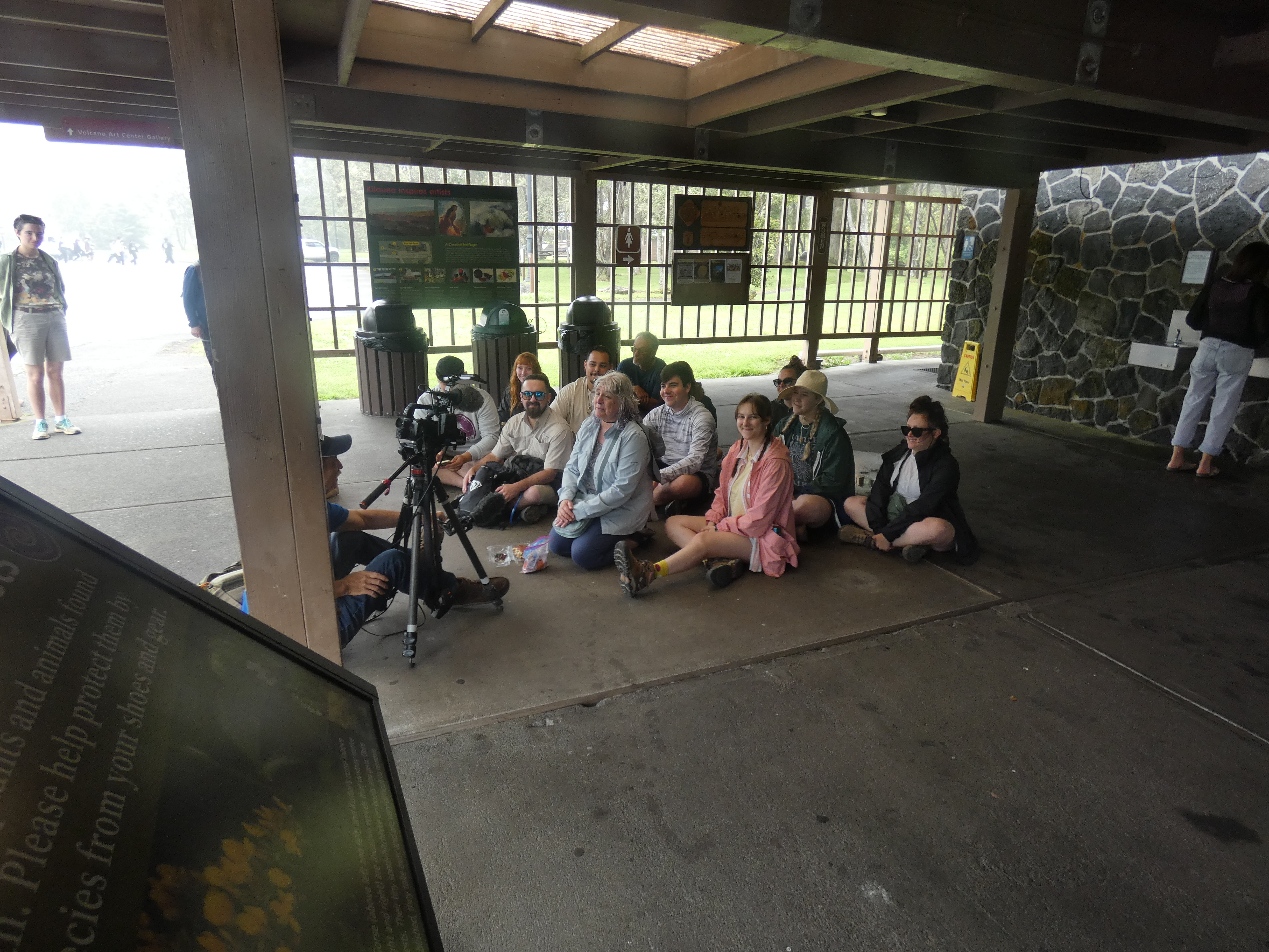
Go to the national park visitor center and hang around for awhile. Get interviewed by the local news media. Use the restrooms. Then continue on the rest of your trip, wondering how you'll ever top this experience!

So yeah, it pretty much happened this way while we were in Hawai'i recently (except for the actual organizing of any eruption). Our students and my co-leader were in fact interviewed on local Hawaiian news (see the story here: HVO: Eruption at Kilauea’s summit has paused, but activity in region remains dynamic (hawaiinewsnow.com)).

The eruption itself was somewhat of a surprise. There had been upticks in the seismicity and uplift in some nearby areas, but the precise spot where the rift opened up was unexpected. It was a very short-lived eruption, lasting only about 12 hours, and the volume of lava was limited. You can see the USGS review of the eruption here: https://www.usgs.gov/observatories/hvo/science/recent-eruption.

Source: USGS Hawaii Volcanoes Observatory
All things considered, it was one of the most satisfying moments of my teaching career... 


Here's my video of the eruption from the site of the old Jagger Museum and Hawaiian Volcano Observatory: https://vimeo.com/959288135?share=copy

Here's the direct access: 


Wednesday, February 14, 2024

Discover the Wonders of the Hawaiian Islands with Geotripper and Modesto Junior College -May 30-June 11, 2024!

Are you looking for a bit of adventure? 

I invite you to join our Modesto Junior College Anthropology 190/Geology 190: Field Studies in the Hawaiian Islands from May 30 to June 11, 2024. This once-in-a-lifetime journey spans nine days on the Big Island of Hawai'i and four days on Kaua'i. 

There is still time to join us for 13 days exploring volcanoes, coral reefs, tropical rainforests, tropical deserts, ancient foot trails, petroglyphs, and archaeological sites! Our itinerary includes Hawaii Volcanoes National Park, Mauna Kea, Hilo, the archaeological parks of the Kona Coast, and on Kauai we'll visit Waimea Canyon (the "Grand Canyon of the Pacific") and the Na Pali Cliffs, and much, much more.


The total cost for lodging, transportation, and inter-island flight is $2,850. Students are required to make their way to Hawaii and arrange their own meals. 

Contact instructor Garry Hayes (that's me) (hayesg@yosemite.edu) for more information.

This is a Zero-Textbook-Cost Class. We are writing our own!

Links for the Informational Brochure, Registration form, and the Tentative Itinerary can be found at the bottom of my MJC Faculty Page at MJC People Finder: Garry Hayes. Although some deadlines mentioned in the brochures have passed, we still have room for several more travelers, and would love to have you join us!


Thursday, January 25, 2018

A Look Back at Ten Years of Geotripping: The Hawai'i That Was

This is one of my favorite bits of writing from Geotripper. I didn't actually write it until 2016-17, but I actually sketched it out way back in 2009 while sitting in a Mexican Restaurant in Bakersfield on a 112 degree day. On that day we were in no hurry to leave, so I was reading about the presence of the Gardner Pinnacles, a seven acre island that is the oldest bit of exposed volcanic rock in the Hawaiian Island chain. As I worked my way through a delicious three-entrée plate of tacos and enchiladas, I was imagining how many species of animals and plants might have existed there, including many that would have disappeared along with most of the island itself. My musings ended up as several handwritten pages of text that would eventually become the first post of the series. I lost the pages somewhere within a few days, but I never forgot the desire to write a series of posts on this incredible place. An extended visit and field class in the summer of 2016 finally gave me the inspiration to get the whole project off the ground. Instead of describing the beaches and tourist hotels, I was seeking to understand the ancient Hawai'i, the one that existed before European contact, and the one that existed before Polynesian contact.

This has been a continuing series of my personal celebration of ten years of blogging. The compilation below appeared on May 5, 2017.

Since last summer I've been working on a blog series based on the geology, natural history, and anthropology of the Hawaiian Islands, loosely based on our field studies class last summer. There are a lot of stories told by these isolated islands in the middle of the Pacific Ocean. I finally reached the (possible) end of the series yesterday, and so today I'm putting together a compilation of the posts (click on the titles to get to each blog).

The Hawai'i That Was: A New Blog Series
This was the opening post that described what I hoped to do with the series. It included a picture of the Gardiner Pinnacles, the last bit of volcanic rock in the Hawaiian chain of islands. This bit of rock is the final remnant of an island that may have rivaled Kaua'i or Maui in size.

The Hawai'i That Was: To know what was we need to know Hawai'i today
I remember that the location and relative size of the islands meant little to me until I actually visited. In this post I laid out the geography of the main islands of the chain.

The Hawai'i That Was: Why Should We Care?
We are often far too ignorant of our dependence on the land and resources, and forget that they can be abused and wasted. All human societies alter the landscapes that they occupy to increase their chances for survival, and some are more successful than others. Hawai'i is a microcosm of the human experience on Earth.

The Hawai'i That Was: The Beginning of All Things, (Ba)salt of the Earth
Hawai'i begins and ends with basalt, the product of the partial melting in the mantle of the Earth. Basalt is the foundation on which the entire story of Hawai'i is written.

The Hawai'i That Was: The Abode of the Gods and Creation at Kilauea
Kilauea is the site of Hawaii's ongoing eruptive active, 33 years and counting. We saw some spectacular spattering when we visited at night. The video is in this post.
The lava lake in Kilauea Iki in 1959. We walked across it last summer

The Hawai'i That Was: Walking a Lake of Fire in "the Little Source of Great Spewing"
In 1959, a huge eruption produced gigantic columns of spewing lava and filled a depression creating a lake of fire. It's still hot today nearly 60 years later. We walked across the abyss.

The Hawai'i That Was: Pu'u O'o, the Volcano We Couldn't See
The present day lava flows at Kilauea originate at a vent called Pu'u O'o a few miles east of the summit. We didn't get to see it on this trip, but I flew right over it in 2009. Here are the pictures!


The Hawai'i That Was: Living on Uncertain Ground - The First Human Wave Arrives
Hawai'i was one of the last uninhabited places on planet Earth. We get a first look at what life was like for the earliest colonizers, and begin to understand how they changed the islands.

The Hawai'i That Was: How Can the Biggest Mountain in the World Stay So Hidden?
It was a bit strange that we were on Mauna Loa, the world's biggest mountain, and barely ever saw it. The weather on the Big Island can be fickle! No worries though, I found a lot of images in the archives.

The Hawai'i That Was: Mauna O Wakea, the Opening to the Heavens, and the Realm of Ice
There is a second gigantic volcano on the Big Island that is taller than Mauna Loa, but of somewhat less bulk. Mauna Kea is considered the realm of the gods, and in a sense modern technology reflects this as some of the world's most powerful observatories on the summit search the Universe for understanding.

The Hawai'i That Was: A Tale of Two Kipukas, and Thoughts on the Rarest Plants in the World
Ever wondered about the world's rarest plant? How about one that existed as a single specimen? That died? Someone preserved just a few seeds, so it may come back (there are about 200 planted in the kipuka today). The role of kipukas in preserving the Hawai'i that was is described in this post.

The Hawai'i That Had Never Been: A Mountain That is Younger Than Me, Mauna Ulu
An exploration of a mountain that didn't exist when I was in grade school, along with another of Hawai'i's fascinating kipukas. Mauna Ulu is a fascinating place to explore.

The Hawai'i That Was: There was a Monster in the Water at Laupahoehoe
The tragedy of the 1946 tsunami at Laupahoehoe, and how it saved hundreds of thousands in the Pacific Ocean later on, but didn't in the Indian Ocean in 2004.

The Hawai'i That Was: Where are the Rivers? Waterfalls on the Big Island
Many parts of the Big Island have no rivers despite near constant rainfall. In other places, there are some really nice waterfalls! We explore some of them in this post.


The Hawai'i That Was: A Veritable Rainbow of Sand (and cute gratuitous sea turtles)
Did you know that there are beaches in Hawai'i that are made of gemstones? Or that beaches range in color from black to white with a whole rainbow in-between? Lets explore a few.

The Hawai'i That Was: Look at the Cute Squirrel! (NOT a squirrel)
You will no doubt see a squirrel-like creature on some the Hawaiian Islands. It's not, it's a mongoose, which is an important control on pests in other lands. In Hawai'i it IS the pest. It's had a devastating affect on the native birds of the islands.

The Hawai'i That Was: Exploring Pololu Valley on an Unstable "Dead" Volcano
The Big Island is not noted for having huge coastal cliffs, but there are some nice ones on the northeast coastline. The origin of the cliff is a notable story as well, that of a gigantic prehistoric landslide.

The Hawai'i That Was: What Happened to the Stones of Pololu? A Look at Pu'ukohala Heiau
This is the story of the Pu'ukohala Heiau, one of the most intriguing archaeological sites in the Hawaiian Islands. It was built by King Kamehameha I prior to his uniting of the islands under single rule. The stones they used to build it came from the other side of the island.

The Hawai'i That Was: Lapakahi, the Kind of Place Where the Rest of Them Lived 
History seems to always be about the kings and presidents. We usually hear little about what life was like for the "commoners". Lapakahi is an archaeological site that protects a commoner's village on the northeast coast of the Big Island.

The Hawai'i That Was: Have We Got Some Real Estate for You! Exploring Kaloko-Honokohau National Historical Park
Hawai'i has a number of national parks, and one of them seems a strange choice, backed up against a Costo store near Kona. It's a barren lava flow, but treasures are hidden within its boundaries.

The Hawai'i That Was: Pu'uhonua o Honaunau, the Place of Sanctuary That Might Not Be So Safe (Geologically)
Can you ever feel safe? There are different kinds of 'safe' in Hawai'i. A few hundred years ago, small infractions could get you killed, but you could find safety and forgiveness if you could make it to a place like Pu'uhonua o Honaunau. Geologically though? Maybe not so much.

The Hawai'i That Was: Watching the Destruction of the Islands in Real Time
Flying from the Big Island to Kaua'i is like riding a time machine both backwards and forwards. We see the progression of the erosion and subsidence of the islands over the last 5 million years, but we are also seeing the future of the Big Island, five million years into the future.

The Hawai'i That Was: We Arrive on Kaua'i and Find the Beauty of Age
The Big Island and Kaua'i are separated by only a few hundred miles, but they might as well be worlds apart. They are different from each other in many ways. We begin an exploration of the oldest of the main Hawaiian Islands.

The Hawai'i That Was: History and Beauty at Ke'e Beach and the Na Pali Coast.
On the north side of Hawai'i is a spectacular coast of some of the highest beach cliffs in the world, and the remains of a hula school that operated for perhaps 800 years. Not many universities in the world can make such a claim.

The Hawai'i That Was: An Idyllic Paradise on the North Shore of Kaua'i. Sort of.
Hanalei Bay is one of the most beautiful places on planet Earth. But even paradise can be a place of danger. Why are all the houses built on stilts?

The Hawai'i That Was: Hanalei, Where the Waterfalls Seem to Stream From the Clouds
The north side of Kaua'i captures the warm moist tropical trade winds, and collects prodigious amounts of rainfall. The mountains here are the wettest places on Earth, with one spot that gets nearly 500 inches of rain per year.

The Hawai'i That Was: Rising Out of Depression on Kaua'i, and Sleeping Giants
Have you ever wondered where that unique mountain in the opening of "Raiders of the Lost Ark" was located? Actually dozens of movies have been filmed on Kaua'i somewhere. We also climb the Sleeping Giant, a slumbering hero of the native Hawaiians.


The Hawai'i That Was: Into the Last Stand of Wilderness in Kaua'i, the Alaka'i Swamp
We take a hike into the last refuge of many of the native species of the Hawaiian Islands, a high-altitude "swamp" on the Alaka'i Plateau. It is an absolutely unique environment, unlike any on Earth.


The Hawai'i That Was: What the Worst Disaster You Can Think of? The Terror of Na Pali...
The cliffs of the Na Pali is one of the most incredible shorelines in the world, and are stunningly beautiful. On the other hand, they are evidence of one of the most violent of disasters, one that was so intense that it sent waves crashing against the other islands more than a thousand feet high.

The Hawai'i That Was: The Lost Wetlands of the Mana Plain on Kaua'i
A portion of the west coast of Kaua'i exemplifies the conflict between the modern world and the natural environment that existed before. Volunteers are attempting to rebuild some of the wetlands that once existed on the Mana Plain.

The Hawai'i That Was: Waimea Canyon, the View You "Have" to Earn...
Our trip was near an end, and we took one last hike, one that end at the brink of a place so spectacular that it's been called the "Grand Canyon of the Pacific". We learned about the need to "earn" a view.


The Hawai'i That Was: The Final Refuge
For the our final blog in the series (for now at least), we have a look at Waimea Canyon, a deep gorge produced when half the island threatened to collapse and sink into the sea. We end with the realization that the natural environment that once existed in Hawai'i still survives in isolated corners here and there. These are the last refuge for many species, and many of us.

Saturday, July 29, 2017

Walking on Broken Glass, Literally: And what is slabby pahoehoe?


Some places on our planet are just not like anywhere else.

Kilauea, on the Big Island of Hawai'i is one of the most volcanically active places on Earth, and very few parts of its surface are older than a thousand years, and most are much younger. It's a place where erosion is essentially a non-existent process. There is only the addition of rock during eruptions, or the collapse of rock (into caldera or pit craters).

Walking on a landscape that has existed for only a few years is truly an otherworldly experience. A raw surface, unsoftened by soil formation or plant cover, is not a normal experience for most human beings. I was at Kilauea in May for a conference and field trip, and we had a chance to walk across one of Kilauea's more recent extrusions, a lava flow near Halemaumau Crater in the caldera that erupted in 1982. The eruption destroyed several hundred feet of the highway that travels around the caldera. It was quickly repaired, but has been closed more recently because of the ongoing (since 2009) eruption in the depths of Halemaumau that is putting out deadly fumes and gases, and the occasional explosion of debris. We were allowed to enter the area on this particular day.

Even if you have walked on basalt flows on the U.S. mainland, the experience is not like this one was. I've always thought of lava flows as being firm and solid, but when they are new, that is not always the case. The entire flow seemed to be covered by loose flakes about the size of potato chips.

One could never sneak up on an adversary on a surface like this. Every step produced loud crunching sounds. A close inspection of the loose chips showed why. The chips were composed not of basalt, but of glassy obsidian!

The more familiar kinds of obsidian most often seen around volcanoes is richer in silica, and is usually associated with lava domes or plug domes, a type of volcano not found in Hawai'i. But all lavas can form glass when they cool rapidly, and that is what happened at the surface of this flow. As the lava was exposed to the cooler air, it quickly solidified, forming a glassy crust. One would think that would be the end of it, and that the whole flow would solidify almost as quickly. But it doesn't. Six weeks after the eruption ended, bulldozers were realigning the highway, and overturned slabs still glowed red.

Such flows continue to be mobile after the crust forms, and lava beneath the crust is still quite molten (it is insulated by the crust). The flow can actually inflate with molten lava, becoming a great deal thicker before a breakout occurs, and the lava drains away. The surface can rise and fall, breaking here and there into large slabs. At the same time, the cooling rock at the surface contracts, and the surface breaks up into the chips we were walking on. In videos of such flows, one can often make out the tinkling sound of the rocks snapping off.

The amount of deflation in this particular flow was considerable, as can be seen in the photograph above, exceeding seven meters or so (about 20 feet). The lava reminded me of a sheet on an unmade bed, partly pulled up over a pillow.

The cliffs were unusual for a Hawaiian-type volcano. They were made up of distinct layers that looked almost sedimentary. They didn't result from any sedimentary process, however. They record a series of violent ash eruptions that culminated in a very explosive event in 1790 that killed dozens, maybe hundreds of Hawaiian warriors, and changed the course of history on the island (the army was facing off against King Kamehameha, and the tragedy was seen as a sign from the gods). Kamehameha soon thereafter united all the islands under his rule.

We climbed the cliff for a perspective of the main part of the flow and steaming cauldron of Halemaumau in the near distance. Halemaumau is the abode of the volcano goddess Pele, and many people take her existence seriously, providing offerings and prayers.

I was fascinated by the swirls that became visible from our vantage point a hundred feet or so above the lava flow. It is much smoother than the lavas I experienced on previous trips along the southeast rift zone of Kilauea. Compare it, for instance, with the pahoehoe flows near the former village of Kalapana that I visited in 2004, only days after they were extruded. They have a more "ropy" lobe-like shape, but note the silvery color. That silver color is also a thin layer of glass. After a few decades or centuries, that silvery luster will weather away, and the flow will have the forbidding black color that most people associate with basalt lava.

Friday, July 7, 2017

Would You Go? The Pit Craters of Kilauea Volcano

Eddie Aikau is a Hawai'i legend. Born in 1946, he was an ancestor of Hawaiian kings, who in antiquity were the only ones allowed to surf. Eddie trained himself to become one of the great surfers of his day, but more importantly he was the first state paid lifeguard on the North Shore of Oahu. He ultimately saved 500 people, often under terrifying conditions. He lost is life in 1978 trying to rescue a crew of a Polynesian-style voyaging canoe. They were trying to travel 2,500 miles to Tahiti, but only made it 12 miles offshore of Molokai before floundering. Eddy, who had volunteered as a crew member, offered to swim for help. The crew was later rescued, but Eddy was never found. Not long afterward, the phrase "Eddie would go" was heard throughout the islands.

I thought of Eddie when I encountered Devils Throat on Chain of Craters Road in Hawai'i Volcanoes National Park. Devils Throat is a stark example of a pit crater. There are a number of them along Chain of Craters Road (you didn't guess that one, did you?), Some of them are hundreds of feet deep. They are odd because there are no lava flows associated with their origin. They form when underground magma chambers on the rift zone of Kilauea drain, causing the land above to suddenly collapse inwards.
Devils Throat is unique in that it formed in historical time, in 1912. When discovered, the opening was only 20 feet across, but it was found to be more than 250 deep. The Eddie connection? When it was discovered, a man was lowered by rope into the dark pit. What do you think? Would you have gone?

What he found inside was an immense inverted cone more than 200 feet across at the bottom. All the walls of the pit were overhanging. Given the fragmented nature of basaltic lava flows, such overhangs are extremely unstable. Boulders started falling essentially from the moment the pit formed. Over time, debris filled the bottom of the pit so that today it is 161 feet deep, and the opening has expanded to 164 feet. The National Park Service has never really publicized the existence of the pit over fears that people would get too close to the edge and have the rock collapse beneath them.
Today, the vertical walls of the pit may be a bit more stable, but who can really say? It's a fascinating place to visit if you can find it (a bit of map work is all it takes; it's just a few hundred feet from Chain of Craters Road).

Sunday, June 11, 2017

Volcanoes in Hawai'i: Rock Finds a Way (to destroy life)

The summit of Mauna Kea in the distance, and the forested lower slopes of Mauna Loa in the foreground

My last entry on the geological drama of Hawai'i concerned the stubbornness of life in a harsh volcanic environment, such as that which is found on the highest slopes of Mauna Loa and Mauna Kea on the Big Island of Hawai'i. I was echoing of course one of the memorable lines from the movie "Jurassic Park". As I started to review my next set of pictures from my recent trip, I realized the opposite supposition also holds true: rock finds a way (to kill life).
Lua Manu Crater on Chain of Craters Road. It formed by collapsing several hundred years ago, and was later filled with lava flows in 1974. 
Now obviously, it couldn't be clearer that lava destroys life as it flows through and burns forests. The aftermath of many a flow is a barren plain with no sign of life of any kind. In the tropical climate of Hawai'i, life returns quickly as wind and water aid in the propagation of seeds from the nearby forest. Sometimes it is bird droppings that scatter the seed and provide the first nutrients that lead to a rebirth of life. The surface of the Big Island gets made over repeatedly over the millennia.
The battle between rock and life does take unusual forms sometimes, which is what I wanted to illustrate in today's post. Basaltic lava is not always the all-consuming fiery hell we often take it to be. It may be in excess of 2,000 degrees Fahrenheit (1,100 degrees Celsius) as it flows from the vent, but when the lava encounters cold objects, the surface of the lava can freeze quickly. When the object is a tree, strange things can happen.
On the slopes of Kilauea or Mauna Loa, the most common tree is the Ohi'a, which I wrote of in the previous post. In 1974, the Keanakāko‘i flow overwhelmed an Ohi'a forest near Chain of Craters Road in Hawai'i Volcanoes National Park. The lava froze around the trunks as the trees themselves caught fire and burned away.


The resulting cavities are called tree molds, and they were spread widely in the Keanakāko‘i flow. The charcoal from the former tree can still be seen in some of the molds after forty years (below).
At times, the molds perfectly preserve the pattern of the bark, as can be seen below.
There is another odd phenomena that occurs in these events. The lava flows past the trees, solidifying around the trunk, and continuing on. It's not always obvious, but as lava flows by, the thickness can change, and the level of the flow can drop around the trees. The tree molds are left behind as towers of basalt with hollow centers (lava trees). It's actually kind of eerie to encounter such ghosts in the midst of a living forest (below), and easy to understand how ancient people considered these to be people turned to stone by the gods.
The 1974 has hundreds of these lava trees, and some take bizarre shapes, as in the case below, where a multiple-trunked tree (or a clump of several) was preserved.
It's obvious that life is slowly being reestablished on the flow, as we were surrounded by Ohi'a trees and other species at various stages of growth.
It turns out that the tree molds themselves offer a hospitable environment for life, with nutrients provided by the charcoal, and cooler wetter conditions below the surface.


The lava forests can be seen in several places. By far the easiest is at Lava Tree State Monument in the Pahoa area. It resulted from a flow in 1790, and the park offers paved accessible trails and interpretive signs. If you want to see the Keanakāko‘i ghost forest, you'll find it in the vicinity of Lua Manu Crater on Chain of Craters Road in Hawai'i Volcanoes National Park. There are no signs and no trails, so you are in for a bit more of a rugged adventure. Be prepared with water, sturdy shoes, and the other usual things you need for a wilderness outing. And...be careful while studying the ghost trees. Many are unstable and fragile and could be destroyed by a thoughtless climb or push. And having one fall on you can't possibly end well.