Thursday, August 16, 2012

The Abandoned Lands...A Journey Through the Colorado Plateau: Surviving in the Great Rift

I've been doing this journey through the Abandoned Lands sort of backward...the places we've been exploring, like Acoma, and today's location in Taos aren't abandoned at all. And we aren't even on the Colorado Plateau at this point. We are actually traveling through the Rio Grande Rift, a giant tear in the crust of the Earth that extends from southern Colorado to Texas and Mexico.

It's backwards because what I have been calling the abandoned land, the Colorado Plateau, was deserted by the Ancestral Pueblo people in the 1200s. The pueblos we are visiting, like Acoma, Cochiti, and Taos, are the places to which the Ancestral Pueblans migrated, and still live today. So we're telling the end of the story before the beginning and the middle. But we will be back on the Colorado Plateau soon enough, and sometimes it helps to know how the story ends before we deal with the beginning. It helps us to understand why things are the way they are today.

Taos Pueblo is one of the single most photographed buildings in North America. Along with Acoma and Old Oraibi, it is among the oldest continuously inhabited villages in the country. It has a spectacular setting, tucked on a high plain between the Sangre de Cristo Mountains and the Rio Grande River. It's not on the Rio Grande River, like most of the other New Mexican pueblos. It's not hard to see why...
The process of forming a rift valley involves tens of thousands of feet of faulting and thinning of the crust. The release of pressure on the underlying mantle allows partial melting and the formation of basaltic lavas that can follow the fault lines to the surface, forming voluminous lava flows. In the vicinity of Taos, the lavas blocked the Rio Grande, but rivers aren't intimidated by lava flows; they cut right through. The Rio Grande Gorge near Taos is no place for a village. There isn't enough flat land for building or growing.
So Taos Pueblo was built at the foot of the Sangre de Cristo Mountains, the southern extension of the Rocky Mountains. A creek flows from Blue Lake, high on the slopes of Wheeler Peak, and flows down into the Rio Grande. Called the Rio Pueblo de Taos or Red Willow Creek, it provided dependable water for the village. That's it in the picture below. The lake and the creek are sacred to the people of Taos Pueblo.

One of the most emblematic battles that ever took place at Taos Pueblo involved the federal government, but didn't involve guns and bows. Instead, it involved lawyers and senators. The creation story of the Taos people points to Blue Lake as their place of origin. It was part of their history and spiritual journey. But in 1906 the federal government took over administration of the lake, adding it to Carson National Forest. The people of Taos expected to have access to their sacred lands, but the forest service had different ideas, opening the region to "multiple-use": ranching, mining and recreation. The pueblo began a campaign to get their lands back. It took a shamefully long time, but in 1970 President Nixon signed legislation returning Blue Lake to the Taos Pueblo.
Things were not always peaceful in the pueblo at Taos. One of the clues is the San Geronimo mission church which is probably the second most photographed building in the country. It was built all the way back in...1850. 1850? That's not so long ago in a town with a 900 year history.

Pecos Pueblo, the subject of our last post, was at a geographical choke-point, and as such was directly involved in wars and battles for much of their existence. The ongoing conflicts took their toll and in 1838 Pecos was abandoned. Taos was farther to the north and could pick and choose their battles. They were major players in the 1680 Pueblo Revolt, and resisted the return of the Spaniards twelve years later. Things were apparently mostly peaceful for the next century or so, but things changed with the Mexican-American War in 1846. The United States laid claim to New Mexico, and the Taos Pueblo resisted the new government, along with Mexican nationals living in nearby Taos.
The battle did not go well for the defenders, and in the end a large number of them took refuge in the San Geronimo mission church behind a heavy wood door and thick adobe walls. The U.S. forces tried axes on the door and failed, so they rolled in a cannon. In a few hours the battle was over and around 150 people were dead. The ruins of the church still stand (below), surrounded by the Pueblo cemetery. The new San Geronimo church was built in a new location.

The Taos Pueblo is among the most conservative of the New Mexico pueblos, and around 150 people follow the traditional ways, living in the old village with no running water or electricity. It is a fascinating place to visit

Tuesday, August 14, 2012

The Abandoned Lands...A Journey Through the Colorado Plateau: The Rise and Fall of Empires...

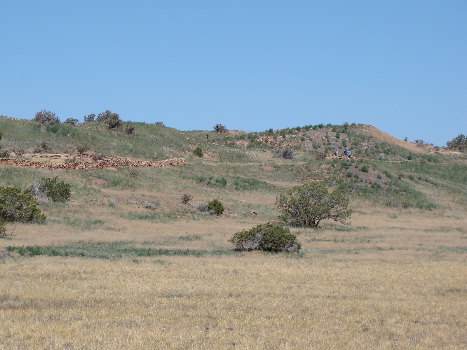
We walked along the pathway, and the only other living thing was a rock wren (I think), perched on the remains of an old wall. It was a peaceful setting with rugged mountains, the Sangre de Cristo, for a backdrop on one side, and the high Glorieta Mesa on the other. Our path took us along the side of high mound, and were it not part of a national park, non-archaeologists like myself might well have missed the significance of this spot. There isn't much left that reveals a human presence (below).
One of the most surprising things I ever found out about the city of Rome, Italy the one time I visited was that after dominating the world, the vast city that once had a population of more than a million people dwindled to fewer than 30,000 people during the Middle Ages. It must have been eerie living among the ruins. I imagine that Isaac Asimov envisioned this when he described the planet Trantor near the end of the Foundation Trilogy: the center of the Galaxy relegated to a minor farm world by history. It was on a much smaller scale, but something like this happened here, at Pecos Pueblo, now preserved as part of Pecos National Historical Park.
Most of the nineteen current pueblos of New Mexico were situated near the Rio Grande River, where water was dependable. Pecos Pueblo was a bit different...it was at a higher elevation, 7,000 feet, where the growing season would have been shorter, and as such, the site didn't make much sense. And yet, at the height of its power the pueblo would have 600 rooms and a population of perhaps 2,000 people. It was considered one of the most powerful of the New Mexico pueblos.

Why? As any realtor will say, "location, location, location". Pecos overlooked one of the most important passes in the American Southwest. The Great Plains lay to the east of Glorieta Pass, while to the west there is the Rio Grande Valley and the Colorado Plateau, which in turn lead to the Gulf of California, Old Mexico, and lands beyond. Whoever controlled the pass controlled the migration and trade routes of a vast region.

The site has been occupied for thousands of years, but the fortress originated about 1450. It was encircled by walls and the buildings reached as high as five stories. The Pecos people controlled the trade between the Plains Indians and the Puebloans of the Rio Grande. Able to field an army of 500 warriors, they acted as a buffer to the occasional incursions of the Apache and other aggressive Plains Indians as well as the Spaniards, at least for a time.

The Pecos people also played a part in one of the greatest pranks in history when they encountered Europeans for the first time. Coronado arrived in 1540 seeking his seven cities of gold. Perhaps realizing their peril, the Pecos people told the Spanish of the incredible cities of gold that lay beyond the pass out on the Great Plains. The Spaniards took a Puebloan guide who led them as far as Kansas before the deception was revealed (and the brave guide strangled). The Spaniards subsequently returned to Mexico and did not bother the pueblos for another sixty years.
But return they did, and by the early 1600s, the missionaries were building churches across the Pueblo lands. One of the biggest was a church at Pecos that was built in the 1620s. It was destroyed during the Pueblo Revolt of 1680, and a kiva was constructed on the grounds. When the Spaniards invaded again in 1692, a new church was started on the foundations of the older church. The kiva was filled in.
With the total control of the pueblo by the Spanish missionaries, the fate of the town was sealed. Without an army, the town fell victim to attacks by the Comanche, and European diseases exacted a heavy toll. By 1780 fewer than 300 people were left in the town. By 1838, the final inhabitants, maybe two dozen people, moved west to the Jemez Pueblo and Pecos was finally completely abandoned. After the Mexican-American War, both sides of the pass were owned by the United States, and the strategic location was no longer strategic. Except for one more war: the one between the states.

I had never really thought of New Mexico as an important Civil War site, but once again history and geography turned Pecos and Glorieta Pass into a critical prize. If the Confederacy could hold Albuquerque and Santa Fe, they could take control of Glorieta Pass. From there, a determined army could march into Colorado and move west to open up coastal trade routes that could not be blockaded by Union boats. The gold fields of Colorado and California could provide much needed cash reserves for the South.

The Confederate army invaded from Texas and took over Albuquerque and Santa Fe by 1862, and was preparing to move north into Colorado through Glorieta Pass. Well-supplied, and with high morale, they engaged the Union forces and caused the Federal troops to once again fall back. It looked like the Union was going to suffer a serious loss, but for one brilliant move on their part. The supply wagons for the Confederate forces were lightly guarded, and a contingent of Union forces climbed down a high mesa and in a surprise attack drove off the guard and destroyed the wagons and animals. The Confederate forces had more or less won the battle but lost the war. Without supplies, they had to retreat and return to Texas. They never threatened New Mexico again for the duration of the war (for a more complete version of a complex battle, check out this link: http://www.nps.gov/peco/historyculture/copy-of-battleofglorietta.htm#).
Today, the region is quiet and peaceful, and a fascinating place to visit. Pecos National Historical Park is easily missed by visitors traveling along the pueblos between Taos and Albuquerque. It is about 25 miles east of Santa Fe along Interstate 25.
Our journey now carried us north towards Taos and the incredible Jemez Caldera. That's coming in a future post. For an explanation of my odd theme for this series, check out: http://geotripper.blogspot.com/2012/06/abandoned-landsa-journey-through.html .

Monday, August 13, 2012

No Meteors, So Some Pictures of a Sunset Instead

The Great Valley is great sometimes, but not if you want to see astronomical phenomena. We have some of the worst air pollution in the nation, along with considerable light pollution. So most years when the Perseids Meteor Shower comes along, we try to find our way up the western slope of the Sierra Nevada for some really dark skies. Besides, it hit 106 degrees yesterday, and it just HAD to be a bit cooler if we could make it a few thousand feet up into the mountains.
The sun was dropping low towards the horizon when we found a wide spot on the highway near Pinecrest Lake. It offered a really fine view towards the Dardanelles country and westward down the Middle Fork of the Stanislaus River (the opening picture of the post).

The mountains around the Dardanelles don't look like your typical Sierra Nevada peaks: they look more like flat-topped mesas in the picture above. They are not composed of granite, but instead are the remnants of lava flows and volcanic mudflow deposits that erupted from a volcanic center that was similar to today's Cascades. The difference? These eruptions were happening 9-10 million years ago, and the volcanic center died away. Erosion took over and stripped away most of the volcanic rocks except for these remnants.

We were getting a little concerned about the cloud cover. Huge thunderheads had been building over the eastern Sierra, and some clouds were starting to spill over the mountains towards the west. Lousy for looking at meteors, but maybe nice for sunset. Or a lightning show...
 The sun broke through and lit up the forest behind us and the sky to the west turned to fire.
There's not that much to say about it geologically. I suppose I could mention the sun pillar, caused by the sun's rays reflecting off ice particles in the clouds. Or I could just say enjoy the sunset...

I'm a real sucker for beautiful sunsets. Anyway, the clouds didn't clear and we didn't see a single meteor, or a flash of lightning. But I'm not complaining one little bit...

Saturday, August 11, 2012

The Abandoned Lands...A Journey Through the Colorado Plateau: Kasha Katuwe Tent Rocks, Erosion in Action

What happens when you take an arid landscape with faulting and high relief, add in some loosely consolidated poorly sorted sedimentary and volcanic rocks, and add yearly monsoon flashfloods? You get the Kasha-Katuwe Tent Rocks, a national monument located in New Mexico on the Cochiti Pueblo at the western edge of the Rio Grande Rift. This was the location of yesterday's mini-quiz, as noted by Chas in the comments.

Yesterday's post was all about looking at erosion from the bottom as we walked through a slot canyon on our way to the upper part of the mesa. Today we take a look at the upper reaches, to see what happens when erosion eats away at slopes composed of random boulders and cobbles in a matrix of finer fragments. The results are fascinating to see...
First are the pedestal rocks. Two formations are exposed at Kasha-Katuwe, the Peralta tuff (6.5-7.0 million years), and the Cochiti formation (2-6 million years). The Peralta was produced by a series of explosive rhyolite ash eruptions from the vicinity of Jemez (Valles) Caldera. The Cochiti has a mixture of sand and gravel with larger boulders. As the boulders are exposed by erosion, they protect the softer rocks underneath from erosion, forming the pedestals.
 Our hike takes us through the narrows that we explored in yesterday's post...
...and we emerge into the upper canyon where some tall hoodoos can be seen high above. The trail starts climbing in earnest.
And then there is the really weird stuff...the "tent rocks". I think of a tent is being dome-shaped, but it starts becoming apparent that the tents in this case were more like the tepees of the Plains Indians. These originated as pedestal rocks, but the boulders have rolled off, leaving the softer rocks to erode into the bizarre cones.
There are dozens of these odd tent rocks in the upper canyon. World travelers note the similarity to the rocks of Cappadocia in Turkey. The origin of the rocks is quite similar. In the case of Kasha-Katuwe, no one is living inside the cones as some people do in Turkey. The park area has been historically utilized by the people of the Cochiti Pueblo for hunting and plant gathering. The park was established by the Bureau of Land Management in cooperation with the Pueblo.
The trail ends at a marvelous lookout that provides views of the Rio Grande Rift and the distant Sandia Mountains, as well as a view into the canyons below.
But mostly it's the "tents" that latch onto your attention. I couldn't stop staring at the odd and bizarre shapes. I headed down the trail. It was time to head to our camp outside Santa Fe, as we got ready to two pueblos whose histories went in opposite directions, Pecos and Taos.

For the reasons for my odd title for this series, check out http://geotripper.blogspot.com/2012/06/abandoned-landsa-journey-through.html

Friday, August 10, 2012

The Abandoned Lands...A Journey Through the Colorado Plateau: I've looked at erosion from both sides now

I guess I will never be a songwriter for Joni Mitchell. But I like looking at the effects of erosion. Sometimes you see it from above, for instance by standing on the rim and looking into the depths of the Grand Canyon. Sometimes you see it from below, by walking through a place like the Narrows of the Virgin River in Zion National Park and looking up at 2,000 feet of sandstone walls. But sometimes there are places where you get to look at erosion from both sides.
That's where we are today, a wonderful trail that takes us first through a narrow slot canyon, and then climbs to the mesa top above for a look down into the depths. This is the next stop on our journey through the Abandoned Lands, the desert environment of the Colorado Plateau. It's probably not all that fair of a quiz, but who can tell us where we are today? It's a place that receives relatively few visitors despite the incredible scenery. There was only one other car at the trailhead before our six vans showed up. A few clues about where we are...
Notice the rocks in the walls of the canyon. It isn't the nicely sorted sandstone that we often expect when water has carved such narrow slot canyons. This is more of a conglomerate with larger chunks of rock embedded in a matrix of smaller clasts. Some of the rocks are huge, as can be seen where large boulders have fallen into canyon. The rocks contain lots of volcanic material, including obsidian fragments that are sometimes called Apache tears ("Apache" is not a clue, though).
I guess I should also admit that a nitpicker would argue that we aren't actually on the Colorado Plateau, being on the edge of the plateau on the margins of a rift valley. The lower valley provides enough of a difference in base level that erosion is very, very fast, so fast that canyon walls can't collapse fast enough to make gentler slopes.
How bad can flashfloods get here? We certainly didn't want to find out. In the picture below, the students are looking at some silt deposits in a hollow about 12 feet above the floor of the gully. That was the water level during a recent gully-washer. If you are caught in such a flood, there wouldn't be much you could do to save yourself. By the way, notice that a fault line cuts across the cliff face in front of the people.
How fast is the erosion in a canyon like this? The trees give us a clue. How old do you think the ponderosa pine might be in the picture below? It's rather tall, and has probably been growing for a century or more...
 Look what has happened around the roots....
So...where are we at? (OK, Nina??)

In the next post we will look at this place from above, and provide the answer if some of you don't figure it out first.

Thursday, August 9, 2012

The Abandoned Lands...A Journey Through the Colorado Plateau: There are some who won't give up

We are back on our journey through the abandoned lands, the geological wonderland of the Colorado Plateau (the journey was in June, but it takes time to tell a story). The theme I chose, of abandonment, refers to the hardness of this land, they way it can break people and their dreams. It is a beautiful land, full of fascinating geology, but it can be a hard place to thrive and make a living.

We followed an itinerary roughly following the old Route 66 through Kingman, Flagstaff (with detours to Grand Canyon, Wupatki, Sunset Crater, Walnut Canyon, and the Little Colorado River), Holbrook, Petrified Forest, and El Morro National Monument. We headed a little further south into the pueblo lands of New Mexico, going through the Zuni Pueblo, and finally to the Acoma Pueblo.

When the Ancestral Pueblo people (once called the Anasazi) abandoned their homes in the central Colorado Plateau, they did not mysteriously "disappear" from history, they simply migrated away. Many of them ended up in New Mexico, and their descendants continue to live in the region today. The people of the Acoma Pueblo are one of these groups.

In the picture above, one can see the mesas of Jurassic Zuni Sandstone that make up the landscape around the most famous village of the Acoma people, Sky City. Can you see the buildings on the mesa top (click the image to enlarge)?
When I was growing up, I was really impressed with anything that came from a time prior to 1900 (When I was 7 or 8 years old, I figured out my grandmother was 60, and called her an antique; history doesn't record her response...). I collected stamps, coins, square nails, and anything else from antiquity. So what is someone like me to think of a place where people have lived continuously for 900 years? That is what we have with Sky City, one of the three oldest settlements in the United States.
The Pueblo covers the summit of a 360 foot high mesa which historically had a single point of access, a steep trail that included steps carved out of the sandstone. A road was constructed in the 1950s when Hollywood made a movie here, but the trail is still available for visitors to explore at the end of their guided tour through the village. The short trail goes on my growing list of most spectacular trails under a half mile in the world (this will be the subject of a post at a later time).
One of the water sources for the pueblo was a "tank" in the sandstone seen below. On our previous tours, the pond was full of water, but in this drought year it was dry. Our guide referred to the lone cottonwood tree as "Acoma National Forest".
There are hints of a violent past revealed in the access to homes in the village. Many are reached only by removable ladders, making the homes into defensible spaces if invaders breach the mesa cliffs. Some of the kivas, which are usually round or oval, are hidden among the residences in square buildings, so Acoma religious ceremonies could be held in secret.
On the other hand, there is a beauty in living on a mesa top. In the picture below, a traditional kiln or oven serves as the foreground for a marvelous view of Mt. Taylor, a composite volcano that lies north of the Pueblo. The Acoma People call it Kaweshtima and consider the mountain a central part of their spiritual life. The volcano contains a wealth of uranium deposits, and a serious controversy has arisen over the issue of mining profits versus spiritual significance. The National Trust for Historical Preservation is working to protect the mountain from further degradation.
There are around 300 buildings in the mesa-top village, but only about 30 people live in the village on a permanent basis. It's not easy, with no running water and no electricity, but many more of the Acoma people spend their days in the village, because tourism is one of the most important parts of their economy. The guided tour is highly recommended. The Acoma people are highly protective of their culture, but their guides are quite open about their history.
A symbol of one of the most painful aspects of their history dominates the mesa: San Estevan Del Rey Mission Church. Built in 1629, the church is the most obvious sign of the contact of the Acoma people with European colonizers. Coronado's 1540 expedition records the existence of the pueblo, and relations were peaceful at first. Unfortunately, things went sour, and in 1598 the Acoma people, fearing an invasion, attacked a contingent of Spanish soldiers, killing 11 of them. The Spanish countered in typical European fashion: they laid siege to the city in 1599 and eventually breached the south ramparts (below). They slaughtered 600 people, and imprisoned 500 more. Men over the age of 25 had a foot amputated, the women were sent away to servitude in Mexico.
The incident is burned into the collective memory of the Acoma people. A statue of Don Juan de Oñate y Salazar (the Spanish governor who ordered the slaughter) was dedicated in 1991 near Española. In 1998, the 400th anniversary of the massacre, someone cut off the left foot of the statue, leaving a note saying "fair is fair".

The situation never got much better. The church was built with slave labor, and if I remember what our guide said, the massive beams used in the construction were carried from Mt. Taylor, 40 miles away. If the logs touched the ground, they were discarded and the transgressors who dropped them had to go back for another. Missionaries were occasionally given "flying lessons" by being tossed over the cliff. Acoma was involved with the 1680 uprising that resulted in the Spaniards being thrown out of New Mexico for twelve years. At other times they allied with the Spaniards to repel invasions by other tribes.
Although the Acoma people adopted some aspects of the Catholic religion and consider the church a sacred place, they still practice their original religion, which they followed in secret for centuries of Spanish rule. For me, walking through the church resulted in a clash of emotions. So much tragedy in this place.
In the end, I found the village and the landscape to be beautiful. One last story about the pueblo caught my geological attention. Another prominent mesa is visible east of Sky City. It's called Enchanted Mesa, and the Acoma people tell a story of how their ancestors also lived on top of the butte. The village thrived until a landslide cut off all access, leaving four individuals stranded on top. A thunderbird swooped down and picked up the stranded villagers and brought them to the valley floor.

Archaeologists were skeptical. In 1897, A professor Libby of Princeton climbed the mesa and found no evidence of a village, but in 1924 a different expedition found plenty of artifacts around the summit area. 
 All in all, a fascinating place!