Showing posts with label crinoid. Show all posts

Thursday, March 9, 2017

A Place Where Water Once Was But Was No Longer, But Once Again Was (sort of) - Travels in Death Valley

Yes, I used that silly title a few weeks ago, but today it is in a very different context. We were continuing our exploration of the Death Valley region, and we were still dealing with the effects of the Bombogenesis storm that dropped so much precipitation across Southern California. We weren't able to reach Devil's Hole to see the rare pupfish because we almost got stuck in the mud. So we headed back west towards Death Valley as the storm finally seemed to be breaking up.

Highway 190 traverses a long northwestern-trending valley or trough flanked on the north by the steep and rugged Funeral Mountains. The mountains were just barely visible through the rainclouds, but we could make out thick gray sedimentary layers tilted to a high angle. Taken all together, the layers are very thick, approaching 20,000 feet, around four miles. There is quite a story in those rocks.
One of the challenges of taking new students into outdoor geological environments is getting them to recognize that the landscape that exists today is far different than those that came before. Nothing accomplishes that quite so well as releasing them onto the floor of an incredibly dry desert valley, and letting them discover that the rocks underfoot were chock-full of fossils that originated on the bottom of a shallow tropical sea. The rocks layers that make up the Funeral Mountains once lay offshore of the North American continent. California simply didn't exist 300-400 million years ago. There was only ocean.
One could argue that this was an exceedingly boring time as far as geological activity was concerned. For 200 or 300 million years there was quiet deposition of layers of lime-rich mud and not much else. It maybe wasn't exciting at the time, but to a paleontologist this is intellectual treasure beyond compare. It's rare around the planet to find places where deposition took place for hundreds of millions of years without interruption, and equally rare for such places to preserve the myriads of life forms that lived in these shallow seas.

The Grand Canyon is a justly famous and spectacular monument to the forces of geology, but the Paleozoic layers there are only 4,000 feet thick, and entire periods (the Ordovician and Silurian) are missing. The fossil record is incomplete. Death Valley National Park on the other hand has layers dating from every period within the Paleozoic era, as well as Cenozoic layers that are entirely missing from the Grand Canyon. It has one of the greatest fossil records to be found anywhere in the national park system. That what we were out to find that afternoon: fossils!
It shouldn't have be said, but we were outside of the boundaries of the national park. Collecting within the park boundaries is quite logically not allowed. We do enough damage to the resource as it is without hauling it off, to be lost to science.
A huge number of fossils lay scattered across the desert floor. The predominant fossils were the bits and pieces of crinoid stems (sea lilies) that once covered the floor of the sea like waving fields of wheat. Even though the crinoids were anchored by roots and had stems, they were most certainly animals, specifically echinoderms. This is the animal phylum that includes starfish, sand dollars, sea biscuits, and urchins. All of these animals are related by a kind of five-fold symmetry: the five legs of the starfish, the five feeding grooves on the surface of the sand dollars. The symmetry can be seen in the "star" shape in the middle of the stem fragment (above).
Other finds of the day included corals and brachiopods. For the students, it was the beginning of an understanding that the desert beneath their feet was truly a place where water once was, but was no longer. And with the continuing rain, it was a place where water was once again, however termporary.

Wednesday, August 21, 2013

Into the Great Unknown: Visions of Paradise, and a Bug's Horror

The third day of our journey down the Colorado River began as an idyllic journey through paradise. If that seems like a set-up for a disaster at the end of the day, it isn't, unless you count the poor bug (read below). We were traveling about 12 miles from Shinumo Wash to Lower Buck Farm Camp, a stretch of river remarkably free of large rapids (Thirtysix Mile Rapid, a 4, was about it). We were well into Marble Canyon, where the river walls are dominated by the Redwall Limestone (not really marble, but the river polish makes it look like marble). To me, the day was as close as I can imagine to being an earthly paradise: full of beauty, color and serenity.

The Redwall Limestone had its origin in a sort of serenity, or maybe stability is the better word. For millions of years during the Mississippian Period, between about 360 and 323 million years ago, a shallow tropical sea spread and regressed across the continental interior. The tropical waters were filled with life, including crinoids (sea lilies), brachiopods, bryozoans, clams, snails, fish, sharks, and even a few trilobites. It accumulated to depths of 400 to 800 feet, and the hard limestone forms one of the most prominent cliffs in the Grand Canyon (the location of practically every trail in Grand Canyon is determined by where it can cross the Redwall).
Limestone dissolves in mildly acidic water, so caverns will form readily in the Redwall. A vast network of caves are present throughout the Redwall, and many open out into the cliffs above the river. Being an armchair spelunker, I wanted to get out and find a way to explore every cave we saw in the cliffs above. Most were clearly inaccessible, but the cave in the photo above could be reached by humans. It was used by Robert Brewster Stanton in 1889 to stow some of their gear as they abandoned their tragic journey down the river after their leader (and bankroller) and two others drowned. It is called Stanton's Cave to this day.

It turns out, though, that humans have used the cave for a long time. 3,000 to 4,000 years ago, humans constructed split twig figurines, and left them in Stanton's Cave by the dozens. It is thought that 165 of these precious archaeological treasures were removed by visitors between 1934 and 1969 before the park service removed the remaining 74 during an excavation (my feelings about this looting is unmentionable in this family-rated blog).
Split twig figurines on display at Tusayan Ruins, South Rim of Grand Canyon National Park
Other creatures used the cave as well, including California Condors and Mountain Goats, whose dated remains go back 12,000 years. And remarkably, driftwood was carried into the cave during a river flood around 40,000 years ago. The cave is 160 feet above the river!

Most recently, the cave has been occupied by several species of bats, including the rare Townsends big-eared bat. The largest nesting colony known in Arizona was present here years ago, but persistent tourist incursions drove them away. Eventually a gate was constructed to allow access for the bats, but to keep people out. Apparently it has been working, and a colony has been re-established.
Just downstream of Stanton's Cave, an expected splash of greenery coated the slopes of the canyon before us. As we drew closer, we could see water bursting out of the cliffs. Water is another wonderful property of the Redwall. The caverns, fractures, and fissures provide avenues for groundwater percolating through the layers above to be concentrated near the base of the formation, and springs are a common feature at the base of Redwall Formation. Vasey's Paradise was a wondrous example of one of these springs.
We pulled out to have a closer look (for some it was an opportunity to fill their solar showers with clear spring water). We had to step carefully, because some of the greenery was composed of poison ivy!
I caught a shot of my brother enjoying a view from a large boulder along the shoreline. I carefully made my way down to join him. Carefully, because only a week before the trip I had done something to my heel and even had to use a cane for a day or two to get around. I didn't want a recurrence, and was only wearing sandals while on the river. The rock provided a nice upstream perspective of the springs.
Back on the river, we passed another Blue Heron. I couldn't resist another few pictures!
After another few bends in the river, I got a lesson in perceived scale. One can see a dark cavern at river level in the distance. As we got closer the hole got bigger...and bigger...and bigger! We had reached Redwall Cavern, one of the more extraordinary sights on an extraordinary river. John Wesley Powell remarked in 1869 that the huge declivity could hold fifty thousand people. Others later suggested more like 5,000, but in any case, it is huge. We pulled out for a little exploration.
Even before turning my camera into the cavern itself, I had to snap a shot or two of the reflections of the surrounding cliffs on the river. This was one of the calmest parts of the river so far, but Redwall Cavern must exist in part because of lateral erosion of the river during high water (the entire cave was filled with water in 1957 during a flow of 122,000 cubic feet per second; today's flow was more like 12,000 cfs).
Blocks of Redwall that had fallen into the cave contained numerous fossils. Some of our travelers pointed out the crinoids and brachiopods seen below.
I started exploring the depths of the cavern, taking the surprisingly long walk around the back of declivity. The scale is impressive, compared to the rafts of our little flotilla.
The ceiling of the cavern provides a nice frame for looking at the river.
Did I mention that the cavern is huge?
It was a fascinating place to wander, and a cool respite from the sun. I've also seen video of Redwall Cavern in an entirely different circumstance; check out this example of the cavern during an intense monsoon storm. It's awe-inspiring...
Ichnology is the study of trace fossils, the tracks, burrows and other traces of past life in the absence of shells or bone. I've seen many trackways in ancient sandstone formations, but we saw a bit of drama reflected in the sand within the depths of Redwall Cavern. A large beetle had been walking along the uneven sandy surface, and had come to grief in someone's footprint. Such dramas have been preserved in formations like the Coconino or Supai, and in the right conditions, the same could have happened here. The story has a happy ending; the beetle wasn't dead yet, and we set him upright again to continue his journey.
The day continued, but this post is already long. To be continued!

Thursday, March 7, 2013

From Little Treasures Come Big Stories: Travels Through Death Valley National Park

Photo by Mrs. Geotripper
I returned from Death Valley to a load of work back on campus, but over the next few days I'll be posting on some of our adventures. On Saturday morning, we awoke to sunrise on the Mesquite Dunes east of Stovepipe Wells. We grabbed our packs and notebooks and hit the road. We had a lot of ground to cover.
Oddly enough, for having spent two days getting to Death Valley National Park, one of our first stops was outside of Death Valley National Park. This was for the simple reason that we were looking to understand the nature of the rocks that make up the mountain ranges surrounding Death Valley. Because we didn't have enough time to climb most of the mountains, we would need to see what had rolled out of the mountains during the many flash floods and mudflows that had scoured their flanks over the countless centuries. I have honest students, but their conscience would have had a tough time dealing with all the little treasures they were about to find. So we made sure we were outside the park boundaries when we let them out onto the alluvial fans coming down from the Funeral Mountains. For many of my students it was their first experience in finding a fossil.
Fossil crinoid stems. These are rare in oceans today (they are known as sea lilies), but during the Paleozoic era, they covered the sea floor like fields of wheat, and entire rock layers are composed of their fragments.
To most normal people, 300-400 million years of nearly continuous mud deposition is perhaps not the most exciting process to consider. But if that 300-400 million years covers the latest Proterozoic eon and the all of the Paleozoic era, such activity is irresistible to a paleontologist. A rock sequence that covers that time period contains the evidence of the rise of multicelled life on Earth, as well as the first appearance of all of the extant phyla known (plus a few extinct ones). A phylum, as a biologist will tell you, is one of the broader divisions into which all life can be organized. One phyla, the chordates, contains all the familiar animals with a notochord or backbone (fish, amphibians, reptiles, birds, and mammals). There are dozens of others, including the arthropods (bugs and crustaceans) and the molluscs (snails, clams and squids) which make up most of the species known today. A more or less continuous record of deposition makes it possible to detect patterns and trends in the evolution of life on the planet through time.

Grand Canyon National Park has a similar range of rocks exposed in the depths of the gorge, but huge pieces of the story are missing because of episodes of erosion. Where the Grand Canyon has about 4,000 feet of Paleozoic sediments, Death Valley has more like 20,000 feet! How can 20,000 feet of sediment fit into a mountain range that rises no more than 5,000-6,000 feet above Death Valley and other grabens in the region? If you look at the photo of the Funeral Mountains below, the answer is apparent: the sediments in the mountain range have been tilted. To walk through 400 million years of Earth history, we need only to walk a few miles along the base of the mountains.

How is it that sediments could accumulate for such a long time in such stable conditions? Most parts of the crust of the Earth are wracked by extreme tectonic activity like volcanism, folding, and faulting. The Paleozoic rocks of Death Valley accumulated in one of the most geologically "gentle" environments on the planet: a passive continental margin. A billion or so years ago, most of the world's continents were combined in a supercontinent we now call Rodinia. The continent began to break up at the end of the Proterozoic, which is a process that involves severe faulting and rifting, along with vigorous volcanic activity, but as the continents moved further and further apart, the processes became less active and finally stopped. The edges of the continents became a site of more or less continuous shallow marine deposition, and as more sediments were laid down, the crust slowly sank beneath the weight, allowing even more sediments to accumulate.

So, from a bit of wandering across a stony desert surface picking up random fossils, a story is told of massive supercontinents breaking apart and forming huge wedges of sedimentary rock that tell the story of 400 million years of evolution of life on planet Earth. In short, this is why I love teaching geology.

Sunday, May 31, 2009

My First Fossil


Andrew Alden over at About.com Geology asks an interesting question: What was your first fossil? It took only a split second to take me back forty years to the North Rim of the Grand Canyon, where a 10 year old boy was on his first trip to the beautiful national park. But I had found out something strange at the small visitor center there. The ground I was walking on at more than 8,000 feet had once been on the bottom of the sea! Say what? How could that be? I was already at an age where I had figured out that Noah's Flood couldn't account for this. Where was all the water that it could even cover Mt. Everest and all the other mountains of the world? It was clear that something had happened, but I wasn't quite in a place where I could understand the idea of vast uplift across an entire region. I spent days musing about this, enough that the memory is clear after all these years.

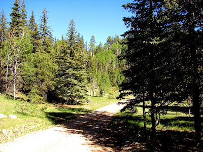
After a few days camping and hiking around the rim (it would be quite some time before I would actually walk into the canyon, an event that caused me to become a geology major) we set out to see more sights in the region, but as we left the park, we drove through the long stretch of highway to Jacob Lake that passed through a beautiful forest and meadowland. We stopped for a few minutes and wandered into the meadow, and looking down I saw some little miniature poker chips, and realized that these were some of the ocean floor fossils I had seen pictures of in the visitor center! They were pieces of the stems of a crinoid, or sea lily, and after a few moments of searching, I had found a fossil sponge as well.

It was a seminal moment that I can count as leading directly to my choice to pursue geology as a career, and one of the great moments of my childhood. I really have to thank my folks for taking me on so many wonderful excursions when I was growing up. Life was such an adventure during my father's ever-so-brief two week vacation.

The pictures above: a view from the North Rim of the Grand Canyon, the less crowded, more verdant part of the canyon, a view of one of the numerous karst meadows north of the rim, and a sampling of some brachiopods, crinoids and sponges found in the Permian Kaibab Formation.