Showing posts with label La Sal Mountains. Show all posts

Thursday, July 5, 2018

Home from Back of Beyond: Images of a Harsh Country, Part Two

The photo above encompasses so much of what captivates me about the southwestern United States. A trail formed from a natural weakness in the rock providing access to an otherwise inaccessible cliff to who knows where? To be fair, hundreds of thousands of people know where the trail leads, but I like the mystery of the image. The thing is, many people DO follow this trail every year, but they may not appreciate the fact that the last time this surface was exposed to the atmosphere, it was 200 million years ago, and on the slip face of a coastal dune. Some of the irregularities highlighted by the shadows in the picture could literally be the preserved footsteps of dinosaurs, other reptiles, or amphibians.

I am slowly working on a short series of posts with my favorite images from our recently completed exploration of the Colorado Plateau and surrounding provinces. I took 1,400 photographs, so it's a bit difficult to choose between them! As we pick up the narrative, we are eight days into a fifteen day trip. As seen in an earlier post, we'd already been to the Mojave National Preserve, Zion National Park, Grand Canyon National Park, Bear's Ears National Monument, and Mesa Verde National Park. As we left Mesa Verde, we needed to find a way over the San Juan Mountains, a major range within the Rocky Mountain chain.
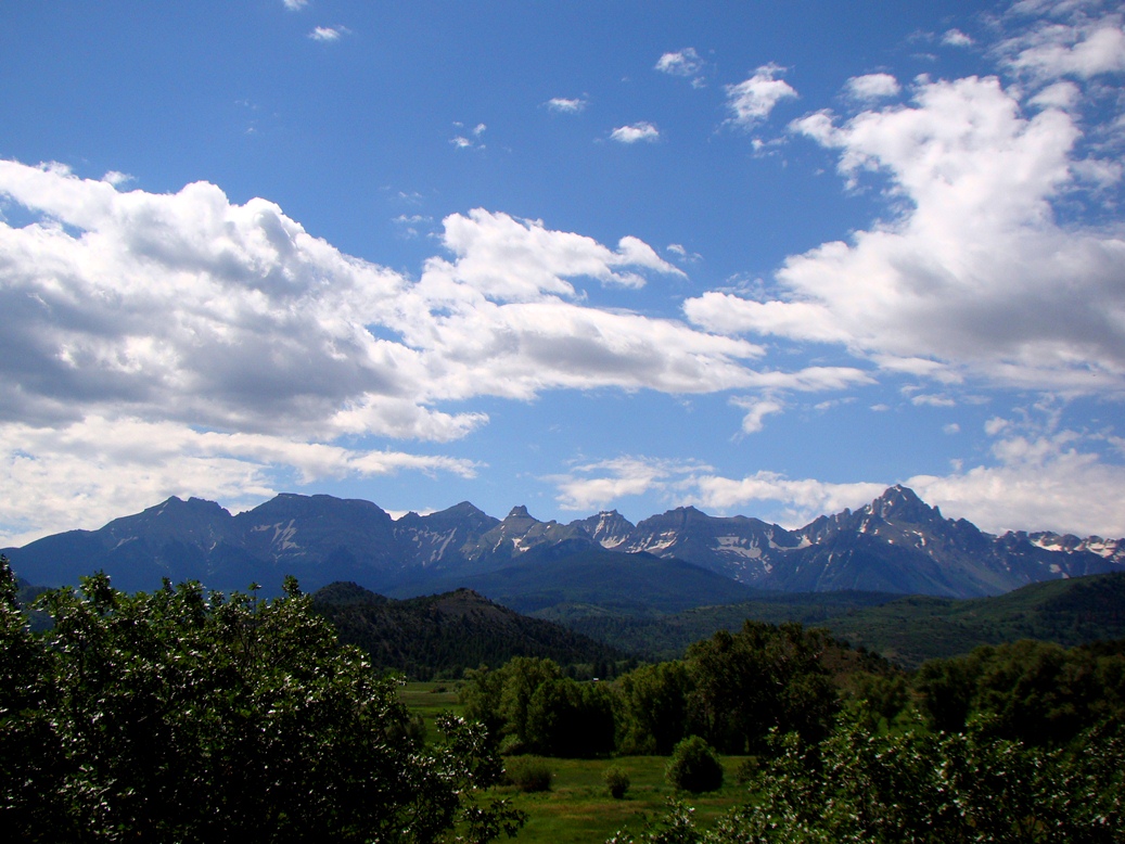
Because of a major wildfire in the drainage of the Animas River above Durango, we had to find another route over the mountains, so we headed instead to Lizard Head Pass (10,222 feet/3,116 meters), which divides the drainage of the Dolores and San Miguel Rivers. There was a beautiful profile of the high peaks from the summit. The brightly colored rocks above the tree line are volcanic, part of the rhyolite caldera eruptions that were taking place around 35-30 million years ago. Mineralization related to the volcanic activity resulted the emplacement of gold and silver deposits. The old mining towns like Ouray and Telluride are picturesque, but the pollution relating to the mining is a sad heritage.
Near the town of Ouray, one of the old mining camps, there is a difficult-to-see waterfall called Box Canyon Falls. The 200 foot high falls are practically hidden in a deep slot canyon, but the slopes above reveal a spectacular angular unconformity. The underlying vertical layers are more than a billion years old, but erosion planed off the rocks and in Devonian time almost 400 million years ago new sediments were draped over the older rocks. The uplift of the San Juan Mountains caused further erosion, exposing the unconformity that represents almost a billion years of missing history.
Black Canyon of the Gunnison is possibly the most bizarre canyon on the continent. It is a nearly vertical gorge that cuts through what is essentially the top of a mountain instead of having been carved through softer rocks that are exposed nearby. The Gunnison River was forced into the present channel by a series of lava flows that diverted the river from a "normal" course. Around 2-3 million years ago the landscape was uplifted, and the trapped river cut down through all the rock in its path, including the extremely hard gneiss and granite that make up the canyon walls in the park. It's not the deepest canyon in the country, but no other canyon combines the depth and steepness of Black Canyon. It is more than 2,000 feet deep in places, and in one place it is only 1,100 feet wide.
The Painted Wall (above) in Black Canyon is the highest sheer cliff in Colorado at 2,250 feet. The rocks exposed in the face of the cliff include 1.7 billion year old gneiss and schist with numerous intrusions and dikes of lighter colored granitic rock, including extremely coarse-grained pegmatite.
Late in the day we headed down one of the most spectacular roads in North America, Highway 128, which follows the Colorado River from near Interstate 70 to the outskirts of Moab, Utah. While mostly confined to a deep and narrow gorge of sandstone cliffs along the river, there is a moment when the canyon opens up and there is an awe-inspiring view of the Fisher Towers and the La Sal Mountains.

The La Sal Mountains are an anomaly in the generally horizonal landscapes of the Colorado Plateau. Between 28 and 25 million years ago, plumes of magma worked their way almost to the surface, intruding laterally between the sedimentary layers, and causing them to swell upwards like a series of blisters in the crust. The intrusions are called laccoliths. Exposed now by erosion, the igneous rocks reach elevations of almost 13,000 feet.
We arrived at our campsite in Arches National Park as the sun approached the western horizon. I don't think there is a more spectacular place in the country to roll out a sleeping bag. The view from the group camp extends for miles in every direction. There is also a beautiful arch, Skyline, visible from camp (below). The arch more than doubled in size in 1940 when a huge chunk of rock fell from the opening.

The landscapes in and around Arches and Canyonlands National Parks are almost beyond description. We spent two days in the area, and one of our stops was a rock art panel that is so delicate and fragile that I can't believe that it still exists 30 years after I first discovered it. Why? It's easily seen from the paved road leading into Canyonlands. But without signs and arrows pointing the way, people miss it. The first of the images are pictographs (below), those examples of rock art that were painted onto the sandstone. The ghostly figures and small hummingbirds are almost nightmarish in their imagery.
The other images are petroglyphs, the ones carved directly from the rocks. They depict some stylized bighorn sheep and other creatures. The panel has been somewhat damaged, possibly by natural erosion, but vandals have also done their evil work here.
Canyonlands National Park has many incredible vistas, but my favorite is the one that is framed by Mesa Arch (below). The arch is relatively small, but it frames the La Sal Mountains and pillars and cliffs of the Colorado River section of the park (the Green River forms meets the Colorado inside the park). Mesa is a popular short trail, and crowds are especially thick in the early morning when the sunrise can be photographed through the opening. You've no doubt seen an example on just about any nature-based calendar!

Pictures of Canyonlands are often mistaken for the Grand Canyon, but this section of the river includes only late Paleozoic rocks and thousands of feet of Mesozoic layers that are not seen at Grand Canyon. It is not as deep, but it is deeply colorful. It's hotter country in the summer, and there aren't many sources of water. Travel away from paved roads is more challenging than your "average" national park.
After we explored the Island in the Sky District of Canyonlands and Dead Horse Point State Park, we headed back to Arches for one of the greatest excursions on our entire trip, the hike to Delicate Arch for the sunset. The trail (a picture of which started this post) climbs 1.5 miles to an iconic overlook of the famous arch. I would love to say that the hike is an awesome desert wilderness trek where one can discover one's self in the isolation and serenity, but as author Edward Abbey feared in his 1968 book Desert Solitaire, the trail (and much of the rest of the park) has been taken over by industrial tourism. There is a large paved parking lot, and hundreds of people make the trek every evening.

Frame Arch view of Delicate Arch
The crowd at the top was rowdy, in large part because there are always selfish individuals and groups who insist on standing within the arch for selfies and group photos, spoiling the view for everyone else. I didn't have the heart to listen to the ruckus (I most certainly would have contributed, shouting at the jerks in the arch), so I headed instead to my favorite little arch in the park, Frame Arch. Frame is a small arch just above the trail only a few dozen yards from the Delicate Arch viewpoint. Most people pass it by in their race to get to more famous arch around the corner. What most of them don't realize is that Frame Arch has a great view of Delicate Arch, but also of the La Sal Mountains and Salt Wash. And I had the arch to myself for quite awhile even as hundreds of people were gathered just around the corner.
The La Sal Mountains and Salt Wash through Frame Arch
I had to think of my students though. There were a dozen of them who had hiked ahead of me, and they had to be worrying that their old overweight professor was passed out somewhere down the trail dying while they were enjoying the view. So I climbed down from the arch and back onto the trail and walked the last few yards to the overlook. I patiently waited while the jerks stood for their pictures in Delicate Arch and finally got a picture sans people as the sun settled into the horizon.

Our trip wasn't over. We had five more days and two more states to traverse. More favorite pictures soon!

Thursday, April 24, 2014

Where are the Ten Most Incredible Places You've Ever Stood? My Number 9: Frame Arch and the Delicate Arch Trail

It's the journey through the Ten Most Incredible Places I've Ever Stood! As I explained in the last post, the list is subjective, and everyone's list will be different. I'm pleased at the response of many of you already listing your most incredible spots in the comments, and on my accounts at Facebook and Google+. I'm looking forward to seeing more! My own list is not in any particular order, other than my choice for number one. Folks will perhaps not be surprised to see that I selected the picture above for my number 9; it's the cover photo from my Geotripper Images website where I've posted a lot of my geological pictures for use in educational/academic projects. It is a view of the La Sal Mountains through Frame Arch at the end of the Delicate Arch trail in Arches National Park.

In the years before PowerPoint, I started all of my geology classes with a set of slides (this was an ancient technology that involved "carousel trays", "slide projectors", and "film") to introduce the students to the world as it is revealed by geological processes. The first picture was always this stretch of trail just short of  Delicate Arch. I chose it because it symbolized so much about the wonders revealed in the incredible history of our planet.
The trail is cut into a formation called the Entrada Sandstone, a layer composed mostly of  windblown sandstone as well is silt and mud in some areas. It once was a system of sand dunes near a coastal delta and estuary during the Jurassic Period around 140-180 million years ago. The trail surface is a natural separation along the surface on one of the dunes, so by walking on this trail we are striding on the same surface that dinosaurs, ancient mammals, and arthropods walked on many millions of years ago. We know that these rocks were buried deeply by thousands of feet of overlying rock, but they were pushed upwards by vast salt domes rising from older formations below. The doming effect split the rocks into linear fins, and the arches developed from weathering and erosion at the base of fins.

At one viewpoint an observer can appreciate the variety of depositional environments that led to the formation of the colorful Entrada rocks, the vast amount of time that the rocks lay buried in the crust, the immensity of earth movements that brought the rocks back to the surface, and the intensity of erosional processes that shaped the rocks into what they are today. And one can walk on a surface that may very well have been a trackway for a dinosaur many eons ago.

But (like they say in late-night television ads), there's more! Although many people use Frame Arch to frame Delicate Arch, I chose to emphasize the La Sal Mountains instead (the top photo). The La Sals represent the role of magmas in earth processes. The mountains are composed of intrusive rock that reached close to the Earth's surface about 25 to 28 million years ago. Some may even have erupted out in volcanic eruptions, but the rest of the rock formed into mushroom shaped plutons called laccoliths. The dioritic rock proved more resistant to erosion than the surrounding shale and sandstone, so the peaks rise 6,000 to 7,000 feet above the plateau surface. The highest peaks in the La Sals reach nearly 13,000 feet above sea level.
It's a scenic, even iconic spot for photographers and park visitors, but what makes this one spot special to me? It's the unique experience of each visit. It's been my privilege to visit this spot perhaps a dozen times in the last 30 years and every time it has been an awe-inspiring journey. We usually head up the 1.5 mile trail in the late afternoon in order to catch the sunset on Delicate Arch. Quite often there is a raucous crowd, and some moron always feels a need to go stand under the arch for an inordinate period of time, prompting shouted complaints from the large group of photographers on the ridge top. Frame Arch becomes the special spot at that point because there is only myself and a few of my fellow travelers. We don't hear the chaos and mayhem at Delicate Arch, and we can just sit and appreciate the changing colors and deepening shadows.

Once or twice we've been doused with a summer rainstorm, and in one particular year we took shelter under the arch and gloried in the lightning and crashing thunder, and watched as the dry sandstone transformed into a series of waterfalls and white cascades. It was one of the most cherished moments of my life. We assumed that the storm would obscure the sunset, but as quickly as the storm hit, it dispersed and the sunshine broke through to highlight the La Sal Mountains in the far distance.


One more reason that this spot is on my incredible list is because of the ephemeral nature of Delicate Arch itself. It may not last my lifetime. The arch is only a foot and a half thick at one point, and there are valid fears that it could collapse in the natural order of events. Of course, humans may help it along; I've heard of at least one episode in which a man attacked the arch with an axe. Then again, it could last another thousand years. Who knows? In the meantime it is a magic place.

Once before I pass on I would like to see it in the snow.

Wednesday, November 28, 2012

The Abandoned Lands...A Journey Through the Colorado Plateau: A day in the canyonlands, a fiery end

So what happens in a single day of one's life? Somehow, today involved a medical appointment, brunch with Mrs. Geotripper, watching the rain fall (it's rare enough here to be a spectator sport), grading some papers, and teaching an evening class. Pretty busy I guess, and pretty mundane, but if I had one day to go in my life, this hasn't been the kind of day I would choose.

What would you choose? Where would you want to be, what would you want to do?

If I was ever given the choice, I suspect my final day would be something like the one I've been describing for the last four posts in the "Abandoned Lands" series. I would want to see as much of the most beautiful corners of the world as I could, and the landscape encompassed by Arches National Park, Canyonlands National Park, and Dead Horse Point State Park in east-central Utah just about fits the bill.
From a fiery sunrise, it progressed to a hike to see the largest arch in the world, and a look at some wonderful arches in the Windows Section of of the park to some incredible pictographs and petroglyphs in Nine-Mile Canyon (the pictures at this link are from an earlier trip), and some sweeping vistas at Canyonlands and Dead Horse Point. It was a long day, but there was one more act.

Most of the students elected to watch the sunset from a perch near Delicate Arch, but I'd done that a few times. Plus, the camp cook crew needed a ride back to the campsite, so I drove them up to the end of the road at Devils Garden Campground. And then I took off on a new trail I had never followed before. It was a short trail out to Broken Arch.
The trail followed several fissures in the fins east of the campground and then climbed across the barren slickrock to a ridgetop that offered a nice panorama to the north and west. A singular Juniper survived in a sandy crack along the ridge.
The trail then dropped through a deep fissure to a sage flat. The La Sal Mountains, massive laccolithic intrusions that exceed 12,000 feet in elevation were framed by the fins.
Truth be told, I had kind of wandered off from the campsite without telling anyone where I was, and I had no flashlight, so with the sun going down, I knew I had to turn around before it got too dark. The fins rose high against the darkening sky. I came over the ridgetop to the sight of one of the most glorious sunsets I had ever seen, and I've seen a great many of them. To call it a fiery sky carried kind of a double meaning because a wildfire had broken out in the distance, adding reds and browns to the yellows and oranges of the setting sun.
Yeah, this is the kind of day I would have if it were the last day of my life, and if I was surrounded by my friends and family (and on this trip I was, actually). But given an actual choice I would bargain for a few more days. There are still too many places I haven't seen yet.

Thursday, November 10, 2011

Vagabonding across the 39th Parallel - A Problem with Vagabonding: Yellow Line Fever

The San Juan Mountains of southwestern Colorado may be the second most beautiful mountain range in world (sorry Colorado, but the Sierra Nevada has my heart and soul!). We were on the homeward road of our long journey last July vagabonding across the 39th parallel, and after the previous day of exploration at Black Canyon of the Gunnison, we found ourselves encamped at a KOA in Ouray at the foot of the spectacular mountain range.

Our rules for the road were to not plan too many days ahead, seek out places we had never been to previously, and stop for pictures whenever the road demanded pictures. This road philosophy had worked out surprisingly well so far, but we were about to discover the limitations of our plan.

The previous evening should have clued us in; we drove up to the KOA, a very pleasant place I had camped at before, only to find that they were full. It was after 9:00 PM, and we really had nowhere else to go, so the proprietors allowed us to squeeze, literally, into a small space with the motorcycles. There were a lot of them, and the drunken conversations around us dragged on into the early hours of the morning. Sunrise always brings new hope, but this particular morning the sunrise was accompanied by the staccato roar of Harley Hogs.
So there we stood at the base of the San Juan Mountains, the stunningly gorgeous spires calling out to us, but our rules were our rules: see something new. I've been through the San Juans quite a few times, but I had never been on highways 50, 62, 145, 90, 46 and 191 to Moab, Utah, except for that last part on 191, so we set out to discover this new territory.

We had just crossed the Dallas Divide and were headed down the canyon when we discovered Yellow Line Fever. White line fever is that hypnotic state sometimes achieved by drivers who've been on the road too long. It usually involves trucks going too far, too fast, with disastrous results. Our yellow line fever was caused by driving waaay too slow, following a truck painting the yellow stripes on the highway along a narrow canyon that had no pull-outs for what seemed like miles. Our meandering vagabonding demeanour was evaporating fast. We had tried to avoid having a schedule, but we were fast falling behind that schedule that we didn't exactly have. There was a lot of barren countryside ahead of us.
In the afternoon we made our way into the long Paradox Valley, and the road stretched out ahead of us, and it was beautiful in its own way, but we were tired, and for once we wanted to just get somewhere. I didn't stop for many pictures, and in fact I was having trouble staying awake on the long straight stretches.
In the distance, the La Sal Mountains dominated the skyline. The peaks are exposures of laccolithic intrusions, essentially mushroom-shaped plutons of diorite and related igneous rocks. They are beautiful, but we drove a long time, and they hardly seemed any closer.
Some roads are lonely, and their beauty is related to their remoteness. Other roads give one a sense of a used up land. We passed village after village with boarded up windows and weathered signs. This was once uranium mining country, but the uranium boom ended decades ago and there aren't many jobs to keep the young people around. There were ranches here and there, but not much else.

Was it a bad day? No day is completely bad when you are on the road. It was a day a bit less spectacular than others, but we learned what there was to see in the blank spot on the map in the Utah-Colorado borderlands. There was a favorite moment: we discovered the town of Bedrock! We couldn't find Fred or Wilma or Dino, but there was the sign...
We reached Highway 191, and we were reminded why we were out here. Moab, Utah lies at the epicenter of some of the most glorious scenery on the planet. Our day ended on a high note...we were next to Arches National Park!

Wednesday, July 8, 2009

Fire Down Below II - a Geological History of the Colorado Plateau


Continuing a long-running adventure, we pick up the tale of the geology of my cherished corner of the United States, the Colorado Plateau....we've come through 2 billion years of the story, and are now only 20 million years from the end!

Volcanic activity had not been a prominent part of the geology of the Colorado Plateau for hundreds of millions of years, throughout Paleozoic and Mesozoic time, except for the volcanic ash that drifted in from elsewhere and ultimately provided much of the color of the Morrison and Chinle formations. That all changed in Cenozoic time. As outlined in yesterday's post, there was a vast outpouring of lava and tephra across much of the western United States around 30 to 20 million years ago, which resulted in the formation of numerous volcanic necks, calderas and the subject of today's post, laccoliths.

There are some real oddities in the landscapes that make up the Colorado Plateau, islands of rock with alpine snowfields and deep green forests that seem more like the Rocky Mountains than part of a desert. These strange out-of-place mountains include the La Sal Mountains (top photo), the Abajo Mountains, Navajo Mountain, the Henry Mountains (center photo), the Sleeping Ute Mountains (bottom photo), and a number of others. The highest, the La Sals, top out at over 12,000 feet. They are a beautiful addition to the landscape; imagine Delicate Arch in Arches National Park (top photo) without the dramatic backdrop of the La Sal Mountains in distance.

How can such mountains develop out of an otherwise flat landscape?

They aren't volcanoes, not in the sense that we normally think of them, but they are volcanic in origin. The mountains are made of a semi-coarse-grained igneous rock that has a number of names, but diorite will do for the moment. 'Coarse-grained' usually means the rock results from slow cooling of the magma miles underground, but the rocks forming the core of these mountains are sort of a hybrid, showing a fine enough texture that they were probably a few thousand feet below the surface, rather than several miles beneath the surface. G.K. Gilbert was studying exposures of these rocks in the Henry Mountains in the 1870's and he realized that although there were complexities, the rocks tended to squeeze between sedimentary layers, and to make room, they pushed the overlying layers upward into a domelike structure, much like a blister pushes the skin upwards. He called these igneous 'blisters' laccolites, and eventually they came to be known as laccoliths.

A simple laccolith, courtesy of http://geology.utah.gov/teacher/tc/tc0108.htm

Navajo Mountain appears to be an ideal example of a simple dome-style laccolith. It certainly looks the part. The more complex mountain ranges include multiple laccoliths at different levels, sometimes branching out in several directions. They often probably constituted the plumbing systems of volcanoes that developed on a surface many thousands of feet above, but have since been eroded away.