The photo above encompasses so much of what captivates me about the southwestern United States. A trail formed from a natural weakness in the rock providing access to an otherwise inaccessible cliff to who knows where? To be fair, hundreds of thousands of people know where the trail leads, but I like the mystery of the image. The thing is, many people DO follow this trail every year, but they may not appreciate the fact that the last time this surface was exposed to the atmosphere, it was 200 million years ago, and on the slip face of a coastal dune. Some of the irregularities highlighted by the shadows in the picture could literally be the preserved footsteps of dinosaurs, other reptiles, or amphibians.
I am slowly working on a short series of posts with my favorite images from our recently completed exploration of the Colorado Plateau and surrounding provinces. I took 1,400 photographs, so it's a bit difficult to choose between them! As we pick up the narrative, we are eight days into a fifteen day trip.
As seen in an earlier post, we'd already been to the Mojave National Preserve, Zion National Park, Grand Canyon National Park, Bear's Ears National Monument, and Mesa Verde National Park. As we left Mesa Verde, we needed to find a way over the San Juan Mountains, a major range within the Rocky Mountain chain.
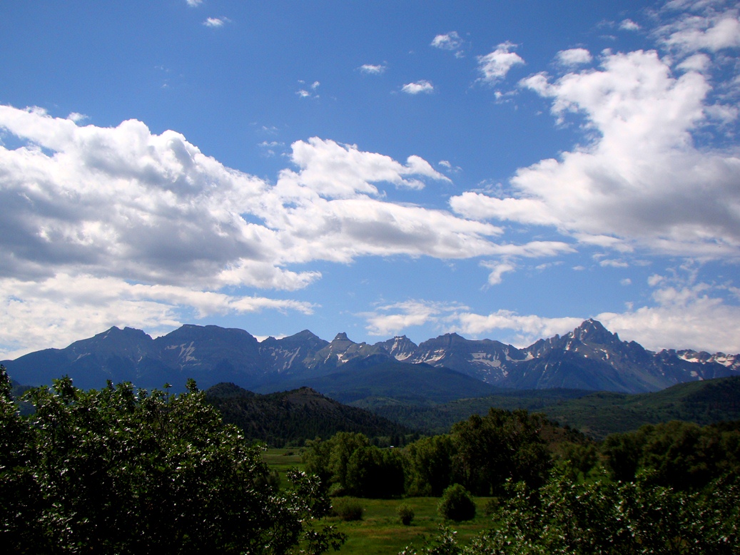
Because of a major wildfire in the drainage of the Animas River above Durango, we had to find another route over the mountains, so we headed instead to Lizard Head Pass (10,222 feet/3,116 meters), which divides the drainage of the Dolores and San Miguel Rivers. There was a beautiful profile of the high peaks from the summit. The brightly colored rocks above the tree line are volcanic, part of the rhyolite caldera eruptions that were taking place around 35-30 million years ago. Mineralization related to the volcanic activity resulted the emplacement of gold and silver deposits. The old mining towns like Ouray and Telluride are picturesque, but the pollution relating to the mining is a sad heritage.
Near the town of Ouray, one of the old mining camps, there is a difficult-to-see waterfall called Box Canyon Falls. The 200 foot high falls are practically hidden in a deep slot canyon, but the slopes above reveal a spectacular
angular unconformity. The underlying vertical layers are more than a billion years old, but erosion planed off the rocks and in Devonian time almost 400 million years ago new sediments were draped over the older rocks. The uplift of the San Juan Mountains caused further erosion, exposing the unconformity that represents almost a billion years of missing history.

Black Canyon of the Gunnison is possibly the most bizarre canyon on the continent. It is a nearly vertical gorge that cuts through what is essentially the top of a mountain instead of having been carved through softer rocks that are exposed nearby. The Gunnison River was forced into the present channel by a series of lava flows that diverted the river from a "normal" course. Around 2-3 million years ago the landscape was uplifted, and the trapped river cut down through all the rock in its path, including the extremely hard gneiss and granite that make up the canyon walls in the park. It's not the deepest canyon in the country, but no other canyon combines the depth and steepness of Black Canyon. It is more than 2,000 feet deep in places, and in one place it is only 1,100 feet wide.

The Painted Wall (above) in Black Canyon is the highest sheer cliff in Colorado at 2,250 feet. The rocks exposed in the face of the cliff include 1.7 billion year old gneiss and schist with numerous intrusions and dikes of lighter colored granitic rock, including extremely coarse-grained pegmatite.
Late in the day we headed down one of the most spectacular roads in North America, Highway 128, which follows the Colorado River from near Interstate 70 to the outskirts of Moab, Utah. While mostly confined to a deep and narrow gorge of sandstone cliffs along the river, there is a moment when the canyon opens up and there is an awe-inspiring view of the Fisher Towers and the La Sal Mountains.
The La Sal Mountains are an anomaly in the generally horizonal landscapes of the Colorado Plateau. Between 28 and 25 million years ago, plumes of magma worked their way almost to the surface, intruding laterally between the sedimentary layers, and causing them to swell upwards like a series of blisters in the crust. The intrusions are called laccoliths. Exposed now by erosion, the igneous rocks reach elevations of almost 13,000 feet.
We arrived at our campsite in Arches National Park as the sun approached the western horizon. I don't think there is a more spectacular place in the country to roll out a sleeping bag. The view from the group camp extends for miles in every direction. There is also a beautiful arch, Skyline, visible from camp (below). The arch more than doubled in size in 1940 when a huge chunk of rock fell from the opening.

The landscapes in and around Arches and Canyonlands National Parks are almost beyond description. We spent two days in the area, and one of our stops was a rock art panel that is so delicate and fragile that I can't believe that it still exists 30 years after I first discovered it. Why? It's easily seen from the paved road leading into Canyonlands. But without signs and arrows pointing the way, people miss it. The first of the images are pictographs (below), those examples of rock art that were painted onto the sandstone. The ghostly figures and small hummingbirds are almost nightmarish in their imagery.
The other images are petroglyphs, the ones carved directly from the rocks. They depict some stylized bighorn sheep and other creatures. The panel has been somewhat damaged, possibly by natural erosion, but vandals have also done their evil work here.
Canyonlands National Park has many incredible vistas, but my favorite is the one that is framed by Mesa Arch (below). The arch is relatively small, but it frames the La Sal Mountains and pillars and cliffs of the Colorado River section of the park (the Green River forms meets the Colorado inside the park). Mesa is a popular short trail, and crowds are especially thick in the early morning when the sunrise can be photographed through the opening. You've no doubt seen an example on just about any nature-based calendar!
Pictures of Canyonlands are often mistaken for the Grand Canyon, but this section of the river includes only late Paleozoic rocks and thousands of feet of Mesozoic layers that are not seen at Grand Canyon. It is not as deep, but it is deeply colorful. It's hotter country in the summer, and there aren't many sources of water. Travel away from paved roads is more challenging than your "average" national park.
After we explored the Island in the Sky District of Canyonlands and Dead Horse Point State Park, we headed back to Arches for one of the greatest excursions on our entire trip, the hike to Delicate Arch for the sunset. The trail (a picture of which started this post) climbs 1.5 miles to an iconic overlook of the famous arch. I would love to say that the hike is an awesome desert wilderness trek where one can discover one's self in the isolation and serenity, but as author Edward Abbey feared in his 1968 book
Desert Solitaire, the trail (and much of the rest of the park) has been taken over by industrial tourism. There is a large paved parking lot, and hundreds of people make the trek every evening.
 |
| Frame Arch view of Delicate Arch |
The crowd at the top was rowdy, in large part because there are always selfish individuals and groups who insist on standing within the arch for selfies and group photos, spoiling the view for everyone else. I didn't have the heart to listen to the ruckus (I most certainly would have contributed, shouting at the jerks in the arch), so I headed instead to my favorite little arch in the park, Frame Arch. Frame is a small arch just above the trail only a few dozen yards from the Delicate Arch viewpoint. Most people pass it by in their race to get to more famous arch around the corner. What most of them don't realize is that Frame Arch has a great view of Delicate Arch, but also of the La Sal Mountains and Salt Wash. And I had the arch to myself for quite awhile even as hundreds of people were gathered just around the corner.
 |
| The La Sal Mountains and Salt Wash through Frame Arch |
I had to think of my students though. There were a dozen of them who had hiked ahead of me, and they had to be worrying that their old overweight professor was passed out somewhere down the trail dying while they were enjoying the view. So I climbed down from the arch and back onto the trail and walked the last few yards to the overlook. I patiently waited while the jerks stood for their pictures in Delicate Arch and finally got a picture
sans people as the sun settled into the horizon.
Our trip wasn't over. We had five more days and two more states to traverse. More favorite pictures soon!