Showing posts with label Natural Bridge. Show all posts

Thursday, March 22, 2018

The Rise of the Turtles and a Flat Earth: Musings on Science and Death Valley

One of the ominous turtles rising from the crust in Death Valley
I've been dismayed to say the least at how gullible Americans have become, in so many ways. We could of course get mired in a discussion of politics, or charlatans in religion, but my real concern on this particular day is over the resurgence of flat-eartherism in current pop-culture. A couple of singers and basketball players made waves recently by looking towards the horizon, and deciding all on their own that the Earth must be flat because that's how it looks. All of that "stuff" about NASA and satellites and moon missions are, in their view, hoaxes.
Draw closer if you dare...

I imagine there are many reasons for this, but a large part of the problem has to do with a pushback against "authority" in society these days, with an increasing lack of trust in government and social institutions like the traditional media and religion. In a number of cases, the mistrust has been earned, but unfortunately science and scientific knowledge have ended up being lumped with the other "authorities" even though the concept of authority in science is different from the others. The authority of science is based on observation and research and has a systematic way to weed out false "facts" from objective truth (it's not perfect, of course, but the structure tends to be self-correcting over time).

Unfortunately, with the decline of science education at many levels of public and private education, the distinction has been lost in some quarters. As a result, science becomes another of the buffet of human ideas that can be believed or not believed as one wishes. The consequences will be (and indeed already are) tragic. We have a government, the only one in the world, that doesn't "believe" in climate change. It doesn't think health will suffer if we allow untested or poorly tested toxins into the environment, or if we allow increased air and water pollution. Science is taking a back seat to profit, and people will suffer and die for it. If the voting population is ignorant of the issues, and ignorant of how science works, the abuses will continue unabated.

This has led to an interesting exercise I like to do with my students. We introduce how the scientific method works (make observations, collect data, devise hypotheses, test the hypotheses, and if fully supported, designate a theory). Then we do a mind game where we place ourselves in our home here in California's Central Valley a few thousand years ago, with the knowledge and technology of the time. What would the shape of the Earth be from that point of view? There are different layers in the answers to such questions.

The first-order answer is "of course the Earth is flat". One merely needs to look around the exceedingly flat Central Valley to see that this is true. It is an explanation that works for everyone concerned and has no serious impact on their daily lives.

But there is a second-order observation to be made. A curious person might climb a local mountain and note that with the wider view that the mountain ranges in the far distance seem to disappear over the horizon (or they might see that ships disappear over the horizon at sea). The realization emerges that the world isn't as it seemed. It is dome-shaped! This new truth has implications. A flat earth offers no reasons for disasters such as earthquakes and floods such as those experienced by the inhabitants on the valley floor.

So a model is proposed to explain the observations (dome-shape, earthquakes, floods): it is suggested that the earth is actually...on the back of a gigantic turtle. When the dust clears, the analyses and arguments can begin. Turtles that we observe don't move very often, and the larger the turtle, the less often they seem to be active. A turtle the size of the earth might not move for months or years, explaining the lack of daily earthquakes. On the other hand, sometimes turtles can be seen submerging themselves in water, providing a handy explanation for occasional floods in our valley.

It might seem mildly outlandish, but the hypothesis is actually valid. If the earth actually was on the back of a turtle, the observed behavior of the planet would have a reasonable explanation.

I usually get a few giggles and chortles, but then I ask the class to prove that the earth is not on the back of a turtle. And things go a lot quieter. A few people will point out that there are pictures of the earth from space, but I respond with the fact that I've seen pictures of Tatooine (Star Wars), or Planetoid LV-426 (Alien) that were very convincing. And then they are at a loss. They haven't had the scientific background that gives them the skills to challenge oddball claims and frauds.

One night many years ago I had one of these great teaching moments. After our discussion, I had the class follow me outdoors, and we looked into the sky at the moon, which I knew was undergoing a lunar eclipse at that very moment. We could look into the sky, and see that the Earth was casting a circular shadow across the surface of the moon. No turtle legs or tails or heads anywhere.
Lunar eclipse of January 2018. No legs, no heads are apparent.

From there we can advance to a discussion of how Eratotosthenes calculated the size of the spherical earth 2,000 years ago, and how modern satellites can detect the flattening of the polar regions of the earth, making it more accurate, and defining the globe as an oblate spheroid. When we take into account the ocean basins and mountain ranges that deviate from a perfect spheroid, we arrive at last as the current description of the Earth: a geoid, an "earth-shaped" object.

In the end, the point of the exercise is not about the shape of the Earth, but about how science works: our observations and conclusions may change in time, but because of new information and evidence, each of our models is more accurate, and closer to the actual truth. We can even acknowledge that we still don't completely understand the geometry of the Earth, realizing that there might be additional dimensions of which we are not yet aware.

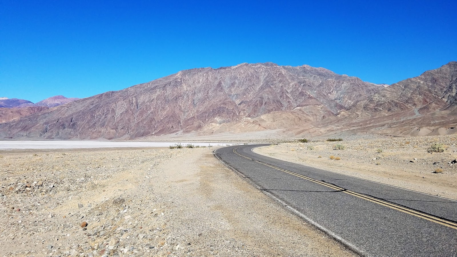
So what does that have to do with all of these pictures from Death Valley? I was very seriously going to try and make a pathetic joke that the Earth actually is made of turtle shells. A look at the top two pictures reveals the presence of some dome-like structures nearly unique to Death Valley that are actually called turtlebacks. So it is clear that the Earth is not on just one turtle. It is on top of a great many turtles, and as a result of crustal stretching and thinning, some of the turtles are breaking through the crust and entering into the upper world like marauding monsters. And there is a government conspiracy to keep these facts hidden from us...
You can access an exposure of the Badwater turtleback fault in Natural Bridge canyon. The hike is just a half mile or so.
But no, I'm not going to go there.

When these enigmatic structures were first studied in detail, they were thought to be like domes found elsewhere in the world, formed largely by compressional forces. That description, like the first order observation about the shape of the Earth sort of satisfied researchers as they worked on other regional problems, but further observations showed features inconsistent with compressional deformation. Most of the surfaces on the turtlebacks were sheared fault planes, not folded strata, and the other faults nearby were extensional ("normal") faults. As a general rule one doesn't expect to find contemporaneous faults showing oppositely oriented stresses.

Questions were raised and researchers began to doubt their original assumptions, and a new model of turtleback formation was proposed that involved extensional forces. The low-angle normal faults associated with the turtlebacks were soon being called detachment faults, and the dome-like systems of ancient metamorphic rocks were termed metamorphic core complexes. These were a new kind of fault, previously unrecognized and undescribed. Their recognition opened up new avenues of research, and new mysteries. A complete analysis is far more than can be accomplished in a blog piece like this, but I can direct you to a nice synthesis of current research on turtlebacks at this link.
The fault surface runs diagonally across the upper part of the photo.
Unlike politics or religion, where belief and opinion are the driving forces, science thrives on observation, analysis, and shared effort towards discerning the best possible explanations for a given phenomenon. One doesn't "believe" in science, and one can never assume that a given answer is the ultimate truth. This can be a difficult concept for many people, and is one of the main reasons that the educational system needs to maintain science programs as a high priority.
The fault runs roughly across the middle of the picture. This is in Natural Bridge Canyon.
On the other hand, maybe the flat-earthers are right, and the Apollo lunar missions never happened, and the edge of the world is a 150 foot high wall of ice guarded by NASA henchmen. And there are zombie dragons on the other side preparing to invade our planet...winter is coming. If you wish to believe it, it must be so.

Wednesday, September 23, 2015

Summer Ramblings: The Second Largest Natural Bridge in the United States

It doesn't look so big...yet
As we drift into the last day of Summer (and it's certainly holding on around here, 100 degrees a day ago), I started looking over some of my adventures. There was our Vagabonding on Dangerous Ground in the Pacific Northwest, of course, but I also spent around four weeks exploring the Southwest, and saw incredible things and places. One of those places was Natural Bridges National Monument in Utah, and one of the things was my first hike to the second largest bridge in the United States (and probably the 7th or 10th largest in the world, depending on the strict difference between "natural bridge" and "arch"). Rainbow Bridge in Arizona is the only one that is larger. Number two is in the picture above...can you see it? It doesn't look all that big, does it?
It's called Sipapu Bridge, and it is one of three spectacular bridges in the monument. How big is it? A sense of scale is everything here. Zooming in a bit, one can notice some trees growing in the opening beneath the bridge. 
It's best to see it up close. A trail, said to be 0.6 miles long (I'm skeptical; it felt longer, especially coming back up), climbs down the cliffs to the canyon bottom near the bridge.
The pathway isn't a gentle slope. There are stairways, and ladders are used to surmount some of the short cliffs. Acrophobic people need not apply.
Midway down the canyon, some Ancestral Puebloan ruins provide a brief distraction. The small room above was probably a granary where seeds were stored. The ledge with the ruin offers a nice view of the bridge if you don't feel like going farther down (the bridge has gotten LOTS bigger, and the trail looks MUCH steeper!). I sometimes think the Pueblo people had a nice sense of location.

Those trees we saw under the bridge earlier? It's becoming apparent that we were looking at large mature Cottonwood trees. This opening is huge.
The trail winds down to the base of the bridge, and the span has become otherworldly. Although precise measurements differ a little, the official height of the opening is 220 feet (67 meters), and the width is 268 feet (82 meters). The width at the narrowest point on the bridge is 31 feet (9.5 meters). I'd never seen anything quite like it.
Natural bridges and arches are similar in ultimate appearance because openings in rock are subject to the same physical forces, but the origins of each are different. Bridges form from the direct effect of water erosion as a stream impinges against a narrow ridge where a river loops completely around (meander necks). Arches can result from the erosion and exposure of underground caverns, or from the undercutting of a narrow "fin" or wall of sandstone.
Source: Wikipedia

Sipapu Bridge to me was stunning. I've been to Natural Bridges many times in the past, but we've always taken the shorter trail to the very scenic, but much smaller, Owachomo Bridge (span 180 feet /55 meters, with a height of 106 feet/32 meters). This bridge was something else entirely. So was the hike out, a climb of 600 feet in just over a half mile. It was worth every step!


Saturday, June 28, 2014

The Superlative Land of Strange Standing Stones (Part III): Bryce Canyon National Park

One of the mysteries of the origin of the Grand Canyon involves the fact that early rivers flowed in the opposite direction of the Colorado River that exists today. Some of those early rivers ended in lakes that covered hundreds or thousands of square miles, and the deposits from those lakes form some of the most vividly colored rocks on the Colorado Plateau. And it's not just the color.. Erosion has sculpted the freshwater limestone of the Claron Formation into one of the craziest landscapes in North America.

Welcome to Bryce Canyon National Park, part III of our tour through the Land of Strange Standing Stones. In the first entry, we were checking out strange erosional forms left after groundwater moved through crushed rocks on the Cockscomb Monocline along Cottonwood Wash Road. In the second, we explored the strange sedimentary pipes of Kodachrome Basin State Park. We've now moved a few miles west onto the Paunsaugunt Plateau, one of the faulted mesas in the High Plateaus province of the Colorado Plateau. Headward erosion along the edge of the plateau has produced the bizarre landscape of Bryce "Canyon" (there is no actual canyon; the park is instead a series of erosional amphitheaters).
Natural joints and fractures in the limestone are exploited by water and ice, producing the pillars of stone called hoodoos. The rate of headward erosion is rapid, amounting to feet per century. Many places in the world erode this way, but few if any display the sheer number of fins, spires and hoodoos. There are tens of thousands of them in the park.

Sometimes people on a strict schedule visit the park, go to a single viewpoint and say "okay, hoodoos and Bryce Canyon checked off the life list", and rush on to the next park. One can miss some pretty incredible things by doing so. For one, the tour buses rarely go past Inspiration or Bryce Points. The views are spectacular at the main tourist parking lots, but the main park road goes fourteen miles farther, past nearly a dozen other viewpoints.
View north from Rainbow Point

Rainbow Point, for instance, is the highest viewpoint in the park (at 9155 feet, it is a thousand feet higher than the more popular viewpoints). From it and adjacent Yovimpa Point, one has an incredible view extending from the Wasatch Front to the north, Navajo Mountain to the east, and the North Rim of the Grand Canyon to the south (part of the view from Rainbow is seen above, and Yovimpa Point is below).
View southeast from Yovimpa Point, towards Navajo Mountain and the north rim of Grand Canyon
Likewise, Natural Bridge is an incredible 85 foot arch that is missed by many park visitors who don't venture beyond the busier parking lots. Every time I mention the feature I feel compelled to point out that natural bridges usually have watercourses of some kind. This one is best described as an arch.


And then there is the fact that every viewpoint at Bryce Canyon is on the rim, which means that every tourist who visits only the viewpoints is an outsider looking in. There is nothing quite like walking among the towering rocks and seeing them from below. I didn't walk below the rim on this particular trip, but I encourage you to check out my post from a previous trip, when I walked the Navajo Loop through Wall Street Canyon. It includes some of what I think are my best ever pictures from Bryce Canyon.
There are also the animals. I caught a nice Say's Phoebe at Natural Bridge (above), and we saw a small herd of Pronghorn Antelope in the woods and meadows back of the rim.
There is a colony of Utah Prairie Dogs next to the park road, and I've had no luck catching a picture of any of them for years.

We didn't have any such adventures on our latest trip, but I must say there is nothing quite like experiencing the summer monsoons of Bryce Canyon. In July and August, moisture-laden air moves north out of the Gulf of Mexico, and sweeps up against the plateau margins, producing spectacular thunderstorms and flashfloods. One of our family memories involved a terrifying lightning storm and cloudburst that produced a lake in our tent, and a six foot wide river below our campsite just a few hundred feet from the rim.

Bryce Canyon is worth a second look if you've ever rushed through in the past, and if you've never seen it in person, make sure to make the time to really explore it! Pictures just don't do it justice.

Thursday, June 13, 2013

A Tale of Two Arches, But Not in Arches

Travelers in the southwest might get the idea that arches can only be seen in Arches National Park in Utah. It's true that Arches National Park has the largest concentration of arches in the world, and the world's longest arch is found there, but arches have formed all over the Colorado Plateau. I saw two notable examples last week, and they can be seen in today's post.
Grand Staircase-Escalante National Monument has a rather spectacular version of one in Grosvenor Arch, about eight miles east of Kodachrome Basin State Park. The cliff is composed of Henrieville Sandstone (Jurassic in age), with a capstone of Dakota Sandstone from the Cretaceous Period.
It used to be called Butler Arch, but an expedition from the National Geographic came through the area in 1949, and they pulled strings to rename it after their boss. The biggest of the two arches is about 152 feet high, and 100 feet wide.

We heard an ungodly screeching all around us while at the arch, and it didn't take long to find the noisemaker: a bunch of cicadas. They look like horrifying beasts of Hades, but are essentially harmless.
Driving west from Grosvenor, we passed a nice viewpoint of Wiggler Wash, where the creek cuts through a fold, exposing the Entrada Sandstone and Henrieville Sandstone. The pink cliffs of the Aquarius Plateau can be seen in the far distance.
This was a tale of two arches, but I actually didn't mean the double arch of Grosvenor. The next morning we were at Bryce Canyon National Park, another place where arches form readily. One of them can be seen from a pullout in the southern part of the park. It's called Natural Bridge, but as the signs and irritated geologists will tell you, bridges span creeks, while arches form by other means. But it's pretty neat in any case.

My posting will be very spotty over the next two weeks. I had so much fun on my one week exploration of Grand Canyon, Bryce and Zion that I am headed back out there again, this time with two dozen students. We're making a huge loop through the plateau country, with no wi-fi motels, and rare access of any kind. I might actually have to breath the air, hike around for entertainment, and gaze at stars at night. I'll try to maintain a positive attitude!