Showing posts with label Grand Teton National Park. Show all posts

Friday, October 5, 2012

Accretionary Wedge 50: Bad Karma or the Giant Spaghetti Monster? Microburst at Grand Tetons

Evelyn Mervine at Georneys is the host of this month's Accretionary Wedge, and the topic is a delightful one: Share a fun moment from geology field camp or a geology field trip. You can share a story, a picture, a song, a slogan, a page from your field notebook– anything you like! Thanks loads, Evelyn...how to choose from 30 years of geological journeys??? If you have followed my blog at all, you know it is mostly stories from the road. So how to choose? I finally settled on the story that convinced me that the Giant Spaghetti Monster must really exist, or at least some level of karma...
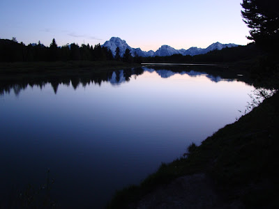
It was a while back, in the 1990s. We were on our way to Montana to assist at a dino-dig at the original discovery site of the Velociraptor cousin Deinonychus. Excitement was high, as this took place right after Jurassic Park premiered, and we were working at one of the excavations directed by Jack Horner. It was a long drive, and we stopped for a night at Grand Tetons National Park.

What happened that particular evening became one of our department legends. One our students had a knack for fomenting trouble with the powers-that-be in the Universe. On various previous trips he had speculated about what it would be like to get stung by a scorpion, and within a day, he had been (unwillingly) stung by a scorpion. At a stop, he asked if we would see any rattlesnakes. He stepped on one moments later. There was a karma that hung about Craig like a hangman's noose.

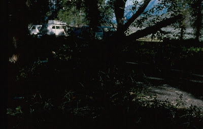
There was a discussion that evening at Grand Tetons in the twilight about whether we would experience any bad weather on our journey. The skies were clear that night with just a few puffy clouds about. For some reason, Craig looked towards the heavens, raised a rock hammer towards the sky, and said "I dare the gods to make it rain!". I'm not kidding about what followed. Within ten minutes of his brash statement, our campground was enveloped in a violent storm, our vision obscured by thick blowing dust, and high winds were knocking down old cottonwood trees all around us. Fifteen minutes later the winds died, the dust cleared, and the camp was a shambles. Tents were ripped apart, and branches were down all over our camp. Our vans were undamaged, but a tree had crushed a van in the other part of the campground (people were in it, but were unhurt). We thought we had been hit by a tornado, but more likely it was a microburst from a storm that approached us unseen from the east.

Needless to say, Craig spent much of the rest of the trip muzzled....but this is not the only Craig story. The other involved rattlesnakes, deer, and a lost student. If you are interested, it can be found here....
Tuesday, August 9, 2011

A Convergence of Wonders: A Compilation

The trip I called the Convergence of Wonders was a combined geology and archaeology course that we conducted on June 15-30, 2011, in which we explored the Pacific Northwest and Northern Rocky Mountains. Our students and volunteers traveled more than 4,500 miles through regions that have been influenced by convergence along the Cascadia and related subduction zones, as well as a hot spot and continental divergence. Each day revealed stunning geological features and insights into the human occupation of the region over the last 13,000 years or more. This is a compilation of all of the blog entries I posted about the trip.

"Journeys in the Pacific Northwest" was the introductory post about the series, and provided some background about why we did the trip we did, and what our goals were. 


"Journeys in the Pacific Northwest, Day 1" was the story of the trip from home to our first camp at Lava Beds National Monument on the night of the full moon. En route, we explored the flanks of Mt. Shasta, the largest stratovolcano in the Cascades, and found out that a record snowpack and late spring was going to be a problem on this trip.
"Day 2, Lava Beds and Newberry Caldera" includes our exploration of Lava Beds National Monument, including the extensive lava tube system, an incredible panel of petroglyphs, and the site of the last war between the federal government and Native Americans in California. Late in the day, we visited an obsidian dome in Newberry caldera.
"Day 3, Crossing the Subduction Zone" chronicled our passage across the Cascades to the Washington coast at the mouth of the Columbia River at Cape Disappointment State Park. Smith Rock State Park in Oregon was an incredibly scenic view into the heart of a rhyolite caldera eruption, and our day ended looking pillow basalts from the floor of the Pacific Ocean floor. In between, we checked out an excavation taking place at Fort Vancouver.
"Day 4: Cape Disappointment and Real Disappointments" was the story of weather-related disappointments. The skies opened up throughout the day, including along the flanks of Mt. St. Helens, which was to be the centerpiece of our exploration. The mountain remained invisible in the clouds. The sun emerged, of course, but not until we were far beyond the crest of the Cascades and almost to our camp in Yakima.
"Day 5: In the Land of the Great Flood" was a narrative of our passage across the wastelands produced by a series of catastrophic floods that defy human imagination. At Dry Falls, we looked at canyons (the coulees) that were carved in a few days or weeks of remarkable "river" flows hundreds of feet deep. We also had a chance to see the Wenas Creek Mammoth at Central Washington University.
"Day 6: In the Land of the Great Draining" was an exploration of the lands where the floodwaters originated: glacial Lake Missoula. We traversed a barren valley (the Camas Prairie) where ripplemarks thirty feet high convinced many geologists of the occurrence of the Spokane Floods. We arrived in beautiful Glacier National Park at the end of the day, and were greeted with an incredible rainbow.
"Day 7: Of Time and Pressure in Glacier National Park" found us at the Canadian border where we started an exploration of Glacier National Park, at least the parts that were not still snowbound. We checked out the Lewis Overthrust, and examined the Proterozoic sedimentary rocks that make up much of the park.
"Day 8: Of Time, Pressure, and the Plain Truth" found us out on the Great Plains east of Glacier. We toured the Museum of the Plains Indians in Browning, and worked our way past numerous thrust sheets in Sun Canyon, where convergence pushed numerous fault slices over one another. We also checked out some exhibits on some of the most famous discoveries concerning dinosaurs at Choteau, Montana.
"Day 9: Into the Depths of the Crust, and of Time" discusses one of the most spectacular roads in America, the Beartooth Highway from Red Lodge to Yellowstone National Park. We also checked out the Stillwater Mine, where platinum and other rare minerals are produced. The outcrops we were traversing including some of the most ancient rocks on the continent.
"Day 10: Explorations of a Real Hot Spot" was just that...a tour of Yellowstone National Park, one of the crown jewels of the National Park System. We explored Yellowstone Falls, the Grand Canyon of the Yellowstone, Mammoth Hot Springs, and Norris Geyser Basin. The highlight for many of us was the witnessing of a wolf competing with a raven at a kill site.
"Day 11: The Orange Steam is OK, but the Blue Stuff Will Kill You" was a further exploration of Yellowstone, with visits to Grand Prismatic Hot Spring, and the famous geysers in Upper Basin (yeah, Old Faithful was spouting off, but I was watching Beehive). We ended the day in Grand Teton National Park.
"Day 12: A Richness of Geological Drama at Grand Teton (and Pelicans)" was a beautiful day of exploration in the Grand Tetons. We also checked out the Gros Ventre Slide, one of the most famous slope failures in the United States.
"Day 13: Hidden Treasures and Hazards on the Road in Western Wyoming" saw us beginning the long journey home. We checked out the Game Creek Archaeological Site and Fossil Butte National Monument, and saw a lot of sagebrush as we made our way south into Utah...
"Day 14: Treasures Discovered and Lost in Nine Mile Canyon" chronicles an expedition through seventy-mile long Nine Mile Canyon, a showcase of Fremont Culture artwork and archaeological sites. The canyon is also a site of controversy, as heavy industry is mining natural gas in the area, with profound effects in the canyon itself. Later in the day, we saw the Dinosaur Museum in Price, and ended the day searching for Topaz crystals in the western Utah desert.
"Day 15: We Go Underground in Great Basin" saw us making a 500 mile journey across the Basin and Range Province, with a stop at Great Basin National Park for a tour of Lehman Cave, and a stop at Garnet Hill, for, eh, garnets. A motorcycle accident caused us to arrive in a spooky camp at 11:00 PM.
"Day 16: Our Home Mountains, Giant Swimming Reptiles, and a Bunny" was our last day on the road. We checked out the bizarre Mesozoic creatures at Berlin-Ichthyosaur State Park in Nevada, Mono Lake in eastern California, and Yosemite National Park in our backyard before arriving at the end our journey.

Monday, August 1, 2011

A Convergence of Wonders, Day 13: Hidden Treasures and Hazards on the Road in Western Wyoming

June 27, Day 13 of our trip through a Convergence of Wonders in the Pacific Northwest and Northern Rocky Mountains, dawned bright and clear as we set out on the long road home, still three more days away. The day began with an absolutely stunning view of the crest of the Grand Tetons, which just begged for a panorama shot on my wife's camera (click on the photo above for the full effect). These peaks are composed of exceedingly ancient metamorphic rocks of the deep crust that have been lifted miles into the sky. The valley floor on which we stood contained thousands of feet of sediment washed from the mountains. The faults responsible for these incredible mountains are undoubtedly still active, which brings us to the theme of the day, if there is any such thing, the idea of geologic hazards. Another thing I sort of realized on reflection was the hidden nature of some of the geology we would be seeing today. We were leaving the really famous national parks behind, and exploring some lesser known parts of the American West.
We would be driving from Grand Tetons to the town of Vernal in northern Utah. Before leaving the park, we took a brief look at the river terraces along the Snake, and the glacial moraines forming the irregular ridge beyond. The Ice Age glaciers didn't reach this part of the valley floor, but the glacial meltwater certainly had. During the glacial periods, the rivers ran muddy and filled in the valley floor with sand, silt and clay. During the warmer interglacial periods, the rivers ran clear and fast, and eroded into the older deposits, forming the flat terraces. The multiple terraces are evidence of multiple glaciations.
Hidden treasures? We had heard that an archaeological dig was going on adjacent to the highway near Hoback. We paid a visit and were graciously given a tour of the Game Creek Archaeological Dig. A highway widening project had uncovered artifacts, and a multi-year excavation revealed a stratified site that encompassed some 10,000 years of human occupation at this location.

The pits were carefully measured, excavated and recorded. This is why I never would have made it as an archaeologist (or a paleontologist, for that matter). I'm too hooked on the moment of discovery, and have not the patience to do the hard work that leads to discovery.
Discoveries happen, though, and we had a close look at a spear point that had been found in the bottom of one of the deepest excavations.
Geologic Hazards? Besides the obvious threat of earthquakes in Jackson Hole and Grand Tetons, we noticed that keeping the road clear in this very wet year was a challenge as well. The weakly consolidated siltstones and mudstones were failing in many places, producing slumps and slides that had damaged the highway in the weeks before our arrival.
Passing through Star Valley, we noticed more evidence of active faulting in the form of triangular facets. As the mountains rise and the valley sink along fault lines, erosion shapes the fault scarps into triangle-shaped slopes.
As if to put an exclamation point on the whole theme of hazards, the Bear River was flooding the valley floor near Cokeville...
The landscape was changing rapidly as we drove south and east. The forests, high mountains, and sharp jagged peaks had been replaced by barren slopes of siltstone and mudstone. We were driving through exposures of the early Cenozoic Green River Formation, which was deposited in vast freshwater lakes that covered much of Colorado, Wyoming and Utah. The sediments are thousands of feet thick and contain huge amounts of hydrocarbons in various forms.
One of the more astounding treasures hidden in the rocks are fossils of the creatures that lived in and around the lakes. Millions of them have been found, and include species of fish, rays, crocodiles, insects, amphibians, birds and mammals. Several of the most productive fossil quarries have been preserved as Fossil Butte National Monument. We made a brief stop to look around.
The park had a nice new addition to their exhibits: a time line that extended for more than a mile (I think) illustrating significant moments in the geologic history of the planet. On the time line, the entire history of human culture barely registered at the very end, essentially the thickness of the paint on the end of the railing. They have a well-done display of many of the fossil species inside the visitor center (no collecting in the park of course; one can pay to dig fossils at several places nearby outside the park boundaries). The strange creature below is a stingray.
We still had quite a few miles to go. We would like to have spent more time along the spectacular cliffs of Flaming Gorge, where an entire section of sediments spanning Proterozoic, Paleozoic and Mesozoic time can be investigated.
We crossed the crest of the High Uintas, driving over a 25,000 foot thick section of sandstones and conglomerates that were laid down around a billion years ago in a fault trough. On the south side of the mountains, we passed through the Paleozoic and Mesozoic rocks again, and in the last shadows of sunset, we arrived at our campsite in Vernal, Utah. It was a long travel day, but we were now situated for an early start on one of our great adventures of the trip, Nine-Mile Canyon. It's not nine miles long, and none of us had ever been there before...
Look for the story in our next post!

Friday, July 29, 2011

A Convergence of Wonders, Day 12: A Richness of Geologic Drama at the Grand Tetons (and Pelicans!)

Our continuing journey through the Pacific Northwest and the Northern Rocky Mountains, the Convergence of Wonders, reached the twelfth day. We woke up in our Colter Bay campsite and set out to explore Grand Teton National Park.

The Tetons are in the Rocky Mountains, but they are not of the Rocky Mountains. The rocks are right, but not the origin of the peaks themselves. Most of the mountains we visited since leaving Washington were the direct result of convergent tectonics, that is, the result of subduction along the west coast of the North American Continent. The forces involved are usually compressional in nature, but the Tetons are the direct opposite. They form because the earth's crust is extending; it is being ripped apart.

But first, the pelicans! We stopped at Jackson Lake Dam to have a look around (the picture above was taken from on top of the dam), and could see dozens of white things floating in the rushing waters below the dam. A zoom shot revealed the objects to be American White Pelicans. I suppose they get good fish at the outlet.
We then drove to the summit of Signal Mountain to get one of the best views of the Grand Teton region. The Tetons have an interesting glacial history. Where Yellowstone was covered by an ice cap, most of the Tetons were dominated by alpine glaciers confined to mountain canyons. Some of the Yellowstone ice cap flowed to the south around the base of Signal Mountain, so the most notable features at our feet included the Potholes, a group of kettles and kettle lakes left behind by stagnant masses of ice (below).
We had a stunning view of the Teton crest and Jackson Lake from the peak of Signal Mountain (although I think some of the students missed the view as they tried to get a signal on their cellphones).
We then headed out of the park briefly and crossed the swollen Snake River. All the rivers we saw this trip were very close to flood stage, and even now in late July they apparently are still running high and cold.
Our destination was a little east of the park in the canyon of the Gros Ventre River. Most visitors to Grand Teton National Park never go out this way, and they miss one of the remarkable geologic sights in Wyoming: the Gros Ventre Slide.

A series of Paleozoic sedimentary rocks are found in the area; the layers sloped north into the valley at about 20 degrees. Tensleep sandstone was exposed at the surface, and was underlain by much weaker shale and mudstone. Weeks of heavy rain had destabilized the rocks, and on June 23rd, 1925, a large mass nearly a mile long and 2,000 feet wide gave way and slid into the valley. It had a volume of around 50 million cubic yards.
The avalanche produced a debris dam more than 200 feet high. The Gros Ventre River began filling the new "reservoir". It was two years before the dam filled, and when the water breached the top of the dam on May 17th, 1925, the weakness of making dams out of loose debris became immediately apparent: the rushing waters tore away at the top of the dam, and much of the lake emptied into the riverbed below. Several miles downstream, the town of Kelly lay unprotected. The resulting flood killed six people and the town was washed away.
 A ghostly forest of dead trees can be seen standing in the middle of the lake.
We noticed a ranch road that crossed the debris field, so we checked it out. Huge boulders of sandstone were scattered all about. It was an eerie sight. The flooded river was pouring through the outlet of the dam, and we remarked how crazy it would be to go rafting on such a raging river. Then, of course, two kayakers made their way under the bridge and headed downstream. We sort of kept an eye on them for a few miles downstream. They apparently survived...
The road back into the park provided spectacular views of the mountain crest.
Flowers were blooming all across the Antelope Flats area. The fault line that produced the mountains has moved the mountains upwards to heights of 13,000+ feet, while the valley floor has at least 10,000 feet of sediment filling it in. The fault has moved some five miles in the vertical sense!

Our next destination was Jenny Lake, which formed behind the terminal moraines of glaciers flowing out from the mountains. It is a beautiful (and very popular) starting point for a number of hikes. I gave the students one of their very precious and rare half-days to hike or do showers/laundry (or, hopefully all of the above).


I headed back to camp, but had to stop and photograph a beautiful Western Tanager hanging out in a tree along the trail. The males are obviously very colorful!
The moraine that dammed Jenny Lake was also covered with beautiful flowers.
After dinner, we went on a moose-hunt in the twilight, and saw a moose at great distance, but more impressive was the serene sunset reflected on the Oxbow Bend of the Snake River. The next day we would be starting one of the long driving days making our way back home. There were just four days left on our journey. The story will continue in the next post.