 |
| 2002 |
I've been leading geology field studies trips to lots of places in the American West for 30 years and started to take digital pictures in 2001. I sometimes struggle to find new things to photograph when I visit a place for the 30th time, but in some cases it is not a problem. There are geologic changes that happen on a yearly basis, and with twenty years of photos (minus two due to Covid), the changes become obvious.
This is a continuing update from a post in 2013, and I'll probably continue updating for the foreseeable future.
 |
| 2004 |
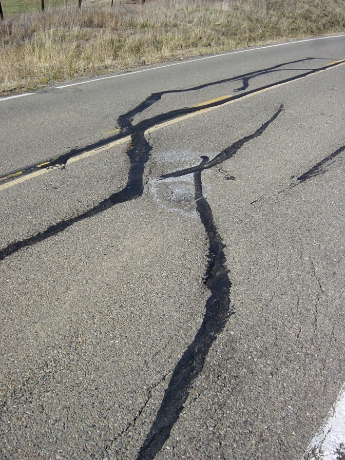
Highway 25 in the California Coast Ranges connects the town of Hollister with the access road to Pinnacles National Park (formerly Pinnacles National Monument). Along the way the highway crosses the San Andreas fault in a section where the fault creeps an inch or so each year (36°35'54.27"N, 121°11'40.19"W). Most years we've stopped to have a look at the effect the movement has on the pavement. In 2002 and 2004, the damage was obvious.
 |
| 2008 |
By 2008 someone had patched the road, and no fault motion was evident.
 |
| 2009 |
Little damage was evident in 2009 either. But by 2010 cracks had begun to appear as the fault stressed the pavement.
 |
| 2010 |
The fact that the fault creeps in this region is a good thing. It means that stress is not building along the fault surface, but instead is being released gradually. The sections of the fault to the north and south of the creeping section are locked by friction, and are building up the ominous stress that will eventually produce quakes with magnitudes in the range of 7.5 to 8.0. The quakes are coming and we need to be as prepared as possible.
 |
| 2012 |
By 2012, the road had been completely repaved, and yet the shearing was already evident.
 |
| 2013 |
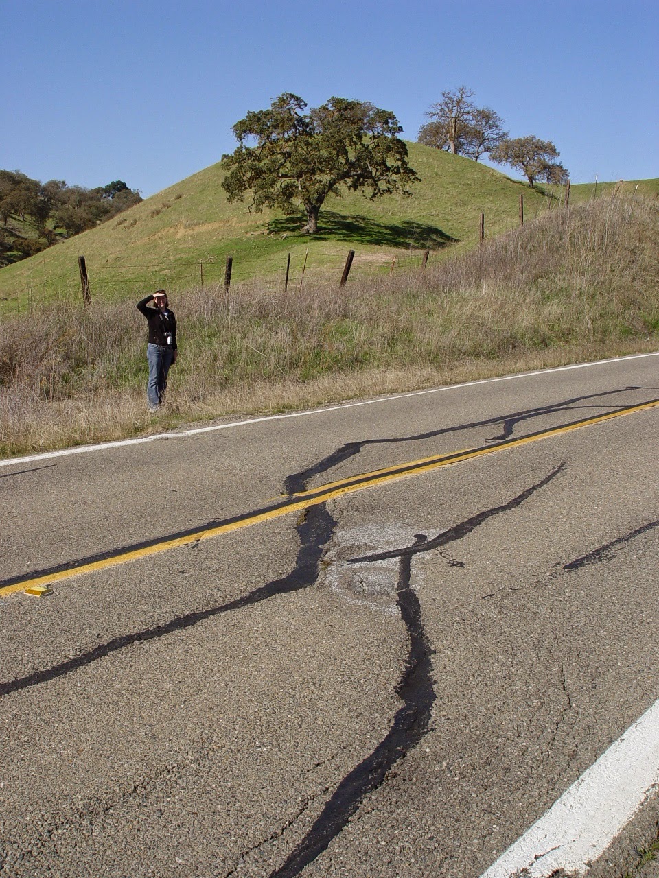
It became even more pronounced by 2013 and in 2014. Just by chance, the person working as a scale was the same individual as in 2004.
 |
| 2014 |
In 2015 the fractures were moderately larger. They'll need to start thinking of road repairs before long.
 |
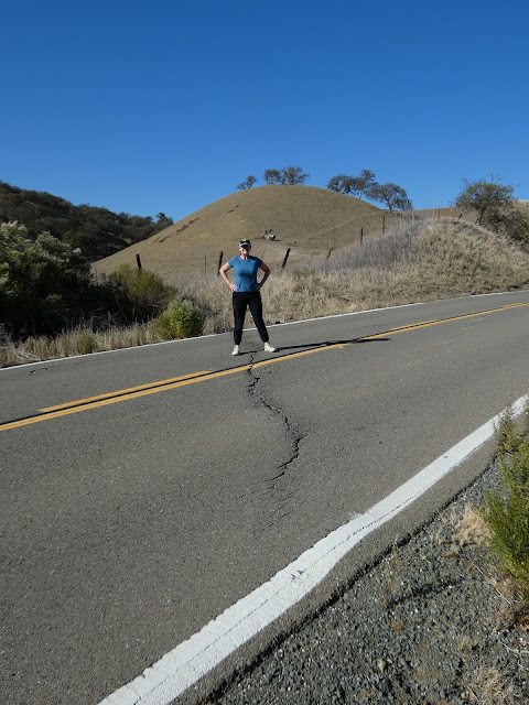
| 2015 |
In 2016 Laura once again provided scale, as she did in 2014 and 2004.
 |
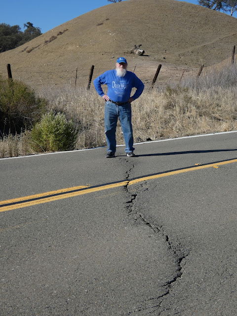
| 2016 |
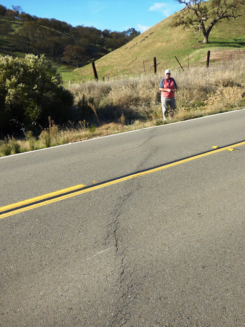
Here in 2017, long-time trip volunteer Mary provides scale. The cracks in the road are just a bit larger, but they didn't look appreciably different than the previous year except for a twist (pun intended).
 |
2017 |
On Dec. 2, 2018, the break to my eye seems more continuous. It's now been six years since the road was completely repaved.
 |
| 2018 |
Last year the paint was deformed (twisted), but not split (below).
 |
2017
|
The offset paint strip reminds me of illustrations of elastic rebound theory, the idea that stress builds up on a fault line over time. In that model, the land on either side of the fault is distorted over time until the frictional resistance is overcome and the rock snaps back to its original shape. That won't be happening with the paint. Last year in 2017 I said "
if they don't repair the road (as they often do; see above), it will probably show a clear break by next year." Here's what transpired:
First, a close-up on 2017's center stripe...
 |
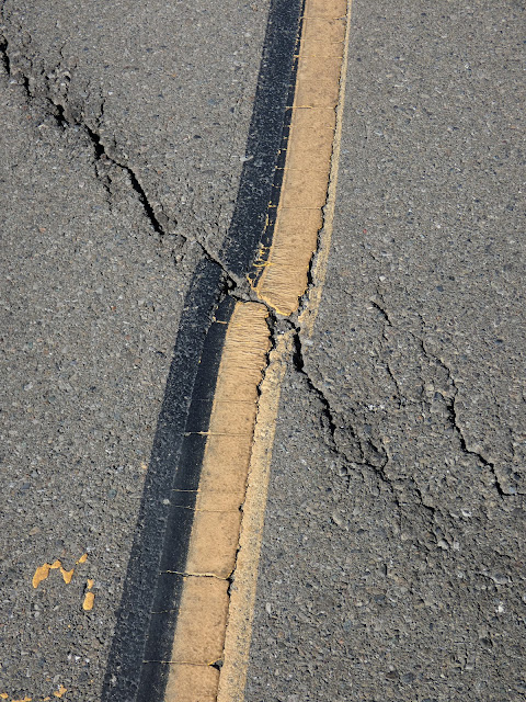
| 2017 |
And here's how it looked on Sunday, Dec. 2, 2018:
 |
| 2018 |
As predicted, the break in the paint is complete...
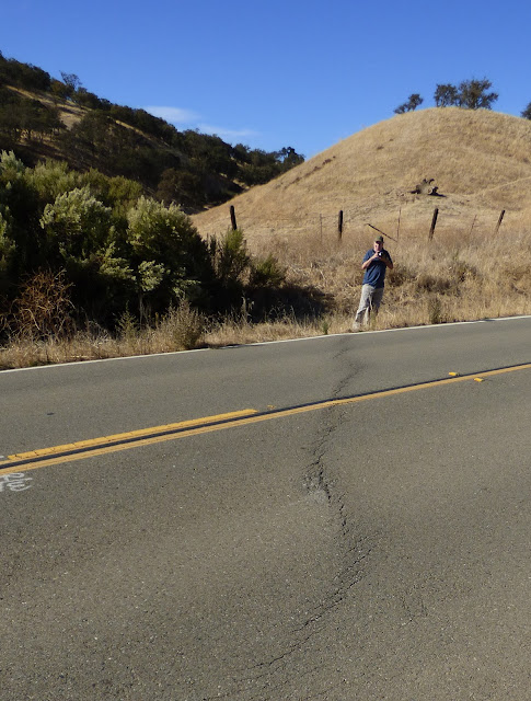
In 2019 (those last few halcyon days before Covid) long-time volunteer Paul provided scale (he has been assisting MJC with field trips for 25 years!). The crack continues to grow, and I wouldn't have been surprised if it was patched by next year.
The paint on the center strip is split even more.
 |
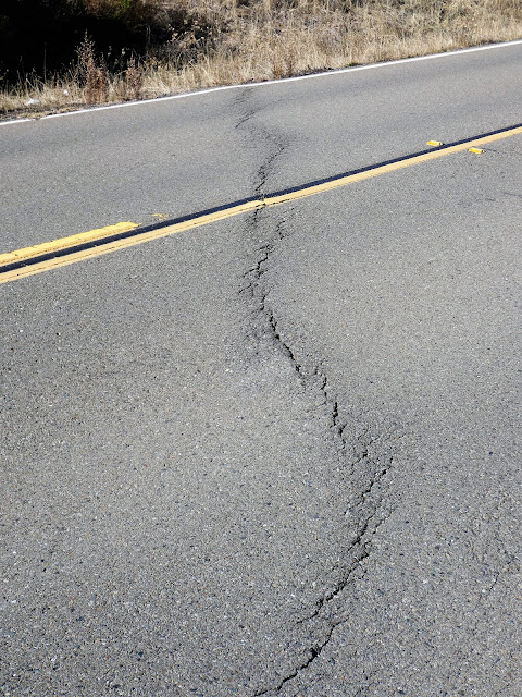
| November 2019 |
And then Covid happened and for a few years we were not able to conduct our field studies classes. Today we made a return visit with our students and here is the current condition of the highway. It doesn't appear that any repairs have been conducted yet. Our host is once again Laura, who was with us back in 2004 and subsequent years!
 |
| November 2022 |
Fault creep is not a constant. I didn't see a whole lot of change over the last three years, although I didn't get as many close-up shots. Here's a closer look with Paul, our other long-time volunteer. What do you see that is different?
 |
| November 2022 |
These little changes that happen at a rate visible in human lifetimes add up to huge changes when multiplied by thousands or millions of years. The nearby eroded volcano of Pinnacles National Park has been displaced 195 miles (315 kilometers) in the last 20 million years or so by movement along the San Andreas.


4 comments:
Wow! I am so happy that I got to be on the trip this year and then to see your comparison photos from the last couple decades - so fascinating! I love that you documented these photos that were taken almost every year! It's wild that in just a few years after getting repaved, that you start to see the fractures again.
Thanks for publishing this. Though I live in South Dakota on the edge of glaciated plains, I'm fascinated by the geology of California. Seeing these year by year photos is a great demonstration of fault creep and plate tectonics
I've seen these photos for years as you've updated the blog entry and enjoy the updates. Is it abnormal to have such a narrow effect on a road? I would think it would be wider, like the fault scar on the carrizo plain. Isn't that many feet wide?
This is just a single strand that happens to be active, but the San Andreas fault zone as a whole is as much as a mile wide, and different strands might be active at different times while others go dormant.
Post a Comment