Showing posts with label Lassen Peak. Show all posts

Friday, September 15, 2023

A California Love Letter: It's the Best Geology to be Found Anywhere!

This is the second of some resource materials I have on our college website that are being removed, so I wanted to preserve them. The following is some info I give to my students of my "Geology of California" course. For the majority of these students, it is their first introduction to geology, and their first introduction to the extraordinary state that is their home. For a more complete explanation of each superlative, click on the orange links (down the rabbit hole!). Enjoy!

Highest point in the lower 48 states: Mt. Whitney, 14,505 feet 

Lowest point in the western hemisphere: near Badwater, Death Valley, -282 feet

The deepest canyon in North America (maybe): Kings Canyon, Giant Sequoia National Monument. Hells Canyon on the Oregon/Idaho border may be 19 feet deeper. Maybe...

Largest living things in the world: Sequoia Trees

Tallest living things in the world: Coast Redwoods

Oldest living things in the world: Bristlecone Pines (5,000 years), White Mtns, or Creosote Bushes in Colorado Desert (11,000 years)

My Scottish BBC Interview at a relatively balmy 110 degrees

Hottest Place on the Planet and Driest Place in North America: Death Valley: 134 degrees, precipitation 1.4"/year

One of the Snowiest Places in the U.S.: Tamarack, Sierra Nevada, 76 feet in one year, 32 feet in one month, 37 feet on ground at one time

Highest Waterfall in the North America (no. 7 in world): Yosemite Falls, 2,425 feet

Second tallest active volcano in the U.S.: Mt. Shasta, 14,162 feet

Second most recently active volcano in lower 48 states: Mt. Lassen (1914-21)

Most voluminous volcano in the lower 48 states: Medicine Lake Highland (around 130 cubic miles) in northeastern California

Scarp from the 1872 Lone Pine earthquake

Some of the largest earthquakes in the lower 48 states: 1906 (San Francisco 7.8), 1872 Lone Pine (7.8), 1857 (Ft. Tejon 7.8)

Old oil derrick near the Santa Clarita Valley

One of the more prolific oil and natural gas producing regions in the world: Los Angeles Basin, Bakersfield, and Santa Barbara-Ventura Channel

One of the biggest explosions ever: Long Valley Caldera, 750,000 years ago, 125 cubic miles of ash spread all over the western states as far east as Nebraska and Kansas

McWay Falls at Julia Pfeiffer-Burns State Park on the Big Sur Coast

No other state has the combination of landscapes: Coastlines, deserts, mountains, river valleys and plateaus, due in no small part to the fact that California is influenced by all three different kinds of plate margins: Divergent, convergent and transform. Few places in the world have this kind of diversity.

The San Andreas fault on the San Francisco Peninsula. San Andreas reservoir, from which the fault took its name, is in the foreground.

What would you add to this list???

Tuesday, September 11, 2018

Want to See Some Incredible Volcanoes Up Close? Geology of California's Volcanoes, Sept. 27-Oct. 1, with Modesto Junior College


I write so much about my travels around the American West and elsewhere, and some might wonder where I find the time. Well...I tend to have a group of students with me. Geology, perhaps more than any other science, is best learned in the field, and our school recognizes the importance of field experiences. The community college system in California is of course one of the best alternatives for beginning a college education, a gateway to transferring into universities, but we also recognize lifelong learning as a part of our mission. Education doesn't just end with a degree. Professionals in one career can benefit from courses in related disciplines as a way of improving their job performance, or advancing up the pay scale. And all citizens can benefit from becoming better informed on the political issues of the day, such as climate change, or energy development (pulling some examples from geology).

With this in mind, I wanted to let my Modesto area-based readers know about some great field studies trips coming up this fall. On September 27-October 1, I'll be teaching Geology 185, the Geology of California's Volcanoes. We'll be exploring Mt. Shasta, Lava Beds National Monument, Medicine Lake Highland, and Lassen Volcanic National Park, as well as Castle Crags and McArthur-Burney Falls State Parks. We will be camping at Woodson Bridge State Park the first night, spend two nights at Lava Beds National Monument, and the last night at McArthur-Burney Falls State Park. There will be hiking and caving opportunities, and some simply incredible scenery among some of the youngest volcanic features in the western United States.

If this sounds intriguing, you can find more information at http://hayesg.faculty.mjc.edu/Cascades_field_studies.html. California residents pay the normal tuition rate (2 semester units), but the rate is higher for out of state participants. The $80 fee for the course covers the van transportation and fees at the various parks and campgrounds. The students provide their own food (we'll have stoves and fuel). For my local readers, we'll have an organizational meeting on Thursday, September 13 in the Science Community Center at Modesto Junior College, room 326, at 5:30 PM. Contact me if you have questions.

Friday, July 14, 2017

California's (not) Biggest, (not) Most Recently Active, and (not) Most Dangerous Volcano


Photo by Mrs. Geotripper
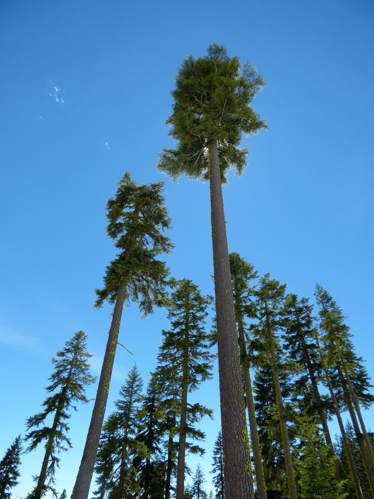
Mt. Shasta is no doubt the most dominating volcano in all of California. It's huge, topping out at well above 14,000 feet, and is visible from over a hundred miles in a number of directions. It was the first main stop on our recent journey exploring the Pacific Northwest and Northern Rocky Mountains, and it really stood out as we essentially circled it on our way to Lava Beds National Monument.

It's big, it's active, and it's potentially destructive. So how bad could it be? Is Shasta the biggest, most recently active and most dangerous volcano in the state? Actually...no. California has a great many volcanic features, and even though some are not as familiar to many of us, they do actually present a hazard for a great many more people than you might suspect. That's not to say that Shasta is not dangerous, however.
Castle Crags in the Klamath Mountains of northern California (photo by Mrs. Geotripper)
As Interstate 5 winds northward into the Klamath Mountains north of Redding, Shasta occasionally peeks out between the trees (the top picture), but for a brief moment near Dunsmuir a totally different set of mountain spires appear off to the west. They are the Castle Crags, a granite stock (an intrusive body of granite exposed over an area of less than 40 square miles; batholiths are larger).

Castle Crags (seen below in a picture from a plane flight a few years back) were relevant to our explorations because they represent a volcano from inside out. About 160 million years ago, the land surface was five or six miles above, and molten magma was moving up through the crust. Some of the magma reached the surface to flow in volcanic eruptions, building up volcanoes maybe similar to Shasta and others of the Cascades. The rest of the molten rock cooled slowly for tens of thousands of years, forming the crystalline granitic rock exposed today at the Crags.

Moments later, we made the imaginary journey up through the crust and onto the flanks of the modern volcanic edifice of Mt. Shasta. We followed the Everitt Highway up the mountain to the about the 7,500 foot level to have a look around. Even though we were on the first day of a crippling heat wave in California, the air was cool, and the snowbanks made it clear that winter was not yet entirely over.
Bunny Flats was the end of the road for us on this particular day. The last two or three miles of pavement above were covered by snow. The road used to end at a ski area, but the resort was closed years ago, due to avalanche danger (as I understand it; there is a newer resort on the lower slopes of the volcano). Working and playing on the slopes of a volcano does have its hazards...

There are a lot of hazards around Shasta. Lava flows might seem to be one of them, but andesite lava tends to be sluggish and slow. Lava doesn't worry me so much. Ash eruptions are certainly a danger, due to their speed and mobility. Shasta has had such eruptions, but they haven't been the usual modus operandi over the years. But...lava or ash flowing onto thick snow: that's a problem. The melting snow and debris quickly turns into a mudflow that can travel for tens of miles at high rates of speed. The Indonesians called them lahars, and the name has stuck. Most of the lower flanks of Shasta are mantled with lahar deposits, and the towns of Weed and Shasta City are built on them. Mudflows have even happened when there have been no eruptions. Meltwater can build up under the glaciers that cover much of the mountain and burst out with no warning (Icelanders call these glacial bursts jökulhlaups). All in all, it's a pretty dangerous volcano.

And it's active. There have been a number of eruptions in the last 10,000 years, including those that built up Shastina and Black Butte. The entire upper part of Shasta, the Hotlum Cone, is less than 9,000 years old. The volcano may have erupted in 1786. So is it the most recently active volcano in California? Nope.
From our vantage point at Bunny Flat, we had an unobstructed view southeast towards Lassen Peak and Brokeoff Mountain. Lassen is the winner of the "most recently active" designation. The plug dome began making noise in 1914, and let loose in 1915 with a lava flow, a destructive lahar, and an ash eruption that interrupted train service out in Winnemucca, Nevada. The eruption produced a mushroom cloud five or six miles high. Geothermal activity continues today in what is now Lassen Volcanic National Park.
Lassen Peak (left) and Brokeoff Mountain (right) from Bunny Flat

So what about the biggest? Surely a mountain 14,000 feet tall is the biggest volcano in the state of California? Well, it's certainly the tallest, and it is the most voluminous stratovolcano in the Cascades, but it actually isn't the biggest volcano in the state. When we camped that evening, we were ensconced on the flank of a massive shield volcano called Medicine Lake Highland. With the gentle slopes composed of basalt lava flows, it hardly looks like a volcano at all, but when you compare the width of the volcano in the picture below (it takes up three quarters of the skyline), you realize it is really big. It consists of around 130 cubic miles of lava, compared to about 108 for Mt. Shasta (which is the snow-capped peak on the right).

So it's the most dangerous, right?

Well...that's a hard concept to quantify. There are lots of volcanoes in California, and some are closer to population centers than others, and some are more capable of chaos and violence than others. The Clear Lake Volcanic Field, north of the Bay Area, has been active as recently as 10,000 years ago, and the Geysers Geothermal Area nearby shows that magma is still present at a relatively shallow depth. Several thousand people live in the general vicinity.

The Lassen Volcanic Center is an obvious threat, given the activity in 1914-17. There are only a few small villages in the immediate vicinity of the volcano, but it is a major tourist destination in the summer season. Lahars could presumably reach the Sacramento Valley.

The aforementioned Medicine Lake Highland is certainly still active, with eruptions as recently as 950 years ago. Although basaltic shields aren't known for violent eruptions, the presence of rhyolite plug domes around the summit area show that such eruptions are not out of the question. Like the others, the region is lightly populated.

Volcanism is also a possibility in Southern California, perhaps to the surprise of some. Young cinder cones dot parts of the Mojave Desert (the Lavic Lake Volcanic Center), and the Coachella Valley (the Salton Buttes). Some of the small volcanic cones are younger than 2,000 years old.

The "elephant in the room" in terms of volcanic hazards of California has to be the Long Valley Caldera, and the nearby Inyo-Mono Craters. Every time there is a jiggle on a seismometer in Yellowstone National Park the internet lights up with predictions of death and destruction, but the conspiracy nuts pretty much totally ignore California's version of a death volcano. An eruption that took place 760,000 years ago produced 125 cubic miles of ash that covered most of the American West (the three Yellowstone eruptions ranged from 67 to 600 cubic miles). Yellowstone has not had a volcanic eruption in 70,000 years. The volcanoes in the Long Valley area of California have erupted as recently as 300 years ago. No one is talking about a repeat of the catastrophe of the 760,000 years ago, but smaller eruptions could certain cause havoc in this very popular tourist area. There was a huge brouhaha in the 1980s that had a lot of implications for how public officials respond to potential geological disasters. I wrote an extensive blog post about the event a couple of years ago; you can read it here (it's one of my favorites).
So Mt. Shasta isn't the biggest volcano in the state, isn't the most recently active, and may or may not be the most dangerous. But does that mean we can disregard the volcano? Hardly. It could cause all kinds of mayhem in the wrong circumstances. And there is one more hazard here that is unique.


The area north of Mt. Shasta is a landscape characterized by a strange hummocky surface composed of volcanic rock, but the hummocks don't look like cinder cones or other volcanic features. Geologists didn't know what to make of this weird topography. Until Mt. St. Helens exploded on May 18th, 1980, that is. One of the most astounding events of that eruption was the collapse of the entire flank of the mountain into a debris avalanche that traveled for twelve miles down the Toutle River. It turned out that an ancient iteration of Mt. Shasta had a similar fate around 300,000 years ago, with a debris avalanche that traveled 28 miles, almost to the present location of the town of Yreka.
The debris avalanche on the north flank of Mt. Shasta. Shasta Lake, a reservoir, is on the left within the debris field (photo by Geotripper)..
It is hard to imagine events on this scale, but the geological world is full of events that challenge our perception. That was one of our themes as we set out on our two week journey, and it was only our first day on the road.

Tuesday, July 4, 2017

Chasing Volcanoes and Overthrusts: Exploring the Pacific Northwest and the Northern Rocky Mountains

Mt. Shasta from Interstate 5 in the vicinity of Red Bluff and Corning. Photograph by Mrs. Geotripper
A few weeks ago I had the privilege of attending a field trip on Kilauea volcano on the Big Island with Don Swanson and Tina Neal of the Hawaii Volcano Observatory (and I'm probably not done with those blogs yet, by the way). Along the way, Don parked our van at the end of a road, and then made a seemingly useless U-turn before turning off the vehicle. He said in passing that when studying active volcanoes, he preferred to park facing away from the volcano...saved time when needing to evacuate in a hurry. With the stories he told, his habit seemed to make a lot of sense.

I was thinking about that as we drove north on Interstate 5 in the northern Great Valley on the first day of our exploration of the Pacific Northwest and northern Rocky Mountains. We were a band of 19 students and staff on a two week journey, camping our way across some of the most spectacular landscapes on earth. Looking out the windshield I couldn't help but think that we were headed right at some particularly young and active volcanoes, such as Mt. Shasta (above).
The Sutter Buttes north of Sacramento in the Great Valley. Photo by Mrs. Geotripper.
These volcanoes are part of the Cascades Range, which extends from Lassen Peak at the south end, to the vicinity of Garibaldi Peak in British Columbia. The "fire" beneath the volcano is derived as the oceanic crust off the coast sinks into a vast subduction zone. When the sinking slab reaches a depth of several tens of miles, water is liberated which changes the melting point of the minerals in the rock in the crust above. Buoyant magma rises into the crust, and eventually some of it leaks out, producing the eruptions that build these volcanoes.

The subduction zone is disappearing in geologic terms as it replaced by the growing San Andreas fault (don't panic too much, it's happening at a few inches a year). Volcanoes at the south end have been going dormant and then extinct. Once possible example is the unusual set of hills in the midst of the Great Valley north of Sacramento. The Sutter Buttes are the eroded remnants of a volcano that erupted around 1.6-1.4 million years ago. They're west of the main axis of the Cascade range, but then again so is Mt. St. Helens. Most research suggests that the volcano is more closely related to volcanic fields in the California Coast Ranges.
Lassen Peak from the west. Photo by Mrs. Geotripper.
Soon after passing Sutter Buttes, Lassen Peak became visible off to the east. The 10,457 foot high volcano is a smaller type of volcano called a lava dome or plug dome composed of viscous silica-rich dacite lavas. The original volcano erupted about 27,000 years ago, but it reawakened in 1914, had a major eruption in 1915, and continued to sputter for a few more years after that. It was made into a national park soon after. It was not on our itinerary on this trip, but we spend time there on our fall semester explorations.
Black Butte on the flank of Mt. Shasta. Photo by Mrs. Geotripper.

We passed one more prominent volcano before we reached the end of the road on the flanks of Mt. Shasta. Black Butte is a large looking volcano when viewed from Interstate 5 around Mt. Shasta City, but is a very small volcano compared to the adjacent edifice of Mt. Shasta  (it can be considered a part of Shasta). Like Lassen, it is a plug dome that erupted about 9,800 years ago.

Wednesday, September 21, 2016

About to Hit the Road Again! There are Volcanoes in my Future

And it's been way too long locked away in an office and laboratory and lecture hall. I'll be hitting the open road with my students on an exploration of California's Cascade volcanoes for the next five days. We'll be seeing Mt. Shasta, Lassen Peak, Medicine Lake Highland, and Lava Beds National Monument. All in all, it's a fascinating corner of the Golden State. I may actually have some web access along the way, so I'll try to send some dispatches.


Monday, December 29, 2014

The Volcano That Wasn't There, and Two That Were...

Mt. Shasta and Shastina from the north
I hope that your holiday travels were safe and happy. I had a fine time visiting family across the Pacific Northwest, from Seattle to central Oregon, Northern California and home again. I had been looking forward to seeing a bevy of Cascades volcanoes, including Mt. Rainier, Mt. St. Helens, Mt. Hood, the Three Sisters, Mt. McLoughlin and the others. Of course, the Northwest had no intention of revealing its treasures, as clouds and rain dominated our trip from one end to the other. There was plenty of geology, mind you, as we saw all manner of flooding, landslides, and mudflows, but I admit to feeling a tiny bit of disappointment at finding the Cascades hidden from sight.
Mt. Shasta from near Weed (photo by Mrs. Geotripper from a fast moving vehicle!)

It wasn't until the last day of our travels, a 600 mile drive from central Oregon to the Great Valley in California that we saw anything of the high Cascades. We crossed the Siskiyou Mountains in a light snow storm, but by the time we reached the Klamath River in California the skies had almost magically cleared. As we turned around the ridge near Yreka, Mt. Shasta came into glorious view. Shasta is the second highest (14,179 feet; 4,322 meters) and most voluminous of the Cascades volcanoes, and the second most active (after Mt. St. Helens). It last erupted in 1786. The volcano consists of at least four volcanic centers, including Hotlum Cone, the highest peak, and Shastina, a parasitic cone on the west side of the mountain (on the right side of both photos above). Shastina is actually the third highest Cascade volcano at 12,329 feet (3,758 meters) .
Lassen Peak from near Red Bluff
Later, as the sun sank lower in the western sky, we were treated to a rare valley view of snow mantled Lassen Peak (10,463 feet; 3,189 meters). Lassen is a dacite plug dome that came into being during a series of eruptions around 27,000 years ago. It has the distinction of being the most recent volcano in California to erupt. After a series of nearly 200 phreatic explosions from May of 1914 to May of 1915, the volcano produced a dark viscous lava flow that melted much of the snow around the summit that resulted in a major lahar (volcanic mudflow). A few days later there was a large explosive eruption of ash, with a pyroclastic surge that destroyed about four square miles of forest.
Lassen Peak and the remnants of Mt. Tehama
I was even more pleased with the view of the volcano that wasn't there. If you look to the right side of the photo above, you can see a series of ragged peaks, which include Brokeoff Mountain, and Mt. Diller. They are the remnants of a large stratovolcano that would likely have towered over Lassen Peak. The peak, now called Mt. Tehama (or Brokeoff Volcano), grew during a long series of eruptive events between about 590,000 and 385,000 years ago. The eruptions grew silent, and erosion began to attack the extinct volcano. It is interesting to sit in the midst of these peaks (the main park road passes among them) and realize that one is looking out from the deep interior of volcano.
It was nice to see the coating of snow on the mountain peaks of northern California. The snow depths are still less than they need to be, but they are certainly better than the near lack of any snow at all that we saw last year during our holiday travels.

Monday, December 23, 2013

Four Terrifying Pictures from Northern California

Here are a couple of scenes from our road trip this Christmas. Does the tagline seem a bit incendiary? It should be. Sure, there are three pictures of active volcanoes, but that isn't what makes them scary. We are looking at Mt. Shasta, the 14,000 foot high volcano that looms over northern California (above), and Shastina, the parasitic cone on Shasta's flank (below). What's terrifying? It's late December, and there is only a light dusting of snow. This mountain should be coated in snow from the high peaks to the low flanks. The road I was on should have been closed by snow drifts.
California is in the midst of a three year drought that shows no signs of abating. By some accounts, the last twelve months have been the driest in the state's history since at least 1895. They are having to fight fires in December in places like Big Sur, a region that should get feet of rain each year. Two years ago, I was able to drive over Tioga Pass, 9,950 feet high, after New Year's Day.
Castle Crags State Park in the Klamath Mountains. These should be covered in snow too.
A worrisome pattern is developing. Three bad years in a row, and in the desert southwest, thirteen years of drought. Some climate scientists are suggesting that we may have to adapt to a megadrought, an event that has happened here twice in the last thousand years. These droughts lasted decades, and caused huge changes in places like Mono Lake and Lake Tahoe. Entire rivers dried up. I hope that won't be the case, but are we prepared in any way to deal with it if that is the case?
A snow-free Mt. Lassen from near Redding

I hope it isn't what's going on. I hope that a whopper of a storm will move in, and that we will get a breather from the dry conditions. But we need to be ready if it doesn't. Some hard choices may have to be made.

Tuesday, October 29, 2013

The Mountain That No Climber Can Ever Summit: Mt. Tehama (the Brokeoff Volcano)

The gigantic boulder is a glacial erratic, left behind by sheets of ice that once covered the Lassen region.
After being slightly distracted by ducks and the beautiful fall day in Yosemite, Geotripper is back on track to finish up his exploration of the Cascades volcanoes of Northern California. It was already approaching noon of our last day on the road back at the end of September, and we had six hours of driving ahead, so our list of features we were investigating was becoming short. In fact, one of the features we were interested in just simply wasn't there.

Mt. Tehama, or the Brokeoff Volcano, began erupting around 600,000 years ago just south of the present-day site of Lassen Peak. It was a stratovolcano similar to Mt. Shasta or Mt. Hood, composed mainly of gray andesite with interbedded ash and lava flows. The mountain alternated between explosive eruptions and effusive eruptions and eventually grew to a height in excess of 11,000 feet, hundreds of feet higher than modern Lassen Peak (10,457 feet).
There is a pretty good reason that mountain climbers can never summit Mt. Tehama, though. It's not there anymore. Around 400,000 years ago the magma chamber under the mountain ended volcanic activity. There has been debate about whether the mountain ended with a tantrum or a whimper, but the consensus seems to lie with the latter. The volcano stopped erupting and chemical weathering, river and glacial activity tore it apart. All that remains are a series of lower peaks surrounding the original throat of the volcano including Brokeoff Mountain, Mt. Diller, Eagle Peak and Diamond Peak.
 In the aftermath of the eruptive cycle that ended activity at Tehama, several plug domes erupted and grew on the flanks of the older mountain, including Lassen Peak itself about 28,000 years ago. Hot rock continues to simmer beneath the complex, evidenced by the recent (1914-1917) eruption of Lassen Peak, and the presence of geothermal systems like Bumpass Hell and the Sulphur Works.

From the Bumpass Hell trail, the peaks of Brokeoff Mountain and Mt. Diller seem to provide a near-perfect profile of the long-gone volcano, but the original edifice was much larger, something like 15 miles around. The center of the volcano was in the foreground and the two peaks were just part of the western flank. An aerial photograph of the mountain (from a Canada flight in 2005) offers a different perspective...

I annotated a version of the picture for a previous post on the volcano, and it is reproduced below. I'm mostly satisfied with it, although the height of the peak may be a bit exaggerated. In any case, good luck climbing to the summit!

Up next, the final stop of our trip!