Surely you have one. If you don't, what's keeping you from making one?
(I've made it to around 70% of them so far and feel exceedingly lucky to have been able to do so).
In any case, how many of the following are (or should be) on your personal list? Possibly Grand Canyon, Zion, Bryce Canyon, Arches, Petrified Forest, Capitol Reef, Yosemite, Great Basin, or Canyonlands National Parks? What about Ancestral Pueblo cliff dwellings at places like Bear's Ears or Grand Staircase-Escalante? Finding ancient petroglyphs along the Colorado River? Or searching for dinosaur bones? How would your life be changed if you could somehow do all these things...in one trip? It's possible!
 |
| Grand Canyon National Park |
There is no place on this planet like the Colorado Plateau. It's hard to find anyplace else on Earth where the crust remained relatively stable for upwards of a billion years, accumulating several miles of horizontal sediments, only to be lifted up rapidly in the last few million. The Colorado River and her tributaries then stripped away much of the sedimentary cover, and cut deep into the underlying metamorphic rocks. Those metamorphic rocks record a violent geologic history of colliding landmasses and mountain-building. The resulting landscape is one of the most beautiful regions imaginable.
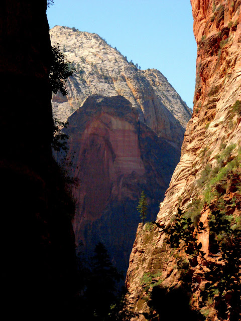 |
| Angels Landing Trail in Zion National Park, Utah |
The plateau country is a training ground for geologists and earth scientists, and has been since the days of John Wesley Powell and Joseph Ives, who were the first to lead research parties into the region (they didn't "discover" the plateau, of course; Native Americans have known the region for thousands of years). If you are curious about learning geology in this incredible region, you might consider joining us as a student (of any age) on our geology field studies course
Geology 191: Geology of the Colorado Plateau, offered under the auspices of Modesto Junior College in Modesto, California. The course is designed to fulfil the curiosity and build the skills of lay geologists and archaeologists as well.
 |
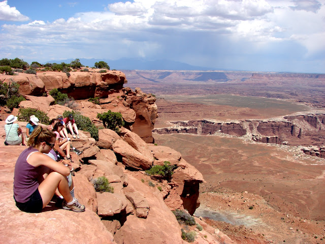
| Mesa Arch in Canyonlands National Park |
Our field course will be a grand loop through the plateau country, with investigations of the Mojave National Scenic Preserve, Grand Canyon, Zion, Bryce Canyon, Arches, Canyonlands, Petrified Forest, Capitol Reef, Great Basin and Yosemite National Parks, as well as many monuments, including Bear's Ears, Grand Staircase-Escalante, Natural Bridges, and Navajo. It will be an unforgettable two week trip from June 3-17, 2025, beginning and ending in Modesto, California. Check the first comment to this post for information about the itinerary and our organizational meeting on April 21, 2025 (by Zoom).
.JPG) |
| Petroglyphs on the plateau |
It's not a comfortable trip...we travel in school vans (which of course are known for their luxuriousness!), we camp every night, and the days can be hot, windy, cold, or stormy, and we are out in the middle of anything that happens. But we are staying in beautiful places each night, and there are even showers and laundry available every third day or so! Extensive hiking is not required, but there will be many chances to explore the trails in each park and monument.
 |
| Petrified Forest National Park |
Geology 191 is a 3-semester-unit course. By end of the course, you will be able to see the landscape the way geologists do: by identifying rocks, minerals and fossils, and interpreting the geological history of an area by working out the sequence of events as exposed in outcrops. If you are a science teacher, you will come home with a collection of photographs that illustrate most of the important principles of geology, and a selection of rocks, minerals and fossils that will make a great classroom teaching tool (legally collected, of course; there are many localities outside of protected parks from which to collect samples). You will also gain some mastery of the archaeology and culture of the plateau region, the home of the Ancestral Puebloans, the Fremont people, the Navajo, the Utes, and others.
 |
| Canyonlands National Park, Utah |
The cost of the trip will be $850 plus the cost of tuition (Currently $46 per unit for California residents, and around $307 per unit for out-of-state residents). The cost includes transportation, food, camp fees, and entrance fees. Participants would want to bring a few dollars along for showers, laundry, and souvenirs. The food is tasty and plentiful (everyone helps cook and clean!), and the school vans...are vans.
 |
| House-on-Fire Ruin, Bear's Ears National Monument |
If you are not in the area, we will be glad to arrange for transportation from nearby airports and train stations (we actually have an Amtrak station in town). Enrollment can be completed online once you are registered with the college (
http://www.mjc.edu). Please contact me with any questions you may have.
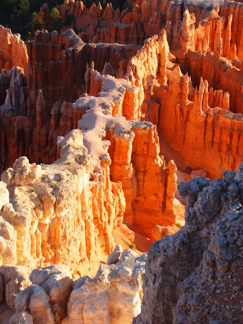 |
| Bryce Canyon National Park |
Hope to see you out there, back of beyond!


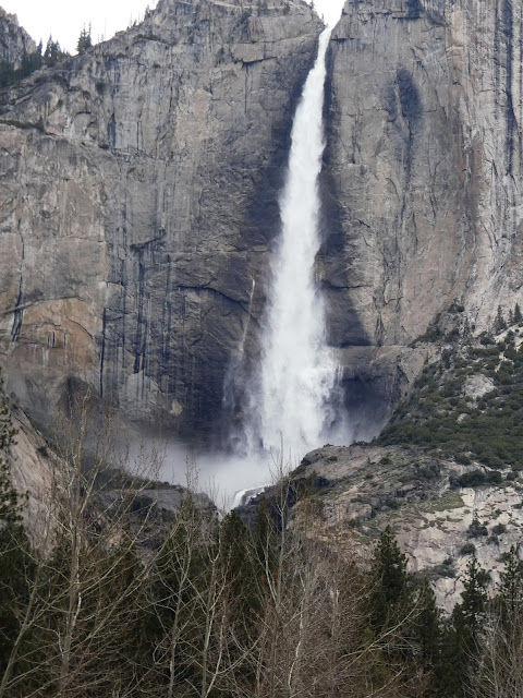 The fall makes a sheer plunge of 1,430 feet (440 meters) at the Upper Fall and then cascades through a series of steep ledges called the Middle Cascades for 675 feet (206 meters). There is a final drop of 320 feet (98 meters) at Lower Yosemite Fall. The Middle Cascades are generally hidden from view unless you hike the steep trail up to the top of the falls (below).

.JPG)


.JPG)


