Tuesday, December 30, 2008

A Random Classroom Conversation and Geologic Predictions for a New Year


The professor speaks: “ Psychics predict earthquakes! True or false?”

The class: “False!” (They know I’m up to something, so even if they believe in psychic phenomena, they know as science class students they should and will almost always say “false”.)

The professor: “No, it’s true!”

Confusion ripples through the classroom for a moment. And then they get it.

The class: “Oh, we get it; sure they predict earthquakes. But they aren’t correct.”

The Professor: “But they ARE correct!”

The class: “Huh? But you’re a science teacher. You aren’t supposed to believe that stuff….”

The Professor: “Look at the usual prediction…a great earthquake will destroy a major city at some point during this year… How could they go wrong? If you set the parameters loosely enough, you will always be right. The only useful prediction will include the place, the time and the magnitude, and no one has really done that yet”

The class: “You know Professor? You are right! Those psychics don’t really predict earthquakes at all! We all really learned something today! Thank you for your brilliance!”

OK, I lied about the ending of the conversation. That never happens in my classes.

I would like to offer my predictions for the new geological year, in the spirit of BrianR at Clastic Detritus. But first, a disclaimer. This is a joke. If you googled something about earthquakes being predicted and volcanic disasters being foretold, I am doing this as a parody, and am not really making predictions. Just the same, check the note at the bottom of the page...

Here are my predictions:

  • The long awaited BIG ONE, the magnitude 8 quake, will take place on the San Andreas Fault. San Francisco, or Los Angeles, or San Diego, or Palm Springs will be devastated. Despite the arguments of geologists, everything east of the fault will fall into the Atlantic Ocean.

  • Yellowstone will erupt with the force of a million hydrogen bombs, and screw up Dick Cheney's vacation home in Wyoming. He will be hiding in an undisclosed location at the time and will be uninjured.


  • Mt. Shasta will erupt and form a gaping caldera. In a few decades the hole will fill with water, but will have to be emptied out when the state of Oregon sues for copyright/trademark infringement.

  • A giant asteroid will land in the Pacific Ocean and cause the extinction of human beings. The dominant species to survive the event will be the little geckos who sell insurance on tv.

  • The Greenland Ice Cap will melt completely away, causing sea level to rise 30 feet, inundating vast areas of the coastlines of the world and displacing hundreds of millions. Global Warming deniers will blame sunspots.

  • Oil prices will top out at more than $140 a barrel (Oh wait, ignore that one, can't possibly happen...)

  • Oil prices will plunge to $35 a barrel (Oh wait, ignore that one, can't possibly happen...)

  • Geologists will be hired out of college with huge salaries (Oh wait, ignore that one, can't possibly happen...)

  • Geologists out of college won't be able to find jobs (Oh wait, ignore that one, happens every year...)


Well, that's all the psychic energy I have for the day. If, even after noting the disclaimer above, any of these events come to pass, I want full credit for predicting them....

Monday, December 29, 2008

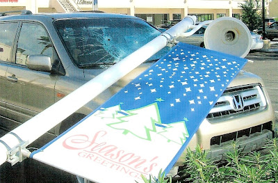
And How Was Your Year? Season's Greetings from California!

I hope and wish that all of you have a better year in 2009! On the road again up to the North Coast of California for New Years. Back to blogging soon, I hope.

(the picture is courtesy of my brother; his new Pilot got mashed twice last year...)

Sunday, December 28, 2008

The Cretaceous Parks of the Colorado Plateau: the Final Discovery


In the last installment of our dinosaur-digging story, we had finally come across evidence that dinosaurs had, in fact, actually lived during the time of the deposition of the Cloverly Formation; we had found deinonychus claws, and bones of tenontosaurs and anklyosaurs. In the final days on the site, we had become fairly sharp at picking out bone fragments on the slopes of the dig site, and two of our party found a fairly significant bone scatter a few yards away from the main quarry.

By working their way up the slope, they found where the bones were emerging, and we started another (much smaller) quarry, and uncovered several dozen bones in situ, of a creature we could not immediately identify. It was smaller than the other species we were expecting to find, and was thus sort of mysterious. We delineated the bone area, and started the process of protecting the exposed bone with "butvar", coating the bones with paper towels and covering the entire mess with plaster. By our last day on the site, we had constructed a giant plaster monstrosity.

The paleo-experts on the dig looked bemusedly at our work, and very politely waited until we had said goodbye and started on our way home before they started tearing off all the plaster and carving the rock mass into smaller parts. The dig was nearly a quarter-mile from the vehicle, and our plaster monster must have weighed 300 pounds! No one wanted to carry it down that hill!

The experts also were nice enough to report on what they found once the specimen had been hauled off to the Museum of the Rockies. Our find turned out to be numerous fragments of a Zephyrosaurus, a species that had been found only once before, and had been named on the basis of a few pieces of the skull, and some vertebrae fragments. We had found leg and claw elements, pieces of a skull, and vertebrae and rib fragments. The animal was a small bipedal herbivore. If your fifth-grader has ever heard of it, it is probably because the kid has a Dinosaur A-to-Z book, and zephyrosaurs are one of the few "Z" dinosaurs!

Images of the bones could be accessed for some time on the Museum website, but they were eventually taken down, so I wonder if they have reconsidered the identification of the specimen. If anyone wants to track it down, it was MOR #759. I would love to know what our creature is up to these days!

The Cretaceous Parks of the Colorado Plateau: the story of a Dino-Dig wraps up


Continuing the story of our 1994 dino-dig, in which we learned the truth of uncovering new scientific knowledge. We were re-opening the quarry where the raptor Deinonychus had first been discovered. After nearly a week of hard digging we were approaching the bone layer, but work was pre-empted by a heavy rain and hail-storm that drenched the area. We had found nothing to speak of, but in the days that followed the storm, bones began to appear.

Our first effort to actually discover bone involved Karma Craig, whose previous efforts had netted us a near tornado, scorpions, rattlesnakes and deer-van collisions. Knowing of his power, we got him to say the words "I wonder what it would be like to find dinosaur bones?". His Karma was strong, and later that day he stumbled over some tail vertebrae (second picture) of a Tenontosaurus, the large iguanadon-like plant-eater that appears to have been the main prey of Deinonychus. Soon after, another member of the party found an odd boulder that turned out to be the carapace of a turtle (third picture; the matching half of the carapace was later found to be already ensconced in the Museum of the Rockies). I had walked past a pile of rocks for a week before it occurred to me that we were in mudstones, and that rock chunks shouldn't be there; they turned out to be the bones of an anklyosaurus relative. And several members of our party wandering on the other side of the gully found a partial Deinonychus claw and numerous other scattered bone fragments (fourth picture).

Meanwhile, the diggers had reached the bone-level of the main pit. Tensions were high as the professionals climbed in with their dental picks and brushes and went to work. What would come to light? Whole skeletons of Deinonychus locked in a death embrace with their victims? Well, no, we didn't find that; we found a single claw, which fell to pieces upon exposure, and was lost. But that's what happens, I guess. We were quite thrilled with our other discoveries.

Just the same, there was one more discovery to be made in our last days on the site. That story follows soon!

Tucson Sunset

OK, I admit my ignorance...are all Arizona/southwest sunsets like this? I spent a week or so traveling through Grand Canyon, Phoenix, Tucson, and every evening was a spectacular play of color that lasted quite a while after the actual sunset. The show continued when we drove through Blyth, CA, and a few days later in my own Central Valley of California, and our valley is not known for colorful sunsets.

So, is this usual? The last time I saw sunsets like these, Pinatubo volcano in the Philippines had pumped cubic miles of ash and aerosols into the stratosphere, and the sky lit up like fireworks. Then again, I spend a lot of time indoors ignoring the sky, and so maybe I have just been missing out. In any case, I appreciated the spectacle!

Monday, December 22, 2008

Christmas Greetings from Grand Canyon!

We decided to do something a little different this year and avoid the chaos by swinging through the southwest in the days before Christmas. As most of the American blogosphere would be aware, there were a series of fierce storms across the country, and a goodly amount of snow came down at Grand Canyon. Luckily, we arrived the day after and enjoyed two heavenly days along the south rim.

One of the nicest things about visiting Arizona are the sunsets. You never quite know what to expect. I suppose there is some meteorological explanation, maybe having to do with being on a high flat plateau surface that slopes west to the horizon, that causes the sky to go from this....
to this in the space of fifteen minutes or so....

The sunset pictures are from Hopi Point on the Hermit's Rest road, while the first is the view from Yaki Point.
Merry Christmas, all!

Saturday, December 20, 2008

Christmas Greetings from the Mojave Desert!

Not an unknown sight, but rare enough that I have only seen it a few times despite living my early life near by: snow in the western Mojave. Caught the picture going 65 mph on the way to Arizona for some Christmas visits. The desert between Mojave and Barstow is composed of granite and metamorphic bedrock, with occasional exposures of volcanic rock, but mostly the landscape is gentle hills and wide alluvium-filled valleys. And pretty when the snow falls.

The unusual looking plant is a Joshua tree, so named because the early Mormon settlers in the region recalled Joshua holding his arms towards the heavens. It is a member of the lily family. I have run across recent studies that suggest that the range of the tree is declining because the seeds were once dispersed in part by ground sloths, which went extinct in this region at the end of the ice ages.

Wednesday, December 17, 2008

The Cretaceous Parks of the Colorado Plateau: the Dino-Digging Begins


Continuing the story of our 1994 dino-dig, in which we learned the truth of uncovering new scientific knowledge. Morning broke on a beautiful warm opening day and our anticipation was at fever pitch. We were about to start digging for dinosaurs, at a famous site no less! The shovels and picks and implements of destruction were laid out in the quarry, and we started to attack the hillside.


The problem was obvious (see the center photo). The original dig site was on a gentle slope, but if we wanted to expose more of the bone-bed, we would have to cut into the steep slope above. Undercutting was an obvious danger (I'm sure Dave's Landslide Blog would concur), so we had to start out by removing rock from 10-15 feet above the bone layer. Much of the rock was relatively soft shale, but there was also a highly cemented sandstone layer that needed to be cut through as well. The next three or four days were spent doing hard, sweaty labor, with nary a fossil to be seen anywhere. Only 5 or 6 students could work the quarry at a time, so others tended to camp chores, or explored the area looking for bones sticking out of the cliff, but few of us had any inkling of what the bone would look like. There was the fun stuff...boulders knocked out of the cliff needed to be pushed over the edge of the ravine, which caused all kinds of satisfying carnage and chaos. There was a single radio station in the region, playing the same 10 songs and 5 commercials over and over and over, so a small radio provided the entertainment and a certain rhythm to the operation. It was hard work, but no one was complaining; we were digging dinosaurs, and if we worked hard enough, we were sure that we would find something approaching the perfection of the raptor in the early scenes of the movie Jurassic Park.


The days passed and we dug deeper and deeper into the slope, getting closer all the time to the bone-layer. I was also anticipating the arrival of my 8 year-old son. I didn't think he'd have the patience to sit through two weeks of this work, but I arranged with my brother to have him fly out to meet us and spend three days on the dig-site. What a great opportunity for a dino-loving kid!


The evening before his arrival, the storm clouds began to gather on the far horizon. I tried to sleep in a van that night, hoping the rain would hold off long enough that we could get a vehicle down the dirt track to the paved highway, and on to Billings and the airport. No luck, the rain started about eleven and continued through the night. I was worried that we wouldn't be able to get out, but we took the van with the highest clearance, and slipping and sliding we barely did get out. And then the rain began in earnest. I realized the problem was not getting out; it was getting back to camp with my son and brother. It rained like I've never seen rain before; inches of hail were reported in Billings. The storm continued for a two days without letting up. I picked up my family and we drove to Bridger and realized it would be impossible to return to camp until the muddy road dried a little. We checked into the only motel in town and hunkered down, and I worried about my students up there in the badlands. I splurged on a steak dinner that night and took a long hot shower in the motel.


It was an epic time in camp (as I would later find). It was too wet to try and cook much, so the camp subsisted on Top Ramen and bananas for breakfast, lunch and dinner. We had packed light, so there was very little reading material in camp; mainly there was a Brides magazine that a soon-to-be married student had brought. This was in the ancient days before electronic hand-held games or IPods. Mostly everyone sat in the vans and stared out into the rain and mud.


After 48 hours, the clouds cleared and the sun peeked out on a sodden landscape. Back at the motel we got out of our beds, stretched, took another shower, had a hot breakfast, and started up the road. Seven slipping and sliding miles later, we pulled into camp, and stepped out of the car with our coiffed hair, clean clothes, and full stomachs. In retrospect, that was probably the wrong approach towards reuniting with the crew....


But as bad as it was, the rain had changed our landscape in one important aspect; for nearly a week we had seen nary a bone fragment. That was about to change.

Tuesday, December 16, 2008

The Cretaceous Parks of the Colorado Plateau: the story of a Dino-Dig


What was your favorite dinosaur when you were a kid growing up?

Before I distracted myself with a series of geo-memes, I was telling the story of my sole experience with a real dino-excavation, as part of my long-running "short" history of the Colorado Plateau. The first posts explained how we got invited to assist on the dig, and some of our adventures on the way to Montana. Today is an explanation of what we were looking for.

As far as I can tell, I am one of the old-timers of the geoblogosphere, so my childhood memories include T-Rex, stegosaurus, brontosaurus (yes, I know the name is wrong...), triceratops, and pteranodons (yes, I know the ptera-animals aren't dinosaurs, but I didn't know it at the time). As far as my five-year-old self was concerned, they all lived at the same time, fought with each other, were sluggish and cold-blooded, and died out because the superior mammals ate their eggs.

In the 1980's and 1990's, public perception of the dinosaurs was changing, due in part to the movie "Jurassic Park", but really because of the extensive work of numerous paleontologists, some of whom were talented at presenting their work to laypeople through such books as The Dinosaur Heresies (Robert Bakker), and Digging Dinosaurs (John Horner). A sort of dinosaur renaissance followed, and with a vast increase in research into the lives (and deaths) of the dinosaurs, the total number of dinosaur species was doubled.

One of the opening salvos in the new perception of the dinosaurs was a report by John Ostrom in 1969 about his discovery of deinonychus fossils in association with a tenontosaurus at a quarry near Bridger, Montana (the picture above is adapted from Ostrom's report; it was drawn by Robert Bakker, who was his research assistant for years). The velociraptors, popularized (and vastly enlarged) in the movie Jurassic Park, were actually no bigger than a german shepherd. The closely-related Deinonychus would have been a bit closer to the size of the creatures in the movie, although Utahraptor would have been even closer. At Ostrom's quarry, at least four individual raptors died along with the large plant-eating tenontosaur, leading to speculation that the predators had attacked the much larger creature together (and had died in the process). The result of Ostrom's analysis was that at least some of the dinosaurs were closely related to the birds, that they were agile and warm-blooded, and that some may have cooperated in bringing down prey. These were revolutionary and controversial ideas at the time.

So, what were we up to in 1994? We were going to help reopen John Ostrom's quarry! The distinctive hill is called the Shrine site (although we were also told it was named for a particular part of the original ranch owner's wife's anatomy), and is located in the badlands near Bridger, Montana. It is an exposure of the Cretaceous Cloverly Formation, which is related to the Cedar Mountain Formation on the Colorado Plateau, and is composed of sand and silt deposited on a muddy river floodplain. The idea of pack behaviour among dinosaurs remains a controversial subject, and by digging further into the side of the hill, we hoped to find more evidence concerning these predators of the early Cretaceous.

We couldn't have asked for a more dramatic setting. Besides the vivid colors of the nearby badlands, we had a skyline view of the high Beartooth Mountains that form the eastern edge of Yellowstone National Park. To the east rose the Pryor Mountains, and a few miles beyond, the Bighorn River (yeah, the Custer's Last Stand one). The picture of the camp above hardly does it justice (all that pre-digital photography with cheap cameras).

We met the professional crew, Geoff and Desmond, and a couple of amateur dino-diggers from the Bay Area, and starting looking over the quarry site. We knew our role; it was to remove the side of the mountain so the bone people could get to the bone layer with their brushes and dental picks. As Arlo Guthrie put it, we came armed with shovels and picks and implements of destruction. We set up camp, and made dinner. Work would commence the next morning....

Ostrom, J. H. (1969). "Osteology of Deinonychus antirrhopus, an unusual theropod from the Lower Cretaceous of Montana". Peabody Museum of Natural History Bulletin 30: 1–165.

Sunday, December 14, 2008

100 Things You've Done Meme: A Geologist's Version (mine)


Since I started this meme thing, I thought it would be fun to throw some of my stories in the mix. I appreciate and enjoy reading all the stories that have been added to the geoblogosphere in the last day (see the comments and the links below). I definitely agree with Andrew at About.com that the list is somewhat slanted towards North American sites (I think at the time, the original article was recognizing that most readers were in NA) and should be updated. I think the geoblogosphere is a great place to collect some of the sites and experiences that Americans like myself should seek out if we are lucky enough to travel the world, and I bet it would be a great Accretionary Wedge topic. BrianR, if you are reading, I would be willing host one.

Anyway, here are some of the things I have been privileged to experience over the years...

1. See an erupting volcano - I've seen two; Kilauea in Hawaii, and the 2004 eruption of Mt. St. Helens. I will watch a bigger one some day from a safe distance (although definitions of "safe" will surely vary as I discuss it with my loved ones). The picture above was taken on my first trip to Hawaii, on a day the lava was approaching the coast for the first time in a couple of months or years.

2. See a glacier - I've seen a couple of the "glaciers" in the Sierra Nevada, and the slightly bigger ones on Mt. Shasta. I didn't really experience glaciers until I got to Banff and Jasper National Parks in Canada. They were spectacular! As were those I saw from the air in Greenland

3. See an active geyser such as those in Yellowstone, New Zealand or the type locality of Iceland - I'm two for three off that list, but I understand there are some in Russia too. There on my list....

4. Visit the Cretaceous/Tertiary (KT) Boundary. Possible locations include Gubbio, Italy, Stevns Klint, Denmark, the Red Deer River Valley near Drumheller, Alberta. I got to see Gubbio. Our bus driver thought we were nuts to skip a cathedral tour to see a bunch of rocks; it turned out to be one of the best days of the trip!

5. Observe (from a safe distance) a river whose discharge is above bankful stage. Not so much from a safe distance. In California's 1997 floods, the Walker River exceeded the previous discharge record by 100% - 12,000 cfs vs. 6,000 cfs. Unfortunately, my in-law's house was on the bank of the river, and I helped as much as I could to dig it out and repair the damage. The river found a new channel, but the Army Corps of Engineers came and put it back. That was fun to watch; they have really BIG bulldozers, and I have never seen a river start over from scratch before.

6. Explore a limestone cave. Try Carlsbad Caverns in New Mexico, Lehman Caves in Great Basin National Park, or the caves of Kentucky or TAG (Tennessee, Alabama, and Georgia). I've been through most of the tourist caves in California and explored a few wild caves in the Sierra foothills. I saw Carlsbad a few years back and was in awe...one of my first wild caves was one in the depths of the Grand Canyon during my first geology field trip.

7. Tour an open pit mine, such as those in Butte, Montana, Bingham Canyon, Utah, Summitville, Colorado, Globe or Morenci, Arizona, or Chuquicamata, Chile. I flew over Bingham, and was allowed to tour the Lone Tree Mine outside of Winnemucca in Nevada as part of an NAGT conference

8. Explore a subsurface mine. I have been in scheelite tungsten mines, gold mines, silver mines, and my favorite, a tourmaline gemstone mine in California's Peninsular Ranges. Never worked in one though, and not sure I would want to.

9. See an ophiolite, such as the ophiolite complex in Oman or the Troodos complex on the Island Cyprus (if on a budget, try the Coast Ranges or Klamath Mountains of California). Del Puerto Canyon in the Coast Ranges is an easily accessible example, one that we tour as a lab exercise near the end of the semester.

10. An anorthosite complex, such as those in Labrador, the Adirondacks, and Niger (there's some anorthosite in southern California too). I've been to the one in California, would love to see the others

11. A slot canyon. Many of these amazing canyons are less than 3 feet wide and over 100 feet deep. They reside on the Colorado Plateau. Among the best are Antelope Canyon (here and here), Brimstone Canyon, Spooky Gulch and the Round Valley Draw.

13. An exfoliation dome, such as those in the Sierra Nevada. I have seen many wonderful domes in the Sierra. Not many people are aware of it, but there is a Domelands Wilderness Area south of Sequoia National Park, well beyond the margins of the Pleistocene glaciers. I went to Boy Scout camp there as a youth, one of the seminal experiences that probably made me a geologist.

14. A layered igneous intrusion, such as the Stillwater complex in Montana or the Skaergaard Complex in Eastern Greenland. I haven't had the privilege of visiting Greenland, but the Stillwater is a stop on our Pacific Northwest trip

15. Coastlines along the leading and trailing edge of a tectonic plate (check out The Dynamic Earth - The Story of Plate Tectonics - an excellent website). I have spent lots of time on the west coast of the United States, and literally just once at Williamsburg/ Yorktown/ Jamestown/ Norfolk. I suppose that barely counts!

16. A gingko tree, which is the lone survivor of an ancient group of softwoods that covered much of the Northern Hemisphere in the Mesozoic. I have one growing outside my office at Modesto Junior College; I think of dinosaurs everytime I look at it.

17. Living and fossilized stromatolites (Glacier National Park is a great place to see fossil stromatolites, while Shark Bay in Australia is the place to see living ones) - I've seen the fossil ones in Glacier, but not the living ones in Australia...some day

18. A field of glacial erratics

19. A caldera - Long Valley Caldera in eastern California is 20 miles long and 10 miles wide, and erupted catastrophically about 750,000 years ago. I have been through it dozens of times over the years, on field trips and with family. Mammoth Mountain ski resort lies on the western edge of the caldera

20. A sand dune more than 200 feet high - Kelso Dunes in Mojave National Scenic Area in California are 500 feet high; Sand Mountain in western Nevada is nearly as high. Climbing it early one morning was a chore and a half, but a great experience! I had great pictures of the gypsum dunes at White Sands but I found out for the first time how easy it is to delete digital pictures by mistake. Always back them up ASAP!

22. A recently formed fault scarp - Looking for Detachment and I seem to have shared some similar experiences during our times at University of Nevada Reno. The most vivid scarps include the 1954 scarps at Fairview Peak, and those from the 1992 Landers quake.

23. A megabreccia

25. A natural bridge - Natural Bridges National Monument on the Colorado Plateau has three marvelous bridges. Our Sierra foothills include a natural bridge formed when a cavern system was breached.

27. A glacial outwash plain - during my visit to Banff and Jasper National Parks in Canada

28. A sea stack - I live two hours from the California coast, with incredible sights, especially along Big Sur

29. A house-sized glacial erratic - giant basalt boulders spread in the wheat fields of eastern Washington

30. An Underground River or Lake - more like a creek, though, in Crystal Cave at Sequoia National Park

31. The continental divide - On my pacific northwest trip, we cross the CV three or four times in the vicinity of Glacier, Yellowstone and Grand Tetons National Parks; I call our trip "Across the Great Divide"

32. Fluorescent and phosphorescent minerals - It's great to take a UV light on field trips. We explored a scheelite tungsten mine that way

33. Petrified trees - the premier site in the United States is Petrified Forest National Park in Arizona, but petrified wood can be seen in many other areas as well. In northern California, a volcanic eruption in the Coast Ranges buried a forest of Redwood Trees. Some of the trunks are more than a hundred feet long.

34. Lava tubes - Lava Beds National Monument is a marvelous little-known park in northeastern California that contains miles of diverse and mysterious lava tubes. It was the site of the last stand of the Modoc People in the California Indian Wars.

35. The Grand Canyon. All the way down. And back.- Many happy trips, and many adventures. Witnessed a couple of rescues, including one of my own students...

36. Meteor Crater, Arizona - a stop on our Colorado Plateau field studies trip

37. The Great Barrier Reef, northeastern Australia, to see the largest coral reef in the world. A marvelous trip, the story told here

39. The Waterpocket Fold, Utah - that would be in Capitol Reef National Park, one of our stops on the Colorado Plateau field studies trip

45. The Alps - I have had one great adventure (so far) in the Alps, with the story here and here

46. Telescope Peak, in Death Valley National Park - I have been within a few miles of the summit (chose the shorter trip to the top of Mt. Rogers)

50. The Goosenecks of the San Juan River, Utah - One of my favorite places in the world

51. Shiprock, New Mexico, to see a large volcanic neck

54. Mount St. Helens, Washington - also the subject of one of my earliest blog entries

59. The Mima Mounds near Olympia, Washington- from the air anyway. We have mima mounds in our local Sierra Nevada foothills too.

60. Siccar Point, Berwickshire, Scotland, where James Hutton (the "father" of modern geology) observed the classic unconformity - I haven't blogged the story of my adventure near Siccar Point, but I've told it here, on my department web page. I left out the hoof and mouth disease part of the story....

61. The moving rocks of Racetrack Playa in Death Valley - I haven't made it to Racetrack Playa yet, but I have seen the same phenomenon on the Carson Sink and Highway 50.

62. Yosemite Valley - I'm lucky enough to live a few hours away and visit as often as I can

63. Landscape Arch (or Delicate Arch) in Utah - many wonderous times, one of my favorite hikes in the world

64. The Burgess Shale in British Columbia - one of my great life adventures and the subject of one of my first blog posts

65. The Channeled Scablands of central Washington- on our northwest US field trip

66. Bryce Canyon - many times on our field trips; it will be subject to a blog entry in the not-too-distant future

67. Grand Prismatic Spring at Yellowstone - several times on our occasional northwest US field trip.

68. Monument Valley - many times on our Colorado Plateau field trips (on the horizon of the picture in this link)

69. The San Andreas fault - I practically lived on it growing up in southern California, and crossed it hundreds of times without knowing it was there.

75. A catastrophic mass wasting event - the Blackhawk slide in southern California, the Gros Ventre slide in Wyoming, Madison Canyon in Montana, the Fox slide in Canada, and Mount St. Helens, of course

76. The giant crossbeds visible at Zion National Park- many happy times!

77. The black sand beaches in Hawaii (or the green sand-olivine beaches)- black sands yes, but green sands will wait til this summer (thanks Callan for the great posts on your Hawaii trip!)

80. The Black Canyon of the Gunnison in Colorado - numerous happy times on MJC field trips, and once as a child with my family

82. Feel an earthquake with a magnitude greater than 5.0 - I was in junior high school in Ontario California when the 1971 Sylmar quake hit, killing several dozen people. I wasn't in the thick of it though, but I got shaken out of bed. I was finishing up a geology lab in 1989 in Modesto when the Loma Prieta quake struck; again no damage in my area, but scary nonetheless. One of the best moments was the Alum Rock quake near San Jose that struck immediately after the earthquake test in my night class last fall. Most of my students felt it, and ran inside to look at the seismograph in the lab!

83. Find dinosaur footprints in situ - there are thousands near Arches National Park (probably where the BLM is trying to allow gas drilling)

84. Find a trilobite (or a dinosaur bone or any other fossil) - Quite a few lucky times, and the subject of an ongoing blog story, assuming I get back to it (I will)

85. Find gold, however small the flake - found a 0.5 gram-sized nugget the very first time I panned a river (the Sierra Nevada's Stanislaus before New Melones Reservoir in a drought year) and never found anything to match it in 30 plus years of trying.

88. Experience a sandstorm - couple of times in Death Valley (with short pants on, ouch), and a few pitted windshields near Cajon Pass in my native Southern California

90. Witness a total solar eclipse - of the great trips of my life was a journey to the southern tip of Baja California to see the 1991 eclipse...it was truly incredible, and a great international moment as we invited perhaps 70-80 people to see the eclipse through our telescope during the six minutes of totality. The temperature dropped maybe 20 degrees in moments.

93. View Saturn and its moons through a respectable telescope. We often take a telescope on our field trips and many students see the ringed planet for the first time.

94. See the Aurora borealis - twice, neither spectacular, but one was very dramatic, given that I was on my first geology trip deep in the Grand Canyon, in Arizona

95. View a great naked-eye comet - Three times, with Hale-Bopp, Hayakutaki, but best of all of Haley's early one morning before sunrise holding my (crying) new-born son in my arms on the beach at Santa Barbara

96. See a lunar eclipse - several times, but the best was last year on the first night of an earth science class when I challenged my students to prove the earth is spherical; we then walked out and saw the spherical edge of the earth on the face of the moon!

97. View a distant galaxy through a large telescope - several times, but most spectacularly from an astronomer who had a rig that filled a truck and set up at Tecopa Hot Springs a year or two ago, projected the image on a screen for all who wandered by. I had not realized the advances in telescope technology over the last few years!

99. See noctilucent clouds - only once, at Goblin Valley in central Utah, couldn't figure out why the clouds were still glowing long after sunset. Read about it in the Salt Lake City paper the next day.

Saturday, December 13, 2008

100 Things You've Done Meme: A Geologist's Version

Memes can be fun, and there is one going around dealing with 100 things that you have done (two recent examples here and here). I counted about 54 things on those lists that I've done in my 51 years. The meme immediately reminded me of the single most influential column I can remember from Geotimes (now Earth), written in 1990 by Lisa Rossbacher on the places that all geologists should try and see in their lifetimes. The list went through several updates, and arrived on the internet in 1997 on a page put together by Terry Acomb, currently in Grand Junction, Colorado. By nice coincidence, the entire list totaled just about 100 items, so I have made only small changes in the content. I have mostly kept the originals; all such lists are very subjective, and if I fiddled with anything I would never have finished. I notice for one that the list tends towards being biased to sites in North America. I would love to see someone put together a purely world-wide list. One geologist I know essentially tried to see them all on one six month journey; you can read his story here.

Of course, the fun part of such a meme is the reliving of those great experiences. The picture above is my visit to the K/T boundary at Gubbio, Italy.

Here they are! Bold the ones you have done (mine are in the comments) and tell us some great stories!

1. See an erupting volcano
2. See a glacier
3. See an active geyser such as those in Yellowstone, New Zealand or the type locality of Iceland
4. Visit the Cretaceous/Tertiary (KT) Boundary. Possible locations include Gubbio, Italy, Stevns Klint, Denmark, the Red Deer River Valley near Drumheller, Alberta.
5. Observe (from a safe distance) a river whose discharge is above bankful stage
6. Explore a limestone cave. Try Carlsbad Caverns in New Mexico, Lehman Caves in Great Basin National Park, or the caves of Kentucky or TAG (Tennessee, Alabama, and Georgia)
7. Tour an open pit mine, such as those in Butte, Montana, Bingham Canyon, Utah, Summitville, Colorado, Globe or Morenci, Arizona, or Chuquicamata, Chile.
8. Explore a subsurface mine.
9. See an ophiolite, such as the ophiolite complex in Oman or the Troodos complex on the Island Cyprus (if on a budget, try the Coast Ranges or Klamath Mountains of California).
10. An anorthosite complex, such as those in Labrador, the Adirondacks, and Niger (there's some anorthosite in southern California too).
11. A slot canyon. Many of these amazing canyons are less than 3 feet wide and over 100 feet deep. They reside on the Colorado Plateau. Among the best are Antelope Canyon, Brimstone Canyon, Spooky Gulch and the Round Valley Draw.
12. Varves, whether you see the type section in Sweden or examples elsewhere.
13. An exfoliation dome, such as those in the Sierra Nevada.
14. A layered igneous intrusion, such as the Stillwater complex in Montana or the Skaergaard Complex in Eastern Greenland.
15. Coastlines along the leading and trailing edge of a tectonic plate (check out The Dynamic Earth - The Story of Plate Tectonics - an excellent website).
16. A gingko tree, which is the lone survivor of an ancient group of softwoods that covered much of the Northern Hemisphere in the Mesozoic.
17. Living and fossilized stromatolites (Glacier National Park is a great place to see fossil stromatolites, while Shark Bay in Australia is the place to see living ones)
18. A field of glacial erratics
19. A caldera
20. A sand dune more than 200 feet high
21. A fjord
22. A recently formed fault scarp
23. A megabreccia
24. An actively accreting river delta
25. A natural bridge
26. A large sinkhole
27. A glacial outwash plain
28. A sea stack
29. A house-sized glacial erratic
30. An underground lake or river
31. The continental divide
32. Fluorescent and phosphorescent minerals
33. Petrified trees
34. Lava tubes
35. The Grand Canyon. All the way down. And back.
36. Meteor Crater, Arizona, also known as the Barringer Crater, to see an impact crater on a scale that is comprehensible
37. The Great Barrier Reef, northeastern Australia, to see the largest coral reef in the world.
38. The Bay of Fundy, New Brunswick and Nova Scotia, Canada, to see the highest tides in the world (up to 16m)
39. The Waterpocket Fold, Utah, to see well exposed folds on a massive scale.
40. The Banded Iron Formation, Michigan, to better appreciate the air you breathe.
41. The Snows of Kilimanjaro, Tanzania,
42. Lake Baikal, Siberia, to see the deepest lake in the world (1,620 m) with 20 percent of the Earth's fresh water.
43. Ayers Rock (known now by the Aboriginal name of Uluru), Australia. This inselberg of nearly vertical Precambrian strata is about 2.5 kilometers long and more than 350 meters high
44. Devil's Tower, northeastern Wyoming, to see a classic example of columnar jointing
45. The Alps.
46. Telescope Peak, in Death Valley National Park. From this spectacular summit you can look down onto the floor of Death Valley - 11,330 feet below.
47. The Li River, China, to see the fantastic tower karst that appears in much Chinese art
48. The Dalmation Coast of Croatia, to see the original Karst.
49. The Gorge of Bhagirathi, one of the sacred headwaters of the Ganges, in the Indian Himalayas, where the river flows from an ice tunnel beneath the Gangatori Glacier into a deep gorge.
50. The Goosenecks of the San Juan River, Utah, an impressive series of entrenched meanders.
51. Shiprock, New Mexico, to see a large volcanic neck
52. Land's End, Cornwall, Great Britain, for fractured granites that have feldspar crystals bigger than your fist.
53. Tierra del Fuego, Chile and Argentina, to see the Straights of Magellan and the southernmost tip of South America.
54. Mount St. Helens, Washington, to see the results of recent explosive volcanism.
55. The Giant's Causeway and the Antrim Plateau, Northern Ireland, to see polygonally fractured basaltic flows.
56. The Great Rift Valley in Africa.
57. The Matterhorn, along the Swiss/Italian border, to see the classic "horn".
58. The Carolina Bays, along the Carolinian and Georgian coastal plain
59. The Mima Mounds near Olympia, Washington
60. Siccar Point, Berwickshire, Scotland, where James Hutton (the "father" of modern geology) observed the classic unconformity
61. The moving rocks of Racetrack Playa in Death Valley
62. Yosemite Valley
63. Landscape Arch (or Delicate Arch) in Utah
64. The Burgess Shale in British Columbia
65. The Channeled Scablands of central Washington
66. Bryce Canyon
67. Grand Prismatic Spring at Yellowstone
68. Monument Valley
69. The San Andreas fault
70. The dinosaur footprints in La Rioja, Spain
71. The volcanic landscapes of the Canary Islands
72. The Pyrennees Mountains
73. The Lime Caves at Karamea on the West Coast of New Zealand
74. Denali (an orogeny in progress)
75. A catastrophic mass wasting event
76. The giant crossbeds visible at Zion National Park
77. The black sand beaches in Hawaii (or the green sand-olivine beaches)
78. Barton Springs in Texas
79. Hells Canyon in Idaho
80. The Black Canyon of the Gunnison in Colorado
81. The Tunguska Impact site in Siberia
82. Feel an earthquake with a magnitude greater than 5.0.
83. Find dinosaur footprints in situ
84. Find a trilobite (or a dinosaur bone or any other fossil)
85. Find gold, however small the flake
86. Find a meteorite fragment
87. Experience a volcanic ashfall
88. Experience a sandstorm
89. See a tsunami
90. Witness a total solar eclipse
91. Witness a tornado firsthand. (Important rules of this game).
92. Witness a meteor storm, a term used to describe a particularly intense (1000+ per minute) meteor shower
93. View Saturn and its moons through a respectable telescope.
94. See the Aurora borealis, otherwise known as the northern lights.
95. View a great naked-eye comet, an opportunity which occurs only a few times per century
96. See a lunar eclipse
97. View a distant galaxy through a large telescope
98. Experience a hurricane
99. See noctilucent clouds
100. See the green flash

UPDATE, February 20, 2009: Think something something should be added to this list? Participate in the Accretionary Wedge Carnival! Details for the February Edition can be found here!

Geologist Spotting Formula (GSF)

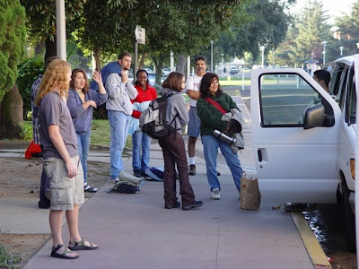
Which of these people is a geologist?

Lounge of the Lab Lemming has an interesting post in which he wonders how he was spotted as a geologist in a grocery store, and mentions some kind of geologist spotting formula (gsf; geodar?). Although it sounds a little like the "you might be a geologist if..." lists that have made the rounds in geology departments, I think it is a little different. We geologists ARE different. So, with unattributed factoids from all around, I offer a few gsf parameters, and would love to hear about others. I don't think this list is quantifiable in the sense that Lab Lemming meant, but I am not that mathematically oriented...


When traveling to famous overlooks at parks and monuments, note that simple tourists will stand in such a way as to enjoy the view, with cameras pointed towards distant vistas. Geologists will be the ones looking at the rocks used to make the walls and embankments, or will be looking at the roadcuts on the opposite side of the road.

Geologist adornments: handlenses on lanyards. 'Nuff said.

In academic settings, such as faculty senate meetings or faculty union meetings, geologists can be identified by their footwear, boots or Keens sandals. This one is tricky because geologists rarely show up at such meetings.

Flower gardens and window gardens in domiciles belonging to geologists are distinguished by the presence of rock samples that are more colorful than the flowers. Or flowers are missing entirely.

Cars driven by geologists are quantifiably dirtier than cars owned by normal people. This is true of the outside, which is often covered by dirt and mud, and what my brother called Arizona pinstripes (scratches caused by driving through thorny thickets), and inside, where the original fabric is obscured by rock samples, collecting bags, fast food debris, and camping equipment.

Hair and Personal Grooming: every day is a bad hair day! Try keeping that 'do in place in a duststorm. Hats are a constant accessory. A quantifiable test might involve beards on men geologists; I suspect the percentage is far higher than the population at large.

The Geologist Tan: for those among us with the pasty skin, the tan lines stop at the sock line, and just above the knee, and on the upper arm where the t-shirt arms stop.

Medical History: lots and lots of scars from those unfortunate rock scrambling accidents

At Home Improvement stores, don't try looking for geologists in the tool section or anything having to do with wood or plumbing products. They will be running their hands over the granite countertops and arguing with the salespeople that "black granite" is not a proper name for the stone.

Bookshelves: Many homes don't even have bookshelves any more, but a geologist home will have many, often in the college-style brick and board construction. Needless to say, there will be lots of geology titles, and ancient copies of the GSA Bulletin, treasured in the way that other people treasure National Geographic (we're talking boxloads in the garage).


And, there's always something about their eyes, something penetrative and insightful, something that can always pick out that small fragment of a fossil or a mineral that would be overlooked by a common person...


What would you add to the list?

Thursday, December 11, 2008

Geokarma or Coincidence? A Few Stories for the Day


I stepped out onto the mesa, embarking on a search for ancient Anasazi cliff dwellings in the Grand Gulch wilderness. It was a beautiful Utah summer morning, folks were excited, it was a great trip, and life was good. I took another step and paused...I had heard something right under my feet...


45 miles away, the deer nibbled at the Mountain Mahogany, considering his possibilities. They seemed dim. This buck was depressed. Did he fail to win a doe? Had his antlers not developed right? Whatever, this deer had decided to end his life. But how?


Craig (see this story about Craig, which takes place approximately two weeks in the future) set forth along with the rest of the students on the same mesa I was exploring. The class had been instructed on safety in the desert: take lots of water, stay in a group, stay in a defined area (the mesa top)...


Meanwhile in the present day, my good friend SciGuy315 was taking a final examination for his Mississippi-based distance-learning class, working towards a master's degree. Twenty questions to go, and he pushed mouse pad to bring up the next problem. Something seemed familiar about that picture...


What is geokarma? Who knows, I just made the word up. But Craig was unique in the annals of our department history. As I said before, karma hung around his neck like a noose. Some karma is good, and some is not so good.


The sound I heard under my feet was that buzzing sound that field workers don't usually like to hear: a rattlesnake. Only it seemed like it was in stereo. I looked down and saw not one, and not two, but three rattlers between my legs. I should have known to cancel the day and just go home, as I jumped through the air in some random and probably poorly chosen direction. No bites, but a very high heart rate for awhile....


The deer decided that 12:43 PM was to be the selected time, some four hours away. The highway between Blanding and Monticello was to be the place....


Craig walked into the wilds, lacking water, companions, and common sense. He wandered off the mesa, climbing down a 4oo foot cliff, and climbing onto the adjacent mesa. He hadn't heard anyone for several hours and finally realized he was lost, and long overdue at the vans. He tripped and fell, wrenching his ankle badly. Back in the parking area, concern was growing and search parties were organized. Finally, two hours later, as we prepared to contact the local Search and Rescue, Craig stumbled out of the pinyon forest, having heard the honking of horns. We were now two hours behind schedule. We set out on the highway, headed to Blanding and Mesa Verde. In forty-five minutes it would be 12:43.


We should have passed the embankment along the highway two hours previously, but Craig...Craig had been lost. And so we were selected to introduce the deer to the hereafter. And the front of our van would never again be the same. That's bad karma.


Meanwhile, yesterday SciGuy315 looked a bit harder at that test question photo. This is good karma, and involved me. You can read his delightful story about the photo right here.


Geokarma or coincidence? You decide...

Tuesday, December 9, 2008

A December Meme: First Things First....

I've been missing in action for a few days...it's finals week and very hectic, so I have a few posts with a story left hanging, which shall resume soon as things settle down (for Christmas holiday, right). So I don't have time for this, this or this, which has been moving through the tubes and seemed harmless enough: take the first line from first post of each month and string them together...it seemed a nice way to look back in my new world of geoblogging, since I started Geotripper last January. So here goes....

January: I hope that this blog will be a clearinghouse for information on geology, earth science education, and the exploration of the beautiful places of the earth! (comment: my very first blog entry)

February: If anyone wonders why I teach at a community college, and why I don't dabble much in research, it would be because I have a scientific version of attention-deficit disorder: as soon as I start concentrating on one subject, something interesting pops up somewhere else, and I explore it for a few weeks, and then get distracted by something else. (comment: for some reason, this entry, concerning marsupials and Australia has been my most-visited post on a continuing basis)

March: Death Valley and environs is an unendingly fascinating collection of naked rock exposures.

April: Was this done in a few weeks? (comment: I waded into the creation science bizarro-world in this entry; the picture was of Grand Canyon)


May: I kind of started this photo-essay about Yosemite Valley by promising myself that I wouldn't be showing the hundreds of pictures that I've taken of the most familiar sights in the park, like El Capitan, Half Dome, and Yosemite Falls.

June: I need to echo the comments of Chris at Highly Allochthonous about the extraordinary picture of the descent of the Phoenix onto the surface of Mars.

July: Still decompressing after a "long" trip of two weeks through geologic time on the Colorado Plateau. (comment: the beginning of my "long" sequence on the history of the Colorado Plateau)

August: John Shelton passed away on July 24th at his home in La Jolla, California.(comment: I have been reminded several times this past year of those who paved the way for our education, and the heritage they left behind)

September: Today we make a return to our series on the geologic story of the Colorado Plateau. (comment: I didn't think my series on the Colorado Plateau was going to last for months! I bet you were moaning about that too)

October: Welcome to one of the most unusual (and most isolated) parks in the American Southwest, Goblin Valley State Park. (comment: yes, the series continues, but heck, I'm enjoying it and it is MY blog)

November: I was in Yosemite Valley yesterday with our campus Geology Club; it was raining, rather heavily at times. (comment: the story of a really special day in one of my favorite places)

December: Well, yeah, except that it isn't the Cedar Mountain Formation, and it's not on the Colorado Plateau, and it isn't a park of any kind. (comment: one of my favorite opening lines as the title of the post referred to parks, the Colorado Plateau, and the Cedar Mountain Formation; this is false advertising at its best. Still, the beginning of the story of one of my finest field experiences)


Almost an entire year blogging! It has been fascinating to watch the growth of the geoblogosphere during this time, and it has been a lot of fun communicating about our earth with the those who work closely with it.


Thursday, December 4, 2008

The Cretaceous Parks of the Colorado Plateau: Every Cloud has a Golden Lining


Following up on today's earlier post, we picked up the debris of our devastated campsite at Grand Tetons, and headed a few miles north to Yellowstone National Park. As if to make up for our rude reception the previous night, the rain gods gave us a tremendously beautiful sunset, and the geothermal gods provided an eruption of Old Faithful at the precise moment the sun hit the horizon. It felt magical.


The next morning, following what must have been the shortest, quickest field trip through Yellowstone National Park in geological field trip history, we made our way north to Bozeman, Montana, and visited the Museum of the Rockies, which has some of the finer dinosaur exhibits to be seen anywhere. I'm not sure if it helped our expectations to see the full mounted specimen of a deinonychus although it did give us an idea of what pieces we would be looking for at the quarry site. The early scenes of dinosaur digging in the movie Jurassic Park may have shaded our expectations a little bit, too. Intellectually, we knew that full complete articulated skeletons of dinos are very rarely ever found. Still, we were going to be digging in a place where relatively complete skeletons had been found in the past (more on this in future posts).


Somehow, distances on the maps of Montana don't quite add up to the distances on the actual roads in Montana, and we pulled into the Montana metropolis of Bridger (population 700) about four hours late to meet the quarry director (aren't first impressions the greatest thing?), and then followed the "road" for seven or eight miles to the quarry site. I use the term "road" only in the sense that the sagebrush was beaten down in such a way that an excellent tracker would be able to discern that a vehicle may have passed this way at some indeterminate time in the past. We crossed a creek, and floored the accelerator to make it up the other side, and pulled into camp....


More tomorrow!

The Cretaceous Parks of the Colorado Plateau: the Story of a DinoDig


To continue our story of the Cretaceous history of the Colorado Plateau, we have taken a slight detour to the north to Montana, where the Cloverly Formation stands in for the Cedar Mountain Formation as the critical link between the late Jurassic ecosystems of the Morrison Formation and the later more widespread late Cretaceous formations. As explained in a previous post, this is because I've dug in the Cloverly, but have never seen (or at least recognized) the Cedar Mountain Formation to the south.

Lots of people participate in dinosaur digs, either as researchers, as students, or as paying volunteers through any number of commercial excavators. Our opportunity arose in 1993 when Jack Horner gave a lecture at Modesto Junior College on Tyrannosaurus rex (thus, the photo above). You may recall that at the time the movie Jurassic Park had pretty much re-ignited dinosaur-mania around the country, and Horner had gained some notoriety as a technical advisor for the film-makers. He had also garnered popular attention as the author of several great books about parenting dinosaurs (the Maiasaurs), and T-Rex (horrible predator or scavenger?). So his arrival at MJC caused quite a stir among my geology students, and they (and me too, I guess) hung around him like a bunch of groupies.

Over beer and pizza the next day, Mr. Horner suggested that we could help with one of his digs that coming summer in Montana, if we were at all interested. He stipulated that we could include 7-8 students, we would have to feed ourselves, provide all our camping supplies, get to Montana at our own expense, and that we would be diggers, not brushers and excavators. It would be hot and dusty or rainy and windy, or even snowy. There would be cows. Starstruck, we said yes, sounds fun!

Over the following months, the list of students crept up to 17 (lots of delicate e-mail negotiations), and they worked hard raising funds with burger sales and yard sales. Eventually they raised something like $5,000 to fund our expedition. So, early in June we set forth in our vans on the way to Bridger, Montana. The first day we slogged our way 550 miles to Angel Lake in the Humboldt Range of Nevada, and the next day traveled to Grand Tetons National Park, where we set up camp in the Gros Ventre Group Campground.

What happened that particular evening became one of our department legends for the ages. One our students had a knack for fomenting trouble with the powers-that-be in the Universe. On various previous trips he had speculated about what it would be like to get stung by a scorpion, and within a day, he had been (unwillingly) stung by a scorpion. At a stop, he asked if we would see any rattlesnakes. He stepped on one moments later. There was a karma that hung about Craig like a hangman's noose.


There was a discussion that evening at Grand Tetons in the twilight about whether we would experience any bad weather on our journey. The skies were clear that night with just a few puffy clouds about. For some reason, Craig looked at towards the heavens, raised a rock hammer towards the sky, and said "I dare the gods to make it rain!". I'm not kidding about what followed. Within ten minutes of his brash statement, our campground was enveloped in a violent storm, our vision obscured by thick blowing dust, and high winds were knocking down old cottonwood trees all around us. Fifteen minutes later the winds died, the dust cleared, and the camp was a shambles. Tents were ripped apart, and branches were down all over our camp. Our vans were undamaged, but a tree had crushed a van in the other part of the campground (people were in it, but were unhurt). We thought we had been hit by a tornado, but more likely it was a microburst from a storm that approached us unseen from the east.


Needless to say, Craig spent much of the rest of the trip muzzled....and this story will be continued.


Wednesday, December 3, 2008

Taking Things Literally...

With a hat-tip to GeoChristian, I am linking to an ad for the Atlas of True Names, which provides world maps with the names of features in their literally English translations. As can be seen by clicking the map above, it is a fun read.

Looking at the map reminds me of the rather fascinating names for the towns and features where I live, places like Lard (Manteca), The Bathrooms (Los Banos), Salt (Salida), Modest (Modesto), Grizzley Valley (Yosemite), The River of our Lady of Mercy (Merced River), the River of the Land of Mountain Lions and Straight Up Steep (Tuolumne River).

I think my favorite literal name is actually over in Kim Hannula's territory in southern Colorado, the River of the Lost Souls (Animas River).

Some of our California towns are perfectly literal in their names; Weed, Weedpatch, Greenacres, Greenfield, Farmersville and Red Bluff come to mind. And at least one doesn't really have translation, at least from what I heard (I'm open to correction on this), but Yreka got it's name when someone saw a bakery sign backwards with the "b" missing. Who knows?

Any other great literal names out there?

BTW, this is my 200th blog entry. I appreciate all the support in my first (almost) year in the geoblogosphere!

Tuesday, December 2, 2008

The Cretaceous Parks of the Colorado Plateau: the Cedar Mountain Formation

Well, yeah, except that it isn't the Cedar Mountain Formation, and it's not on the Colorado Plateau, and it isn't a park of any kind. If I may explain, the Cedar Mountain Formation is an exceedingly important part of the geological history of the Colorado Plateau, being the only representative layer in the region dating from the early/middle Cretaceous Period. It has also turned out to be a treasure trove of fossils with a rich collection of dinosaurian and other species preserving a time when animals were mixing or being separated from related species in Europe and Asia. So it is really important and all, and every geology field trip should stop and have a look at it and take lots of pictures and stuff. Except that I haven't done so on all of my many trips onto the plateau.

Extensive work on the Cedar Mountain Formation does not seem to have begun until the early 1990's (compare to the Morrison Formation, which was being excavated for dinosaurs in the 1870's). Some two dozen dinosaur species have been found in the unit, including several sauropods, iguanadons, troodons, one of the earliest hadrosaurs (eolambia), and my personal favorites, deinonychus, utahraptor, tenontosaurus, and a zephyrosaurus. At different levels in the formation these dinosaurs share affinities with European faunas while others are related to faunas from Asia. These connections reveal the severing of North America from the former and the linking to the latter during early and middle Cretaceous time.

So what's with the picture above? It is an exposure of the Cloverly Formation near Bridger, Montana. The Cloverly is nearly contemporaneous with the Cedar Mountain Formation, and many of the fossils found within it are similar as well. And I have actually been there, and participated in a dinosaur dig that was a defining life event for me and many of my students. So a few posts will soon follow, describing what we did there back in 1994. Please excuse the somewhat diminished quality of the photography, as these are scans of slides that were taken by a grossly incompetent photographer (me) back in the dark days before digital imaging.

These stories will also serve as my contribution to this month's Accretionary Wedge, hosted by Dave Shumaker at Geology News. The topic of the month is our favorite places to do field work, and was this ever it!

More soon!