Showing posts with label basalt. Show all posts

Friday, June 9, 2017

Volcanic Flows in Hawai'i: Life Finds a Way (to destroy rocks)

Ohi'a Lehua (Metrosideros polymorpha) clinging to a crack in a 1974 lava flow on Kilauea
I had kind of a schizophrenic (split-brain) response in regards to what I wanted to accomplish with this post. A couple of weeks ago while still in Hawai'i, I did a post on what I considered the ultimate wilderness on planet Earth, the nearly lifeless high-altitude basalt flows of Mauna Loa on the Big Island. At first, as a follow-up, I was thinking of the idea of how life finds a way to propagate even in the most barren settings. As I went along though, I started to think about how rock is destroyed, and how often life has something to do with the destruction. Whatever way this post decides to go, the unique Hawaiian tree Ohi'a Lehua (Metrosideros polymorpha) is going to have something to do with it.
Ohi'a Lehua (Metrosideros polymorpha). The trees are threatened by Rapid Ohia Death disease.

The Ohi'a is one of the most remarkable tree species on the planet. The Latin name polymorpha ('many shapes') provides a clue why: it can grow in a stunning number of deeply contrasting environments. Ohi'a trees can be found as the first pioneering species on fresh lava flows, as in the pictures above. They can be found on the near-desert leeward slopes of the island's volcanoes. They form the canopy of most of the island's rainforests, growing to heights approaching 100 feet (30 meters). They grow in near alpine conditions at 8,000-9,000 feet on Mauna Loa and Mauna Kea. And stunted trees, barely shrubs, survive in the high altitude bogs on Kauai where the rainfall exceeds 300 inches a year. I know of no other tree species that is capable of such feats.

It's true that you could try and cultivate Ohi'a trees in these kinds of environments elsewhere in the world and they might not do very well in competition with other established species. On Hawai'i, though, all they have to do is survive, because the isolation of the islands has meant that only a handful of other tree species ever arrived. So it is that in the unending battle between rock and life in Hawai'i, the Ohi'a tree is often the main combatant.

The Ohi'a trees aren't entirely alone as colonizers of barren landscapes in Hawai'i. The ʻŌhelo ʻai (Vaccinium reticulatum) is a shrub that can be found on new cinder cones, ash fields, lava flows and alpine slopes. The berry is edible, and is a treat for the nēnē, the native Hawaiian Goose. The geese in fact have a lot to do with spreading the seeds in the inhospitable environments of volcanic landscapes (they leave the seeds in their droppings). I'm trying to think of any other plant or shrub that produces mature fruit when it is only an inch or two high (as in the picture below).
ʻŌhelo ʻai (Vaccinium reticulatum)
There are a number of native fern species as well, growing in the most inhospitable environments I can imagine. Those below are growing in a pit on the flank of Mauna Ulu, which came into existence during a series of eruptions from 1969 to 1974.
And then there were the "furry rocks" I saw on Saddle Road at the pass between Mauna Loa and Mauna Kea. The mosses and lichens survive on the surface of the rock itself, and draw out nutrients directly from the minerals. The acids produced by the plants contribute to the alteration of the basalt to various clay minerals that end up producing pockets of soil that support numerous other plants. Forest succession eventually produces mature rainforests over time (at least with the cessation of constant lava flows as some of the volcanoes go dormant).
I guess "life finds a way" ended up as the predominate theme as I wrote. I was musing, though, about those high slopes of Mauna Loa at 11,000 feet where I saw no visible life. All the normal ways that rock is destroyed don't seem to apply up there. There are no plants to aid in the production of soil. There are no rivers to carry away sediment (any water seeps into the cracks and fractures of the lava flows and emerges far downslope). There are no glaciers. Snow falls on both Mauna Loa and Mauna Kea, and there were glaciers thousands of years ago, but they have little influence in the present day (one of the talks at the conference I attended concerned the permafrost at the summit of Mauna Kea). Waves can't attack the rocks until the islands have subsided enough, a process taking millions of years. Mass wasting has little effect on the gentle slopes of the giant shields, although gigantic megaslides eventually destroy the flanks of the volcanoes and ultimately lead to their destruction. The barren lava fields on the high flanks of Mauna Loa seem permanent until one realizes that they will no doubt be covered by new lava flows in a matter of decades or centuries. And when the volcano goes dormant or extinct, time (and life) will indeed destroy the rocks.
Life creeps ever higher towards the barren summit of Mauna Kea


Friday, June 2, 2017

Answer to a Hawaiian Mystery, and a Cautionary Tale

If you've had a geology or earth science course, do you remember what you learned about basalt? Basalt, the low-silica volcanic rock, the one that flows instead of exploding. The one that isn't all that dangerous. Even if you haven't had such a class, you've heard that visiting volcanoes on the Hawaiian Islands is one of the things tourists can do. Helicopters fly over the lava flows, and people watch lava pouring into the sea from a few hundred yards (or feet) away. Basalt is the black volcanic rock with holes in it.
Pele's Hair collected near the edge of Kilauea Caldera
In my last post, I provided a bit of a mystery, a series of circles found in the barren plains near the summit of the Kilauea caldera on the Big Island. I'm going to provide the answer (and yes, someone accurately solved it), but first I'd like to show you some unusual things you'll see if you get access to some parts of the Kilauea volcano complex.

First off, the stuff in the first two pictures. These fibers are found around the summit area of Kilauea, and in protected hollows they can accumulate in large masses. It's called Pele's Hair, and it's made of natural volcanic glass, otherwise known as obsidian. Glass is not usually associated with basalt in the minds of most people, but glass can form around any lava that cools so quickly that crystals can't readily form. This odd feature develops around spattering edges of lava lakes like that which currently resides in the crater of Halemaumau. As globs of liquid are thrown into the air, some of the liquid trails behind as a thin fiber, which then breaks off and floats away in the turbulent hot air currents. If you visit the Big Island, you can usually find some near the Jagger Museum on the crater rim.
Reticulite from Kilauea Caldera
Then there is this weird material that can also be found around the summit region of Kilauea. It made me think of old weathered sponge rubber, but it is no such thing. It is a rock. It's composed of volcanic glass, and could be described as a sort of golden pumice, but it is distinctly different from any pumice I've ever seen. It's lighter, for one thing, and that is hard to believe, even while holding it in your hand. Most pumice is between 64-94% air bubbles, but this material exceeds 95% air. The walls of the bubbles are so thin that many are open, and this rock will not float the way that pumice can because it fills with water too quickly. It is called reticulite. It's so light that it can be blown a long ways from a crater by high winds. It is so delicate it can be crushed between one's fingers, and it can't be expected to last long in most geological environments.
Close up of reticulite from Kilauea
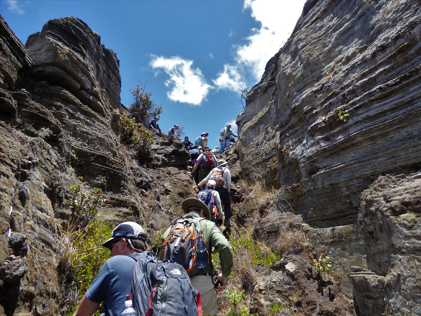
And finally there is this rock outcrop on the rim of Kilauea Caldera. It looks, well, almost like sedimentary layers! That is most decidedly not the kind of thing one expects to find on the edge of a basaltic shield volcano, the edifice that is supposedly constructed by multitudes of basaltic lava flows. What the heck is going on here, and what does it have to do with the strange circles of our little mystery?
A closer look reveals that these are layers of volcanic ash and scoria, the smaller particles that are associated with explosive eruptions, the kind we expect to find on the slopes of a Mt. St. Helens or a Mt. Shasta, the stratovolcanoes found on continental landmasses near subduction zones. What was going on here? The layers are more than 30 feet thick, and have been named the Keanakāko‘i Tephra.
Keanakāko‘i Tephra partially covered by a 1983 basalt flow.

It's clear that what we get taught about basaltic lava is not the entire story. Sometimes basalt erupts violently, and as such it can be exceedingly dangerous. An eruption in 1790 killed several hundred Hawaiian warriors on the eve of a major battle, and the event changed Hawaiian history, as the tragedy was seen as the judgment of the gods. These deposits were once thought to be the results of the 1790 eruption, but it turns out that they include dozens of explosive eruptions that took place between about 1500 and the early 1800s.
Exposures of the Keanakāko‘i Tephra on the margin of the Kilauea Caldera. A 1983 basalt flow can be seen below on the right.

What caused this explosive activity? In a word: water. When rising magma encounters groundwater, the water can flash to steam, causing intense explosions. Apparently the caldera collapsed to a depth great enough to reach the regional water table, and huge explosions ensued. Something like this happened at Kilauea in 1924 (see the picture below), but the massive explosions totaled only about 1% the volume of the 1790 and earlier eruptions. There have been some seriously dangerous eruptions throughout time on this volcano.
1924 eruption of Kilauea Caldera, courtesy of the USGS and Bishop Museum

And that brings us to the strange circles of the mystery. In 1924 some huge blocks were thrown out of Halemaumau crater and were thrown a thousand or more meters. When they landed, they produced bowl-shaped craters. One of the biggest from 1924 weighed 8 tons, and can be seen in the picture below.

Subsequent eruptions produced Pele's Hair, reticulite, and small cinders or coarse ash. All of these particles blew across the landscape, and accumulated in the shallow craters. The blocks remain visible in the centers of some of the craters, while others are buried. The filled craters in some cases trap water more efficiently than other surfaces, so plants are able to gain a foothold (roothold?) in the craters.

The evidence of 300+ years of explosive eruptive activity around Kilauea is sobering. Such eruptions have the potential to do serious damage to surrounding communities around the caldera and in the Puna District to the east. Current research is seeking to better understand the cycle of activity surrounding these periods of violence.
It was a real privilege to explore the flanks of Kilauea Caldera with Don Swanson, Tina Neal, and Frank Trusdell of the Hawai'i Volcano Observatory during my visit to the islands last week. It was a fascinating learning adventure. More stories to come!


Thursday, May 25, 2017

Here's a Hawaiian Mystery for You: Where Did These Circles Come From?

We were on a desolate plain on the south side of Kilauea Caldera on the Big Island exploring the ongoing volcanic activity. The smoking pit of Halemaumau Crater with her bubbling lake of molten lava was only a half mile or so north of us, so yes, we were in a closed area (but legally in this instance!).
Given that no part of the exposed Kilauea shield is older than about 1,000 years, it's almost needless to point out that this is a young geological landscape. You can see that a thick forest can be seen off in the distance, but only a few shrubs and spindly trees are present at our feet. I saw just a few bugs when I got on my hands and knees for a closer look at the gravel.
Circles occur in nature for plenty of reasons. I don't want to provide a list because this isn't a multiple-choice test: it's a thought question! Where did the circles come from?
The middle of the circles are composed of relatively uniform particles about 1-2 millimeters across. The intervening edges are made of larger unsorted fragments. As you can see in the pictures, there is sometimes a single rock in the middle of the rings, and sometimes there is a shrub.

A couple of other background information items: Kilauea is a broad shield volcano composed of thousands of basalt lava flows. It is highly active, and indeed there has been a non-stop eruption going on one place or another on Kilauea since the early 1980s, the longest sustained eruption in recorded history. The lava lake in Halemaumau has been active since 2008. One further point to consider...should we be seeing gravel here, so close to the summit of Kilauea?

So there you go: don't be afraid to speculate! Give us some ideas in the comments section...

Monday, February 27, 2017

Volcanoes in the Mist (and underground): Travels in Death Valley

The Inyo Mountains, in any other setting in the world, would be considered a major mountain range, preserved as a national park perhaps, and celebrated as scenic wonderland. But just like an accomplished sibling overshadowed by a more famous brother or sister, the Inyos lie across the valley from the most spectacular part of the Sierra Nevada, and south of the higher White Mountains. For better or worse (mostly better), only a few roads penetrate the range, including the main western highway into Death Valley National Park, State Route 190. That was the road we followed on our recent exploration of Death Valley.
As was noted in the previous post, we attempted our trip during the Bombogenesis storm that wreaked havoc across Southern California. This kind of storm can often result in disaster as highways get closed or damaged by landslides, but we were lucky and were able cross the Inyo Mountains and Darwin Plateau without problems. But we did get the opportunity to see some great geology, and even were able to add a new stop to our itinerary (because we missed a different one, but I'm not complaining).

Our first sight as we approached the mountains was the snow covering the desert peaks (first picture above), a hint to the seriousness of the storm we were challenging. The tilted rocks are Paleozoic-aged (300-550 million years) limestone layers. They recall a time when California was very different, completely submerged under a shallow tropical sea. We would be seeing more of these fascinating rocks later on. The road crossed the flat uplands of the Darwin Plateau, and then plunged down a steep incline towards the Panamint Valley.

We actually had fog in this arid environment, since the clouds were crowding against the edge of the steep mountains. As we passed the Father Crowley Vista Point, the clouds briefly parted and we had a view into the deep gorge of Rainbow Canyon. At this point, the slopes and flats are covered with basaltic lava flows ranging in age from 8 to 4 million years old. The immediate question becomes, why volcanoes? Why right here?

In a sense, volcanism is possible almost anywhere on the planet. It's not that there is magma everywhere, but that a hundred miles beneath our feet there is a zone, the asthenosphere, where the rock is almost molten, but not quite (perhaps 5-10% liquid). To melt this rock and create volcanic activity would require raising the temperature (as happens at hot spots like Hawai'i), or releasing pressure (pressure keeps the rocks from melting in the same way that pressure cookers prevent water from boiling). There aren't any hot spots in the immediate vicinity, but the crust across the Basin and Range Province has been stretched and thinned, allowing pockets of basaltic magma to form and rise into the rocks above, often following fault zones to the surface.
Although we couldn't see it through the clouds, there are basaltic lavas across the Panamint Valley that are of the same age and the same exact composition as those at the vista point. In addition, the rocks across the deep valley have no obvious source (the picture below is from last year, a decidedly drier trip). The best explanation for these rocks is that the lavas flowed across an original surface that was later broken up by faulting when the Panamint Valley formed. Since the youngest volcanic rocks are just 4 million years old, the Panamint Valley is younger still. The Panamint Valley is more than a mile deep and 65 miles long! That's a lot of geologic activity in a short period of time.
Looking across the Panamint Valley towards Hunter Mountain. The dark rocks on the left summit area are identical to the rocks at Father Crowley Vista Point.
We made a stop along the road descending into the Panamint Valley to check out some spectacular exposures of the dikes and sills that once fed the eruptions of the basaltic lavas (most years we are in too much of a hurry to get a camping spot at Stovepipe Wells). The magma was following whatever weakness in the surrounding rock that could be exploited by the molten rock. In some cases, vertical fractures allowed the magma to rise, forming dikes. In other cases, the molten rock flowed between limestone layers, forming sills. This extraordinary roadcut (below) showed textbook examples of both kinds of intrusions in the same outcrop. The usually black basalt has been oxidized (rusted) to produce the strange reddish-brown color.
There's a saying that one should never blindly sit on the ground in the desert. There are just too many things with fangs, stingers, or spines. The barrel cacti were looking to grow quickly in these rare wet times!
We headed down the highway. We had reached Death Valley National Park, and we faced whatever Bombogenesis was going to throw at us...

Sunday, June 19, 2016

The Hawai'i That Was: The Beginning of All Things, (Ba)salt of the Earth

There are lots of places that are associated with a particular kind of rock. There's the granite of the Sierra Nevada, or the sandstone of Zion National Park. Geologists think Franciscan graywacke sandstone when someone mentions the California Coast Ranges. But nearly every mainland location is really made of a variety of different rocks. That's not the case with the Hawaiian Islands. There is but one rock. It comes in many guises, but it is compositionally the same thing: basalt.
A pahoehoe flow from Kilauea from 2004. The flow was only a few days old and looks silver because of a thin layer of volcanic glass that degrades and falls away within weeks or months.
That's the starting point of our journey through The Hawai'i That Was. Hawai'i began as basalt, and until the eroded rocks are covered by coral reefs, that's all there will be, the basalt or the weathered components of the basalt. Every island in the chain began as a series of sterile tracts of the black volcanic rock.
That's not to say that basalt in Hawai'i is everywhere the same. It originates in the same place, as a "partial melt" magma deep in the Earth's mantle at a (probable) hot spot. Magma results from the melting of rocks, but rocks are made of different kinds of crystals, and different crystals melt at different temperatures. So a partially melted magma will be made of the minerals that melt at slightly lower temperatures. In the case of Hawai'i, the original rock, peridotite (or related rock like dunite), is composed primarily of olivine and a few other minerals, but the partial melt produces a rock composed of pyroxene, calcium-rich plagioclase and lesser amounts of olivine. Two kinds of lava, not easily distinguished in the field, are found in Hawaii: a sodium-depleted tholeiitic basalt (early-stage eruptions), and a sodium-rich alkali basalt (late-stage eruptions). At times, the magma will bring bits of peridotite to the surface as clots in the lava like the one in the picture below. These clots are called xenoliths ("alien rocks").
A mantle xenolith in basalt. The green mineral is olivine (it weathers to red iron oxide quickly in the moist climate of Hawai'i)
Olivine is a semi-precious gemstone, and is occasionally visible as phenocrysts in the basalt. Given the name, it's not hard to guess that the stone is green in color. Hawai'i hosts one of the few green sand beaches to be found anywhere on the planet (which we visited; the story will come in a follow-up blog).
Olivine phenocrysts in vesicular (holey) basalt at Pu'ohonua o Honaunau National Historical Park
Eruptions of basalt can vary in temperature, gas content, water content and other factors. Depending on the circumstances of the eruption, basalt can take the form of a pahoehoe flow (see the second picture above) where the surface is smooth or ropy looking. It can also take a rough and blocky aspect like the one in the picture below called an a'a flow (believe it or not students misspell this word sometimes). Lava flowing into the sea can explode into sand-sized particles (forming black-sand beaches), or pillow-shaped lobes called (not surprisingly) pillow lavas.

Explosive eruptions of basalt are fairly rare on Hawai'i, but they do happen. The rapidly cooling lava may not even form crystals, forming a glass instead. The glass can take the form of a gold-colored basaltic pumice (below), a spongy material with the consistency of styrofoam.
Basaltic pumice at the Lyman Museum in Hilo
One of the oddest materials to result from a basaltic eruption happens when molten lava flies through the air trailing long thin strands of glass called Pele's Hair. The strands are so delicate it's amazing they can be found at all, much less in bunches like the sample below from the Lyman Museum in Hilo. I've only found single strands out in the wilds.
Pele's Hair at the Lyman Museum in Hilo
Larger chunks of molten lava can twist during flight into so-called lava bombs. In the picture below, the sample is lying in a bed of cinders, the smaller bits of explosive eruptions. Take some serious advice here: if you collect lava bombs in Hawai'i and you are going through airport security, and they ask what you have in your luggage, DO NOT use the word "bomb". The results are not happy or convenient, based on a true story (thankfully not mine; I have plenty of lava bombs from California).

Basalt is the beginning of all that is in the Hawaiian Islands. The islands began as thousands upon thousands of lava flows, the soils on which plants and animals survive are derived from the weathering of basalt, and the platform on which coral reefs later grow at the end of the island's existence is basalt. Basalt forms the base on which all travels took place and basalt was the building stone of choice (the only choice).
The Mamalahoa Trail, that stretches from Kona to Puako. It was built in the 1800s.

The islands started as sterile basalt, but as the saying goes, "life finds a way". Certain native ferns and trees are able to colonize the rock even in the absence of anything resembling soil. In the picture below, native 'Ohi'a trees are growing in basalt that erupted in 1959. Barring any more eruptions (a risky proposition in this particular spot on Kilauea), this will be a rainforest in a few centuries.
Native 'Ohi'a trees growing in a recent basalt flow in the interior of the Kilauea Iki crater, which erupted in 1959.
It was June 1st. Although Mrs. Geotripper and I had been on the islands for nearly a week doing some reconnaissance, the students were now arriving at the airport, and we were gathering our class together. Our exploration of the Hawai'i That Was had reached the starting gate.

Sunday, March 1, 2015

Where the River No Longer Runs, Life Persists: Fossil Falls in the Eastern Sierra Nevada

Red Hill near Fossil Falls, with the crest of the Sierra Nevada in the distance.
The Sierra Nevada is the largest single block of rock in the United States. It takes the shape of a huge 400 mile long westward tilting range reaching elevations exceeding 14,000 feet. As such, it acts as a gigantic barrier to Pacific storms. The lands to the east are dry and largely barren. One high mountain range after another, like the White and Inyo Mountains, or the Panamints, capture what little precipitation remains, so that Death Valley is left as the driest place on the continent.

A few streams originate near the crest and flow into the Owens Valley. For years these streams fed the Owens River which filled Owens Lake, covering just over 100 square miles to a depth of 30 feet or so. From there the water could only evaporate or sink into the ground. Today the lake is dry, the victim of water diversions that sent Sierra water to Los Angeles. The lake would have to fill to a depth of 200 feet before spilling over into the next basin at China Lake. That would require much more precipitation than happens in the present day.
Upstream portion of Fossil Falls
But the climate has not always been like it is today. At various times during the last 2 million years the world cooled, and glaciers grew in the Sierra Nevada, eventually covering as much as 30% of the range. The glaciers would melt and some 10% of the Sierra water would drain into Owens Lake and spill over into China Lake, eventually reaching Death Valley. Rivers once flowed across the barren desert.

The rivers were like a highway for life. At some point in time, they connected with the Colorado River and numerous species of fish entered the waterways: trout, chub, pupfish and many others established populations in the streams and lakes of the Sierra and eastern desert valleys. As the glaciers receded and disappeared, so did the rivers and lakes of the desert. The few fish populations that survived did so in springs and Sierra streams. For the most part, aquatic life withered away in the desert heat.
There was another element to the story. The extensional forces that broke up the crust and formed the desert valleys produced fault lines, and provided conduits for lava to reach the surface. Volcanoes formed in many areas of the desert, including impossibly large calderas like the one at Mammoth Lakes, but in other places, the volcanism was less explosive. South of Owens Lake, there were a number of basaltic lava flows extruded within the last 130,000 years or so. Some of them crossed and blocked the Owens River. The rivers developed channels across the lava  flows, and in one place, the waters poured over a forty foot wall, forming a waterfall.

The waters carved a channel in the solid basalt, and swirling gravel and boulders carved deep potholes. Fossil Falls, just a short distance off of Highway 395 near Red Hill cinder cone is what remains of this now extinct river. It is a fascinating place to explore, and was one of our stops on our journey to Death Valley a few weeks ago.
There is little to suggest that aquatic life could survive here, but the potholes play host to a surprising survivor of wetter days. Fairy shrimp are small branchiopods that lay eggs that can survive long periods of dehydration. They lie in the sediment in the bottoms of potholes at Fossil Falls, and on the rare occasions that rain fall, water fills the potholes. This sets off a race for survival as the eggs hatch, and the organisms try to reach adulthood and reproduce before the pitiless sun dries up the water in the holes. It's a hard life, but they've survived this way for thousands of years.

It had rained a week before our arrival and water stood in a few of the potholes. I took a close look, and the  small pools were teeming with life. I couldn't get any good pictures, but a video I took shows the action. There are longish gray shrimp and some kind of very small swimming creatures at the water's edge. It's is amazing to see life persisting in the most difficult of environments.

Sunday, August 10, 2014

Northern Convergence: The Olympics, Where a Trench Became Sky-Piercing Peaks

Our journey through Western Canada and the Pacific Northwest began as we met with our students in the Seattle area one evening in late July. After a complicated couple of hours of meetings and negotiating van rentals (reservations three months earlier are only the preliminaries), we settled in for the night, and prepared to hit the road at 6:30 AM. We had a long day ahead that wouldn't end until we rode the last ferry across the Strait of Juan de Fuca, arriving in Victoria at 11 PM. It wasn't the kind of itinerary I like, but in the end it worked out (as noted in one of the few posts I was able to complete during the trip itself).

We wove through the morning traffic of Tacoma and Olympia (luckily most everyone was headed the opposite direction). We reached the village of Blyn near Port Angeles by 9 AM or so where we stopped at a roadside rest to have our first introductory presentations on the geology and anthropology of the Puget Sound and Olympic Peninsula. The skies were somewhat overcast, which was worrisome because a storm was rolling in soon, and we had hopes of having a clear view of the Olympic Mountains from Hurricane Ridge.
Mrs. Geotripper and I had paid a visit to the ridge a few days earlier and were treated to spectacular views, and I would have been heartbroken if we had showed up with the students to a fogged-in viewpoint. It's happened before; you can ask my students of their memories of seeing Mt. St. Helens in 2011 and get blank stares. We spent most of a day at St. Helens looking at fog, rain, and a few downed trees next to the highway. I didn't want such a thing to happen again, so I was tense as we started the climb out of Port Angeles towards Hurricane Ridge. In fog.

To my great relief, we broke through the clouds and drove into bright sunlight. We climbed the winding highway through the thick forest with increasingly far-ranging views. But nothing quite prepares anyone for the view from the end of the paved road at Hurricane Ridge. It is simply astounding.
The Olympic Mountains are geologically distinctive, to say the least. The mountains rise from sea level to nearly 8,000 feet and are extremely rugged. They capture prodigious amounts of rain and snow on the western flanks, so much so that temperate rainforests coat the western slopes. It would have been a nightmare for geologists who were trying to unravel the geologic history.

Subduction is the story of the Pacific Northwest. For most of 200 million years a convergent boundary has been active in the region, as the crust of the Pacific Ocean basin has been sinking against the edge of the North American Continent. In some places, for instance California, the subduction zone has been replaced by a transform boundary (the San Andreas fault). But in Northern California, Oregon, Washington, and part of British Columbia, the subduction zone is still active, still producing earthquakes, and still raising mountains. It's called the Cascadia Subduction Zone
Source: Geological Society of America

In a "normal" subduction zone, there are four parts: the trench, an accretionary wedge, a forearc basin, and a magmatic arc. The trench is the deepest part of the ocean floor where the oceanic crust sinks back into the mantle. The accretionary wedge is a collection of seafloor sediments and crust that has been scraped off the subducting plate and added to the edge of the continent. The forearc basin is a shallow sea that may develop inland of the accretionary wedge (California's Great Valley originated in this fashion). The magmatic arc is a system of volcanoes and intrusive plutons resulting from the melting of rocks in the lower crust and upper mantle above the descending slab (water released from the slab lowers the melting point of the rock, leading to the formation of the molten rock). Other features may develop, depending on the angle of subduction or the geometry of the plate boundary. There will be more on those later in the series.


Looking at the thickly forested slopes below Hurricane Ridge, I cannot envy the geologists who originally mapped the Olympic Mountains. Simply finding an exposure of rock must have been challenging at times. What these geologists did was to take the rare rock exposures and extrapolate them into a semi-coherent map that reveals the structure of the Olympic Mountains. They did the equivalent of taking a few pieces of a jigsaw puzzle, putting them in the right location relative to the others, and then drawing in the remainder of the puzzle from scratch. I've been way too spoiled by the naked rock exposures of places like Death Valley and the Mojave Desert!

The geologic map reveals the basic structure of the Olympics. A "horseshoe" of basalt and sedimentary rocks (the Peripheral Rocks, or Crescent Formation) partially surrounds the "Core Rocks", an assemblage of lightly metamorphosed sandstone and shale layers. The Core Rocks are characteristic of the types of deposits that form from underwater landslides ("turbidity currents") within the trench and accretionary wedge of a subduction zone. The fact that these rocks are now thousands of feet above sea level is the interesting conundrum. Accretionary wedges are generally below sea level, or exist as small islands. They can be pushed higher. For instance, the rocks of the Cascadia accretionary wedge are exposed in the Coast Ranges of  Washington, Oregon and California, but nowhere are the exposures as spectacular as the Olympic Mountains.
Convergent boundaries can be exceedingly complex places. Bits and pieces of continents and island arcs may randomly arrive at the subduction zone, mucking up the subduction process the way too many sheets of paper at once can muck up a paper-shredder. In the case of the Olympics, there was a mass of land north (Vancouver Island) and an accreted terrane to the south (the North Cascades), and a bend in the subduction zone itself. In essence, too much material was being stuffed into the subduction zone, so the excess material went the only way it could, which was up (see my earlier post on this subject, "Sorry, this trench is full..."). The mountains have been rising for around 15 million years. They would be higher, but the incredible amount of precipitation tears the mountains down at a roughly equivalent rate.
The basalt is exposed along the Hurricane Ridge Road and along trails near the viewpoint. The slopes below Hurricane Ridge also include exposures the intensely folded shale layers.

When we first visited Hurricane Ridge the prior week, the highest peaks were obscured by clouds. When the class arrived, the mountains were clear and we could easily observe the glaciers that scour the upper reaches of the mountains. Glaciers technically shouldn't exist here. Although we were at a high enough latitude, the nearby Pacific Ocean moderates the climate, keeping things warmer than they would otherwise be (the Olympics are at the same latitude as Great Falls, Montana, or St. Paul, Minnesota). But temperature isn't the only factor in glacier development. The sheer amount of snowfall in combination with temperatures that are just cold enough allows glaciers to exist at these unusually low elevations.
We had a good introduction to the basic features of alpine glaciation as we gazed across the valley to Mt. Olympus. We could clearly see bergshrunds (the cracks that develop at the top of glaciers where they pull away from cliffs), and crevasse fields in the lower parts where the glaciers flowed over obstructions. There were horns, aretes, and cirques as well. Glaciers were going to be a big part of the story of British Columbia, and Hurricane Ridge provided a spectacular setting for the first discussion of how they worked.
We gave the students some time to wander the network of trails around the visitor center, and I set off to Sunrise Point to get a panoramic view. I was so relieved that the storm had not yet arrived, but of course it was still out there, and there would be a few consequences for our trip. But not on this most beautiful of days.

We headed down to Port Angeles for lunch and to find to road to the other major locale the day: Neah Bay and lands of the Makah people.