Showing posts with label Del Puerto Canyon dam. Show all posts

Monday, November 11, 2024

In the Heart of the Devil: The Damning of Del Puerto Canyon

This beautiful canyon is under serious threat

California geology is complicated. Unlike any other state, it is affected by the interactions of all three kinds of plate boundaries: divergent (the crust pulling apart), convergent (the crust compressing together), and transform (the crust sliding laterally). All of these forces have formed a complex landscape with incredible scenery unlike any other place in the world. 
The Coast Ranges province is one of those unique regions. Extending some 400 miles from the Oregon border to the Transverse Ranges near Point Conception, it is one of the least familiar parts of California (aside from the Pacific Highway 1 corridor through Big Sur and the Marin Headlands/Point Reyes region). The province is defined by a series of individual mountain ranges that trend roughly parallel to the coast, but the variation in rock types and structure is astounding. Within the province there are active volcanic fields, older inactive volcanoes, vast tracts of tilted sedimentary rocks, exposures of twisted and folded rocks formed deep within subduction zone complexes, and even a displaced section of Sierra Nevada granitic crust. Numerous active faults slice through the province, including many of California's most dangerous: the San Andreas, the Hayward, the Calaveras, and many others.
We just explored the heart of the devil: the so-called Diablo Range. It is one of the largest individual ranges in the province, running for around 150 miles from Mt. Diablo and the Carquinez Strait on the north to the Coalinga area in the south. The region is largely undeveloped, and few paved roads cross range. We followed one of those few roads, the one that traverses Del Puerto Canyon. It's a one-of-a-kind experience, the equivalent of driving into and through the crust of the Earth and into the mantle below. It is the path to the nether-world that has often been called the home of the devil.
Del Puerto Canyon lies just west of the Central Valley town of Patterson. A paved road, state route 130, connects Patterson with the Santa Clara Valley, but anyone thinking it would make a shortcut between the two localities is in for a rude awakening: curvy, narrow, with steep drop-offs, it is not a road for the faint-of-heart. It also has some extraordinary scenery and some absolutely fascinating geology. 
The lower canyon exposes 25,000 feet of late Mesozoic and early Paleogene marine sediments deposited in the forearc basin of the Cordilleran subduction zone that stretched the length of California. The middle stretches reveal the oceanic crust on which the sediments were deposited, the Coast Range ophiolite (the second-most complete section found in California). The uppermost canyon is the strangest environment of all, consisting of rocks that were once part of the Earth's mantle. The rocks are interesting, and so are the plants that survive on the ultramafic soils.
One of our students discovered an ammonite fossil on this trip!

The canyon also has a place in the history of California paleontology. The 25,000 feet of oceanic sediments provide an extensive record of fossil species, including the clams, snails, ammonites and shark teeth that are expected in such environments. Mesozoic marine reptiles have also been found in the region, including plesiosaurs, ichthyosaurs, and a new species of mosasaur, Plotosaurus bennisoni. The canyon was also the site of the discovery of California's first dinosaur, a species of duckbilled dinosaur called Saurolophus. It was discovered by 16-year-old Al Bennison of Gustine in 1936. We found a single fossil this trip, an ammonite. Someday, it'll be a dinosaur, right?
To me, the most interesting rocks are found in the upper canyon. The mantle of the Earth is a 1,800-mile-thick layer that starts at a depth of 15 or 20 miles beneath the continental crust. It is generally composed of a rock called peridotite or dunite, made up of the mineral olivine with varying amounts of pyroxene and various ores of chrome, mercury, magnesium, and copper. Peridotite is chemically unstable in surface conditions and alters mostly to serpentine. Many of the rocks we observed showed some degree of alteration. The rock below that looks like alligator skin (below) is composed of fractured chunks of pyroxene (the reddish-brown) and serpentine (the green fracture filling).
In a few spots one can find some relatively unaltered peridotite (below).

We also found some samples of chromite ore. Chrome contributes to the production of stainless steel and has applications in forming armor. During peacetime, there are cheaper sources of chrome overseas, but during wars the supplies may be cut off. During the world wars, chromite was mined in the upper canyon and transported by rail down the canyon to Patterson to be processed.
The little black grains are chromite
The upper canyon was also a source of cinnabar, a mercury sulfide mineral. Despite its toxic nature, mercury was a critical component in the processing of gold ores during the Gold Rush. Miners could often make a good wage mining the ores, but they would do so at great risk to their health. Luckily the temptation to gather mercury ore was not possible as the mine properties are fenced off.
The last part of our journey is the saddest. The lower canyon, the first five-and-a-half miles, is under threat. A local irrigation district is intent on building a reservoir that will flood much of the canyon under hundreds of feet of water. It will serve no purpose other than to store excess water from the California Water Project (in the rare years when such excess is available). It would then be used in subsequent drought years. In other words, it would be an evaporation pond, a waste of water. There would be no recreational facilities. Numerous archaeological sites would be flooded, and precious prairie and riparian ecosystems would be destroyed.
Del Puerto, ("the Gate") Credit: Elias Funez, Save Del Puerto Canyon
There are geological concerns. The dam itself would be constructed a quarter mile from a potentially active fault system (there was an earthquake swarm in the canyon earlier this year). There are seven gigantic earthflows and slumps, one a mile long, that would be partially inundated and potentially reactivated. And it's true I'm not an engineering geologist, but I question the stability of the shale, siltstone and sandstone that the dam abutments would be anchored in. I wasn't reassured by the environmental impact report.

In any case, there is community opposition to this misguided plan. It will do nothing to benefit the local community even while it threatens nearby cities. If you would like to learn more, and support efforts to stop this boondoggle project, please contact the organization Save Del Puerto Canyon. It would be such a shame to destroy yet another beautiful place in service to economic benefits for the very few.


Friday, January 24, 2020

Our Dinosaur is Here (More or Less). Stanislaus County's Secret is Soon to be Out!

Parasaurolophus

We are anxiously awaiting one of the last fixtures in our Great Valley Museum's Outdoor Nature Lab...our dinosaur! I hear that it is sitting in Receiving awaiting its placement near the paleontology mock dig. It's a scaled down version of the original creature, but will still be 16 feet long and 8 feet high. The model is a Parasaurolophus, which is serving as a stand-in for California's actual state dinosaur, the Augustynolophus morrisi. It turns out that our state dinosaur is rare enough that suppliers don't seem to offer them yet.

The Augustynolophus was a plant-eating dinosaur of the Hadrosaur family, the duck-billed dinosaurs. It has been found in Central California in the Late Cretaceous Moreno Formation, which is extensively exposed along the eastern margin of the Diablo Range, including Del Puerto Canyon in our county. The type specimens were found south of Stanislaus County, but fragmentary remains found in Del Puerto in 1936 are considered likely to be the same species. The 1936 discovery by teenager Allan Bennison was the first time dinosaur remains had ever been found in California. The Moreno Formation where the dinosaur remains were found was a marine environment, so the find could be considered unusual (dinosaurs were terrestrial creatures). What likely happened is that the animal was overwhelmed by a river flood off to the east where the Sierra Nevada is today, and the carcass floated out to sea where it finally sank to the bottom and was buried. Bennison found the bones, recognized their significance and reported them to his teacher in Gustine. The teacher notified paleontologists at U.C. Berkeley, and they eventually excavated 500 bone fragments, including 29 tail vertebrae and parts of the hind feet. The remains apparently reside in the University of California Museum of Paleontology (and wouldn't I love to get pictures one day!).
Augustynolophus Morrisi

The discovery site is on private land that is not accessible, but it can be viewed from the road in Del Puerto Canyon. It is perhaps very relevant to mention that plans are afoot to inundate the lower part of Del Puerto Canyon with a largely useless and possible dangerous reservoir, and the presence of this dam will make it more or less impossible to even see the location. It's a shame that one of the most important paleontology sites in California doesn't even merit a mention in the draft environmental impact report for Del Puerto dam.

There is time to have some impact on whether this dam is ever built. If you would like to be involved, please check out this Facebook site: https://www.facebook.com/groups/463664377903706/?multi_permalinks=478825349720942&notif_id=1579883197857937&notif_t=group_activity. There are some important meetings of regulatory committees coming up, and the public comments period on the draft EIR ends on January 27.


Sunday, January 19, 2020

What's Wrong With This Picture? Part 3: The Mass Wasting of Del Puerto Canyon

It's no secret that I am against the construction of a useless wasteful dam in Del Puerto Canyon. I have had a lot to say about the project in public testimony and in recent blogs, and my opposition is deeply rooted in my appreciation of the canyon as a unique and irreplaceable outdoor laboratory for understanding the geology and natural history of the Diablo Range. It ought to be a national park or monument, not a stagnant pool of mud. But my opposition to this project also follows from my understanding of the hazards of constructing a reservoir in unsuitable and unstable rocks with a proximity to earthquake fault zones of unknown potential activity.

The words "mass wasting" in the title might be interpreted in several ways. It would certainly be a huge waste of money, and a squandering of a treasure of national significance. But to a geologist, mass wasting has a specific meaning: it is the downhill movement of rock and debris under the influence of gravity. Most people call this landsliding, but "land" is a non-specific term, and "sliding" is too specific. Mass wasting can involve sliding debris, but also flowing and falling material.  This post is not about the future potential hazard of mass wasting in Del Puerto Canyon. It is about the active slides that are already there.


Let's see what the Geotechnical Memorandum of the Environment Impact Report has to say about the mass wasting hazard in Del Puerto Canyon:
A significant number of landslides are found within and in the immediate vicinity of the reservoir inundation area, the majority of these landslides are located within units of the Cretaceous Moreno formation, upstream from the proposed main dam. At least seven landslides are mapped within the inundation area of the proposed reservoir – six are in the Moreno formation and one landslide occurs in the Panoche formation (Figure 5). It is expected that additional small landslides and movement of existing landslides would occur as a result of reservoir infilling and operations. These landslides would be expected to experience continuous deformation without some form of stabilization/mitigation. The rate of movement of these landslides would likely be slow. Stability of the reservoir rim, including potential for seismically triggered landslides would be required for design of the Project.
But wait, as they say, there's more...
The proposed reservoir would inundate areas underlain by the Cretaceous Moreno and Panoche Formations. Landslides are found within and in the immediate vicinity of the Project Area, the majority of which are located within units of the Moreno formation, upstream from the proposed main dam. Movement of these landslides is expected as a result of infilling and seasonal operations of the reservoir. It is expected that additional landslides would form as well. Movement of existing and any newly developed landslides resulting from reservoir operation is expected, any deformation of the landslide would be relatively slow and at scale that would not form seiche waves of significant magnitude that would overtop the proposed dam. An assessment of landslide potential and impacts to the Project would be needed for final design of the reservoir and dam.
That's pretty much it. Seven landslides within the reservoir inundation zone, with no specifics about the age of the failures, or the volume and length, and nothing about the current activity. These are precious few words for what could be one of the most hazardous aspects of the proposed reservoir.

Here's figure 5 from the EIR (above). It is a geologic map that shows the different rock formations found at the dam site and the location of the landslides mentioned in the quote above. The proposed reservoir is outlined in blue, and the landslides are the white areas are in white, with black arrows showing the direction of movement. The scale of this map is very roughly 1 inch = 1 mile. These mapped landslides are not small. The smallest mapped slides are about 1/5 of a mile in length, while the largest is about a mile. A mile. These are not minor earth movements.

The three pictures in this post provide a perspective for understanding the size of these unstable masses. The images show the same slide from three different angles, and the trees and farm buildings provide scale. It's huge. It is probably several thousand years old, as it filled the canyon it occupies, pushing the stream all the way to the right against the mountain slope. But it is not done...as Del Puerto Creek has undercut the base (the toe) of the slide, the lower parts have been reactivated, forming the sharp terraces (scarps) above the creek.

Whatever stability exists with this slide lies in the friction between the mass and the underlying rock. But the slide is slated to be at least halfway inundated by the waters of the reservoir, and water is a hugely destabilizing force in mass wasting. It gets between rock surfaces and in essence breaks down the frictional resistance. Geologists other than myself will have to assess the possibilities of inundation, but one of the worst-case scenarios would involve a rapid flow or slide of a huge volume of rock and debris into the reservoir, displacing vast amounts of the water over the top of the dam (the seiching mentioned in the EIR). A less catastrophic outcome, but no less significant, would be the slow flow of debris into the lake. Every cubic yard of debris going into the lake is a cubic yard less of water storage. The slide in these pictures is the smallest of the mapped slope failures. Imagine what happens when all six or seven of the slides are rejuvenated by the waters of the proposed reservoirs.

These are serious concerns, and although the draft EIR addresses some of them, they are buried within something like a thousand pages of the EIR itself, and the background memorandums. This dam is being proposed for construction in an area of unstable and unsuitable rocks and sediments within an area where the earthquake risk is poorly known. I've been learning about the region for thirty years, and I was surprised to find that there was a 6.1 magnitude earthquake in 1881 in the immediate vicinity of the dam site (six miles), but that "the location is highly uncertain given its pre-instrumental age and is based on intensity estimates documented in the public record". That is the kind of uncertainty that should give everyone pause about the magnitude and risks of this dam proposal.

There will be many reasons offered as to why this reservoir is SO necessary, and how there will be SO many benefits. But the questions need to be asked, what is this taking away from all of us, and what is the full magnitude of the threats we will face if it constructed?

If you are on Facebook, check out https://www.facebook.com/groups/463664377903706/

Read the Environmental Impact Report at this link. If Del Puerto Canyon has significance to you, please respond and be active in the opposition! If you have expertise in any of the areas that will affected, you need to be heard from.

There are several important meetings and deadlines coming up very soon:

1/27 5:00pm Public Comments DUE. ahansen@delpuertowd.org OR Anthea Hansen PO Box 1596 Patterson CA 95363 (use the forms outlined in the EIR documents)
1/28 9:00am Board of Supervisors Meeting 1010 10th St Modesto CA - voice concerns, they have final decision


Wednesday, January 15, 2020

What Can You Say in 3 Minutes About One of the World's Special Places? Del Puerto Canyon and the Proposed Dam


I was one of a large number of speakers at a forum this evening on the future of a proposed dam at the mouth of Del Puerto Canyon near Patterson, California. I counted roughly 200 people in attendance, and of the 30 or so of the attendees who spoke, none spoke in favor of building the dam (there may have been supporters, but they chose not to speak). What follows is approximately what I said tonight (I had my comments all written out, but I always go off-script!). I've added the pictures to this post (I couldn't use them at the session).
Image may contain: one or more people and people sitting
Statement on the proposed dam and reservoir in Lower Del Puerto Canyon

Thank you for the opportunity to speak to this important issue. My name is Garry Hayes, and I have been a professor of geology at Modesto Junior College for 32 years. I wish to speak to several issues about the canyon and proposed dam.


First, the national significance of Del Puerto Canyon

The Environmental Impact Report is a perfunctory report on the geological resources and hazards at the proposed dam site in Del Puerto Canyon, but fails to communicate the national significance of canyon. Describing Del Puerto as a “typical” canyon of the Coast Ranges is like describing Yosemite as just another glacial valley. If the Diablo Range were under federal ownership, I am convinced that Del Puerto would have warranted consideration as a national monument or national park. Why? It is the only place in Central (and maybe all of) California where one can drive from the earth’s surface into the mantle and do it in an exceedingly scenic manner. One passes through 25,000 feet of marine sediments, through the underlying ocean crust, and into rocks that were once part of the earth’s mantle. At the same time, as others will note, the canyon offers a unique assemblage of endemic plants and animals. It has a rare riparian wetland habitat in an otherwise arid mountain range. I have taken hundreds of students into the canyon for field studies over the last 30 years. The National Association of Geoscience Teachers, the Geological Society of America and other national organizations have conducted tours in the canyon and many geologists have done research there.


It is not widely known, and the EIR fails to mention that the first dinosaur fossils ever found in California were found on a slope just above the inundation zone of the reservoir. I am disturbed that such a significant site would be simply ignored in the planning for this reservoir.
Saurolophus, the species of dinosaur found in Del Puerto Canyon


My other concern about this reservoir involves the instability of the slopes above the proposed reservoir. There are huge and clearly active landslides within the inundation zone. The EIR fails to address the possibilities of large-scale slope failures when the dam is filled. I am concerned about what happens when a slide that formed under arid conditions is subsequently inundated beneath a hundred feet or more of water. I find the statement in the EIR that “the rate of movement of landslides would likely be slow…” to be inadequate and worrisome.


Del Puerto Canyon is a region of national scientific significance, and I am concerned that the EIR does not acknowledge this fact. The backers of the dam have not adequately considered the importance of this important educational locality, and I strongly and sincerely request that the Del Puerto Water District reconsider the Ingram Canyon alternative, given that the Ingram project will not have the detrimental impact that would occur if a dam is built in Del Puerto. We should be increasing educational access to the canyon, not restricting it.

Thank you for your time and attention.
(end of comments)

Del Puerto can use your help! To get involved, there are several things you can do:

If you are on Facebook, check out https://www.facebook.com/groups/463664377903706/

Read the Environmental Impact Report at this link. If Del Puerto Canyon has significance to you, please respond and be active in the opposition! If you have expertise in any of the areas that will affected, you need to be heard from.

There are several important meetings and deadlines coming up very soon:

1/21 6:30pm City Council Meeting. 1 Plaza Circle. - request they take a stand, voice concerns
1/27 5:00pm Public Comments DUE. ahansen@delpuertowd.org OR Anthea Hansen PO Box 1596 Patterson CA 95363
1/28 9:00am Board of Supervisors Meeting 1010 10th St Modesto CA - voice concerns, they have final decision

Monday, January 13, 2020

What's Wrong With This Picture (Part 2)? The Problem of a Dam in Del Puerto

Actually, nothing is wrong with this picture, or any of the others in this post. Not yet...
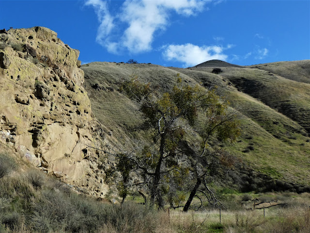
These are pictures of the lower portion of Del Puerto Canyon, the parts that will be inundated if plans to build a dam are successful. There are viable options to this dam that will not destroy a popular and scientifically significant canyon in the Diablo Range of California's Coast Ranges. It is the only publicly accessible canyon in the range within Stanislaus County.
The canyon is a treasure for many reasons. Geologically, it is the source of a huge amount of research into the geologic history of Central California. Driving up the canyon is the equivalent of driving from the Earth's surface through 25,000 feet of oceanic sediment, another five miles of oceanic crust, and into the mantle, the Earth's layer that reaches all the way to the outer core. California's first dinosaur discovery was in the lower canyon, and other paleontological discoveries have been made nearby. The canyon has a unique mining history: mercury, chromite, magnesite, and others have been found in the upper canyon.
The canyon is a wonderful outdoor laboratory for botanists and zoologists. More than 160 bird species have been found here, making Del Puerto the third most diverse bird habitat in the entire county, exceeded only by the San Joaquin River National Wildlife Refuge, and the Modesto Water Treatment Plant (!). Canyon explorers will see a huge variety of mammals, reptiles, amphibians, and insects. I've seen badgers, bobcats, coyotes, rattlesnakes, king snakes, and all manner of lizards.
The wildflower displays in the canyon can be stunning. The unique soils in different parts of the canyon allow hundreds of flower species to flourish, including some that are found nowhere else in the world. There were few flowers last weekend, but come spring the slopes will be awash in color.

There are archaeological sites in the canyon of the occupation by the Yokuts and earlier cultures. These have barely begun to be understood or explored.
People of the San Joaquin Valley have few places where they can go in the Coast Ranges for recreation, and the building of a dam will remove yet one more access point. Del Puerto Canyon is a treasure for so many reasons, but not the least of which is that the canyon is a nearby place for spiritual recharge, exercise, and personal exploration. These intangibles are hard to put a price tag on, and that's the problem.

There will be many reasons offered as to why this reservoir is SO necessary, and how there will be SO many benefits. But the question needs to be asked, what is this taking away from all of us?

If you are on Facebook, check out https://www.facebook.com/groups/463664377903706/

Read the Environmental Impact Report at this link. If Del Puerto Canyon has significance to you, please respond and be active in the opposition! If you have expertise in any of the areas that will affected, you need to be heard from.

There are several important meetings and deadlines coming up very soon:

1/15 3:30pm Protest. Corner of Ward and Sperry
1/15 4:00pm Public Meeting. Hammon Senior Center 1033 West Las Palmas, Patterson
1/21 6:30pm City Council Meeting. 1 Plaza Circle. - request they take a stand, voice concerns
1/27 5:00pm Public Comments DUE. ahansen@delpuertowd.org OR Anthea Hansen PO Box 1596 Patterson CA 95363
1/28 9:00am Board of Supervisors Meeting 1010 10th St Modesto CA - voice concerns, they have final decision


Sunday, January 12, 2020

What's Wrong With This Picture? The Problem of a Dam in Del Puerto

What is wrong with this picture?

This is a map of all the historical sightings of Red-tailed Hawks on eBird in a portion of the Diablo Range between the Bay Area and the Central Valley. The Red-tail is a common bird that lives in a wide variety of habitats, ranging from coastal areas to mountains to savannas. So why, except for a single east-west line across the center of the picture, have they never been sighted in the interior of the Diablo Range? Is there a no-hawk zone in the range interior? It turns out that you could do a similar map for any common (or uncommon) bird species and the pattern would be similar. Are there no birds at all in the Diablo Range?
We raptors want to know...
The answer is that of course there are birds all over the range. But there is no public access in the majority of the mountain range. It is largely under private ownership, and the most common sign to be seen anywhere is "No Trespassing". Except for that narrow stripe in the center of map, at Del Puerto Canyon. There is a public route, Del Puerto Canyon Road, that crosses the range and provides a (very slow) connection between Patterson and the Santa Clara Valley.

And that's the problem with the picture. Del Puerto is the only public access to the mountain range in Stanislaus County, and as such is one of very few places where anyone can study the unique geology, biology, botany and archaeology of this intriguing place. And it is the only place that offers year-round recreational opportunities (there are several county parks and a campground in the upper canyon). But now there are plans afoot to eliminate much of that access, and indeed to severely impact the natural environment. There are plans to build a large dam that will inundate five miles of the extraordinarily scenic canyon.

There will be many reasons offered as to why this reservoir is SO necessary, and how there will be SO many benefits. But the question needs to be asked, what is this taking away from all of us? Look to this blog for some answers in coming days. Also, check this blog from several days ago. If you are on Facebook, check out https://www.facebook.com/groups/463664377903706/


Read the Environmental Impact Report at this link. If Del Puerto Canyon has significance to you, please respond and be active in the opposition! If you have expertise in any of the areas that will affected, you need to be heard from.

There are several important meetings and deadlines coming up very soon:

1/14 9:00am Board of Supervisors Meeting 1010 10th St Modesto CA
1/15 3:30pm Protest. Corner of Ward and Sperry
1/15 4:00pm Public Meeting. Hammon Senior Center 1033 West Las Palmas, Patterson
1/21 6:30pm City Council Meeting. 1 Plaza Circle. - request they take a stand, voice concerns
1/27 5:00pm Public Comments DUE. ahansen@delpuertowd.org OR Anthea Hansen PO Box 1596 Patterson CA 95363
1/28 9:00am Board of Supervisors Meeting 1010 10th St Modesto CA - voice concerns, they have final decision

Tuesday, December 17, 2019

Damning Del Puerto Canyon, a Geological and Natural Treasure in our County

I awoke this morning mildly astonished to see my own words making up the headline of a Modesto Bee article about a proposed dam in Del Puerto Canyon, a deep gorge cutting into the heart of the Diablo Range in the western part of Stanislaus County. Del Puerto is one of the most unique landscapes of California's Coast Ranges, and as I noted, a geological and natural treasure. I was hugely dismayed to find that a proposal exists to build a large reservoir in the lower canyon, and my email to a colleague ended up being quoted in the Modesto Bee article linked above (hence my surprise at being quoted; I wasn't directly interviewed). The article accurately describes my concerns about the project. There are large landslides in the lower canyon that canyon that would almost surely be reactivated (or accelerated; they show evidence of recent motion) if the base is inundated by lake water. There are definite seismic concerns, as a probable active fault lies just east of the dam site. But my biggest concern is the effect the dam will have on the natural environment of the canyon.

The environmental impact report was published recently (read it here.). Comments on the Environmental Impact Report can be made at a public meeting from 4 p.m. to 6 p.m. Jan. 15 at the Hammon Senior Center, 1033 W. Las Palmas Ave., in Patterson. Written comments will be accepted until Jan. 27 at Del Puerto Water District, 17840 Ward Ave., Patterson 95363. If you appreciate the intrinsic value of our precious local canyon, I hope you will comment and make your voice heard.

I've written often about Del Puerto Canyon over the years (see many of the articles here), and to give you a feel for the unique nature of the canyon, I'm adapting an article from last May.
The strange and alien landscape in upper Del Puerto Canyon.
California has some really strange landscapes. A state that has beaches, mountains, volcanoes, forests, and deserts is going to offer many perspectives of the complex geological influences on the state. But for alien and otherworldly, few places in the state can compare to the journey you take when you follow Del Puerto Canyon from its mouth in the Great Valley to the headwaters in the Diablo Range. It's a journey into the middle of the world.
"Del Puerto" refers to "The Gate", the constriction of hard sandstone at the mouth of the canyon. This will be the site of the proposed dam. It will be more than 200 feet high.
I guess I should be a bit more specific. We journey to rocks that had once been part of the Earth's mantle, the 1,800 mile thick layer that lies just beneath the thin crust (3-50 miles thick). We can't reach the core of the planet, because no one can (despite sci-fi movies that say otherwise). Since mantle rock is very hot and is subject to convection, it is at least conceivable that the rocks we are exploring have once been close to the Earth's core.
This is an active landslide that will be partially inundated by the proposed reservoir. I am concerned about the effect of adding water to the slip plane. California's first discovery of dinosaur bones was at the top of this slope.
So how does one explore the Earth's mantle? Well, first one has to get through the crust, and the thinnest crust is that which makes up the ocean floors. It's nominally composed of basalt, but the details are more complex.

In Del Puerto Canyon, the ocean floor is covered by...a bit of sediment. About 25,000 feet of it! The sediments poured off the mountainous edge of the continent during the later part of the dinosaur era, the Cretaceous Period. There was a huge subduction zone that formed as oceanic crust plunged into the mantle beneath the edge of the North American continent. This so-called Cascadia Subduction Zone caused volcanoes to form where the Sierra Nevada is today, but the area offshore of the volcanic arc, the forearc basin, collected sediments. As the sediments accumulated, they pressed the crust downward and even more sediment piled on top. Eventually the layers reached a thickness of five miles.

The basin collected fossils as well. There were the usual shells of clams, snails and ammonites, a variety of shark teeth, and three groups of seagoing reptiles, the plesiosaurs (think Loch Ness), ichthyosaurs (think reptilian version of a dolphin), and 35-foot-long mosasaurs (think "swim for your life!"). Even dinosaur fossils have been found. The first dinosaur ever found in California, a Saurolophus, was discovered in the lower reaches of Del Puerto Canyon in 1935.

Eventually, one will reach the base of the oldest sediments, and encounter the ocean crust itself. Faulting obscures some of the relationships, and so in the picture below we see some of the oldest sediment on the right (somewhat brownish shale) and basaltic/andesitic volcanic rock on the left (greenish gray), separated by a fault. The volcanic rocks are harder, and the canyon takes on a more rugged aspect as we climb higher into the mountains.
The Coast Ranges of California are one of the youngest mountain systems in the world, having been uplifted mostly in the last 3 million years or so. The streams in this dry environment have not been able to downcut as fast as the mountains are rising, so they flow much of the way over bedrock. There are few floodplains in these mountains.
The water flows almost year-round and thus the canyon is a critical habitat for all kinds of wildlife. Dozens of mammals and reptile species are known, and nearly 200 bird species have been observed here.
Oceanic crust is basaltic in composition, but there are differences at depth. On the ocean floor, basalt flows form "pillows", globular masses of the volcanic rock. Beneath the pillow basalts, basaltic dikes fed the eruptions. Dikes occur when volcanic rock fills cracks and fissures in the surrounding rock. Since the surrounding rock is also dike material, the entire layer, a mile or two thick, is made of vertical sheet dikes. Feeding these dikes were magma chambers composed of...basalt! But some of the basalt was left at the base of the oceanic crust where it then cooled slowly to form a sparkling crystalline rock called gabbro. The entire suite of rocks is called an ophiolite sequence. The Coast Range Ophiolite sequence in Del Puerto Canyon is considered to be the second best exposed in the state, behind the Point Sal Ophiolite in southern California.

There is a spot in one of the most rugged parts of the canyon to investigate the gabbro where it was pierced by a vein of quartz (below). People have looked for gold here, but I doubt they found any.

Just a few more miles up the canyon we penetrate the uppermost part of the mantle. The rock originally consisted of ultramafic minerals like olivine and pyroxene, but here the rock has been metamorphosed into serpentine, California's state rock. The rock was sheared and faulted on its way to the surface, leaving shiny green and black polished surfaces (below).
And then we are there. In the uppermost part of the canyon, we reach the netherworld of mantle rock that was far less altered, so it retained some of its original appearance. In places we can see olivine and pyroxene crystals, as well as grains of chromite. These ultramafic rocks contain few nutrients needed by plant life, so only a few species can tolerate living on these slopes. Gray pines are among them, grasses generally are not. There are a number of wildflower species endemic to California that can be found here.
Looking at these shattered broken rocks from very deep in the Earth, one imagines hell freezing over. The forges of the demons and devils lie frozen in place, to be slowly removed by earthly weathering. They try to invade the surface realm, but they are defeated by the forces of the heavens, the water and ice falling from the sky.
It may have been a metaphorical battlefield, but in the end there is great beauty in the rarity of the flowers, plants and animals that thrive, or at least tolerate the conditions in the upper canyon.

Del Puerto Canyon is traversed (slowly) by Highway 130, originating in Patterson on the floor of the Great Valley. It can also be reached by way of Mines Road out of Livermore, a winding road out of the San Jose area over Mt. Hamilton and the Lick Observatory complex. It is not a fast way to go!


I know that there is a need for water in the Central Valley. But no matter how many dams get built, there will never be enough to meet the expressed needs and desire of agribusiness. But I feel that we need to keep some of the wild places, and Del Puerto is one of those especially unique places to learn about our planet. I hope you will make your voice heard about this project.