Showing posts with label Bristlecone Pines. Show all posts

Friday, August 16, 2019

Geotripping! It Could Be You! Geology of the Eastern Sierra Nevada, September 26-30


The east side of the Sierra Nevada and the adjacent Owen's Valley is one of the most dramatic landscapes on planet Earth. The valley that forms the eastern boundary of the range is two miles deep, twice the depth of the Grand Canyon. The valley contains active faults (responsible for one of California's most powerful earthquakes ever, the 1872 Lone Pine quake), and active volcanoes, ranging from small cinder cones to gigantic calderas that rival those of Yellowstone.
The region is full of fascinating geological features, including Bodie, one of the most well-preserved ghost towns in the American west. There is also the nation's "Dead Sea" which is not really dead at all, preserving the lives of millions of migratory birds. Mono Lake is the epicenter of the LA water wars, an issue that can only become more important as California enters a new and unprecedented climate regime.

Scenery abounds, and tourists and explorers love this region like few others. But how often have people traveled through this region without the awareness of the incredible geology exposed at their feet? Are you one of them? Have you never had the privilege of exploring this incredible landscape? Well, I've got a great opportunity for you...
On September 26-30, the Geology Department at Modesto Junior College will be offering Geology 186, a 2-unit field course on the geology of the eastern Sierra Nevada and the Owen's Valley. We'll leave the college early Thursday afternoon and drive to our expected first night stop at Baker Station, the High Sierra Institute, located in the high country of the Sierra near Sonora Pass. The facility is run by our district for a variety of multidisciplinary classes.
From there we'll cross the Sierra Nevada at Sonora Pass and explore the lands to the east, including Bodie and Mono Lake before arriving at our base camp at Millpond Recreation Area just outside of Bishop in the Owens Valley. We'll spend three days there. We'll check out the Long Valley Caldera, the Volcanic Tableland, Devil's Postpile, Inyo Craters, and Minaret Summit the next day.
The following day we'll head up into the White Mountains across the Owens Valley from the Sierra Nevada, where we'll have a bird's-eye view of some of California's remaining glaciers, and have a look at the oldest trees on the planet. We'll then head south to Lone Pine and Owens Lake.

Our final day we'll head back up through the caldera with a stop at Convict Lake (below) and then make our way home via Tioga Pass and Yosemite National Park.

We'll be camping out, and you'll be your own cook on this trip. We'll travel in school vans. The trip will cost $80 plus the cost of tuition at MJC (about $100 or so). Information can be found at http://hayesg.faculty.mjc.edu/Eastern%20Sierra%20Nevada.html, and the MJC website (to enroll in the class) can be found at https://mjc.edu/. If you live in the Modesto area, we'll have an organizational meeting on Thursday, September 12 at 5:30 PM in the Geology Lab at MJC, Science Community Center 326. If you live outside the area, I can send you the relevant materials.

The Sierra Nevada and Owens Valley is an incredible place to explore. I hope you'll be joining us!

Friday, September 26, 2014

A Gallery of Sierra Nevada Scenes: Part II

Alabama Hills near Movie Flats
I picked out some more scenes from our recent field studies class in the eastern Sierra Nevada and Owens Valley. Above, the Alabama Hills expose granitic rock essentially similar to that of the rugged high Sierra. It looks different because it weathered beneath the surface, possibly in more subtropical conditions. Cracks and fractures allow water to seep onto the surface of the granite, breaking the feldspar minerals down to clay and removing corners and edges over time.
Devil's Postpile National Monument near the headwaters of the San Joaquin River
The Devil's Postpile is a famous example of a different process of breaking up rock. When lavas flows back up and form pools, the cooling rock contracts and fractures into hexagonal shapes (although columns with 4, 5, and 7 sides are known). It is somewhat unusual to see such straight columns; they usually are far more irregular.
Mamie Lake at Mammoth Lakes
The Mammoth Lakes are a series of beautiful glacially carved tarns (some enhanced by small power generating dams). Mamie Lake is seen above, and the Twin Lakes below.
A storm blew through in the midst of our journey. The morning after brought smoke-free conditions and beautiful sunlight through the clouds. The picture below shows Mt. Tom and Mt. Humphreys west of the town of Bishop in the Owens Valley.
One of the best ways to see the Sierra Nevada is to view the range from the next ridge over. The White Mountains in any other setting would be a celebrated National Park. It is a stunning wall of rock with unique topography and unique biology. We climbed the road to the Schulman Grove of Bristlecone Pines across from the Palisades Crest of the Sierra Nevada.
Palisades Crest from the White Mountains. The Owens Valley is in the foreground.
The Palisades Crest is home to the largest remaining glaciers in the Sierra Nevada. The biggest is about a half mile long and a mile wide. In this drought year, few snow patches were left...pretty much all the ice you see in the picture above is a glacier.
The Bristlecones are special trees. Besides living in one of the toughest environments of any tree in the world (two miles in elevation, with a two or three month growing season), they grow to great antiquity. The oldest discovered thus far is more than 5,000 years in age.
The trees subsist in nutrient poor soils, but even poor soils are better than the barren debris formed on pure quartzite. The forest ends abruptly where the Cambrian quartzite begins.
The day included a spectacular view of clouds curling around the summit of Mt. Whitney (14,505 feet; 4,421 meters), the highest mountain in the lower 48 states. The spheroidally weathered boulders of granite in the Alabama Hills can be seen in the foreground.
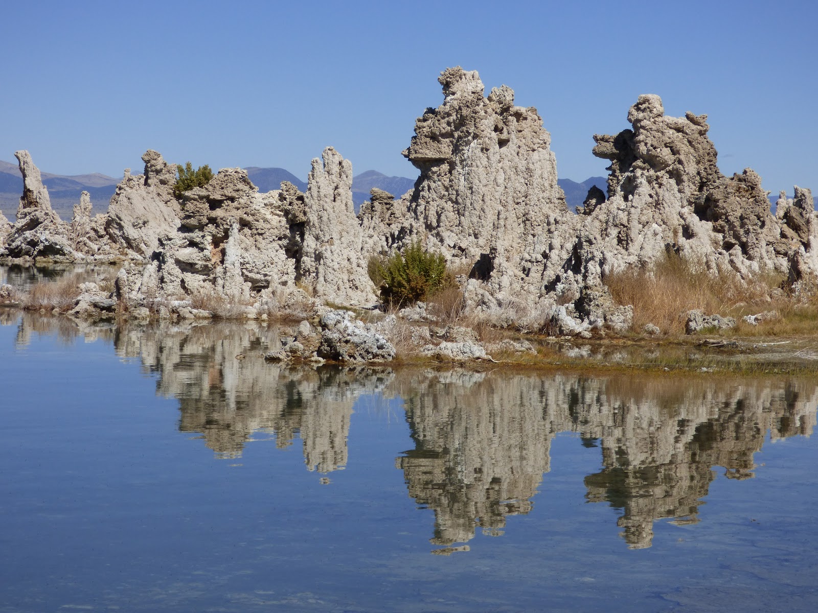
The last day of our trip was clear, providing a beautiful view of the metamorphic rocks above Convict Lake south of Mammoth Lakes, and the tufa towers at Mono Lake. Some detailed geologic descriptions of these fascinating places are in the works for a future blog post.


Monday, July 7, 2014

How to Hide a 14,000 Foot Peak in California? Make it Red, Call it White...

And then put a mountain right next to it that is actually white. Seriously.

So, quick, what's the name of the third highest mountain in California? And for a bonus point, what is the name of the second highest? No, quicker than that, and no Googling! What about the mountain range where these peaks are located?

When I was in my early teens, I developed a fascination for topographic maps, and with it a desire to know the heights of all the major mountains in Southern California and across the rest of the American west. This was closely tied to a desire to climb most of them, and I spent many weekends as a youth adding to my "hundred peaks" list. I was a bit limited by a lack of desire to be dangling by ropes, but there were plenty of peaks within my skill set, and I've enjoyed the view from many a mountaintop.

Two books had a powerful influence on me in those years. The first was a little book by Frank Ashley called "Highpoints of the States", which provided the name and location of the highpoints in each of the states (which is sometimes hard to pin down, some being in cornfields or in the middle of a city block). Ashley climbed (or drove) to all the 48 high points in the contiguous United States in 112 days, a road trip I imagine was fascinating.

The second was "The Thousand Mile Summer" by Colin Fletcher. Fletcher described his walk from the Mexican Border to Canada at a time long before the Pacific Crest Trail existed. He didn't follow (as would be expected) the John Muir Trail through the Sierra Nevada. Instead he opted to follow a more easterly route across the White Mountains on the other side of the Owens Valley. In doing so, he introduced me to a mountain range that has fascinated me ever since.
Nope, North Palisade Peak is fourth, at 14,248 feet (4343 meters). Viewed here from near Lida Summit in Nevada
So, how did you do? I know from my students that many have trouble recalling California's highest mountain. Mt. Shasta is often a first guess, but it is actually only number five at 14,179 ft
(4322 meters). The highest is Mt. Whitney, 14,505 feet (4421 meters) in the Sierra Nevada. Number two is Mt. Williamson, a few miles north of Whitney (14,379 ft, 4383 meters). But number three is one of the best kept secrets in the state of California. It's not in the Sierra Nevada or the Cascades. It's off to the east, forming the highest peak within the Basin and Range Province
Wild horses near the small village of Dyer, on the east side of the White Mountains
The mountain is called White Mountain Peak (14,252 feet, 4344 meters), and it is located in the White Mountains of the westernmost Basin and Range province on the border between California and Nevada. The mountain range has the distinction of having not only the third highest peak in California, but also the highest peak in the state of Nevada, at Boundary Peak (13,146 feet, 4007 meters).

I had a chance to see White Mountain Peak from a new perspective during our trip in early June. We were headed home after our marvelous journey through the western Colorado Plateau, and we really didn't want to drive over Tehachapi Pass and follow Highway 99 up the Central Valley through Fresno and Bakersfield. Been there, done that, a hundred times over. So we set out across the empty country north and west of Las Vegas, crossing Lida Summit and going north through Fish Lake Valley. Eventually we would climb Montgomery Pass and make our way home through Yosemite National Park via Tioga Pass. Yes, traveling through the Basin and Range province requires going over lots of passes.

For a mountain called "white" there is very little white, unless you count the winter snow. The mountain is mostly composed of red and brown metavolcanic rock dating from the early to middle Mesozoic era. The Basin and Range lies in the rain shadow of the Sierra Nevada, so despite being just as high, it receives far less rain and snow, but during the Pleistocene Ice Ages, small glaciers developed adjacent to the peak. From our vantage point on the valley floor we could pick out a prominent glacial cirque (below).
Glacial cirque near White Mountain Peak. Cirques are bowl-shaped valleys that form at the head of glacial valleys where the ice pluck boulders from the cliffs.

There are lots of biologic oddities about the White Mountains. They do not have extensive forests in the way we normally perceive forests. There are vast areas of pinyon-juniper woodland, and higher up there area thickets of Mountain Mahogany. At the highest elevations there are several open forests of Bristlecone Pine, including the oldest living tree on the planet at just over 5,000 years. There are also a few "relict" forests of Ponderosa, Jeffrey Pine, Lodgepole and Aspen, which were more widespread during the ice ages when precipitation levels were higher. There are no native fish, but trout have been introduced into some drainages, and in one, the Paiute Cutthroat Trout has been introduced as part of an effort to preserve the species. It may be the only genetically pure strain of the species left in the world (and no, until the species is stable you can't fish there!).

The highway winds around the north end of the range at Montgomery Pass and we turned west at Benton Hot Springs onto Highway 120 to make our way to Lee Vining for dinner. As we reached the ridge top, we got a stunning view of White Mountain Peak from the west (above). It is a huge mountain, maybe forever overshadowed by the Sierra Nevada, but a fascinating place nonetheless. 
No, this isn't White Mountain Peak, despite the color. It's Montgomery and Boundary Peaks, composed of light colored granitic rock. Even though Boundary is the shorter of the two, it is over the state line and is the highest point in Nevada.

Montgomery and Boundary Peaks, composed of light-colored granitic rock, are sometimes mistaken for White Mountain Peak, but they are both hundreds of feet shorter. Boundary is the shorter of the two, but because the state line passes between the two, it is the highest point in the state of Nevada.

I've flown over the White Mountains on a few occasions, and they are spectacular from above as well. I've not made it yet to the summit of White Mountain Peak. There is actually a "road" that reaches the summit, and  a high altitude research laboratory on top, but the roads are gated, and the climb is a pretty long hike. One of these days, though....

The White Mountains are scenic, geologically interesting, and remote. There is a lot to explore there, and we intend to during our fall field course to the eastern Sierra Nevada! 


Sunday, February 3, 2013

The Airliner Chronicles: A Broken Land of Unspeakable Violence

That's an inflammatory title, and yet in the context of geology it is quite literally true. The land in today's picture is indeed broken, and was the scene of unspeakable violence 760,000 years ago. If such an event were to recur, it's a fair bet that civilization could end up in danger of collapsing into unrecoverable chaos.

Yellowstone National Park gets a lot of attention for being a "supervolcano", and numerous TV documentaries fan the flames of concern about the possibility of a giant eruption in the midst of our country. It's quite true that a full scale explosion like those that have happened three times in the last 2.1 million years could wreak havoc on a wide scale, but Yellowstone hasn't actually had an eruption in 70,000 years.

The proper geological name we geologists use for a "supervolcano" is rhyolite caldera. This works a little better because these calderas are not volcanoes in the normal sense of the word. They are gigantic holes in the ground caused by the collapse of the crust after vast amounts of magma are blasted into the atmosphere. Some calderas were singular mountains at one time (like Mt. Mazama, which collapsed to form Crater Lake in Oregon). Others weren't. They were volcanic centers that included a collection of smaller cones and lava flows. The collapse of giant calderas seem to begin with smaller eruptions that grow in intensity over a time scale measured in decades or centuries. That's why Yellowstone caldera is of somewhat less concern to geologists (that's not to say that lesser eruptions aren't impossible). What is less known to many is that we have more than one recently active rhyolite caldera in the United States; we actually have three. I got a close look at the other two on my plane flight in December.

My flight took a more southerly route than past trips, and as we crossed the crest of the Sierra Nevada, I realized I was flying directly over the north end of the Owens Valley and the Volcanic Tablelands. The Tablelands are the southeastern flank of the Long Valley Caldera, California's version of a "supervolcano". And if anything, it's more dangerous than Yellowstone, if for no other reason than the fact that volcanic activity is ongoing, even though gigantic eruptions like the one that rocked the region 760,000 years ago are unlikely.

The caldera itself was obscured by clouds, but I had a perfect view of the Tablelands, a region adjacent to the caldera that was covered by 400 feet or more of volcanic ash that was so hot when it landed that it welded itself into solid rock. The pink colored rock is called rhyolite tuff. The tuff from this eruption is called the Bishop Tuff.
The scale of the eruption is hard to imagine. For perhaps a week, huge explosions blew ash into the stratosphere. Not a little bit of ash; it amounted to around 150 cubic miles of ash. The ash buried the local landscape under hundreds of feet of hot steaming rock, while some ash deposits have been found as far away as Kansas and Nebraska.

The collapse of the caldera was a stupendous event as well. The hole was around 20 miles long and 10 miles wide, and as much as 1-2 miles deep (much of the caldera was filled with ash during the eruption itself as the ash column collapsed downwards). After 760,000 years, it is still plainly visible in satellite imagery and topographic maps (below).

After the eruptions ceased, water started to fill the caldera, eventually forming a 1,000 foot deep lake. The lake ultimately breached the margin of the caldera and rapidly carved a gorge hundreds of feet deep across the western edge of the Tableland. The walls of the Owens River Gorge expose a fine cross-section of the rhyolite tuff, allowing geologists to work out the sequence of events during the eruption.
Map courtesy of GeoMapApp
The Tablelands provide a window into the tectonic environment of the region. By covering the slope like a thick blanket, the tuff provided a blank slate on which post-eruption faulting can be easily seen and analyzed. There are dozens of faults, mostly trending north or northwest, with scarps that face west (the sunlit terraces) and east (the shadows). Geoblogger Callan Bentley provided a marvelous grounds-eye view of these faults in this post on his old NOVA Geoblog (Callan is now blogging primarily at Mountain Beltway under the auspices of the American Geophysical Union; he's always posting something interesting).

There is a much more extensive example of the broken nature of this landscape. The prominent mountain range on the upper right of the picture below is the White Mountains. In any other setting this mountain range would be a national park, but lying east of the Sierra Nevada, it sort of loses out. It tops out at 14,242 feet, rising as much as two miles above the adjacent Owens Valley. It is a gigantic fault block that formed when the land that is now the Basin and Range province began stretching and collapsing, forming a series of horsts (mountain blocks) and grabens (faulted valleys). The mountains lie in the rain shadow of the Sierra and never formed glaciers of any great extent. The highest arid slopes play host to the most ancient life on planet Earth: the Bristlecone Pines. The oldest Bristlecone is 5,062 years old. The Whites are a fascinating (and lonely) place to visit.
The Airliner Chronicles is one of my on-again/off-again serial features, which is usually updated whenever I fly somewhere.

Thursday, August 18, 2011

Vagabonding across the 39th Parallel: A Park without its Namesake, and an "Oh, s**t" moment in Science

What is it that this park is missing?
Our next destination, as we went vagabonding across the 39th parallel, was one of our country's more unusual national parks. Unusual? We have lots of unusual national parks; they preserve unique natural and historical landmarks all over the place. But what about a park that doesn't preserve what it is named after? A park that sort of won a lottery to get chosen as a park in the first place? Great Basin National Park has an unusual history. Click on the picture above, and the one below (click a second time to magnify the panorama) to get a sweeping view of one of our newer national parks.
The answer is in this picture somewhere...
My first paragraph is not meant to disparage the park; it is actually one of my favorites, and the park and I go back pretty far in time. I visited the area in 1984, two years before the national park designation was passed by Congress and affirmed by Ronald Reagan (that by itself is a surprise). I've been back 15 or 20 times since then. It has some things that many other national parks lack: solitude and crystal-clear skies. The number of visitors at Yosemite Valley during just three days this last June equals the number of visitors in an entire year at Great Basin. At the beginning, there were more cows in the park on a daily basis than people (that aspect has thankfully changed, however). The park has some intense geology, too.

The centerpiece of the park, and the destination for the vast majority of visitors is Lehman Cave. I discussed Lehman a few weeks back, and the self-imposed rules of our trip required us to do different things than normal. One choice would have been to explore one of the other 25 caves in the park but we definitely were not prepared for such an undertaking. There is also a spectacular limestone arch in the southern part of the park, but we just didn't have the time this trip. We headed up to the end of the road beneath the cliffs of Wheeler Peak.

On the way up, we had a marvelous view of the northern part of the Snake Range and Mt. Moriah (12,072 feet). An impressive detachment fault system is exposed on the flanks of the mountain, and is the destination for numerous geology field camp mapping expeditions.
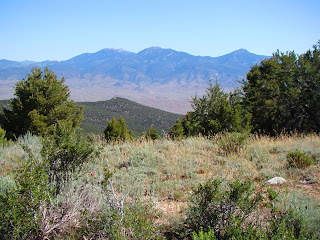
Mt. Moriah and the Northern Snake Range
There were numerous prickly pear cacti growing along the roadside. The ecosystem of Great Basin National Park is changing. For more than a century, cattle grazing took place within the area that would become the park. The political compromise that led to the formation of the park included a provision that grazing would continue unimpeded, but eventually an agreement was reached with the grazing leaseholders that removed cows from the park (and gave the ranchers allotments elsewhere). This was a nice change. The first few years, camping was smelly, and one had watch where one stepped.

The removal of cows from the park has meant that riparian habitats have begun to recover, and the vegetation cover on the mountain slopes has been changing. Eventually, the deer, and perhaps bighorn and elk, will become the dominant grazers. I don't know how the cacti will do; they usually thrive in cow landscapes, but I don't know if they compete well in other situations. They sure are pretty when they are blooming!
Prickly Pear Cactus
Great Basin has a diverse collection of trees, including spruce, fir and ponderosa that indicate connections with the Rocky Mountains. The Great Basin has other trees that are more characteristic, such as Pinyon Pine, Utah Juniper, and a personal favorite, Mountain Mahogany. Mahogany is barely a tree, really, more like a very woody and tall shrub. But when I am high on a mountainside in the Great Basin, the odor of the mahogany is distinctive, and invariably brings back pleasant memories.
Mountain Mahogany
The road ends at a small campground and trailhead at about 10,000 feet. We wandered along the nature trail beneath the high glaciated limestone cliffs and enjoyed the late spring. Snowbanks were still melting and little rivulets were flowing everywhere.
Wheeler Peak (13,063 feet) is the second highest peak in Nevada. Unlike Boundary Peak, which I discussed in the last post, Wheeler is entirely within Nevada, and it is a dominating presence in the region. I think Nevada should just trade Boundary Peak to California for another casino somewhere and celebrate Wheeler as their distinctive mountain. It has a lot of geological personality.
Wheeler Peak
There was a beautiful collection of Shooting Stars in the meadow along the trail...
Shooting Star
We started back down the road, and stopped for a moment at Mather Overlook, at just over 9,000 feet. Mather provides a wonderful perspective of the cirque containing Nevada's only glacier/rock glacier/permanent ice field, depending on how you want to define such things.
Wheeler Peak from Mather Overlook
The glacier, the cave, the prominent peak, the arch, they all add up to a unique park that nicely represents Nevada's Basin and Range Province. The only thing it seems to lack one thing: a basin. Why call it Great Basin National Park, if it doesn't have a basin? The answer is mildly convoluted, so bear with me.

First of all, the "Great Basin" refers to the hydrologic province that covers practically all of Nevada, in which no water flows into the Pacific Ocean. The water from the three hundred or so mountain ranges in the state flows into the adjacent basins and either sinks into the ground or evaporates. There is no "great basin" as such; Nevada is probably the most mountainous state in the union. The Basin and Range Province covers some of the same territory, but is a much larger landscape that spills over into Utah and Arizona.

There was a movement decades ago to designate a park that could represent Nevada's unique landscape. Death Valley National Monument (a monument at the time; today it is a national park) preserved the driest and lowest parts of the province, but Death Valley is in California, and one could not mistake the barren peaks and valleys as being similar to the typical mountains of Nevada. At first, they couldn't quite decide which mountain range should be preserved. As I understand it, three ranges were finalists: the Toiyabe Range near Austin, the Ruby-East Humbold Range near Wells, and the Snake Range, which was eventually chosen. I think any of these would have been a great choice, and I would even ask: Why not all three?

The Ruby-East Humboldt is a high glaciated range with some lakes, and a wildlife refuge on the adjacent lake on the valley floor. The Toiyabes are more typical of the Basin and Range, in that while very high, there was little in the way of glaciation, and little connection with the Rocky Mountains or Sierra; the forests are primarily pinyon, juniper and mahogany. Both of these mountains are rugged and beautiful. But the Snake Range won out in the end, perhaps because the National Park Service already had a presence with Lehman Cave National Monument.

But the new park ended up not having a 'basin' in it. An appropriate park designation would have included the adjacent valley floors and even another mountain range (the Schell Creek range, perhaps) to preserve a complete example of the province. The central focus of Death Valley, for instance, is the valley floor. The original boundaries were much larger, in fact. Because of political realities (an anti-environment president was in office, and the "Sagebrush Rebellion" was in full swing), the proposed boundaries shrank until they were palatable to the Republican legislators (the compromise included the grazing exception as well). Wouldn't it have been nice to see what at least one major valley in Nevada looked like without cattle grazing? Imagine, for instance, what other animals visitors could enjoy. The valley floor would also preserve more cultural features. The remains of the westernmost known Fremont Culture village is found close to Great Basin National Park (the Baker Archaeological Site).
Why isn't this valley part of Great Basin National Park?
We were done with our exploration of Great Basin, and we set out on Utah 21 to Milford. In a matter of minutes, we could see a herd of non-cow animals in the distance. We stopped and pulled out the zoom lens. They were pronghorns!
It would be so nice if this were part of Great Basin National Park. There is value in the barren arid landscape, too. It's part of the complete ecosystem that makes up the Basin and Range Province, and a portion should be preserved.
Picture by Mrs. Geotripper
Oh yeah...my title alluded to an "Oh s**t moment in science (I'm still striving, hard, to keep my blog family friendly, but the word is so appropriate here). Another wonderful and distinctive aspect to Great Basin National Park are the Bristlecone Pines. These trees cling to life on the highest slopes of Wheeler Peak and other mountains in Basin and Range. They are small trees, and live up here because they can't compete well in lower, warmer climates. But if you want to talk about persistence and tenacity, these trees stand alone. They can live for thousands of years, and a tree in the White Mountains of California has survived for 4,700 years, the oldest non-clonal life form on the planet.

The bad moment? Back in the 1960's Donald Curry (a graduate student who went on to a very distinguished academic career) was working on efforts at tree-ring dating and determining the timing of the "Little Ice Age". He was coring bristlecones in what would later become Great Basin National Park. His coring tool broke, and he asked permission to cut down the tree to retrieve the data from the tree rings. The forest service decided the tree was not significant and gave him permission to do so. They cut down the tree, and analyzed the rings. To their abject horror, they discovered they had just killed the oldest living organism on the planet, perhaps several hundred years older than the Methuselah Tree in the White Mountains.

What a thing to be remembered for. To his credit, Curry advocated for the establishment of Great Basin National Park.
A bristlecone snag in the White Mountains. Even after death, the wood may resist decay for thousands of years.
Another geoblogger who spends time at Great Basin National Park is Silver Fox over at Looking for Detachment. Check out some of her posts; there's some excellent writing there...

Tuesday, September 23, 2008

Back from the Eastern Sierra Nevada


We are back from our journey to the east side of the Sierra Nevada, mostly in one piece, mostly not sore, and quite not thrilled to be back in a stuffy classroom! We spent four days touring the length of the Owens Valley, Mono Lake basin, the White Mountains, and the barren hills around the ghost town of Bodie.

The Sierra Nevada is a discrete block of continental crust that is considered to be sort of a micro-plate that is moving northwestward, stretching and breaking the crust in its wake, causing the formation of the deep fault valleys of the Basin and Range province. Owens Valley is one of the deepest of these, with a floor at 4,000 feet, and mountains on either side reaching 14,000 feet (a valley nearly twice as deep as the Grand Canyon, but not carved in any way by rivers). The Sierras include numerous granitic intrusions interspersed with roof pendants of older metamorphic rocks. The lesser-known White Mountains on the east side of Owens Valley are composed of some granite, but mostly of late Proterozoic and early Paleozoic sedimentary and metasedimentary rocks (the Cambrian sediments alone are around 3 miles thick).

Growing up, I thought the eastern face of the Sierra Nevada would be a great stand-in for the Mountains of Mordor in the Lord of the Rings by J.R.R. Tolkien. The rocks make a nearly impassable barrier for something like 100 miles with only an occasional pass at less than 10,000 feet. To say the mountains are scenic is a gross understatement...the first of today's photos is the range crest in the vicinity of Mt. Williamson near the village of Independence.

Farther north, the mountain front is only slightly less rugged, but other factors make for a fascinating geology field trip. In the center photo one can see the inland sea of Mono Lake in the foreground, some of the plug domes of the Mono Craters in the middle distance, and the high peaks just east of Mammoth Lakes on the skyline (the view is from the viewpoint near Conway Summit on Highway 395).

Mono Lake is an ice-age relic that has no outlet (a pluvial lake), so water leaves the region only by evaporating. There are no fish (it is three times saltier than sea water), but there are plenty of brine flies and their larva, and there are trillions of brine shrimp. This is a tasty mix for the millions of birds that use the lake as a stop-over on their seasonal migrations. The lake lost much of its volume when Los Angeles diverted many of the streams that fed the lake in 1942. Recent litigation has led to an agreement to bring the level of the lake to something approximating its original depth (not really, but at least enough to keep the shrimp and flies alive). Parts of the shoreline are decorated by the eerie looking tufa towers that form where fresh water springs flow into the brine.

The Mono Craters have very few actual craters. They are instead a curving line of rhyolite plug domes that began erupting around 35,000 years ago, and it is a safe bet to say they are not done yet; the last episodes of volcanic activity were only 600 years ago, at Panum Crater and Inyo Craters.

The last photo shows one of the oldest living things in existence: a bristlecone pine. Some of these trees have survived for 4,500 years in the harsh environment at 10,000 feet on the flanks of the White Mountains. The tree in the picture is not dead; a thin line of bark and a few needle-covered branches show that it still lives. It is one of the old ones, though. The fierce winter winds have abraded and polished the resin-rich wood where the bark is gone. Even the dead trees persist; a dendrochronology of the living and dead trees reaches back at least 7,000-8,000 years, giving us an accurate record of droughts and climate change over the time period.

Four days is not nearly enough time to see all the geologic wonders in this region...