Showing posts with label Basin and Range Province. Show all posts

Saturday, June 21, 2025

Journeys in the Back of Beyond: Adventures on the Colorado Plateau


Devils Garden in Arches National Park
What is an adventure anymore? 

I ask my students to describe the meaning in one of my offbeat assignments in my geology courses and I get all kinds of answers. Many will describe a experience from our local educational camp in the Sierra Foothills, or an excursion they took to a local river or lake. Many of them have almost never left the city limits, and camping in the Sierra to them is terra incognita, far beyond their experience or expectation. 

I've always known I've had a blessed life in many ways, and what has made it especially rich is the privilege of leading my students on true adventures way out there in America's Back of Beyond, the Colorado Plateau and the Basin and Range country. I've just returned home from one of those journeys.

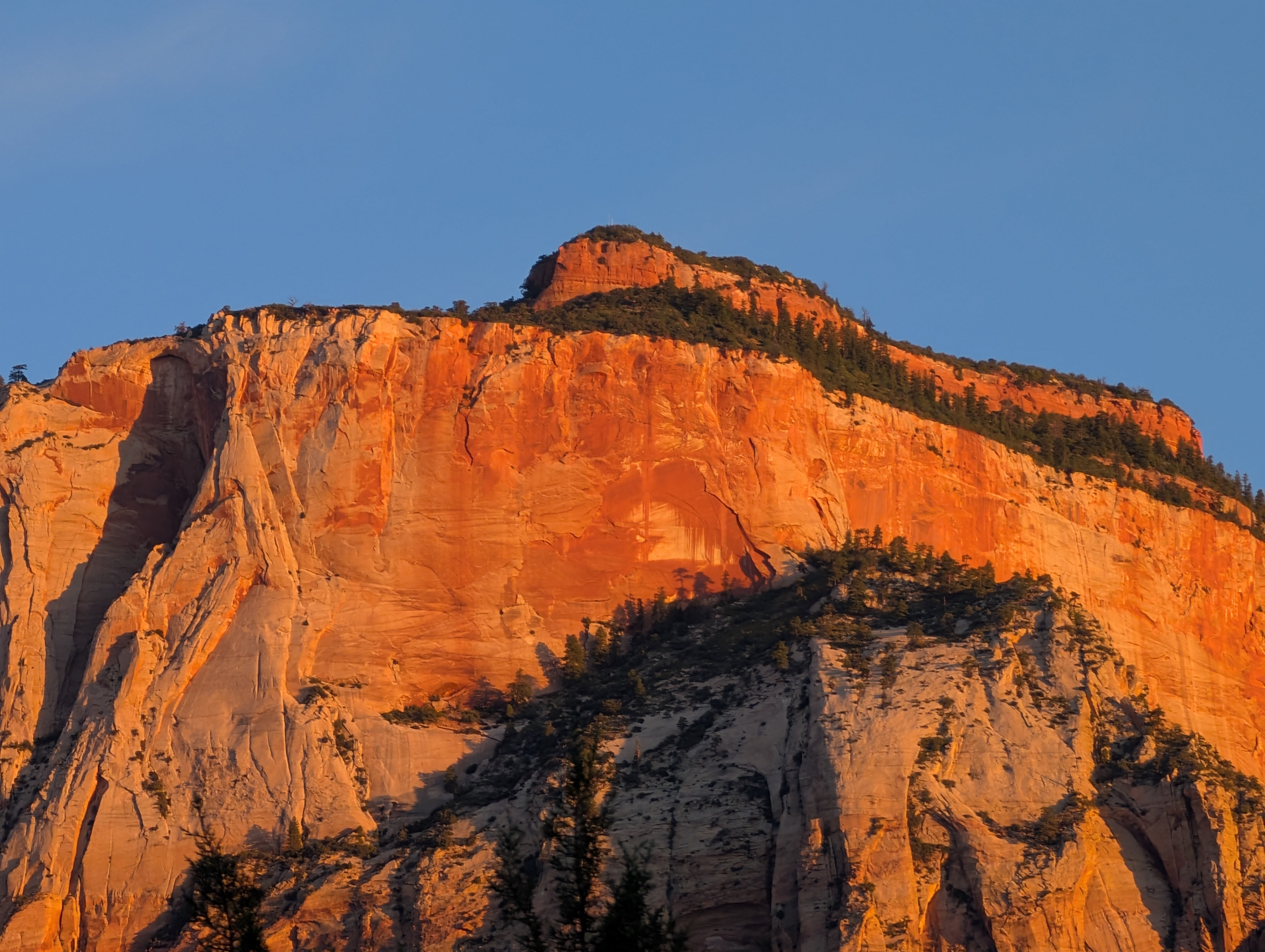
In Zion National Park

"Back of Beyond" is informally defined by Merriam-Webster as "a place that is very far from other places and people: a remote place". There are literary connections in the writings of Edward Abbey and C.J. Box, and a 1954 documentary from Australia. It is also the name of one of the finest bookstores in Utah. Outside of Alaska, some of the wildest and remote country in the United States is indeed the Colorado Plateau and the Great Basin, and to me it is some of the finest scenery in the world, and its geological story is fascinating. And...the land is endangered.

I'd like you to experience this country, if only through narrative and photography. I hope you will join me over these next few weeks as I describe our experience in a series of blog posts, and perhaps understand why we need to take action to protect the heritage of these fragile lands.

Mesa Arch in Canyonlands National Park

As usual, my ambitions often exceed my time allocation, so forgive me if delays occur in new postings!

Thursday, July 8, 2021

My Thesis Area is Misbehaving: 6.0 Earthquake Near Walker, California


That was exciting. I live in the Central Valley of California. The valley is famously boring for a number of reasons, and one of the good ones is because we rarely feel earthquakes here. But that wasn't the case today. I was at my computer station and the desk started vibrating and I had to look and see if my wife was shaking it. She wasn't and she was not looking happy. 

It took a while for the USGS to untangle the many wave signatures in the seismic network (there was a brief report of a 4.8 quake just 20 miles from us), but as things have settled out, it looks like the quake took place smack dab in the middle of my masters thesis area in the eastern Sierra Nevada at the small town of Walker, California. The most recent estimate of the magnitude is 5.9 (upgraded to 6.0). The quake has the signature of a normal fault, the kind of faulting to be expected in a crustal region that is being stretched apart. 


Walker is the village in the picture above at the south end of the Antelope Valley, which exists because of faulting. The valley has sunk as the mountains on the right side of the photograph rose along the fault indicated by the solid black line. The epicenter of the quake would be just out of the picture on the lower right side (the picture is looking south).

Antelope Valley sits astride the boundary of the Sierra Nevada and Basin and Range provinces, where the solid block of the Sierra is being sliced up into a series of fault-bounded grabens. The picture below shows the upper (southern) end of the valley from Monitor Pass, with the Sweetwater Mountains in the distance. 

The next picture is from the hill behind Walker looking north. The break in slope on the left is where one would look for evidence of recent earthquakes, but slopewash has covered the fault terraces (scarps) in most places except for the streams and alluvial fans that cross the fault trace. That was what I was searching for when I was doing my masters thesis many years ago in this valley. I was very pleased when I found some.


The person who did the original mapping in the 1950's was working primarily on the rock exposures, and wasn't really looking for recently active faults. By the 1980's a number of people were looking a lot harder, trying to determine the seismic hazard for the region. Fresh alluvial fans provide a possibility of dating the occurrence and size of the last earthquake to cause ground rupture in an area.

The picture below is the Mill Creek fan, at the extreme south end of Antelope Valley. Under normal circumstances, an alluvial fan should be a smooth, gently sloping surface. Here at Mill Creek, the surface steps down to the left, forming a terrace. Immediately after the earthquake this terrace may have been essentially vertical (examples of scarps are shown on this post - Slinkard Valley lies immediately west of Antelope, and the post has a nice cut-away showing the arrangement of the fault blocks).

Scarps like these show that the last major earthquake took place in the recent geologic past, very likely less than 10,000 years ago, and maybe as recently as 3,000 years ago . The length of the fault and the size of the scarps are characteristic of quakes in the range of magnitude 6.5-7.0. A magnitude 5.8 event, the Double Springs Flat earthquake, shook the extreme north end of the Antelope Valley fault system in 1994. Today's quake one-upped that event, but do not be surprised if the magnitude is revised upward or downward (NOTE: the quake was revised upward to 6.0). It takes awhile to fully analyze the seismometer records. It is not inconceivable that some small cracks may appear along some of these older scarps.

I'm listening to reports of a rockfall off the cliffs above Meadowcliff Lodge. That would be very close to the epicenter.

I will revise this post as more information comes in. 

Postscript: I finally got to my office at Modesto Junior College to download the seismogram of the quake, and here it is. The shaking was off-scale for nearly two minutes.


The second shows a compressed version of the quake, along with some of the larger aftershocks.


Friday, February 21, 2020

The Islands of Interior California: A New Geotripper Series


I've always been fascinated by islands. I visit the Hawaiian Islands every chance I get, and I am literally haunted by the vast expanses of open ocean that separate the islands from any other landmasses. It's an odd combination of loneliness and wonder. It's not something you ever feel when you are staying in Waikiki hotels and sunning yourself on a crowded beach. The sense of isolation comes when you spend time in the rainforests, the alpine deserts, and the barren volcano slopes. When you read about and experience the incredible biological isolation, it becomes an incredible story of survival and adaptation that has produced hundreds of unique endemic species found nowhere else in the world.

Which leads to a question: what does that have to do with a bunch of pictures of localities in the California desert?

I was in Death Valley National Park for much of the past week, and while I was teaching a field course, I also had a few moments of observation and reflection about life in the desert. I was watching for bird species in particular, and I was struck by an odd contradiction: Death Valley (Furnace Creek specifically) has more bird species (339) than my county in California's Great Valley (315). It doesn't seem possible, since conditions are far more benign at home, and in fact the Great Valley can support vastly greater numbers of birds. But Death Valley has a way of forcing more species together in one place where they can be seen and recorded...it is a system of biological islands. The islands are made of water, and the intervening space is largely barren land.
The concept of biologic islands in a landscape is not a new concept at all, so I am not introducing any kind of new idea here. It's just that I sensed the concept more than usual during the recent trip. So in the next few posts I want to describe some of the unique and different "islands" that exist in the California desert, and the geological conditions that caused them. Some of these we explored last week, but as I considered the idea of a series, I thought of a few unique spots I've visited in earlier journeys, so I will include a few of them as well.
Coming up in the next post: the spot that made me think of islands in the first place...


Part 1: The Littlest Islands of All
Part 2: The Pygmy Mammoths and the Doomed Sky Islands
Part 3: There's a Reason Why I Don't Hug Ducks

Saturday, February 23, 2019

What's the Most Alien Landscape You've Ever Explored? Here's a Candidate

What is the strangest landscape you've ever explored? That is, the kind of place that makes you think that this just isn't part of planet Earth. I got to experience one of those places last week during our field studies trip to Death Valley National Park.
Only this bizarre landscape is not in Death Valley National Park. It's part of the California desert southwest of Death Valley in the Searles Lake valley. It's not part of any national or state park. It's administered by the Bureau of Land Management as an Area of Critical Environmental Concern and more recently as part of the California Desert Conservation Area.
The Bureau of Land Management has always had an uncomfortable fit with land use priorities in the American West. The Bureau began as a land disposal operation under the direction of the Homestead Act back in the latter part of the 1800s. The land that was not selected by settlers from the east was seen as sort of a wasteland of little interest to most people. But land ethics change and by the 1970s many people began to recognize that many BLM lands were every bit as precious as the adjacent national parks and monuments. This is one of those landscapes. They're called the Trona Pinnacles, and I saw them up close for the first time in my life last week.
When one realizes the richness of Death Valley National Park and all of the strange and wonderful features within, one can almost understand why I haven't been to the Trona Pinnacles before. By the time we arrive in their vicinity, we've already seen four days full of strange landscapes and on the last day we have two important geological localities and then a six-hour drive home. There just hasn't been enough time.

This year was different. We arrived at the park in midst of one of the most intense storm events of the year. Record snow and rain was falling in the coastal regions and the Sierra Nevada, but we had mostly benign conditions during our journey. But the storms caused the closure of the road that we needed to access Aguereberry Point, and construction had closed the access to Mosaic Canyon. We needed a last geological stop and I remembered how we often could see the pinnacles in the distance as we headed home. Why not see if we could get there? We headed south on the five-mile gravel road outside of Trona and had little problem reaching the pinnacles. We started exploring. I was awe-struck.
There are 500 of these pinnacles in three groups. They range in size from a few feet to more than 140 feet high, with an average of around 40 to 50 feet. They occur in three groups (the north, central, and south groups). We were exploring the north group, consisting of some 200 pinnacles. But how did they form? Are they volcanic? Are they alien landing beacons? According to the Star Trek canon, that might be the answer...in what is widely regarded as the worst Star Trek movie, The Final Frontier, the pinnacles formed the setting of the final confrontation of Captain Kirk and the "God" who needed a starship to escape his planetary prison ("What does God need with a starship").

So what really happened?
Today the bottom of the Searles Valley is a sun-blasted dry lake full of salts and other soluble chemicals that are mined on a large-scale basis. But between 12,000 and 25,000 years ago the landscape was much different. The last of the major ice ages, the Tioga, produced extensive glaciers throughout the Sierra Nevada. The Sierra rain shadow prevented many glaciers from forming in the mountains to the east, but glacial meltwater filled the basins. One by one they spilled over into the adjacent valley forming a series of large lakes: Mono, Owens, China, Searles, Panamint, and ultimately Manly in the bottom of Death Valley. These are called pluvial lakes. The surrounding valley floors sported grassy prairies and the hills had forests of trees like pinyon, juniper and at higher elevations, firs. The prairies were grazed by bison, horses, camels, and mammoths. They were hunted by Dire Wolves and Saber-tooth Cats and other fearsome carnivores.
The towers are composed of calcium carbonate, which is the mineral calcite. The porous form of calcite is called tufa. The tufa formed when calcite-rich freshwater springs on the lakebed interacted with the alkaline water of the lake. The location of the springs seems to have been guided by faults running through the area. The towers could only have formed when covered with water, so the pinnacles have been exposed to the elements for more than 10,000 years.

More recently formed towers are visible at Mono Lake near Lee Vining and Tioga Pass in the Sierra Nevada. They were still forming when Los Angeles diverted the water from streams flowing into Mono Lake in 1940. The lake began to dry, exposing the tufa towers.
The snowcapped peak in the picture above and below is Telescope Peak, the highest point in Death Valley National Park at 11,043 feet, more than 9,000 feet above the floor of Searles Lake. Such are the extremes of this fascinating landscape.

There was a lot to see in Death Valley and the surrounding region during our journey last week. More blogs will follow! And while you are waiting for the next entry, tell me about the most alien landscape you've ever seen...

Monday, June 2, 2014

Revealing the Riddle of the Red Rocks

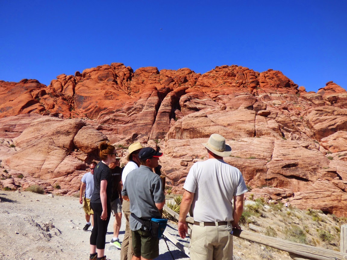
 It's pretty amazing the places that didn't get made into national parks. It's pretty amazing that tens of millions of people visit Las Vegas and never make it just a few miles west of the city limits to see an incredible place where the rocks are red, and the rocks are a bit of a riddle. The problem? The rocks on the top, the gray limestone seen on the distant ridges is 300 million years older than the red rocks underneath. They are out of proper order.
The red rocks are the Aztec Sandstone, a Jurassic aged sand dune deposit that is correlated with the Navajo Sandstone, found in national parks like Zion, Arches and Capitol Reef. They developed in an immense sand dune "sea" that once extended from Wyoming to Arizona to eastern California.
The red color comes from iron oxide (the mineral hematite, or natural rust) coating the sand grains. I haven't found a lot of agreement over whether the red staining is a secondary effect, or a primary feature of the sandstone.
In either case, the outcrops are colorful, in shades of white, pink, red and brown. The rock exposures also display beautiful crossbedding, the sloping layers representing the slip faces of the ancient dunes, frozen in time by calcite or other mineral cement. In many places the rocks are broken up as if they have been through a gigantic nutcracker.

Which, by the way, they have.
Faults run through the region, an earlier set representing intense compression related subduction off the western coast of North America, and a later set formed during the extension that led to the development of the Basin and Range Province. The compressional thrust faults had the effect of pushing the older limestone rocks up and over the younger Jurassic sandstone during the Sevier Orogeny towards the end of the Mesozoic Era (that's the one with the dinosaurs). There are several such faults in the area, but the best known is the Keystone Thrust.
The later normal faulting dropped the valley floors and lifted the mountains, exposing the older faults to view. Erosion has resulted in the spectacular outcrops that make up the conservation area we see today.

Red Rock Canyon National Conservation Area is a wonderful place to visit, whether you've blown all your money at the casinos and can't afford to do anything else (hold back $10 for park admission!), or if you came to Vegas for the expressed purpose of visiting this wonderland of rocks. It is a much better use of your time if you ask me!

Sunday, June 1, 2014

"Fly-over Country" Moniker Doesn't Do this Land Justice: Crossing the Basin and Range

The Basin and Range province is one of the largest geological provinces in North America, covering all of Nevada, parts of eastern California, half of Utah, and large parts of Arizona. It is also one of the least populated, at least outside of the urban centers of Las Vegas, Phoenix, Reno, and Salt Lake City. The region was stretched in late Cenozoic time (during the last 30 million years) so that the crust broke apart and gigantic blocks slipped against each other like shelves of books tipping over. Several hundred horsts (ranges) and grabens (fault valleys) are the defining features of the province.

We were on our way to an exploration of the Colorado Plateau, but needed to make our way to Las Vegas to meet our group. We could have taken the freeways through the Central Valley and Mojave Desert, but I've been down that road several hundred times over the last quarter century. We elected to cross the Sierra Nevada at Tioga Pass and cross the high ranges and deep basins of the region referred to by many as "fly-over" country. It's barren on some ways, but it is a treasure in so many others. How many places will you visit in your life where you have a decent chance of being the only human being on a particular mountain range? That can happen out here.
I could be accused of false advertising in showing these pictures of the alpine scenery of Yosemite National Park, but the presence of the Sierra Nevada is what forms the character of the Basin and Range. Many consider the Sierra to be the westernmost of the Basin and Range mountains, and the high 400 mile long mountain crest blocks the majority of precipitation from ever reaching the region. During the ice ages, the glaciers of the Sierra had a profound effect on the province, primarily in the formation of vast freshwater lakes in some of the driest places on the planet, Death Valley being an outstanding example. It once contained a lake 100-plus miles long and 600 feet deep.

A few of the lakes persist, barely. After we crossed Tioga Pass, we had an outstanding view of Mono Lake, which is huge, but it was once much larger and deeper. Evaporation (and water diversions by Los Angeles) have left behind saline water in which only small fairy shrimp and brine flies can survive. Not a complex ecosystem, but millions of birds depend on the rich protein.
Those birds include species like the gull below, which I suspect of supplementing its diet with scraps of sandwiches from the Whoa Nellie Deli!

The White Mountains, the next major range east of the Sierra Nevada, are spectacular, with a high point of 14,252 feet at White Mountain Peak, and several others exceeding 13,000 feet. The north end of the range extends into Nevada where Boundary Peak forms the highest point in the state of Nevada at 13,147 feet. We headed south along the east flank of the mountains in Fish Springs Valley.
The valley supports some ranching and alfalfa fields, but it's also very dry. We saw some immense dust devils that looked a bit like tornadoes.
We climbed to Lida Summit and looked back across one mountain range after another to the Palisades Crest in the Sierra Nevada.
A number of wildflowers were in evidence, including many Prickly Poppies and Globe Mallows. It's dry country, but lots of plants have adapted to the harsh conditions. The extreme range of elevations from 14,000 feet to below sea level have caused the province to have a stunning number of plant species.
We headed down from Lida Summit and started south towards Las Vegas on Highway 95.
As we rolled slowly (lots of speed traps) through the town of Beatty, Nevada, we encountered dozens of wild Burros. They are the descendants of animals abandoned by the early miners, and they have become a pest in many ways, contributing to overgrazing, trampling rare plants, and fouling springs, but darn it, they're also terribly cute. In hopes of controlling the populations of these creatures the Bureau of Land Management captures as many as they can and puts them up for adoption.

We made to Sin City, and today we met our fellow travelers for the coming week. We had a great day touring the geological environs of Las Vegas, and pictures will undoubtedly appear soon here on Geotripper!

Thursday, May 29, 2014

Headed for the Hinterlands: Basin and Range and the Colorado Plateau.

Hitting the road tomorrow, and much looking forward to getting away for a few days. It may seem like I do a lot of traveling, and I have been, but it's mostly been day trips. We're putting in a few miles this time, heading across the Basin and Range province to an exploration of the Colorado Plateau.
If I can, I'll put in a few dispatches from the road. We'll hopefully be busy doing geology, and discovering some new vistas. I found out that my friends from SBCC will be at Grand Canyon the same time as I will, so I hope to see some familiar faces out there!

In the meantime...

Friday, December 20, 2013

CREC, the Basin and Range, and Sunsets: On the Lower Colorado River

Although there is some geological discussion going on here, this series of photos is really an excuse to share an extraordinary sunset that I enjoyed yesterday evening. Sometimes a sunset is spectacular in its own right, no matter where one might be (my home in the Great Valley being a rare example). Sometimes, though, the landscape and the geological forces that produced it become part of the sky show. That's how it felt yesterday.
It had actually been a gloomy overcast day as we traveled from the Phoenix area to Laughlin, Nevada, with only a bit of sunshine breaking through now and then. Laughlin is of course the small casino strip that provides an alternative to Las Vegas. As a casino town it has the bright lights and giant billboards, but lacks the level of crime and grunge. It has very cheap but reasonably nice rooms ($24 on a weeknight!), and it sits on the shore of the Colorado River. I'm not like a lot of people...I didn't lose any quarters to the one armed bandits because we were there for the room, being a nice overnight break from the long drive home.

We came up from Phoenix on Highway 93 through Wickenburg and Kingman. From Kingman we headed west across Highway 68 through Golden Valley, and over Union Pass in the Black Mountains. We were not far from the edge of the Colorado Plateau (the Grand Wash Cliffs are north of Kingman), and were headed into the interior of the Basin and Range geological province.
The Basin and Range is one of the larger geologic provinces of the United States, extending across all of Nevada, much of Arizona and Nevada, and the eastern part of California. It is a part of the Earth's crust that has been stretched quite literally to the breaking point. Hot upwelling mantle material had raised the landscape and stretched it not unlike the crust on a baking loaf of bread. The solid crust and upper mantle fractured and split, forming major systems of normal faults and near-horizontal detachment surfaces. The land broke into large mountain ranges (horsts) and deep fault valleys (grabens). Ancient river systems were broken up, and with the exception of the Colorado, no rivers flow out of the region to reach the sea. Most of the valleys are interior drainages, ending in playas (dry lakes).

The Colorado River is a strange one all on its own. The upper reaches of the river have been in place for tens of millions of years (dinosaurs may have roamed some of the most ancient canyon passages), but the gorge of the Grand Canyon has probably existed for no more than 6 million years (researchers are still arguing), and the passage to the sea in the Gulf of California for only 4 million years. There have been some wholesale changes in the pathway followed by the river, with the details a great mystery, although more is learned each year.

The valley of the Colorado River at Bullhead City and Laughlin is a heritage of the tectonics of the Basin and Range Province. The river did not carve the valley. It instead flows through a valley that developed from the extreme extensional faulting that formed this part of the province. The researchers in this region call it the Colorado River Extensional Corridor, or CREC.
The upper mantle is a region in the Earth's interior a hundred or so miles down where it is hot enough to melt rock, except for the extreme pressure the prevents the melting from taking place. One of the consequences of extreme extension is that pressure is released on the upper mantle, and some partial melting occurs, forming bodies (or plutons) of hot magma. Volcanism is thus a constant geological phenomenon in areas of crustal extension. We were crossing the Black Mountains, which are mostly composed of exposures of ancient schist, gneiss and granite. But at Union Pass, there are numerous exposures of light colored rhyolite.

Rhyolite can be a violently explosive material depending on the gas content of the magma. One of the eruptions in the immediate region produced the Peach Springs Tuff, an ash layer that coated the landscape from Barstow California to Peach Springs Arizona, with around 150 cubic miles being extruded in one eruptive sequence. Numerous other eruptions rocked the region from about 16 to 19 million years ago (a new geologic map of the area was published this year if you want to take a look).
So what does the landscape have to do with beautiful sunsets? Maybe not much, but here are some ideas: the Basin and Range is a hard place to live. Behind the rain shadow of the Sierra Nevada and Peninsular Ranges of California, the region is the nation's driest. Aside from the aberration of Las Vegas, there are few large towns and consequently few sources of air pollution. The air masses that move across the region are constantly encountering mountain ranges and thus rise and fall, leading to instability of the wind currents. It's rare, I imagine, to see stratus clouds blanketing the region as they might do in flatter places. And finally, the high mountains provide a vantage point from which to see horizons that might be more than a hundred miles away.
 So it was that we came over Union Pass in the Black Mountains at the end of a long day, expecting more of the gloomy overcast that we had seen all day. That's not what we got. As we started down the long grade to the Colorado River, a sliver of sunlight broke through the clouds on the western horizon, and the rhyolite cliffs seemed to catch fire from within.
I found a gravel road on the south side of the highway and we climbed to the top of the ridge to catch the light show. For a few brief moments a sun pillar lit the sky across the valley from us (below).
As the yellow and golden light faded, we got in the car and started down the highway, only to see the sky light up again in bright crimson and magenta. We stopped again in front of a new housing development on the highway.
The colors were stunning. Even the locals were impressed; our waitress at dinner saw some of these pictures on my laptop and commented how gloriously the evening had ended.
I used the zoom lens to concentrate on the most distant horizon, catching a sky that had seemingly caught fire. After a few moments the colors faded and we headed down the hill, back to habitations of humans.