Showing posts with label Normal Fault. Show all posts

Friday, March 16, 2018

All My Faults are Normal, But Not Really: Travels in Death Valley


Death Valley is the ultimate expression of the extensional forces that have ripped apart the crust of the western United States. The affected area reaches from northern Nevada and Oregon, east to central Utah, and south into Arizona. The broken up crust has resulted in the formation of countless fault basins and high mountain ranges (the entire region is called the Basin and Range Province). But few of those basins (really just one, the Owens Valley) approach the grandeur of Death Valley.


The valley (which is just part of the larger national park) is more than a hundred miles long, and it's deep. The vertical distance from the summit of Telescope Peak to the valley floor at Badwater is more than two miles (11,331 feet). Few places in America display greater relief. And the valley was not carved by water or any other erosional force: it is the result of faulting, the movement of the crust of the earth.

Most students of geology are taught early on that fault valleys are called grabens, and that they are formed by normal faulting. That begs the question of "what is normal?" (a concept I'm sure we all struggle with). Faults displaying vertical motion often have a sloping fault plane, and the fault block that "hangs" over the other is called the headwall (which therefore covers the footwall). When the crust is stretched, or extended, the headwall drops relative to the footwall, and that is what defines a "normal fault". If the crust is compressed, the headwall will move up relative to the footwall, forming an "abnormal fault"...no wait, that's my bad joke from the classroom. It's called a "reverse fault".
Death Valley is in an isolated lonely region, except for the main tourist area, which lies mostly along Highway 190 and Badwater Road which leads to...Badwater. But Badwater Road doesn't end there. It continues on to the south end of Death Valley and eventually over Jubilee Pass to the village of Shoshone. Few tourists ever venture this way. But there are things to see out there in the deep desert.
There is an odd little hill on the floor of Death Valley at the south end near the Ashford Mill (the remains of an old mine). It's a cinder cone, a small eroded pile of volcanic cinders and bombs that erupted tens of thousands of years ago. It's out on the valley floor in the midst of the alluvial fans, made up of the gravel and sands eroded from the surrounding mountains. The short climb from West Side Road provides a fine view of the graben of Death Valley. It's odd because it may be the only mountain you will ever climb whose summit is below sea level (-73 feet to be exact).
There are other reasons it is odd. Being in the middle of the valley, there seems no obvious way for lava to reach the surface of the valley. For another, it's in pieces. One half can be seen in the photo mosaic below.
From the main highway (below) it becomes apparent that the two pieces are offset from each other. It's been torn apart by faulting, but not by the kinds of faults we looked at above. The side are moving laterally. This kind with the lateral motion is caused by shearing and is called a strike-slip fault. The presence of the fault provides an explanation for the presence of the cinder cone (the magma was able to follow the fault fracture to the surface). But what are strike-slip faults doing in the Death Valley graben?

There are two kinds of strike-slip faults, right and left lateral. The type can be determined by looking at what the opposite block has done from the observers position: notice below that Pokey moved to Gumby's right. But from Pokey's point of view, Gumby has moved to Pokey's right. That's a right lateral fault.

One can therefore see that Cinder Hill in the Google Earth image below is offset in a right lateral manner, with the southwest portion moving northwest. That's a coincidence (not really) because the San Andreas fault, many miles away to the west, is also a strike-slip fault, and it is moving in the same direction. The two faults are roughly parallel. And that provides a clue about the nature of the faults in the Death Valley region.

There are other strike-slip faults in Death Valley, and they "step over" in such a way that a gap opens between the ends of the fault. In that area the crust is being stretched apart, forming a "pull-apart basin" (below). Death Valley National Park is being stretched apart to form grabens, but the overall motion is towards the northwest as the Sierra Nevada pulls away from the rest of the Basin and Range Province.
The clues to the broad forces affecting the crust of the planet show up in the way that they deform and fracture the rocks at the surface. Observations of an obscure little cinder cone at the south end of Death Valley reveals that the park is part of a much bigger process of continental motions that divide the North American plate from the Pacific plate. The faults might seem normal, but not all of them actually are.


Friday, March 13, 2015

A Roadcut as a Microcosm of a Province - The Charlie Brown Outcrop


A lot of geologic knowledge is gleaned from roadcuts. In less arid regions, vegetation and soil cover is so thick that roadcuts provide essentially the only information about the underlying geology. That isn't as much of a problem in the Basin and Range Province of Nevada, eastern California, and western Utah. It's a dry land, and the rocks stand out in bold relief. And with flat valley floors, roads don't need to be carved through solid rock all that often. But sometimes roads have to cross the mountain ranges, and there they are. A peek at the interior of a mountain range.
Some outcrops are more instructive than others, and once in a while, a road crew uncovers something spectacular. That's what happened when Highway 178, the Charles Brown Highway, was constructed over the Resting Springs Range from Shoshone, California to Pahrump, Nevada. It's about three or four miles east of Shoshone, and you can hardly miss it. There is a huge black "thing" climbing the slope that grabs your attention, and brings any geologist's foot down on the brakes. Caltrans has kindly provided a wide turnout, no doubt because of the congestion that occurs here during field studies season.
The view from the pullout takes in a broken land, as Professor Frank DeCourten has called it. The tan hills of the Resting Spring Range lie in foreground. Across the Amargosa "River" Valley is another ridge of twisted and broken rock, the Amargosa Range, then the Greenwaters, and on the skyline, the Black Mountains. Beyond lies the deep trough of Death Valley. This is a land with a violent history that has included dozens, if not hundreds of astoundingly huge volcanic eruptions, any one of which, if they happened today, could bring about the end of human civilization (through the disruption of agricultural production). The land was stretched until the crust snapped and huge fault systems developed, with deep fault valleys (grabens) and high mountain ranges (horsts). Whatever river systems existed were disrupted (one of them may have been the ancestral Colorado River). Today, even if there were water to flow, none would flow to the sea. The rivers would end in the adjacent valley, forming large lakes.

The Charlie Brown Outcrop, as it is informally known, encapsulates many elements of the story.
There are really three stories told in this exposure, that of distant ash eruptions, a violent eruption close by, and earthquakes with associated mountain-building.

Distant ash explosions sent clouds of pulverized pumice shards that landed in lake beds and valley bottoms. The exposures took various hues due to oxidation of metals, mostly iron, in the ash beds. When major fault systems broke up the landscape, many smaller subsidiary faults shifted a few inches or feet. The ash beds and faults are nicely exposed on the right side of the outcrop. Pictures of this fault grace many geology textbooks.

The dark layer also tells of violent events. A nearby ash eruption produced very hot clouds of incandescent rock particles that landed in a thick layer, and remelted. Such rocks are called welded tuff or ignimbrite. The black layer is the most completely melted rock, and is called a vitrophyre. In essence it is obsidian, but not of a quality that one would want to make arrowheads with.
Photo by Mrs. Geotripper
It's all quite a puzzle for our field students who are seeing these kinds of features for the first time. We introduce the classification of faults, talk a bit about pyroclastic rocks, and then they sketch out the relationships that they can see. They give their best interpretation of what happened here, and the nice thing is, a lot of them find out that they can do a pretty fair job of discerning the story revealed by the rocks.

The idea of calling this the story of the Basin and Range in a roadcut was most assuredly not my idea. It comes from a short study of the rocks by Bennie Troxel and E. Heydari in 1982:

Troxel, B. W., and Heydari, E., 1982, Basin and Range geology in a road cut, in Cooper, J. D., Troxel, B. W., and Wright, L. A., eds., Geology of selected areas in the San Bernardino Mountains, western Mojave Desert and southern Great Basin, California: Geological Society of America, Guidebook, p. 91 – 96.

Tuesday, June 10, 2014

Little Mysteries in Big Canyons: The Faulty View from Yavapai Point, Grand Canyon

The Grand Canyon certainly has its faults. Loads of them actually. For a place that is famous for having relatively unbroken strata for tens of miles, the number of fault lines is kind of staggering. A stop at Yavapai Point and the Geology Museum is a nice spot to gain an appreciation for the role of faulting in the shape of the canyon.

If you look just right of center in the photo above, you can see the canyon of Bright Angel Creek and the linear pattern that it follows. Erosion worked preferentially at removing the crushed and broken rocks along the fault line, giving the canyon its unusually straight appearance. The picture below provides a closer perspective.


Faulting has influenced the region numerous times in the history of the Kaibab Plateau, including episodes of faulting in Proterozoic time 1.7 billion years ago that were primarily compressional in nature. Later, another period of mainly extensional faulting took place around 600-800 million years ago as the ancient supercontinent of Rodinia was breaking up. As can be seen in the geologic map below of the Bright Angel Creek area, the ancient rocks are riddled with faults (the entire map of the eastern part of Grand Canyon National Park can be found at http://pubs.usgs.gov/imap/i-2688/i-2688.pdf).

Source: http://geomaps.wr.usgs.gov/fed_lands/task1.html

There's an interesting little "twist" just downstream of Bright Angel Creek in the canyon of the Colorado River. Can you see it? There's another fault exposed in the Proterozoic rocks of the Granite Gorge Metamorphic Suite and the Grand Canyon Supergroup. The fault is ancient, having not offset the overlying Paleozoic rocks. It may be a trick of perspective (and I'm open to correction), but I think I'm seeing a prominent drag fold where the layers have been twisted in the direction of the fault motion. If it is a drag fold, can you see the little mystery?
I've annotated the picture below to help define the fault relationships in the outcrop. So, what strange thing happened here? When a few of you have guessed, I'll tell you what I think in the comments section!

Monday, June 2, 2014

Revealing the Riddle of the Red Rocks

 It's pretty amazing the places that didn't get made into national parks. It's pretty amazing that tens of millions of people visit Las Vegas and never make it just a few miles west of the city limits to see an incredible place where the rocks are red, and the rocks are a bit of a riddle. The problem? The rocks on the top, the gray limestone seen on the distant ridges is 300 million years older than the red rocks underneath. They are out of proper order.
The red rocks are the Aztec Sandstone, a Jurassic aged sand dune deposit that is correlated with the Navajo Sandstone, found in national parks like Zion, Arches and Capitol Reef. They developed in an immense sand dune "sea" that once extended from Wyoming to Arizona to eastern California.
The red color comes from iron oxide (the mineral hematite, or natural rust) coating the sand grains. I haven't found a lot of agreement over whether the red staining is a secondary effect, or a primary feature of the sandstone.
In either case, the outcrops are colorful, in shades of white, pink, red and brown. The rock exposures also display beautiful crossbedding, the sloping layers representing the slip faces of the ancient dunes, frozen in time by calcite or other mineral cement. In many places the rocks are broken up as if they have been through a gigantic nutcracker.

Which, by the way, they have.
Faults run through the region, an earlier set representing intense compression related subduction off the western coast of North America, and a later set formed during the extension that led to the development of the Basin and Range Province. The compressional thrust faults had the effect of pushing the older limestone rocks up and over the younger Jurassic sandstone during the Sevier Orogeny towards the end of the Mesozoic Era (that's the one with the dinosaurs). There are several such faults in the area, but the best known is the Keystone Thrust.
The later normal faulting dropped the valley floors and lifted the mountains, exposing the older faults to view. Erosion has resulted in the spectacular outcrops that make up the conservation area we see today.

Red Rock Canyon National Conservation Area is a wonderful place to visit, whether you've blown all your money at the casinos and can't afford to do anything else (hold back $10 for park admission!), or if you came to Vegas for the expressed purpose of visiting this wonderland of rocks. It is a much better use of your time if you ask me!

Sunday, September 15, 2013

Into the Great Unknown: Vulcan the Fire God says "You Call That Little Piece of Concrete a Dam?"

Dam engineers sure love their dam creations. The Colorado River, being the only river of note draining the Colorado Plateau, was a target of their fevered dreams, and major projects have "tamed" the river, most notably at Hoover Dam/Lake Mead, and Glen Canyon Dam/Lake Powell (above). Those who administer the giant concrete plugs love to cite the statistics: Hoover holds back 28 million acre feet, Powell 24 million, Mead is 112 miles long when full, Powell is 186 miles. It can't be denied that the concrete monsters have had a huge effect on the ecosystems of the river. Glen Canyon is entirely submerged. The river downstream runs cold all year, and surges high and low in response to electrical production needs. Native fish and flora struggle to survive in the new regime.

We were at the end of our thirteenth and starting the fourteenth day of our journey into the Great Unknown, a rafting trip down the Colorado River from Lees Ferry to Diamond Creek. I had taken an involuntary swim through Lava Falls Rapid that afternoon, but with the swim having been a far less terrifying experience than the first flip back at Crystal, I was feeling okay. Passing through Lava Falls represents to many the climax of the trip, and the last two or three days are sort of a winding down of the journey, with few large rapids.
For me though, the last two days were some of the most astounding because we had reached the site of one of the most extraordinary geological stories in the entire history of the Grand Canyon. Visitors to the main tourist areas on the north and south rims of the canyon never see the rocks that lined the canyon walls around us, and are often surprised to find they exist at all: miles and miles of basaltic lava flows!
The edge of the Colorado Plateau is punctuated by a series of north trending extensional ("normal") fault zones. They represent the boundary zone between the thick crust of the Colorado Plateau, and the thin extended crust of the Basin and Range Province that reaches across Arizona, Nevada and eastern California. When the crust stretches and breaks, pressure is released in the Earth's mantle below, allowing partial melting of the hot pliable rock. The resulting magma follows the fault zones to the surface. Between 1.8 million and just 1,300 years ago, at least 150 eruptions took place in the vicinity of the western Grand Canyon, covering 600 square miles, forming the Uinkaret Volcanic Field.
Most importantly, at least 13 of these flows spilled over the edge of the canyon and filled the canyon bottom. Vulcan, the fire god, had built his own version of Bureau of Reclamation dams. They weren't small dams. They were hundreds of feet high, and one topped out at least 2,500 feet (Glen Canyon Dam is 710 feet tall). It was the remnants of these lava flows and lava dams that surrounded us as we floated down the river. It was the first time I had seen these rocks. I was mesmerized (yes, we geologists are a strange lot).
What's even more incredible are the lakes that formed behind the dam. The largest dam formed a lake that backed the river up into Utah. If it happened today, the lava dam lake would inundate Lake Powell. It would make for a long hard rafting journey, but the rapid at the end would have been memorable...
Even more mysterious would be how the lakes met their end. It's still the subject of some research, but evidence suggests that at least five of the lava dams failed catastrophically, collapsing and ending the lake in days rather than years. What kind of evidence? The most compelling would be river deposits containing basalt boulders 115 feet across. How do you move boulders that big?
The amount of water unleashed on the lower canyon by such a failure is almost unimaginable. A modest 'fake' flood produced by releasing water from Glen Canyon Dam up the river might involve flows of 40-45,000 cubic feet per second. The largest historically recorded flood (in 1884) produced flows of about 300,000 cfs. A researcher has found evidence of a flood of 400,000 cfs around 4,000 years ago. Estimates of major floods during the Pleistocene ice ages range in the vicinity of a million cubic feet per second.

The collapse of a 1,500 foot tall lava dam may have produced a flood of 15 million cubic feet per second. That's more than 30 times larger than the biggest flood ever recorded on the Mississippi River. That's how you move 115 foot boulders.
Pictures of gigantic floods filled my imagination as we drifted past lava flow after lava flow. At first, the most vivid outcrops were the flows that had spilled over the rim in the vicinity of Lava Falls and Whitmore Wash. As we floated downstream, the basalt flows tracked along the river, forming low cliffs that went on for miles. The longest flows traveled more than sixty miles down the river bed.

In places the lava flows were thick enough to develop columnar jointing, similar to places like Devils Postpile in California or the Giant's Causeway in Ireland. The columns form when the lava flow pools and then contracts while it cools. The contraction causes the vertical fractures to develop, and they characteristically form hexagonal columns or sometimes rosettes. All in all, the day had been fascinating.
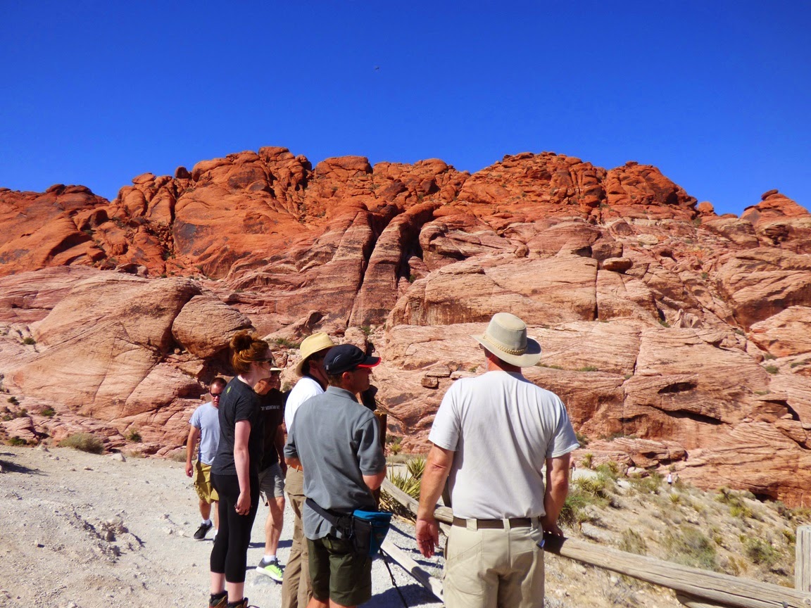
Lava wasn't the only feature of the day. At Whitmore Wash we had a chance to hike up to some interesting pictographs on a sandstone panel a few hundred feet above the river.
 The view up the river was fantastic...
We camped at the very creatively named 202 Mile Camp. While I was cooking, my nephew came up to report that the bank of the river was collapsing. I wandered down to have a look and found that an underwater slide was causing large slabs of sand to be pulled towards the river, forming a large arcuate landslide scarp. After seeing a gigantic normal fault to begin the day, it was interesting to see a small-scale version of the same kind of faulting along the riverbank. The little collapsed block in the center would be called a graben.
The slide ultimately ate up a lot of the shoreline, more than 30 feet, and it was clear that a lot of sand was being lost to the deeper part of the river channel. Ever since the floodgates of Glen Canyon Dam closed in 1963, sand has been disappearing along all the shorelines of the river. There have been a few attempts to produce artificial floods that have temporarily moved sand back onto the beaches, but without the sand that is now trapped in Lake Powell, the beaches are going to continue to disappear.
At the end of the day, the moon made an appearance. It was the first we had seen of it on pretty much the entire trip. I had enjoyed seeing the Milky Way each night, and the moon would have obscured many of the stars, but it was nice to see the beautiful crescent setting over the basalt cliffs.
With the last of the twilight, I hit the sack, realizing we were down to our final two days on the river. Our takeout at Diamond Creek was only 24 miles downstream.

Saturday, April 7, 2012

Strangers in a Strange Land: I'm feeling detached...is that normal? Looking at Death Valley's faults

Strangers in a strange land is my latest blog series, dealing with the geology of one of California's most unique environments, the Basin and Range Province and the Mojave Desert. I visited both in the last few months, and I have been inviting the readers of this blog to learn the basic principles of geology through the eyes of my community college students. The last few posts have concerned the nature of faulting. Sixty years ago, as far as anyone was concerned, there were essentially four kinds of faults, left and right lateral, normal and reverse. There was a variation of a reverse fault, one with a low angle plane of movement called a thrust. Thrusts result from compressional forces, and are commonly seen the Appalachians, the Alps and the Himalayas, all of which are produced at convergent plate boundaries.
Thrust faults generally push older rocks over younger rocks, and a number of Mesozoic-aged thrust faults are found in the mountains of Death Valley. Levi Noble, one of the first geologists to map Death Valley, found many of them. As noted in the last post, he also found a series of unusual "thrusts" that were distinguished by having younger rock on top of older sequences. A nearly horizontal young rock-on-old rock fault can be seen crossing the middle of the photo above.

Another geologist, H. D. Curry, who worked the region in the late 1930s noticed some very strange structures in the Black Mountains on the east side of Death Valley. He called the huge dome-like mountains turtleback faults. That's the Copper Canyon turtleback in the picture at the top of this post. The turtlebacks (there are three obvious ones in the Black Mountains, and a number of somewhat cryptic ones scattered through other mountain ranges across the region) are made of ancient Proterozoic-aged metamorphic rock, and their surfaces are fault planes. When rocks are found above the fault planes, they are invariably younger. The enigmatic young-on-old 'thrusts' and turtlebacks seemed to be closely related. 

Other geologists started to question the idea that these faults were compressional. Even though Noble was initially sure that the faults were thrusts, over the years he began to accept that his first perceptions might possibly be invalid. The 'thrusts" were associated with numerous normal faults, and it was known by then that the Basin and Range province was produced by extensional forces in middle and late Cenozoic time. Finding the odd exception to the rule is not unusual, but by the 1970s, geologists were finding these enigmatic fault systems all across the Basin and Range province. As they realized the extensional nature of these faults, they knew they had discovered a counterpart to the compressional thrust faults. These low-angle normal faults were soon being called detachment faults, and the dome-like systems of ancient metamorphic rocks were termed metamorphic core complexes.
The picture above shows the exposure of the Badwater Turtleback where it plunges into the subsurface in the canyon above Natural Bridge in the central part of Death Valley. It is an astounding feeling to lay one's hands on the surface between young volcanic rocks and the ancient rock from deep in the continental crust. Recognition that these structures were an entirely new kind of fault zone did not provide answers to all of the questions raised by their discovery. The nature of detachments and metamorphic core complexes is still a field of ongoing research and controversy.
The exact nature of the turtlebacks in Death Valley is not a settled issue. Are the turtlebacks like the other core complexes, or are they a more unique local phenomena involving steeper normal faults? You can check out this report by Miller and Pavlis for a review of the issues involved, or pick up the excellent guide to the geology of Death Valley by Miller and Wright.
Diagram of a 'typical' detachment fault from Spencer and Reynolds, 1989, Middle Tertiary Tectonics of Arizona
and Adjacent Areas, Arizona Geological Society Digest 17, p. 539-574.

When one stands on the top of the Black Mountains and looks across the incredible Death Valley graben to the Panamint Mountains on the far side, one can barely comprehend the implication of the discovery of detachment faulting and metamorphic core complexes. The Panamints were once on top of the Black Mountains, or nearly so. And only a short time ago in the geologic sense, just a few million years before the present.