Showing posts with label San Luis Reservoir. Show all posts

Thursday, January 4, 2018

A Look Back at Ten Years of Geotripping: The Story Told by a Single Rock

I'm commemorating a decade of blogging by dredging the archives for some of my favorite posts. 2010 was a turbulent year. We were still in the depths of the Great Recession (at least in our area), my summer trip was cancelled for the only time in the last 29 years, we broke ground on our new Community Science Center (affordable only because of the recession and the drop in construction bids), and I posted 298 blog entries, my most productive year on Geotripper. A great many posts continued the Other California series, and a really strange political controversy over the California state rock serpentine accounted for many more(more on this in the next post). It was hard to choose, but my favorite post of the year was the story of a single rock...
From November 20, 2010:

Meet my new deskcrop! I was out on the last field trip of the year, a journey through the Diablo Range to the San Andreas fault and Pinnacles National Monument. We had a wonderful day, which we didn't exactly deserve or expect. It poured all night, and somehow the rain stopped at daybreak. We had a few showers during the day, but a big storm was brewing in northern California (four feet of snow expected in Lake Tahoe, for instance). Happily, the deluge didn't start until we arrived back in town, and it has been pouring ever since.

In between we were treated to a beautiful display of clouds and rainbows, and we had a full day learning about California's most famous fault, and a few others as well. I picked up one rock, though, which captured my imagination, and reminded me of why I fell in love with the science of geology so long ago. It's a porphyritic andesite that I picked up on the shoreline of San Luis Reservoir near Pacheco Pass in the Diablo Range. The mountains form the western boundary of the Great Valley of California for a distance of about 125 miles.

It's not a remarkable rock in and of itself. Andesite is one of the most common of volcanic rocks, found pretty much all over the Pacific Rim in places like the Cascades, the Japanese islands, Indonesia, and by incredible coincidence, the Andes! The story of this rock could be very straightforward; it could be as simple as: it erupted...the rock weathered a bit...and I picked it up.

But that isn't the whole story. Context is so important; I picked the rock up from a layer, seen below, that was exposed on the eastern flank of the Coast Ranges. It is a sedimentary conglomerate. Again the story could be fairly simple; conglomerate is a fairly common rock too. We could hypothesize that the rock journeyed a bit further from the volcano, down a river and the river flowed from the mountains onto an alluvial fan. Along the way, it was rounded off by bouncing against other rocks...then I picked it up.

It turns out that story doesn't quite work as a hypothesis either. This conglomerate has some odd features that tell us that it didn't form in a river. It is topped by a gray sandstone that is in turn covered by siltstone and shale. Above it is another layer of conglomerate that is covered by sandstone, siltstone and shale. This pattern is repeated over and over, until we have a sedimentary formation more than 20,000 feet thick (four miles)! The layers contain marine fossils; some are shells of snails and clams, but sometimes the rocks include shark teeth and the remains of giant marine reptiles like ichthyosaurs, plesiosaurs, and mosasaurs.

OK, but what in the world could be moving boulders and cobbles around on the sea floor? Isn't that one of those places where the water is calm all the time? Sometimes that is the case, but not here. These rocks accumulated in large river deltas extending into a shallow sea that lay off the coast of California in late Cretaceous time, the final period of the dinosaurs. Because of constant large earthquakes, the edges of the river deltas were unstable and were often shaken loose. The mass of rocks turned into turbulent chaotic masses flowing along the sea floor at 30 or 40 miles per hour. These violent events are called turbidity currents. The turbidity currents can carry rocks for many miles. As the flow slows down, the larger particles settle first, followed by the finer particles, and so on. The sedimentary beds become graded by grain size (graded beds).

But why earthquakes? And where did the lavas and magma come from? It turns out these things are related too. This story seems to grow more complicated by the moment! In Cretaceous time, there was no San Andreas fault, and there was a lot less of California, at least a California that could be seen from above sea level. A vast subduction zone lay offshore, a place where the Pacific Ocean crust was being pushed under the North American Continent. As the ocean crust was pushed deeper and deeper into the underlying mantle, it heated up, and assisted by the presence of water, melted into magmas that rose upwards through the crust. Some of the magma exploded and flowed out the surface forming andesitic volcanoes, but other magma chambers cooled slowly three or four miles down in the crust, forming crystalline igneous rocks like diorite, granodiorite, and granite. Those are the characteristic rocks of the Sierra Nevada batholith, exposed in places like Yosemite Valley, Tuolumne Meadows, and Sequoia/Kings Canyon National Park.

I've often stood on the edge of Yosemite Valley and looked at the vast exposures of granitic rock, and imagined the volcanoes that once stood above, miles higher. I even wrote an extensive web series about being under the volcano. In my mind I could stand on the flanks of the Mesozoic volcanoes, watching out for predatory dinosaurs and gazing at pterodactyls flying overhead. It took a lot of imagination, but today the feeling was a little more tangible. I was holding a piece of the volcano in my hand.

I love where my geologic journeys lead; there are lots of pretty spectacular places to see in our present world, but so many more incredible landscapes of the past. It was a good day in the Coast Ranges!

Monday, November 17, 2014

Dinosaurs, Volcanoes, Monsters of the Deep, and Other Stories Told by a Pile of Rocks. And Disneyland.

One of my most vivid childhood memories was Southern California Gas Company's Disneyland Night. My dad worked for the company at the time. Once a year the company rented Disneyland and practically every employee and their family showed up. It's hard to explain why this is so extraordinary, but let me try. Have you ever heard the expression "E ticket ride", referring to an event almost too exciting to bear? Disneyland used to require the purchase of a ticket book which was used to buy your way onto the rides. The A, B, C, and D tickets were for the boring slow rides like Storybook Land, It's a Small World, or the Swiss Family Robinson Tree. They were okay, but the E tickets were for the good stuff, mainly the Bobsleds. So why was Disneyland Night so incredible? They didn't dole out tickets that night. You could ride any ride you wanted, as many times as you wanted. For us kids, this was better than Christmas and Halloween combined.

On those long evenings, we would ride every ride possible, and around midnight we would be exhausted. Everything was starting to close up, but there was one last ride we could do...the train. It passed through the diorama of the Grand Canyon and then it passed onwards into the Primeval World. I'm pretty sure that every misconception I ever had about dinosaurs and ancient life was shaped by the scenes that passed before me in that dark tunnel. If you've never had the opportunity, someone (probably many, really) has it posted on YouTube (thank you, Dan Smith):


One of the associations that was imprinted on my mind was the T-Rex battling a Stegosaurus with an erupting volcano in the background. I look at the diorama today and see Apatosaurs lolling in swamps (they didn't), Tyrannosaurs standing like tripods (they didn't), and other misconceptions, but it was always the lavas in the distance behind the battling dinosaurs that I remember so well. So, what possible connection could there be between childhood memories of Disneyland and yesterday's class field trip to the Coast Ranges? Bear with me!

Our first stop of the day was at San Luis Reservoir, a major storage site for the California Water Project. Water is drawn from the Sacramento River Delta and pumped into the reservoir where it is eventually sent south through an extensive canal system. It is the largest "off-river" reservoir in the country. Shoreline erosion has removed the extensive coating of soil, exposing the underlying rocks, a unit known as the Panoche Formation, a complex of conglomerate, sandstone, silt, and claystone that was deposited in Late Cretaceous time, the final years of the Mesozoic, the dinosaur era.

The rocks seemingly defy explanation. They formed in thousands of feet of water, in the forearc basin that developed on the landward side of a vast subduction zone/trench system that existed on the west coast of North America for millions of years. The subduction zone was eventually replaced in central California by the San Andreas fault, a transform boundary between the Pacific and North American plates. The thing about these rocks is that on an ocean bottom one tends to expect to find mud and silt. Sand, pebbles, and boulders don't make sense. There are no strong currents on the ocean floor like there are in rivers. Or are there?

On river deltas and on the edge of the continental shelf where shallow ocean floor gives way to steeper slopes leading to abyssal depths sediments may be shaken loose, by earthquakes for instance. In this situation sediment gravity flows and turbidity currents form, fast-moving bottom-hugging masses of sediment moving very fast into deeper water. These masses are capable of considerable feats of underwater erosion, carving deep submarine canyons into the continental shelf. There are many examples of these along the present-day coast of California, the Monterey Canyon being one of the most famous.
Source: U.S. Geologic Survey

So, dinosaurs and volcanoes? The boulders in the Panoche Formation contain the occasional piece of granite derived from the deep erosion of the Sierra Nevada. The granite cobble is a fragment of what once were the magma chambers for a vast system of volcanoes that would have closely resembled the Andes or the Cascades. Yosemite Valley and the other exposures of granite across the Sierra Nevada were once situated miles beneath volcanoes. In Cretaceous time. Meaning dinosaurs once wandered the flanks of volcanoes right here in California!

That's kind of a stretch, isn't it? Is there actually any evidence of the actual volcanoes? And what about the dinosaurs?
The volcanoes are the easiest to prove. Most of the rocks in the photos above are volcanic in origin. They are the eroded pieces of lava flows that once adorned the summit ridges of the Sierra Nevada much as Lassen Peak and Mt. Shasta do today in the Cascades. It really stokes my imagination to pick up one of these rocks and to realize it started as a mass of molten rock that was erupted onto the flanks of a large stratovolcano off to the east. The lava flow was eventually eroded and removed, the bits and pieces being carried in a river and dumped onto a river delta at the edge of the continent. One day the edge of the continental shelf was shaken by an earthquake, and the chunk of rock disappeared into the depths, carried along by a turbulent mix of water and sediment. It came to rest on the deep ocean floor. Eventually intense compression folded and lifted up the rocks, and finally a last bit of soil washed away and the rocks were once again exposed to erosion and trampling by the feet of geologists.
Proving the dinosaurs were here is a bit harder, but it happened. In the 1930s, a young teenager from Gustine was exploring Del Puerto Canyon in the Coast Ranges looking for fossil shells. What he found instead were the remains of a Saurolophus, a duck-billed dinosaur. It was the first dinosaur fossil ever found in California. How much more exciting can that be? The dinosaur was apparently drowned in a river flood, and the carcass floated out to sea where it eventually sank to the seafloor. 
The great thing is, the fact that you can find an occasional dinosaur bone in these hills isn't even the best thing one can hope to discover. There were other creatures living in the sea, and they were terrifying. Al Bennison, the boy who found the dinosaur, also eventually discovered the remains of a Mosasaur.
The Mosasaurs were relatives of the varanid lizards, a group that also includes the Komodo Dragons that still live today in Indonesia. They were fearsome marine predators, swimming with flippers instead of clawed legs, perhaps even attacking and consuming sharks (or unwary geology professors). They reached lengths of more than 30 feet.
And that is the story told by a pile of rocks along a nearly empty reservoir in central California!
Plotosaurus is one of the genera of Mosasaurs. P. bennisoni was the species found in the California Coast Ranges.

For a description of some recent research on the conglomerates of the Panoche formation check out: http://www.searchanddiscovery.com/abstracts/html/2013/90162pacific/abstracts/green.htm

Wednesday, April 6, 2011

Another View of Spring in California: the Central Valley and the Diablo Range

I often use this blog to discuss the interesting and strange elements of California's geologic story, and I try to emphasize the beautiful and spectacular, but I don't seem to talk as much about my home ground, the Central Valley (or the Great Valley, when we're feeling proud). It is flat, exceedingly flat, so flat as to not vary more than a few dozen feet over its 400 mile length (with the exception of the Sutter Buttes), and for much of the year it is dry, hot and dusty. During a few months in the winter we can't even see it, as the valley is socked in with the legendary Tule Fogs. For those interested in learning and seeing the natural landscape, well, there's not much of that in our valley. Only about 5% of the land surface looks at all like it did before European contact. Agricultural fields and cities cover most of the landscape.
On the other hand, there are two seasons I really like out here. In the fall before the fogs, the trees can be so very colorful as the leaves turn. And in spring, the blossoming orchards can be a beautiful sight. A couple of pictures came my way recently that provided a nice overview of the springtime in the valley and adjacent Diablo Range in the eastern Coast Ranges. Many thanks to photographer Ed Dwyer, and pilot Allan Ramsay who made these shots available to me.
The picture above shows some of the water accumulating in ponds at the San Luis Wildlife Refuge, which includes the notorious Kesterson Reservoir. The shales of the Diablo Range contain high levels of selenium, which forms soluble compounds that can flow onto the valley floor and accumulate in the soils. A shallow hardpan layer causes a perched water table in some areas, and when such fields are irrigated, the soluble material can be concentrated close to the surface where the selenium and salts interfere with plant growth and agricultural yields. In the early 1970s farmers dealt with the problem by flooding their fields, dissolving the salts, and sending the runoff into a canal that distributed the wastewater into ponds at what would eventually become the Kesterson Wildlife Refuge.

Things went fine at first when only fresh water was delivered. A variety of fish and birds utilized the ponds, but after a few years most of the water deliveries were brackish, and animals started producing deformed offspring, and others died out. The reason was not apparent until analysis indicated extremely high levels of selenium. Cattle on nearby ranches were also affected.

Ultimately the wildlife disaster forced authorities to close the reservoir and fill it with clean soils. The problem has not been solved, and today most of the wastewater ends up in the San Joaquin River where it is at least somewhat diluted.

Luckily, other parts of the San Luis National Wildlife Refuge are not contaminated, and the region is utilized as a wetlands environment that supports thousands of migratory birds and other animals.
For those who are curious about the rocks that lie beneath the Great Valley, they can actually walk through the rocks without tunneling or drilling. The rocks have been twisted to nearly vertical outcrops in the eastern flank of the Diablo Range, seen in the picture above. The rocks are collectively called the Great Valley Group, and include around 20,000 feet of mostly sands and siltstones of Cretaceous age. The Cretaceous Period was part of the reign of the dinosaurs, but only a few bone fragments of dinos are found here; the sediments accumulated in a shallow sea where the dinos didn't live. On the other hand, the rocks have been a good place for finding remains of plesiosaurs and mosasaurs, large reptilian predators adapted to life in the sea.
San Luis Reservoir is a water storage facility for the California Water Project, and is the largest off-stream reservoir in the United States (it doesn't receive significant water from the local watershed, but is supplied by the CWP canal system instead). The surrounding rocks are a chaotic mix of shale, graywacke sandstone, basalt, chert and limestone that accumulated in the accretionary wedge of the huge subduction zone that once lay off the coast of California.
Pacheco Pass is a low break in the range that funnels coastal winds, so the hills are utilized as a wind farm, providing California with some renewable energy sources.
Thanks again to Ed and Allan for allowing the use of these pictures, and to Sarah Mesenhimer-Johnson for sending them along to me!

Monday, November 29, 2010

My California, A Bipolar State

It didn't take long for Ron Schott and Silver Fox to figure out my little quiz yesterday about some odd similarities and disparities in California geography. The question had to do with an "a is to b as c is to d" equivalence concerning the Pinnacles and Neenach volcanics, and San Luis and Castaic reservoirs. The short answer is: they are on opposite sides of the San Andreas fault, they are separated by 200 miles or so, but they are exactly the same. The volcanics are the same volcano, and the reservoirs hold water from the same river system. The difference is the magnitude of timing: it took the San Andreas fault more than 20 million years to shift the sundered volcano 195 miles apart, but we have made an artificial river that carries water 200 miles south in a matter of days or weeks.
I've talked about the story of the Pinnacles volcano in the past (here, for instance), but in short, a volcano that erupted in the vicinity of Palmdale and Gorman in southern California has been ripped apart, and a portion has been transported north at the stunning pace of 2 inches per year, along with the entire Baja Peninsular and everything else west of the San Andreas (see the map above). In some places the fault creeps (see this post from last week), but in at least three long segments the fault builds up stress which is released in huge earthquakes upwards of magnitude 8. The quakes have recurrence intervals of around 100-150 years, and we have experienced two, or maybe three of these in recorded time (1857, 1906, and possibly 1812). If you've done the math, you understand why seismologists are always going on about being prepared for the BIG ONE(s)...

The California Water Project is an engineering marvel (or monster, depending on your political and environmental leanings). The state is truly bipolar, in political leanings (kind of a coast versus inland bifurcation), population (mostly in the south), and in water availability (mostly in the north). The problem is that all the people down south need water, lots of it, and the local mountains only capture about 15% of what they need. In 1960 California voters passed a massive (for its day) bond issue of $1.5 billion to construct a system of aqueducts, canals and reservoirs to transfer entire rivers to the southland. The peak pumping discharge exceeds 13,000 cubic feet per second, which to me is pretty incredible given that our local river, the Tuolumne, is considered to be in flood stage at just 9,000 cfs. It mostly provides water for agriculture in the south San Joaquin Valley where the land had been sinking for decades from overdrafting the groundwater. The remainder is pumped over the Tehachapi Mountains to provide water for 20 million plus people.

Map courtesy of the Legislative Analyst's Office of California

San Luis Reservoir is the largest offstream reservoir in the country with a storage capacity of more than 2 million acre-feet. 'Offstream' refers to the fact that the watershed it blocks provides little or no water. All of it is provided by the aqueduct.

The California State Water Project has caused problems. Decreased water flow into the Sacramento Delta and San Francisco Bay have caused serious environmental problems, and have affected salmon runs as well as impacting other fish and bird populations. It also has a gaping vulnerability: a moderate earthquake could destroy levees in the Sacramento Delta, and inundate the Tracy pumping station with salt water for months or years depending on how soon winter runoff could flush out the water (check my previous post on this here).

Our state is bipolar. After fossil fuels, water is one of the most contentious of political issues that we face now and in the future. It would help if people stopped a moment sometimes while spraying off the driveway and watering their tropical rainforest plants they use for landscaping to consider how much effort was made to get that water.

Saturday, November 27, 2010

Similarities and Disparities: Odd Thoughts and Connections from the Road

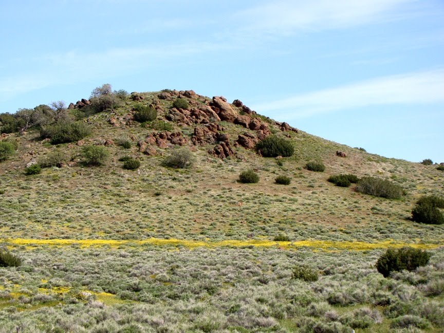
When you are stuck on a 400 mile long highway on a holiday weekend, the mind wanders in strange places. As I drove along, I made kind of an odd connection between a few places I visited in the last week. Can you? The picture above is at Pinnacles National Monument in the central Coast Ranges. The place in the picture below is part of the Neenach Volcanics in the Transverse Ranges of California between Palmdale and Gorman.
The lake in the picture below is San Luis Reservoir near Santa Nella.
The lake in the picture below is Castaic Lake in Southern California (picture from the commons at Wikipedia). It fills a canyon region in the western San Gabriel Mountains near I-5 above the Santa Clarita Valley.OK, so here is my observation: Picture #1 is to picture #2 as picture #3 is to picture #4, but on a different scale of magnitude (magnitude of what? Not stated here!). Any ideas?

Saturday, November 20, 2010

What Story Can a Single Rock Tell? A Day in the Coast Ranges

Meet my new deskcrop! I was out on the last field trip of the year, a journey through the Diablo Range to the San Andreas fault and Pinnacles National Monument. We had a wonderful day, which we didn't exactly deserve or expect. It poured all night, and somehow the rain stopped at daybreak. We had a few showers during the day, but a big storm was brewing in northern California (four feet of snow expected in Lake Tahoe, for instance). Happily, the deluge didn't start until we arrived back in town, and it has been pouring ever since.

In between we were treated to a beautiful display of clouds and rainbows, and we had a full day learning about California's most famous fault, and a few others as well. I picked up one rock, though, which captured my imagination, and reminded me of why I fell in love with the science of geology so long ago. It's a porphyritic andesite that I picked up on the shoreline of San Luis Reservoir near Pacheco Pass in the Diablo Range. The mountains form the western boundary of the Great Valley of California for a distance of about 125 miles.

It's not a remarkable rock in and of itself. Andesite is one of the most common of volcanic rocks, found pretty much all over the Pacific Rim in places like the Cascades, the Japanese islands, Indonesia, and by incredible coincidence, the Andes! The story of this rock could be very straightforward; it could be as simple as: it erupted...the rock weathered a bit...and I picked it up.

But that isn't the whole story. Context is so important; I picked the rock up from a layer, seen below, that was exposed on the eastern flank of the Coast Ranges. It is a sedimentary conglomerate. Again the story could be fairly simple; conglomerate is a fairly common rock too. We could hypothesize that the rock journeyed a bit further from the volcano, down a river and the river flowed from the mountains onto an alluvial fan. Along the way, it was rounded off by bouncing against other rocks...then I picked it up.

It turns out that story doesn't quite work as a hypothesis either. This conglomerate has some odd features that tell us that it didn't form in a river. It is topped by a gray sandstone that is in turn covered by siltstone and shale. Above it is another layer of conglomerate that is covered by sandstone, siltstone and shale. This pattern is repeated over and over, until we have a sedimentary formation more than 20,000 feet thick (four miles)! The layers contain marine fossils; some are shells of snails and clams, but sometimes the rocks include shark teeth and the remains of giant marine reptiles like ichthyosaurs, plesiosaurs, and mosasaurs.

OK, but what in the world could be moving boulders and cobbles around on the sea floor? Isn't that one of those places where the water is calm all the time? Sometimes that is the case, but not here. These rocks accumulated in large river deltas extending into a shallow sea that lay off the coast of California in late Cretaceous time, the final period of the dinosaurs. Because of constant large earthquakes, the edges of the river deltas were unstable and were often shaken loose. The mass of rocks turned into turbulent chaotic masses flowing along the sea floor at 30 or 40 miles per hour. These violent events are called turbidity currents. The turbidity currents can carry rocks for many miles. As the flow slows down, the larger particles settle first, followed by the finer particles, and so on. The sedimentary beds become graded by grain size (graded beds).

But why earthquakes? And where did the lavas and magma come from? It turns out these things are related too. This story seems to grow more complicated by the moment! In Cretaceous time, there was no San Andreas fault, and there was a lot less of California, at least a California that could be seen from above sea level. A vast subduction zone lay offshore, a place where the Pacific Ocean crust was being pushed under the North American Continent. As the ocean crust was pushed deeper and deeper into the underlying mantle, it heated up, and assisted by the presence of water, melted into magmas that rose upwards through the crust. Some of the magma exploded and flowed out the surface forming andesitic volcanoes, but other magma chambers cooled slowly three or four miles down in the crust, forming crystalline igneous rocks like diorite, granodiorite, and granite. Those are the characteristic rocks of the Sierra Nevada batholith, exposed in places like Yosemite Valley, Tuolumne Meadows, and Sequoia/Kings Canyon National Park.

I've often stood on the edge of Yosemite Valley and looked at the vast exposures of granitic rock, and imagined the volcanoes that once stood above, miles higher. I even wrote an extensive web series about being under the volcano. In my mind I could stand on the flanks of the Mesozoic volcanoes, watching out for predatory dinosaurs and gazing at pterodactyls flying overhead. It took a lot of imagination, but today the feeling was a little more tangible. I was holding a piece of the volcano in my hand.

I love where my geologic journeys lead; there are lots of pretty spectacular places to see in our present world, but so many more incredible landscapes of the past. It was a good day in the Coast Ranges!