Showing posts with label Great Unconformity. Show all posts

Friday, September 6, 2013

Into the Great Unknown: Crossing the Great Unconformity Again; But Which One?

Every day is new. Every day the Canyon is different...

I look back over the notes of my journey down into the Great Unknown, the Colorado River through the Grand Canyon, and I am struck by the number of times I mention change. By mile 80 we had passed through essentially all the major rock units of the Grand Canyon, and one can be forgiven for thinking that things might get repetitious, but it just never happened. I was now fifty miles farther downstream, and every morning, every day produced new revelations. I knew by now on Day 11 that I was having one of the most incredible experiences I would ever have in my life, and still five days remained.
The day began as a sort of "passages" kind of journey. We needed to make 15 miles or so, and there was just one excursion up a side canyon in the plan. But there were also some big rapids to worry about, including Specter, Bedrock, and Deubendorff, as well as seven smaller ones. I could tell I was still a bit spooked after my swim down Crystal Rapid a few days earlier.
Enfilade Camp was on a sandy beach below a large terrace that promised a decent view. My nephew had hiked up the previous evening and had come face to face with a bighorn ram, so I was a bit curious to see what would be around in the morning. I found a nice view upstream and downstream, and a lot of sheep tracks and droppings, but none of them were visible (of course, given their excellent camouflage, they were probably there watching me).
We started the day in the Bright Angel Shale of Cambrian age, but before long we entered into the Granite Gorge again. It's interesting how we refer to the "Granite Gorge" when so much of it is actually composed of black schist. I was just stunned by the polished surfaces that looked all the world like obsidian, even on slopes dozens of feet above the river.
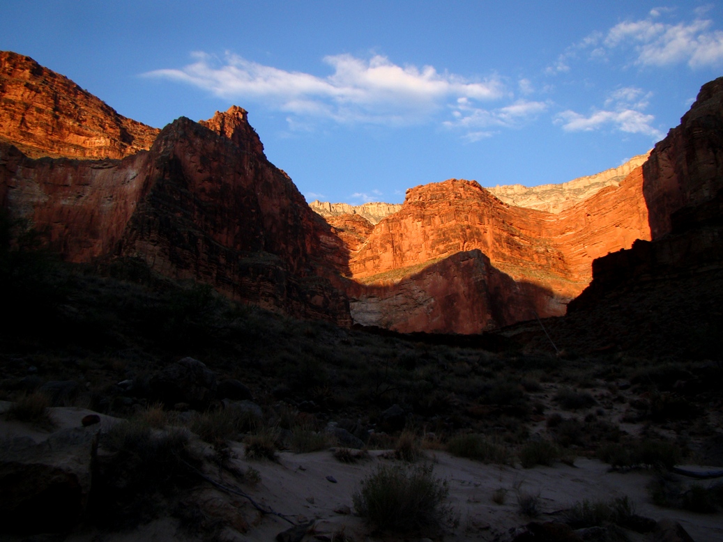
 The canyon walls closed in once again, and the schist cliffs rose high above us.
In eleven days we had dropped 1,200 feet or more, and the flora was picking up a definite Mojave-Sonoran flavor. Barrel cacti were common on the slopes above the river. Within a day or so we would be seeing ocotillo.
We reached Bedrock Rapid (6-8) and stopped to scout. It was appropriately named, as a big chunk of granite and schist split the river. If a boat went to the left, it would be caught in a too-small current and impossible eddy. But the river right tried to dash the boats against the rock outcrops. It took some hard rowing, but the boatmen got us through just fine. We bounced off a boulder, but it was done quickly and we were okay.
The river at Bedrock Rapid tries to mash my brother and sister-in-law against a cliff. I give them credit for carefully observing the geology.
Below the rapid I saw one of those extraordinary sights that seem to occur with continuing regularity. I've mentioned the Great Unconformity, and we saw a wonderful exposure in Blacktail Canyon, described in the previous post. The ancient erosion surface separates 500 million year old sediments from 1.7 billion year old metamorphic rocks.  It is marvelous to be able to lay one's hands on 1.2 billion years of missing history.

But the canyon hides secrets, and one of them is that rocks exist that fill that void. There are in fact lots of rocks, in layers about 12,000 feet thick. We had visited them earlier in the trip, in the area between Nankoweap and Hance Rapid. They too rest on a "great unconformity" spanning 500 million years. They in turn are overlain by the Tapeats Sandstone. Because the Supergroup has been tilted, they contact the rocks above at an angle, so this contact is known as an angular unconformity.
Above Bedrock Rapids, both unconformities could be seen in the same outcrop! The sun was at a difficult angle, so if you can't see it, take a look at the labeled version below. I've drawn this kind of rock relationship on chalkboards many, many times, but I haven't seen as many of them in the real world.
Downstream we encountered Deubendorff Rapid (5-8). As we bulled our way through, we caught the edge of a hole and lost an oar. Pete worked with the remaining oar, but got us through okay, if not a bit soaked.
Drifting along the river below, we encountered the second extraordinary sight of the day. Dikes and sills are the result of molten material forcing its way through solid rock. Dikes cut across the previously existing rock, while sills squeeze their way between layers. You can see examples of dikes, but few sills on my Geotripper Images website, and that's the thing: I don't have many pictures of sills.
As we came around the bend of the river, a black cliff came into view, a layer that ran parallel to the enclosing layers of Bass Limestone and Hotauta Conglomerate (these form the base of the Grand Canyon Supergroup). It was a basaltic sill of huge proportions. The precise name of the rock is diabase, which was a shallow intrusion that was neither extrusive in texture (fine-grained) or intrusive (coarse-grained). It's a grain-size in-betweener.
It was one more stunning sight in a canyon with many of them.
Soon after, the river re-entered exposures of the Granite Gorge Intrusive Suite, and the canyon narrowed. A lot. The walls of schist rose straight out of the river and soared for hundreds of feet. Just past Mile 135 we traveled through the narrowest gorge in the entire Grand Canyon, the Granite Narrows. It was only 76 feet wide. The river was over 100 feet deep!
It had been an incredible day, but the best part was just ahead. More on that in the next post!

Saturday, July 7, 2012

The Abandoned Lands...A Journey Through the Colorado Plateau: And not a single sentient being ever laid eyes on the mountains

What an incredible story can by told by rocks that are not there! Seriously, the Grand Canyon is full of rocks, but some of the most important parts of the geological story emerge when we realize just how much rock is missing. In the picture above, erosion has scooped out a small alcove on the right side. The rocks forming the roof of the alcove are crossbedded sandstones that formed on a beach around 500 million years ago. The rocks underneath are composed of schist and granite pegmatite (an extremely course-grained type of the plutonic rock) that date to between 1.4 and 1.8 billion years. The picture below shows a typical intrusion of the pegmatite between the layers of schist. What's missing? Just a billion years or so of geologic history!
Imagine: An ocean in the tropics...but no palm trees, no coconuts. No visible life at all except for a hint of green in the water; single-celled microorganisms rule the ecosystem. The air is unbreathable, as there is only a fraction of the oxygen we find in our atmosphere today. Our own world would be a foreign place to visit; we would need spacesuits to survive.

On one horizon, a landmass...it is large, more than a thousand miles across, the core of the North American continent.  It has existed already for most of a billion years. In the other direction, an island is visible in the distance. It is also large, hundreds of miles long. The two lands are on a collision course. It is not an overly fast collision, as they approach at the stunning speed of three or four inches a year. But over millions of years, they collide, first disturbing and folding the sediments on the seafloor between them, and then a vast mountain range grows as one land mass is pushed up and over the other. And within a few tens of millions of years, a second island collides, pushing the mountains even higher. A vast range now extends across the edge of the continent, from what is now the southeastern United States to California, and an unknown distance westward.

It was a mountain range that no eyes ever saw. Eyes would not develop in this world for another billion years. No trees ever graced its slopes, not a blade of grass, no terrestrial life at all. The mountain was composed of barren rock, and was touched only by snow and flowing water. But no life. The mountain range was pushed to great heights, and erosion tore away at its flanks. Over several hundred million years the mountain range was eroded away until it was a low plain, interrupted here and there by low hills no more than a few hundred feet high. The rocks that now lie exposed were once buried 12 miles deep in the crust. They have been changed by the extreme heat and pressure into schist and gneiss.
It is that surface that my students are exploring in the picture above. They are laying their hands on the core of a mountain range that no eyes ever saw, but whose existence is indicated by the rocks and by the erosion surface. 500 million years ago, a rising sea covered this region, leaving behind a sequence of sandstone (the Tapeats), shale (the Bright Angel), and limestone (the Muav). John Wesley Powell, the leader of the first team of people to navigate the Colorado River through the Grand Canyon, called the surface the Great Unconformity.

The Great Unconformity was one of our objectives while traveling down the Peach Springs Road into the Grand Canyon on our trip last month. In 21 miles we drove 4,000 feet into the canyon to the Colorado River at Diamond Creek. I'm not superstitious or anything, but in May we only got to the 17 mile mark before our car broke down, so this time our vans made the trip to the river without stopping, except for the rather incredible distraction of a herd of Bighorn Sheep grazing by the road.
 Yeah, we get sidetracked by furry mammals every time...
Back on the road, we made it to the river at the head of Diamond Creek rapids. I had not been this close to the Colorado River in the Grand Canyon in many years, and had forgotten what power the river exudes, even as her water is processed through dams and reservoirs. The river ran fast and surprisingly cold. It was a relief in the 113 degree temperature.
After cooling off in the water, we started back up the road, with several stops to visit the Great Unconformity and to have a look at the formations that are the most difficult to see and access from the rim of Grand Canyon. We were able to see the sandstones of the Cambrian beach, lying over the unconformity.
A few hundred feet higher, and we were able to check out the former muds of the Bright Angel Shale. We could see the trails of worms, trilobites and other creatures that squirmed and disturbed sediments for the first time in three billion years of Earth history. Ripplemarks can be seen in the picture below, on the left.
The Bright Angel Shale yields under pressure, and if not buttressed from below, it slides readily. A huge slide block was visible in the canyon wall on the west side of the Hurricane fault. The exposure of Bright Angel in the picture below is tilted about 45 degrees despite being sandwiched between horizontal layers.
Up close, the deformation of the greenish shale and siltstone is obvious....
The road to the bottom of the Grand Canyon, the only road to the river, is a fascinating journey. It is all gravel, it's bumpy in places, and the entrance fee is pretty steep. I didn't mind paying it, as tourism is essentially the only income for the Hualapai people who own this part of the Grand Canyon. But it provides unparalleled exposures of the Proterozoic rocks of the Grand Canyon Metamorphic Suite, the Paleozoic Tonto Group (the Tapeats, Bright Angel, and Muav formations), and the Devonian Temple Butte Limestone, a layer that is almost impossible to see from the rim of the Grand Canyon in the national park.
We made it back to Peach Springs without incident, and headed to our campsite on the south rim of Grand Canyon. Between our exploration of Hole in the Wall and the trip down to the river, it had been a full day! And it was only our second day out in the field...

PS: I forgot...there were more furry distractions on the way out of the canyon. I don't know how wild they were, given the rope on one of them, but there they were on the open range....

Here is the explanation of my "abandonment" theme for this series: http://geotripper.blogspot.com/2012/06/abandoned-landsa-journey-through.html

Friday, May 11, 2012

What's Missing From This Picture? Only a billion years or so...

Geology is good for perspective. The bookends of this particular day: the very very long hour spent trying to restart a dead car in a remote canyon, and a billion years in one hand. I'm on the road researching a field seminar for the AAPG in Arizona and Nevada, and I saw some incredible things.

1.7 billion years ago, fragments of continental crust were colliding to form the core of a new North American continent. Those mountains climbed to the sky, rivaling the Himalaya or the Andes in their grandeur. The time was so ancient that not a bit of life existed on the mountain flanks. The only lifeforms at all were single-celled organisms in the oceans.

The forces pushing the mountains upwards ended, and the ice and rain tore away the flanks. The gigantic peaks eroded to hills, and in hundreds of millions of years, the hills eroded to nearly flat plains. They were gone, but the rocks that formed the roots of those mountains remained. Around 530 million years ago, the continent had begun to break up, and the edges subsided slowly while a shallow sea advanced. The beach sands swirled back and forth across the roots of the ancient mountains.
An unconformity is a buried erosional surface. Sometimes the time missing might be a few hundred thousand or a few million years. The unconformity in the Grand Canyon is profound, representing a gap of a one thousand million years. Get to the right place, and you can place your hand across 1,000,000,000 revolutions around the sun: nearly a quarter of the age of the Earth.

The problem with the Great Unconformity, as the early geologists called it, is that it is mainly exposed in the bottom of the Grand Canyon. There are only a few ways to see it and touch it: you can float down the Colorado River in a raft, or you can walk down the long difficult trails from the rim of the canyon. Or, as it turns out, you can drive.
I left Las Vegas this morning and traveled up Lake Mead Boulevard. The growth of the town has slowed with the depression, but over the last twenty years I've watched the urbanization of the valley wash up the slopes of Frenchman Mountain on the eastern edge of town like a tsunami. Fortunately, the wave stopped at the boundary of the city limits and the federal lands around Lake Mead. It turns out that the rocks making up the Great Unconformity are exposed no more than a mile from the residential neighborhoods of Sin City. The sand layers of the Tapeats Sandstone cover the weathered granite and schist of the 1.7 billion year old basement complex.
The geologists at the University of Nevada, Las Vegas knew of the treasure in their backyard. Years ago they set up a trail and some very nice interpretive exhibits. I regret to say that vandals and garbage dumpers destroyed the exhibits in a short time, but you can still see the rocks.

If the exposure lacks anything, it is grandeur. The oldest rocks of the Grand Canyon are at the bottom of one of the deepest and longest gorges in the world, and there is much to be said for seeing the rocks in their full perspective, underneath a mile of subsequent sedimentary layers. When time or health is short, hiking or rafting is not feasible. But I was on a mission today, to see the only place in all of the Grand Canyon where one can drive to the Great Unconformity. It is well-known to rafters as it is the take-out point for the river voyagers. It's called Diamond Creek, and Peach Springs Canyon. The road starts at the administrative headquarters of the Hualapai Nation in Peach Springs, and winds 19 miles and 3,500 feet down to the Colorado.
Anyone who has seen the Grand Canyon, either in pictures or in person, has to wonder how any road could intrude into such rugged terrain. There are so many cliff-forming layers that a road seems next to impossible (which it is, given that only one exists). But Grand Canyon is also crossed by faults and folds, and the disruption of the cliff-forming layers is what makes roads and trails possible. The road starts innocently enough, dipping into rolling terrain composed of Mio-Pliocene sediments that have huge significance in understanding how the Grand Canyon was carved. We actually follow canyons that originated at the end of the age of the dinosaurs (the Cretaceous Period) and were subsequently filled, and then exhumed in the last hiccup of geological time.

Heading deeper into the canyon, we see some evidence of deformation; in the picture below, we can see a gentle monocline crossing the picture where the layers step down in elevation without splitting. A major fault zone, the Hurricane fault, crosses the canyon in front of the fold. The road turns and follows the fault zone.
The gorge becomes deeper and deeper, and we pass into older and older layers. The Mississippian Redwall limestone forms the highest cliffs, and the lower cliffs are dominated by the Devonian Temple Butte limestone and Cambrian Muav limestone. The gentler slopes cover exposures of the Cambrian Bright Angel shale. The rocks on the left side of the canyon sit around a thousand feet lower than the rocks on the right due to displacement along the Hurricane fault.
The cliffs grow higher and higher, and we finally reach the base of the Paleozoic rocks with exposures of the Tapeats sandstone, the same layer seen at Frenchman Mountain in Las Vegas. The Tapeats can be seen in the first picture of this post, forming the prominent layers at the lower left. The orange-brown rocks at the base of the cliff are the 1.7 billion year old granite and schist.
It would take only a moment's walk to lay one's hand on the unconformity, but we also wanted to see the Colorado River. We were nearly 16 miles into the canyon, with only three to go. We got into the car, turned the key....and nothing. Not a click, not a warning light, nothing. 16 miles into the depths of the Earth, and we had a dead car.
So we had the longest hour I've ever felt (aside from the births of my children), trying anything and everything to get the car going again. A construction crew stopped by, five guys in one truck, and we did the engine worship thing where all six of us stood around the open hood and jiggled connections. A river runner came up the road with his boat trailer. He had room, so Mrs. Geotripper jumped in to go arrange for a tow truck. River runners like this guy drive this road all the time, so the Missus had a regular Mr. Toad's Wild Ride up the bumpy road. Meanwhile, I stayed with the car, pretty much preparing to camp out for the night. The ranger for the Hualapai tribe showed up, and we did some more jiggling of engine connections, and he helped me get the transmission unstuck, but we still weren't getting anything when I turned the key. In final desperation, we tried the obvious, and pulled out the jumper cables. They worked.

I zoomed up the road, picked up Mrs. Geotripper, and sped on to Williams without turning the car off once. Thus, our unexpected night in a motel, and a delay, looking for a saturday mechanic before we head on to Grand Canyon tomorrow. And internet access! We'll see what surprises tomorrow holds for us.

By the way, the ocotillos were blooming in the lower canyon...enjoy!
NOTE: Tourism is almost the sole source of income for the Hualapai tribe. You need to pay an exploration fee of $25/person at the Hualapai Motel in Peach Springs. Looking at the town of Peach Springs, I was glad to give them some support.