Showing posts with label Bighorn Sheep. Show all posts

Tuesday, August 2, 2016

Playing "Where's Waldo" with Bighorn Sheep in Zion National Park

How many Bighorn Sheep can you see in this picture?
One of the surprises of a visit to a place like Zion National Park is the possibility of seeing some of the rarer large animals. We were taking a "short cut" through the park last week on our way to the North Rim of Grand Canyon National Park. The lower valley was crowded, just as one would expect in the height of summer (not unlike Yosemite). We headed towards the much less crowded eastern entrance road when my son spotted some large animals on the ridge above, maybe two miles up the highway from the Zion Tunnel.
Would a slightly closer view help?
I stopped at the first safe pullout and walked back to try and find them. I didn't at first, but then realized they might have walked over the ridge. I walked up the road and across a rock bench and then saw them across the canyon.
Okay, I'll point to them...
They are well camouflaged. I was photographing just the two that I had spied, and then realized another three were nearby. It was a group of ewes and lambs. 
Desert Bighorn Sheep (Ovis canadensis nelsoni) were wiped out in the Zion region in the early 1900s. They were mainly done in by diseases introduced by domestic sheep who grazed the region. In 1978, 14 sheep were re-introduced to the park, and according to the National Park Service, they did poorly at first. They are doing well now, numbering around 400.
There were once millions of Bighorn Sheep across the desert southwest, so much so that they were a primary food source for the ancestral Puebloan people and other groups. 
The sheep are one of the most common motifs in the rock art (petroglyphs) found across the American West. Over the years, though, I have seen relatively few live ones. It was wonderful to see them roaming free, back in their ancestral homeland.

Friday, October 24, 2014

Saying Good-bye to the Glaciers of Glacier National Park


The view north from Logan Pass in Glacier National Park
Make no mistake about it. Glacier National Park is one of the most spectacular parks in the United States, and indeed is one of my favorite places on planet Earth. That said, it's losing something important, and the change is profound.
How many animals are in this picture?
When I was a child, I loved museums, but I knew there was a big difference between seeing a stuffed animal in a quiet exhibit hall versus seeing one in the wild. A living, breathing animal trumps a stuffed one every time, especially if said animal is capable of killing you!
I suppose Bighorns could kill you, but I was thinking more of bears...
And that's my problem with what's happening in Glacier National Park. It's hard to put a glacier in a museum. In 1850, there were around 150 glaciers within the park boundaries. Today there are only 25. And they will be gone soon, probably by 2030. The sights we've been enjoying over the years with our visits to Glacier are disappearing at a rate that is heart-breaking. Of all of the signs of climate change, the loss of glaciers is the most vivid. Glacier will always be a beautiful park, and I will keep going back for as long as I am able, but it will soon stand as a monument to glaciation rather than a place where one can experience glaciers. And that is a shame.
Clements Mountain near Logan Pass in Glacier National Park
The changes will go beyond just the loss of glacial ice and scenery. The balance of river flows will change, both in the patterns of volume, but also temperature. Some native species depend on the year-round cold flows that emanate from glaciers. Some streams without a glacier at the source will be drying up before the next winter comes around. Habitats of all animals will be driven to higher elevations, and those at the higher altitudes in the park may find themselves without any habitat at all. We are already seeing the kinds of devastation wrought by pine borer beetles in Colorado and Wyoming. Devastating wildfires have already affected large parts of the park. We are now living the predicted changes in our global climate.
Glacially carved valley east of Logan Pass
The primary purpose of our trip was an exploration of Canada, so our visit to Glacier National Park was a short one as we drove west. We usually stay two nights and spend some time on the trails. We traveled along the spectacular Going to the Sun Highway over Logan Pass, and spent several hours exploring the alpine meadows above the pass. 
Glacier Lilies at Logan Pass
As every climatologist will tell you, there is a big difference between climate and weather. Weather is the day-to-day conditions outside ("It's cold outside") whereas climate is the long-term patterns of temperature and precipitation. Climate changes slowly over time while weather happens daily. Yet it is hard not to notice the daily extremes. When we climbed out of our vehicles at Logan Pass (6,647 feet; 2026 meters) it was 86 degrees. We were surrounded by rapidly melting snowbanks, and it was uncomfortable 86 degrees. The herd of Bighorn Sheep noticed. Some of them were laying in the snow to keep cool.
The meadows above Logan Pass in Glacier National Park
The geologic story of Glacier National Park bears some resemblance to that of Banff and Yoho National Parks in Canada, but there are big differences as well. Like the Canadian Rockies, large blocks of sedimentary rocks have been thrust eastward over softer Cretaceous rocks of the High Plains. Unlike the Canadian parks, the rocks at Glacier are older, closer to a billion years of age (Banff and Yoho sediments are around 500 million years old). They are part of a sequence of rocks called the Belt Series. They contain fossils, but they are of algal deposits called stromatolites. Multicelled creatures did not yet exist.
The peaks were high enough to stand above the vast continental ice sheets that covered the adjacent plains. The glaciers plucked and abraded the flanks of the high peaks, leaving behind outstanding examples of horns, aretes, and cirques. But unfortunately, many of the banks of ice are no longer considered glaciers, as they have shrunk and stagnated. When the chunks of ice no longer move, they aren't glaciers anymore.
Horns and aretes north of Logan Pass
We headed down the incredible west side of the Going to the Sun Highway very slowly, both to avoid plummeting to our deaths down the steep cliffs, but also to avoid running into the beautiful Rocky Mountain Goats who were licking up salt off the roadway.
We reached beautiful Lake McDonald, had a last look at the high glaciated peaks, and then headed west to Kalispell to our hotel. We would be making our way to Washington the next day on our way home. The Northern Convergence tour was reaching the final stages, but there was still much to be seen on the road ahead!
Lake McDonald at the west end of the Going to the Sun Highway.


Monday, September 16, 2013

Into the Great Unknown: Heat...and All Things Beautiful

It was our last full day on the Colorado River through the Grand Canyon, the Great Unknown as John Wesley Powell called it in 1869. One full day, and one more night on the life-giving stream of water through one of the spectacular canyons on Earth. We had eighteen miles to go, from our camp at Mile 202 to 220 Mile Camp (it was clear that the geographers were running out of names for the features in the canyon; it's that big).

It was a day full of the best things the canyon could offer. But it was also hot. Blazing oven hot. Merciless sun beating down hot. In other words, a normal summer day in the Inner Canyon. The thing is, we had already experienced a few hot days on the trip, but not quite the kind of 115 degree days that we were warned about in the training materials. I don't actually know how hot it got, but in my memory, it was the hottest day of the trip.

They said a few things in the training videos for rafting the river. To drink before you get thirsty. To drink a gallon a day. To always wear a hat. Seek out shade when possible, and don't hike between 10 and 4. They said it takes a human body about two weeks to acclimate to extreme hot temperatures, meaning a river trip was not long enough to do so.
We were seeing all kinds of adaptations to the heat as we explored the area around our camp during the relatively cool morning hours. We had dropped nearly 2,000 feet during our two weeks on the river, and the desert vegetation was characteristic of the Lower Sonoran Life Zone (or whatever the biologists are calling it these days). Cacti had been rare in the upper reaches of the river, but now they were common.
There were a few shrubs with their characteristic waxy leaves taking advantage of the recent storms by putting out a few flowers.
Best of all were the ocotillos that we had been seeing for the last two or three days. They too had taken advantage of the recent storms, and had put out thin leaves along their green branches (most of their food production happens in the branches rather than the leaves). There were none of the beautiful  red flowers (we'd need to be here in May for that).
We took advantage of the relative cool of the morning to search out some pictographs that were said to be up in 202 Mile Canyon. It took a while (which is why I had given up and photographed the plants instead), but eventually we found them. It was a small measure of the rate of geologic change that some of the blocks of rocks containing the rock paintings had tumbled down from the ledge.
Once the sun reached our boats, we set off down the river. We continued to see remnants of the lava flows that had once produced high dams, and which had continued downstream for many tens of miles (above).
We also saw another gigantic landslide that had involved the entire canyon wall (above). Lava flows aren't the only things that have produced dams on the river. As noted in an earlier post, landslides have altered the course of the river a number of times.
We saw more evidence of human occupation in the canyon. We discovered roasting pits in several of the debris fans at the mouths of some of the tributary streams. Along with the cracked and shattered rocks we found bit and pieces of pottery.
A short hot hike up Indian Canyon offered a fine view up the river. But it was hot and there was no shade. I shiver to thick how quickly I would have been in trouble here had I not been carrying a quart of water at all times. I was drinking at least a gallon and a half of water on days like this, and when it got too uncomfortable, I could splash in the river water to cool off. Despite being 200+ miles downstream from Glen Canyon Dam, the water was still in the mid-to-upper fifty degree range.
The scenery continued on a grand scale, with high cliffs at every turn. We saw another bighorn along the riverbank. It was as if the river was giving us reminders of why the canyon was precious. And that was the way I was feeling. This was the last full day, and while I was wanting to see the people I was missing in the outside world, I was also feeling like I wanted to hold onto these incredible experiences that I felt were enriching and transforming my life.
We crossed the Hurricane Fault again, and the ancient Vishnu Schist was exposed at river level once more.
 In the intense sunshine, the polished surfaces of mica, quartz and feldspar reflected brightly.
 It's amazing what the silt-filled water can accomplish!
 As we searched for (unsuccessfully) for a shady lunch stop, we encountered an unusual looking ledge of Tapeats Sandstone on the left bank.
The top of the ledge had been scoured and eroded by river currents, and it looked recent, yet the bench was 15 or 20 feet high. It looked extremely fresh.
 At the lower end, there was a strange orange-colored edifice called Pumpkin Spring. It was a warm spring deposit that was redepositing travertine that had been dissolved from the overlying limestone formations. The heat probably came from nearby active fault zones. The water was green and uninviting. The river guide suggested not drinking it because of high concentrations of arsenic (is that a poison or something?).
 We set up a canopy and crowded underneath it to eat lunch. There was a hot breeze blowing so the shade barely helped. Unfortunately the wind was trying to destroy the umbrellas that most of the boats had, so there was really no place to retreat from the sun. For pretty much the first time voluntarily, I spent most of the time soaking in the river as long as I could stand it (cold!), then getting out and warming up until I was dry and hot, and then getting back in the river!
Despite the heat, we wanted to check out the unusual terrace in the Tapeats Sandstone that we had just floated by. We grabbed some water and headed back up the canyon. The edge was pockmarked with huge potholes, many of which had carved right through the rock, forming little tunnels and caves. Many of the potholes still had the pebbles and cobbles that had carved them.
It turns out the terrace has been flooded by river water in historic time during the big spring floods, but only rarely since the floodgates of Glen Canyon Dam shut in 1963. The dam is still altering the river, even 200 miles downstream.
 We made one more stop that afternoon, at Three Springs Canyon. Like so many tributaries, it had a small stream of clear water that we could use for drinking. Some of the crew pumped the water filters while others hauled the five-gallon buckets down the trail to the boats.
 Yours truly found he could make a human dam across the trickling creek and have a nice bath.
It was the hottest part of a very hot day, and a hot breeze was blowing up-canyon. No one felt like rowing against the wind, not in the hot sun without the umbrellas. We holed up in the shade behind a ledge at Three Springs Canyon for quite awhile, letting the afternoon shadows extend across the canyon a bit.
 We arrived at our site for the night at 220 Mile Camp. As if to make some kind of point so late in our trip, it was one of the most beautiful camps of the trip. There was an island of Vishnu Schist in the river decorated with a few wispy tamarisk saplings. Our camp was in the shade (relief!), but the sun was shining brilliantly on the cliffs across the way, reflecting on the river.
The view upstream was gorgeous as well. At this late point in the day, no one else was on the river; the feeling of isolated wilderness was complete. It was strange to think that only six miles away a road reached river level, and that we would be driving out of the canyon in the morning.
We drank the last of the beers and the sodas, ate most of the remaining food, and sat in the warm air watching the sunlight drain away from the cliffs as night fell. After a while, a cool breeze wafted off the surface of the water.
The moon was a touch higher in the sky than the previous evening (it always happens that way), but it soon dipped below the cliffs. It was the 11th of August and the Perseids Meteor Shower was scheduled to debut in the night sky. It did not disappoint; as we talked and sang and played the guitar, I counted maybe a hundred shooting stars, some of them blazing a trail all the way across the sky. I had been turning in early on many nights of the trip, but on this night I was still awake staring at the show in the sky until well past midnight. I'll not forget it any time soon. I didn't want the night to end, and yet I did.

Tomorrow we would be back into civilization, and I would be starting the journey home...

Thursday, September 5, 2013

Into the Great Unknown: The Hidden Places, and Putting a Hand Across 1.2 Billion Years

It's so hard to imagine the tourist who drives for hours and hours, arrives at the rim of the Grand Canyon, looks down and simply leaves. A person can be impressed with the huge gorge, the beautiful colors, and may even appreciate the incredible geologic story they read in the visitor center. But it sort of ends, and they move on to other things. The schedule must be maintained. The curiosity is awakened for a moment, but then it slumbers again. When do we lose the desire to yearn after greater knowledge?

Watch a child in the outdoors sometime (I know, an increasingly rare situation). A trickle of water will fascinate them for hours, and they'll pick up pebble after pebble. Leaves and bugs. Frogs. They'll play with the tadpoles. And they'll ask questions. So many questions! What is it that drives that fascination with nature out of their lives?

Standing on the edge of the Grand Canyon makes me feel like a child all over again. Maybe a child of the Cosmos. I don't want to leave; I want to explore the folds in the rock, the dark mysterious canyons. I want to float down the big river hidden in the depths below. And then it happened!

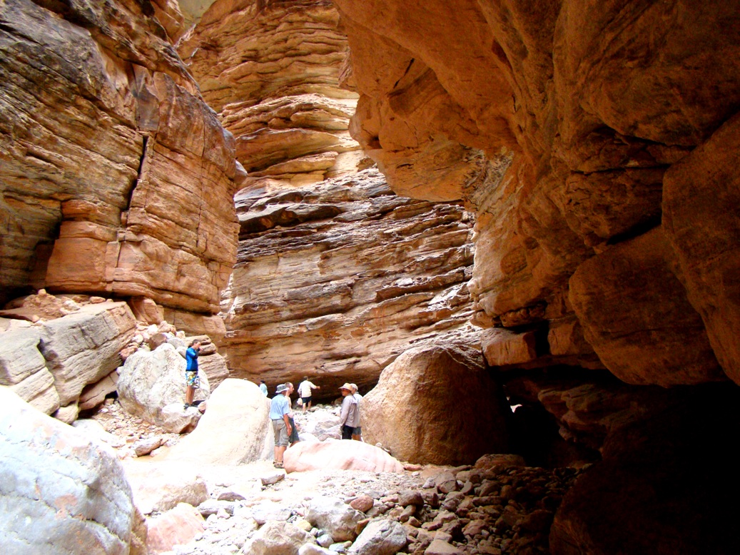
I went into the Great Unknown as John Wesley Powell called it. 226 miles over 16 days, drifting with the slow currents, and making headlong rushes down the 160 or so rapids, including a pretty good dunking at Mile 99. There was no way we could stop at every side canyon and explore, despite my intense desire to do so. I've been around long enough that I have to be a lot more careful than I used to be jumping from boulder to boulder, or climbing around on exposed cliff sides. But there were many beautiful hidden places that we did stop and explore. Shinumo Creek on the morning of day 10 was one of them. Later in the day we reached two more, Elve's Chasm and Blacktail Canyon.
As I've said many times as I've written about this trip, the canyon constantly changes. There was always something new to see and experience. Elve's Chasm was such a new place. It is a tributary canyon to the Colorado River, like hundreds of others, but in this particular spot travertine spring deposits covered much of the sedimentary rock. The creek (and debris flows) cut down through the solid rock, but then the springs flowed and mineral deposits (mostly calcite) developed and covered the rocks.
The travertine is a porous rock (as can be seen above), but it is also strong and easily cut. I was much to surprised to find that the massive columns surrounding St. Peter's Square at the Vatican in Rome (and many other building facings) were carved from travertine rather than marble.
It was bit of a climb up the canyon, but the waterfall at the end of our walk was wonderful. The fallen boulders made for easy climbing in the darkness behind the waterfall, so the kid in me delighted in climbing and then jumping into the deep pool below! Being a kid doesn't involve just asking questions...
I saw multitudes of reptiles and amphibians over the course of the trip, and once in awhile one would stay in place long enough for a picture. Anyone want to identify the species for me?
As we drifted down the river we passed a massive travertine deposit that could have been a statue of Jabba the Hut. I don't know why we need to make these natural features into something more familiar, but it happens. I guess it helps us to remember them more easily.
We stopped for lunch at the imaginatively named Mile 117.6 Camp. As we were wrapping up, we had a treat. I had seen a bighorn sheep along the river on the second day out, but had no chance for a picture (we were at the very top of a big rapid). Someone in the group spotted movement across the river, and we realized there was a herd of bighorns coming down to the river for a drink.
It was a number of ewes and their lambs. It was a sight watching them climb along the cliffs and rocks. They made me feel positively clumsy.
 Even the young ones looked supremely confident. The bighorns were hunted by the Ancestral Puebloans, but I find it hard to accept that they were a major food staple. It seems like they would be a difficult prey. Powell's men had rifles, intending to supplement their diet with sheep and deer, but it almost never worked out. The sheep were simply too cautious and quick.
 And hard to see! How many sheep are in the picture below?
I wondered if the sheep ever swim across the river. This didn't answer the question for sure, but a short distance downstream there was a handsome ram all by himself. I have no idea if it was his harem on the other side, but then on the other hand, maybe the ewes swam across to get away from him!
Downstream we pulled out for one more excursion up a tributary stream, this time at Blacktail Canyon. It is a narrow gorge cut through the Tapeats Sandstone of Cambrian age (around 520 million years), and a bit of the underlying metamorphic rocks of the Granite Gorge Metamorphic Suite (mostly about 1.7 billion years old).
The ledges of Tapeats contain layers of sandstone and conglomerate that represent the coastal rivers and beach deposits of the transgressing Cambrian sea that eventually covered much of the early North American Continent. As we walked up the canyon, an extraordinary contact became visible.
It was a wonderful exposure of the Great Unconformity, the buried erosion surface representing a gap in time of 1.2 billion years. We had seen the unconformity in several places along the river upstream, but it was often hidden by debris and fallen rocks, or was too high above the river to get a close look. Here in Blacktail, one can put a finger on a line representing more time than the entire existence of complex life forms on planet Earth.


The canyon had another virtue. It was a wonderful acoustic chamber. Our crew brought a harmonica, but they told stories of others who have brought brass instruments or cellos to make beautiful music. As Pete played a song, a canyon wren added a counter melody that just made my heart soar (you can scroll down this page to hear a canyon wren). I love those birds !
At the head of the canyon, we found a pool and a small tricking waterfall. It was such a peaceful place to explore. As everyone wandered back down the canyon I sang a few verses of "Amazing Grace". I was still upset by the rough ride down the rapid the previous day. I had profusely thanked the wonderful people who were there to pull me out of the turbulent water, but thought it would be nice to send another message into the Cosmos to whomever might be listening.

Through many dangers, toils and snares
I have already come;
'Tis Grace that brought me safe thus far
and Grace will lead me home.


We headed down the canyon and back onto the river. We reached a sandy camp called Enfilada. Interesting things lay ahead down the river, and the boatmen were beginning to talk about Lava Falls.