Showing posts with label thunderstorm. Show all posts

Thursday, August 4, 2016

Notes from the Monsoon in Grand Canyon National Park


One of the most awesome things I've ever seen

Timing is everything. If one schedules a trip to the American Southwest in July or August, one may very well have to contend with the monsoons, the change in prevailing winds that brings warm humid air out of the Gulf of Mexico. The hot weather produces convection cells and intense thunderstorm activity, and flash flooding is a deadly possibility. Such flooding was in the news today in Utah and Arizona (here and here).
No, I didn't get a lucky shot, it's a screen capture from a video I took of the storm.
I got incredibly lucky in my travels this last week. We spent three nights on the North Rim of Grand Canyon (two of them in tents), and we got two evenings of dramatic clouds with all kinds of lightning and thunder in the distance. A bit of rain fell (with some serious thunder), but not enough to soak our gear. We had a delightful pair of evenings watching the light show from the viewing deck of the Bright Angel Lodge.
Storm cell over the South Rim of Grand Canyon
The third evening seemed calmer, and we saw only a few lightning bolts in the far distance. We headed into the lodge for dinner after the sun set and were enjoying our food, but we became aware that things were changing dramatically outside. The lightning strikes were happening only seconds apart, and the thunder was deafening. Rain was filling the canyon below. Like idiots we went outside in the raging storm to watch! I live in an area that gets maybe one or two thunderstorms a year, so I'm easily impressed. But there is another aspect: rainbows, sunsets, and lightning strikes are beautiful in their own right, but placed against the backdrop of one of America's greatest national parks they become truly awesome.
Sometimes you just need to look up

Though lightning was striking only a few hundred yards away, no one was hurt so far as I know. The rain fell for most of the night on Monday, and in the morning the ground was thoroughly soaked and everything felt fresh. The storms gained in intensity the following day, and there are now reports of flooding in places where I was eating lunch in the hot sun just a day ago.

One can never underestimate the power of flash flooding. It has proven deadly many times over through the years. No matter how strong you are, you simply cannot swim out of a rapidly swirling mix of mud, boulders, and water. If you are ever in the southwest exploring slot canyons, be aware of the weather. They became slot canyons precisely because of flash flooding. Even just driving your evening commute in Phoenix or Las Vegas can be dangerous. Take the warnings seriously.
The monsoons are dangerous, but they also bring needed rain to an area ravaged by drought for most of the last two decades. And they bring great beauty. I hope you enjoy this selection of photographs from my trip to the Grand Canyuon.

Thursday, April 24, 2014

Where are the Ten Most Incredible Places You've Ever Stood? My Number 9: Frame Arch and the Delicate Arch Trail

It's the journey through the Ten Most Incredible Places I've Ever Stood! As I explained in the last post, the list is subjective, and everyone's list will be different. I'm pleased at the response of many of you already listing your most incredible spots in the comments, and on my accounts at Facebook and Google+. I'm looking forward to seeing more! My own list is not in any particular order, other than my choice for number one. Folks will perhaps not be surprised to see that I selected the picture above for my number 9; it's the cover photo from my Geotripper Images website where I've posted a lot of my geological pictures for use in educational/academic projects. It is a view of the La Sal Mountains through Frame Arch at the end of the Delicate Arch trail in Arches National Park.

In the years before PowerPoint, I started all of my geology classes with a set of slides (this was an ancient technology that involved "carousel trays", "slide projectors", and "film") to introduce the students to the world as it is revealed by geological processes. The first picture was always this stretch of trail just short of  Delicate Arch. I chose it because it symbolized so much about the wonders revealed in the incredible history of our planet.
The trail is cut into a formation called the Entrada Sandstone, a layer composed mostly of  windblown sandstone as well is silt and mud in some areas. It once was a system of sand dunes near a coastal delta and estuary during the Jurassic Period around 140-180 million years ago. The trail surface is a natural separation along the surface on one of the dunes, so by walking on this trail we are striding on the same surface that dinosaurs, ancient mammals, and arthropods walked on many millions of years ago. We know that these rocks were buried deeply by thousands of feet of overlying rock, but they were pushed upwards by vast salt domes rising from older formations below. The doming effect split the rocks into linear fins, and the arches developed from weathering and erosion at the base of fins.

At one viewpoint an observer can appreciate the variety of depositional environments that led to the formation of the colorful Entrada rocks, the vast amount of time that the rocks lay buried in the crust, the immensity of earth movements that brought the rocks back to the surface, and the intensity of erosional processes that shaped the rocks into what they are today. And one can walk on a surface that may very well have been a trackway for a dinosaur many eons ago.

But (like they say in late-night television ads), there's more! Although many people use Frame Arch to frame Delicate Arch, I chose to emphasize the La Sal Mountains instead (the top photo). The La Sals represent the role of magmas in earth processes. The mountains are composed of intrusive rock that reached close to the Earth's surface about 25 to 28 million years ago. Some may even have erupted out in volcanic eruptions, but the rest of the rock formed into mushroom shaped plutons called laccoliths. The dioritic rock proved more resistant to erosion than the surrounding shale and sandstone, so the peaks rise 6,000 to 7,000 feet above the plateau surface. The highest peaks in the La Sals reach nearly 13,000 feet above sea level.
It's a scenic, even iconic spot for photographers and park visitors, but what makes this one spot special to me? It's the unique experience of each visit. It's been my privilege to visit this spot perhaps a dozen times in the last 30 years and every time it has been an awe-inspiring journey. We usually head up the 1.5 mile trail in the late afternoon in order to catch the sunset on Delicate Arch. Quite often there is a raucous crowd, and some moron always feels a need to go stand under the arch for an inordinate period of time, prompting shouted complaints from the large group of photographers on the ridge top. Frame Arch becomes the special spot at that point because there is only myself and a few of my fellow travelers. We don't hear the chaos and mayhem at Delicate Arch, and we can just sit and appreciate the changing colors and deepening shadows.

Once or twice we've been doused with a summer rainstorm, and in one particular year we took shelter under the arch and gloried in the lightning and crashing thunder, and watched as the dry sandstone transformed into a series of waterfalls and white cascades. It was one of the most cherished moments of my life. We assumed that the storm would obscure the sunset, but as quickly as the storm hit, it dispersed and the sunshine broke through to highlight the La Sal Mountains in the far distance.


One more reason that this spot is on my incredible list is because of the ephemeral nature of Delicate Arch itself. It may not last my lifetime. The arch is only a foot and a half thick at one point, and there are valid fears that it could collapse in the natural order of events. Of course, humans may help it along; I've heard of at least one episode in which a man attacked the arch with an axe. Then again, it could last another thousand years. Who knows? In the meantime it is a magic place.

Once before I pass on I would like to see it in the snow.

Monday, August 26, 2013

Into the Great Unknown: Living in a Thomas Moran Painting, and Through a Canyon Storm

Others may have differing opinions, but this may be my favorite picture from the entire trip.
There are, of course, many Grand Canyons. The one you will see depends on the time of day, the location of the sun and clouds, the presence or absence of storms, and your location, whether deep in the canyon, or somewhere on the rim. It also depends on the rocks you are passing through. I saw a different canyon every day, and almost every hour. It was never boring, not once. Pete, whose raft I traveled in, would probably agree that I spent every moment on the river gazing up at the canyon walls (or transfixed in horror at the lip of big rapids!).
Our fifth day ended at Carbon Creek under gathering clouds. We hadn't experienced any rain since the first day, but storms had always been lurking in the distance. We set up camp and I decided to explore a little bit. I grabbed the camera and a canteen and headed up the gorge behind the camp. The personality of the canyon had changed into one of brooding and gloom. It was partly the clouds, but it was the rocks too. We had reached the Dox Formation, part of the Grand Canyon Supergroup, the billion year old rocks that lay exposed beneath the Tapeats Sandstone.
The Dox is composed of layers of silt, shale and sandstone deposited in a variety of environments, including river floodplains, coast complexes, and deltas. In some places the formation is brightly colored, but here in Carbon Creek on this day, brown and gray seemed to predominate.
I had hoped to go far enough up the canyon to see the Great Unconformity between the Dox and the overlying Tapeats Sandstone, but I found the way to be choked with gigantic boulders that had rolled down the adjacent slopes.
Some of them displayed cavernous weathering, with deep pits and hollows that brought to mind certain horror movies...
 One boulder of Tapeats Sandstone really stood out...it was 15 or 20 feet tall.
People have hiked some distance up the canyon, and have added slabs of rock to produce a makeshift stairway up the layered shale. I worked my way upward.
I would have explored farther up the canyon, but a sudden flash of light and peal of thunder told me that the storm had arrived. I had no rain gear, but I was not overly concerned since I was no more than 200-300 yards from camp. The giant boulders that impeded my progress up the canyon now provided handy shelter from the storm.

The rain came, not in torrents like the first day of our trip, but certainly enough to get wet. I gave some thought to the possibility of a flash flood, and from where I hunkered down, I made sure I had a direct line of escape onto the slopes above.
The thunder crashed and echoed through the canyons. I didn't worry; I had no place I needed to be, so I settled in and enjoyed the experience of a desert rainstorm for the next hour or so. It was even exhilarating, as I recalled the writings of John Muir when he climbed to the top of a pine tree to better observe a wild thunderstorm (I guess we're lucky he survived the experience!).
I had the sense that I wasn't alone. I looked around and realized that two of us were enjoying this storm. The lizard was enjoying it in a different way. He/she was luxuriating in the moisture, just laying there getting wet from head to toe. You can see a little droplet hanging off its tail.
Thomas Moran (1837-1926) was a painter who did much to bring about the existence of our national park system. His dreamlike images of Yellowstone and Grand Canyon popularized both regions, especially two gigantic paintings of the parks that hang in the halls of the Smithsonian. I've always enjoyed his work, even as I recognized the somewhat romanticized views of the scenes that he set on canvas. Such vistas couldn't exist in the real world, of course.
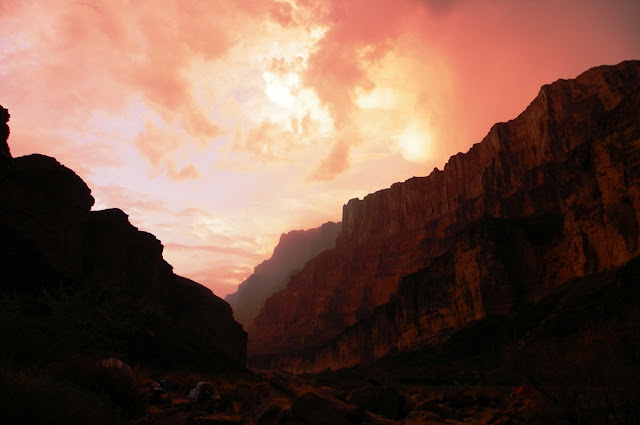
Except that they do. As the storm briefly cleared I realized I was living in a world that had previously existed only in the imagination of the long deceased painter. The clouds opened up holes that briefly let sunlight flash across the cliffs, and in other moments there was only the indirect glow of sunlight reflected off the clouds.
 I took advantage of the lull in the storm and wandered back to camp.
As we ate our dinner the storm returned, and the cliffs across the canyon changed color by the moment, and appeared and disappeared as the squalls moved across our line of sight. The storms continued until the setting sun removed the energy in the air masses, and a few stars began to twinkle in the sky above us. For only the third time in the entire trip I set up my tent, but no more rain fell that night.
Looking at the picture below, the joker in me wants to say "this campsite was just plain rocky", but in reality we were simply drying off the base of the tent prior to packing it up for the day.
 A stream had indeed flowed through Carbon Creek in the night, but it was no flashflood. The water did carve a small channel in the sand near the confluence with the river.
In the morning we saw the one and only scorpion of the trip. I was astounded at the small size. I've seen many of them in my travels, but never one that was barely bigger than a red ant. It was nice of the ant to wander by and provide scale for the picture. They say the smaller ones pack the biggest wallop, but according to the records no one has died in Grand Canyon from getting stung. I wasn't in any mood to experience such a thing, so we let the little guy scurry off under a rock. I shook my shoes every morning after that!

Wednesday, August 3, 2011

A Storm in the Desert: Every Day is a Gift

I didn't want to do this drive...a seven hour slog through the most boring part of the Central Valley in Fresno and Bakersfield, and across part of the Mojave desert during the hottest and dustiest time of year. I generally hate the monotony, and it kinda needed to be done. The sky was dull gray blue, and temps were over 100 degrees. Bleh...

Things started to change as we crossed Tehachapi Pass headed east. There were some awesome looking clouds on the horizon. I wondered if we would reach them before we turned south again...

As we drove closer, it got hard to pick out landscape features in the grayness beneath the clouds. Something was certainly going on over Boron and Four Corners (Kramer's Junction). It looked like we were going to go right through it after all.
First we got hit with some pretty intense dust clouds that obscured the hills. It was a first wave of sorts for meteorological instability, a cooler downdraft that was blowing pretty hard. We passed the dust and things cleared a bit before we approached the next gray wall of...something.
With the afternoon sun at our back, it was clear we were headed into a squall. There was a rainbow ahead of us, with a background of dark gray rain.
Then the rain hit, hard, and the road ahead almost disappeared. The monotonous drive had suddenly become very interesting, and a little intimidating too. There was a lot of truck traffic headed both directions.
Water quickly ponded everywhere. This is how flash floods begin. Luckily, we were crossing a corner of what appeared to be a pretty intense storm. I'm glad we weren't headed all the way into Barstow. It looked a lot worse that direction.
The clouds were intense off to the east...just then we passed through one more squall, and with sun sitting low on the horizon, a beautiful rainbow appeared in front the wall of white cumulus clouds.
I hit the brakes to stop and snap a few pictures (most of these pictures are courtesy of Mrs. Geotripper, just so you know I wasn't driving and shooting at the same time). The rainbow got brighter and brighter, and when I zoomed out, I saw that it had developed into a double bow.
It was just gorgeous. I noticed that the temperature had plummeted, from 100 to 68 degrees within the space of few minutes. The desert was cool, and the sagebrush and other plants smelled just wonderful.
As the sun settled towards the horizon, the storm we were under started to lose energy and broke up. The interplay between the sun and clouds became an astounding palette of gold, silver, black and blue.
Clouds really do have silver linings sometimes...
As the sun sank below the horizon, the storm's energy dissipated and the clouds disappeared. We reached the summit of Cajon Pass and descended to our destination in the urban jungle of Southern California.
I didn't want to do this drive. It is usually long and monotonous, and we here for a sad and tragic reason. We were given a gift of a wild storm, and were reminded once again that every single day of life is a gift as well.

Rest in peace, David, and may your family and friends find peace as well. You will be missed.

Tuesday, July 19, 2011

Bookends to a Storm: Longs Peak in Rocky Mountain National Park

The calm before the storm; Bear Lake and Longs Peak
Wouldn't you just know that we would decide to go camping in the middle of flash flood-producing storm at  Rocky Mountain National Park...

We had a gorgeous day strolling around an almost eerily calm Bear Lake, but in the late afternoon the sky opened up with a tremendous thunderstorm. We delayed setting up camp, and when we arrived later at our campsite, things were peaceful and the night skies clear.

The next day, the same pattern built up, a late afternoon deluge, followed by a break, so (having moved to a different campsite) we set up camp and lazily had dinner in Estes Park. When we got back, lightning and thunder were rocking the entire valley, and the skies were opening up with all manner of hail, rain, and wind. We found out there were limits to the "waterproofness" of our new tent, termed the Taj MaHayes by my students. We sat in the car for a few hours, and when things finally settled down, we sopped up the mess and dried off as well as we could. We found out later that the storm dropped inches of rain across much of the park and areas south (Breckenridge got nearly 4 inches overnight).
The morning after the storm
Morning brought a beautiful sunrise, and bizarre looking clouds over the summit of Longs Peak, the highest mountain in the park. There were lakes and new channels all over the campsites. The rivers we saw today were overflowing their banks, including the river in Moraine Park, and the Colorado in the Kawuneeche Valley. It's been a neat vacation....