Showing posts with label Half Moon Bay. Show all posts

Friday, August 20, 2021

The Other California: Catch it While You Can, the Devil's Slide

California is nothing if not audacious. Our state possesses so many incredible landscapes known throughout the world: alpine mountain ranges, volcanoes, deserts, and of course the legendary California coastline. The coastline in particular has garnered a lot of attention over the years to the extent that roadbuilders tried to provide vehicular access to practically all of it. There are only a few short stretches of coast, especially in the north state, where wilderness reigns instead of highways. Highway 1 is a spectacular engineering feat for better or worse, providing some of the most astounding views a driver could ever hope to see.

But this incredible feat of engineering didn't come without serious costs and continuing hazards. Hardly a year goes by in which some portion of Highway 1 isn't shut down by mudflows and landslides. The Big Sur section of the coast has been especially hard hit in recent years. But there is one part of the highway that we Californians constantly heard about in the news, but not any longer. It just sort of disappeared from the public consciousness. It's a section between Pacifica and Half Moon Bay called the Devil's Slide.

One needs only to look at the Google Earth image (above) to see the insanity of trying to build and maintain a road across the coastal cliffs here. The near total lack of vegetation is an immediate clue to the instability. A closer look at the geology of the rocks exposed in the cliff reveals a complex mess. To the right is the bold cliff labeled on the map below as Devil's Slide, although that particular rock is not the source of the problem. It's a relatively coherent intrusive complex called the Granitic Rock of Montara Mountain. The unit consists of granite and quartz diorite, which to most humans looks like granite. It formed about 86 to 93 million years ago as part of the Sierra Nevada batholith. Being found along the coast, it seems a bit out of place, and it truly is. It was sliced off the south end of the Sierra Nevada by the San Andreas fault system and transported several hundred miles north at the furious rate of about 2 inches per year. 

The problem child of this geologic mess is the gray colored unit labeled Tss on the geologic map below. It is an unnamed sequence of sandstone, shale, and conglomerate of Paleocene age, from around 55-60 million years ago, just after the great extinction that wiped out the non-avian dinosaurs and many other species. These weakly consolidated sedimentary rocks have been severely deformed and sheared by nearby fault zones into a jumbled mass of unstable blocks prone to sliding. The main slide surface is about 150 feet beneath the surface, and the entire unstable block is 4,000 feet long, and as much as 900 feet high.

It was a treacherous slope, but engineers (well-educated or not) love a challenge. The first attempt at building a road came in the late 1800s when a road was carved about 100 feet above the present trail. Landslides and slope failures soon commenced, and by 1914 the road was abandoned in favor of a winding route on the other side of San Pedro Mountain (which serves today as a fire lane). 

Then the railroad designers took their turn, putting in a railway on the lower part of the cliff in the early 1900s. The slopes disagreed with the railway, and the tracks were abandoned by 1920 (the 1906 earthquake did not help). Then in 1936, the roadbuilders were ready to try again. Highway 1 was being constructed along much of the Central Coast of California, and the engineers decided they simply must have a highway across the Devil's Slide. It was finished in 1937.
The problems of course began right away. Slope failures caused major closures of the highway, in some instances for days, in others weeks, and in 1995, five months. Numerous fixes were proposed, but most would have caused severe environmental disruptions in the marine ecosystem below, and unwanted urban growth above (an improved and widened freeway would have brought commuters to Half Moon Bay). So the status quo continued (fix the breaks and keep the damaged road open as much as possible). Driving the highway was an exhilarating and bumpy experience, and for geologists it was a frustrating adventure because there was no safe place to stop and study the geology of this fascinating case study in slope failure. 

Another solution gained steam in the early 2000s: a tunnel bypass. What was proposed were two single lane tunnels underneath San Pedro Mountain. At 4,000 feet each, they would be among the longest of tunnels in California, and would end up costing 'only' a third of a billion dollars. The Tom Lantos Tunnels were completed in 2013, and the transportation saga of traversing the Devil's Slide appeared to be over. 
So what to do with the old highway? It could have simply been abandoned like the nearby WWII defense installations, but a better idea emerged: convert the old highway into a hiking trail. San Mateo County took over the property and converted the highway into a 1.3 mile long hiking and biking trail, complete with parking at both ends, restrooms, and a series of useful interpretive signs. It opened in 2014, but I didn't get a chance to explore it until last week.
The paved trail was in excellent condition. Maybe the lack of heavy truck traffic eases some of the pressure on the slope. There are great exposures of the rocks on the mountain side, and glorious ocean views on the cliff side. More than 150 bird species have been observed along the trail since its opening in 2014, but there is the potential for many more as birders have access that wasn't possible prior to the construction of the tunnels.
The trail also offers some close-up examples of slope mitigation methods as well. A section of the cliff has been covered in a metal mesh to prevent boulders from injuring people. 

One might argue that this locality is not in the spirit of "The Other California", since it has been a famous section of Highway 1 for many decades, but it's only been the last few years that anyone could actually walk and study this fascinating spot, and only a relative few people know about the trail. If you visit the Bay Area it is well worth a visit.

But you might consider doing it soon! There is less stress on the slope from heavy traffic, but the fundamentals of the slide are still in place, and it can't be predicted when new damage might occur...

For the park brochure and trail map of the Devil's Slide Trail, use this link:

DSTrailBrochure-Nov2018-FINAL-web-formatted.pdf (smcgov.org)

For a geology road trip along the coast south of San Francisco check out this link:

Microsoft Word - chapter8.doc (usgs.gov)

For engineering details on the slide, check out the following USGS Bulletin:

USGS Bulletin 2188, chapter 7

For a geologic map that covers the slide area, check out:

Microsoft Word - smgeo.doc (usgs.gov)

USGS Open-File Report 98-137

Sunday, March 11, 2018

Waves on Fire at the Devil's Slide near Half Moon Bay

Even though Geotripper is a geology-based blog, it seems ocean waves don't make an appearance all that often in my posts. Try as I might, I don't photograph them very well, or very creatively. I love them, however, and can watch them for hours at times.
I think part of my difficulty is the point of view. Most of the time we are standing on a shoreline and the waves crash in front of us, always with the curl of the impending breaker, and the swash upon the sand beach. Always the same angle. And that's what caught my attention tonight. We had occasion to be in Half Moon Bay at sunset, and it was a truly beautiful splash of color in the sky. We had finished dinner at Miramar, where the coast is a long curving stretch of sand. Certainly pretty, but we wondered what the sunset would look like from a bit higher...like hundreds of feet higher. So, as the sun sank closer to the horizon, we headed north on Highway 1, and soon reached the new tunnels at Devil's Slide.
The Pacific Coast Highway was meant to hug the coast from Mexico to Oregon, and the effort to complete it was monumental. Regrettably, almost all of California's coastal cliffs bear the scars of road construction, and only about 25 miles of the state's spectacular shoreline remains as true wilderness. Just the same, there is no experience quite like following this highway from one end of the state to the other. It begins in the nightmare of urban traffic throughout most of Southern California, leading to winding mountain roads through immense Redwood forests in the north. Of all the spectacular stretches of highway, the one between Half Moon Bay and Pacifica has given road engineers the biggest headache of all. It's called the Devil's Slide.
The highway was built over an active landslide hundreds of feet above the shoreline. From the very beginning, the road experienced constant damage from slope failures, and the highway was often closed for expensive repairs. The powers-that-be finally gave up and eventually built the Tom Lantos Tunnels through the mountain behind the slide and closed the old highway in 2014. It was given to the county and is now operated as a trail and scenic overlook.

That's where we found ourselves tonight at sunset: hundreds of feet above the shoreline looking almost straight down on the crashing waves. I realized I was seeing something unique, the waves from above, with the dramatic light of the sun on the backside. It was an indescribable sight, so I won't even try. You'll just have to enjoy the pictures.
I've included a couple of pictures of the broader view so you can have some context for understanding the pictures above.
The waves are rolling into a narrow cove, and break as they reach shallow water. The shore is mostly bedrock with no sand, so as the waves break, they often reflect (bounce off the water's edge) and roll backwards, breaking again against the other side of the cove. The intersecting waves create an interesting tapestry.


Despite the imposing name, the Devil's Slide is one of the most spectacular stretches of the California coast, and is not to be missed if you ever find yourself in San Francisco. It's no more than 30 minutes from downtown or the airport. I've often visited there while waiting to pick up people from the airport.

Sunday, June 4, 2017

The Airliner Chronicles: The San Francisco Peninsula and the San Andreas Fault

Crystal Springs Reservoir is on the upper left, while San Andreas Reservoir is on the lower right
As has been no doubt obvious, I was in Hawai'i last week, and there have already been several posts about some of my adventures. I started through the many pictures in a more chronological manner, and realized there were some neat things I saw before I even left California. I always notice on a flight that some people do such things all the time and are not particularly impressed that they are in a large metal tube traveling at hundreds of miles an hour at 35,000 feet. Others have a sense of history, realizing that for the first few million years of hominid existence, this was an unnatural thing to be doing. I don't get to fly all that often, so I tend to fall into that second category. As soon as we are off the ground, the camera that I surreptitiously placed at my feet swings into place and I start snapping pictures as if I were the first human being ever to see such incredible sights. My photo habit led to my first blog series in 2008, the Airliner Chronicles. Consider this a new entry...

It is the geologist's perspective that provides some insight as to the nature of the landscape below. We left from Oakland Airport and flew over the north end of the San Francisco Peninsula, which provided an outstanding view of the San Andreas fault. Often such faults are indicated by linear valleys owing to the ease with which crushed rock in the fault zone erodes. But on the peninsula the fault is even easier to pick out because of the presence of two reservoirs filling the linear valley, Crystal Springs reservoir, and San Andreas reservoir.
It's quite a coincidence, the fault and the lake both being called "San Andreas", so the question naturally arises, which was named first? The fault may be more famous to most people, but the lake came first. It was constructed in 1868. In 1895, the geologist Andrew Lawson was mapping in the area and discovered the fault, which he named after the lake. He had no idea that the fault was 600 miles long, or that it was particularly active, or that it was the boundary between the Pacific and North American tectonic plates. And he most certainly didn't know that it would shift in 1906 in a most tragic way.
The city has grown in the years since 1906, to say the least. We know a great deal more about fault zones and earthquakes, and thus we have a better understanding about the threats of future quakes in the Bay Area. Both by law and by subsequent experience (Loma Prieta in 1989 and the Napa Valley in 2014), the cities of the peninsula are better prepared for large earthquakes, but no matter how ready they may be, the next large earthquake will cause major damage on the peninsula and many will die or be injured. Seeing the proximity of the fault and the cities from above provides a stark reminder of the need to be prepared.

We flew out over Half Moon Bay, and soon land was left behind. There was more than 2,000 miles of open ocean ahead of us, a five hour flight. I settled in and thought of how the islands were inaccessible to humans of any kind until only a thousand or so years ago, and even a hundred years ago it took weeks or months to cross the ocean. How even more wondrous the number of bird and insect species that survived the journey over the millennia.

Thursday, January 30, 2014

Where the Sierra Nevada Rises From the Sea: A Compilation of Posts


The Sierra Nevada of California is one of the great mountain ranges of the world. The soaring granite peaks, the deep glacial valleys, and the towering Sequoia trees represent some of the most beautiful sights to be seen anywhere on the planet. What is less known is that a portion of the Sierra Nevada is present elsewhere in the state. Around 30 million years ago the San Andreas fault system became active and sliced off a portion of the southern Sierra Nevada batholith and carried it northwest for several hundred miles. It now makes up a considerable portion of the Central California coastline, stretching from Big Sur on the south to Bodega Bay on the north. It is in my humble opinion one of the most beautiful and dynamic coastlines to be found anywhere on planet Earth.

I recently finished my latest blog series, and I present here a compilation of the fifteen entries in the series. If you missed any, here is the place to find them!
A sneak peak at the coming series. At this point I hadn't fully appreciated that I was going to be covering the entire Salinian Terrane, so I didn't mention the Sierra Nevada connection in the first post.
With the second post I hit upon the idea of the Sierra Nevada connection with my exploration of Limekiln State Park in the southern part of the Big Sur coast. It is a stunningly rugged stretch of coastal cliffs, and amazingly, the state of California almost shut down this beautiful place.
I punted on this one. I wrote this blog four months earlier about what may be the prettiest cove along the prettiest coast in the world. But the post fit well with the theme and scope of this series, so here it is: one of California's two tidal falls. And gigantic landslides.
A short distance inland from the coast we discover a gem of a state park, Pfeiffer Big Sur. The Sierra Nevada has the Sequoia trees, Big Sur has Coast Redwoods. And both the Sierra Nevada and Big Sur have huge wilderness areas. The wildlands around Big Sur are far less crowded.
Big Sur has some nice beaches, and not all of them are on the main highway. You have to be a bit of a sleuth to find Pfeiffer Beach, but it's worth the effort. And...garnet sand beaches!
One of the lesser known beach parks of the central California coast, Garrapata is a beautiful place that belies its horrendous name ("tick" beach). It has some of the nicest exposures of "Sierran" granite in the region.
Point Lobos was named for the seals and sea lions, not for terrestrial canines. It is another gem along the coast with unique exposures of conglomerates that accumulated in deep underwater canyons that rival Yosemite in their depths.
We finish our journey through Point Lobos and move north onto the Monterey Peninsular. Here it is trees that take up some of the geologic story. Monterey Pines grow naturally only in a few places, mainly on the Peninsula, but have become one of the most widely planted trees in the world. The Monterey Cypress is another unique species in the region.
We take a look at coastline of totally different character as we reach the Half Moon Bay region. There are prominent marine terraces that make for gentle scenery (and apparently great golf courses). There are some nice tidepools in the area, and during the right time of year, the Mavericks hit, the gigantic waves that bring surfers from around the world.
The San Andreas fault looms large in the history of the Central California coastline, but hasn't made an appearance on our journey until now. At Mussel Rock in Daly City, the fault trace moves offshore. The epicenter of the 1906 San Francisco may have been close by. And there is a famous folk song about the cookie-cutter houses on the high, unstable slopes...
Maybe you haven't heard that there is a big bridge that connects the city of San Francisco with the Marin Headlands and the rest of Northern California. It's not likely, but it's possible. There is some interesting geology going on underneath the bridge abutments.
The Marin Headlands expose rocks that were once part of the midocean ridge, the vast planet encircling mountain range that no mountain climber can ever hope to climb. The scenery on the Marin is majestic. And to invaders in World War II, the cliffs would have been deadly.
The Point Reyes Peninsula has wide sandy beaches, sand spits, a bay that may have been a landing for Sir Francis Drake, Tule Elk, and a lighthouse that has to put up with some really rotten weather.
If the Point Reyes Peninsular bears the brunt of violent Pacific Storms, the mountains of the peninsula shelter the lands to the east. Two bays along the San Andreas fault are peaceful and serene, which belies their violent origin.
We wrap up our exploration of the Sierra that rises from the sea with a look at Bodega Head, the site of a classic horror movie, and a horror story with a nuclear reactor as the main character. A reactor that was almost built on top of the San Andreas fault. It's also the northernmost exposure of the Salinian/Sierra Nevada rocks.

Thursday, December 5, 2013

Where the Sierra Nevada Rises From the Sea: Half Moon Bay


There was a time when the seas lapped against the Sierra Nevada foothills. Around 50 million years ago, the Great Valley was a shallow sea trapped between the western edge of the North American continent and a huge subduction zone that was carrying ocean crust, seafloor sediment and assorted volcanoes back into the crust and down into the mantle. The Sierra Nevada Mountains as we know them today didn't exist. At most there were low hills and a long slope that led to highlands in central Nevada. Vast rivers carried sediment into deltas and swamplands along the coastal complex. The resulting layer in the Sierra foothills is called the Ione Formation. It is related to the Domengine Formation found in the Coast Ranges along the west side of the valley.

Half Moon Bay is a bit different than the other coastal regions we've visited in my little mini-series on the most beautiful coastline in the world, the stretch between Big Sur and Bodega Bay. The mountains above the coast at Half Moon Bay don't rise so abruptly as they do further to the south. I can look at the coastal terraces and low hills and imagine a scene that is reminiscent of the Sierra in the time of the Ione. Except for the jungles. There are no jungles here. The presence of coal seams and fossils of palm trees suggest that the Sierra Nevada looked more like the Yucatan Peninsula of Mexico than any place in California. Still, the hills above the coast have extensive exposures of Sierra granite that has been carried hundreds of miles northwest along the San Andreas fault over the last 20-30 million years.

The fairly muted terrain along this stretch of coast displays some really fine examples of geologic structures and coastal erosion features. In the cliff shown in the picture above at Miramontes Point, one can see the tan colored gravels and sandstones of the coastal terrace, but underneath are tilted layers of the Purisima Formation, a gray silt-rich deposit. The Purisima was deposited as horizontal layers, but subsequent faulting and tectonic activity caused the rocks to be pushed and eroded before being covered by the terrace sediment. This type of contact is called an angular unconformity.
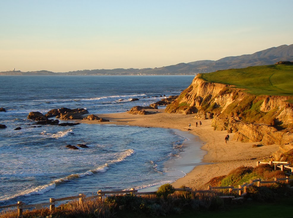
The most intense wave erosion in a beach environment is going to be directed at headlands, the rocky points that stick out into the sea. Conversely, the least wave action occurs within the protected coves. As a result, sandy beaches accumulate in the coves (as in the picture above, and sea stacks (small rocky islands) predominate just offshore of headlands (such as in the picture below at the Ritz-Carlton).

The Ritz-Carlton is a bit rich for my taste (~$500/night), but the beach is free by state law. It's a beautiful place to wander.

There are some nice tide pools in the bedrock exposures, and low tide brings many small discoveries. Snails, clams and octopi are related families within the phylum Mollusca. They are descended from a common ancestor that may have resembled the chiton, the creature with the segmented shell in the middle of the picture below. A chiton can be thought of as a snail with a flat segmented shell instead of a coiled shell. Or it could be thought of as a half clam, with just a top shell (and biologists everywhere want to yell at me now).
The terraces and sea cliffs of Half Moon Bay result from uplift along local faults that has raised former wave-cut benches out of the surf. In other words, waves once rolled across the flat areas at the top of the cliffs. Undercutting of the slopes by relentless wave action maintains the vertical cliffs and cliff retreat can measure in inches or feet per year (be careful how you site your beachcliff home!).

It isn't just the cliffs. The coastal lowlands just north of town have been suffering from wave erosion, and some shoreline roads have to be reinforced with riprap, large boulders used to absorb wave energy. We've watched severe storm waves splash on the front windows of one our favorite restaurants in the area.

There is one other thing I would love to see some day in the Half Moon Bay region. One certain days of the year when the offshore storms are just right, the configuration of the seafloor off of Pillar Point (below) causes the production of monumental waves that can exceed 50 feet in height. The so-called Mavericks are legendary, and when they are crashing, a major surfing competition is organized.


Sunday, May 9, 2010

Gotta Love California: Sunday at the Shoreline

I can't really call this post part of the "Other California", because that series concentrates on geologically interesting places in unfamiliar corners of the state. My trip today was to the shoreline at Half Moon Bay along one of the four or five star resort complexes that costs hundreds of dollars a night and appears on lots of postcards. Note that I was not staying at said resort: I'm a teacher, after all, on a teacher's salary. But one very nice thing about California is that the shoreline belongs to everyone, and so despite that rich trappings, anyone can stroll along the beautiful cliffs and beaches.

Wave-cut cliffs abound along this section of the coast, due to tectonic uplift and deformation along nearby faults, including the San Andreas and San Gregorio. The rocks exposed in the cliffs tell a complex story of deformation of this block of crust, including granite rocks of the Sierra Nevada that have been displaced at least 200 miles northward, and seafloor sediments folded and lifted above sea level (check out this 2001 NAGT field guide, published by the USGS for some details).
Evidence of vigorous wave erosion is evident not just in the fresh seacliffs, but also in human developments close to the edge of the interface between water and land. The stairwell above has been undercut by powerful winter waves, and has been reinforced with the large boulders called riprap. The boulders absorb the force of waves, slowing down the water and preventing it from washing the softer sediments of the cliff away. The road below is probably not long for this world. I've been at a restaurant here in winter and seen water was splashing on the windows facing the beach.
The fun of the central coast of California is the diversity of landscapes. Not five miles from the beach we found a beautiful quiet redwood forest at Purisima Creek Reserve. The reserve has 24 miles of trails in a second-growth forest. Most of the older trees were logged in the early 1900's, but the evidence is nearly buried away in the rich undergrowth. The park was established with the help of the Save-The-Redwoods League. It was a nice place to end the day.