 Lessee....after reading of the travel travails of my many geoblogging and tweeting geologists during the AGU meeting last week, after blogging repeatedly about the threats and hazards of living underneath very high and steep mountains in Southern California, and after making a modest attempt at humor about "traveling dangerously", guess who's leaving today on a journey through the Central Valley and Mojave Desert? They've had more than 7 inches of rain in a few places in SoCal in the biggest storm series to hit the state in at least 5 years (and possibly more than that). The conditions are reminiscent of some of our most famous flood years, like 1969 or 1938. I will keep my camera handy if anything interesting happens!
Showing posts with label Geologist travel meme. Show all posts
Showing posts with label Geologist travel meme. Show all posts
Monday, December 20, 2010
2010, The Year of Traveling Dangerously (The Postscript)
Lessee....after reading of the travel travails of my many geoblogging and tweeting geologists during the AGU meeting last week, after blogging repeatedly about the threats and hazards of living underneath very high and steep mountains in Southern California, and after making a modest attempt at humor about "traveling dangerously", guess who's leaving today on a journey through the Central Valley and Mojave Desert? They've had more than 7 inches of rain in a few places in SoCal in the biggest storm series to hit the state in at least 5 years (and possibly more than that). The conditions are reminiscent of some of our most famous flood years, like 1969 or 1938. I will keep my camera handy if anything interesting happens!

Sunday, December 19, 2010
2010, The Year of Traveling Dangerously (Geology Meme!)
OK, now Silver Fox at Looking For Detachment started it this year, and others are picking up the theme; the question is where you have traveled this year? It's always dangerous to ask a geologist about their travels. They do it a lot, whether for their jobs in industry, or as teachers leading field trips, or just for the fun of it. And they are always glad to expound on their experiences and show LOTS of pictures. And that, poor reader, is what is happening to you now. Some of our destinations will seem similar to those of last year, as I lead field trips to the same places, but a few new spots show up on the itinerary every year. I like seeing new places whenever I can, but I also like to return some haunts over and over, getting to know them intimately, and through their seasonal changes (note the Yosemite pictures that follow).
As usual, I did travel a lot, for a lot of reasons. Traveling dangerously? It felt that way a few times, but mostly it was just a lot of fun exploring.
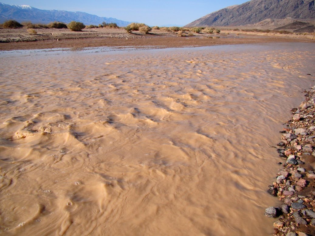
 February brought the big field studies journey to Death Valley National Park. We saw water in the Amargosa River (if you aren't from around here, the word 'river' is tricky; most years, very little water flows, but this year the river was almost navigable in a canoe). There were a number of road closures that stymied our efforts to see some of the popular overlooks, but we did get to see something unique: The Devils Hole Pupfish in Ash Meadows. OK, we didn't see the actual fish; a fence protects the extremely endangered species in their cavern entrance home.
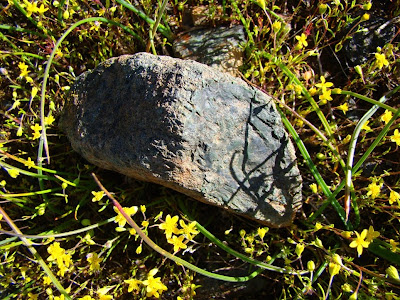
 March was our day tour of the southern Mother Lode between Mariposa and Sonora. I snapped a shot of a chunk of ultramafic rock in the serpentine exposures in the Bagby Grade area. Serpentine...I had no idea what was about to happen with that rock this year!
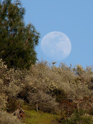
 A week or two later, I was exploring the Red Rocks Area of Critical Environmental Concern, caught an interesting moonrise, and wrote about life on serpentine-based soils. Again, I didn't know what was about to happen with serpentine, our state rock.
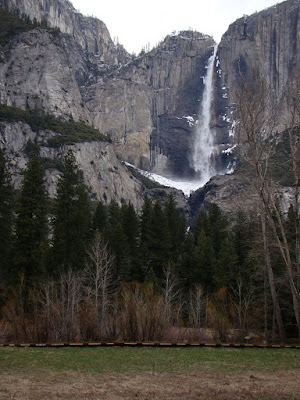
 I made some April trips to Yosemite Valley and found the park still in the grip of winter. It was a cold spring this year, and the snow runoff was delayed by weeks. The valley floor was showing just a hint of greenery, and the waterfalls were modest.
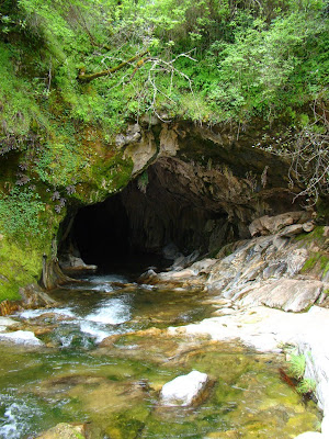
 A few weeks later, the Geology Club at the school hiked down to a pair of natural bridges in the karst topography of the Mother Lode near Columbia in the Sierra Nevada foothills. They are imaginatively called "Natural Bridges", and are actually a pair of marble caverns that have been breached by Coyote Creek. They are a fascinating place to explore.
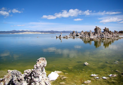
 The National Association of Geoscience Teachers, Far Western Section had a conference at the beginning of May, and we explored the eastern Sierra Nevada and Owens Valley. We drove over Carson Pass which was still encased in snow, and had a wonderful time exploring Mono Lake and the Long Valley Caldera.
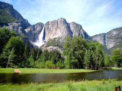
 Later in May, we managed to pay a visit to Yosemite Valley on the peak day of runoff from the long delayed snowmelt. The river hit around 7,000 cubic feet per second, and there was some minor flooding of the meadows (yes, the wood pathway goes into the water in the picture below).
As usual, I did travel a lot, for a lot of reasons. Traveling dangerously? It felt that way a few times, but mostly it was just a lot of fun exploring.
 Our holiday travels brought us to within a four-hour drive of the South Rim of Grand Canyon, so we headed to one of our favorite winter destinations...icy roads, shivering cold temperatures, and no crowds. And a beautiful covering of snow to offset the intense reds and yellows of the Permian formations (the Kaibab, Toroweap, and Hermit Formation and the Supai Group).
A few days later, we got caught in a scary dust storm outside of Tucson. Four or five people died in a massive chain reaction accident in the southbound lanes. Visibility was as bad as I have ever seen, worse even than our Tule Fogs in the Central Valley. Apparently the dust was caused by agricultural fields being plowed, but I have heard that dust storms in the Four Corners region have been getting worse lately with the intense drought (apparently the worst in 1,000 years according to Ken Salazar).
 February brought the big field studies journey to Death Valley National Park. We saw water in the Amargosa River (if you aren't from around here, the word 'river' is tricky; most years, very little water flows, but this year the river was almost navigable in a canoe). There were a number of road closures that stymied our efforts to see some of the popular overlooks, but we did get to see something unique: The Devils Hole Pupfish in Ash Meadows. OK, we didn't see the actual fish; a fence protects the extremely endangered species in their cavern entrance home.
 March was our day tour of the southern Mother Lode between Mariposa and Sonora. I snapped a shot of a chunk of ultramafic rock in the serpentine exposures in the Bagby Grade area. Serpentine...I had no idea what was about to happen with that rock this year!
 A week or two later, I was exploring the Red Rocks Area of Critical Environmental Concern, caught an interesting moonrise, and wrote about life on serpentine-based soils. Again, I didn't know what was about to happen with serpentine, our state rock.
 I made some April trips to Yosemite Valley and found the park still in the grip of winter. It was a cold spring this year, and the snow runoff was delayed by weeks. The valley floor was showing just a hint of greenery, and the waterfalls were modest.
 A few weeks later, the Geology Club at the school hiked down to a pair of natural bridges in the karst topography of the Mother Lode near Columbia in the Sierra Nevada foothills. They are imaginatively called "Natural Bridges", and are actually a pair of marble caverns that have been breached by Coyote Creek. They are a fascinating place to explore.
 The National Association of Geoscience Teachers, Far Western Section had a conference at the beginning of May, and we explored the eastern Sierra Nevada and Owens Valley. We drove over Carson Pass which was still encased in snow, and had a wonderful time exploring Mono Lake and the Long Valley Caldera.
 Later in May, we managed to pay a visit to Yosemite Valley on the peak day of runoff from the long delayed snowmelt. The river hit around 7,000 cubic feet per second, and there was some minor flooding of the meadows (yes, the wood pathway goes into the water in the picture below).
.
 In August, we headed out to the Hawaiian Islands, for a bit of personal exploration instead of a class. The lava was starting to flow again in Kalapana, and I had a brief moment at the edge of the lava flow.
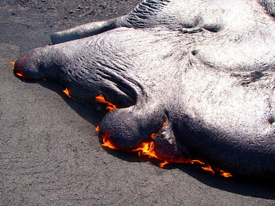
 In August, we headed out to the Hawaiian Islands, for a bit of personal exploration instead of a class. The lava was starting to flow again in Kalapana, and I had a brief moment at the edge of the lava flow.
In June, July and August, California's state rock turned into a nationwide news story, and I had a brief career as a hand model on the cover of the San Francisco Chronicle. I was glad I had a store of pictures of the serpentine landscapes in our Coast Ranges and Sierra foothills so I could participate in the efforts to retain the rock as one of our state symbols.
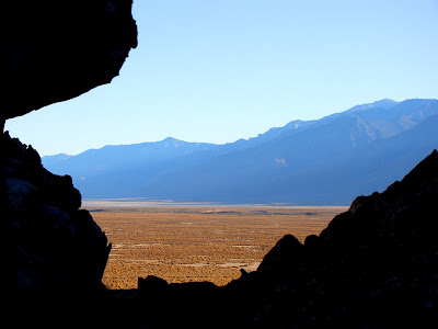 Fall arrived, and it was time for some more field trips with my students. We spent five days exploring the eastern Sierra, the Owens Valley, and the White Mountains. We were searching for amazonite and aquamarine when I snapped the shot above of the Owens Lake depression.
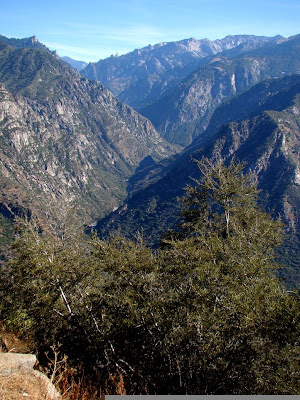 In October the NAGT--FWS had their fall conference, sponsored by CSU Fresno, with explorations of the Carrizo Plains, Yosemite, the Sierra foothills, and one of the deepest canyons on North America, Kings Canyon (above).
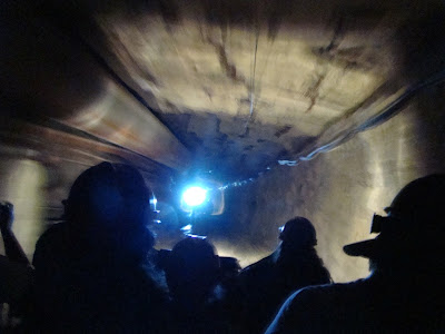 A week or two later, we took a day trip to the Mother Lode near Jackson and Angels Camp. Our journey included an underground tour of the Sutter Gold Mine (Sutter Creek), and Black Chasm Cavern outside the village of Volcano.
 In November, we made one more trip into Yosemite Valley, and saw some glorious fall colors. There had been enough early rain to have a bit of water flowing over the falls. It was one of the most beautiful sights I've ever seen.
 Fall arrived, and it was time for some more field trips with my students. We spent five days exploring the eastern Sierra, the Owens Valley, and the White Mountains. We were searching for amazonite and aquamarine when I snapped the shot above of the Owens Lake depression.
 In October the NAGT--FWS had their fall conference, sponsored by CSU Fresno, with explorations of the Carrizo Plains, Yosemite, the Sierra foothills, and one of the deepest canyons on North America, Kings Canyon (above).
 A week or two later, we took a day trip to the Mother Lode near Jackson and Angels Camp. Our journey included an underground tour of the Sutter Gold Mine (Sutter Creek), and Black Chasm Cavern outside the village of Volcano.
 In November, we made one more trip into Yosemite Valley, and saw some glorious fall colors. There had been enough early rain to have a bit of water flowing over the falls. It was one of the most beautiful sights I've ever seen.
OK, wake up now, the slide show is done! Have some more eggnog!
Monday, December 14, 2009
Geologists Travel...Part II
Continuing one geologist's travels in 2009...
 Three weeks were spent on the Hawaiian Islands, an absolutely glorious journey with enough sights (and pictures) to last a lifetime. Here, Halemaumau crater on Kilauea is belching out tremendous amounts of sulfur dioxide and other gases into the atmosphere. The eruption began only a year or so earlier, with a vent 300 feet across and 600 feet deep. Lava is bubbling inside.
 A July trip to Balboa Beach in Southern California saw the arrival of unusually large waves from a tropical storm off Baja. A couple of people were actually killed by them.
 July also saw a trip to Lake Tahoe, the giant subalpine lake (1,700 feet deep) formed as a huge fault valley (graben) was dammed by lava flows. Mount Tallac, on the skyline, is composed of metamorphic rocks intruded by Mesozoic granitic rocks.
 September included a field studies journey to the Cascades of Northern California and southern Oregon. We toured Mt. Shasta, Crater Lake (above), Lava Beds, and Lassen Volcanic National Park.
 October was a field studies trip to the central Mother Lode, including an exploration of Black Chasm cave.
 November included a tour of Pinnacles National Monument (above), and a Geology Club tour of Natural Bridges near Columbia in the Sierra Nevada Mother Lode.
 And for December, a lot of family, and a quick look at the Grand Canyon!
 Three weeks were spent on the Hawaiian Islands, an absolutely glorious journey with enough sights (and pictures) to last a lifetime. Here, Halemaumau crater on Kilauea is belching out tremendous amounts of sulfur dioxide and other gases into the atmosphere. The eruption began only a year or so earlier, with a vent 300 feet across and 600 feet deep. Lava is bubbling inside.
 A July trip to Balboa Beach in Southern California saw the arrival of unusually large waves from a tropical storm off Baja. A couple of people were actually killed by them.
 July also saw a trip to Lake Tahoe, the giant subalpine lake (1,700 feet deep) formed as a huge fault valley (graben) was dammed by lava flows. Mount Tallac, on the skyline, is composed of metamorphic rocks intruded by Mesozoic granitic rocks.
 September included a field studies journey to the Cascades of Northern California and southern Oregon. We toured Mt. Shasta, Crater Lake (above), Lava Beds, and Lassen Volcanic National Park.
 October was a field studies trip to the central Mother Lode, including an exploration of Black Chasm cave.
 November included a tour of Pinnacles National Monument (above), and a Geology Club tour of Natural Bridges near Columbia in the Sierra Nevada Mother Lode.
 And for December, a lot of family, and a quick look at the Grand Canyon!
Geologists Travel...Part I
After NOVA Geoblog, after Magma Cum Laude, who did it after Woman Scientist...ahh, geologists are nothing if not happy to be traveling. And it has been awhile since we had a good meme! Of course, I'm in...
I spent a fair amount of time close to home, but when you live in Central California, that means a lot of nice places to visit! In January, it was a wintertime journey to Yosemite Valley...
 In February, it was our field studies trip to a rather snowy Death Valley National Park. From Dante's View, one looks down a vertical mile to the lowest point in the western hemisphere, near Badwater (-286 feet).
 By March, the Sierra Nevada foothills were blooming; these are poppy fields in the Merced River Canyon, seen during our field studies trip in the southern Mother Lode.
 In April, it was a return trip to Yosemite, to check out one of the biggest rockfalls in years, at Ahwiyah Rock near Half Dome. Luckily no one was hurt in this one
 Didn't do much in May, because we were planning our biggest trip of the year, a field study of the Hawaiian Islands. 25 students joined us on an exploration of the Big Island, Maui, and Kauai. Below, a view of Mauna Loa from the flanks of Mauna Kea, at 9,000...which is cold in the morning!
 More in a moment! Part II is here.
I spent a fair amount of time close to home, but when you live in Central California, that means a lot of nice places to visit! In January, it was a wintertime journey to Yosemite Valley...
 In February, it was our field studies trip to a rather snowy Death Valley National Park. From Dante's View, one looks down a vertical mile to the lowest point in the western hemisphere, near Badwater (-286 feet).
 By March, the Sierra Nevada foothills were blooming; these are poppy fields in the Merced River Canyon, seen during our field studies trip in the southern Mother Lode.
 In April, it was a return trip to Yosemite, to check out one of the biggest rockfalls in years, at Ahwiyah Rock near Half Dome. Luckily no one was hurt in this one
 Didn't do much in May, because we were planning our biggest trip of the year, a field study of the Hawaiian Islands. 25 students joined us on an exploration of the Big Island, Maui, and Kauai. Below, a view of Mauna Loa from the flanks of Mauna Kea, at 9,000...which is cold in the morning!
 More in a moment! Part II is here.
Subscribe to:
Posts (Atom)