Showing posts with label Ancestral Sierra Nevada. Show all posts

Wednesday, June 3, 2015

Driving Through the Most Dangerous Plate Boundary in the World: The "Dr. Who" of Mountain Ranges

The Whitney Crest of the High Sierra. Mt. Whitney is just out of sight to the right.
I was torn over the title for this addition to the "Driving Through" blog series. I thought of taking the zombie approach and calling them the living dead mountains ("they keep coming at you"), or the crazed killer angle ("they're never truly dead"), but these seemed...um...overly negative for a mountain range that I love. Then it occurred to me that there is a well-loved media character who is regularly mortally wounded and is regenerated with a new body. And Doctor Who is certainly loved by millions of rabid fans. And that seemed a good analogy for the Sierra Nevada of California. The mountain range has been uplifted, deeply eroded, rejuvenated, eroded, and risen yet again, and the mountains have been different each time.
Tenaya Lake and Mount Conness in Yosemite National Park

The are at least three different mountains that occupied this part of California in the last 400 million years, and most of them were related in some way to convergence, the subduction of sea-floor lithosphere beneath the western edge of the continent. The most recent incarnation of the Sierra Nevada has an enigmatic origin, and many uncertainties remain about the specific mechanics of uplift. But rising they are, even to the present day.
Highly deformed calc-silicate metamorphic rocks in Kings Canyon near Boyden Cave.
The earliest mountains were related to the collision of exotic terranes with the western edge of North America. Some of the rocks had their origins in early Paleozoic time, and were severely deformed during the Devonian period roughly 400 million years ago. Some researchers have related the deformation to the Antler Orogeny that is best revealed in central Nevada. Had one been there at the time, the scene might have been reminiscent of some of the complicated island arcs in Indonesia.
Highly folded slate near Dial's Rock Shop near Mariposa, west of Yosemite National Park

By Triassic time, about 250 million years ago, subduction zones were directly active along the west coast of North America, and chunks and bits (the exotic terranes) became incorporated into the continent itself. Mountains were pushed up along the coast in much the same way as mountains have formed in southern Alaska, but without the glaciers. The edge of the continent was located closer to the equator than today.
Mt. Shasta, in northern California, as a stand-in for the Ancestral Sierra Nevada

By late Jurassic time, about 150 million to 85 million years ago, the so-called Ancestral Sierra Nevada mountains pierced the sky. Subduction was feeding vast batholiths of granitic rock deep in the crust, and large volcanoes and calderas caused mayhem at the surface. These mountains may very well have resembled today's Andes Mountains, and indeed, the margin at that time is referred to as the Andean-style plate margin. And then...the mountains died away again. A massive erosional unroofing began that removed 5-6 miles of overlying rocks, exposing the granitic rocks. Evidence strongly suggests that the mountains had been laid low, to mere hills (although contradictory research exists). Sedimentary rocks from 40-50 million years ago show a system of coastal marshes and estuaries, sandy beaches, and large rivers with sources in at least central Nevada, and possibly farther inland.
Much of the western Sierra Nevada is composed of gently sloping, deeply eroded metamorphic rock, covered here and there by volcanic mudflow deposists (lahars), and ash tuff.

It's only been in the last few millions or tens of millions of years that the present-day Sierra Nevada began rising to their present-day prominence. The mountains rose as a westward tilted block, outlined by major faults on the east side, and the Great Valley of California to the west. As the mountains rose, deep valleys were carved by the westward flowing rivers like the Kings, Merced and Tuolumne. In the last two million years, global cooling brought about a series of ice ages, and glaciers scoured the upper parts of the river valleys, giving rise to the spectacular gorges that we visit today, Yosemite Valley being the epic example.
Yosemite Valley from the vicinity of Turtleback Dome.

So, our drive through the most dangerous plate boundary in the world will continue, following pathways into the heart of this mountain range that is both ancient and youthful at the same time.

Monday, May 11, 2015

An Invasion of Ents? No, Just the Biggest Living Things on the Planet

Giant Ent toes. Or Imperial Walkers. Run for your lives!
There are things in Yosemite National Park other than Yosemite Valley. One of the gems (out of a great many) is the Mariposa Grove, a forest of about 500 gigantic Sequoia Trees near the south entrance of the park. A visit to the grove is a delight, as I found out yesterday. I've been there a few times, but on this occasion we spent several hours wandering through the trees, having sworn ourselves to a leisurely pace, a bizarre concept with which I am unfamiliar. It turns out this will be our last visit (and everyone else) to the grove for at least two years. They are shutting it down so they can do right by the wonderful trees.
Until last year, there was a tram that offered tours of the grove (for a price, of course), so a paved road wound through the forest. There is a large parking lot within the forest, a small store (now permanently closed), and that staple of parks and monuments: pit toilets. The problem is that the trees have shallow root systems that are generally less than six feet deep, but which spread widely about the tree. The constant pressure of vehicles and feet damages the root systems. We have been slowly loving the trees to death.

When finished, the grove will be a different place. Parking will be moved to the edge of the grove, and trams will provide free access from an even larger parking lot two miles away. The grove will be traversed by footpaths only, including an ADA access trail to the largest tree in the grove, the Grizzly Giant. There will be flush toilets at the parking area. If these changes work like similar actions that have been taken in other national parks, visitors will have a much different experience, including better chances to observe wildlife in the groves.
The cars are tree-killers
There is a bit of confusion about the Giant Sequoias (Sequoiadendron gigantea), because California has two gigantic tree species. The other tree is the Coast Redwood (Sequoia sempervirens), which grows in a narrow coastal corridor between Big Sur and the Oregon state line. The Coast Redwood grows to immense heights (nearly 400 feet), but is usually slimmer. The tallest Sequoia trees usually don't exceed 300 feet (the tallest is 311 feet), but the trunk is more robust to a high level, so the shorter trees have the greater bulk, making them the largest living thing on the planet. The state legislature didn't know the difference (a big red tree is a tree, right?), so they made the "native redwood" into the official state tree without defining which of the trees they meant. The attorney general of the state eventually got involved, making a final ruling declaring both species to be the state tree. Both tree species live for thousands of years, but neither is the oldest living thing in existence. That honor goes to the Bristlecone Pine which is found in several western states. The oldest, a recently discovered 5,000 year old survivor, is also a California resident.
The trees have a geological story. They once thrived across the northern hemisphere, and in North America fossils of the trees are preserved in Yellowstone and Petrified Forest National Parks (the direct ancestors are preserved in Nevada). The petrified trees in Yellowstone are several tens of millions of years old, but the trees in Petrified Forest are several hundred million years old! Ancestors to the Sequoia date at least to the Jurassic Period, so the trees were witness to the evolution of the dinosaurs and their extinction. Climate change seems to have been the tree's nemesis, and the Pleistocene ice ages probably eliminated them from most of their former range. The trees were able to survive in the Sierra Nevada in part because they could propagate downslope and upslope in response to the advancing and receding glaciers (see this National Park Service article for the details on the origin and distribution of the Sequoia trees).
Not much can kill the trees, as they are resistant to fires, insects, and disease. Their main enemies are humans, gravity, and geology. Humans cut them down of course, for a while, but their wood is useless for most purposes. They made pencils and grape stakes out of them. The logging was put to an end, but in protecting the groves wildfires were suppressed, allowing big Sugar Pines to grow among the Sequoias. Fires can't burn through the bark of the Sequoia trees very well, but the Sugar Pines go up in flames easily, allowing the fires to "crown", burning away the foliage of the Sequoias and killing them. Fires have always been part of the ecology of the trees, as the small ground fires burned away invasive saplings of other trees, and cleared the duff from the forest floor, allowing the Sequoia seeds to germinate properly.

Most trees die by toppling over, in the occasional violent windstorm, or because erosion has undercut part of their root system. The fallen trees take centuries to decay away, as the Fallen Giant in the picture above illustrates. It fell long before the grove was discovered by European settlers.
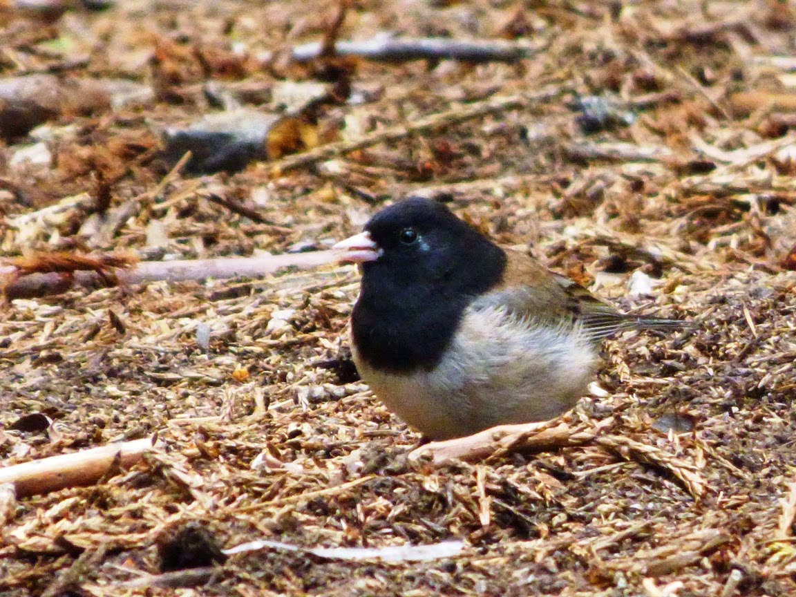
We saw several forest species on our stroll through the Sequoia grove, including Juncos (above), and the White-headed Woodpecker, a purely western species. It's found only in California, Nevada, and the Pacific Northwest. There were the requisite rodents, the squirrels and chipmunks, and the ever present deer. The deer are dangerous; they've killed more people in Yosemite National Park than the Black Bears (bears: 0 / deer 1).
There was also some kind of creature at the base of the big tree in the picture below...
Walking through a Sequoia grove is like walking back in time. One can imagine Velociraptors hunting prey in the shadows of these forests. Or, if you will, Imperial Storm Troopers looking for Luke Skywalker ("A long time ago in a galaxy far away").
Perhaps the most eloquent reminder of the antiquity of these incredible trees was a discovery made by my colleague at Modesto Junior College. During the Jurassic period, there was an ancestral Sierra Nevada, a mountain range that would have resembled today's Andes in South America, with high mountain ridges and active volcanoes. Rivers flowed through the mountains and onto the coastal plains, and dinosaurs wandered through forests of Sequoia-related species of trees. Some trees would occasionally fall into the rivers, and woody debris would be carried into the adjacent sea. Some of the needles and stems would be preserved as fossils that would later be uplifted and exposed by erosion in the foothills of the modern Sierra Nevada. And a twig of Sequoia needles is what my colleague Noah found in 2013 as we searched for fossils in the Foothills Terrane of the Sierra Nevada Mother Lode. A tree that was once widespread across the northern hemisphere now exists only along the California Coast, and in a few dozen scattered groves in the Sierra Nevada.
You can read the whole story of our little fossil adventure here: http://geotripper.blogspot.com/2013/02/hunting-for-fossils-in-sierra.html.

And if your plans this summer include Yosemite, try and visit the Mariposa grove before they shut it down. If you are too late, you can still hike to the smaller Tuolumne and Merced groves in the western part of Yosemite, or you can visit spectacular groves in Sequoia and Kings Canyon National Parks to the south, or Calaveras Big Tree State Park on Highway 4 to the north. There are a few other groves tucked away in the national forests that lie between the other parks.

Thursday, March 3, 2011

The Other California: Why worry about Yellowstone? We've got our own "Supervolcanoes" to worry about

First off, let's get something straight. As far as geologists are concerned, there are no "supervolcanoes". There are stratovolcanoes, plug domes, cinder cones, and shields, but no "supervolcanoes". What the tv documentaries call a "supervolcano" wouldn't technically be a volcano at all, since it is a giant hole in the ground, not a mountainous feature produced by lava flows.

The volcanic features referred to as "supervolcanoes" are actually calderas, large, generally round depressions in the crust that form when huge eruptions of hot ash empty out magma chambers. The destablilized crust collapses inward to fill the void. Calderas form in a number of circumstances, and are not always catastrophic events. On the Big Island of Hawaii, for instance, the calderas on the summit of the vast shield volcanoes are just a few miles across, and are stable enough that the Hawaii Volcano Observatory is perched on the edge of one. On the other hand, the formation of some calderas is a catastrophe of almost unimaginable proportions. The eruption that produced the caldera at Crater Lake involved the extrusion of something like 25 cubic miles of ash, and turned the 11,000-12,000 foot high mountain into a gaping crater 4,000 feet deep, with a crater rim elevation of only 8,000 feet or so. The eruption was around 7,000 years ago, and human witnesses related stories of the eruption that have survived as myths into the present day. A similar-sized eruption in 1815 at Tambora in Indonesia caused food shortages in the northern hemisphere by blocking sunlight. Snow fell during the summer months, disrupting agriculture.

The ultimate in a caldera eruption, though, is one that forms over a rhyolite magma chamber. Rhyolite is a silica-rich magma that can be highly explosive. It is also pasty (highly viscous), and the magma chambers can grow to massive proportions, sometimes tens of miles across. Rhyolite magma underlies Yellowstone National Park, and eruptions produced 185 cubic miles of ash 640,000 years ago, 67 cubic miles of ash 1.3 million years ago, and a simply unimaginable 585 cubic miles of ash 2.1 million years ago. An eruption of that size in the present day would be a civilization killer by way of a more or less instant ice age and massive disruptions of agriculture worldwide.

Everyone (at least everyone on cable tv channels) seems worried that the Yellowstone "supervolcano" is going to explode and kill us all. But if you live in California, you have other volcanic catastrophes to worry about. But that's not what I'm writing about today. I want to talk about a giant caldera that is part of California's past.

Rhyolite and granite are the same rock, at least as far as composition is concerned. The difference between them is crystal size; granite has visible crystals of quartz, feldspar and mica, while the crystals in rhyolite are too small to see. The difference arises from the place where the rock cooled. Granite cools slowly over many years deep in the crust, while rhyolite cools in a matter of hours or days following an eruption at the earth's surface. The Sierra Nevada is justly famous for the extensive exposures of granitic rock that form the sharp pointed alpine peaks and deep glacial valleys. The range is essentially a 400 mile-long tilted block of the speckled rock. What intrigues me is that while all that granite was intruding into the crust 100 million or so years ago (actually from about 140 to 85 million years), there must have been quite a collection of volcanoes and volcanic features on the surface above, features that would have been removed long ago by erosion. Except in a few spots...

The Minarets are probably the most beautiful and spectacular mountain ridge in the state that is not protected in the boundaries of a national park or monument (It is however protected as a National Forest Wilderness Area). The peaks are familiar to travelers headed to Devils Postpile National Monument, as they pass a pullout called Minarets Vista as they cross the crest of the Sierra Nevada. Far fewer actually walk among the pinnacles and towers in the depths of the wilderness.
The rocks of the Minarets are clearly different than your "average" Sierra. Granitic rock doesn't usually have the dark tones that are characteristic of the Minarets and is not usually as "spiky" (is that a geology word?). A closer inspection of the rock reveals that they are metamorphic, that is, baked and pressurized. Usually such rocks are older than the surrounding granite, but research reveals that this is not the case here. The metamorphic rocks are roughly the same age as some of the surrounding granitic rocks. The rocks include ash flow tuffs and large chunks of various kinds of volcanic rocks. Chunks, as in pieces as much as a mile wide. Big pieces of rock that collapsed into an evacuated magma chamber. The rocks of the Minarets are the remains of giant caldera, as seen from inside the crust of the earth.


So...Yellowstone National Park is a really neat place to see an active caldera, and if the cable news channels are right, it will probably kill us all by erupting, I dunno, maybe in 2012, but what a cool idea to be able to explore a caldera from the inside out! And it has the added virtue of being absolutely extinct, so it won't destroy us and our society in a cataclysmic explosion (just 15 miles to the east, the news isn't so good; more on that later).

As noted before, the Minarets are easily seen from a distance at places like Minaret Vista, and a somewhat less visited view can be had from the Sierra Vista Scenic Byway on the west slope of the Sierra Nevada. The only good way to see the rocks themselves is to hike in. I did some hiking there in my pre-geology days, and would love to return!

R. S. Fiske and O. T. Tobisch, 1994, Middle Cretaceous ash-flow tuff and caldera-collapse deposit in the Minarets Caldera, east-central Sierra Nevada, California: GSA Bulletin; v. 106; no. 5; p. 582-593 (abstract here)

Wednesday, February 9, 2011

The Other California: What do you do with a used forest?

Humans have cast a long shadow over Sierra National Forest (oh, sorry about literal metaphors).


The Sierra Nevada is a world-class mountain range. Scenic, in turns rugged and visitor-friendly, spectacular, destination of millions of travelers from around the planet, the mountains host one of the earth's most precious parks in Yosemite, and the only slightly lesser-known (but no less incredible) Sequoia/Kings Canyon National Park. Regular readers of this blog will certainly know of the explorations we have covered in those parks, but my Other California series is about those significant places that aren't quite so famous. They are the places that don't always show up on the postcards...

There is a huge swath of mountain territory between the south boundary of Yosemite, and the northern reaches of Kings Canyon. This is the drainage of the San Joaquin River, and to most travelers it is terra incognita, a blank spot on the map.

Structurally the Sierra Nevada is a 400-mile-long block of mostly granitic rock that is tilted towards the west, with a long gentle western slope and a very steep eastern flank. Most of the major rivers start at the crest and flow west through deep canyons to the Central Valley. Due to a geological glitch of sorts, the San Joaquin has its headwaters more or less east of what by all rights should be the Sierra Crest. The high rugged ridge of Mts. Ritter and Banner and the jagged Minarets extends south from Yosemite, and reaches elevations exceeding 13,000 feet. This would seem to be the crest, but the river flows in a deep canyon around the south end of the Minarets, and the actual Sierra Crest off to the east is a somewhat uninteresting ridge of volcanic rock that barely exceeds 10,000 feet in elevation. Mammoth Mountain (that of the ski area) is the high point on that part of the crest, and from the west it doesn't look like much. Even the John Muir Trail skips this part of the crest and winds along the lakes and ridges below Ritter, Banner and the Minarets. The headwaters of the San Joaquin is a spectacular area, and Devils Postpile National Monument draws many visitors. But that's not the region I want to talk about today.

The blank spot I speak of is downstream, west of the Minarets, and between the national parks. The land is administered by the Department of Agriculture as Sierra National Forest, and there aren't generally a vast number of tourists to be seen there. That's not to say that the land is not known. It is known quite well by some. It is a landscape that has been fully utilized under the doctrine of multiple-use, the operating principle used by the Forest Service to justify any money-making enterprise that anyone can think of. The vast conifer forests have been logged heavily, huge dams have been constructed, herds of cattle graze the meadows, and mining took place, especially in the metamorphic rocks near the Minarets. In land-use terms, this is a used-car lot of a natural environment.
So what do you do with a used forest? What do you do when the biggest trees have been cut down, and the mills shut down? The mines have been abandoned for years even though they were probably the reason the Minarets were left out of Yosemite's boundaries in the first place (although a desire to build another paved trans-Sierra highway might have been another motivation). It starts with the understanding that time is a healer. Trees are growing back, and logging has left a network of roads through the region, some paved, others not, but somebody got creative and linked a series of utility roads into a rather marvelous route that explores some very scenic and interesting country. The public relations people labeled it the Sierra Vista Scenic Byway. We explored the road last fall, and I can give it a thumbs-up as a great place to explore.
Much of the region is a densely forested plateau pockmarked by green meadows and the occasional granitic dome. The San Juaquin River has carved a deep gorge through the bedrock, which is mostly an intrusion of granitic rock called the Mt. Givens granodiorite. It is one of the largest single intrusions of the Sierra Nevada batholith, with a length of about 50 miles and a width of 10 to 20 miles. It was emplaced about 90 million years ago (Bateman, P., 1992, Plutonism in the Central Part of the Sierra Nevada Batholith, California; USGS Professional Paper 1483). Glaciers carved the rugged peaks of the Ritter Range, and extended across much of the area betwen the parks.
The whole loop is more than 70 miles, and is paved road for the most part. Several sections were once paved, but they sort of gave up trying about 40 years ago, so there are a few bumps here and there, but most cars will have no problems. The road is closed during the winter and spring until the snow melts. The Forest Service has a handy map and guide online here, and America's Byways has a guide here. A number of interpretive displays have been constructed, and there are a few chemical/pit toilets at the picnic stops, but don't look for much in the way of amenities or gas stations. Supplies can be had down the hill at North Fork, Bass Lake, and Oakhurst.
Mammoth Pool Reservoir (above) impounds the waters of the San Joaquin River. A side road provides access. A second side road near the southern end of the loop road visits the geographic center of California. The Eagle Peaks (below) are exfoliating slopes of granitic rock seen at the Mile High Overlook, one of the best view points on the road. The Overlook provides the spectacular views of the Minarets seen in the pictures above as well (photos courtesy of Susan Hayes; first photo is mine, standing in Jackass Meadow, appropriately enough). Globe Rock, a huge balanced boulder, was discussed in a previous post.
Check it out! In a few months, that is. I didn't get a chance to visit the Nelder Sequoia Grove on our last trip out, so we might run into each other this summer...

Thursday, October 29, 2009

Hosing Down the Mother Lode: Hydraulic Mining

Continuing our journey through the Sierra Nevada Mother Lode on our field studies trip last weekend, we arrived at Chili Gulch south of the town of Mokelumne Hill to talk about another way of wresting gold from the earth. We were gathering at a rather poor roadcut when a local rancher drove up and offered to let us onto his property where the walls of an old hydraulic mine could be seen. I was thrilled (ranchers don't always like geologists, as many of you know). The picture above shows some of the Tertiary "Auriferous" Gravels exposed in the old quarry wall. These gravels were obviously carried and deposited by a vigorous river, but at this point we were several thousand feet above the present-day Mokelumne River. How did river gravels end up near the top of a mountain??

The trick is to realize how much the topography of the Sierra Nevada has changed in 50 million years. If one were able to travel back to that era, a flight over the Mother Lode would have revealed a shoreline where the Central Valley is today. The shoreline would merge into swampy estuaries and lagoons, and every so few miles along the coast a large river would be flowing into the sea. Looking eastward would reveal a surprise: where the present Sierra Nevada Crest pierces the skyline there would be...no mountains! They had not yet risen (I hereby acknowledge that there is some fierce debate about the uplift history of the Sierra). Instead, the rivers would be flowing from sourcelands in central Nevada, or maybe even farther north and east (one has to wonder where the diamonds came from). The path of the rivers through the Sierra is fairly well established, and becomes more speculative as one travels farther east (see the map below).

Ash eruptions and lava flows covered parts of the Sierra Nevada while the mountains were rising, and rivers were diverted to their present-day channels. The rivers carved deep canyons as the mountains rose, isolating the patches of older stream gravels on the adjacent ridge tops.

It didn't take the forty-niners long to dig up and process all the gold-bearing gravels in the present-day rivers of the Mother Lode: they were pretty well played out by 1853. Some enterprising (i.e. hungry) miners started exploring the slopes and mountains above and soon found the Tertiary River Gravels, but there was a problem: they needed water to sift through the gold-bearing sediment, and water was not abundant on the mountain ridges.

It did not take the miners very long to come up with an ingenious and devastating solution to their problem. They built reservoirs in the high country near the Sierra Crest, and diverted the water before it flowed into the deep canyons. Using literally thousands of miles of flumes, canals and penstocks, they delivered water to the mines on the mountain tops, and using giant nozzles (called monitors) they blasted the cliff with stream of high pressure water (photo below). They had (re)invented hydraulic mining, one of the most destructive human activities to ever affect the Sierra Nevada and adjacent Central Valley.

To capture the gold, large riffles were carved in the rock where the water left the mine quarry. Hundreds of pounds of mercury sat in the riffles to amalgamate the gold, although the sheer quantity of water swept much of the mercury (and plenty of gold) downstream. Of course, ALL of the loosened debris was sent downstream as well, and there was a LOT of it. What was left behind was widespread devastation.

The hydraulic pits were cleared of all topsoil, and many square miles of forest were washed away, sometimes to a depth of several hundred feet (the original surface of the mine shown above coincided with the gray ledge on the far ridge). In a few places, like Malakoff Diggings State Park, the old quarries have taken on a vaguely Bryce Canyon-type beauty, but that is the exception.

Downstream, sediment choked river channels many tens of feet deep. In the picture below, the full thickness of the tailings can be seen in the terrace at the top of the photo. The stumps in the channel are actually the fifty foot level of mature trees that were buried in the gravel. The mud and silt continued downstream to fill the shallow channels of rivers in the Central Valley. Flooding became a yearly problem in towns like Yuba City and Marysville. About 40% of San Francisco Bay filled with mud from the mining operations. The total amount of sediment (1.5 billion cubic yards) was eight times what was moved to dig the Panama Canal.

The devastation of the mining finally drove the victims to court, and in 1884 the Sawyer Decision declared that the hydraulic mines had to confine the waste sediments to the mine property. The ruling effectively ended large-scale hydraulic operations in the Sierra, but the not pollution problems. Mercury continues to contaminate the mine properties, the sediments downstream, and San Francisco Bay. At some of the worst mine sites, an ounce of mercury could be panned out of two pounds of sediment.

As an aside, a few years I was watching the movie "Pale Rider", the Clint Eastwood western. It was set in the Gold Rush era Sierra, and the good guys were the gentle placer miners, who with their gentle and beautiful wives and children gently pulled gold from the little streams near their village. The bad guys of course were hydraulic miners who wanted to destroy the bucolic little town. The pictures of the hydraulic mines were well done, and there was, as I recall, a mention of the Sawyer Decision that ended the mining. They solved all the problems at the end of the movie by shooting at each other, of course.

Friday, April 11, 2008

Touring the Underside of the Volcanoes, Part 2


Yosemite Valley and Yosemite National Park contain incredible exposures of the magma chambers that once fed eruptions of volcanoes that topped the Ancestral Sierra Nevada, the mountain edifice that graced the Cretaceous landscape of California and western Nevada (now, when is the last time you heard Yosemite introduced that way?).

As a glacially carved valley (ignoring for the moment the work of rivers and mass wasting), Yosemite doesn't really fit the stereotype of a U-shaped valley. It has a very flat valley floor, and instead of a relatively linear valley, it has many reentrants and coves. This in large part is responsible for the unique scenery of this beautiful place. The flat floor exists because lake sediments filled the trough in the area upstream of some of the valley moraines. The walls vary, because more than one kind of granitic rock is present, and in fact at least eleven intrusions are defined in the area (see the map at http://virtual.yosemite.cc.ca.us/ghayes/geology.htm).

Ironically, the rocks are not all that easily observed up close. The cliff base is often covered with loose and unstable talus, and many of the accessible exposures are covered with lichens. Hetch Hetchy Valley is often a better bet, having been more recently scoured by glacial ice (see my very first picture post: Photo of the Day).

A slide in 1982 brought down huge boulders of the El Capitan granite, one of which is pictured above. The photo shows a large number of darker colored enclaves*, blobs of dark rock that probably originated as two different intruding magmas mixed. The enclaves can perhaps be thought of as globules of oil floating in the vinegar of Italian salad dressing.
*Enclave: Body of external origin in an igneous rock. The main varieties are xenoliths (fragments of solid rocks) and microgranitoid enclaves (former magma globules derived by mingling of magmas).
Vernon, R.H., 2004, A Practical Guide to Rock Microstructure, Cambridge University Press