Monday, April 11, 2016

A Single "Moment" in Geologic Time: A Finder of Lost Worlds in Death Valley

Red Pass in the Grapevine Mountains, Titus Canyon Road
Death Valley is one of the premier paleontology parks in the entire National Park system. There is a stunningly complete record of fossil-bearing strata extending over nearly a billion years, including rocks from every period of the Paleozoic era (543-251 million years ago). The Paleozoic era was a critical period of Earth's history, having seen the first appearance of most of the most important (i.e., diverse and common) animals and plants. There were the marine invertebrates like the brachiopods, corals, bryozoans, gastropods, cephalopods, pelycypods, and graptolites. There were the first fish, the first amphibians, and the first reptiles. There was the first invasion of the land by plants and animals. In fact, the only major groups that didn't evolve in Paleozoic time were dinosaurs, birds and mammals. 
Outcrop of the Titus Canyon Formation along Titus Canyon Road
Even the Grand Canyon is missing vast swaths of geologic time from the Paleozoic, including the entire Ordovician and Silurian periods.  Death Valley is truly unique, but when we start a discussion of the next two geologic eras, Death Valley is lacking in some respects. The thing is, if we are going to see exposures of the oldest rocks, rocks that are usually buried deep in the crust, than something has to happen to bring them to the surface. At Death Valley, only one layer can be found from the Mesozoic era (251-65 million years), and it's from the earliest period, the Triassic. There are Jurassic and Cretaceous rocks, but they are intrusive in nature, having formed deep in the crust from molten magma (granite and related rocks). Although dinosaurs and early mammals no doubt roamed the landscape many miles above, no record remains of their existence at Death Valley, as the rocks were uplifted and eroded away long ago.
Exposures of the Titus Canyon formation
The situation is the same for the Cenozoic era (65 million years to the present). In most parts of the park, Cenozoic rocks can be found, but none are more than 14 million years old. In other words, there is a gap of well over two hundred million years at Death Valley for which no fossil records can be found. Except for a single moment in time 34 million years ago...
Titus Canyon Road above Titanothere Canyon
Death Valley was proclaimed as a national monument in 1933 by the only U.S. president who had a career as a geologist, Herbert Hoover. A newly graduated geologist named H. Donald Curry was appointed as the first ranger/naturalist at the park. In his role, he provided evening programs for park visitors and did research during the day. He mapped large areas of the park, and was the first to describe the enigmatic turtleback surfaces that led to the discovery of an entirely new kind of fault, the detachment fault.
Upper Titus Canyon at Red Pass
Some blasting was being done to clear a road to Leadfield and down Titus Canyon. Curry noticed the rocks in the upper canyon were sedimentary, and that a skull was exposed in one of the roadcuts. It turned out to be the first discovery of a Titanothere west of the Rocky Mountains, and an entirely new species to boot (it's now called Protitanops curryi, after Curry). Further work revealed numerous other fossils as well, including Mesohippus (one of the earliest of horses), Colodon (a species of tapir), Teletaceras (a primitive Rhinoceros), Protoreodon (extinct species of artiodactyl, distantly related to modern cows, deer, pigs, and camel), and Leptomeryx (a small deer-like ruminant). Other fossils included early species of rodent, fish, and turtles.
Titanothere (Source: Wikipedia)
In other words, Curry had stumbled across a snapshot of a single moment in time that provides us a look at the world that existed after the dinosaurs had been extirpated. Mammals were working themselves into dominance of the rapidly changing terrestrial environments of the early Cenozoic era (they were in a rather intense competition for a time with the birds). That these sediments were preserved at all is lucky, as rocks of similar age are found nowhere else in the region. Somehow the so-called Titus Canyon formation was not eroded even though all the rocks dating from the time of the dinosaurs had disappeared, as well as those from the first thirty million years of the Cenozoic era. It would be another twenty million years before other sedimentary rocks would be preserved in the Death Valley region (the Artist Drive formation, 14 million years ago).
Mesohippus, an early horse species found in the Titus Canyon formation of Death Valley (from Wikipedia)

The Titus Canyon formation is composed of conglomerate, sandstone, calcareous mudstone, algal limestone, and tuffaceous sandstone, preserving what once was a savanna environment with adjacent forests. Although rocks like the Titus Canyon aren't found elsewhere in Death Valley, rocks of similar age are found in southern California (the Sespe formation), and west of the Sierra Nevada in the Great Valley (Ione formation).
Figure 147: The holotype skull and mandible of Protitanops curryi (LACM/CIT 1854). (A) Left view, (B) lateral view of right external auditory pseudomeatus, (C) dorsal view slightly rotated to the left, (D) anterior view, (E) posterior view.
The type specimen of the Protitanops curryi. A replica was on display for many years in the Death Valley National Park visitor center Source: Researchgate
This has been part of an off and on series about our February visit to Death Valley National Park. We were following the gravel road that crosses the Grapevine Mountains and descends through Titus Canyon. The road is accessible by most cars, though high clearance is recommended, and travel is definitely not recommended in bad weather (the road passes through a narrow canyon in the lower reaches). From here, we were about to pass through an upside-down mountain range!

Sunday, April 10, 2016

Flowers, Folds, and Floods on the Way to Yosemite

So this thing happened yesterday. California, despite near-normal amounts of precipitation this year, is still in the grip of a long-term drought. The first part of March was wet, but for the last three weeks the rain ceased entirely, like someone turned off the tap. Then a low pressure system parked itself  right on top of my town and the swirling air mass dropped around two inches of rain onto the region between Yosemite National Park and Modesto-Turlock. Our Great Valley towns had the unusual distinction of being pretty much the wettest places in the entire state.
That being the case, I had a field studies class scheduled yesterday to Yosemite Valley. The weather forecasts (which had not really predicted the prodigious amounts of rain) suggested that the storm was waning and that we might see some clearing in the afternoon when we arrived at the valley. We have schedules to keep, and timelines to follow, so the trip left as planned. It never stopped raining for a minute that entire trip from start to finish.

Despite the nonstop rain, we accomplished most of our goals, and saw most of the features of Yosemite and the Merced River Canyon (Half Dome was a no-show, though). We managed to thread our way through the day, catching some stops when the rain had declined to a drizzle, or having a sheltered place to discuss the geological features of particular stops.
One of our first stops was on Highway 140 to Mariposa, where we got to see an outcrop of the Mariposa Slate, a former mudstone from the deep ocean floor that had been compressed and baked into a hard sequence of slate and phyllite. The rocks have been uplifted and tilted, but as one can see in the picture above, folded into a series of very tight 'v's. The rocks have been on a long journey, forming on the floor of the Pacific Ocean, and being swept under the North American plate. We are looking at the part of the seafloor that was scraped off and added to the continental edge around 200 million years ago.
The Merced River was a raging fury. The very warm March and April dry periods were causing an early snowmelt so the river was running high, and the widespread rain added to the runoff. Average flow for early April is around 800 cubic feet per second. The flow of the river yesterday was at least three times average, around 2,800 cfs.

The flow yesterday may have been a record for the date (although I'm not quite clear how to interpret the graph on that count). The river was not actually officially flooding (it would have to reach 6,600 cfs), but flows yesterday were consistent with the peak runoffs that normally occur in late May and early June. The record low flow for the date was just set last year, at 244 cfs. The greatest recorded flood ever occurred during the El Nino year of 1997 when the river reached 24,600 cubic feet per second.
Whether assisted by yesterday's freak rainstorm or not, the high flows are a bit ominous. The future of the Merced River under the most generous of global warming scenarios includes the possibility of more precipitation, but far less snow. That means earlier runoff and less chance to store water in reservoirs because of the necessity to leave room for flooding events.

Sunday, April 3, 2016

There are Islands in the Desert: A Look at Ash Meadows National Wildlife Refuge

There are islands in the desert. One might argue that islands are supposed to be surrounded by water, and water is in short supply in the driest corner of North America's Basin and Range province. But islands can take many forms, and in this region there are extremely high mountains and deep fault valleys that cross so many life zones that the "island" can be defined as an isolated ecosystem atop a high mountain. There are relict forests in the Mojave Desert of fir trees that survived the end of the ice ages in their cool mountain redoubts, for instance. On our way to Ash Meadows National Wildlife Refuge, we could see a mountain island rising out the Amargosa River plain. Eagle Mountain is an isolated fault block that rises above the blowing dust of the afternoon.
Desert surrounds Ash Meadows, an unlikely oasis in western Nevada
There are of course islands of civilization that persist in the desert, maintained by the importation of energy and supplies. These outposts actually make the exploration of this desert possible, one of the most isolated regions in the lower forty-eight states. In the end though, it is water that makes the islands. In this case an "island" of water surrounded by barren desert. It is the largest island of endemic species in the lower 48 states.
Endemic species are those that occur nowhere else on the planet. The boundaries of endemism are usually the shorelines of islands, because new species arise from isolation. Hawai'i is the absolute leader in endemic species in the United States, being one of the most remote islands on the planet. There are literally thousands of endemic plants and animals on the islands that are found nowhere else in the world. The Galapagos Islands are another famous example of numerous endemic species. There are lots of endemic species within the boundaries of the lower 48 states, but there are relatively few found in any specific area. There are simply too many pathways for species to spread out over a wide region.

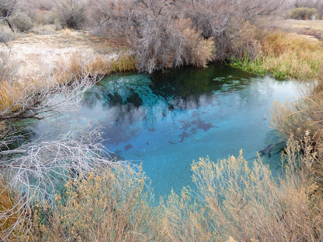
One such island is the oasis of Ash Meadows in western Nevada. Within the 37 square miles of the National Wildlife Refuge are (or were) nearly three dozen endemic species of plants and animals, species found nowhere else on the planet. They exist in this one isolated location because of the geology, which has funneled the groundwater of a vast region into a series of three or four dozen springs that emit tens of thousands of gallons per minute. Water in the desert is life. Lots of water in one spot of the desert is almost miraculous, and that is the situation at Ash Meadows.
The creek that flows from Crystal Spring. An ADA accessible boardwalk provides access

The unique lifeforms found here include four living species of fish (along with one extinct species), eleven species of snails, three aquatic bugs, two species of bee, one extinct mammal (the Ash Meadows Montane Vole), and nine plant species.
"Ash" Meadows seems a particularly apt description of the region in winter
The desert that surrounds Ash Meadows is every bit as much a barrier to species travel as the open seas that surround Hawaii or the Galapagos. The meadows are only a few miles from Death Valley, the hottest place on the planet. So how did these water species come to be here in these springs and pools? Much of the explanation lies with the Pleistocene Ice Ages. A dozen or more times in the last 1.8 million years, the climate cooled and glaciers developed in the Sierra Nevada mountains off to the west. Meltwater from the glaciers filled the intermontane valleys of the Great Basin, forming a series of huge lakes and connecting rivers. These precious tendrils of water allowed fish and other aquatic species to invade the former deserts, but as each ice age stage ended, the dry conditions returned, and a few survivor species found safe harbor in isolated springs and pools like those found at Ash Meadows.

Devil's Hole, home of the extremely endangered Devil's Hole Pupfish. The pool in the cavern opening is their only home.


The refuge at Ash Meadows includes a single pool of water called Devil's Hole that contains the rarest fish species on the planet, the Devil's Hole Pupfish. The pool is an outlier of Death Valley National Park. Two other species of pupfish are found at Ash Meadows, the Ash Meadows Amargosa and the Warm Springs Pupfish. The Ash Meadows Speckled Dace is also found here. The Ash Meadows Killifish was driven to extinction in the 1950s as a result of spring alteration and agricultural development.
King's Spring can also be visited by an ADA accessible boardwalk.

It is remarkable that Ash Meadows ever came to be a protected ecosystem because water in the desert attracts another species, one capable of altering the landscape and erasing from existence the other species that have survived in isolation for tens of thousands of years. The water at Ash Meadows caught the attention of desert travelers more than a century ago, and the water was used to irrigate alfalfa fields and other crops. Many of the springs were put into piping systems and numerous invasive species arrived to compete with the native ones. It's hard to believe, but as recently as the 1980s, a proposal to build casinos, strip malls, and 30,000 houses almost became a reality.

If you have visited Ash Meadows in the past, you will find some major changes. A marvelous new visitor center opened only a few months ago. There was plenty of excellent information about the geology and biology of the refuge, but I was especially impressed with the paleontology exhibits. Entire walls are devoted to a creative diorama of the fossil species found in the region, including the ancient billion year old animals as well as the various waves of Homo sapiens throughout time.
Western Kingbird at Point of Rocks in Ash Meadows
Death Valley National Park is one of the greatest national parks in our country, and if you visit, you will find more than enough to keep you busy for many days. But if you find you have a day to spare, drive on over to Ash Meadows. Closed roads (flood damage) convinced us to pay a visit in February.

To wrap up, have a look at an Ash Meadows Amargosa Pupfish defending its territory at Longstreet Spring. These are fascinating creatures, and true survivors. In our next post we'll drive through a mountain range. Not over, but through...

This is a highly abridged version of a blog I did on Ash Meadows last year. I've included pictures of our latest trip.

Saturday, April 2, 2016

Death Valley is Really Second Generation Death Valley: A Look at Death Valley Version 1.0

Death Valley is a stunning example of a fault graben, a large area of crust that subsided because of extensional forces that produced widespread "normal" faulting (where the fault plane slopes towards the basin). The valley has relief of more than two miles, from the summit of Telescope Peak at 11,043 feet (6,168 meters) to Badwater Basin at minus 282 feet (-86 meters). Perhaps more extraordinary is the fact that the valley has filled with eroded sediments to a depth of as much as 9,000 feet. Remove the sediment and Death Valley would be nearly four miles deep!
One might imagine what it would look like if the sediments of Death Valley were somehow lifted up and dissected by erosion. What would one see? There would no doubt be layers of salt and gypsum, silt and clay, and conglomerate and breccia from the alluvial fans that line the margins of the valley. Volcanoes are found along the margins of the Death Valley today. Perhaps one could expect to see colorful exposures of lava and tuff in the deeply buried valley sediments.
What's fascinating about Death Valley is that we don't have to imagine what the valley fill would look like. It turns out that the graben that formed the valley is not the first to have existed in this area. It formed around two or three million years ago, but extensional forces have been stretching this region for something like 15-16 million years. Other grabens developed, filled with thousands of feet of sediment, and were lifted by faulting so that erosion revealed the underlying rock and sediment. One of these more ancient basins is revealed at Zabriskie Point, one of the most visited and dramatic of Death Valley's tourist destinations. The rock is called the Furnace Creek formation.
The rocks of Death Valley-Version 1.0, as seen in the Furnace Creek formation consist of fine-grained silt and clay interspersed with evaporate minerals like salt, gypsum, and most importantly for the miners of Death Valley, borates. There are layers of conglomerate and breccia from ancient alluvial fans, and colorful tuff and lava flows from associated volcanic activity. In the dry environment of Death Valley, the rocks have eroded into the intricate badlands that made Zabriskie Point a must-see part of any trip to the park.
The badlands are practically devoid of any kind of plant life. The barrenness results from the inability of stable soils to develop on the steep slopes. Any soils are quickly washed away during infrequent but violent cloudbursts.
The layers exposed in the Furnace Creek formation provide information about ancient environments that once existed in the Death Valley region, but also feed the imagination about the rocks hidden deep within today's fault graben, Death Valley-Version 2.0.

This has been another in an off and on series about our February visit to Death Valley. In the next installment, we'll be leaving Death Valley for other sights in the region, a detour made necessary by October flash floods that took out some of the park's roads. We'll be visiting a unique biological island in the desert...

Thursday, March 31, 2016

The Fabled Island of California? Stunning New Research Suggests the Early European Explorers may have been Right

Source: https://en.wikipedia.org/wiki/Island_of_California

Some of the earliest maps of California show it to be an island. The "correction" to this misconception didn't occur until 1746 when the Gulf of California and its terminus at the delta of the Colorado River were accurately mapped. For something like two hundred years, the legend persisted that California was a giant island, populated by beautiful women, and possessing vast treasures.
Geologists, geographers, and cartographers have long wondered about this conundrum. How could so many explorers have made such a huge error? Some stunning new research reveals that the explorers may have been right all along. In a paper published in the journal Enquiries (the national edition), geologists have come up with a startling model that suggests that as recently as 250 years ago, California was an island.

Seismologists have long known that most earthquakes are the result of elastic rebound, a theory that suggests that earthquakes occur because of a build-up of stress along faults. Frictional resistance prevents the fault from moving while stresses accumulate, but at some point the stresses overcome the resistance and the fault moves, generating large earthquakes. The idea was proposed by Professor Harry Fielding Reid after the Great San Francisco Earthquake of 1906, and evidence derived from subsequent earthquakes has confirmed the model.

Professor Avril Primum was the lead researcher. She says that the work of her team along the San Andreas fault in Southern California has provided a crucial addition to the model of elastic rebound. Sometime around 1250 AD, a huge earthquake caused massive slip along the fault and a vast region separated from the edge of the continent. But unlike models that would have left California as a permanent island, Primum's team argues that the elastic nature of the upper crust actually caused the island to rebound back to the edge of the continent, maybe during an epic earthquake reported in the early 1700s.

Avril contends that we don't have to worry so much about California falling into the sea. Sure, it might do it, and Duane Johnson, Pierce Brosnan, and Tommy Lee Jones will have to run around saving stranded people, but ultimately the elastic forces will pull it right back just like a bungee cord. We just need to be patient.

Wednesday, March 30, 2016

Job Openings with the Science, Math and Engineering Division at Modesto Junior College


These positions aren't in the area of teaching earth sciences, but if you have always wanted to work with a school that places a high priority on science education and community outreach, this may interest you. Modesto Junior College is seeking some math instructors, and an administrative secretary for our division. I've been here for a quarter century; it's a decent place to work and have a career. For more information, check out the announcements here:

Full-time tenure track instructor of mathematics: https://yosemite.peopleadmin.com/postings/2049

Full-time administrative secretary: https://yosemite.peopleadmin.com/postings/2035

We also have a number of adjunct positions open: https://yosemite.peopleadmin.com/

Monday, March 28, 2016

This is One of the Rarest Forests on our Planet, and Yet One of the Most Widespread

This is one of the rarest forests on our planet. I know of a number of different species that are represented by extremely limited habitats; there are the Dawn Redwoods of China (a grove of maybe 5,000 individuals), the Wollemia "Pine" of Australia (only a 100 or so in the wild), and the Ginkgo biloba (a few scattered possibly wild groves). But I also have a rare native tree in my own backyard, one that is found in just five widely scattered groves: on Cedros and Guadalupe Islands offshore of Baja Mexico, and in Cambria and Ano Nuevo along the California Coast. The fifth, the one I visited this last weekend, is here on the Monterey Peninsula, south of San Francisco.
Natural distribution of the Monterey Pine (http://evolution.berkeley.edu/evolibrary/article/montereypines_01)
The species is, strangely enough, the Monterey Pine (Pinus radiata). The pine is well known to many as a Christmas tree species or as a landscaping ornamental, and it is grown as a lumber species on some 10 million acres worldwide, mainly in Australia, New Zealand, Spain, South Africa, and Chile. It's a common tree. And also practically unrecognizable in its own native habitat. The trees that are grown for timber, landscaping and Christmas are highly modified organisms in the genetic sense (GMOs). They look little like the spindly knotted trees that grow on their native landscape.
We may often prefer to choose "organic" or "natural" foods for our diet, but practically none of the foods that we grow for our consumption look much like their wild forbears. Bananas, for instance, were practically inedible with giant seeds. Corn was little more than a grass, as was wheat. But these practically inedible natural species have a great value to our civilization: genetic diversity.

Our food supply is vulnerable to disruption from any number of diseases and disorders: such things as fungi, bacteria or viruses could kill off vast sectors of our agricultural products because they are genetically homogeneous. The currently favored banana variety, for instance, may be wiped out in just a few years by a  fungus. 
And so it is with the Monterey Pine. Silvicultural methods have taken the pine and transformed it into a rapidly growing tree with few knots in the lower two-thirds of the tree. But the pines that grow on plantations across the world do not have the genetic diversity of the forests in the isolated stands in California and the Baja islands.

The native groves of Monterey Pine are under environmental assault, from development pressures, and from disease. The Pitch Canker fungus weakens the trees, making them susceptible to beetle attack. There is not much in the way of a coordinated treatment for the trees. None of the native groves are on protected federal land, and only one grove is within a state park. For the most part the native groves exist at the pleasure of the private corporations that own the land.  
Although they have been far too willing to cut down Monterey Pine forests to make villas and golf courses, the corporation that owns the forests in these pictures knows it has some fiscal responsibility to its shareholders to preserve some intact forests of these trees. They make a lot of money charging tourists like myself who pay $10 to follow Seventeen Mile Drive to see the forests along with the beautiful coastline, the wildflowers, and the mansions of the rich inhabitants of the area. 

Strangely enough, the Monterey Peninsula plays hosts to more than one extremely rare native forest. The Monterey Cypress (Hesperocyparis macrocarpa) is found in natural groves only at Cypress Point on the peninsula, and at Point Lobos State Reserve. The trademarked tree called the "Lone Cypress" is perhaps the most famous single tree in the California (I think the sadly deceased Jeffrey Pine on the summit of Sentinel Dome in California was a close competitor for the honor). Like the pine, it has become widespread due to planting as an ornamental.
For more on the evolution and distribution of the Monterey Pine, see http://evolution.berkeley.edu/evolibrary/article/montereypines_01.