Friday, February 27, 2009

Accretionary Wedge #16: Is One Life Enough?

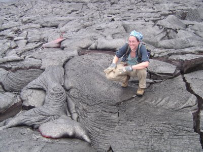
(Tuff Cookie plays with lava)


I am pleased to host February's Accretionary Wedge Geoblogosphere Carnival! I am impressed and gratified by the contributions; it is wonderful to learn of the fascinating places of our planet, brought to you by those who know and love them.

As you may recall, the mission set forth was as follows:

What are the places and events that you think should all geologists should see and experience before they die? What are the places you know and love that best exemplify geological principles and processes?

It was my hope that there would be a good sampling of international sites and localities (the original list of 100 sites was fairly North America-centric), and I was not disappointed. The pictures in this Wedge are from the contributors unless otherwise noted.


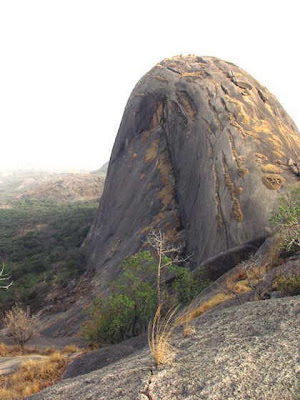
The very first post was from Ikenna, a new geoblogger from Nigeria who offers us the Inselbergs of Nigeria. Check Ikenna's blog for some nice views of a variety of granite domes that dot the terrain in that region of Africa.

Terry Wright, Professor Emeritus at Sonoma State University, suggests that three places of the world that should be included on our list are:


  • Saline Valley Hot Springs and the Last Chance Thrust (these are in California, in a newly added portion of Death Valley National Park)
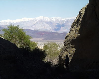


  • Victoria Falls-Zambezi River Canyon, Zimbabwe-Zambia

  • Darwins Outcrop-Capetown, South Africa, where he proved the igneous origin of granite.

Renee Aubrey, a high school teacher in New York suggests in an e-mail that Newfoundland is beautiful! She would add to the list two places from there – sunrise at Cape Spear (easternmost point of North America) and a visit to Western Brook Pond (landlocked fjord). She also suggests sunset from the top of Mauna Kea in Hawaii.


Silver Fox at Looking for Detachment suggests three additions to the list:
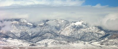


  • See a metamorphic core complex (her photo is the Snake Range in eastern Nevada, USA; I share her admiration of the landscape. I did some of my field camp work in these mountains)

  • The Tibetan Plateau

  • South China Karst

Check her post for more details


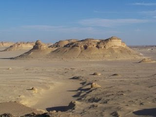
Eric at Dynamic Earth offers up the Wadi Al-Hitan in Egypt (I'm thrilled that we got so many suggestions of sites in Africa). The World Heritage Site is both scenic and full of important fossils. Read about it here.


Geology Happens went and changed the rules (oh, no!) to describe what he would do in one year, with the following choices:


Visit the type area of my favorite formations.
Do a Powell and travel the length of the Grand River system by boat.
See lava coming out of the earth. This need not be a significant event.
Climb in the Himalaya.
See a surging glacier if there are any left.
Calving icebergs
Climb an icefall
Walk a transect of some really interesting geology, coast range of California or the Appalachian mountains
Visit a deep sea trench
Feel an earthquake, again this need not be a major event.
Spend a summer at the INSTAAR field camp.
Climb the walls in Yosemite Valley


If I may editorialize a bit, that would be one heckuva year!


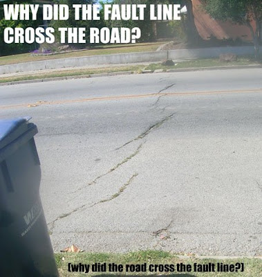
Julian at Harmonic Tremors (only a former music major would take a blog name like that...) suggests that simply listing the San Andreas Fault as a destination doesn't quite do the feature justice and suggests exploring the entire length from the Salton Sea to Mendocino. Two sites are singled out for special exploration:


The Carrizo Plain National Monument, where the San Andreas is starkly exposed for all to see


The town of Hollister, where streets and buildings are being slowly torn apart by aseismic creep

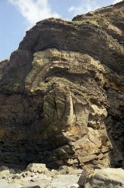
Ian at Hypo-Theses offers up ten sites in the United Kingdom that ARE NOT the Giant's Causeway but are far more geologically significant:


The Pembrokeshire Coastline, West Wales (photo below)
The Jurassic Coast
Siccar Point, Berwickshire, Scotland
Eriboll, Sutherland, Scotland
Glen Sligachan, Skye, Scotland
The Ercall, Shropshire, England
Kilve, Somerset, England
Wren’s Nest Dudley, West Midlands, England
Isle of Mull, Scotland
West Runton, Norfolk, England

Excellent descriptions and photographs can be found at his post here. Check them out!

Jessica, at Magma Cum Laude, fleshes out the idea of "visit a volcano", including seeing an active lava flow (think blast furnace), skiing down a scoria cone, inhaling the delicious aroma of a degassing volcano, and standing on top of a stratovolcano. Check it out here, and also check out one of the things she suggests NOT to do...(that's her picture at the beginning of the post)

Lockwood at Outside the Interzone was one of several contributors who worked with and modified the original list of 100 places, a notion I strongly support. Check his new list out here. He also added a several new ideas:

Identify an overturned sequence (not have it pointed out to you)
Spend a few minutes mesmerized by a waterfall or lake, and contemplate their ephemeral nature from a geologic perspective
Go on a geologic field trip
Lead a geologic field trip
See fossil fuel leaking from the earth at a natural seep or vent
The Mid-Atlantic Ridge, where it emerges on land in Iceland


Callan Bentley, at NOVA Geoblog responded to the original "100 things" list with a carefully considered rewrite, which he reposted for the wedge (check it out here)


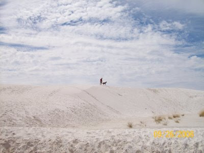
Mel, at Ripples in Sand breaks the rules too (what is it about geologists and rules? But, hey, go for it!) and suggests a comprehensive list of the world's great deserts. Her idea has the benefit of expanding our list to all of the continents (don't forget there are polar deserts, too). He also has a nice list of dune fields that he has visited, including White Sands, shown below.

Chris at Highly Allochthonous has an aversion to visiting places just to fulfill a list, and offers us some thoughtful ideas that, in his words, "... identify occasions in my geological journey so far where my perspective has been broadened, and my understanding has been catalysed, by something that I have seen, and generalised from those examples". His ideas (and wish list)include:
An angular unconformity
The centre of a stable continental craton
Jarring geological contrasts
Nature vs Civilisation
An active fault scarp and raised terraces
Crazy deformation
An active volcano/geothermal field
An eroded, extinct volcanic caldera
The contact aureole of a large igneous intrusion
An igneous intrusion into sediments
Seeing fossils from a Lagerstatten
Diving on a coral reef
The beach
Living stromatolites
Black/white smokers
Antarctica or Greenland (or both)


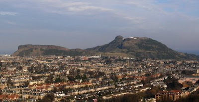
See his post for some excellent descriptions of his adventures as well as some very nice photos, including Arthur's Seat and the Salisbury Crags in Edinburgh, Scotland (shown below).


Geotripper: Ironically, I did not spend very long thinking about how I would change the 100 things list, but in the announcement of the Wedge, I had a picture of a deep glacial canyon in the Sierra Nevada of California that was "Not Yosemite". It is Kings Canyon National Park, and it contains some of the most dramatic and geologically instructive scenery in the entire range. Beautiful vertical exposures of granitic plutons, excellently exposed metamorphic roof pendants, highly deformed metamorphic rocks, marble caverns, glacial moraines, hanging valleys, waterfalls, river-cut gorges, and even the occasional exposure of lava flows. And...it is the second deepest (by a paltry 19 feet) canyon in North America. And despite being perfectly accessible, it has a fraction of the crowds of Yosemite National Park (which I also love, by the way).


Now, click your heels together, because after all our explorations of the big wide world, Kim, at All My Faults Are Stress Related, has one of the great ideas of the wedge this month: to appreciate the uniqueness and beauty, no matter where you live, of the ground beneath your feet. She makes a great argument: every place in the world has a geologic story, and it is almost invariably a fascinating adventure.


It's been an adventure hosting the Wedge this month, and I deeply appreciate everyone's contributions. If I have missed any, please let me know and I will add your contributions. You have added a lot of ideas for us to all think about as we map out the arc of the remainder of our lives. Looking over these lists I found myself thinking: Is one life enough?


Thank you very much!

Wednesday, February 25, 2009

An Extraordinary Picture (at least for us Central Valley denizens)

No, not mine (I wish...). This was taken by Tony Immoos following a discussion on the Yosemite Blog (here and here) about whether Half Dome in Yosemite could be seen from points in the Central Valley. Follow this link (please!) for an explanation of how and where he got this photograph. The picture also includes a portion of El Capitan, Sentinel Dome, and Clouds Rest.

Living in the Central Valley is an exercise in frustration sometimes. One knows that there are spectacular mountains out there, only a few miles away, but it is a rare day that we see them, and few (even among long-time residents) realize that some of the iconic cliffs and peaks of Yosemite Valley are actually visible from the floor of our valley. Far too often it is dust and smog that obscures the view.

Are Republicans Really Suggesting This?


I didn't begin blogging for political reasons, but every now and then I hear a politician say something so ludicrous, so ignorant, that I feel a need to comment. Especially in reference to geology and geological hazards.

Louisiana governor Bobby Jindal gave the Republican response to President Obama's speech tonight, and and suggested that it was a waste of taxpayer of money to spend "$140 million on something called volcano monitoring". If you don't really know a lot about volcanoes in the United States, follow the link for an effective explanation. In a nutshell, the U.S. has the third highest number of active volcanoes of any country in the world, including several that are uncomfortably close to major population centers. This month alone, activity began at a volcano near Anchorage, Alaska. And has anyone forgotten what happened at Mt. St. Helens in 1980 (pictured above, along with Mt. Adams in Washington)? The volcano was also erupting from 2004-2007.

I am appalled at the scientific ignorance displayed here; perhaps Mr. Jindal (of Louisiana, as you may remember) thinks we could also save money by turning off the weather satellites that monitor hurricanes in the Caribbean. I mean, really, what are the chances of a hurricane hitting the Louisiana coast?

I'm glad that a different party is in charge of the government now...

Immediate Update: Green Gabbro is on the topic already....ditto, I say.

Sunday, February 22, 2009

Aberrations of Nature: A Morality Play and New Meme


There's a new meme in town, started by Outside the Interzone concerning waterfalls we have visited. Like 100 places, it asks of us which waterfalls we have seen, in this case from a North American perspective. The list is as follows, and I'm even going to tell you which ones I have seen, but I have more to say at the end....

#10 Lower Calf Creek Falls, Escalante National Monument, Utah (A wonderful sight in the center of one of our country's most spectacular national monuments)

#9 Lower Falls of the Yellowstone River, Yellowstone National Park, Wyoming (A simply spectacular sight from any angle; from the very brink is absolutely mesmerizing)

#8 Upper Whitewater Falls, in southwestern North Carolina (haven't been to NC yet

#7 Snoqualmie Falls, between Snoqualmie and Fall City, Washington (Nope, not yet)

#6 Havasu Falls, Supai Village, Havasupai Indian Reservation, Grand Canyon, Arizona (Not yet, it's on my bucket list)

#5 Shoshone Falls, Twin Falls, Idaho (A spectacular waterfall, but often "turned off" as the river is diverted for irrigation. I got to see it in pre-digital-photography days)

#4 Multnomah Falls, Columbia River Gorge, Oregon (I visited this one as a child, but I was highly impressed at the time and still remember it well)

#3 Bridalveil Fall, Yosemite National Park, California (One of many spectacular falls in one incredible place; if you follow my blog you know I spend a lot of time here)

#2 McWay Falls in Julia Pfeiffer Burns State Park, Big Sur, California (This is one of the most beautiful waterfalls in existence, falling as it does right into the sea, which is one of only two in all of California. If you only follow one link on this post, check out this incredible view)

#1 Niagara Falls, Niagara, New York (nope, not yet, so I never know what anyone is saying when they say "it's twice as high as Niagra")

Waterfalls are an aberration of nature, a temporary interruption in the regular scheme of things, if we are to accept the models of the geomorphologists. Waterfalls don't get much respect from us geologists it seems, since a brief review of the relevant chapters of my textbook reveals little about waterfalls, except as decoration for the chapter cover photos. The chapters I looked at had literally no mention of waterfalls except as deviations from a graded condition.

"Graded"? Rivers adjust their channels in such a way as to remove irregularities by eroding "knickpoints" or depositing sediment within depressions. Following the dictates of physics and gravity, rivers are constantly approaching, but never quite achieving, a graded condition, in which no unusual areas of erosion or deposition exist. Waterfalls are the ultimate deviation, and rivers work furiously over time to remove them. As such, waterfalls truly are temporary, and we are privileged to see the ones that do exist.

This idea of approaching an "ideal" state sounds vaguely like a Victorian morality play in which we as humans seek, but never quite reach, some model of perfection. Scriptural passages speak of the inability of humans to reach a sin-free state without supernatural intervention or grace, and other passages talk of how the mountains will be laid low and the paths made straight. It sounds just like a river adjusting the channel it flows through....

Waterfalls ARE aberrations, and ultimately there is some kind of interesting explanation for why a particular waterfall exists. The river crosses a particularly hard exposure of rock, like a lava flow; glaciers have carved a deep gorge where tributary canyons cannot keep up; water falls off the edge of a plateau with a prominent caprock; a fault has lifted part of a river-course; a landslide has changed the canyon a river flows through.

Part of the waterfall meme allows that we can add one of our favorites; I offer four:

The first photo is Mealt Falls on the Isle of Skye in Scotland. It may be my favorite waterfall on the planet although I have only seen it once and from only one view point. Like McWay Falls at Big Sur, it essentially falls into the ocean. The seacliffs are composed of columnar-jointed basalt flows related to the splitting of Pangea and the opening of the Atlantic Ocean in late Mesozoic time.

The second photo is Akaka Falls on the Big Island of Hawaii. There are hundreds of incredible waterfalls on the Hawaiian Islands, but relatively few on the Big Island, and none as tall as this one, at 442 feet.

The third fall has no name that I have been able to find. I saw it near the town of Bellinzona in the Italian/Swiss Alps, and it left me breathless. It's also my favorite picture of a church!

The final photo is in no way an exciting or particularly beautiful waterfall, and it is only 20 feet tall. It's uniqueness is in the location: in the middle of the hottest, driest desert in the United States. It is called Darwin Falls, and can be found in a remote canyon leading into the Panamint Valley within Death Valley National Park. Somehow the waterfall feels all the more precious, and it is a vital permanent water supply for wildlife from miles around.

Have you got a favorite waterfall? Join the meme! If you feel that waterfalls were under-represented in the 100 places meme of a few months ago, you are also invited to make a contribution to this month's Accretionary Wedge Blog Carnival! Submissions due in a few days!


Saturday, February 21, 2009

Call for Submissions! Accretionary Wedge #16: What Would Be On Your 100 Places List?


I'm pleased to be hosting the February 2009 edition of the Accretionary Wedge Geoblogospheric Carnival (#16)! I hope you have some fun with it!

A few months ago I posted a list of 100 places that a geologist should see in his or her lifetime, based on a 1990 article in Geotimes by Lisa Rossbacher, and a subsequent web page posted by Terry Acomb. The post took off in ways I never imagined; I got dozens of comments, and Chris at Highly Allochthonous took up a running total of how many places everyone had visited. The best part was the stories; everyone enjoyed describing their adventures while facing down lava flows and climbing mountains, and retreating from floods. Even as I posted the list though, I knew it was missing a lot of important places and experiences. Some people felt like they were breaking the "rules" if they counted an important feature like a BIF on their list, but that it wasn't actually in Michigan. It was North America-centric, too. I found myself wanting to revise the list in a few ways, and so I arrive at the subject of this month's Accretionary Wedge:

What are the places and events that you think should all geologists should see and experience before they die? What are the places you know and love that best exemplify geological principles and processes?

It would be great to have a truly international list. I also want to get a list of those places that don't always make the "must visit" lists. And why should this place be included? Pick one or three, or seven, and note them in the comments to this post, or e-mail me at hayesg AT mjc.edu, or send me a link to your blog, if you have posted something there.

A brief example from my own backyard. Yosemite Valley was on the 100 things list. And it is a truly wonderful place to visit, and I do so whenever I can. It is precious to me. But...if you want to truly understand the history of the Sierra Nevada, there is a another canyon in the California mountains that has a greater diversity of rocks, more evidence of glaciers, far fewer crowds, and get this: it is more than twice as deep as Yosemite Valley! It is pictured above, and will be one of my contributions to a new revised "100 Places List".

Please try to get your submissions in by February 25th. Happy hunting!

Friday, February 20, 2009

The Cretaceous Parks of the Colorado Plateau: A City in the Wilderness


I started a brief history of the Colorado Plateau eight months ago, never imagining what an extensive project it would become. I have been working my way through time, from two billion years ago to the present day. Several months ago, thinking I was approaching the end of the narrative, I started to describe the parks displaying Cretaceous rocks, the last period of the dinosaurs (the Mesozoic era), and I find I am beginning the twelfth entry just for that period. But what a fascinating place we are exploring today! Chaco Culture National Historical Park is also just a bit eerie...

The New Mexico plateau country south of Farmington is a barren looking landscape dissected by the occasional shallow arroyo. The treeless terrain is populated by a few Navajo families who graze animals on the arid grasslands. At the end of a 13 mile gravel road, in one of the most isolated and lonely parts of the reservation, one can witness the ruins of Chaco Canyon. For 300 years, beginning about 800 A.D., this was the center of the Ancestral Puebloan universe. The park preserves a collection of some of the most ambitious architectural developments of the Puebloan peoples, with numerous villages of great kivas, plazas and great houses that are unrivaled in their complexity. Some were 4-5 stories high. The villages lay along carefully measured lineations and alignments. Thousands may have lived or traded or worshiped in this shallow canyon. The dwellings included some 200,000 ponderosa beams that had to be hauled from Mt. Taylor or the Chuska Mountains, some 30 miles away.

The Great Houses were constructed at the base of cliffs of the Mesa Verde Group, specifically the shales of the Menefee Formation, and the cliffs of the Cliffhouse Sandstone. The canyon was deepened as the soft Menefee was eroded, undercutting the cliffs, which then collapsed into the gorge. This process was recognized by the Puebloans. At Pueblo Bonita, the builders had tried to buttress a huge rock that threatened to break away from the cliff, and one could say they were successful, in that the rock did not fall until 1941, when it destroyed 60 rooms in the pueblo. The debris can be seen on the left side of the top photo.

The inhabitants of the region were also cognizant of their skies; the cliffs of the canyon contain petroglyphs and and pictographs that may include pictures of the 1054 A.D. supernova that produced the Crab Nebula, and Halley's Comet. The Sun Dagger on Fajada Butte marks the location of a ray of morning sun on the morning of the Winter Solstice.

One other remarkable feature of the park are the roads that radiate out from the canyon, pointing in all directions. The roads run in exceedingly straight lines, sometimes for many tens of miles, and sometimes straight up cliffs (see the bottom photo). Rocks were cleared for a width of fifteen feet and more. They are hard to see from ground level today, but are apparent in aerial photos and satellite images.

Chaco Canyon is a special place to visit; it is difficult to get there, but is well worth the effort. There is a modest campground, a visitor center, and an interesting network of trails. Check it out!

We have reached the end of the Cretaceous Period! This was the beginning of huge changes on the Colorado Plateau, both in the landscape and for the ecosystems. The seas retreated for the final time, and the land began to be twisted and deformed. The entire region began to rise, and erosion began to strip away the thousands of feet sediments that had accumulated during the preceding 500 million years or so. The dinosaurs, and something like two thirds of all the species in existence at the time were obliterated. The world had changed...

More later!

Monday, February 16, 2009

Fossil Falls


A bit more on Fossil Falls, which was the subject of Friday's Mystery Photo. The falls formed when Owens Lake overflowed during the Pleistocene ice ages. In 2005, we had the unusual pleasure of seeing water actually flowing through the gorge, as we had arrived on the heels of a pretty large storm. The water was rich with silt, giving it the latte-like appearance.

Althought the falls are almost always dry, a modern analogue is visible on the Rogue River in Oregon, just outside Crater Lake National Park. The Rogue River Gorge is a pullout on Highway 62 from Medford, about 7 miles from the park. The river flows through a breached basalt lava tube, and is actively forming potholes that are strikingly similar to Fossil Falls.