Showing posts with label Valley of Death. Show all posts

Saturday, May 10, 2014

Where are the Ten Most Incredible Places You've Ever Stood? My Number 3: Standing over Dante's Inferno in the Broken Lands

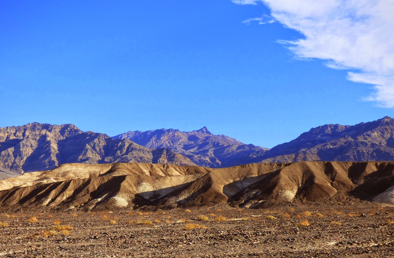
The Panamint Mountains and Telescope Peak, the highest part of Death Valley National Park, as seen from Dante's View..
Death Valley is the hottest place on planet Earth.  Furnace Creek recorded a temperature of 134 °F (57 °C) in 1913. With the dethroning of the improperly recorded temperature in Libya from 1922, this is the hottest officially recorded temperature in world history. Badwater, a dozen miles south of Furnace Creek at the deepest point in the valley, is often a few degrees hotter. The hottest overnight temperature ever recorded, 107 °F (42 °C), was measured here on July 12, 2012. That day, the average temperature was 117.5 °F (47.5 °C), the world's hottest 24-hours on record.

Hot temperatures are an interesting feature of Death Valley National Park, but the park is much more significant for other reasons. It contains a wider range and variety of rocks than any other park that I know of. I have been chronicling our February journey to Death Valley over the last few months in a series called "Out of the Valley of Death", and today's post is a confluence of the two series that I've been working on. Dante's View was our next stop after exploring the interior of an upside-down mountain at Titus Canyon, and it makes number three on my list of the Ten Most Incredible Places I've Ever Stood.

The Black Mountains of Death Valley are one of the most rugged mountain ranges in existence. They rise 6,000 feet almost straight up from the lowest part of the Death Valley graben and are practically devoid of trails or roads. The thought of climbing the mountain front near Badwater is as daunting a challenge as I can imagine. The Proterozoic metamorphic rocks are highly deformed and internally sheared by intense faulting, making for a highly unstable climbing surface. But there is a way to the top of the range. A paved highway winds up the other more gentle eastern side of the mountain range, reaching Dante's View at an elevation of 5,476 ft (1,669 m). The overlook is directly above Badwater, more than a mile below at -282 feet ( -86 m). It has one of the most incredible views to be found in any national park.
Frank DeCourten called the Basin and Range province where Death Valley is located the "Broken Land", and the description is apt. From Dante's View, thousands of square miles of land are visible as range after range marches off into the distance. In the last few million years crust in this region was stretched beyond the breaking point, and it broke into countless grabens (fault valleys) and horsts (fault-block mountain ranges).  River drainages that once reached the sea do so no longer, and water leaves the region only by evaporation. The region is sometimes called the "Great Basin" despite the multitude of mountain ranges. Death Valley is the lowest of the low, the ending point of numerous desert washes and the Amargosa "River" that sometimes in wet years has water.

At Dante's View, one's attention is most often drawn towards the salt pan of Death Valley, the lowest land in North America (in the picture above). It is quite a sight, and so alien-looking that it stood in as the location of Mos Eisely in the original Star Wars. Obi-Wan Kenobi and Luke Skywalker stood here, looking at the spaceport and mentioning that "You will never find a more wretched hive of scum and villainy". The salt that covers the valley floor to a depth of hundreds of feet was washed out of the marine sediments that make up many of the mountains in the region, and from the rain itself. Water flows into the salt pan and evaporates, leaving behind the salt and other minerals, including gypsum and calcite.
The view from Dante's encompasses, well, the entire compass. To the south (above) the Black Mountains continue for several miles, including two of the gigantic "turtleback faults". The rocks are some of the oldest in the western United States at 1.7 billion years. The dark metamorphic rocks gave the mountains their name. Although the slopes are not as hot and dry as the valley floor, it is still a tough environment for most plants. The mountains are as barren as any I've ever seen.
To the north (above), the Black Mountains include younger volcanic rocks dating from the middle and late Cenozoic era. They include the Artist Drive Formation, and the ancient lake and valley sediments of the Furnace Creek and Funeral formations. The Grapevine Mountains rise in the far distance. They are composed of thick sequences of marine sediments dating from the Paleozoic era. The farthest ranges are more than 60 miles away.
To the east (above), range after range culminates in the snow-covered Spring Mountains above Las Vegas (did you know you can ski near Las Vegas?). The highest peaks exceed 12,000 feet. Some of the water that accumulates on the slopes of the Spring Mountains travels underground through the intervening mountains to emerge as springs in Death Valley.
One of the most amazing things about the view from Dante's is how different it would have appeared 20,000 years ago during the last of the ice ages. Meltwater from the glaciers of the Sierra Nevada drained into the Great Basin, filling one valley after another until it spilled over into the Death Valley graben, forming a 600 foot deep lake more than 100 miles long.The lake left behind shorelines and terraces in what is currently the driest place in North America, and at least four species of native fish which still live in isolated springs around the park.

Water still accumulates in the Death Valley graben on occasion. Lakes were there in 2005 and 2010, but the same wet weather that filled the salt pan with water also wreaked havoc with the road to Dante's View and it was closed, so I have no pictures of the lake from above. This one from the valley floor will have to do.

Some of my choices for the "ten most incredible places" involved lava, or fossils, or significant historical and geological events. I chose Dante's View for sheer grandeur. From the high vantage point of Dante's, one gets a sense of being on top of the world, a world that is sometimes an inferno, and certainly broken up. There are few places on Earth like it.

Friday, April 11, 2014

Out of the Valley of Death: What the Heck Happened at Ubehebe?

The geology at Death Valley National Park is naked and raw. Nothing is hidden beneath a soft matte of vegetation. It's in your face, all the processes of tectonism, volcanism, erosion, and deposition. Every era and most of the epochs of the geologic time scale are represented somewhere in the boundaries of the park. Not even Grand Canyon National Park can make that claim. On the previous day we had explored the oldest rocks in the American West, the contorted metamorphic rocks of the Black Mountains and the ancient sediments of the Pahrump Group.

Our first destination on our third day of exploration in the park was the Ubehebe Craters at the north end of the valley, a place representing the opposite extreme in time. The events that took place here can be measured in just hundreds or thousands of years. On the drive there we were treated to amazing views of fault scarps, sand dunes, and alluvial fans, which formed mostly in the last few tens of thousands of years.

To arrive at Ubehebe Crater is kind of an otherworldly experience. For miles, the road has been following the broad rocky surfaces of the many alluvial fans that flank the Grapevine Mountains. The valley floor between the Cottonwoods and the Grapevines narrows and soon the alluvial fans merge in the center of the valley and in a few places the road climbs in earnest. But soon the Cottonwood Mountains come to an end, with the final ridge tapering down to the valley floor. We've reached some kind of a structural nexus. The formerly deep trough of the northern part of Death Valley seems to pinch out, and another valley merges with it from the south. The Ubehebe Craters have formed along the intersection of the faults that formed the valleys. The crustal weakness of the fault zones allowed the magma to rise from deep in the Earth almost to the surface.

It's clear when standing on the rim of Ubehebe Crater that something big happened here. This hole is a half mile across (~1 km) and around 700 feet (215 meters) deep. Whatever happened here did so more than once. There are perhaps a dozen overlapping craters, and each of them is rimmed with dozens of layers that represent numerous explosions. What in the heck happened?

The red, orange and yellow layers below the rim provide some clues. They are partly composed of alluvial fan gravels, but mostly they are fine-grained lake sediments. And they used to be saturated with groundwater. The darker rocks along the rim are composed of bits and pieces of basalt and volcanic ash. The volcanic rocks mantle several square miles around the craters (below).

The best way to see the details of Ubehebe Crater is to walk the rim (and to walk down to the bottom, but that will be a story for a different time).  The gullies that have been carved into the sediments are shallow, indicating the recency of the events here.

Still the trail is steep in a few spots. It's about one and a half miles of up and down pathways leading around the rim. From high points, one can see the overlapping cones and the layers of basaltic material.

From the highest part of the rim, one can see the strong contrast between the orange and yellow sediments in the wall of Ubehebe. They mark the location of a fault line related to the Cottonwood Mountains just to the south.

It's quite a view from the top!

The only actual lava at the complex can be seen inside the crater of Little Hebe, in the picture below. Little Hebe is the remains of spatter cone that was later blown apart by the kind of explosions that formed the rest of the craters in the vicinity.

So here at Ubehebe are the ingredients for an explosive event. Saturated lake sediments, a fault line providing a conduit for magma to approach the surface, and the tendency of water under pressure to explode when it gets too hot. The Ubehebe Craters are world-class examples of maars, the craters that result from groundwater (phreatic water) flashing to steam in an explosive manner.

It must have been awe-inspiring to witness the explosions, and considering that human artifacts have been discovered underneath some of the ash deposits, there is a very good chance that people saw the event take place. Precise dating of the explosions has proven challenging, but few researchers think that the eruptions were more than 6,000 years ago, and some recent findings provide hints that the eruptions could have been only a few centuries ago...and the conditions responsible for the eruption are still present. What a spectacle it would be if it happens again!

There was one thing extraordinary about our visit last February...the air was calm! The narrow constriction at the head of the northern stretch of Death Valley causes winds to be funneled across the rim of the craters, and it's usually...um..."breezy" up there. As in barely able to stand up straight. But this day was one of the most pleasant I have ever experienced.

The display at the parking lot at Ubehebe provides a nice overview of the overlapping craters. It is easy to combine a tour of Scotty's Castle (interesting but not very geological) and Ubehebe Craters. They are only a few miles apart. Ubehebe is also the starting point for the rough road leading to Racetrack Playa and the sliding stones. Another rough road heads north across Eureka Valley to Big Pine in Owens Valley. It is another road that I intend to explore one of these days!

We got in the vans and headed south with the intention of walking into an upside-down mountain. But that will in the next post!

Monday, April 7, 2014

Out of the Valley of Death: Geology at Fifty-five


One of the first things I tell my students (and occasionally even with some success) is "don't sleep while traveling in the vans". Death Valley National Park is the largest national park in the lower 48 states, and no matter how much time one has, it's hard to take it all in. When you only have four days, it's pretty well impossible, but there is still much to see in transit between stops. On our third day out we were set to explore the northern end of Death Valley, which in a park that is mostly desert wilderness, feels even more isolated and lonely (despite the presence of Scotty's Castle up one of the side canyons).
The day started with a stunning sunrise as seen from one of the most isolated RV parks in the American west, Stovepipe Wells. The campground is literally a parking lot, but it's a parking lot with one of the most incredible views possible. The resort is situated on the distal end of the huge alluvial fan that emerges from Mosaic Canyon on Tucki Mountain, which we'll check out in a future post. The elevation is sea level, but it somehow feels higher, given the spectacular and far-ranging view.
Two great desert mountain ranges form the boundaries of the northern reaches of Death Valley, the Cottonwoods on the left and the Grapevine Mountains on the right in the picture above. The mountains tower over the valley floor, reaching nearly 9,000 feet above a valley floor that is barely above sea level. The view extends thirty miles or more.
A drive north towards the end of the valley reveals a series of classic desert features, starting with the Mesquite Flat sand dunes, sometimes known as Death Valley dunes. Sand dunes are picturesque enough by themselves, but in Death Valley they have a dramatic backdrop of high barren mountains.
We raced by at 55 miles per hour ("Honest, officer!"), but cameras these days are versatile, capturing the image as if we were standing still. And this is the sort of incredible sight one could miss if one is snoring away.
The dunes have formed here because prevailing winds sweep down the northern reaches of Death Valley (and a number of destroyed tents over the years can attest to the power of these winds). The vast bulk of Tucki Mountain at the north end of the Panamint Mountains stands in the path of these winds, causing them to break up and form eddies. The sand accumulated in the region as the powerful winds lose energy and drop their load of sand and dust. They are sometimes referred to as star dunes, or modified sub-barchan dunes. Even if you've never been to Death Valley, you've probably seen these dunes anyway; they formed the backdrop for the droids lost on the planet Tatooine in the original Star Wars movie.

In the picture above, one can see the valley floor beyond the dunes is interrupted by a terrace of some sort. This is the scarp for the Furnace Creek fault zone which is one of the important structural features of the Death Valley graben.
A closer look provides a view of light-colored sedimentary rocks exposed in the face of the scarp. The fine-grained mud and silt layers are part of the Furnace Creek formation, which was deposited into a fault trough similar to present-day Death Valley, but oriented in a more northwest-southeast direction. Crustal stretching has effected the crust in the region more than once. The erosion of the Furnace Creek formation in this dry environment produces badlands topography, which we will explore in greater detail in another post.
The fault system interrupts the surface of the alluvial fan, shifting it in an right lateral direction (the rocks across the fault are displaced to the observer's right). These faults roughly parallel the San Andreas fault, which lies far to the west. The fault is presumably still active, but has not produced a major earthquake in modern times.
Another incredible sight visible from the road is the series of alluvial fans that extend from the edge of the mountains down to the valley floor. They build up as the rare but violent flash floods and mudflows carry boulders and debris across the valley floor. They have a somewhat convex slope, becoming steeper near mountain front. Death Valley is famous for the variety and number of fans it has.
The fans reveal variations in color. The darker surfaces on the fans result from desert varnish, a mixture of manganese oxides and clay that coat the exposed surfaces of the rock. It accumulates over time, and the origin is debated. Bacteria are likely involved in the process.

As we drove further north, the valley floor narrowed, and we soon reached an area where the alluvial fans from the two mountain ranges merged in the center of the valley. We were approaching the end of the Death Valley graben. In the distance we could see dark-colored rocks coating the surface of the alluvial fans. We had reached the volcanoes of Death Valley.

In the next post: the Ubehebes!

Saturday, March 22, 2014

Out of the Valley of Death: Hitting the Lowest of the Low, the Driest of the Dry, and the Hottest of the Hot

Just how low can one go? Just how far can people descend in life before they hit bottom? In Death Valley National Park, there is a precise answer: -282 feet, or -85.5 meters at a spot called Badwater. That's also the lowest you can go in North America, but if you look at the big picture, there are seven other places around the world where you can sink even lower:

Earth’s Lowest Elevations (Courtesy of the National Park Service)
  • Dead Sea (Jordan/Israel) -1360 feet (-414 m)
  • Lake Assal (Djibouti, Africa) -509 feet (-155 m)
  • Turpan Pendi (China) -505 feet (-154 m)
  • Qattara Depression (Egypt) -435 feet (-133 m)
  • Vpadina Kaundy (Kazakstan) -433 ft (-132 m)
  • Denakil (Ethiopia) -410 ft (-125 m)
  • Laguna del Carbón (Argentina) -344 ft (-105 m)
  • Death Valley (United States) -282 ft (-86 m)
  • Vpadina Akchanaya (Turkmenistan) -266 ft (-81 m)
  • Salton Sea (California) -227 ft (-69 m)
  • Sebkhet Tah (Morroco) -180 ft (-55 m)
  • Sabkhat Ghuzayyil (Libya) -154 ft (-47 m)
  • Lago Enriquillo (Dominican Republic) -151 ft (-46 m)
  • Salinas Chicas (Argentina) -131 ft (-40 m)
  • Caspian Sea (Central Asia) -92 ft (-28 m)
  • Lake Eyre (Australia) -49 ft (-15 m)
I had this awesome idea! I bet no one has ever thought to take their picture here before!
As the park service notes, most of these lowest points have a few things in common: they are very dry, and the origin of their low altitude is tectonic. The Basin and Range Province of which Death Valley is part of has been described as "The Broken Land" by Frank DeCourten, and indeed it is: fault after fault breaks up the Earth's crust into high mountain ranges (horsts) and deep fault basins (grabens). Death Valley is the ultimate expression of the process with relief of 11,330 feet between Telescope Peak (11,049 feet) and Badwater (-282 feet). The highest point in the United States outside of Alaska, Mt. Whitney (14,505 feet), is only 76 miles away as the crow flies.

If erosion wasn't a thing that happened, Death Valley would be even deeper. The sand and gravel that fills the Death Valley graben extends to a depth of about 9,000 feet, meaning if the gravel weren't there, the total relief would be 4 miles!
Fault scarps interrupt the smooth surface of this alluvial fan just south of Badwater.
From Badwater, it's not hard to see the evidence of the tectonic activity that formed the vast trough. In the picture above, two fault scarps are visible cutting across the relatively smooth profile of the alluvial fan. The earthquakes that caused these scarps happened in the last few thousand years, but they look fresh because of the lack of erosion in the dry climate.

Did we mention that Death Valley is also the driest place in North America? Average rainfall here is less than two inches a year. The Sierra Nevada and the other mountains of the Basin and Range province are very effective rain shadows (orographic barriers). Badwater lies at the edge of the Death Valley salt pan, a 200 square mile flat surface covered by salt and other evaporite minerals. It is hard to imagine a place more inhospitable to life on the planet. There are a few salt tolerant plants that grow on the edges of the pan, but I've heard of nothing that lives in the interior areas (except maybe some microbes here and there?).


To stand on the salt flat and look off in all directions is a lesson in isolation. Were it not for the vehicles and the ice chests and water bottles parked over against the mountain, this would be a moment of great concern. If it weren't February and summertime instead the concern would be near panic. We can easily forget the harsh nature of this environment when we are largely insulated from it. Furnace Creek, about a dozen miles north of this location, recorded a temperature of 134 °F (57 °C) in 1913. With the dethroning of the improperly recorded temperature in Libya from 1922, this is the hottest officially recorded temperature in world history. The hottest overnight temperature ever recorded, was 107 °F (42 °C) on July 12, 2012. That day, the average temperature was 117.5 °F (47.5 °C), the world's hottest 24-hours on record.

We talked about the geology and got back into the vans and headed north, up the valley towards Furnace Creek.

As we drove towards camp, we had a look at the edge of the vast turtleback fault surface at Badwater that forms the Proterozoic core of the Black Mountains (in the picture above). The long smooth slope in the shadow on the right is just about all fault surface. The sunlit rocks in the center  and on the left have slid off the fault to the north. They are composed of Miocene volcanic rocks of the Artist's Drive Formation.

The sunlight was a pleasant surprise. For much of the day the skies had been overcast, but in the latest part of the afternoon, the clouds parted for a moment and the rocks glowed orange and gold. The sediments and flows of the Artist's Drive formation are colored by oxidation of various metals in the volcanic ash and tuff layers, and are striking in almost any conditions, but they are especially bright at sunset.

The sun disappeared into the clouds again and the harsh edges of the valley blurred as the evening arrived. We headed back to our camp at Stovepipe Wells.

Thursday, March 20, 2014

Out of the Valley of Death: Mountains Hidden Within Mountains

I don't think there's anything nicer for a teacher of the earth sciences than to have a classroom in the outdoors. The planet is always around us and to step outside a classroom is to step outside of book learning and theoretical constructs, and into the actual chemical and physical reactions that affect every aspect of our lives. Yes, there is always gravity, and we are always respirating whether we are indoors or out, but there is nothing quite like being right on top of the volcanoes or the faults that can cause geological mayhem. We can tell the story of how rocks and mountains and continents came into being, but it is something else entirely to stand on the rocks that actually tell us the story step by step. There is just no substitute for field experience in a geology class.

So here is our class sitting in the midst of one of the greatest geological parks in the world, Death Valley. Rocks from nearly all the periods and eras of the geological time scale can be found within the boundaries of the park, and the park includes some of the oldest rocks in western North America (one has to get to Montana and Wyoming to find rocks that are older). They are quite literally sitting on the trace of a major fault line, and the darker slope on the left is a small volcanic cone that erupted along the fault. It's all the geological mayhem in one spot than anyone could ask for!
We had spent the day working our way through geological time, with a stop at a roadcut containing Miocene tuff and examples of faulting, a stop on the alluvial fan below a mountain of Paleozoic-aged fossil bearing limestone, and an exploration of a former rift valley containing late Proterozoic sediments. We had now reached the base of the Black Mountains of Death Valley, the deepest crustal rocks exposed anywhere in the park. They are exposed here because extreme extensional forces have  ripped the crust apart, and the deep trough of Death Valley gives us a peek into the deeper parts of the continent. These are rocks from the early Proterozoic around 1.7 billion years ago. The radiometric age date of 1.7 billion years records the time that these rocks were metamorphosed, so the actual age of the protoliths (the original rock before metamorphism) is millions of years older still. There are hints of rocks and detrital grains (the Mojave Block) that may be as old 2.3 billion years, more than half the age of the Earth.
A look at the rocks where they spilled out onto the valley floor offers a hint of the massive changes these rocks have experienced. They are composed of gneiss and schist, rocks that normally develop in regions of extreme temperature and pressure deep in the crust. About the only geological circumstance in which such conditions occur are in places where continents or exotic terranes are colliding with each other, in the way that India is colliding with Asia today to form the Himalaya Mountains. Such a mountain range once existed right here. And it eroded away, almost completely. Then, the continent split, and a portion of the ancient mountain range rifted away to become part of Australia and/or Antarctica. The remainder of the rocks were buried under tens of thousands of feet of younger sediments during the Paleozoic era. And there they remained for several hundred million years.

It wasn't until intense extensional forces ripped the crust apart, causing the graben of Death Valley to sink and form the imposing western face of the Black Mountains. As the mass of the overlying rocks slid off the deeper crustal rocks, the deep rocks domed upwards to form the curving footwall of the strange "turtlebacks" of Death Valley. In other words, the roots of an ancient mountain range rose to form the core of a modern day range, the Black Mountains: mountains hidden with mountains.
And the drama was visible within the rocks we were sitting on. It was a most amazing classroom!

Thursday, March 13, 2014

Out of the Valley of Death: Mountains and Mountains of Animals

So many colors in a desert environment! It was the second morning of our trip into the Valley of Death, or Death Valley National Park as others call it. On the previous day we had made our way across the southern end of the Sierra Nevada after searching for shark tooth fossils in the dusty hills near Bakersfield. We then crossed the Garlock fault at Red Rock Canyon State Park and drove north into the Owens Valley and looked at the dry water course at Fossil Falls. Late in the day we had forced passage over two mountain ranges, the Darwin Plateau at the south end of Inyo Mountains, and the Panamint Mountains. Of course, passing over mountain ranges in the modern day is a great deal less difficult than it used to be.
We set up camp in the dark, and so had no idea the scene that would greet us in the morning light. It was glorious. There was movement in the camp as the students started waking up and looking around. It was going to be an interesting day.

There was a storm brewing out in the Pacific Ocean, and I was sure we were going to catch a corner of it, but storms come to die in Death Valley just as surely as the dreams of avarice in the eyes of miners wither in the face of the desert heat. All we could see of the weather disturbance were the high clouds drifting above.
Few of the original settlers who were trapped in Death Valley and gave it the name actually died. On the other hand, the mountains that surround the valley are full of death, in a way. For several hundred million years the region that is today Death Valley was a passive continental margin on the edge of the (much smaller) North American continent. Rivers carried some sediment into deltas that connected to the shelf, but mostly in the tropical conditions limestone formed, more often than not as the result of organic activity. As organisms died, their shells became incorporated into the limestone layers that dominate mountain ranges surrounding Death Valley. The formations ultimately reached a thickness of at least 20,000 feet. There are mountains of animals!
Erosion has ripped away the rocks and deposited them in widespread alluvial fans, and the remains of the ancient creatures can be viewed in the rocky detritus. The students were interested in searching for them. The urge to collect can be powerful, and that's illegal in a national park, so we headed east towards the park boundary on the road to the Amargosa Valley and Death Valley Junction. When we stopped, the students scattered across the desert, not finding much at first, but soon there were cries of discovery. Horn corals (below), crinoid or blastoid columns (the next picture after), brachiopods, bryozoans, gastropods, and even an occasional cephalopod.
 Some of the samples were quite showy!
Occasionally I looked up towards the forbidding peaks of the Funeral Mountains and contemplated how many creatures lived, struggled and died to make up the many thousands of feet of carbonate rock in the slopes above. Untold trillions...