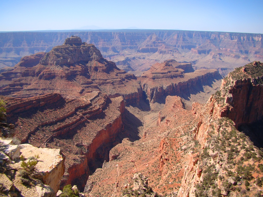
There are times when I hate perspective. I really do. I came of age in the 1970s during that turbulent time when we as a society realized that we were poisoning ourselves to death, that our air was putrid, that our water was contaminated, and that our lands were not infinite. The Wilderness Act of 1964 was not yet a decade old, and new wilderness areas were being established.. A great battle was fought over the wilderness lands of Alaska, and at least in small ways, one came into the 1980s thinking there was some hope for the future.
The victories were in many ways illusory. Corporations that contributed to pollution of our air and water made changes, yes, and our air and water got cleaner. So much so that in many cases we came to take it for granted (don't ask Flint, Michigan about this). Wilderness areas were established, national monuments were declared, and one could look to a future where these lands would be permanently protected.
The problem with complacency is that often the opposition is not being equally complacent. The very moment a victory was achieved, when another little corner of the country was "saved", those who lost their potential to profit off of national resources began plotting ways to undermine the victories. They knew how to play the long game, so they paid their political bribes and bided their time.
So as I look back on the changes in the last forty years, I start to realize how much we have lost. The rise of population has caused cities to spread into formerly wild lands with horrifying efficiency. Species have been lost and threatened due to loss of habitat world-wide. Old-growth forests continue to be cut down (yes, we need wood, but it can be grown in a sustainable way). And a new threat manifested itself in the thermometers around the planet. Climate change and global warming threaten to overwhelm our ecosystems. So much of the planet's resources are strained to the breaking point. But I hold on to those few places that haven't been paved over, logged, or strip-mined. I find this little bit of hope in the wild places that are left.
And that is what is so depressing about the events in the past couple of weeks. In 1996, President Clinton used his prerogative under the Antiquities Act of 1906 to put a stop to a proposed coal strip-mine on the Kaiparowits Plateau in southern Utah. He established a national monument, Grand Staircase-Escalante, to protect the plateau as well as the spectacular drainage of the Escalante River, and the unique geologic feature called the Grand Staircase. It was controversial, yes, but it was also farsighted. As geologists and biologists began to assess the resources of the park, they discovered unique treasures. Paleontologists began discovering new dinosaur species as well as a host of other fossilized animals and plants. The uniqueness of this incredible landscape gained wider recognition, and tourists and adventurers tired of the crowds in the small confined parts of Zion and Bryce Canyon National Parks came to love the wide-open spaces of Grand Staircase-Escalante. The local towns and villages, initially disappointed at the apparent loss of jobs, began to see an uptick in their economies, and employment increased in the tourist trade.
But then catastrophic things happened, culminating in the election of the most environmentally ignorant man ever to hold public office in America. The coal companies, the uranium miners, and the oil drillers had been waiting for the chance to take over the public lands that they wanted for themselves, and they greased the palms of enough politicians to make sure that Donald Trump was convinced to try and rescind the establishment of the monument. There was a sham of an evaluation period that included public comments running 98 to 2 in favor of maintaining the boundaries of the monument. 98%! In a politically divided time, how many issues have the literally unanimous support of our citizens? But it wasn't enough. Interior Secretary Ryan Zinke said flat out that he would ignore the desires of the American people because the comments were part of a "well-organized campaign". Would it have helped if it wasn't organized?
The vultures in the Trump administration are insisting that they will split the monument into three much smaller units, and delete nearly half of the monument from any protection at all. By some incredible coincidence, the unprotected lands happen to be on the site of that prohibited coal mine, as well as uranium prospects, and potential oil drilling sites. Keep in mind that these sites were ignored and unutilized for a century before Clinton made his proclamation official. But on an even more fundamental level, what justification exists to give over precious public lands, under legal protection for twenty years, over to the profit for a handful of people? Here's a hint: there is none. These lands belong to all of us, and 98% of us say "no".
The attempt by Zinke and Trump to steal our lands, both here at Grand Staircase-Escalante and at Bear's Ears, as well as the other monuments scattered across the country, will be judged in a court of law. One of the lawsuits can be reviewed here. Congress needs to know that we want these lands protected, too. There is an effort to make these changes in the legislature, and that effort needs to fail.
I hope that you will have a chance to see and explore these lands before they are despoiled by economic parasites and vultures. Even more importantly, I hope that you will join the efforts to protect these lands. A good place to start is with any of the parties to the lawsuit listed above. They are included in the article found here. The clothing manufacturer Patagonia deserves credit as well. They have taken a very public stand in favor of the monuments (information here).
In the meantime, please enjoy these images of some of my explorations of the monument.
Showing posts with label Grand Staircase. Show all posts
Thursday, December 7, 2017
Saturday, July 13, 2013
Out in America's Never Never: Is it the Journey or the Destination? Plus an unkindness and a bunch of bull...
Our exploration of America's Never Never included a lot of destinations: Zion, Bryce, Arches, Black Canyon, Mesa Verde and many others. But what is the value of seeing specific points in a landscape without seeing the lands between? Sometimes I have to convince my students that sleeping while traveling between incredible places causes us to miss the context of each of our stops (don't look for hypocrisy on my part; it's too easy. I sleep a lot on the road). If we only see specific sites, and miss the transitional landscapes that lie between them, we miss out. This is especially true while traveling between Zion National Park and Grand Canyon National Park. The two parks could hardly be more different: the rocks of the Grand Canyon are Proterozoic and Paleozoic in age. The walls of Zion Canyon are composed of Mesozoic rocks, primarily the Navajo Sandstone.
What happens in between? How do we transition between 100 million years of geologic history? As we drove beyond Kanab and Fredonia onto the sage-covered plains, we could look north and see the Grand Staircase. It is a series of cliffs that contain all of the sediments that once covered the Grand Canyon region, but which have been eroded away in a northward direction. Clarence Dutton coined the term in the 1870s and identified each cliff by color: Chocolate, Vermilion, White, Gray and Pink.
The Grand Staircase is preserved today as the western part of Grand Staircase-Escalante National Monument. It is a larger park than Grand Canyon, and contains a diverse landscape of deep slot canyons, high plateaus, faults and monoclines. The origin of the park was clouded by controversy (President Clinton established the park over the objections of local politicians), but new national monuments often are controversial.
We soon left the arid plains and climbed to higher elevations on the Kaibab Plateau, the vast uplift through which the Grand Canyon has been carved. The scrub and pinyon forest fell away and a thick forest of ponderosa and fir dominated the scenery. Soon we were passing through green meadows, a sharp contrast to the dry lands below.
It is odd that literally no streams or rivers cross the surface of the plateau. It turns out that the Kaibab Plateau is covered by the Permian-aged Kaibab Formation, a layer composed mostly of limestone. Limestone is soluble in slightly acidic water and joints and fissures will grow into caverns. The ceilings of some caverns will collapse, forming sinkholes. Any surface water tends to disappear into the subsurface quickly. Such surfaces are said to exhibit karst topography.
Some of the sinkholes will fill with clay or mud, forming an impermeable layer. It is these sinkholes that will develop into the lakes and ponds occasionally found on the North Rim. They are pretty much the only source of open water and thus are important to the animals that live here.
We usually arrive at the North Rim of the Grand Canyon in the late afternoon when the shadows are crossing the meadows and grazing animals start emerging. I've learned to see black spots in the distance and identify the creatures before anyone else. Often there are deer, and often a flock of ravens, which I learned tonight is called an "unkindness". I guess that's better than what they call a flock of crows...
On this trip I saw specks in the distance that looked different than anything I had ever seen before in twenty-five years of travels to the North Rim: too fat to be deer, and too large to even be cattle, which aren't supposed to be here anyway. It was a herd of buffalo!
Or "more or less" buffalo. It turned out this was a herd that originated in the adjacent House Rock Valley. They were the result of an experiment in the 1920s to "beef up" the cattle herds by crossing them with bison. It didn't work out, but the "mostly bison" continued to live in the valley over the years. Since they aren't a genetically pure herd, the state of Arizona sells permits to hunt the animals, and for a long time the herd remained relatively small.
Enter global warming and the crippling drought that has affected the region for the last 10 years. The herd moved uphill to find greener pastures, and fences and park boundaries mean little to these large animals. They found their way onto the meadows of the Kaibab Plateau and took up residence in grasslands that have not felt the hooves of creatures this big in thousands, maybe tens of thousands of years.
It was exciting to see these creatures, a feeling reminiscent of being in Yellowstone National Park, but it was disturbing as well. The animals trample springs and meadows, and may be upsetting the checks and balances of the local ecosystem. The park service is quite unsure about what to do.
A few more miles, and we arrived at our destination: the North Rim of Grand Canyon National Park! And what a grand place it is. More later!
What happens in between? How do we transition between 100 million years of geologic history? As we drove beyond Kanab and Fredonia onto the sage-covered plains, we could look north and see the Grand Staircase. It is a series of cliffs that contain all of the sediments that once covered the Grand Canyon region, but which have been eroded away in a northward direction. Clarence Dutton coined the term in the 1870s and identified each cliff by color: Chocolate, Vermilion, White, Gray and Pink.
![]() |
| Source: National Park Service |
The Grand Staircase is preserved today as the western part of Grand Staircase-Escalante National Monument. It is a larger park than Grand Canyon, and contains a diverse landscape of deep slot canyons, high plateaus, faults and monoclines. The origin of the park was clouded by controversy (President Clinton established the park over the objections of local politicians), but new national monuments often are controversial.
We soon left the arid plains and climbed to higher elevations on the Kaibab Plateau, the vast uplift through which the Grand Canyon has been carved. The scrub and pinyon forest fell away and a thick forest of ponderosa and fir dominated the scenery. Soon we were passing through green meadows, a sharp contrast to the dry lands below.
It is odd that literally no streams or rivers cross the surface of the plateau. It turns out that the Kaibab Plateau is covered by the Permian-aged Kaibab Formation, a layer composed mostly of limestone. Limestone is soluble in slightly acidic water and joints and fissures will grow into caverns. The ceilings of some caverns will collapse, forming sinkholes. Any surface water tends to disappear into the subsurface quickly. Such surfaces are said to exhibit karst topography.
Some of the sinkholes will fill with clay or mud, forming an impermeable layer. It is these sinkholes that will develop into the lakes and ponds occasionally found on the North Rim. They are pretty much the only source of open water and thus are important to the animals that live here.
We usually arrive at the North Rim of the Grand Canyon in the late afternoon when the shadows are crossing the meadows and grazing animals start emerging. I've learned to see black spots in the distance and identify the creatures before anyone else. Often there are deer, and often a flock of ravens, which I learned tonight is called an "unkindness". I guess that's better than what they call a flock of crows...
On this trip I saw specks in the distance that looked different than anything I had ever seen before in twenty-five years of travels to the North Rim: too fat to be deer, and too large to even be cattle, which aren't supposed to be here anyway. It was a herd of buffalo!
Or "more or less" buffalo. It turned out this was a herd that originated in the adjacent House Rock Valley. They were the result of an experiment in the 1920s to "beef up" the cattle herds by crossing them with bison. It didn't work out, but the "mostly bison" continued to live in the valley over the years. Since they aren't a genetically pure herd, the state of Arizona sells permits to hunt the animals, and for a long time the herd remained relatively small.
Enter global warming and the crippling drought that has affected the region for the last 10 years. The herd moved uphill to find greener pastures, and fences and park boundaries mean little to these large animals. They found their way onto the meadows of the Kaibab Plateau and took up residence in grasslands that have not felt the hooves of creatures this big in thousands, maybe tens of thousands of years.
It was exciting to see these creatures, a feeling reminiscent of being in Yellowstone National Park, but it was disturbing as well. The animals trample springs and meadows, and may be upsetting the checks and balances of the local ecosystem. The park service is quite unsure about what to do.
![]() |
| Definitely a bunch of bull! |
Subscribe to:
Posts (Atom)