Showing posts with label Far Western Section. Show all posts

Sunday, August 21, 2022

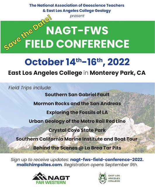
The National Association of Geoscience Teachers, Far West Section holds first post-pandemic field conference in Southern California, Oct. 14-16, 2022

The Far West Section of the National Association of Geoscience Teachers is offering the first field conference since the beginning of the pandemic! It is open to non-members and friends of geology. It looks like a great line-up of field trips in Southern California!

The NAGT and the Far Western Section exist to help teachers of the earth-related sciences. Part of our mission is to increase the expertise of our members (and friends) in the geology of their home regions, and our past meetings have been held all over California, Nevada and Hawaii. The conferences usually include the field trips, a field guide, and featured speakers. It's a great way to meet other teachers as well. My personal journey as a teacher has been deeply impacted by my participation in these events over the last 25 years. 

Check it out! We would like to get many new faces as we renovate the organization in a post-pandemic world. We hope to see you there! For announcements and updates, sign up at the link above.

Friday, October 26, 2012

Geological Excursions in the Sonora Pass Region now available at Sunbelt!

Our field guide to the geology of the Sonora Pass region and the eastern Sierra Nevada region is now available for sale at Sunbelt Publishing for $24.95 (here is the link)! This was the roadguide for our recent meeting of the Far Western Section of the National Association of Geoscience Teachers. There are quite a few geological road guides out there for the eastern Sierra Nevada, especially around the Mono Lake area, but there have been fewer guides for the area to the north. It is a fascinating region, with widespread Miocene volcanism, faulting and Pleistocene glaciations (the largest glaciers of the eastern Sierra Nevada traversed the West Walker River gorge).
One of California's most intriguing ghost towns can be found at Bodie (above), and one can also find a strange "fluvial forest" in the West Walker River, a group of long-dead Ponderosa pines that provide evidence of a century-long mega drought only a thousand years ago (below).
The western slope of the Sierra along the Stanislaus River hides some geological treasures as well, including the Columns of the Giants and the Natural Bridges in the cave country north of Columbia State Park (below).
Here is the table of contents...

A Geographical Sketch of the Central Sierra Nevada
A Brief Overview of the Basement Rocks of the Central Sierra Nevada

Trip 1: The Sierra Crest Graben: A Miocene Walker Lane Pull-Apart in the Ancestral
Cascades Arc at Sonora Pass
by Cathy Busby, Alice Koerner, Jeanette Hagan, and Graham Andrews at the University of California, Santa Barbara
Trip 2: A Guide to the Geology of the Eastern Sierra Nevada between Sonora Pass
and June Lake, California
by Garry Hayes, Modesto Junior College
Trip 3: Geology and Climatology of the Saddlebag Lake Region near
Tioga Pass
, CA by Laura and Ryan Hollister
Trip 4: Sword Lake Debris Flow by Jeff Tolhurst, Columbia College
Trip 5: Unique Geology along the Stanislaus River, Western Central Sierra Nevada by Noah Hughes, Modesto Junior College
 Appendix A: The Flora of Central California: Central Valley to the Great Basin by Mary Cook

A reminder: Sales of this guide will fund the scholarship program of the Far Western Section of the NAGT, which supports geology majors throughout California, Nevada and Hawaii. The book can also be purchased directly from the Far Western Section at this link. Check it out!

Monday, September 10, 2012

Just Published! Geological Excursions in the Sonora Pass Region of the Sierra Nevada (and cute furry animal)

The newest guide by the Far Western Section of the National Association of Geoscience Teachers is now available for sale! Geological Excursions in the Sonora Pass Region of the Sierra Nevada, edited by Noah Hughes and yours truly, is a series of field trips at Sonora Pass and along the eastern Sierra Nevada as far south as June Lake and Saddlebag Lake near Tioga Pass. Other excursions include significant geologic sites on the Stanislaus River, including the unique Natural Bridges near the town of Columbia.
This is a fascinating region that hasn't always received the attention it deserves. A great deal of recent research has been done on the Miocene volcanism in the region and how it relates to the uplift history of the Sierra Nevada and the development of the Sierra Nevada microplate. The region is part of the Walker Lane, which in all likelihood is the future margin of the North American Plate. There are ghost towns, saline lakes, ancient metamorphic rocks glacial deposits and a strange "fluvial forest" in the West Walker River. There is the strange "Reversed Creek" near June Lake.

Chapters in the book include the following:

A Geographical Sketch of the Central Sierra Nevada

A Brief Overview of the Basement Rocks of the Central Sierra Nevada

Trip 1: Sierra Crest Graben: A Miocene Walker Lane Pull-Apart in the Ancestral
Cascades Arc at Sonora Pass (by Cathy Busby, Alice Koerner, Jeanette Hagan, and Graham Andrews at the University of California, Santa Barbara)

Trip 2: A Guide to the Geology of the Eastern Sierra Nevada between Sonora Pass
and June Lake, California
(by Garry Hayes, Modesto Junior College)

Trip 3: Geology and Climatology of the Saddlebag Lake Region near
Tioga Pass, CA
(by Ryan Hollister of Turlock High School and Laura Hollister of Pitman High School)

Trip 4: Sword Lake Debris Flow (by Jeff Tolhurst, Columbia College)

Trip 5: Unique Geology along the Stanislaus River, Western Central Sierra Nevada (by Noah Hughes, Modesto Junior College)

Appendix A: The Flora of Central California: Central Valley to the Great Basin (by Mary Cook, Modesto Junior College)
The book was prepared for the Fall 2012 meeting of the Far Western Section of the National Association of Geoscience Teachers held last weekend at the High Sierra Institute at Baker Station below Sonora Pass. All proceeds from the sale of the book support scholarships for geology majors in California, Nevada and Hawaii (details of the scholarship can be found here).
At this time, the book can be ordered directly from the Far Western Section at http://nagt-fws.org/publications.html for $29.95 plus shipping and handling (checks only). The web page also includes dozens of other guides for geological tours all over California and Nevada. The guide will soon be available from Sunbelt Publishing, which published the volume (http://www.sunbeltbook.com/). The ISBN number is 978-0-9606704-4-4.
Photo by Ryan Hollister

We are excited to be able to offer this exploration of a fascinating region! If you are interested in seeing some unique landscapes and want to catch up with some new Sierra Nevada research, check it out (and help some worthy students advance their studies in geology at the same time).
Photo by Ryan Hollister
Here is the promised furry animal. The pika is a rodent adapted to living at the highest elevations in the Sierra Nevada. Their habitat is being affected by global warming. They can be seen near Sonora Pass and in the region above Saddlebag Lake.
Sunday, November 13, 2011

Bizarro Rocks Day and a Roadrunner

We were on the road this weekend, attending the fall meeting of the Far Western Section of the National Association of Geoscience Teachers. When geologist-teachers get together, we may talk about teaching, but we make sure our activities revolve around geology. We explore.

The sponsor of our meeting was Copper Mountain College, which serves the towns of Yucca Valley and Twentynine Palms. The towns are right next to Joshua Tree National Park which sits astride the boundary between the Mojave and Sonoran Deserts in Southern California. One group explored the scarps produced by the 1992 Landers Earthquake, a 7.6 temblor that produced a prominent scarp that is still visible today. The other trip was a tour of a park named for an odd tree, but whose other distinction is the bizarro rocks it has. Joshua Tree is a showcase for plutonic processes, with thousands of acres of weirdly weathered granitic boulders.
This is a brief post before I hit the long road home, but here are a smattering of photos of my favorite outcrops. They include the very colorful lichens I found in sheltered spots. Lichens are an entire ecosystem of lifeforms in miniature, a symbiotic relationship between algae and fungi.
And then there was the Triassic megacrystic Twentynine Palms quartz monzonite. I've seen plenty of porphyritic granitic rocks before, but a canyon filled with giant boulders of this stuff was just extraordinary.
I could swear I heard a little "beep-beep", and there it was, a little roadrunner wondering what we were up to. More pics later!

Wednesday, November 9, 2011

Don't Take Joshua Tree for Granite: The Fall Meeting of the Far Western Section of the National Association of Geoscience Teachers

There is still time to see one of California's most unique national parks!
(The folllowing is re-posted with minor edits from Teaching the Earth Sciences, the blog of the Far Western Section of the National Association of Geoscience Teachers and from Geotripper on Oct. 1; registration forms, maps and more information on the Far Western Section website)

Joshua Tree National Park is one of the most unique desert environments to be found anywhere in North America (See a representative journey with Geotripper here). Sitting astride the boundary zone between the Mojave and Sonoran deserts, the park displays a startling variety of plant and animal species, and stunning displays of a Proterozoic metamorphic complex and Mesozoic plutonic rocks. It is a great place to learn about geology.

Copper Mountain College will be the host for the Fall 2011 meeting, which will include explorations of the park, and a journey to the interior of the Mojave to see the scarps from the 1992 Landers earthquake, still starkly obvious after two decades. The magnitude 7.3 quake killed two and produced a fracture that crossed fifty miles of desert.

The Far Western Section of the National Association of Geoscience Teachers invites anyone interested in the geological sciences to join them, including students (especially students!). Membership in NAGT is not required. This is a wonderful opportunity to see a fascinating corner of California's geology, and a chance to meet earth science teachers from all over California and Nevada (Hawaii is in our section too). It is an exciting and economic way to see some of southern California's most incredible geology.

Friday November 11, 2011
6:00 PM Meet at Copper Mountain College Bell Center Community Room for Registration 
(On-site registration cost estimate is $50.)
7:00 PM NAGT Far Western Section Board Meeting
8:00 - 9:00 PM Registration
Saturday November 12, 2011
8:00 - 10:00 AM Meet at the Bell Center Community Room for Registration
10:00 AM – 5:00 PM Field Trips (Choose One)
Field Trip Number 1
Landers Earthquake: Scarps still visible after 20 years plus Pioneer Town: Dating of a Miocene(?) erosional surface – Bob Reynolds
Field Trip Number 2 
Geology of Joshua Tree National Park – Bruce Bridenbecker

Presentation: 6:00 – 9:00 PM Evening Social with Lecture on Mines and Mining in Joshua Tree National Park - Dee Trent
Sunday November 13, 2011
8:00 AM Meet at Bell Center Parking Lot for Field Trip to Desert Queen Mine – Dee Trent
Field Trip should conclude by 2:00 or 3:00 PM.                                           
Logistics:

Joshua Tree Area Services
For a directory of area motels and restaurants visit the Joshua Tree Chamber of Commerce Web Site at http://www.joshuatreechamber.org/.
Joshua Tree Area Camping
Indian Cove is located 13 miles east of Joshua Tree Village and 10 miles west of Twentynine Palms on the north side of the Wonderland of Rocks. Indian Cove Road dead-ends at this secluded area. Campers register at the ranger station located at the entrance to the Indian Cove area. Water is also available there.

Contact Bruce Bridenbecker for additional information.

Saturday, October 1, 2011

Come and See Joshua Tree National Park with the Far Western Section of NAGT, November 11-13

(Cross-posted with minor edits from Teaching the Earth Sciences, the blog of the Far Western Section of the National Association of Geoscience Teachers)

Joshua Tree National Park is one of the most unique desert environments to be found anywhere in North America (See a representative journey with Geotripper here). Sitting astride the boundary zone between the Mojave and Sonoran deserts, the park displays a startling variety of plant and animal species, and stunning displays of a Proterozoic metamorphic complex and Mesozoic plutonic rocks. It is a great place to learn about geology.

Copper Mountain College will be the host for the Fall 2011 meeting, which will include explorations of the park, and a journey to the interior of the Mojave to see the scarps from the 1992 Landers earthquake, still starkly obvious after two decades. The magnitude 7.3 quake killed two and produced a fracture that crossed fifty miles of desert.

The Far Western Section of the National Association of Geoscience Teachers invites anyone interested in the geological sciences to join them, including students (especially students!). Membership in NAGT is not required. This is a wonderful opportunity to see a fascinating corner of California's geology, and a chance to meet earth science teachers from all over California and Nevada (Hawaii is in our section too). It is an exciting and economic way to see some of southern California's most incredible geology.

Friday November 11, 2011
6:00 PM Meet at Copper Mountain College Bell Center Community Room for Registration 
(On-site registration cost estimate is $50.)
7:00 PM NAGT Far Western Section Board Meeting
8:00 - 9:00 PM Registration
Saturday November 12, 2011
8:00 - 10:00 AM Meet at the Bell Center Community Room for Registration
10:00 AM – 5:00 PM Field Trips (Choose One)
Field Trip Number 1
Landers Earthquake: Scarps still visible after 20 years plus Pioneer Town: Dating of a Miocene(?) erosional surface – Bob Reynolds
Field Trip Number 2 
Geology of Joshua Tree National Park – Bruce Bridenbecker

Presentation: 6:00 – 9:00 PM Evening Social with Lecture on Mines and Mining in Joshua Tree National Park - Dee Trent
Sunday November 13, 2011
8:00 AM Meet at Bell Center Parking Lot for Field Trip to Desert Queen Mine – Dee Trent
Field Trip should conclude by 2:00 or 3:00 PM.                                           
Logistics:

Joshua Tree Area Services
For a directory of area motels and restaurants visit the Joshua Tree Chamber of Commerce Web Site at http://www.joshuatreechamber.org/.
Joshua Tree Area Camping
Indian Cove is located 13 miles east of Joshua Tree Village and 10 miles west of Twentynine Palms on the north side of the Wonderland of Rocks. Indian Cove Road dead-ends at this secluded area. Campers register at the ranger station located at the entrance to the Indian Cove area. Water is also available there.

Contact Bruce Bridenbecker for additional information.

Saturday, February 26, 2011

Registration Deadline Extended: Far Western Section NAGT Meeting


(Cross-posted from Teaching the Earth Sciences)

The registration deadline for the Spring 2011 NAGT conference (see previous post), to be held at Caltech in Pasadena, CA, on March 25 - 27, has been extended to March 11. The registration fee is $95 for all payment postmarked by March 11. For payment postmarked after March 11, the fee will be $125. Go to the conference web site at

http://www.tectonics.caltech.edu/meetings/nagt/index.html

Students of the geological sciences are invited and encouraged to attend Far Western Section events at greatly reduced rates. See the conference website for details. Hope to see you there!

Wednesday, February 23, 2011

Far Western Section, National Association of Geoscience Teachers Spring Meeting: Caltech Tectonics Observatory, March 25-27, 2011


(Cross-posted from Teaching the Earth Sciences)
Have you ever wanted to know more about the geology of southern California, the San Andreas fault, and some of the incredibly strange rocks that crop out around the San Gabriel Mountains, like Vasquez Rocks or Devil's Punchbowl? The Far Western Section of the National Association of Geoscience Teachers invites you to join us on March 25-27, 2011 for our spring meeting, hosted by the Caltech Tectonics Observatory in Pasadena, California. These meetings are a great way to learn some fascinating geology, meet some fascinating people, and as much as I would like to say "have a scholarly time", I'm going to instead say "have a fun time".

Complete details of the meeting can be found on the Caltech Tectonics Observatory website at http://www.tectonics.caltech.edu/meetings/nagt/. You do not need to be a member of NAGT to attend (but we will gladly welcome you into membership if you wish to!), and the cost of the event is modest (less than $100 if you register before Feb. 25, plus a bit more for the Saturday banquet).

Check out the wonderful slate of activities and field trips below!

Field trips:
•Erosion and Sediment Transport in steep Mountain Terrain, San Gabriel Mountains - Mike Lamb (Caltech)

•San Gabriel Anorthosite and the San Andreas Fault - Bruce Carter (Pasadena Community College)

•Vasquez Rocks - Elisabeth Nadin (UA, Fairbanks) and Rebecca Walker (Mt San Antonio College)

•Devil's Punchbowl and Red Rock Canyon - Donald Prothero (Caltech/Occidental College)

Evening Speakers:
•Good Vibrations Inside the Earth - Jennifer Jackson (Caltech)

•TBD -Jess Adkins (Caltech)

Exhibits and tours:
•Tour of Seismo Lab - Margaret Vinci (Caltech)

•Southern CA Earthquake Center (SCEC) display

Workshops:
•Low-T Thermometry and Thermochronometry and Applications (including dating the formation of the Grand Canyon) - Ken Farley, John Eiler, and Brian Wernicke (Caltech)

•Earthquake Magnitude, Energy, and Focal Mechanisms (beach balls) - Joann Stock (Caltech)

•Plate Tectonic Rotation of the Transverse Ranges: what happened, how we know it happened, and how it created Southern California’s unique geography, climate, ocean currents and biological richness - Tanya Atwater (UCSB)

•Historical Earthquakes and Uplift/Subsidence of Sumatra from Coral Growth Rings - Elizabeth Nadin (UA, Fairbanks) and Belle Philibosian (Caltech)

•Operations of Community Seismometer Network (How your laptop can help scientists better understand earthquakes) - Tom Heaton and Ming-Hei Cheng (Caltech)

The registration form is here: http://www.tectonics.caltech.edu/meetings/nagt/register.pdf. Join us!

Learn more about the activities and opportunities at the Far Western Section! Check out our website, the Far Western Section of the National Association of Geoscience Teachers here, the FWS blog here, and our Facebook page here.

Thursday, August 26, 2010

A Great (and Inexpensive) Opportunity to tour some of California's Most Incredible Geology: Far Western Section NAGT Fall Conference, Oct. 8-10

The Far Western Section of the National Association of Geoscience Teachers would like to extend an invitation to all geologists, teachers, and students who are interested in the geology of California. We are having our Fall Conference at CSU Fresno on October 8-10, and will be offering a wide ranging roster of field trips to Sequoia/Kings Canyon National Park, Yosemite National Park, the Sierra Nevada foothills, Carrizo Plains National Monument, the Diablo Range of the Coast Ranges, and a look at the brand new Madera Fossil Discovery Center and the excavations of Ice Age faunas at the Fairmead Landfill. We will also have a vast array of California and Nevada geology field guides and other resources available for sale. You do not need to be a member of the NAGT to participate.

Special discounts are offered to students, and costs are low for this kind of opportunity. Information and registration forms can be accessed on the Far Western Section website. For questions and more information, please contact conference coordinator Paul Troop.

Cross-posted from Teaching the Earth Sciences.