Thursday, March 31, 2016

The Fabled Island of California? Stunning New Research Suggests the Early European Explorers may have been Right

Source: https://en.wikipedia.org/wiki/Island_of_California

Some of the earliest maps of California show it to be an island. The "correction" to this misconception didn't occur until 1746 when the Gulf of California and its terminus at the delta of the Colorado River were accurately mapped. For something like two hundred years, the legend persisted that California was a giant island, populated by beautiful women, and possessing vast treasures.
Geologists, geographers, and cartographers have long wondered about this conundrum. How could so many explorers have made such a huge error? Some stunning new research reveals that the explorers may have been right all along. In a paper published in the journal Enquiries (the national edition), geologists have come up with a startling model that suggests that as recently as 250 years ago, California was an island.

Seismologists have long known that most earthquakes are the result of elastic rebound, a theory that suggests that earthquakes occur because of a build-up of stress along faults. Frictional resistance prevents the fault from moving while stresses accumulate, but at some point the stresses overcome the resistance and the fault moves, generating large earthquakes. The idea was proposed by Professor Harry Fielding Reid after the Great San Francisco Earthquake of 1906, and evidence derived from subsequent earthquakes has confirmed the model.

Professor Avril Primum was the lead researcher. She says that the work of her team along the San Andreas fault in Southern California has provided a crucial addition to the model of elastic rebound. Sometime around 1250 AD, a huge earthquake caused massive slip along the fault and a vast region separated from the edge of the continent. But unlike models that would have left California as a permanent island, Primum's team argues that the elastic nature of the upper crust actually caused the island to rebound back to the edge of the continent, maybe during an epic earthquake reported in the early 1700s.

Avril contends that we don't have to worry so much about California falling into the sea. Sure, it might do it, and Duane Johnson, Pierce Brosnan, and Tommy Lee Jones will have to run around saving stranded people, but ultimately the elastic forces will pull it right back just like a bungee cord. We just need to be patient.

Wednesday, March 30, 2016

Job Openings with the Science, Math and Engineering Division at Modesto Junior College


These positions aren't in the area of teaching earth sciences, but if you have always wanted to work with a school that places a high priority on science education and community outreach, this may interest you. Modesto Junior College is seeking some math instructors, and an administrative secretary for our division. I've been here for a quarter century; it's a decent place to work and have a career. For more information, check out the announcements here:

Full-time tenure track instructor of mathematics: https://yosemite.peopleadmin.com/postings/2049

Full-time administrative secretary: https://yosemite.peopleadmin.com/postings/2035

We also have a number of adjunct positions open: https://yosemite.peopleadmin.com/

Monday, March 28, 2016

This is One of the Rarest Forests on our Planet, and Yet One of the Most Widespread

This is one of the rarest forests on our planet. I know of a number of different species that are represented by extremely limited habitats; there are the Dawn Redwoods of China (a grove of maybe 5,000 individuals), the Wollemia "Pine" of Australia (only a 100 or so in the wild), and the Ginkgo biloba (a few scattered possibly wild groves). But I also have a rare native tree in my own backyard, one that is found in just five widely scattered groves: on Cedros and Guadalupe Islands offshore of Baja Mexico, and in Cambria and Ano Nuevo along the California Coast. The fifth, the one I visited this last weekend, is here on the Monterey Peninsula, south of San Francisco.
Natural distribution of the Monterey Pine (http://evolution.berkeley.edu/evolibrary/article/montereypines_01)
The species is, strangely enough, the Monterey Pine (Pinus radiata). The pine is well known to many as a Christmas tree species or as a landscaping ornamental, and it is grown as a lumber species on some 10 million acres worldwide, mainly in Australia, New Zealand, Spain, South Africa, and Chile. It's a common tree. And also practically unrecognizable in its own native habitat. The trees that are grown for timber, landscaping and Christmas are highly modified organisms in the genetic sense (GMOs). They look little like the spindly knotted trees that grow on their native landscape.
We may often prefer to choose "organic" or "natural" foods for our diet, but practically none of the foods that we grow for our consumption look much like their wild forbears. Bananas, for instance, were practically inedible with giant seeds. Corn was little more than a grass, as was wheat. But these practically inedible natural species have a great value to our civilization: genetic diversity.

Our food supply is vulnerable to disruption from any number of diseases and disorders: such things as fungi, bacteria or viruses could kill off vast sectors of our agricultural products because they are genetically homogeneous. The currently favored banana variety, for instance, may be wiped out in just a few years by a  fungus. 
And so it is with the Monterey Pine. Silvicultural methods have taken the pine and transformed it into a rapidly growing tree with few knots in the lower two-thirds of the tree. But the pines that grow on plantations across the world do not have the genetic diversity of the forests in the isolated stands in California and the Baja islands.

The native groves of Monterey Pine are under environmental assault, from development pressures, and from disease. The Pitch Canker fungus weakens the trees, making them susceptible to beetle attack. There is not much in the way of a coordinated treatment for the trees. None of the native groves are on protected federal land, and only one grove is within a state park. For the most part the native groves exist at the pleasure of the private corporations that own the land.  
Although they have been far too willing to cut down Monterey Pine forests to make villas and golf courses, the corporation that owns the forests in these pictures knows it has some fiscal responsibility to its shareholders to preserve some intact forests of these trees. They make a lot of money charging tourists like myself who pay $10 to follow Seventeen Mile Drive to see the forests along with the beautiful coastline, the wildflowers, and the mansions of the rich inhabitants of the area. 

Strangely enough, the Monterey Peninsula plays hosts to more than one extremely rare native forest. The Monterey Cypress (Hesperocyparis macrocarpa) is found in natural groves only at Cypress Point on the peninsula, and at Point Lobos State Reserve. The trademarked tree called the "Lone Cypress" is perhaps the most famous single tree in the California (I think the sadly deceased Jeffrey Pine on the summit of Sentinel Dome in California was a close competitor for the honor). Like the pine, it has become widespread due to planting as an ornamental.
For more on the evolution and distribution of the Monterey Pine, see http://evolution.berkeley.edu/evolibrary/article/montereypines_01.

Sunday, March 27, 2016

Sea Otter using Geologic Materials to Procure a Snack


If I lived along the coast, I would get to see this kind of thing all the time, but I don't, and I don't always see otters when I do visit, so this was kind of special. The funny part is, I didn't really notice the otter at the bottom of the scene pounding on the rock until the very end when I zoomed in. We spent part of the afternoon at Cypress Point on the Monterey Peninsula, and were so distracted by the Harbor Seals that we nearly missed seeing the otters a little ways offshore.
I mean, really, would you be distracted by this?

I remember reading as a kid how humans were better than all the animals because we used tools. I also remember those first discoveries by Jane Goodall and others that primates were using tools, and later how otters used rocks to bust up shells. The otters will carry a rock in a pouch under their arm, and scour the seafloor for snails and other delectable shellfish, bringing them to the surface for a geology-based extraction leading to a juicy snack.

But I never got to witness such things in all these years. I didn't get any clear pictures of the otters today other than the video, so I dug into the archives for a few pictures of otters in Morro Bay that I photographed in 2007.
California's Sea Otters are an endangered species, and it is practically a miracle that we have any at all. Their original population was estimated to be around 16,000, but Russian fur traders and others extirpated most of the colonies. They were thought to be extinct until 1938, when a group of about 50 were discovered in a living in a cove near Bixby Bridge north of Big Sur. Their numbers have risen slowly to about 3,000 individuals today. It's hard to imagine that we nearly lost them forever.


Friday, March 25, 2016

A Sight That Overwhelms: Dante's View and a Sense of Scale

It's one of the most astonishing viewpoints in all of North America. The Black Mountains form the eastern edge of Death Valley, and they are one of the most rugged mountain fronts in existence. In places the mountains are so steep that one cannot see the slopes at the base from the summit. Looking up from the lowest point in North America, Badwater, one can barely contemplate walking or driving to the summit across the barren cliffs.
And yet a road does just that. Taking advantage of the asymmetrical nature of the range, a paved road winds up the eastern flanks, and only the last few hundred yards of the drive are a vertiginous nightmare. And then there is a view like no other.
Death Valley is the largest national park in the lower forty-eight states, and Dante's View takes in much of the park, offering on clear days a view that extends across more than a hundred miles of desert ranges and salt flats. The view is so unlike any other place on the planet that George Lucas used it as setting for his alien planet in some movie about wars across the stars ("Mos Eisley spaceport. You will never find a more wretched hive of scum and villainy.").
Even though the summits reach nearly 6,000 feet above sea level, the slopes are barren and dry. The range lies in the rain shadow of the Sierra Nevada and two other high mountain ranges, including the Panamints that rise to 11,000 feet on the other side of Death Valley. In any other mountain range, 6,000 feet would support a thick forest. Here in the Black Mountains, only sage and seasonal wildflowers can grow.

The lack of vegetation is a boon to the geologist, of course. The exposures of bedrock are unparalleled, revealing a great deal about the geologic history of this part of the world. And it is a strange story. Much of the mountain range is composed of the Black Mountain Metamorphic Complex, a selection of gneiss and schist sequences that reveal evidence of a titanic series of plate collisions 1.7 billion years ago. At that time, North America was hit by a series of terranes, island systems maybe the size of New Zealand or California. The collisons produced a mountain range hundreds of miles long that would recall the coastal ranges of southern Alaska, minus the rainforests (terrestrial life didn't arise for at least another 1.2 billion years). These rocks are related to those found in the depths of the Grand Canyon and farther south in Arizona and New Mexico.

In the ensuing years, the vast range would be eroded to a nearly flat plain, and the surface would eventually subside below sea level. Tens of thousands of feet of Paleozoic sediments covered the rocks so they lay hidden deep in the continental crust. In the last few tens of millions of years, the regional crust was stretched and extended, and the overlying rocks slid away, causing the Black Mountains to "pop up" in the geologically short stretch of two or three million years. The exposure of the deep crust was accompanied by violent caldera eruptions, and parts of the mountain range are covered by colorful ash deposits (the rocks along Artists Drive Loop are particularly memorable).
Some places are so overwhelming that one can lose a sense of scale while staring into the abyss. Take a look at the picture below: we are looking at the vast salt pan of the Badwater Basin, the lowest place in North America at minus 282 feet. The salt flats cover 110 square miles. How big an area is this?
To find out, take a look at the thin channel of salt marked with the arrow in the picture above. We'll zoom in a bit, and find that we are looking at a spot next to the Badwater parking lot, which is just out of sight at the bottom of the picture. One can make out the Badwater Road on the left side of the photo. What are those dots on the salt channel? Let's zoom in a bit more (120x by now).
They're tourists! Badwater is a main destination for visitors to Death Valley. The stop lies 5,700 feet beneath Dante's View, and only two miles west. These mountains are about as steep as any can be.
The view from Dante's View on this afternoon in February was unique for me. Flash floods in October had destroyed some roads in the park, and I found it necessary to alter our usual itinerary. We usually see the viewpoint in the early morning. Until this day I had never seen the sun set over desert like this. It was an astounding sight. Even overwhelming...

Wednesday, March 23, 2016

A Living Kaleidoscope in the Red Hills of the Sierra Nevada Foothills

I always thought that kaleidoscopes were named after someone named Kaleid, but the authoritative source (Wikipedia, of course) indicates that the name is a mixture of Latin terms that translates to "observation of beautiful forms." Today I was observing just that at the Red Hills Area of Critical Environmental Concern. I was also there less than a week ago, and in the manner of a kaleidoscope, it is changing colors. 
The Red Hills host a unique ecosystem quite unlike the oak woodlands of the adjacent Sierra Nevada and Great Valley. The underlying rocks are composed of serpentine and other ultramafic rocks, and the soils are poor in many necessary nutrients, and rich in a number of toxic metals. Few "normal" plants, most notably the grasses and oak trees, can live or grow on these soils. Some plants merely tolerate the soils, and can grow elsewhere (like the Poppies), but others are adapted to living on the soils and nowhere else. 
The foothills are semi-arid, and the seasonal lack of water is another factor in the survival of plant species in the area. But when the water comes, the hills explode with life. We've been in the grips of a horrific drought for the last four years, but this year has brought normal, even above-normal precipitation. In these few weeks of spring we are getting the best wildflower show in years.
We've made three trips to the Red Hills in the last few weeks, and it has changed dramatically with each visit. The first visit was early, and there were just a few splashes of yellow here and there around the main parking area. By the second trip, the yellow flowers had expanded rapidly, with widespread areas covered by Goldfields and Monkey-flowers.
Our trip today revealed a vast expansion of the blue and purple flowers, primarily Blue Dicks (Brodiaea) and Bird's-eye Gilia. They provided a nice contrast to the red and brown rocks (rich in iron).  You can literally think of the iron-rich rocks as rusting; they are actually green to black on fresh surfaces.

The rocks that are ultimately responsible for this wonderful scenery were once important for a different color: gold. The ultramafic rocks were closely associated with the Melones and related fault zones that were the conduits for highly mineralized fluids that worked their way towards the surface around 140 million years ago. As the chemical-rich water approached the surface, minerals precipitated out as quartz veins that hosted the gold that was so eagerly sought by miners. These rocks didn't have the gold, but it was near by. When the ores gave out, this landscape was abandoned and left behind for a century. It was the realm of garbage piles, shot-up abandoned automobiles, and off-road vehicle trackways.

It wasn't until the 1990s that people began to recognize the true value of this unique ecosystem. Volunteers cleaned up the messes, and the Bureau of Land Management reclassified the landscape as an "area of critical environmental concern", which is effectively a park designation. The "goldfields" today are the Goldfields flowers that appear after the rain falls. And all of the other wonderful colors that come just a few weeks later.

Tuesday, March 22, 2016

Storm Clearing in California's Great Valley

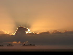
The onset of Daylight Savings Time, an anachronism if there ever was one, has meant that I'm headed to work before sunrise once again, a miserable time for a night owl like myself. There are occasional benefits though, such as seeing the sun rise. A storm blew through our valley last night, dropping around a third of an inch in the Modesto area, and bringing the cold air and moist ground that results in fog. 

The warmer climate over the last few years has meant that we've had fewer of the horrific weeks-long sieges of fog that led to chain reaction accidents, but some mornings there is a mystical look to the valley floor as the mist rises just a few feet off the ground.

It looks like at least ten days of sunshine and warming temperatures in the weather forecasts. The rainy season is drawing to a close. Not the drought buster season we had hoped for, but above average, enough to help a bit in filling the reservoirs.

Monday, March 21, 2016

Scenes from a Superbloom (Part 2), and Evidence of a Snowball Earth (in Death Valley???)

Death Valley is a wondrous place at any time of the year, although it can be darned uncomfortable. There is value, however, in understanding the limits of human existence, which is something you indeed experience when the temperature reaches 120 degrees or so. I prefer visiting at times other than summer as a rule, and late winter is often ideal. We've been bringing students out here in February for more than a quarter century, and I never get tired of seeing this place.
 
But every decade or so, events conspire to turn a journey to Death Valley into something very special. The geology is always there and in your face (and in your nose, ears, and shoes). But if there have been a few precious rainstorms spaced just right in the fall, you can experience an explosion of life in the desert. Seeds that have lain dormant in the thin soils for years will suddenly germinate, and the barren rocks will be painted bright yellow, with lavender and white undertones here and there.
Beck Springs formation on the left, and Kingston Peak formation on the right.
We had driven just a few miles past Ashford Mill for a chance to look at some of the rocks from the earliest history of the North American continent. Around a billion years ago, an earlier supercontinent (called Rodinia, not Pangea) was stretching and started to fracture and break up. A series of fault basins developed in what is now Arizona, Utah, Montana, and here in Death Valley. Sediments filled the valleys, producing a three-mile-thick sequence of sedimentary rocks preserving several hundred million years of Proterozoic history (the time before complex multicelled life came to dominate the ecosystems of Earth). The mouth of the canyon below Jubilee Pass provided accessible outcrops of the three formations, the Crystal Springs, Beck Springs, and the Kingston Peak.
The Crystal Springs formation preserves ancient algal structures called stromatolites. They are the oldest evidence of life in California (but not in the world; life had already been on the planet for two billion years). The Beck Springs formation (in the dark hill below) is composed mostly of dolomite, which formed at tropical, even equatorial latitudes.
The presence of tropical rocks makes the Kingston Peak formation a real enigma. It's composed in part of a strange conglomerate referred to as a diamictite. The large boulders are in a matrix of muddy sediments such as one might expect to find on the ocean floor. The puzzle is: where did the large rocks come from? Big boulders don't usually get carried far out to sea unless they are encased in icebergs.
Icebergs? In the tropics? Even the most intense of the ice ages that we've studied from the last two million years never approached the tropics. They barely crossed the northen flanks of the United States. As evidence mounted, geologists started to realize the occurrence of an ice age more intense than any other ever discovered. The Snowball Earth hypothesis suggests that the entire planet may have been covered by ice around 700 million years ago, except maybe for a narrow strip at the equator.
We walked across the alluvial fan for a closer look at the Beck Springs and Kingston Peak rocks, but were distracted somewhat by the incredible flower display.
I got down on the ground and tried to get a few shots from a ground squirrel's point of view. If nothing else, the local rodents are able to  look around and say "salad" today!
The explosion of life on the barren desert floor was just stunning. These plants are supremely adapted to survive in this most harsh environment, and it was such a privilege to see it happening.
There were trade-offs, of course. The storms that brought the flowers also brought devastating flash-floods that destroyed roads. We couldn't visit some of our normal outcrops, so I had to redesign our itinerary for the next day. That led to a rather fine adventure, one in which we drove through a mountain range. That's "through", not "over". More in coming posts!

Friday, March 18, 2016

The Red Hills Weren't Exactly Red Today: Goldfields in the Gold Fields

If my blog posts seem a bit scattered of late, bouncing from one place to another, well, it's kind of true. On the other hand, there is an occasional theme that runs through many of my disparate posts: California has had more water fall from the sky this year than any of the last five. We have been and still are in the grips of the worst drought in California's state history, and so a season of slightly above average precipitation feels like a miracle of moisture.
This afternoon we paid a return visit to the Red Hills Area of Critical Environmental Concern, a small natural wonder in the foothills of the Sierra Nevada, within the Mother Lode gold belt. The "area" is protected by the Bureau of Land Management, preserving one of California's really unique habitats, the serpentine soils.
A strange thing happens with the landscape close to the park boundary: the grass and oak woodland suddenly gives way to an area of very sparse grass (if any) and no oaks. There are instead Buckbrush shrubs and Gray Pines. The precipitation and sun exposure are the same. The difference is in the weathered rock beneath. Serpentine is deficient in many required plant nutrients, and is rich in some toxic metals. As a result, almost no grass or other normal groundcover plants can survive in such conditions. Only plants that are serpentine tolerant or adapted to thrive in serpentine can survive. As a result, many of the plants here are endemic to California, and at least a few aren't found outside the preserve.
The area once was the realm of target shooters, off-road vehicles, garbage piles, and vandals. It took time for the unique nature of the area to be recognized, and now it has returned to something of its original appearance as the native plants have reclaimed their territory. When the rains come, it explodes with color, including the early season blooming California Goldfields (Lasthenia californica) that we saw today. California Goldfields in the gold fields of California...it's a beautiful sight.

Information on the Red Hills ACEC can be found here: http://www.blm.gov/ca/st/en/fo/folsom/redhills.html

Thursday, March 17, 2016

Scenes from a Superbloom: Death Valley 2016 (Part 1 of 2)

I could have made up a detailed geological description of the geology of this alluvial plain at the south end of the Death Valley graben. This is a geology blog, after all. But we were there in the middle of February during the most extraordinary flower show, a "superbloom", in a decade. A series of fall storms were spaced just well enough to wake up the myriads of seeds that hide in the soil, biding their time and waiting for the right conditions to bloom. And this was the time. I'm showing flowers today!

First and foremost is the Desert Five Spot (Eremalche rotundifolia). I'm in Death Valley every year during February, and I might see a few flowers scattered about even in dry years, but I only find the Five Spots during years like this, and I have almost no good pictures of them. That changed this year!
The slopes were covered with Desert Gold (Geraea canescens). A few Desert Golds seem to sprout in the dry years, but if there is water, these are the flowers that turn the slopes and fans bright yellow. It almost feels like walking through alpine meadows, yet one can never escape the sense that these flowers are growing as fast as they can, setting seeds, and dying as the hot winds begin to blow (and the hot winds can come at any time of the year).
Another dependable flower even in drier years is the Desert Sand Verbena (Abronia villosa). There were lots of them in the washes at Ashford this year.
The Ashford Mill was built to process gold ores from a mine a few miles away in the Black Mountains. A bit of gold was produced over the years, but the total output was described as providing the owners with little more than "groceries and lawsuits". Not much is left beyond a few walls and foundations, but they provide a decent frame for viewing Telescope Peak.
The Black Mountains form the eastern wall of the south part of Death Valley, and they are one of the most rugged mountain ranges to be found anywhere. The steepness results from the rapid uplift of the mountains (or rapid subsidence of the valley floor, or both), and the slow rate of erosion in the exceedingly dry climate of eastern California. In this season of "plenty" (in the relative sense, of course), they provide a somber backdrop to the rich display of flowers across the valley floor.
In the next post, we'll check out a few other flowers from another spot just up the highway.