Tuesday, April 28, 2015

Driving Through the Most Dangerous Plate Boundary in the World: The Alien Bursts Forth in the Diablo Range!

The strange alien terrane bursts out of the core of the Diablo Range!

The next stage of our journey through the most dangerous plate boundary on the planet takes us across the Coast Ranges from the Bay Area to the Great Valley. There are freeways that make the trip easy, but they don't go through the interesting parts. Traveling Interstate 580 at 65mph, one mostly just sees grassy slopes and precious little rock. The problem, from the geologist's perspective, is that they cut the freeways through the easy rocks, the sediments of the Great Valley Group, or unconsolidated alluvium. Featureless siltstone and sandstone, not much to look like.
San Jose and the Bay Area from State Route 130 on Mt. Hamilton
To see interesting things, one needs a route through the core of the Diablo Range. The sub-range of the Coast Ranges makes a formidable barrier more than 100 miles long from Mt. Diablo to the Coalinga region. Geologically the core of the Diablo Range is kind of like (structural geologists everywhere, forgive me) the horrible beast thing that burst out of John Hurt's chest in the movie Alien. It's composed of deep crustal rocks from the accretionary wedge of the great Mesozoic subduction zone (the Franciscan Complex) that have been squeezed up along faults while erosion removed the overlying sediments. The Great Valley sediments were never deeper than a few miles, but the rocks of the mountain interior show evidence of burial at depths as great as twenty miles (32 kilometers). These rocks are different from those of the Marin Headlands, and the difference is not just the lack of coastal cliffs. We'll look at them a bit more in the next post.
Typical stretch of State Route 130 on west side of Mt. Hamilton.


A funny thing happens to a few poor folks every so often. They're new to the area, and they have to go from the Bay Area to the Great Valley for some odd reason or another. It's late in the afternoon and the GPS tells them that traffic is bad on the Altamont. They look at the map and see an alluring sight: a paved road from San Jose to Patterson. It's even listed on the map as "State Route 130", which means it's a highway, right? And no traffic jams according to the GPS! So off they go. And go. And go some more. The number of twisting curves is unbelievable. The road doesn't even go over a pass, it goes right over the top of the highest peak in the area. What kind of road does this sort of thing? Maybe three hours and fifty miles later, tired and frazzled, they arrive in Patterson, far behind schedule and looking desperately for a bathroom and a Starbucks.

The probably don't realize it, but they've just traveled one of the most geologically interesting roads in the state of California. Even more, they've taken a journey to the bottom of the sea and through the underlying crust, right into the Earth's mantle. They've passed through the realm of dinosaurs, and bizarre giant marine reptiles that probably ate sharks as a light snack. And they've passed through one of the diverse ecological habitats left in the Coast Ranges. Along the way they encountered the Lick Observatory, an important locality for groundbreaking astronomical research.
We'll pick up the story of this fascinating region from the summit of Mt. Hamilton in the next post. 

Saturday, April 25, 2015

Major Earthquake in Nepal Upgraded to Magnitude 7.9

Source: http://earthquake.usgs.gov/earthquakes/eventpage/us20002926#general_summary
A very strong earthquake has struck in Nepal with a magnitude of 7.9 (initial reports listed 7.5). One would expect that serious damage will result; three earthquakes in the last 110 years have approached this size, and the death toll for all three was in the tens of thousands (1934 M8.1 Bihar, 1905 M7.5 Kangra, and 2005 M7.6 Kashmir earthquakes). Although the data is preliminary, the depth listed at this point is worrisome, only 12 kilometers. Such shallow quakes are the most dangerous kind. A magnitude 6.6 aftershock has been reported.

The earthquakes in this region are caused by the convergence of the Indian landmass with the Asian continent. India is being forced under Nepal and China, and the resulting thickening of the crust has lifted the Himalaya to form the highest mountain range on the planet.

For the most up to date information, consult the event page at the U.S. Geological Survey. Moment by moment blogging on the quake can be seen at http://earthquake-report.com/2015/04/25/massive-earthquake-nepal-on-april-25-2015/.

Update, 9:30 AM PST: More than a thousand people reported dead, but many more are missing. At least 10 climbers and sherpas are dead on Mt. Everest, due to an avalanche. It's been a bad year on Everest, as an avalanche took 16 lives about a year ago.

The latest consensus of the magnitude places it at 7.8. Magnitude is measured in several different ways (Richter, or Local magnitude is not a useful method for quakes larger than magnitude 6.5), and early instrumental calculations are often revised as more data is collected.

Wednesday, April 22, 2015

A Teacher of Astronomy? Have we got a place for you!

I don't know if astronomers love geology as much as a geologist like myself loves astronomy. But if you are a teacher of astronomy and you are good at it, have we got a place for you! Modesto Junior College has an opening for a full-time tenure-track astronomy-physics instructor. Just imagine working in our wonderful new Science Community Center! We also have one of the finest planetariums in the country, and a fully-equipped observatory. Full information about the position can be found at https://yosemite.peopleadmin.com/postings/1531.
I don't know if I can fully convey the excitement of teaching at this facility. The local community is crazy for science education. Our telescope nights, held once a month, draw hundreds of people. The planetarium shows are often sold out. It's hard to imagine a better place for a great teacher who loves conveying science to others.

Tuesday, April 21, 2015

Driving Through the Most Dangerous Plate Boundary in the World: Terra Fatale on the Marin Headlands

In the old film noir movies, the femme fatale was a staple character, an attractive and seductive woman, especially one who brought disaster to any man who became involved with her. To be fair, there were plenty homme fatale characters in movies over the years too. But how many movies have a terra fatale character, a seductive and beautiful geographical region that brought disaster on those who chose unwisely to visit or settle in? A few quickly come to mind, Pompeii and Vesuvius, for instance (although Pompeii was not the greatest movie ever made), and Southern California (Volcano, Earthquake, 2012). Some lands are simply more hazardous than others.
The lands near a subduction zone are the most dangerous on Earth. To live along a convergent boundary, in the zone of the magmatic arc, or on an island of an accretionary wedge is courting disaster. The worst earthquakes, and some of the most violent volcanic eruptions occur near such boundaries. We've been slowly conducting a journey across an ancient subduction zone, one that is no longer active. It's exposed in the Coast Ranges, Great Valley, and Sierra Nevada of California, where the rocks from the heart of the zone have been exposed by erosion. The rocks have been severely changed by heat and burial deep in the crust of the Earth, and now provide valuable information to geologists. In our last two posts we took a look at some of the strange rocks found there, the chert and pillow basalt of the Franciscan Complex. Today we are looking at some of that seductive scenery, the terra fatale.
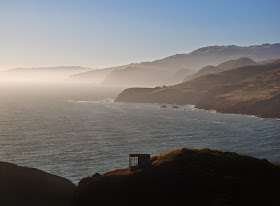
The subduction zone is no longer active, but this isn't to say the land isn't still dangerous. The San Andreas fault lurks just offshore, and the steep terrain invites landsliding and severe shoreline erosion. The western side of the Marin Headlands has never been developed to the extent of the more sheltered eastern side along San Francisco Bay. But in the extreme ruggedness, we can find great beauty. A system of roads and trail explore this spectacular landscape. Conzelman Road winds across the slopes above the Golden Gate, offering a view of the Point Bonita Lighthouse (top picture). The road ends at Rodeo Beach, a small lagoon that has been blocked off from the open sea by a baymouth bar. The color of the sand looks off to those who are used to white sand beaches in such places as Florida. A closer look reveals why: the sand has very few clear quartz grains. The grains are mostly composed of the chert eroded from nearby cliffs.

Another road winds across the ridge between Rodeo Beach and Point Bonita, providing stunning views of the steep coastal cliffs, Rodeo Beach, and the lighthouse at Point Bonita. Bird Island, seen in the second picture of the post, and on the far left side of the picture below, is a resting and roosting site for Cormorants and Brown Pelicans.
Although the Marin Headlands are protected as a natural area under the administration of the Golden Gate National Recreation Area, there are signs and hints of intense human use. As mentioned previous posts, numerous cannons and gun emplacements dotted the cliffs, especially during World War II. Incredibly, some 2,000 acres were sold in the 1960s for housing developments that would have housed 30,000 people. Thankfully, the project failed, and the land was preserved as parkland.
The Point Bonita Lighthouse has stood on this rocky bluff for 160 years guiding ships into San Francisco Bay. A lot of ships missed. Around 300 ships have run aground over the years, including the wreak of the steamship City of Rio de Janeiro in 1901, with a loss of 128 lives.
With the end of this brief exploration of the Marin Headlands, we now cross the Golden Gate Bridge, passing through San Francisco, and driving through the urban center of San Jose. We're ready to take on the interior of the accretionary wedge, by crossing the Coast Ranges at Mt. Hamilton and Del Puerto Canyon. That will be in the next post...

Memories of Floods Past: The 1997 New Year's Day Flood in the Sierra Nevada


There is a very strange looking meadow in the Sierra Nevada foothills 700 feet above the Tuolumne River. Bedrock around here is generally poorly exposed and deeply weathered. The region is one of gentle topography, with low hills and broad open valleys. But in this meadow, the rocks are barren and unweathered, looking as if they were recently quarried. And in a sense they have. A river once flowed here once. And I mean "once" in the most literal sense. It was here only once. This is one of the few places where one can see evidence of an extraordinary event, the flood of 1997. It was an event expected to happen here on average once every 250 years or so.
I was pondering the floods of 1997 because I visited Don Pedro Reservoir the other day and saw just how low the lake level has fallen after four years of crippling drought. The lake stands at about 35% of capacity, with around 800,000 acre feet of water remaining. The lake will be considered a "dead pool" (too low to produce hydroelectricity) if it gets as low as 300,000 acre feet. There isn't much danger of flooding this year with the snowpack sitting at 5% of normal.

Don Pedro Reservoir stores water for the Modesto and Turlock Irrigation Districts, and also serves as storage for Hetch Hetchy Reservoir water bound for San Francisco. The earth-fill dam stands 580 feet high and inundates 26 miles of the Tuolumne River, which flows out of Yosemite National Park. The dam was built for irrigation storage, hydroelectric power generation, recreation and...flood control.
The water year of 1996-1997 was unusual to say the least. A series of large storms in December had built up a record or near-record snowpack in the Yosemite high country. Then a New Years Day Pineapple Express storm took aim at central California. The warm, moist atmospheric river flowed over the Central Valley dropping only a few inches of rain, but when it hit the mountains, it poured as much as three feet of rain at elevations as high as 10,000 feet, and onto the record snowpack.
Don Pedro Reservoir was at the proper level for normal flash flood conditions, with about 300,000 acre feet of storage available. But the water coming downstream was not normal. At the peak, the rivers flowed into the lake at an unbelievable rate of 130,000 cubic feet per second. To put this number into perspective, the Tuolumne River is considered to be at flood stage at 9,000 cubic feet per second. The dam operators had a big problem and they knew it. They had to purposely flood the cities downstream to prevent a total catastrophe. They ramped up the power generating turbines, and for the first time in the dam's history, they opened the floodgate.
The floodgate didn't open into the Tuolumne River. It faced a meadow that had never before had a river flowing through. As can be seen from the pictures here, the meadow was hit by a flood of gigantic proportions. Ripping away soil and solid rock, the river quarried a channel forty feet deep in the space of three days. And it barely worked. At the highest point, the reservoir was flowing uncontrolled over a concrete weir that was the never supposed to be topped. The water was only a foot deep, but spread out over several hundred feet, it ripped away soil, rock, and the highway that passed below the floodgates.
The city of Modesto and others downstream experienced the greatest flood in their history, with top flows of around 60.000-70,000 cubic feet per second. But if Don Pedro Dam had not been there, the towns would have been hit with a flood twice as big.

Today, the scene is a complete contrast to 1997. I was standing on a hill above the dam looking at the floodgate from the backside. The entire region in the picture below would be inundated if the reservoir was full. As you can see, there was no water in sight.

Only one flood in recorded history could possible compare with 1997. That was the flood of 1861-62, which was so large that parts of the Great Valley turned into a lake for weeks. Sacramento was abandoned as the state capitol for months while the waters subsided. No gauges were present on any of the rivers so we don't know how the numbers compare, but considering that 1997 was considered a 250 year flood (a 1/250 chance of occurring in any one year), it must have been truly extraordinary.

And that's the way it is with water in California. We rarely have a "normal" year. It tends to be a feast or famine kind of environment. Frankly, we're hoping for a "feast" next year, and for several years after, but the record kind of leans the other way. In the last 2,000 years, California has experienced two "megadroughts" that lasted a century each. The watermasters in our fair state have been consuming lots of antacids lately, I suspect.

The pictures of the flooding in 1997 are courtesy of the visitor center at Don Pedro Reservoir. I experienced the flooding, but I was in Waterford and Modesto. It was a sight. A normally dry creek in the middle of town called, creatively, Dry Creek was flooding at 9,000 cubic feet per second. As noted before, that's flood stage for the Tuolumne River. And Dry Creek was a small tributary. It truly was a one-of-a-kind event.

POSTSCRIPT: Turlock Irrigation District has a video of the flooding of the Tuolumne at  https://www.youtube.com/watch?v=94sAz3gZciQ&feature=youtu.be&a. Stunning footage...

Sunday, April 19, 2015

Where the Rivers are "Upside-Down": A Hike to the Stanislaus Table Mountain

Around 10 million years ago, a lava flow surged from a volcano near present-day Sonora Pass in the Sierra Nevada. Composed of latite, but non-viscous like basalt, it flowed off the volcano and into the channel of the ancestral Stanislaus River, eventually flowing close to sixty miles. The river eventually eroded another valley and the lava flow was left relatively intact. The Sierra Nevada rose and tilted westward, and erosion removed the surrounding softer rock, leaving the former river valley as a ridge several hundred feet high. This was the origin of the Stanislaus Table Mountain, an inverted stream.
In this GoogleEarth image, the trail mostly follows the white line along the base, and then climbs the forested slope on the right.
Table Mountain forms a mesa-like ridge around Sonora and Jamestown in the Mother Lode of the Sierra Nevada. A lot of it is on private property, and as such is inaccessible for close investigation. But one portion lies within the boundary of the U.S. Bureau of Reclamation lands around New Melones Reservoir. The Bureau has constructed a trail to the summit, and that's where we were headed today on our Geology Club hike.
The trail is about 1.5 miles in length, and the first mile is a gentle grade through meadows and oak woodland. The grass was still green and wildflowers were reasonably abundant, but it isn't going to last. The soil felt bone dry, crunching under our feet. It's going to be a long, hot summer.
For the last half mile, the trail becomes increasingly steep. It's a climb of several hundred feet to the top of the lava flow. It was hot today, nearly ninety degrees, and I was appreciative that our trail was on the shaded north side of the lave flow. Oak trees provided shade, but also obscured the view but for a few choice moments.
The view provided us with confirmation of our progress up the mountain. But near the top the trail became a near scramble up the rocks. The short-cuts of use were hard to distinguish from the actual trail, as both were so steep.
The scramble was short, however, and we broke out into the barren surface of the top of the inverted stream. It was an alien landscape. Alien in the sense that it was covered mostly with actual native vegetation, unlike the grasslands below, which have been taken over almost entirely by European or Asian invasive grasses. The invasive species cannot compete in this harsh, mostly dry habitat. It was most certainly dry on this day, as we have had few rainstorms since February.
These rocky flats sometimes contain vernal pools and swales, and constitute one of California's rarest habitats. This section of the flow is one of the only protected portions of this type of landscape. The pools exist for only a few weeks at a time in the winter and spring seasons. At least one of the flower species here is found nowhere else in the world. In spite of the intense dryness, a few flowers persisted here and there, including on the shaded north slopes.

The top of the flow was a fine lookout for views in all directions.

The cliffs drop off steeply on both sides. The local casino lies directly below, and the abandoned open pit Harvard Mine lies just to the east.
To the north lies the nearly dry New Melones Reservoir.
It's a strange and wonderful environment on top of the lava flow, one that is quite different than any found elsewhere in the state. We explored the summit area for awhile, had lunch and started down the trail back to the road.
We visited Table Mountain in an entirely different time back in 2011. We arrived in a wet year, and hot on the heels of an overnight rainstorm. It's hard to describe just how different the scene was on that trip. There were pools and rivulets all over the summit area, and hundreds of small waterfalls cascaded over the cliffs. Flowers were everywhere. It was a totally different experience.
Here are a few scenes. For more, check out these posts from 2011:http://geotripper.blogspot.com/2011/03/day-in-fieldday-backwards-on-fun-having.html, http://geotripper.blogspot.com/2011/03/day-in-fieldday-backwards-on-fun-having_22.html and http://geotripper.blogspot.com/2011/03/day-in-fieldday-backwards-on-fun-having_23.html

Saturday, April 18, 2015

A Fleeting Spring in Yosemite: When Going Out Was Really Going In

“I only went out for a walk and finally concluded to stay out till sundown, for going out, I found, was really going in.” John Muir

Has that kind of thing ever happened to you? We headed east yesterday afternoon on a short jaunt, ostensibly to check out the progress at the Osprey nest on Lake Road, but when we got there, we decided to go a bit farther to look in on Don Pedro Reservoir, and once we were there, we realized it was just a bit farther to Greeley Hill where there was a backwoods route I've been curious about, and somehow at 5:30 PM we rolled into Yosemite Valley, much to our surprise.
It was probably inevitable though. Mrs. Geotripper hadn't seen the Dogwoods yet this season, so I knew I wanted to get up that way sometime soon. There seemed to be even more of them yesterday than just a week ago. The Dogwoods are inconspicuous understory trees so much of the time, but during a few weeks in the spring, they dominate the scenery.
I also realized that in my last post I had not included a lot of the "regular" sights of Yosemite Valley. Like Half Dome, or Yosemite Falls. What could be a better excuse to go again than the need to get a couple more pictures?
This shot of North Dome highlights how many more Dogwood blossoms there are this week. Compare it to the same shot from last Saturday.
Half Dome always looms over the Yosemite. It's over 4,000 feet above the valley floor, and yet is nearly a mile shorter than the highest peaks of the Sierra Nevada crest farther to the east. Yosemite National Park encompasses many life zones and habitats!
In the deepening shadows at the upper end of Yosemite alley, Half Dome was the only major rock still illuminated by sunlight. At this time of year, the lower valley acts like a gunsight as the sun sets, focusing the light onto the iconic rock face.
Despite the drought, there is still some water in Yosemite Falls, but it isn't going to last. We could feel the dryness of the valley floor, a feeling that shouldn't be happening until June or July. It's going to be a tough summer.

But on this day, it was just beautiful. By the time we arrived, most people had retreated to their camps, hotel rooms, and restaurants. We had all of the trails and pullouts to ourselves. We only had a few short minutes in the valley, but it seemed well worth the effort.
This is kind of a special week for Yosemite. It celebrated its 150th year as a park in 2014, and celebrates the 125th year as a national park this year. It's Earth Week, and park admission is free today and tomorrow. Special events will be held all week.

Wednesday, April 15, 2015

A Fleeting Spring in a Horrible Drought: A Day in Yosemite Valley

There are so many moments when I want to deny the reality of the California drought. It has been relentless, the winter air warm and dry, the soil crunching under my feet at a time when it should be muddy and covered with vegetation. Even though my backyard rain gauge says we've had a normal year for precipitation, the reality is that it almost all fell in December, and almost none fell as snow in the Sierra Nevada. The snowpack is 5% of normal. Five percent! It's still April, and the main pulse of snowmelt in the mountains has already taken place when it should be happening in May and June. The spring season is fleeting this year, and that's the background to my trip to Yosemite Valley last weekend.
It was incredibly beautiful up there as it always is, but there were signs of a stressed environment. The forest is showing large patches of dead and dying trees. Dry spring conditions mean the trees have less sap to fight off pine-borer beetles which are then able to kill the trees. The valley does in fact have too many trees, but I'd rather not see them die off this way.
Bridalveil Fall and the Leaning Tower
There is still water in the waterfalls, but of course they should be booming and flooding, not merely falling. Visitors in the height of summer this year need to scale back some of their expectations. Yosemite without waterfalls is still an incredible place, but they shouldn't be dry by May. 
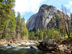
I was able to get a unique view of the Cathedral Rocks from the middle of the Merced River. At this time of year I should have been drowning in the flood, not standing on a rock. 
A very pretty sight for this time of year is the blooming of the Dogwood trees in the valley. The white "petals" aren't actually flowers, they are modified leaves. The actual flowers are at the center. I have to admit it's been awhile since I've seen such a colorful explosion of the flowers.
The Redbuds were mostly past their main blooming period, but there were still a few of them around.
The rocks are more or less eternal, though, at least from human standards. They could care less whether there is a drought or not. Some rocks will come tumbling down here and there, but in a thousand years, the valley walls will look pretty much the same. Below is North Dome from Curry Village.
The meadows are green, but are already showing a bit of brown in places. It's really been dry. Below is Stoneman Meadow, with Royal Arches, North Dome, and Washington Column behind.
The bridges of Yosemite Valley are beautiful human works of art. The placid Merced River flows under Stoneman Bridge with the bright green of newly awakened Cottonwood trees in the background. As pretty as it is, the river should be surging and flooding right now, not flowing gently. 
And that's why I want to deny the reality of the horrific drought. I don't want the summer to come, I don't want the rivers to be dry, I don't want the forests dying from beetle kills or from apocalyptic wildfires. Changes are coming to this beautiful valley that I don't really want to contemplate. I want it to thrive. But we'll see. The walls of rock will always be there no matter what happens, standing like sentries over the plants, trees, and animals on the valley floor below. Including the only slightly furry ape-like creatures running around in bermuda shorts with cameras in hand.