Sunday, March 31, 2013

The Other California: Getting a Good Look at California's Faults

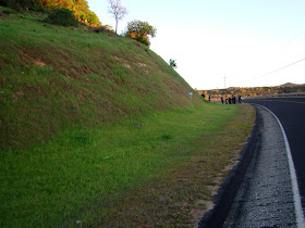
The San Andreas fault in Lone Pine Canyon near Cajon Pass in Southern California. Photo by Mrs. Geotripper

If there is anything that people know about California, it's the San Andreas fault. In a vague sense anyway...California has a lot of earthquakes that many people assume happen along the San Andreas (most don't), that there are occasional BIG ONES that happen on the fault (some of them, but not all), and if popular culture as expressed in movies like the original 1978 version of Superman reflects common knowledge, no one knows where it is or what it looks like (oh, and California is going to fall into the sea).
Still, the San Andreas is a fundamental part of the structure of California, and it is indeed capable of causing a great deal of seismic havoc, with some parts of the state considered at a high risk of moderate to large earthquakes. If one is curious about seeing the state's most famous fault line, there are a great many places to explore it, some in surprisingly visible locations. We are exploring one of them today in a segment of my "Other California" blog series.

Thousands upon thousands of cars follow Interstate 15 daily across Cajon Pass on their way to Las Vegas or their jobs in the L.A. Basin. I imagine few of the drivers know they are crossing California's most famous fault just a few miles north of the Interstate 15/Interstate 215 above San Bernardino. For a few moments, travelers are treated with a spectacular view up the linear track of Lone Pine Valley (the picture at the top of today's post shows the view, taken at 65 mph). I explored the lower end of Lone Pine Canyon and the "mysterious" Lost Lake (really not mysterious) in a post several years ago (click here to see it), but a weekend or two ago I had a chance to explore the upper end for the first time in a few decades.
The Mormon Rocks (or Rock Candy Mountains) expose the 18-20 million year old Cajon Formation. Interstate 15 climbs towards Cajon Pass on the skyline.
The road through Lone Pine Canyon takes off from Highway 138 about a mile west of the junction of 138 and Interstate 15. The road climbs through some beautiful exposures of the Cajon Formation  (the tilted exposures of the arkosic sandstones and conglomerates are called the Mormon Rocks or the Rock Candy Mountains; I've written about them before). The rocks have been tilted and folded due to their proximity to the San Andreas fault. The road surmounts a low pass and drops into Lone Pine Canyon.
The San Andreas fault is not a single break, but is instead a half-mile wide system of different slices of crust. Constant shearing over the last few million years by fault motions has left the rock fractured and easily eroded, forming the distinct linear valley of Lone Pine Canyon.
The series of fault blocks have formed a series of benches and scarps on the southwest side of the canyon, and a few offset channels are easily seen in the chaparral-covered hillsides (above).
Approaching the upper end of Lone Pine Canyon, we can see an odd hill in the middle of the valley. Looking at the steep slope to the right, it is apparent that we are looking at a rather large debris avalanche, caused no doubt by an earthquake along this stretch of the fault (above). The road skirts the lower end of the slide, confirming the nature of the hill with the broken and brecciated rock (below). There are plenty of candidates for the causative event; major earthquakes happened along this stretch of the fault in 1857(info here), 1812 (info here), and as many as a dozen other times in the last 1,500 years. There is a distinct warning in the earthquake history for this stretch of the San Andreas: the recurrence interval of large quakes is just over a century but it has been more than 150 years since the last major event.
The road reaches the top of the canyon, and a short walk along the ridge at the summit provides a spectacular view back down Lone Pine Canyon towards Interstate 15, and the two largest mountains in Southern California, San Gorgonio Peak and San Jacinto Peak. The fault passes between them on the way to Palm Springs and the Salton Sea.
 There is a large outcrop at the head of the canyon that exposes highly sheared rocks from the fault zone. The original rocks may have included the Pelona schist and granitic rocks but they are almost unrecognizable in hand samples.
But one thing is kind of cool: how often can you hold a major fault zone in your hand?
The road through Lone Pine Canyon ends in the village of Wrightwood, the subject of our previous post about a recurring mudflow originating in the Pelona Schist on the high ridges above. As if they didn't have enough to worry about...

The Other California is my continuing blog series on the geologically fascinating places in our fair state that don't always make it onto the tourist postcards.

Wednesday, March 27, 2013

The Other California: That slope won't be a problem will it? The Wrightwood Mudflow

You learn something new everyday. At least I hope you do. I learned something astounding revealed by satellite imagery of the Mojave Desert.

We were headed home a week or two ago, and were taking a "short cut" along the San Andreas fault in Lone Pine Canyon and through the town of Wrightwood. That's right, "through" the town. The village is built on top of the San Andreas! But that's not what I learned. I've known of the close proximity of the fault and the town for years.

It had something to do with the town's other famous natural hazard: the Wrightwood mudflow. There is a slope south of the town heading at an elevation of more than 8,000 feet composed of deeply weathered and crushed Pelona Schist. As can be seen in the picture below, the slope is so steep that trees and shrubs can't gain a roothold, and failures are constant, especially during the spring snowmelt and during heavy rainstorms.
The Pelona schist formed in the accretionary wedge of the subduction zone that lay off the California coast during the Mesozoic Era, and as such may be similar to the Franciscan Complex farther to the north. It is an attractive muscovite mica quartz albite schist in hand samples, but it doesn't do well on steep slopes.
We passed several channels that were clearly designed to send the flows through town without causing further damage.
In May of 1941, just over a million cubic yards of mud and boulders flowed down Heath Canyon and into the town of Wrightwood, damaging and burying a number of structures. No deaths or injuries were reported. The immediate cause was the rapid melting and runoff of the heavy snowpack during a period of unseasonably warm temperatures. Surges of mud continued for a week. Other damaging mudflows occurred in 1969 and 2004.

This basic information was something I was made aware of during my first geology class at Chaffey College many years ago. One thing I didn't know is that the mud passed beyond Wrightwood and continued for 15 miles into the adjacent Mojave Desert. The flow traveled a vertical mile, from 8,000 feet to 3,000 feet.
Source: http://www.wrightwoodcalif.com/mudflows/53SharpRptMud.pdf
The other thing I didn't know is that Wrightwood mudflow has been active for at least five centuries, and that the results of the slide are clearly visible from space! Check out the Google earth image below and note the dark gray alluvial fan just right of center. The gray colored fan is composed of the Pelona schist, which is much darker than the sediments in adjacent fans which contain more granitic rock.
Source: http://epod.usra.edu/blog/2009/06/heath-canyon-landslide.html

The town of Wrightwood is easy to visit. It is just off of Highway 138 west of Cajon Pass on the Angeles Crest Highway. As noted previously, the town sits on the San Andreas fault, so the locality is a good spot to visit and reflect on the many hazards that must be dealt with when one decides to take up residence in the state. For more information on the mudflow, check out this state report: http://www.wrightwoodcalif.com/mudflows/79MortonMudRpt.pdf

The Other California is my on again-off again blog series on the geologically interesting places in our fair state that don't show up on the tourist guides.

Monday, March 25, 2013

Spring arrives in the Sierra Nevada Foothills (and a gratuitous mammal photo)

A long work week, and then another family gathering, this time in Porterville in the southern part of California's Great Valley. We couldn't resist the desire to see what was happening in the Sierra Nevada foothills, so we headed up a new road for us, Yokohl Valley Road.
The road goes nowhere in particular, joining the valley with roads leading to Success Reservoir and Balch Park in the Sierra high country south of Sequoia National Park. Mostly it provides access to a number of ranches.
Descending some steep switchbacks below the pass, we began encountering wildflowers at about the 2,000 foot level. I've seen more fiddlenecks than I recall seeing in the past. Many yellow slopes so far this year have been fiddlenecks instead of poppies. That's not to say we didn't see poppies; they were abundant in a few places, along with some beautiful bush lupines.
 There were the usual unidentified small flowers that I the geologist can never remember a name for...
And more bush lupine providing a foreground for Yokohl Valley Road in the distance. There was some interesting geology along our route, which will likely be the basis of another "Other California" post in the near future.
The spring flower season comes and goes quickly in the Sierra foothills and Great Valley. It's building to a climax, and I hope I can think of enough excuses to hit the road again soon.
Oh, and as promised, a gratuitous mammal photo. This little guy was looking pretty well fed, but someone should warn him about the coyote that was lurking around the next bend in the road....

Monday, March 18, 2013

California's Great Valley Turns Technicolor

Springtime is arriving in the Sierra Nevada foothills and the Great Valley (most people know it as the Central Valley, but we have our pride). This is the time when the rare rains have awakened the long dormant seeds of wildflowers, and for a few short weeks, the flowers will grow, bloom, and go to seed before the summer heat kills them off. Because agricultural development has preempted most of the valley floor, the wildflowers are best seen by traveling into the Sierra foothills to the east or the Coast Ranges to the west.
These pictures were taken near the Caliente turnoff of Highway 58 about 20 miles east of Bakersfield, and on Highway 223 above the small town of Arvin. The earliest bloomers seem to be the fiddlenecks. They are considered weeds by some, but they make for a colorful start to the spring bloom.
Some of the trees were emerging from their winter slumber. I'm not sure what kind of trees these were, but the red leaves provided an interesting contrast to the yellow fields of fiddlenecks.
 As we were hunched over taking photos of the fiddlenecks, some folks stopped their car and suggested we should head down Highway 223 to catch the poppies. It was good advice!
 Some of the hillsides were covered by carpets of purple and orange which to my eyes is one of the most beautiful of color combinations. In some places they were segregated, but in others they were totally mixed in an explosion of color. I caught a hawk soaring over the hillside.
Then we turned a corner, and I had a brief vision how the Great Valley looked before the land was co-opted by orchards and vineyards. We have to eat, and the Great Valley is one of the most productive agricultural regions on our planet, but I do sometimes wistfully wonder just what it was like to wander this landscape for those few weeks in spring when the whole valley was awash in bright colors. It must have been astounding, just as these few acres of grasslands were astounding last Sunday.

If you have any excuses to visit the Great Valley, this is the time to do it!

Sunday, March 17, 2013

Life from an Ant's Point of View: Springtime in the Sierra Foothills

I find that the average lifespan of an ant is something like a month or two. So bear with me while I have some silly thoughts about ant culture. What must the average ant think when it sees the explosion of color above when spring arrives in Sierra Nevada foothills? Probably not much, but it's fun to imagine the legends they might pass on down through the generations. "Your great aunt ant? Remember her? She was so old: four months. She told us of a time when the brown stalks were green and alive with color, and there was sweet nectar in the midst of the plants, and it was a time of richness, never to be forgotten in our legends"
I was off on another adventure this weekend. It was work, actually, helping a relative move in Southern California. I've been down Highway 99 probably 150 times in the last 25 years, so when we woke up this morning, the San Bernardino to Bakersfield drive prior to following Highway 99 to our home near Modesto just did not seem all that...appealing.
Luckily, we did not have a strict schedule, so we got very creative, seeing if we could spend as little time as possible on Highways 58, 14 and 138, and despite all my explorations, we found four roads that I have never traveled, or hadn't traveled in more than 25 years. They included Lone Pine Canyon along the San Andreas fault near Cajon Pass, Backus Road and Willow Springs Road outside of Mojave, Woodford-Tehachapi Road at the top of the Tehachapi Mountains, and Arvin Road at the bottom of the Tehachapi Mountains. Four adventures in one day, capped by the 200 mile drive on Highway 99 to Modesto. We had the most fun on the first part...
I took 200 pictures, and Mrs. Geotripper took even more, so there are probably a few more posts coming in the next few days, discussing faults, wind energy, trains, and wildflowers. Since wildflowers are the subject of today's photos, I can report that spring has arrived at the very south end of the Great Valley, and there are some beautiful sights along Highway 223 out of Arvin to the junction with Highway 58. It's been a dry year, so I don't know how the long the show will last. I don't know how often people find a reason to visit Arvin, but this is a really good time to head there. More coming on wildflowers!
Meanwhile, please enjoy these few shots of life from an ant's point of view....

Saturday, March 16, 2013

Such a Peaceful Scene...and the Birth of Horrific Destruction

A beautiful serene stretch of river on a sunny spring evening. How could anything like this be associated with the extermination of not just a culture, but of many cultures? How could this be linked to one of the most environmentally destructive periods in our state's history? Yet it is...
In late January of 1848, James Marshall had a contract with John Sutter to construct a sawmill on this stretch of the American River near Coloma in the Sierra Nevada foothills of California, and on January 24th, he was realigning the millrace to get the sawmill working properly. They let the river do some of the work by letting water flow through the culvert all night, and in the morning he and his workers found yellow flakes of metal in the bottom of the millrace ...

On February 2, 1848, far to the south in Mexico, the Treaty of Guadalupe Hidalgo was signed, ceding California to the United States in the aftermath of the Mexican-American War. This strikes me as one of the stranger chronological coincidences ever.

Word spread quickly about the gold in the Sierra foothills, and the rush was on. Sutter's Mill didn't operate for very long. It was essentially abandoned by 1853, and all surface evidence was swept away during a flood in 1862. Many years later, the foundation timbers were excavated, allowing archaeologists to calculate the dimensions of the mill. A replica was constructed on the site in 1967, and the original timbers have been put on display (below).
The village at Coloma is now a state park that commemorates the discovery of gold and the rush that followed. There is a fundamental fascination with the yellow metal that caused hundreds of thousands of people to abandon their homes to seek a fortune in the gold fields of California. Legends abound of miners who found giant nuggets and rich pockets that made them instantly rich. Other legends tell the story of bandits and desperadoes. Few stories are ever told of the people whose culture disappeared into the mists of history without ever being recorded. The Native Americans of California, who may once have numbered over a million people, had already been decimated by European diseases, but for some cultures the Gold Rush was the last nail in the coffin.
The 1967 reconstruction of Sutter's Mill in Coloma
The Gold Rush did not last for very long. By 1853, the rivers had been overturned in the quest for the yellow metal, and the miners were beginning to disperse in hopes of finding ores in eastern California and across Nevada. The attention of the mine owners and investors shifted to methods of gold extraction that were more efficient and even more destructive.

Gold-bearing gravels could be found on ridge lines where ancestral rivers once flowed prior to the main uplift of the Sierra Nevada. The miners couldn't efficiently work the deposits because of the lack of water. Mining companies put together a system of flumes and canals in the high country to bring water to the gravels, and one of the most destructive kinds of mining ensued: hydraulic mining. A water cannon, called a monitor, was pointed at the cliffs with the gold bearing gravels, and the explosive spray washed away the gravel into a large tunnel. Large riffles filled with mercury trapped the particles of gold, and the waste material was dumped into the nearby rivers.
A monitor (water cannon) used in hydraulic mining at North Bloomfield.
Millions upon millions of cubic yards were washed away. In the scene below near Interstate 80, the landscape was once level with the white cliff in the far distance. The valleys downstream were choked with debris, and silt filled the floor of the Central Valley. Floods became commonplace as river channels filled with silt and overflowed. Mud filled parts of San Francisco Bay to the extent that it is only about 70% of its original extent. Mercury that escaped from the mines contaminated the sediments, and continues to be a problem today. Hydraulic mining was so destructive to the environment that it was essentially outlawed in 1884.

And then there were the dredges. It took the mining companies a long time to figure out a way to find the very fine gold particles that filled sediments in the Central Valley. The first successful dredge went into action in the late 1890s, and profitable production continued into the 1970s. The dredges were large factory barges with a system of shovels on one end, a waste conveyor belt on the other, and a series of sieves and mercury coated copper plates in the middle to trap the microscopic particles of gold. The dredges were floated in a pond, where they dug away at one end, and filled in the other. In this way, they "sailed" across parts of the Central Valley, producing huge rock piles where fertile soils once existed. Huge swaths of land were ruined in the chase for the elusive metal.
The hard rock mines of the Mother Lode had their own problems. The first mines were dug in 1849, and they were active until 1942, when presidential orders shut down the mines for strategic reasons. A few tried to start up again after the war, but were ultimately unsuccessful. The miners brought huge amounts of ore to the surface, where the rock was crushed to a powder in stamp mills and treated with mercury or arsenic to tease out the gold (cyanide is used today). The mine dumps are toxic, not only with the mercury and arsenic, but also the acids produced by exposure of the sulfide minerals in the gold veins to oxygen in the atmosphere. Clean up efforts are still ongoing today, 70 years after the mines closed.

The mines weren't just damaging to the environment. The miners themselves were subject to constant dangers from explosions, cave-ins, falls down shafts, and the gold miner's equivalent to black lung disease: silicosis, a deadly lung disorder caused by breathing in fine quartz dust.
Source: Kennedy Mine Foundation
Today the Mother Lode is a tourist destination, and the miners have achieved a sort of legendary status. The heritage of the Gold Rush is more equivocal: the destruction of cultures, and the environmental devastation of a wide swath of the Sierra Nevada foothills, the Central Valley, and San Francisco Bay. And yet, every time I take a field trip through the Mother Lode, I can't help but look through the mine dumps for the bright yellow gleam of the strange metal.
The Fricot Nugget, the largest surviving nugget from the Gold Rush era. Thieves attempted to steal the nugget last year, but failed. They still made off with numerous other beautiful specimens.


Thursday, March 14, 2013

Adventures in a Roadcut: It's All in Your Point of View


It's March in Central California, which makes for a really fine time for a geology field trip. We headed east into the Sierra Nevada foothills for a look at some Mother Lode history. For those of you not familiar with the history of California, the Mother Lode was the site of one of the world's greatest gold rushes, starting in 1848 with the discovery of gold flakes in the American River by James Marshall. Ultimately several hundred thousand people made the difficult journey to California to try and find their fortune. As is often the case with such things, only a few ever really prospered. We traveled through Hornitos, an off-the-beaten-track gold era town with some beautiful old ruins, and then followed Highway 49 from Mariposa to Coulterville and then to the hills near Jamestown.
The sun was getting low in the sky when we reached our last stop of the day on Peoria Flat Road outside of Jamestown. It's a neat little mystery for the students to work with, and a great lesson in the need for alternate points of view when problem-solving.

We had spent much of the day in typical rolling hills of the Mother Lode, and crossed several deep gorges, including the Merced River which flows out of Yosemite Valley. When we reached Peoria Flat, the landscape was different. The hilltops were flat and barren, even mesa-like. The flat hills were topped with some kind of dark brown rock that was unlike any of the the slate and serpentine outcrops we had been seeing all day. We found a spot where the road crossed through the flat-topped ridges and had a closer look at the dark rock and the sediments underneath it.

The students found that the dark rock was volcanic, and unweathered surfaces were nearly black. At their level (physical geology or historical geology), black volcanic rock usually equals basalt, though additional study would show the actual composition of the rock to be more along the lines of latite or trachyandesite. The rock underneath the ridge turned out to be conglomerate, with clasts composed mostly of a variety of rounded volcanic rocks. They were clearly deposited in a river. So we had something strange: a flat-topped hill composed of river gravels and topped by a volcanic flow. How did a riverbed and lava flow end up as a ridge?

The best clue to understanding this strange relationship is a different point of view. Several years back, a friend with a plane invited me on a flight over Sonora and Jamestown, and we flew right over the strange outcrop. I knew exactly what I was seeing because Table Mountain is a famous example of an inverted stream.

Nine or ten million years ago, the Sierra Nevada was a lower mountain range with a series of volcanic centers near the crest at Sonora Pass that would have resembled a region like Lassen Volcanic National Park. One lava flow was unusually long, some 60 miles, and as such had followed a stream canyon that had been occupied by the ancestral Stanislaus River. The lava displaced the river to something closer to its present pathway, and as the mountains rose and tilted to the west, erosion stripped away the softer rocks surrounding the lava flow. The old river bed became the flat summit of the Stanislaus Table Mountain; it had become an inverted stream.
You just have to look at the problem from another angle.
It was a beautiful day, and the flowers are ready to bloom. It's a really good time of year for geology problem-solving!

Monday, March 11, 2013

Earthquake Swarm in Southern California

An earthquake swarm is shaking up part of Southern California along the San Jacinto fault near the town of Anza. According to the U.S. Geological Survey, three moderate quakes occurred in quick succession at about 9:56 AM, with magnitudes 4.7, 4.7 and 4.6. Many dozens of smaller aftershocks have followed, most in the range of magnitude 1 or 2.

The San Jacinto fault is a major structure in Southern California, an active right lateral strike slip fault that trends parallel to the San Andreas. It has produced damaging quakes in the past, most notably in 1899 and 1918 which caused serious damage in Hemet and San Jacinto. At least 10 historic quakes have exceeded magnitude 6.

The quakes today are not nearly as large (a magnitude 5 quake has only 1/30 the energy of a magnitude 6 event), but all earthquake swarms on active fault systems should be noted carefully. Most of the time nothing else happens, but on occasion these swarms may presage a larger event. If you live in the region, it is a good time to evaluate your earthquake preparedness, storing water, flashlights, food, batteries, first aid kit, and radio, and having a family emergency plan.

For more information on earthquake hazards in California refer to this site from the USGS: http://earthquake.usgs.gov/prepare/ . For a look at the historical record of large earthquakes in Southern California, check here: http://www.data.scec.org/significant/index.html . For an interactive map that provides the latest data on earthquakes in California (and other parts of the world), check here: http://earthquake.usgs.gov/earthquakes/map/. If you felt any of the earthquakes and want to report your experience, check out Did You Feel It?.

Update:
As is often the case, the preliminary data is a bit uncertain, and the latest official count is one magnitude 4.7 quake, which as of 1:30 PM has been followed by over 200 aftershocks.

Source: http://www.consrv.ca.gov/cgs/rghm/psha/Pages/index.aspx

Saturday, March 9, 2013

A Bald Eagle, a Raven, and a Turkey Vulture Were Having Lunch Together...No, Really!


To my birding readers: how is this for an odd scene? It's the strangest bird picture I've ever taken, and the first ever of a bald eagle. I imagine they've been in our area for awhile, but until today I had never seen one south of Lake Tahoe. We were driving up through the Sierra Nevada foothills between the Gold Rush towns of Hornitos and Mariposa, and came across the group of scavenging birds. Mrs. Geotripper saw a pair of eagles in the Don Pedro Reservoir area two weeks ago, so I am wondering if they have moved into the region permanently.
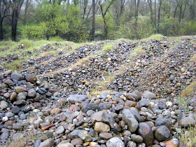
I am also wondering if the coyote was shot (I certainly hope not poisoned) since I'm guessing that coyotes are too big to be attacked by the eagles. The scene was playing out in a large pasture allotment along Hornitos Road at an elevation of about 1,100 feet.