
I have a once-in-a-career opportunity coming up soon. Our community college, for better or worse, is the highest-level public academic institution in our town (we fought for and lost the chance to host the newest UC campus, which ended up at Merced instead). A while back, the public passed a huge bond issue, and we now are designing a community science center, which will include the physical sciences labs, classrooms and instructor offices, but will also include a planetarium, observatory, and best of all, a public museum. We have a local natural history museum (the Great Valley Museum), which has been struggling for years in a couple of ancient buildings next to our campus, but now we will have one beautiful integrated structure that will be a centerpiece of science education for our county.
The conundrum? What do we do for the "wow factor"? The building will have three stories, and there will be a main entrance atrium that will be the gateway to the museum and to the classrooms as well. What do we put in this atrium area that will capture the attention of people, and especially children who are visiting the museum? What can we put there that will capture the essense of what is special about the natural history of the Great Valley of California?
Well, I have some ideas. It will take a couple of posts, so my apologies to Chris at Highly Allochthonous for filling up his Geoblogosphere feed.
As geologically boring as our valley might seem at first glance, with endless flatness, and agricultural fields, it does have some striking geology, admittedly mostly beneath the surface. The sediments of the Great Valley are thousands of feet thick, dating back to Jurassic and Cretaceous time, but they have been curled up at the edges to form a homocline in the eastern Coast Ranges, so we know what these layers contain, and there is some good stuff here, mostly having to do with the history of life in Mesozoic and Cenozoic time.
Which brings us to idea #1: The Pleistocene Megafauna and Smilodon
Noting the picture above, I figure this is the most bang for the buck. A full-sized replica of a Smilodon californicus (the saber-tooth cat) can apparently be had for around $6,000-7,000. It was a denizen of the plains of the Great Valley, has been found nearby in the Fairmead Sanitary Landfill, and has the added benefit of being the California State Fossil. I imagine the squeals of kids as they see one of these things greeting them as they enter the museum. This would lead in turn to some possible displays in the museum, some discussions of the kinds of animals that Smilodon hunted.
What do you think? I have a few more ideas to be presented in the next couple of posts, and I am hoping to catch the attention and imagination of some of my committee members. Thanks for your ideas!


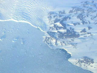
 Grinnell Glacier in Glacier National Park is expected to be gone within a few decades, along with all of the others in the park. For a striking graphic of glacial and vegetation change from 1850 to the present and then projected into the future (to 2100), see


